Saturday, February 19, 2022

Jacksonville Forest Park 2/19/2022


Take a bowl of spaghetti soaked in red marinara sauce, flip it upside down on a white tablecloth, and voila, you'll have your very own rendition of a Jacksonville Forest Park trail map. And do make sure to clean up the mess before the wife gets home! Messy culinary metaphor aside, the point I'm trying to make is that trails proliferate everywhere in the esteemed woodland park, filling the map with squiggles that resemble a ball of wriggling baby snakes (or bowl of spaghetti) more than a network of well-used footpaths. There are so many paths, routes, and junctions that the very idea of leading a hiking group there would (and should) fill one with trepidation. Appropriately enough, Lane (the designated hike leader for this Friends of the Umpqua outing) was justifiably trepidated. 

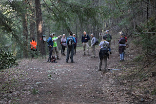
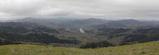
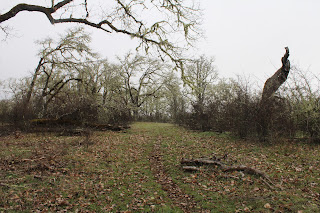
A flock of Eagles and Monkeys gather in the forest

Glenn and I had hiked this route just a couple of weekends prior to the official Friends of the Umpqua hike, so I'm not going to rehash the hiking thereof since the club hike was the same route described in my prior blog entry. However, the complexity of the hike presented a degree of difficulty not normally encountered because on our chosen route there were at least 38 trail intersections presenting 38 opportunities to peel inattentive hikers away from the group. Unique challenges require unique solutions, so we'll talk about those instead.

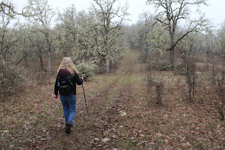
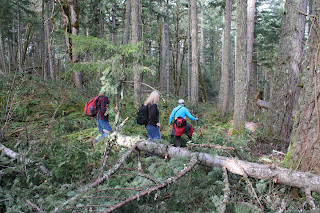
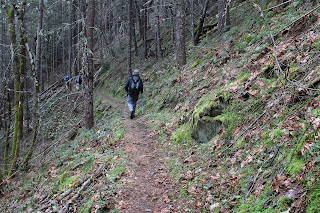
Chuck leads the Turtle charge, such as it is

Because Lane, Glenn, and yours truly were familiar with the route, the 17-member group was partitioned into three teams, based on hiking speed. In order of anticipated rapidity (or lack thereof) the teams were named after animals: Eagle, Monkey, and Turtle; and stickers were handed out to all hikers like so many kindergartners on a field trip. And guess who was in charge of Team Turtle? In response to the cruel japery directed my way by those who felt superior to our slow but mighty team because they could walk faster, I could only remind them that it was a turtle that had won the race against the hare.

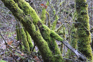
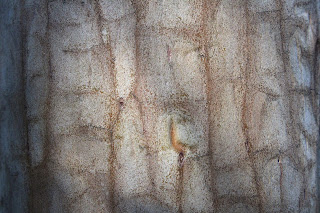
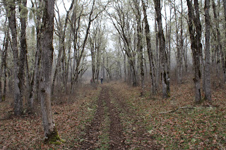
A rolling stone gathers no moss, but
standing trees on the other hand, do

Two-way radios were distributed to two leaders in each team (except for the Turtles) and all leaders were assigned code names: Eagle Beak, Eagle Claw, Monkey See, Monkey Do, and Turtle Head.  Additionally, each team leader was given a list of check-in and regroup points and I must say, the whole system worked quite well other than the many turtle insults broadcast over the public radiosphere. I chose not to respond in kind and just retreated into my shell.  

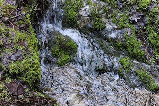
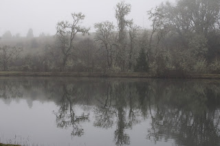
Jacksonville Creek had some water in it

Because I had been here just a couple of weeks prior, I noticed Jackson Creek was carrying a bit more water this time out, thanks to some intervening rain. As always, I had my trusty camera with me but really, I didn't take a lot of pictures, preferring instead to concentrate on my duties as chief turtle herder and overall hike sweep.

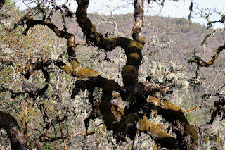
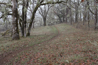
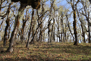
An oak, uncertain about which direction to grow

As the hike wore on and the trail trended towards the uphill, some hikers dropped into the next slower group down and accordingly, I soon acquired more turtles in our bale and yes, a group of turtles is really called a bale. At any rate, I preferred to think of the neo-Turtles that were former Monkeys as Turkeys.

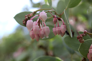
Manzanita was in bloom on Upper Twin Peak summit

One of our regroup points was atop Upper Twin Peak where we fed the animals, so to speak. We ate lunch on the wooded summit while soaking in the view of Mt. McLaughlin and Bear Creek Valley, enjoying the hiking camaraderie, and denigrating all things turtle. With so many hikers all chatting and chomping atop the summit, it was quite the zoo. The main thing for the three team leaders was that all hikers were present and accounted for. So far, so good.  

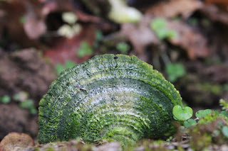
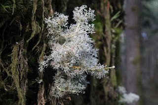
Lichen clings to life on a tree trunk

The good news from a hiking standpoint was that after the summit of Upper Twin Peak, the route was all downhill, causing some of the Turkeys to self-promote back up to Monkey rank. As an aside, the Monkeys were indeed pretty rank all right, but that's another story.

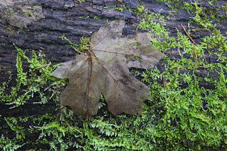
A maple leaf, about to get devoured by moss

It was a pretty satisfied and happy group that last gathered at the trailhead for a final head count when the hike was over. In speaking to some of the participants post-hike, the consensus seemed that as the hike started, there was much grumbling and talk of mutiny because of the stultifying team hiking rules and regulations. However, after the first several dozen trail intersections or so within the first set of miles, everybody saw the need for being organized and all would-be rebellious types soon became happily compliant. Should have named that group Team Sheep.

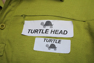
I wear my badges with honor

My only complaint about the whole outing is that apparently, my new trail name is now Turtle Head. Not sure I particularly like that, I'd gladly shed my turtle shell, but then I'd either be homeless or naked and not really sure which.
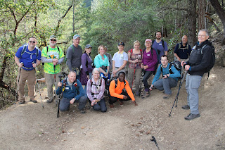
Quite the menagerie

For more photos of this hike, please visit the Flickr album.

Wednesday, February 16, 2022

North Bank Habitat


While I was researching trails the other day, I ran across a hiking difficulty calculator that dispassionately rated the difficulty of any given hike based solely on empirical data, something that always will seduce my geeky mathematician's heart. Basically, the operative formula is the square root of twice the product of distance in miles and cumulative elevation gained. The number obtained is then matched up to a scale for the rating. There'll be a pop quiz in the morning, kids.

John's army

The destination of choice this day was the North Bank Habitat and surely the steep hills and trails of the habitat would provide some interesting fodder for the arithmetic machinations described above. It'd be interesting to take into account other factors such as weather, trail quality, mosquitoes, and bad puns from those hikers so predisposed. Not that things were particularly dire on the day of our North Bank hike, for the weather was merely chilly and just perfect for hiking in, provided the potential rain remained in abeyance.

Oak trees, yup, lots of oak trees

Our little gang of five enjoyed an easy warm-up walk for the first mile or so. The route was initially on a level working ranch road before peeling off onto an equally level hiking-only trail along the wooded Chasm Creek bottomland. The track there was surrounded by thick stands of oak and madrone, the oak trees being bare of leaves this time of year, but well-bedecked with copious strands of Mesuthelah's beard and other lichen drapery. In the madrone groves, a virtual tabernacle choir of songbirds were chattering and nattering among the leafy trees, nearly drowning out the chattering and nattering of some hikers in our party.

If it's in the North Bank, then it's steep

Heh, heh, the nice level trail was too good to last, seeing as how this is the North Bank we are hiking in. The angle of the trail gradually began inclining steeper and steeper, stopping seemingly somewhere at just marginally less than full vertical, but only just. My new lighter and improved physique felt more like my heavier and unimproved former self in direct proportion to the increasing grade.

Our "reward" for going downhill looms above us

After what felt like an endless death march up through the oaks and grassy slopes of the "gentle" and rolling hills of the Habitat, the North Boundary Ridge was finally reached. None of us overtly celebrated though, as we were all aware that the trail would go up and down in steep fashion along the ridge for the next mile or two and there'd be no respite for weary legs until the hike was pretty much over. There's probably like 10 separate uphill pitches on this section that felt more like 1,183.

A vista like this makes the hard work worth it 

Photo stops are the last refuge of tired hikers and I availed myself of the many opportunities on the up and down ridge. The terrain dropped off at our feet, bottoming out in the nascent valleys of Jackson and Chasm Creeks. The area was surrounded by ridges and lesser peaks, most covered by a dark fuzzy blanket of woods and forest. On the valley floor, the North Umpqua River glinted silver in what little light managed to seep past the heavy cloud cover. The scenery is spectacular on any day but the foreboding weather added a touch of gloomy drama, further enhancing the panorama from the top.

A brief wooded interlude on Middle Ridge

Middle Ridge was our route back down to the trailhead and since this is the North Bank, there were still several steep uphill pitches to contend with, even though we were heading downhill in general. We were all appropriately tired from the hilly exertion so we stopped at a picnic table sited under some madrones for a well-deserved lunch break.

Epic view down to the Whistler's Bend
area on the North Umpqua River

After lollygagging for a bit on the Middle Ridge rest and repast session, we continued with our descent down Middle Ridge. The terrain was generally grassy and treeless, and we continued to enjoy the ever enfolding view as we lost elevation. Cold air was wafting up from the valleys as the temperature dropped, seemingly in concert with the drop in elevation. Precipitation somewhere between a hard drizzle and actual rain splashed both trail and hikers for a few minutes but the sun eventually made a weak appearance at the trailhead. And speaking of weak appearances, I also eventually showed up at the trailhead.

Scratchy

It was somewhat disappointing that the hiking difficulty calculator rated this hike as "moderately strenuous". Even though my admittedly biased and highly subjective hike rating was more like "super-duper strenuously hugely strenuous" you really can't argue with the numbers. As a comparison or point of reference, the empiric calculator had likewise rated my recent hike at Jacksonville Forest Park as "moderately strenuous". But applying the O'Neill methodology, which basically consists of me asking my legs for their opinion, said this North Bank hike was far tougher than what the Jacksonville hike had ever served up. That leaves me where I started from, calculator-wise, in that the difficulty of a hike is still a highly subjective determination based on not just grade and miles, but on the conditioning and overall whineability of the hiker making the determination. My geeky mathematician's heart remains unrequited.

My downhill form

For more photos of this hike, please visit the Flickr album.

Saturday, February 12, 2022

Sterling Ditch Mine Trail (From Deming Gulch)


It was such a beautiful day. The sun was out with nary a cloud in the clear blue sky, manzanita bushes were in bloom, bees were buzzing, and the temperature was a wonderfully mild 70 degrees. So, why so glum, Richard? Despite absolutely the near-perfect spring-like weather, my inner Chicken Little was screaming "BUT IT'S FEBRUARY, WHERE'S THE #$@& SNOW??!!!" So yeah, it was a delightful hike in the fine weather conditions along historical Sterling Mine Ditch, yet there had been a sense of unease and foreboding about what promises to be a hot, dry, and fiery summer because of "winter" days just like this one. So, I just lived in the moment and enjoyed the hike anyway, much as a lemming would enjoy the run approaching the cliff.

Just a trail and its ditch

And speaking of environmental disasters, back when Jacksonville was experiencing its mining boom in the mid to late 1800's, the Sterling Mine Company employed Chinese laborers to dig a 25'ish-mile ditch to divert water from the Applegate River to the mine's hydraulic operations. Along with the prodigious mining scars, the remains of the old ditch still exist. The good part about the ditch is that the downhill-side berm makes for a handy-dandy hiking and mountain biking trail. And simply because I'd never been there, today's hike began on the Deming Gulch Trailhead.

Tats on a madrone trunk

Right from the get-go, the hike had that distinctive Siskiyou foothill vibe. The terrain and atmosphere were clearly drier than our comparatively sodden Cascades, and the thin woods and forests were populated with madrone, oak, cedar, Ponderosa pine, and other assorted conifer. The oak trees were currently bare, stark, and leafless but the plentiful lichen adorning the scraggy trees didn't seem to mind. Madrone and Ponderosa pine each added some color to the hike, mostly in the form of orange trunks like so many ex-presidential limbs. Poison oak was a thing too, but let's give thanks to the wide and well-maintained Sterling Mine Ditch Trail for letting us avoid the itchy madness that Satan's favorite shrub can engender. 

A sparse forest as the trail rounds Peak 3259

The route was rounding a combo of Peaks 3214 and 3259 on the northwest side and as a result, much of the first part of the hike was in shade. Armstrong Gulch sort of cleaves the peaks in two, bending them into a U-shape and once we rounded a ridge and entered Armstrong Gulch at the mile and a half mark, the sun was screened from view and we'd have to wait just a little bit longer for that 70 degree weather. Green and grassy vegetation grew in the shady forest even though the gulch was dry, thanks to a mostly rainless February.

Manzanita ushers in spring and the bees are happy

Once the track rounded Peak 3259, the slopes were totally exposed to the sun and harsher elements. Tall shade-giving trees were in short supply here, although that may be ameliorated when the oak trees leaf out and provide some shady succor to perspiring hikers, bikers, and trail-runners. The vegetation was increasingly dominated by manzanita shrubs sporting bee-attracting umbels of pale pink tubular bell-like flowers. 
View of the terrain surrounding the Little Applegate River


It goes without saying that the sparse tree cover allowed for some expansive vistas of the surrounding landscape. The dry slopes of Peak 3214 sloped down into the Little Applegate drainage, which could be observed running all the way to the much wider Applegate Valley, near the small town of Ruch. The lesser peaks of the Siskiyou foothills could be seen all round, most notably being those of Woodrat Mountain, Burton Butte, Mount Baldy, and Ben Johnson Peak. 

Nearby Woodrat Mountain

As the hike continued in a southerly direction, the snow-covered Siskiyou Mountains became more and more visible, increasingly commanding attention and respect. In particular, the prominent peak of Grayback Mountain presided over the landscape sprawling beneath a vibrantly-colored blue sky. Closer to the trail, Peak 3214 rose high above, aspiring to be a mountain worthy of a name other than the current numeric identifier.

This was as "hilly" as the trail got

This was one of those hikes that was all about the journey, particularly since it lacked a clear and logical destination. Accordingly, I made the decision to turn around at the 5 mile mark and as luck would have it, that happened to be right at Cantrall Gulch, which actually had a few puddles of water as evidence a creek sometimes flows here. From there, it was back the way I had come, in increasing warmth, sunlight, and longer shadows (where there were trees).

Lichen takes over a small branch

At the end of the day, it was with a sense of accomplishment that the hike ended. It had been quite some time since I had last walked 10 miles or better. Plus, this section of the Sterling Mine Ditch Trail was a new trail for me, a rarity since it seems like I've hiked everywhere there is to hike in southern Oregon. And the spring day was superb with mild temperatures, clear sky, and generally glorious weather, EVEN THOUGH IT'S FEBRUARY!!!

Oak trees and blue sky, all hike long

For more photos of this hike, please visit the Flickr album.

Wednesday, February 9, 2022

Mildred Kanipe Park


Slowly, the predator stalked his prey, innocently standing in a meadow and totally unaware and oblivious to the menace creeping up from behind. Once within striking distance, it was time to swoop in for the kill, "HEY PATTY, what do you think of this hike?" Patty reacted pretty much like you'd think a startled cat would, leaping instantaneously into the air like a coiled spring suddenly being let loose, simultaneously letting out a feral shriek that sounded something like "Yowrk!" Gravity had no choice but to return its airborne prize back to earth and shortly after landing, that's when Patty hit me.

Fog envelopes the livestock pond

Our little Wednesday group of hikers were originally going to hike at Mount Pisgah, near Eugene, but the weather was predicted to be densely foggy and about as gray as an alien cadaver. Since the point of hiking to Pisgah's summit generally is to see stuff (which you can't do in the fog) from the top, it was decided to hike at Mildred Kanipe Park instead. I'm not sure what the exact point of hiking in Kanipe Park is when the same foggy blanket smothers the park (other than giving a friend a heart attack) but you have to hike somewhere, I suppose.

Fallen trees were a thing after this last winter

As we set out into the misty air, we noticed a few downed trees next to the trailhead. Winter had obviously had paid a visit and it looked like last December's snowstorm had claimed more than a few casualties. Fallen trees were a common sight all throughout the park and because we have all been hiking here for many years, it felt like we were bidding a sad farewell to old friends who had recently and tragically passed.

Trail through the oak savanna

My favorite part of Kanipe Park, which has many beautiful parts, is the oak savanna. Here, oaks grow closer than sardines crammed into a tin full of mustard sauce. This time of year, the oak trees were bereft of any leaves but lichen more than made up for the lack of foliage by draping off of everything that did not move. The narrow dirt path wove its way through the oaks and the woods were as quiet as a morgue in the wee hours of the morning.

Pathway through a glade of oak trees

Once the path burst out of the oaken woods, it began a nice little climb through a meadow of low-growing grass. I was feeling walky this morning so I charged up the hill, as eager and energetic as a dog that just heard the word "treat". The trail crested at a boundary fence in the midst of an idyllic and peaceful glade of ever ubiquitous oak trees and from here on in, it would be mostly downhill walking.

A moss-colored turkey-tail

The speed-walking was too good to last! So many interesting things on the ground and I soon stopped my mercurial pace to kneel and lie down to more closely examine and photograph the world at my feet. Spider webs, soaked by mist, were strewn everywhere looking like so many miniature trampolines for the wee folk. Dead oak leaves sported perfectly round galls, the wasp larvae contained within long since departed to commence their lives as adults. On a decaying log, a population of common fungi colloquially known as turkey-tail were all tinted green by moss. Much photography abounded!

Lichen thrived on the trees in Fern Woods

Our route led through the Fern Woods Loop and the pretty little woods were a little bit worse for the wear because of winter. There were a few more fallen trees than usual to contend with and the ferns that so overpopulate the forest floor were doing a fine job of encroaching the path. At least it wasn't as muddy as it can get here. Apart from my factual observations about trail quality, the woods were and always are quiet, peaceful, and eminently beautiful.

A little scrambling over downfall

We ran into half of our party hiking in the opposite direction in Fern Woods. Seems that there are two kinds of hikers in the world: those staid establishment types who hike a loop in a clockwise direction or those colorful rebels and misfits who hike counter-clockwise. Guess which group I was in! At any rate, this wound up being a short 4 mile hike that ended before noon, no matter which direction was hiked.

A pleasant little stand of oaks

Halfway through our outing, Patty did resume speaking to me long enough to apologize for her near-felonious assault upon my person in the meadow. I told her no worries, because she hits like a girl and also because I pretty much had it coming.

Tough and woody, just like me!

For more photos of this hike, please visit the Flickr album.

Saturday, February 5, 2022

Cape Arago


The signal light turned green and I stepped on the gas. In response, my Jeep gave a small shudder and feebly inched forward as fast as a beetle with two legs. After hearing the prognosis from the vehicle's physician, we made the hard decision to authorize a death warrant for our long-term faithful servant. Naturally, I was devastated, so much so that Dollie and I happily purchased a brand new vehicle the very same day. And as I parked my new ride at the trailhead on what will be the first of many such drives, I cheerily sung to myself "I'm a Soul man!" mostly because I'm now the proud owner of a brand new Soul.

Heigh ho, it's hundreds of hikers we go

Hiking and the driving-to thereof, are good for both my soul and Soul, and we parked with a bright cherry red splash at Sunset Bay State Park. This hike to Cape Arago and back was a South Coast Friends of the Umpqua Striders venture, which is what you call a cooperative effort between Friends of the Umpqua and sister hiking club South Coast Striders. The superb weather and scenery ensured a large turnout and all hikers present at the trailhead had plenty of old and new hiking friends with whom to bond with.

A secret beach at low tide

I've hiked in the Cape Arago area when the weather's been nasty and belligerent but on this day, it was downright balmy as the day dawned as sunny and bright as a granddaughter's smile. Lest we get too comfortable though, a chill breeze made sure to ruffle both windbreakers and the ocean's surface and at the start, I didn't see anybody hiking without jackets or extra clothing layers.

Norton Gulch lured some hikers down for a visit

With so many hikers (around 30!) what could possibly go wrong? Plenty really, but the worst of it came when the hikers in front, who did not know the route like us grizzled vets, made a right turn at the first junction and began to head down into Norton Gulch and I figured everybody just wanted to visit the gulch where it meets the sea. They made it about halfway down before stopping and asking me which way we should go. So amusing to see approximately 30 hikers turn around and backtrack on a narrow trail.

Low tide

High tide

It was low tide at the Cape Arago environs, the retreating ocean exposing reefs and rocky shoals to the airy elements. The booming waves at nearby Shore Acres are famed the world over but on this morning, they were barely making a ripple. The wind-driven whitecaps out to sea were larger than the waves lapping against the shore like a thirsty cat at a water dish. However, the ocean patiently bides its time and will once again rampage against the coastal ramparts come high tide.

Panorama of Simpson Reef 

From the gardens and viewpoints at Shore Acres, the coastal trail dipped in and out of the forest, sideswiping iconic landmarks such as Simpson Beach, before winding up at Simpson Reef Overlook. At the viewpoint, tourists and hikers alike can observe the sea lion bacchanalia and debauchery taking place on Shell Island. Replete with fishy smell, all that barking, belching, and farting was kind of like a gathering of through-hikers, but without the backpacks or hiking poles.

The forested path heading up to the Pack Trail

I'm not bragging (oh, but I am!) but I've lost weight lately and where I really notice the difference is when I'm hiking uphill. There is no direct trail from Simpson Reef Overlook to Cape Arago and one can either walk along the road to the cape, or cross the road and take the forested path leading to the Pack Trail. That particular path is a steep one but my lighter new and improved self just charged uphill, nearly as quick as a brand new Soul when the light turns green. Whew, did that ever feel good!

Lunchtime view

The coastal woods, fed by the perpetual fog at the cape, were predictably lush and verdant. The earthen track wound through the trees while numerous clumps of green ferns flanked the footpath. After reaching the Pack Trail, which is actually a gravel road, it was a short drop to Cape Arago herself, where we ate lunch while admiring the view of the sparkling sea and the rugged Oregon coast running to the south.

The sea was a bit more agitated on the way back

On the hike back to the trailhead, high tide was beginning to roll in and the waves were now a lot more entertaining than they had been earlier. We (John, Merle, and I) would see a huge wave break in spectacular explosive fashion, so cameras would be readied and then we'd wait...and wait...and wait for the next large wave. It apparently is a Cape Arago truism that waves are only spectacular when you aren't pointing a camera at them.

Pictorial definition of whitewater

The cool part about going home after the hike is I got to drive my new car all over again. Unfortunately, John and Merle took the occasion to pepper me with technical questions that I did not know the answers to, other than "Yeah, I'm pretty sure it has a motor". My ignorance of all things automotive was further exposed at my first fuel purchase when the attendant asked me to pop the gas tank lid open. Crap, how do I do that? Shaking his head in condescension and with a smirk on his face, the dude showed me where the lever was down on the floor by the seat. Hiking is so much easier!

A wall of solid rock, exposed by the low tide

For more photos of this hike,
please visit the Flickr album.