Saturday, August 20, 2022

Salt Creek Falls to Fall Creek Falls


Salt Creek Falls is Oregon's second tallest waterfall, eclipsed only by iconic Multnomah Falls. Situated approximately halfway between Eugene and Bend, the falls receive a lot of visitors who generally take a very short walk to a paved overlook. However, there are two other falls in the area with actual trails that go to them and once you leave the viewing area, it's a quiet walk on a real trail with few people on it.

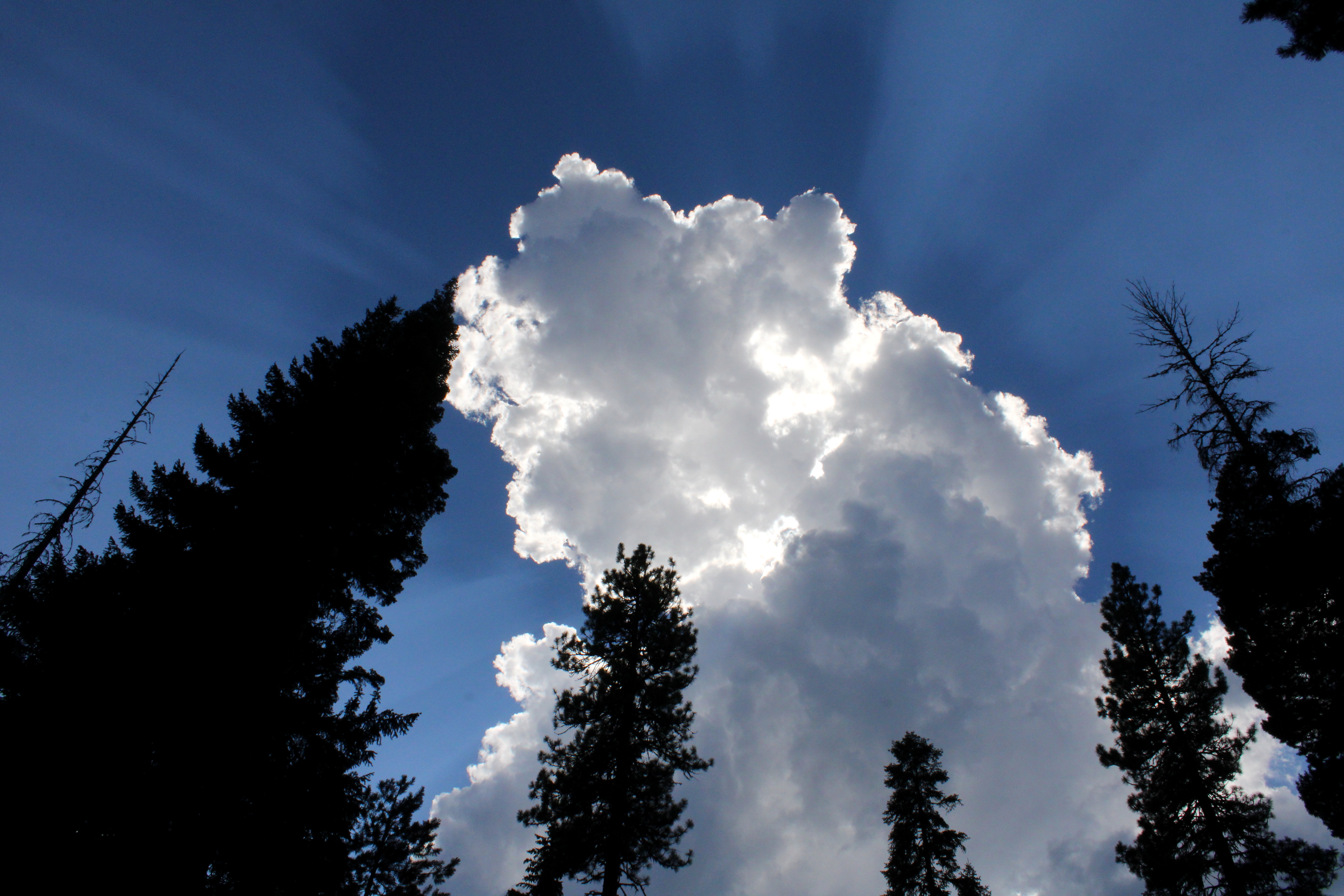
Mist and sun had a baby and called it "Rainbow"

From the viewing platform, a dirt trail takes hikers down for a closer look at impressive Salt Creek Falls. The path does not go all the way down to creek level (unless you illegally hop the barrier and do the dangerous scramble down) but it was close enough for the eight of us to soak in the majesty and splendor of the falls. We also got to soak in the cool mist swirling off the cascade and admire the resultant rainbow spanning the Salt Creek's canyon.

The epitome of "rickety bridge"

There's no pavement in hiking, or so I've often said, but you do have to hike a paved path to a long and saggy wooden bridge spanning Salt Creek above the falls. Diamond Creek Falls Trail officially commences at the bridge and once we crossed the rickety span, we were off hiking through a lush forest on our way to Diamond Creek

One small facet of Diamond Creek Falls

It was a steady uphill slog to the path leading down to Diamond Creek Falls. The muddy track was steep and you had to watch your step. A complicating factor was a vertically oriented log with notches cut into it, serving as a rustic one-railed stairway. The cascade is what is termed a "fan waterfall" and I'm definitely a fan! However, "fan waterfall" probably has more to do with the way the creek delicately fanned out across the face of its cliff and less to do with any ardent admirer. In my modest but totally correct opinion, Diamond Creek Falls were the best of the waterfalls we'd visit today.

The irony of crossing tracks in
order to enter a wilderness area

If there's no pavement in hiking, then there probably shouldn't be any trains, either. But there they were, a set of railroad tracks for us to walk across, which we did, nervously looking both ways for any train speeding in our direction. Make fun of me if you will, but I saw the movie "Fried Green Tomatoes" and I know that feet getting stuck in rails in front of an onrushing train is a calamity best avoided. 

A moment of reflection on Diamond Creek

After the railroad crossing, our route entered the Diamond Peak Wilderness via the Vivian Lake Trail, which went totally steep on us.  Huff, puff, we were soon gasping for breath like beached carp while admiring the beautiful forest we were trudging through. There were a number of small creeks and bogs on the trail but decaying boardwalks got us through and across. The forest did provide some fruity succor in the form of huckleberry, salmonberry, and thimbleberry and I partook thereof.

What little we could see of Fall Creek Falls

By comparison to splendid Salt Creek Falls and Diamond Creek Falls, Fall Creek Falls was rather mundane and ordinary. Because of the way the trail was perched on a cliff next to the cascade, you could only see the top half of the falls. I'm sure the cascade would be a lot more spectacular if you could see it completely from top to bottom but if you tried to bushwhack down, you'd be one of those "never heard from again" people.

Much of the Diamond Creek
Falls Trail looked like this

My legs quit on me at that point, having given their all to get me up to Fall Creek Falls. So while everybody continued on to Vivian Lake, I called it good and headed back down the trail to return to Diamond Creek. This time I'd head past Diamond Creek's waterfall and continue on the loop route back to Salt Creek Falls. At this juncture, most of the route went through some lovely shaded forest that felt cool on an increasingly warm day. While Diamond Creek was not seen much, it was always heard as the trail paralleled the creek's path.

Salt Creek has carved a deep and massive gorge

Diamond Creek eventually joins up with Salt Creek and the two creeks then conspire to carve out a deep and spectacular canyon. Periodic openings in the forest cover provided impressive vistas of the gorge with Salt Creek flowing way below the trail. Being prudent in my dotage, I did not venture too close to the rim's edge, it could be a quick trip down, for sure.

Too Much Bear lake was "unbearable"

There is a small lake in the area by the name of Too Much Bear Lake but you could only reach the lake from one particular side trail. I did go down to see the lake and snap a few photos and I "enjoyed" the steep but short hike back to the main trail when done. I didn't see any bear so on this day at least, the lake was quite misnamed.

Salmonberry provided some hiking sustenance

While waiting for my comrades to return to the trailhead, I took a pleasant nap next to Salt Creek, the sound of the rushing stream dropping me into a peaceful slumber. When I woke up to the sound of Lane's squeaky voice permeating the otherwise peaceful air between the trees, I was fully refreshed and sated. A waterfall hike (and nap) will do that to you and this had been one of the better ones.

Mike and Missy on the "trail"
down to Diamond Creek Falls

For more photos of this hike, please visit the Flickr album.

Friday, August 19, 2022

Little Cultus Lake to Cultus Lake


We woke up to "Smoke on the Water". No, not the totally awesome rock song by Deep Purple but instead, real smoke wafting across Odell Lake and penetrating the hairy nostrils of unwashed and unshaven hikers eating a rudimentary breakfast at camp. And the same could also be said about the men in our group, too! The acrid air quality could only mean one of two things: Either prevailing air currents had shifted direction, or else nearby Cedar Creek Fire had dramatically increased in size and bellicosity while we slept dreaming of blister-free heels and level trails. Fortunately, the culprit behind the smoky air was the change in air currents and we could deal with that.

Prepare to eat dust for the next 10 miles!

Seeking cleaner air to breathe, we piled into our vehicles and drove out to the Cultus Lake area. We were much pleased to see blue sky at the lake, although the air did have a touch of haze to it. Others were not as pleased, particularly those hikers who had to ride to Little Cultus Lake Trailhead, stuffed tight into the bed of Lane's truck like an open tin of oily sardines when we set up the shuttle for this end-to-end hike.

Little Cultus Lake on a hazy and smoky morning

After that dusty drive on an unpaved forest road where we front-riders made fun of the dust-breathing rear-riders in the pickup bed, we arrived at Little Cultus Lake. While the air was slightly hazy with smoke, as it had been at Cultus Lake, the Cedar Creek Fire was still a quaint little 5,600 acres in size and the Cultus Lake area was not yet under a Level 3 (Get out now!) evacuation order so we were pretty happy with our lot in life. Both of those things would change for the worse a week or so after this hike.

On the trail between lakes

After a brief teasing sideswipe of scenic Little Cultus Lake, the trail ducked into the forest and then stayed there for many a mile, in what would be a pattern for this hike. Our preference would have been more lakes and less forest but then again, we weren't hiking at smoky Odell Lake so we mostly kept our rude comments to ourselves. Mostly.

Deer Lake

After a couple of miles of quality forest time, the trail hit idyllic Deer Lake, which could have been Little Cultus Lake's fraternal twin. Ringed by forest, the little lake reposed under a blue sky with forested hills all around. We didn't see any deer at Deer Lake but I held on tight to my hiking poles anyway.

Lunchtime view at Cultus Lake

In what was now an obvious trend, from Deer Creek it was again another couple of miles through viewless forest before our arrival at West Cultus Lake Campground, which is a campground for the boating crowd. Seeing how it was a nice day and all, the camp was in heavy use but since we didn't have a boat or campsite, we simply commandeered some logs to sit down on while we ate lunch next to large Cultus Lake.

Cultus Mountain loomed at
the west end of Cultus Lake

The lake stretched out for several miles in front of us, the blue waters sparkling in the sun. In the distance, the symmetrical volcanic cone of Mount Bachelor rose beyond the far end of the lake. Closer to our campsite, rose another symmetrical cone, that being forested Cultus Mountain. None of us menfolk noticed the young lady in a bikini sunning in the campsite next to us because the awesome scenery commanded our full and undivided attention.

Nascent thunderclouds form on the eastern skyline

To the northeast, a bank of clouds formed and it sure looked like they were trying really hard to become thunderheads. The clouds were far away and seemed fairly benign but as they became larger and more numerous, it seemed prudent to commence hiking again so as not to get caught out in the middle of a lightning storm. Plus, the lady in the bikini that we did not notice, had retired into her tent.

Much of the eight mile hike was like this

Although the trail followed three miles of Cultus Lake's shoreline, we saw none of the scenic lake as the route spirited us off into three miles of viewless forest. We eventually did see Cultus Lake again when the trail ended next to a campground. Not all of us fit into the shuttle vehicle so Mike, Missy, and myself hiked another mile-plus to the Cultus Lake Resort where Lane picked us up once his vehicle was retrieved. Predictably, even though we were walking on the roadway next to the lake, most of the walk was in viewless forest until we reached the resort. But on the plus side, we get the Golden Boot for hiking farther than everybody else.

Pine-drops prettified the forest

So, this wasn't the most exciting hike we've ever done, consisting as it did of mostly walking in a viewless and not particularly scenic forest. But hey, we'll take it, because it sure beats walking in a veritable smokehouse, breathing in ashy remains of trees, hopes, and dreams. The good news too, was that upon our return to camp at Odell Lake, the winds had once again shifted and blew the smoke elsewhere. I'm sure the residents of Oakridge weren't as happy as we were about the change in wind direction, though.

Mass confusion at Little Cultus Lake

For more photos of this hike, please visit the Flickr album.

Thursday, August 18, 2022

Rosary Lakes


Lane brought a new toy to this hike. It was a brand new GPS with a screen large enough for a Super Bowl party in a Las Vegas sports bar. Suddenly, my own humble GPS seemed woefully inadequate and while I congratulated Lane, deep down inside I may have been envious. However, Lane made the mistake of showing Edwin the new GPS and that in turn, wound up interjecting three bushwhack side-trips into this otherwise staid hike on the Pacific Crest Trail (PCT).

The Rosary Beads

A bunch of us were camping at nearby Odell Lake and our original plan was to hike in the Waldo Lake area. However, the Cedar Creek Fire had rendered the Waldo Lake Wilderness trail system off limits, and wisely so. The nearby Diamond Peak Wilderness was off limits too, due to a different fire, and the two closures didn't really leave a lot of open trails to choose from. But lucky us, a small section of the Pacific Crest Trail between the two wilderness areas remained open and was just minutes away from Odell Lake and that's the story of how we wound up hiking to the Rosary Lakes.

The first several miles were well forested

A light rain fell off and on during the entire hike and the forest was filled with the hissing sound of rainfall to go along with the noisy chattering of our little group. We may have numbered few, but our voices were mighty. The PCT gently climbed through a forest comprised of uniformly sized trees, which were also uniformly fuzzy with a light green coat of lichen and moss. 

Lower Rosary Lakes is the epitome of stillness

In short order, the trail crested and then dropped into the basin of Lower Rosary Lake. The rain had temporarily abated and the lake was like polished onyx, the dark waters reflecting the surrounding forest, mountains, and gray sky above. The craggy spire of Pulpit Rock dominated the view here, as it did at all three Rosary Lakes. The stillness of the water was preternatural and we spoke in hushed reverential tones for fear the sound waves from our voices would rend the serenity asunder. As we gazed in wonder at the idyllic scene, the spell was broken by a brazen doe coming to join us. Clearly, she was quite habituated to the presence of humans.

Edwin Lake

Our next stop would have been Middle Rosary Lake but Edwin espied a marshy pond off-trail and before you could say "no, Edwin, no!" we were all following the madman as he tromped through a mild tangle of woods and vegetation to reach the body of water. The pond was somewhat inaccessible in that a shallow marsh of water, mud, grass, and maybe a bog orchid or two kept us away from the main body, not that we wanted to swim on this semi-rainy day anyway.

Pulpit Rock is nearest to Middle Rosary Lake

Once we were able to pry Edwin away from his discovery of a small lake (we'll have to petition the Oregon Geographic Names Board to name it Edwin Lake) we resumed hiking on the PCT up to Middle Rosary Lake. The craggy spire of Pulpit Rock again dominated the view, being closest to the trail at Middle Rosary Lake. Accordingly, we stopped for a bit to gawk at the sight of the imposing pinnacle reflecting upon a quiet and serene lake.

Penny excels at the balance beam

At Upper Rosary Lake, the last bead in the rosary, so to speak, we decided to leave the PCT and take a use-path around the back side of the lake. After crossing a grassy marsh on fallen logs, we followed a faint track which didn't take long to go sketchy and disappear altogether. However, navigation was simple, all we had to do was keep the lake on the right, and eventually we'd rejoin the PCT, which is exactly what happened.

Backpacker's digs at Lower Rosary Lake

"What's that?" Lane was consulting his new GPS and sharp-eyed Edwin spotted another small lake on the GPS screen. And before you could say "oh no, not again!" we were all following Edwin to a backpacker's campsite. Here PCT through-hikers had fashioned a living room set out of rocks from Pulpit Rock's avalanche basin but Edwin had his eyes set on the small pond in back of the campsite.

A nameless pond full of ripples from the rain

We hatched a plan to walk around the pond, expecting to find another sketchy path going round. Nope, the faint track we had set out on soon "dissipated" (quoting Terry, here) and we were soon fighting the brush, which was in turn doing a fine job of fighting back. It was much easier to head downhill away from the pond through a forest, where presumably we'd eventually run into Lower Rosary Lake and that is exactly what happened. 

Literally can't see the forest for the trees

Edwin wasn't done though, he again studied the screen on Lane's GPS and figured out the first pond we had bushwhacked to, was the source of Rosary Creek. That creek then plunged steeply down the mountainside before emptying into Odell Lake, right near our campground. Before you could say "bushwhack thrice", Edwin and Terry were off into the forest to shortcut the route home. The remainder of our group, being averse to getting lost, nifty widescreen hi-def GPS notwithstanding, returned to the trailhead. I'm both happy and sad to report Edwin and Terry beat us back to camp. In the meantime we have a new rule: don't let Edwin look at your GPS!

Late summer is the season for pinesap

For more photos of this hike, please visit the Flickr album.

Wednesday, August 10, 2022

Fall Creek Falls and Susan Creek Falls


At the trailhead and right next to our vehicle, somebody had spray-painted an outline of a human figure on the asphalt, like something right out of a homicide investigation. Somehow that was apt, for we had most definitely hiked in a mass casualty scene. You see, in 2020 the Archie Creek Fire had swept through this area, leaving behind charred carcasses of what once had been live trees. Because of the extensive fire damage, the Fall Creek Falls Trail had been closed for over a year, but on an overcast weekday morn, Rheo, Dianne, Jane, and I went out for a an investigative look-see at the newly reopened trail to the falls.

Fall Creek is a little worse for the wear
Prior to the fire, the walk to the falls had been the quintessential green hike. Back then, Fall Creek burbled next to the trail, nearby boulders were heavily mossed, and ferns ruled the creek banks. What a difference a catastrophic forest fire can make, for now the boulders were moss-free and bore the scorch marks of the rampaging conflagration. Tall and very dead trees flanked the trail, and debris choked Fall Creek.

Queen Anne's lace 
However, not all was lost, for beneath the many acres of dead trees, thrived a healthy population of sun-loving plants and late-season bloomers such as fireweed, pearly everlasting, thistles, and Queen Anne's lace. The vibe is not as green as in years prior, but these new vegetative populations are doing their best to prettify the trail.

Maple beetles are thriving in the burn area
Insect life has returned to the burn zone too, mostly in the form of numerous maple beetles crawling on the trail and on most of the aforementioned plants and flowers. Ladybugs were also spotted huddling together for shelter on the underside of common yarrow flower heads. 

Lower Fall Creek Falls
Because of the lack of foliage, we could actually now observe both upper and lower falls at the same time from a fair distance away. Even though the picturesque cascade was fully visible, it still was much cooler to admire the lower falls from the splash basin and the upper falls from a railed overlook, and we obliged both.

It was a berry nice hike
The hike to the falls is pretty short, which is one reason I haven't hiked there all that much. So, for some extra mileage we explored the forest road at the top of the cascade. The homes that had been here before had also been lost to the fire and the road was clearly sagging, ready to slide downhill at the slightest provocation, like hikers walking on it. The atmosphere up here among all the death and destruction was somewhat on the forlorn side, although the blackberries growing here were delicious.

The "forest" at Susan Creek
Susan Creek was likewise ravaged by Archie but it was conveniently located on the way home, so we stopped there for another short hike to another spectacular waterfall. Just like at Fall Creek, the hike took place among the charred skeletons of trees past. But at least there was no coroner's pictograph on the parking lot pavement.

Pretty to look at but common tansy is not welcome
There were the same type of wildflowers seen at Fall Creek but there were some different ones too. The yellow daisy-like flowers of common tansy were pretty to look at but are most unwelcome, since tansy is a prolific invasive species. Pale blue wild chicory and lavender-tinted aster were more abundant here than they had been at Fall Creek.

Susan Creek Falls
Susan Creek Falls tumbles over its rocky ledge in spectacular fashion, although it's still a bit odd for us old-timers to see the falls in bright daylight instead of in its former mossy and shady basin. Get used to it Richard, it's not going to change much during your remaining time on this planet. We lunched at the picnic area below the falls and enjoyed the scene as we ate our respective fruits, snacks, hot peppers, and gummy worms.

Stink bug gendarmes escort the St. John's wort beetle prisoner
As at Fall Creek, insect life abounded on the surrounding vegetation. Shiny black St. John's wort beetles thrived not on St. John's wort, but on fireweed instead. Stink bugs wandered among the St. John's wort beetles, trundling along like insectile armored tanks warring over the same patch of fireweed. Not willing to engage hostile bug forces in combat over fireweed apparently, maple beetles crawled all over thistle plants and not on maples as their name would suggest. 

Western tailed blue butterfly
Not all of the insects were of the beetle variety as numerous butterflies danced from flower to flower. Of note were some brilliant sulfur-colored butterflies that would not stay still long enough for stealthy photographers. Oh well, I had to settle for a photo of a gray butterfly thingy but the fun was all in the chase.

One small piece of Fall Creek Falls
All of us on this outing are long-time (also known as "old") hikers and are quite familiar with how things used to be along this section of the North Umpqua River. To keep sane, which is a relative term, one just needs to accept the basic fact that things will never be like they were, at least during our lifetime. However, it's not necessarily a bad thing and these two short hikes proved the point that there is still great beauty along the river post-fire, it's just a different kind of beauty than what used to be.

Upper Fall Creek Falls
For more photos of the Fall Creek hike,
please visit this Flickr album.

Not the trail it used to be
For more photos of the Susan Creek hike, please visit this Flickr album.