Usually, it's like Christmas morning the first day of a backpack trip. I get up early, excited beyond reason, and I just can't wait to begin. But then again, there are trips like this recent trek on the Rogue River Trail. It wasn't the river's fault, nor was it the trail itself. No, the decided lack of enthusiasm for backpacking can be squarely laid at the feet of some rather wet April weather.
 |
| Stands of oak were a common sight |
With ever-increasing horror, the five of us on this trip (Kevin, Lane, Dale, John, and your merry blogster) had spent the week watching the forecast change with each passing day. Generally, we knew rain was going to be involved but it was a question of how much and how many days we would be dealing with the wet stuff. But, since our baseline was a forecast of heavy rain all week, the two days prognosticated at the hike's outset wasn't bad at all. Or at least, that's what we told ourselves. After the hike, we each pretty much admitted that left to our own devices, each one of us would not have gone on the hike. But since we were committed not only to each other, but also to a
shuttle service payment, we all gathered at my home on Tuesday morning. Some would argue that our level of commitment to backpacking in poor weather is cause enough to be committed, but to a mental institution. Of course, those grumpkins and naysayers think we should be committed anyway for being so committed to hiking in general, even in good weather.
Day 1
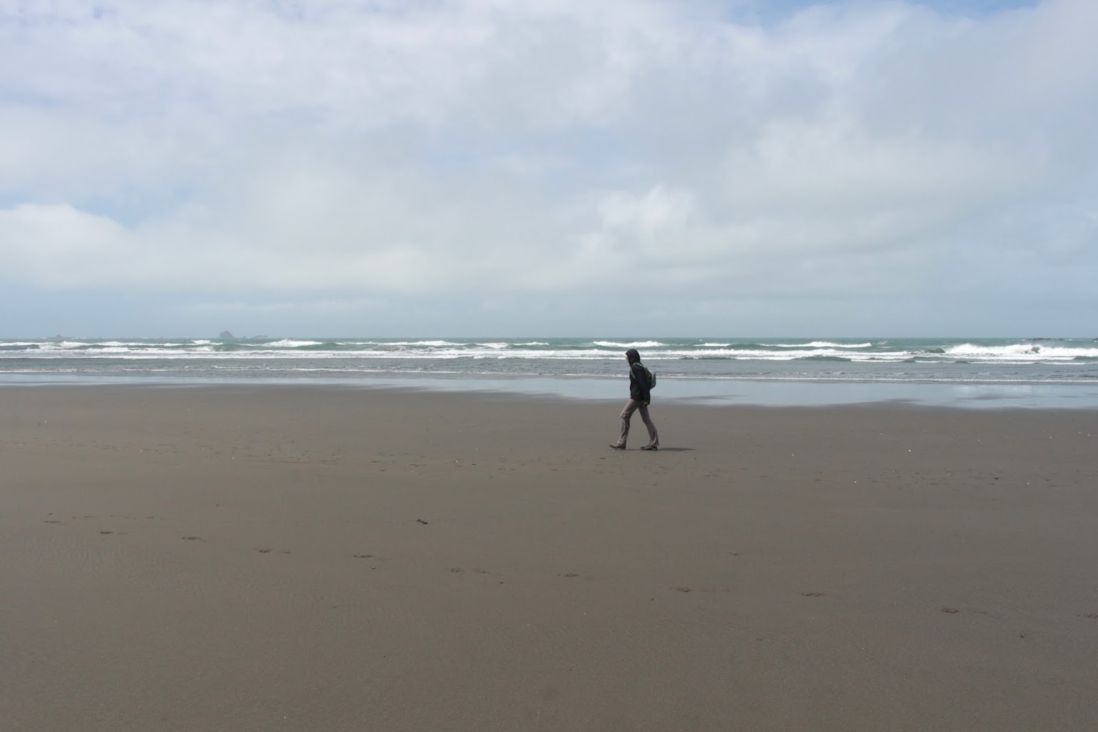
 |
| Band of Rogues, 2017 edition |
With all of us wondering what the heck we were doing out in the rain, we put on the Frogg Toggs (of course, I was the only one in a very chic and bright yellow suit; I sort of looked like either a human banana or the Man In the Yellow Suit from Curious George) and hoisted our packs. Yeah it was raining but really, the rain was fairly kind and gentle as it only rained intermittently and for short periods of time. The temperature was cool, bordering on chilly, but just perfect for hiking. It wasn't bad at all. I keep telling myself that, too.
 |
| Hiking in the rain is so much fun |
The Rogue River Trail from the Graves Creek Trailhead is a common destination for day hikers and most of us had been on this trail a number of times. None of us Rogue River Trail grizzled veterans had ever seen so many wildflowers on the trail, though. Large swaths of tarweed, sea blush, popcorn flower, and red larkspur painted the grassy slopes yellow, pink, white, and red. Our little group of 5 quickly segregated themselves into those with cameras and those without; those with cameras naturally brought up the rear.
 |
Crossing the wet spot with utmost care
|
Not even a half-mile into the hike, a small creek presented the first travail (besides the rain). The creek waterfalled onto the trail and ran over the rocky tread. This particular little creek runs all year so the rocks are slipperier than an eel with a runny nose, perfect conditions for top-heavy backpackers to take a spill. We hugged the wall and carefully picked our way to safety, although Kevin's dog Wish had no problem; but then again he has 4-wheel drive and natural traction tires.
 |
| Russian Creek |
Once safely across the snotty creek, it was time to enjoy the oh-so-familiar 3 miles to Whisky Creek, where a short break was taken. From there, it was up-and-down on a trail that alternated between grassy slopes; copses of madrone, tan oak, and fragrant laurel trees; conifer and cedar forests; and exposed cliffs. The basic pattern was that the trail would drop down to cross a creek and then back up to the cliffs high above the river; repeat for each of the many creeks splashing across or under the trail.
 |
The only thing better than hiking in
the rain is camping in the rain |
We had started late because the plan was to hike short the first day but nobody wanted to put out early and spend more rain time in camp. So, we actually went farther than intended, eventually dropping off the trail and scrambling down to a flat spot at Slate Slide. Not sure why it is called that but nobody slid down to camp. The tenters in the group squeezed in tight on the small shelf. Meanwhile, the two hammockers (me and Dale) in our group had to find two spindly trees on the rocky slope to dangle between. In camp, I plucked one small tick I felt crawling on my back and then I felt thousands of imaginary ticks crawling on me afterwards.
Day 2
 |
| Yep, another rainy day |
In the middle of the night, the heavens opened up and it really rained hard. The staccato rhythms of the raindrop on my rain-fly was soothing and despite the noise, I slept quite well. Score one for the hammock! Unfortunately, everybody's gear got quite wet in the process of striking camp: sleeping bag, clothes, pack...you name it, it had gotten wet despite best efforts to keep stuff dry. Because of the wetness, I believe my pack had actually gained weight from the day before. Kevin and Wish were only with us for the first day so we bid them both adieu as we grudgingly began the day's hiking activities.
 |
Giving thanks to a gift
left by a trail angel |
Life was wet on Day 2. The rain fell steadily but we all were clad in Frogg Togg rainsuits, although I was sporting the only bright yellow suit. The others wore more conservative but dignified desert brown and forest green, but were nowhere as cool, suave, and debonair as I. And I keep telling myself that, too.
 |
| Ground cones, sprouting forth |
Speaking of forest green, the vegetation was busting forth in spring profusion, be it ferns, trees, wildflowers, or poison oak. But mostly it was poison oak. The Frogg Toggs probably helped in warding off poison oak rashes as well as repelling water. Also celebrating spring, was a healthy population of ticks. Remember the one I found crawling on me in camp? Well, that turned out to be the only tick I would find crawling on me this trip and the guys were fairly irritated with me as they flicked ticks off of pant legs by the dozens. Unfortunately, not all were plucked off and each was at some point, bitten by the little tick-wads. Not sure why I was deemed unflavorable by the ticks, but I was sure glad I was!
 |
| Saw and stepped on a lot of these guys |
Despite the rain, the views high above the river were astounding. The river snaked in the canyon several hundred feet below, and tendrils of mist hugged the forested mountains in a rainy embrace. Once past Horseshoe Bend, I promised the guys a flat and fast trail but memory does play tricks because the trail was not particularly fast or flat.
 |
| Ditch Creek, from camp |
After 8'ish miles of hiking we set up camp next to Ditch Creek, a rambunctious stream tumbling next to a meadowed hillside. I suspect this was the site of a former homestead because the slopes were dotted with rogue fruit trees. Just below our campsite, the Rogue silently coursed by and fortunately, the rain finally let up by the time we set up camp. I couldn't find two trees the right distance apart so I just set up the canopy and slept underneath but on the ground. Note to self: buy more parachute cord.
Day 3
 |
| Hitchhiker on my sleeping pad |
Day 3 was the midpoint in terms of mileage, calendar, and weather. Gone was the rainstorm from the first two days and we would enjoy a pleasant mix of sun and cloud on the day. When we stopped and rested periodically, we took the occasion to dry out wet clothing and gear in the warm sunlight. Dale's phone (his camera) quit working when it got wet on the first day so he took out the battery and dropped the wet phone in a package of dehydrated bacon and eggs. That did the trick although he now feels like eating breakfast every time he makes a call. Day 3 was also the midpoint of sartorial hygiene as I joyfully donned clean socks, shirt, and underwear. Same old smelly hiker, though.
 |
| Zane Grey's cabin |
Leaving Ditch Creek, we noticed an old flume ditch running next to the trail, that's more than likely how Ditch Creek earned its name. A few miles into the day's hiking, John, Lane, and I left the Rogue River Trail for a short walk down to Winkle Bar, which coincidentally is the name of Dale's favorite nightclub. The bar, a meadowed flat spot next to the Rogue, is private property but the owners allow hikers to visit Zane Grey's old cabin. Apparently, the famed author spent time fishing on the Rogue River and the ramshackle cabin where he stayed still is in existence. Also in existence is the original two-hole privy. We didn't look to see if any fossilized Zane Grey poops still existed beneath either hole.
 |
| Landslides were a challenge to get past |
About a mile beyond our Winkle Bar sojourn, a massive landslide had taken out a significant portion of the Rogue River Trail. Getting across required hiking poles and utmost concentration so I didn't take any mid-slide pictures as is my normal wont. The first landslide was the most challenging and the largest, but not the last such one we would encounter.
 |
| John and Dale hid at Rogue River Ranch |
Lane and I lagged well behind, taking pictures of everything, while John and Dale hiked ahead. It seemed like the Rogue River Ranch would be a logical spot to regroup but this is where things went awry. John and Dale had the same thought and took the side trail to the ranch, a working museum and historical site, and waited on the porch for us to show up. However, not being sure if Dale and John were at the ranch or whether they had continued on the Rogue River Trail, we chose the trail.
 |
| Bridge at Quail Creek |
So while we observed the red buildings of the ranch below the trail, we could not see Dale and John on the porch side of the buildings as we continued on past the ranch. Meanwhile Dale and John waited patiently for us to show up, unaware we had leapfrogged past. We had all agreed we were camping at the confluence of Mule Creek and the Rogue River but when Lane and I arrived there, naturally there was no Dale and John.
 |
| Douglas's iris |
Not sure what to do, we continued on the Marial Road (the Rogue River Trail requires a short road walk to continue on) to the Marial Trailhead. The road had a lot of muddy puddles on it and Lane and I quickly deduced by the lack of footprints that Dale and John were behind us and sure enough, just as we were about to turn back, here they come, they likewise deducing we were ahead of them. The experience was rather discomfiting and the end result was that from here on in, we were a lot more circumspect about communicating our regrouping points, plus we regrouped more often.
 |
| Cliffy trail at Mule Creek Canyon |
Since it was nearly two miles back down the trail to camp at Mule Creek, we all opted to continue on. So, in the late afternoon we enjoyed Mule Creek Canyon, arguably the most spectacular portion of the trail. At Mule Creek Canyon, the suddenly treeless terrain turns into a black, rocky, and stark moonscape. The Rogue funnels into a narrow canyon and at The Coffeepot, the unhappily constrained river swirled in powerful eddies, the river seemingly running backwards.
 |
| Stair Creek Falls |
Here, the Rogue River Trail is chiseled precariously into the rock and you do want to watch your step. At Inspiration Point, Stair Creek stairsteps down out of its canyon in a series of thundering waterfalls. Way cool, and our pace was slow because those with cameras were snapping away and those without simply soaked in the view.
 |
| Seep-spring monkeyflowers grew on the cliffs |
Despite the relative lack of vegetation in all the rock, everybody (except for me) was busy harvesting ticks. Just call me the Tick Whisperer as the bloodsucking arachnids showed no interest in O'Neill blood at all. Must be a benefit of all the spicy food I eat!
 |
| Lane crosses one of many small creeks |
Camp was set up among rusting mining equipment at Burns Creek. I actually camped closer to Blossom Bar Creek, about 75 yards further up the trail, because that was the only place I could find two perfectly spaced trees without poison oak growing underneath. Because I was camping separate from everybody else, I missed the Lane scream and light show.
 |
| My humble abode |
Lane had stowed his gear underneath his tent canopy which meant his gear was right next to him. In the middle of the night, a creature actually had the temerity and nerve to start rummaging in his gear. Lane spotlighted the midnight raider with his headlamp and he saw some alien lemur-otter thingy with a striped tail. Everybody was awake by that point with with all the shouting and light waving. The camp larcenist was the rarely seen
ring-tailed cat, actually a member of the raccoon family. Despite the reclusiveness of the species, this particular specimen was fairly brazen, returning several more times during the night.
Day 4
 |
| Blossom Bar Creek, in the morning light |
Day 4's morning found everybody (except for me, thankfully) plucking ticks out of each other's necks, scalps, and backsides. The day was cool but eminently sunny. And only a mile or so into the hike, we crossed picturesque Paradise Creek and strolled onto the grassy grounds of Paradise Lodge.
 |
| All life should be like a laze at Paradise Lodge |
When I had hiked the Rogue River Trail 5 years ago, we stopped for beer at the idyllic lodge and nearly did not continue hiking further that day. On this current trek, fortunately or unfortunately (depending on your point of view) the lodge had not yet opened for the season so the consumption of alcohol was not an impediment to the required mileage for the day.
 |
| We hated to leave Paradise |
Even though the lodge was closed, the benches on the shaded porch were eminently inviting. We partook thereof, lazing for about an hour, not doing much of anything but watching the Rogue flow below. But the more we hiked on this day, the less we'd have to hike the next day so reluctantly, we shouldered our packs and left the bucolic setting of the lodge and returned to the forest.
 |
| The Rogue flows by Brushy Bar |
Between Paradise Lodge and the Brushy Bar Guard Station, the trail tended to be cliffy and on open grassy meadows. We enjoyed superb views of the Rogue running below. Because of the rain earlier in the week, the river color had changed from a murky blue-green to a decidedly brown hue. The warm sun had brought reptiles out of hibernation. Plenty of alligator lizards and bluebellies skittered just off-trail, their rustling in the grass and leaves eliciting excited yips from a startled Lane.
 |
| Shady forest was a Day 4 bonus |
Poison oak grew everywhere, and in the end, I was oddly grateful for a mere quarter-sized rash on my arm as my sole dubious badge of honor. Maybe that rash was a balancing of the books by the Itch Gods for my seeming immunity from ticks. Much more pleasing than the accursed itch-spawning plant however, was the plethora of wildflowers nodding in the grass. Plenty of rampant photography ensued, what with flowers, forest, and fantastic river scenery to point the camera at.
 |
Flora Dell Falls
|
After about 8 miles of hiking, noisy Flora Dell Falls cascaded next to the trail. The mist and breeze engendered by the falls was a welcome respite from the hot and sweaty work of backpacking. Our intent was to camp at Flora Dell Camp but despite the 4 of us looking for the campsite, we never did find it. Several miles later, we arrived at Hicks Creek as day was beginning the process of easing into night. We walked off trail and down a slope to a large meadow and dry-camped there.
 |
| Golden Iris |
After a cold night, most of us struck camp and eagerly began the short hike out. I slept in and didn't hit the trail til nearly 10 o'clock. The trail peeled away from the river and became mostly all about walking through an exquisitely shaded trail in a sublimely beautiful forest. The river was transitioning away from its Wild and Scenic designation to a wider and tamer version of itself, so we were OK with spending time away from the river after 4 days of constant companionship.
 |
| Typical trail scene on Day 5 |
Near the end, the Rogue River Trail is a cruel taskmaster because for no reason at all, the trail heads straight uphill in a series of steep switchbacks before dropping down close to river level again. I had always assumed we were contouring around private property but after checking the map, we were within Forest Service boundaries so really, there was no reason to climb uphill except for the capricious spite and maliciousness of trail designers. And just to hammer the point home, a second such climb came up just as we had ceased grumbling about the first climb. Trail designers will NOT go to Heaven!
 |
| Bridge, spanning Dan's Creek |
Several miles from the finish, we crossed paths with a hiker and his dog, heading in the opposite direction. It was Kevin and Wish! They seemed fresh and clean, totally unencumbered by their puny little day packs. We were really glad to see Kevin, because he had a car with which to shuttle us to Foster Bar, where my car was waiting; we were mentally done with hiking and even one mile more was one mile too many. Plus, Kevin brought cookies, what a guy! Wish was glad to see me, particularly since I doled out some tasty beef sticks.
 |
| The last part of the trail was through a pastured valley |
The last mile of trail was through a grassy valley well away from the river. A party of younger backpackers were just setting out, they were so fresh and naive unlike us jaded and unwashed band of Rogue rogues. We too would have been just as starry-eyed eager at the hike's commencement, had it not been for the rain.
Epilogue
 |
| Sea blush pinks up the trail |
A couple of gear notes here: This was my first hammock trek and I found out several things in the process. First off, I need to rethink my method of hanging the hammock: a couple of lengthy hanks of parachute cord should do the trick. The way I was doing it, the trees had to be perfectly spaced so extra cord will provide greater flexibility in my choice of trees.
 |
Stout bridge at Bunker Creek
|
Secondly, a hanging hammock has no insulation and is completely surrounded by air. A cool night is a cold night when spent in a hammock. On my shopping list is an underquilt and a better sleeping pad. I kind of hate to do that because it just means I have to carry more gear and weight. But the additional gear should still use up less pack space than a tent and it may be worth the extra fuss because the sleep quality in a hammock is far superior to that of sleeping in a tent.
 |
| Maple trees kept us shaded and cool |
Well, that's it for now, another epic hike in the bag! It was awesome, despite (or maybe because of) the rainy weather. For more pictures of this renowned trail, please visit the Flickr albums:
Day 1
Day 2
Day 3
Day 4
Day 5
Here is a link to Lane's pictures:
Backpacking the Rogue River Trail
And here is Dale's version of events:
The Rogue River Trail