Showing posts with label backpacking. Show all posts

Sunday, July 10, 2022

Windigo Pass to Bingham Lakes


Well, the Cowhorn Mountain day-hike was all over and done with and that was my cue to trade in my daypack for a backpack. I'm a glutton for punishment apparently, but doing a day hike and a backpack trip all in the same day really seemed like a good idea after knocking down several peach tea ciders the day before.

The mosquitos await me and my blood

The basic plan for the backpacking segment of the day was just to depart (immediately after the hike to Cowhorn Mountain) from the Pacific Crest Trailhead at Windigo Pass and hike a mile or so down Forest Road 60 to the Metolius-Windigo Trailhead. There is a creek running at the Metolius-Windigo Trailhead from which to water up at, and I figured I'd unceremoniously camp in the forest above the creek. However, I was all dressed up with nowhere to go, so to speak, and my legs still had plenty of pop so I just wound up hiking all the way to Nip and Tuck Lakes, roughly about 3 miles from Windigo Pass
Nerd alert!

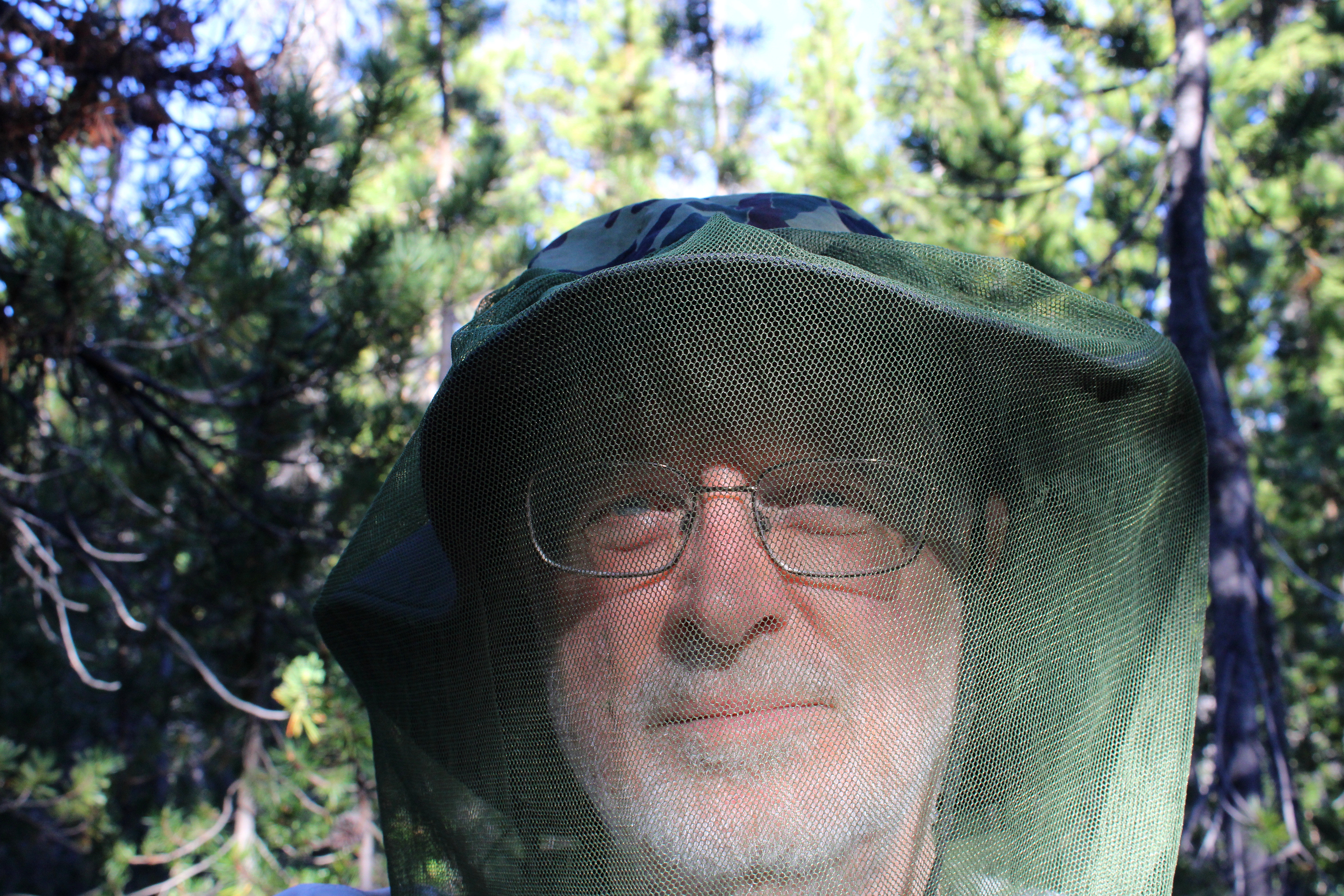
I had hiked here a week prior and already there were a few noticeable changes. There were no snowdrifts for one, the drifts being supplanted instead by thick clouds of ravenous mosquitoes. It had been a long time since I had felt the need to hike with a head net on but there I was, my handsome visage geekily swathed in netting in a desperate attempt to retain a modicum of blood for my own personal use.

Sunset at Nip and Tuck Lakes

Camp was set up on the narrow forested isthmus forever separating Nip and Tuck Lakes, and in between cooking, eating dinner, and fending off vast clouds of miniscule Dracula spawn, I explored the shore along both lakes. The sky was blue but trending towards sunset and small puffy white clouds moved across the sky overhead. Eventually, sunset arrived, turning the clouds pink, and then it was time to get inside the tent while the mosquitoes whined outside, thankfully stymied by the tent's mesh fabric.

Trees dead and live

Hiking all the way to Nip and Tuck Lakes had totally screwed up my logistics. Because I had hiked farther than intended, Oldenberg Lake was now under two miles away and Bingham Lakes were only two and a half miles away. Not a lot of walking would be required on Day 2, making for a long fun-filled day of mosquito and human interaction.

Day 2 was a dry and dusty affair

The Metolius-Windigo Trail is about one hundred miles in length, connecting the Mount Jefferson Wilderness to Windigo Pass. I'd be hiking on the MWT but locally, the trail was signed and mapped as the Oldenberg Lake Trail, which only made sense, seeing as how I was hiking to Oldenberg Lake itself. The dry and dusty trail got there via a short but rigorous stretch that went up and over a forested ridge, followed by a longer descent down to Oldenberg Lake. It'd be a steep climb on the return leg but hey, at least I had something to look forward to.

Oldenberg Lake

Oldenberg Lake is a popular stop for Pacific Crest Trail through-hikers hiking the MWT as an alternate route, for unlike the PCT, the MWT passes by many lakes and makes water replenishment easy and convenient. However, on this day I had the place to myself, not counting about two million mosquitoes, and I kicked back for a while, appreciating the calm lake under a blue sky. Off in the distance, the tip of Odell Butte was visible on the horizon, with its lookout affixed to the summit like the world's smallest party hat.

If you like dry lodgepole forests, then this is your hike

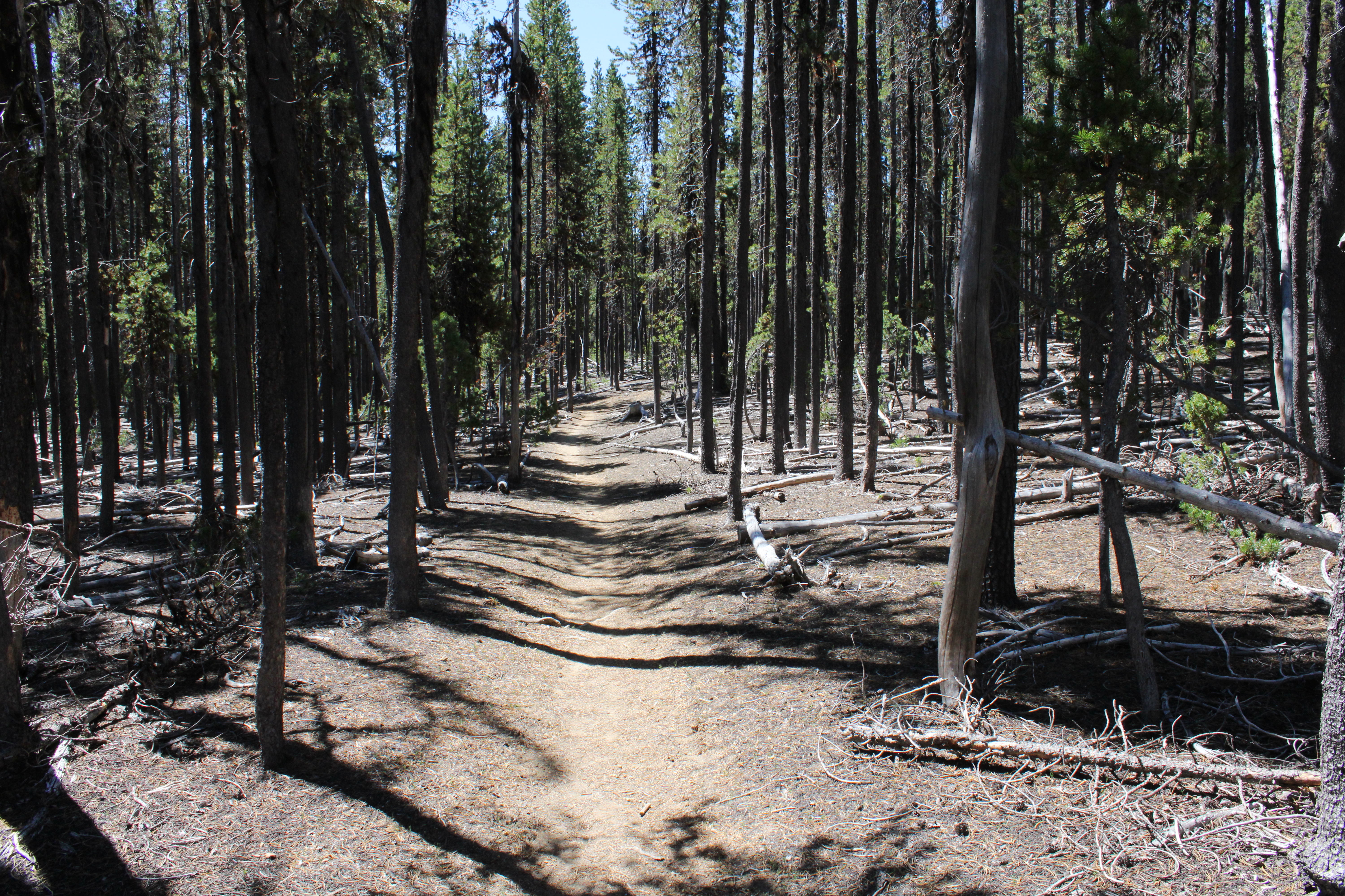
Between Oldenberg and Bingham Lakes, lay a dense forest of spindly lodgepole pines. I don't think there was any other plant species growing in the pumice-based soils that lodgepole thrives in. There weren't any mosquito-hunting species of fauna either, judging by the unimpeded hordes following my every move. Nothing here but lodgepole, mosquitoes, and one incredibly handsome backpacker with tasty blood.

One of the Bingham Lakes

Bingham Lakes is a collection of four or five medium sized lakes situated below and on the northeast side of Cowhorn Mountain. When I arrived at the first Bingham Lake, it was still early and before ten o'clock. It was already pretty warm for early morning, too. Rather than set up camp and swelter inside a hot tent while doing battle against a relentless airborne armada of insectile piranhas, I decided to turn my three-day hike into a two-day affair. So, it was an early lunch and then a turnaround to begin the hike out.

Back on the dry trail

So, back through the lodgepole trees I go, the trees providing some shade but not nearly enough on a warm day. The hiking rendered me into one sweaty dude in no time at all, and the resulting ungodly goo of sunscreen, Deet, perspiration, and trail dust rolled into my eyes, making me cry like a child whose cherished yellow balloon had suddenly and unexpectedly popped.
So many trees, so little shade

But hey, the really cool (sarcasm!) part was that the long descent I had come down on when approaching Oldenberg Lake, was now a long and protracted climb out of the lake's basin that had me feeling the "Old" in "Oldenberg". While I had felt pretty darn walky the day before, on this day I felt more like a jelly bean melting on a hot sidewalk. Let's just say I took a few more rest stops than normal before the trail crested and all that bad uphill stopped. The good news though, was that the amount of mosquitoes trying to eat me decreased in inverse proportion to the rising temperature.

That ridge had been our route to Cowhorn Mountain the day prior

The Oldenberg Lake Trail dropped steadily back into the same forested basin that contained Nip and Tuck Lakes. Periodically, I could see distant mountains and peaks like Black Butte and Cappy Mountain. Nearer to the trail, and way above, were the cliffs and crags of the same rocky ridge we had walked on the day before, when hiking to Cowhorn Mountain.

Brunch, anyone

Right before arriving at the MWT Trailhead, a startled bird flew up from the base of a tree growing right next to the trail. The bird was not particularly noteworthy but what got my attention is that I had seen the same bird not only on yesterday's hike, but on the prior week's hike as well. Sure enough, a quick search of the area revealed two eggs unceremoniously laying on the ground. I took off my pack, fired up my stove, and enjoyed a tasty omelet of wild eggs. Kidding! What I actually did do was take a quick photograph of the gray speckled eggs with apologies directed to Mama Bird anxiously watching me from a nearby branch.

Carpenter ant on a hike of its own

When I finally made it back to the Windigo Pass Trailhead, gone were the thundering hordes of aromatic through-hikers, but there was That One Brunette (her trail name, actually) taking a breather among the cache of water jugs at the trailhead. At this point I was feeling like my trail name could have been Nipped And Tucked but on the plus side, it had been just under a twenty-mile weekend for me.
That way for a future hike

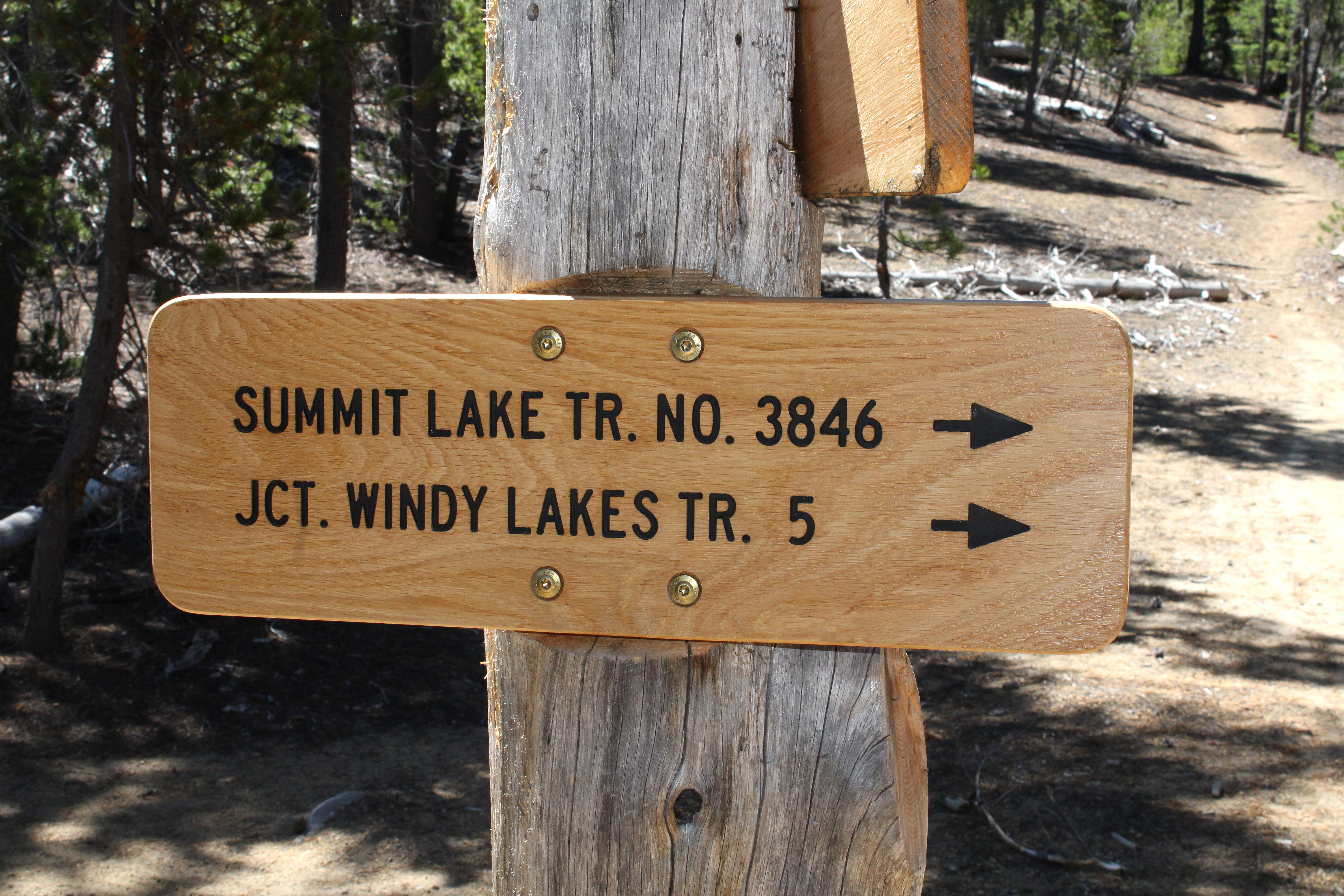
In retrospect, the hike was a bit short for three days. I'm already thinking about returning to do a loop hike in the area that would include Susan, Darlene, and the Windy Lakes with maybe a return via Summit Lake and the Pacific Crest Trail. That would bump up the mileage to a respectable 35 miles or so.

X marks the spot

On second thought, scratch that! Shortly after I completed this hike, a lightning-caused wildfire set up camp on Windigo Pass itself. Looking at the maps, the Windigo Fire came pretty close to the trailhead, as the fire burned on either side of Road 60. In response, the Forest Service closed the Pacific Crest trail from Crater Lake to Bend, along with half of the Diamond Peak Wilderness, and half of the Mount Thielsen Wilderness. Meanwhile, the mammoth Cedar Creek Fire has closed all of the Waldo Lake Wilderness. Looks like I'll be pretty much hiking in my living room these days.

Random skyline snippet along the trail

For more photos of this hike, please visit the Flickr album.

Friday, May 27, 2022

Rogue River Trail (backpack)


So there we were on the last day of our Rogue River Trail backpack trip, eating lunch in the shade and sitting next to the trail. A fellow backpacker came up from the opposite direction and as is customary, we greeted each other, he by giving us a friendly nod and a curt acknowledgment of "Gentlemen". Three out of the four people in our party thought it no big deal while one was singularly nonplussed. The one irritated member of our quartet was not gentleman nor man and Missy was fuming at being so mistaken for a member of the male species. "Couldn't he see that I'm not a man?" she wailed, our laughter no tonic for her discomfiture. We decided Missy's trail name could be Sir or Mister, but looking at her long braids draping over the front of each shoulder, I'm of the opinion that our erstwhile dude could have no greater honor than to accept with pride, her given trail name of  "Willie Nelson".

Day 1

Golden iris put on a show for
the entire time of our visit

The first day of our forty mile journey was overcast but we (Rogue River Trail newcomers Missy, Mike, and Terry) were off and hiking anyway, except for yours truly, who had to backtrack to the car to retrieve a rain hat, which would be sorely needed on this trip. But at least I get the Golden Boot Award for hiking farther than everybody else. 

Whiskey Creek, as we arrived

All participants were familiar with the first three miles to Whiskey Creek, but once we passed that first major stream, it was all new trail for my Rogue River Trail newbs. However, by the time we reached Whiskey Creek, we had all become accustomed to the basic pattern of the trail, consisting of a climb to a cliff overlooking the river in its canyon and then a descent down to a tributary creek, followed by another climb away from the creek to a cliff overlooking the river. Up and down, in and out, and repeat for forty miles. Also repeated for forty miles were the soft caresses of poison oak leaves on our arms and legs as that pernicious shrub was constantly encroaching the trail.

These flower smelled lovely, Blogger
needs to add a scratch n' sniff option

We passed creeks Whiskey, Alder, Russian, Bronco, and Bunker over the first nine miles of trail and so far so good as far as my aged legs were concerned. However, the next three'ish miles had some pretty steep grades and by the time we reached Horseshoe Bend I was thoroughly pooped, but on the plus side, we had knocked off nearly twelve miles which wasn't bad for us old hikers.

Day 2

A cloudy dawn yet Terry said
the storm was dissipating

Day 2 will live in infamy in the memories of all participants. Although, there were just some clouds in the sky when we struck camp, the day would soon be as wet as the interior of a water balloon, Terry's cheery and overly optimistic prognostication of "it's dissipating" notwithstanding.

Missy has a bonding moment with the wet earth

After an hour or so of hiking on a trail covered with numerous piles of bear poop, the first raindrops began to fall. We hiked another hour or so before we all began to feel the need to put on raingear. Missy should have put on mud gear too, for she took a spill crossing a creek and suffered an ignominious sit-down upon the wet earth. 

OK, it's raingear o'clock

One highlight of the second day was a side trip to Zane Gray's cabin, a rustic ramshackle cabin in the middle of a grassy meadow where the famed author stayed when he fished the Rogue. Shortly after leaving the cabin and resuming our hike on the Rogue River Trail, we ran into a party of about eight day hikers. It was our friends, the Friends of the Umpqua Hiking Club, day hiking to the cabin and they looked wet. They probably thought we looked wet, too.

The rain did not dissipate

After exchanging pleasantries with our friends, we continued on and at the eleven-mile mark, we arrived at the Rogue River Ranch, now a historical backcountry museum. And that was when the wind started. We were all soaked at this point, having hiked in the rain for the last six hours or so, and that wind had us all shivering in no time flat. Backpacking is so much fun!

Arrival at Rogue River Ranch

We went to the ranch and sat on the porch with about a half-dozen other backpackers in a vain attempt to seek shelter from the elements. The caretaker offered the services of his wood stove to dry out clothing and gear but we all politely declined for there's no wood stoves in backpacking. He was a nice guy though, and it was a relief to know hikers in trouble could have a place to go to for help, if needed. At any rate, we camped by the river and all of us were in our tents by three o'clock in the afternoon, listening to the wind and rain raging on the other side of our flimsy tent fabric.

Day 3

Still not dissipating, Terry

The ranch caretaker did share with us that the storm would abate this morning, but you'd never know it from the rain that was still vigorously pelting our campsite. Humorously enough, we held a quick meeting to decide that we'd start our hike later in the morning when the weather would break, the humor being that the meeting was held verbally, each one of us participating from inside one's own tent. It was like the backpacking version of a Zoom Meeting.

Overjoyed when the sun broke out

From the ranch, there is a short road walk to the Marial Trailhead and it was somewhere around there that the mid-morning sun came out, warming limbs and souls alike. From Marial, the trail entered an amazing world comprised mostly of black jagged rock at the bottom of the river canyon. Here, the Rogue funnels into narrow Mule Creek Canyon, famed as a formidable challenge for rafters. The precarious trail is etched into a cliff face and you really want to watch your step here, for the drop-off from the trail is sheer. The highlight of this section is Stair Creek, which tumbles into the Rogue in a series of awesome waterfalls. One other highlight was that because of the sun, we removed rain gear, jackets, pant legs, and applied sunscreen to our pale and pallid skins. 

Precarious trail etched onto a cliff

Continuing onward, we passed through the grounds of Paradise Lodge, which was not as backpacker friendly as it had been in years past, although they graciously let us picnic on their deck. From there it was the usual up and down ramble over flowing creeks, through lush forests, and across dry and open cliffs. At the ten mile mark, we set up camp at Tacoma Camp, well populated with rafters camping there.

Day 4

Tacoma Rapids as we began the hike out

Day 4 was getaway day. It also was our shortest day, coming in at a paltry 7.9 miles. Good thing too, because hiking in wet shoes during Day 2's deluge had given me some blisters. Of course, the last and easiest day also had the best weather, something that had also occurred during my two other through-hikes of the Rogue River Trail. It must be a rule.

Peaceful Flora Dell Falls

The main highlight as we left Tacoma Camp was Flora Dell Falls, where Flora Dell Creek tumbles over a cliff to splash into its basin. The weather wasn't particularly warm but the cool spray blowing off the picturesque cascade still felt refreshing.

Pathway through the woods

The remainder of the hike crossed several creeks and was mostly wooded. The Rogue had been the official Wild and Scenic Rogue River during our hike but here, the river widened and began flowing a lot more in keeping with its now ponderous bulk. Welcome to the Tame and Civilized Rogue River, boys and girls. We did have two steep uphill sections to hike over though, as the trail had to detour around some private property parcels, much to our annoyance.

Advertisement for "Come to Oregon!"

The end of the Rogue River Trail was pretty spectacular, though, as it went through a long extended pasture in a valley ringed by forested mountains.  As we hiked by, appreciating the postcard view under a blue sky, incurious cows impassively gazed at us. The trailhead put an official end to the Rogue River Trail but we still had a short walk on a roadway to where my car was waiting for us at Foster Bar.

We did it!

We did it! Even though this was my third go-round with the Rogue River Trail, I still felt a profound sense of accomplishment. No doubt my newbs felt a similar sense of accomplishment, unburdened by the ennui that multiple hikes on the same trail can engender. And as a reward, we stopped in Gold Beach for barbecue sandwiches that were to die for, in our deprived post-hike condition. There are some things about civilization that you just appreciate more after a long backpack trip.

Elegant brodeaia, looking elegant, as always

For more photos of this hike, please visit the Flickr album.

Monday, May 16, 2022

Lost Creek Lake (weekend backpack)


It was just a small sign tacked onto a trailhead kiosk, measuring maybe a foot square but the words on it were sufficient enough to throw my plans for backpacking around Lost Creek Lake into chaos. The stern blue letters on the sign advised the bridge at Blue Grotto was closed to hikers, no reason given other than it was unsafe. Somewhat uncharacteristically, I heeded the terse message and on the fly, rearranged my itinerary.

All life should be walking in a field of daisies

Spring was in full song at Lost Creek Lake as I began hiking from the lake's dam, at the time blissfully unaware of any upcoming closures. Everything was green as the trail initially set out across a grassy field of shin-high daisies. I had never been on this part of the lakeside trail and was immediately impressed with the lushness of the vegetation growing alongside the large lake.

One of several million elegant cat's ear flowers

Life was burgeoning all along the trail but elegant cat's ear was the dominant life form on this two-day hike. Figuratively purring in the sun, the white fuzzy flowers brightened up grassy hillsides and leafy duff alike. My pace was slow as I seemingly took a photo of each and every bloom, for no two ears are ever alike.

Green was the color of the day

There was plenty of shade to be enjoyed on this sunny day, for the lake's shore was heavily wooded with firs and other conifers. A lush understory of ferns and other moisture-loving plants thrived in the shade beneath the trees. Just past Four Corners Camp, a backpackers' camp where there were no corners at all to be seen, much less four of them, the fir forest was then supplanted by oak woodland.

So nice to see Lost Creek Lake full of water

Periodically, the trail would leave the oak woods and traverse across open semi-arid patches of manzanita and dry grass, the lack of trees allowing hikers to spend some quality time with Lost Creek Lake. The lake was ringed by forested hills and mountains with distinctive Flounce Rock being the nearest and most prominent. The lake's water level had been low the last several years, thanks to an extended drought, so it was nice to see it full of water after this wet winter.

The relatively narrow Lost Creek arm

Lost Creek Lake from overhead, would resemble a pollywog were it not for the Lost Creek arm of the lake. Thanks to the aforementioned arm, the lake looks like a pollywog with a giant dorsal fin holding a flashlight. Actually it really resembles nothing more than an amorphous blob but my imagination feels the need to come up with some kind of simile.  At any rate, the trail went up and around the arm which eventually felt more like narrow fjord than significant-sized lake. 

Well, this screwed up my plans

There's a trailhead located where the route crosses burbling Lost Creek, and that was where the sign filled me up with consternation. What to do? I was about four miles into the hike and Blue Grotto was probably another four miles ahead. I dithered as I hiked some more and at roughly the six mile mark, I decided to stop and camp, if only because the trail passed through a series of amazingly beautiful meadows atop cliffs with spectacular overlooks of the lake. If I wasn't going to circumnavigate the lake, then these bucolic pastures were certainly an appealing place to spend the night at.

My home away from home

After pitching my tent in the middle of an idyllic copse of oak trees, I then stealth-cooked dinner. Stealth cooking is that technique where you cook and eat dinner on the trail and then hike another hour or so before setting up camp. This is done so as to prevent bears from getting too interested in your campsite, lured in by enticing food aromas. Bear scat had been spotted on the trail, so I hiked ahead to a scenic overlook and cooked and ate on a convenient bench while enjoying the late afternoon scenery. 

An up-close look at German knotweed

After dinner, I slapped a macro lens on my camera and began crawling through my meadow home, photographing all things small and smaller. It's amazing the things you can find at the other end of a macro lens and I noted a tiny plant with prickly green leaves that when magnified, were actually miniscule green flowers. Hello, German knotweed, I believe we haven't ever met before, pleased to make your acquaintance! 

Got an early start on the hike out

After a breezy night spent listening to the pleasant soughing of windblown oak branches, I bid the German knotweed "auf Wiedersehen", struck camp, and hit the trail somewhere around eight o'clock in the morning. Doing anything by eight o'clock is a rarity in my retirement years but I was glad I did, for the temperature was cool and the morning light slanting through the woods was most enjoyable. Although, it did feel strange to finish hiking before eleven o'clock in the morning.

Tall silvercrown was a common sight

Upon my return to home and computer, I researched the question as to whether the closure at Blue Grotto was still in effect. I had my doubts because in all honesty, the sign did look a little weatherworn, like it had been there for quite some time. Unfortunately, I couldn't find any info so I'll just have to hike at the other end and find out, or take my chances on another circumnavigation attempt. Nonetheless, I really did enjoy my meadow camp and outing so I'm not too upset at not being able to do the full hike around the lake, it was all good.

This lake patrolled by guard geese

For more photos of this hike, please visit the Flickr album.

Friday, May 14, 2021

PCT (West from Soda Mountain TH to livestock pond)


Some niggling little health problems (I'm fine, thanks for asking!) predestined this overnight backpack trip in the Cascade-Siskiyou National Monument to be a short one. However, despite the diminutive mileage, this hike was big in forests, scenery, and hugely epic (but not in a good way) when it came to weather conditions. Still, two out of three is a passing grade and I could have always stayed home to file my crusty old toenails. 

Look, a hiker, let's get him!

When I hoisted my backpack onto my shoulders at the trailhead, the sky was blue, the temps were mild, and all was bathed in bright sunlight despite a looming bank of baby thunderhead clouds parked several safe miles to the east. Perfect conditions for hiking in and you'd never suspect bad weather could become an issue on this hike, but such is Oregon weather and keep on reading, dear readers of mine.

Not all the snow had yet melted off

May is, in my humble opinion, the optimal time to visit the Cascade-Siskiyou National Monument. The small mountain range of the Monument bridges the gap between the Siskiyous and Cascades mountain ranges and the whole vibe is at turns, either or neither or both Cascade and Siskiyou in terms of vegetation, climate, and geology. In about a month or so, the terrain will brown out due to the aridity of the area, the dried out hellebore meadows then rattling in the summer breeze like thousands of cackling witches. But in May, the snows have not completely melted, the forests are damp, the mountains are cloaked in a green blanket of lush vegetation, and wildflowers put on a show for camera-toting backpackers.

After the storm

The Pacific Crest Trail bisects the Soda Mountain Wilderness, a wilderness preserve set within the Monument's boundary. In the Wilderness, the forest was cool, dark, and shady while a virtual army of marching trilliums bloomed on the forest floor, if thousands of elegant flowers could be accurately described as a marching army. Maybe that's not an apt descriptor but it would not be the first time I babbled or dabbled in inept metaphors. At any rate, there were lots of white trilliums blooming, with bluish Oregon anemone and nodding glacier lilies playing a significant supporting role.

Avalanche lilies were everywhere

Periodically, the trail would break out of the forest and onto open slopes that tended to be somewhat on the rocky side. On either side of the trail sprawled huge meadows with nubs of sprouting hellebore being just a few inches tall. A byproduct of the open meadows or rocky slopes were expansive views of Bear Creek Valley with Mount Ashland dominating the skyline and crest of the Siskiyou Mountains. Snow had been here until just recently, evidenced by the sprouting hellebore and rampant patches of avalanche lilies, the dangling star-shaped flowers pointing face-down toward the ground, which was still wet and muddy thanks to the recently thawed snow.

The water pond and yes, I drank the water


In one of the meadows, there is a small livestock pond that is an important water source for PCT hikers as water gets to be in very short supply in August, when the through-hikers pass through Oregon on their way to Canada. Camping near the pond was a little problematic because the soil was wet and mushy during my initial search for a camping spot. However, a long and broad meadow extended north and I set up camp on the meadow's edge, with an awesome view of the valleys and mountains dropping and rising from my campsite as my reward.

Larkspur inhabited the meadows, too

The low grasses were chock full of short flowers, notably those of larkspur and the ever plentiful avalanche lily. When not crawling on my hands and knees in my never-ending quest for the perfect wildflower photo, I spent time at the edge of the meadow, admiring the view as the day waned into late afternoon. But clouds rolled in overhead and the day went dark while a gusty breeze began to shake trees and tent alike. Yet, looking north and west, Medford, Ashland, and Mount Ashland were enjoying a sunny day while I was having to unfairly contend with ever increasingly belligerent weather.

Rain cometh, it has been foretold

The weather continued to turn and the light clouds turned as dark and oppressive as a pessimist in a bad mood. The breeze increased in velocity and I was having to restake my tent every now and then as bellicose air currents worked the stakes loose from the very soft soils of the meadow. Soon a nonstop pitter-patter of raindrops on my hat brim announced the change from intermittent shower to out-and-out rain. Yet, the sky to the north was tinting yellow and orange as sunset drew nigh while I was stuck on my meadow having to endure the elements.

Strange weather over Emigrant Lake

Tired of getting wet, I retired early, listening to the soothing sound of rain on my tent. Not so soothing however, was the rumble of distant thunder. In short order, I could see flashes of lightning and discerned the lightning was fairly far away, for I could count up to five before the thunder arrived. Pretty soon though, I couldn't even count up to one and if I closed my eyes, I could see the veins in my eyelids every time the lightning flashed. And that thunder was loud too, each boom starting in the left ear and finishing in the right like an Airbus A380 from Hell dive-bombing my puny tent from east to west.

Sunset at the same time as the hail
storm was pummeling my tent

The staccato noise of the rain on my tent fly suddenly changed in tenor and intensity. Those raindrops were now fat and heavy and I stuck my head outside of my tent to see the latest weather wonder. What fresh new Hell was this? Instead of rain, my tent was being pelted by heaviest hailstorm ever. I almost said "Well, at least it's not large-sized hail!" but managed to catch myself before that thought was uttered out loud. Because the wind insisted on working my tent stakes loose, the tent's roofline sagged a bit and the hail began collecting in the dip. Removing hail off of the tent was added to my list of weather-related duties. Yet, while hail accumulated on and around the tent, light from a beautiful sunset over Mount Ashland was slanting into my eyes. Weird.

The next day was like "Rainstorm? Lightning? Hail? Really?"

The hail lasted about an hour and a half and the whole storm about five hours in duration. But eventually and for no reason at all, all went quiet as if the Supreme Storm Master had capriciously flipped the "OFF" switch just because she could. The peace and quiet were most welcome and I then fell into a relaxing slumber that was probably more exhausted stupor than sleep. The next day dawned bright and near cloudless, making for a nice and easy hike out while at the same time, reminding me I had definitely picked the wrong evening for my first backpack trip this year. 

Right outside my tent door

For more photos of this hike, please visit the Flickr album.