Showing posts with label Jackson County. Show all posts

Monday, May 16, 2022

Lost Creek Lake (weekend backpack)


It was just a small sign tacked onto a trailhead kiosk, measuring maybe a foot square but the words on it were sufficient enough to throw my plans for backpacking around Lost Creek Lake into chaos. The stern blue letters on the sign advised the bridge at Blue Grotto was closed to hikers, no reason given other than it was unsafe. Somewhat uncharacteristically, I heeded the terse message and on the fly, rearranged my itinerary.

All life should be walking in a field of daisies

Spring was in full song at Lost Creek Lake as I began hiking from the lake's dam, at the time blissfully unaware of any upcoming closures. Everything was green as the trail initially set out across a grassy field of shin-high daisies. I had never been on this part of the lakeside trail and was immediately impressed with the lushness of the vegetation growing alongside the large lake.

One of several million elegant cat's ear flowers

Life was burgeoning all along the trail but elegant cat's ear was the dominant life form on this two-day hike. Figuratively purring in the sun, the white fuzzy flowers brightened up grassy hillsides and leafy duff alike. My pace was slow as I seemingly took a photo of each and every bloom, for no two ears are ever alike.

Green was the color of the day

There was plenty of shade to be enjoyed on this sunny day, for the lake's shore was heavily wooded with firs and other conifers. A lush understory of ferns and other moisture-loving plants thrived in the shade beneath the trees. Just past Four Corners Camp, a backpackers' camp where there were no corners at all to be seen, much less four of them, the fir forest was then supplanted by oak woodland.

So nice to see Lost Creek Lake full of water

Periodically, the trail would leave the oak woods and traverse across open semi-arid patches of manzanita and dry grass, the lack of trees allowing hikers to spend some quality time with Lost Creek Lake. The lake was ringed by forested hills and mountains with distinctive Flounce Rock being the nearest and most prominent. The lake's water level had been low the last several years, thanks to an extended drought, so it was nice to see it full of water after this wet winter.

The relatively narrow Lost Creek arm

Lost Creek Lake from overhead, would resemble a pollywog were it not for the Lost Creek arm of the lake. Thanks to the aforementioned arm, the lake looks like a pollywog with a giant dorsal fin holding a flashlight. Actually it really resembles nothing more than an amorphous blob but my imagination feels the need to come up with some kind of simile.  At any rate, the trail went up and around the arm which eventually felt more like narrow fjord than significant-sized lake. 

Well, this screwed up my plans

There's a trailhead located where the route crosses burbling Lost Creek, and that was where the sign filled me up with consternation. What to do? I was about four miles into the hike and Blue Grotto was probably another four miles ahead. I dithered as I hiked some more and at roughly the six mile mark, I decided to stop and camp, if only because the trail passed through a series of amazingly beautiful meadows atop cliffs with spectacular overlooks of the lake. If I wasn't going to circumnavigate the lake, then these bucolic pastures were certainly an appealing place to spend the night at.

My home away from home

After pitching my tent in the middle of an idyllic copse of oak trees, I then stealth-cooked dinner. Stealth cooking is that technique where you cook and eat dinner on the trail and then hike another hour or so before setting up camp. This is done so as to prevent bears from getting too interested in your campsite, lured in by enticing food aromas. Bear scat had been spotted on the trail, so I hiked ahead to a scenic overlook and cooked and ate on a convenient bench while enjoying the late afternoon scenery. 

An up-close look at German knotweed

After dinner, I slapped a macro lens on my camera and began crawling through my meadow home, photographing all things small and smaller. It's amazing the things you can find at the other end of a macro lens and I noted a tiny plant with prickly green leaves that when magnified, were actually miniscule green flowers. Hello, German knotweed, I believe we haven't ever met before, pleased to make your acquaintance! 

Got an early start on the hike out

After a breezy night spent listening to the pleasant soughing of windblown oak branches, I bid the German knotweed "auf Wiedersehen", struck camp, and hit the trail somewhere around eight o'clock in the morning. Doing anything by eight o'clock is a rarity in my retirement years but I was glad I did, for the temperature was cool and the morning light slanting through the woods was most enjoyable. Although, it did feel strange to finish hiking before eleven o'clock in the morning.

Tall silvercrown was a common sight

Upon my return to home and computer, I researched the question as to whether the closure at Blue Grotto was still in effect. I had my doubts because in all honesty, the sign did look a little weatherworn, like it had been there for quite some time. Unfortunately, I couldn't find any info so I'll just have to hike at the other end and find out, or take my chances on another circumnavigation attempt. Nonetheless, I really did enjoy my meadow camp and outing so I'm not too upset at not being able to do the full hike around the lake, it was all good.

This lake patrolled by guard geese

For more photos of this hike, please visit the Flickr album.

Sunday, March 20, 2022

Viewpoint Mike


You may find this hard to believe, but I don't particularly like hiking uphill. Ironic, given that I spend so much time doing that very thing, but it sure seems like all good hikes inevitably wind up going uphill at some point. It's a necessary evil, when it comes to hiking. Forbearance is the key to making peace with uphill hiking though, and I've since learned long ago to simply accept the things I cannot change. However, a recent bout with Covid left me a little short of breath and now the struggle is real, the complaining justified and not all that funny. But the trail still calls to me and I chose Viewpoint Mike because while uphill, the short 5-mile hike (my first since getting Covid) would provide some good feedback as to what kind of post-virus hiking shape I'm in.

Brrr...let's go hiking already!

At the start, the temperature was a chilly 34 degrees and the cold air slapped at my face like the flipper of an annoyed seal. There's really only one thing to do in that case and that is to start attacking 1,000 feet of elevation gain between me and the 2.5 miles to the summit. If you don't get warm doing that, then check for the pulse you do not have, you zombie.

Tall trees make me feel small and insignificant

As the trail wound its way ever upward, the whole vibe was definitely Siskiyou foothill. Leafless oaks dotted low growing grassy meadows with occasional rock formations scattered throughout. Interspersed intermittently throughout the hike were shadier woods consisting of a mix of madrone, Ponderosa pine, cedar, fir, and the ever ubiquitous oak. And it almost goes without saying, poison oak grew everywhere underneath the trees, which is why I mostly stayed on trail.

A lone Oregon sunshine brightens up a bed of moss

Spring has just arrived and the early spring wildflowers were beginning to bloom. Yellow seemed to be the color du jour and desert parsley, Oregon sunshine, and buttercup were only too proud to hoist the yellow standard in the low grasses. Not to be outdone by their butter-colored brethren, lavender snow queen bloomed on the forest floor while purple grass widow, arguably the most elegant wildflower ever, gentrified the grassy slopes.

Rail and trail

The route switchbacked back and forth up a wooded ridge where at the edge and summit thereof, sits the actual viewpoint of Viewpoint Mike. On the way up to the overlook, much of the path was flanked on the downhill side by wooden rails and I can only speculate that the rails-for-trails are there to prevent bikers and hikers from shortcutting down the hillside. And I can only rail (pun intended) at the idiocy of going for a hike (or bike ride) while being unwilling to actually hike (or bike) on the trail.

The trail was relatively benign in the middle section

The first third of the route ended at a gravel roadway, where signs direct hikers down the road for a bit before the track resumes on the opposite side. This middle portion of the hike is a relatively level wander through sparse oaks and low growing grassy pastures. Water and mud was a thing though, as the hillside was leaking water through a number of seasonal seeps. My boots and pants legs became wet and muddy and they better have liked it.

Not that bad, unless you've just had Covid

After the brief level respite, the trail began heading uphill in earnest. While I have hiked on much steeper trails, my post-Covid legs and lungs really felt this section of trail. Nonetheless, perseverance won out and legs and lungs kept doing their job, despite the obligatory complaining. 

Viewpoint Mike rocks!

Just like my head, the lush growth thinned out near the top. Here, the trail wandered through an old flow of lava sludge where the only things growing on the black rock were lichen, moss, and the occasional desert parsley plant blooming in the cracks. The thinning woods allowed for ever increasing trailside vistas down the Rogue River valley, tantalizing your merry blogster when just like that, the actual viewpoint was arrived at.

Lost Creek Lake from Mike's summit

And what a view it was! Lost Creek Lake sprawled across the mountainous landscape, the dark blue-green waters contrasting with the dark forested hills and the gray sky above. To the west lay a prominent valley carved out by the Rogue River, and little pieces of the river could be seen here and there. Not quite as scenic but visually interesting nonetheless, were the complex of holding pools and ponds belonging to the Cole Rivers Fish Hatchery, sited just below the dam holding Lost Creek Lake at bay.

The weather made a decided turn for the colder

As I tarried at the overlook, the day definitely became grayer and more overcast and as a result, the temperature dropped noticeably. When I had begun the hike, it was 34 degrees at the trailhead and up here on the viewpoint, it was now 31 degrees. That was my cue to head downhill back to the car.

Grass widow grieves her dearly departed

I must say that the Covid did not affect my downhill legs at all, and I made quick work of the return leg like a veritable King of the Downhillers. If only every hike could go all downhill but then again, it wouldn't really be hiking now, would it?

Natural telescope

For more photos of this hike, please visit the Flickr album.

Saturday, February 19, 2022

Jacksonville Forest Park 2/19/2022


Take a bowl of spaghetti soaked in red marinara sauce, flip it upside down on a white tablecloth, and voila, you'll have your very own rendition of a Jacksonville Forest Park trail map. And do make sure to clean up the mess before the wife gets home! Messy culinary metaphor aside, the point I'm trying to make is that trails proliferate everywhere in the esteemed woodland park, filling the map with squiggles that resemble a ball of wriggling baby snakes (or bowl of spaghetti) more than a network of well-used footpaths. There are so many paths, routes, and junctions that the very idea of leading a hiking group there would (and should) fill one with trepidation. Appropriately enough, Lane (the designated hike leader for this Friends of the Umpqua outing) was justifiably trepidated. 

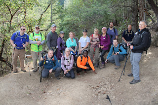
A flock of Eagles and Monkeys gather in the forest

Glenn and I had hiked this route just a couple of weekends prior to the official Friends of the Umpqua hike, so I'm not going to rehash the hiking thereof since the club hike was the same route described in my prior blog entry. However, the complexity of the hike presented a degree of difficulty not normally encountered because on our chosen route there were at least 38 trail intersections presenting 38 opportunities to peel inattentive hikers away from the group. Unique challenges require unique solutions, so we'll talk about those instead.

Chuck leads the Turtle charge, such as it is

Because Lane, Glenn, and yours truly were familiar with the route, the 17-member group was partitioned into three teams, based on hiking speed. In order of anticipated rapidity (or lack thereof) the teams were named after animals: Eagle, Monkey, and Turtle; and stickers were handed out to all hikers like so many kindergartners on a field trip. And guess who was in charge of Team Turtle? In response to the cruel japery directed my way by those who felt superior to our slow but mighty team because they could walk faster, I could only remind them that it was a turtle that had won the race against the hare.

A rolling stone gathers no moss, but
standing trees on the other hand, do

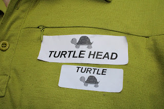
Two-way radios were distributed to two leaders in each team (except for the Turtles) and all leaders were assigned code names: Eagle Beak, Eagle Claw, Monkey See, Monkey Do, and Turtle Head.  Additionally, each team leader was given a list of check-in and regroup points and I must say, the whole system worked quite well other than the many turtle insults broadcast over the public radiosphere. I chose not to respond in kind and just retreated into my shell.  

Jacksonville Creek had some water in it

Because I had been here just a couple of weeks prior, I noticed Jackson Creek was carrying a bit more water this time out, thanks to some intervening rain. As always, I had my trusty camera with me but really, I didn't take a lot of pictures, preferring instead to concentrate on my duties as chief turtle herder and overall hike sweep.

An oak, uncertain about which direction to grow

As the hike wore on and the trail trended towards the uphill, some hikers dropped into the next slower group down and accordingly, I soon acquired more turtles in our bale and yes, a group of turtles is really called a bale. At any rate, I preferred to think of the neo-Turtles that were former Monkeys as Turkeys.

Manzanita was in bloom on Upper Twin Peak summit

One of our regroup points was atop Upper Twin Peak where we fed the animals, so to speak. We ate lunch on the wooded summit while soaking in the view of Mt. McLaughlin and Bear Creek Valley, enjoying the hiking camaraderie, and denigrating all things turtle. With so many hikers all chatting and chomping atop the summit, it was quite the zoo. The main thing for the three team leaders was that all hikers were present and accounted for. So far, so good.  

Lichen clings to life on a tree trunk

The good news from a hiking standpoint was that after the summit of Upper Twin Peak, the route was all downhill, causing some of the Turkeys to self-promote back up to Monkey rank. As an aside, the Monkeys were indeed pretty rank all right, but that's another story.

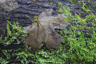
A maple leaf, about to get devoured by moss

It was a pretty satisfied and happy group that last gathered at the trailhead for a final head count when the hike was over. In speaking to some of the participants post-hike, the consensus seemed that as the hike started, there was much grumbling and talk of mutiny because of the stultifying team hiking rules and regulations. However, after the first several dozen trail intersections or so within the first set of miles, everybody saw the need for being organized and all would-be rebellious types soon became happily compliant. Should have named that group Team Sheep.

I wear my badges with honor

My only complaint about the whole outing is that apparently, my new trail name is now Turtle Head. Not sure I particularly like that, I'd gladly shed my turtle shell, but then I'd either be homeless or naked and not really sure which.

Quite the menagerie

For more photos of this hike, please visit the Flickr album.

Saturday, February 12, 2022

Sterling Ditch Mine Trail (From Deming Gulch)


It was such a beautiful day. The sun was out with nary a cloud in the clear blue sky, manzanita bushes were in bloom, bees were buzzing, and the temperature was a wonderfully mild 70 degrees. So, why so glum, Richard? Despite absolutely the near-perfect spring-like weather, my inner Chicken Little was screaming "BUT IT'S FEBRUARY, WHERE'S THE #$@& SNOW??!!!" So yeah, it was a delightful hike in the fine weather conditions along historical Sterling Mine Ditch, yet there had been a sense of unease and foreboding about what promises to be a hot, dry, and fiery summer because of "winter" days just like this one. So, I just lived in the moment and enjoyed the hike anyway, much as a lemming would enjoy the run approaching the cliff.

Just a trail and its ditch

And speaking of environmental disasters, back when Jacksonville was experiencing its mining boom in the mid to late 1800's, the Sterling Mine Company employed Chinese laborers to dig a 25'ish-mile ditch to divert water from the Applegate River to the mine's hydraulic operations. Along with the prodigious mining scars, the remains of the old ditch still exist. The good part about the ditch is that the downhill-side berm makes for a handy-dandy hiking and mountain biking trail. And simply because I'd never been there, today's hike began on the Deming Gulch Trailhead.

Tats on a madrone trunk

Right from the get-go, the hike had that distinctive Siskiyou foothill vibe. The terrain and atmosphere were clearly drier than our comparatively sodden Cascades, and the thin woods and forests were populated with madrone, oak, cedar, Ponderosa pine, and other assorted conifer. The oak trees were currently bare, stark, and leafless but the plentiful lichen adorning the scraggy trees didn't seem to mind. Madrone and Ponderosa pine each added some color to the hike, mostly in the form of orange trunks like so many ex-presidential limbs. Poison oak was a thing too, but let's give thanks to the wide and well-maintained Sterling Mine Ditch Trail for letting us avoid the itchy madness that Satan's favorite shrub can engender. 

A sparse forest as the trail rounds Peak 3259

The route was rounding a combo of Peaks 3214 and 3259 on the northwest side and as a result, much of the first part of the hike was in shade. Armstrong Gulch sort of cleaves the peaks in two, bending them into a U-shape and once we rounded a ridge and entered Armstrong Gulch at the mile and a half mark, the sun was screened from view and we'd have to wait just a little bit longer for that 70 degree weather. Green and grassy vegetation grew in the shady forest even though the gulch was dry, thanks to a mostly rainless February.

Manzanita ushers in spring and the bees are happy

Once the track rounded Peak 3259, the slopes were totally exposed to the sun and harsher elements. Tall shade-giving trees were in short supply here, although that may be ameliorated when the oak trees leaf out and provide some shady succor to perspiring hikers, bikers, and trail-runners. The vegetation was increasingly dominated by manzanita shrubs sporting bee-attracting umbels of pale pink tubular bell-like flowers. 
View of the terrain surrounding the Little Applegate River


It goes without saying that the sparse tree cover allowed for some expansive vistas of the surrounding landscape. The dry slopes of Peak 3214 sloped down into the Little Applegate drainage, which could be observed running all the way to the much wider Applegate Valley, near the small town of Ruch. The lesser peaks of the Siskiyou foothills could be seen all round, most notably being those of Woodrat Mountain, Burton Butte, Mount Baldy, and Ben Johnson Peak. 

Nearby Woodrat Mountain

As the hike continued in a southerly direction, the snow-covered Siskiyou Mountains became more and more visible, increasingly commanding attention and respect. In particular, the prominent peak of Grayback Mountain presided over the landscape sprawling beneath a vibrantly-colored blue sky. Closer to the trail, Peak 3214 rose high above, aspiring to be a mountain worthy of a name other than the current numeric identifier.

This was as "hilly" as the trail got

This was one of those hikes that was all about the journey, particularly since it lacked a clear and logical destination. Accordingly, I made the decision to turn around at the 5 mile mark and as luck would have it, that happened to be right at Cantrall Gulch, which actually had a few puddles of water as evidence a creek sometimes flows here. From there, it was back the way I had come, in increasing warmth, sunlight, and longer shadows (where there were trees).

Lichen takes over a small branch

At the end of the day, it was with a sense of accomplishment that the hike ended. It had been quite some time since I had last walked 10 miles or better. Plus, this section of the Sterling Mine Ditch Trail was a new trail for me, a rarity since it seems like I've hiked everywhere there is to hike in southern Oregon. And the spring day was superb with mild temperatures, clear sky, and generally glorious weather, EVEN THOUGH IT'S FEBRUARY!!!

Oak trees and blue sky, all hike long

For more photos of this hike, please visit the Flickr album.

Saturday, January 29, 2022

Jacksonville Forest Park


So I sort of volunteered Lane to lead a hike in Jacksonville Forest Park. Of course, the one drawback to my diabolical plan was that Lane had never been to the park and I'd been only once. Clearly a scouting trip was in order so Glenn, who is quite familiar with the park's network of trails, was enlisted to show us the way. But Lane called in sick, so it wound up just being me and Glenn, and we all see what Lane did there.
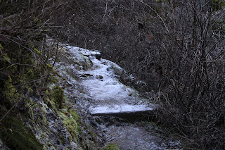
The Rail Trail ambled through the pleasant woods

Starting from the trailhead below smallish Jacksonville Reservoir, our route crossed the dam on a footbridge and set out on the Rail Trail. In short order, we arrived at the ruins of an actual railway trestle. Here, the bridge abruptly ended in mid-air and lest I be tempted to come up with a bunch of jokes about this, a plaque somberly reminded us that in 1917, one Denver Marsh perished in a train accident here. 

Jackson Creek needs more water

The Norling Trail ran next to Jackson Creek and to see the creek in its full glory, you need to be here right after a rainstorm (or during, maybe). On this day, the creek was barely trickling but the sound of water burbling through the trees was reward enough. At Confluence Bridge, where creeks Cantrell and Jackson meet, trails scatter in different directions like so many dandelion seeds floating in a breeze. Here, hikers have to decide in which direction they are going. For us, it would be a continuation on the Norling Trail up Jackson Creek. Norling is a popular name in the park as there is a road, creek, mine, and trail that all carry the name, the oddity being that the Norling Trail does not go to any of the other Norling-named features.

Norling Creek cuts a swath through leafy duff

There were no falls on the Canyon Falls Trail either, although there was a bench that was labeled "Canyon Falls" that offered a look at lethargic Norling Creek desperately trying to make it as far as Jackson Creek before running dry. The hike was a steady uphill endeavor but never overly so, and offered a pleasant walk through woodlands carpeted with a thick layer of decomposing maple leaves. 

Watch your step, the trail is icy!

Small isolated snow patches flanked the trail, which was heavily frosted in places. Virtually all of this hike took place on the shady side of Jackson Creek's frigid canyon and even though the day was sunny, extra clothing layers were an all-day requirement, thanks to the chilly air and general all-around lack of sunlight on our route.

The entrance to Norling Mine was barred shut

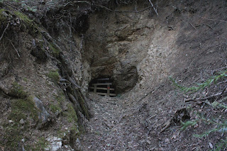
This park's history is heavily interwoven with historical mining activity around the rustic town of Jacksonville. Accordingly, our route sideswiped several mines, the first of which was Norling Mine. The mine entrance was just a small hole on a wooded slope, the entrance barred shut to prevent silly people from crawling into the mine and never being heard from again, or maybe to keep pallid cave deer from slithering out.

View of Mt. McLaughlin and Bear Creek Valley

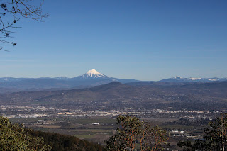
The Atsahu Trail was on an old roadbed that angled upwards through woods increasingly trending to madrone before cresting at an open saddle. At the saddle, we made a hard right turn and Glenn gaily skipped up the path to Upper Twin Peak while I trudged step by painful step, darn younger people anyway. Our reward for all the toil and trouble was a rest on a strategically sited bench with an awesome view of Bear Creek Valley, Mount McLaughlin, and Grizzly Peak, all covered with white snow under a vibrantly blue sky.

No Richard, the hike was named after ME!

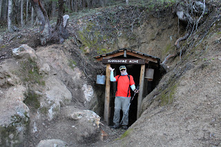
It was all downhill from here, thankfully and we switchbacked down the Owl Hoot Trail, passing El Patron (a huge madrone tree) along the way. Hoot man, the downhill was certainly a lot more fun than the slog up Upper Twin Peak! The Owl Hoot met up with the Boulder Trail which in turn led to the Handsome Mine entrance, triggering a lively discussion between Glenn and I over which one of us the mine was named after. This mine was also doored shut, although a tap on a window pane turned on lights inside of the mine, illuminating railway tracks disappearing into the inky black bowels of the very earth itself.

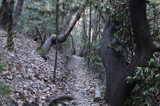
Narrow trail in the deep and cold shade

The Ol' Miner's Trail could have triggered another lively argument between Glenn and I but neither one of us had any real interest in claiming the moniker of Ol' Miner. If it were Handsome Ol' Miner, then maybe. At any rate, after wandering past an old hydraulic mine site littered with rusting mining equipment, the trail spit us out onto Jacksonville Reservoir Road near the trailhead parking lot and just like that, the hike was over. Many thanks to Glenn for helping us out with planning our upcoming hike.

Map of our route

So, I ran into Lane a couple days later and let me tell you, he did not look sick at all. Far be it from me to say he pulled a fast one, but his recovery was a medical miracle on the face of it. However, since I am now the only one with knowledge of the route, I'll probably get stuck leading the hike for him but then again, I could call in sick!

Even the trails have trails

For more photos of this hike, please visit the Flickr album.