Sunday, August 30, 2020

The Twins


"Double the pleasure, double the fun, The Twins are fun for everyone!" I may have missed my calling as a jingle writer but then again, I'd have to learn music and lose my self-respect, but on the other hand it would pay the bills. And moving right along from inane rhymes to the far more serious topic of hiking, this was Getaway Day of the campout at Odell Lake and just as I broke up the long drive to the campground by hiking to Bobby Lake, I decided to break up the long drive back home with yet another hike in the Waldo Lake area.
 

Trail sign at the intersection with the PCT

The Twin Peaks Trail is basically Bobby Lake Trail's neighbor from a parallel universe, meaning that the two trails were only about four miles apart but travel in parallel to each other, and never shall the trails meet. Each trail begins from the Waldo Lake Road, both cross the Pacific Crest Trail, and both head due east to reach their respective destinations. Each spends several miles in dry and dusty forest with nary a view to be had but there the similarities end. The Bobby Lake Trail is relatively level while the Twin Peaks Trail is most assuredly the very antithesis of level.
 

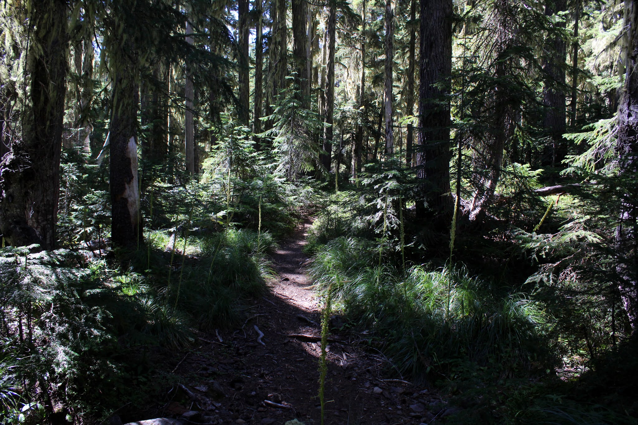
It was a dusty slog for the first several miles

The soils in the Waldo Lake area are volcanic in nature and in keeping with the theme of this week's hiking, my legs were soon covered with a thick layer of volcanic dust. Within a mere quarter-mile of the trailhead, the path inclined sharply and I began having 
glute-burning flashbacks to the last time I was here. Apparently, the trail hasn't gotten any less steep during my extended absence. At ground level, it looked and felt like it was just another slog up through a forested grade but the reality was that the trail was actually climbing the slopes of The Twins. 

A pond of stagnant water provides succor for mosquitoes

After a mile or two of thankless toil on the slopes of The Twins, the trail crossed the Pacific Crest Trail heading to either Charlton Lake or Bobby Lake, depending on your direction of travel. If anything, the path had become even steeper in grade as it slogged on ever upward through a densely shaded forest. In testament to the geologic origins of the (relatively) small peak, basaltic formations of gray and black rock flanked either side of the trail. Also flanking the trail were a series of small stagnant ponds and sparse meadows, the meadows sprouting where there once were shallow puddles before summer's heat dried them out.
 

Just about on the crater's rim

And just like that, the forest ended and the trail charged madly up a slope comprised of inch-high grass. Just when you thought it couldn't get any steeper, it did, but I was by now fully committed to reaching the two summits. After a hot and sweaty bit of hiking, the grass thinned out and then it was all red, brown, and ochre pumice and small rocks as the footpath finally reached the rim.
 

Wildfire smoke occluded the view of Waldo Lake

The Twins (or Twin Peaks) implies there are two completely separate summits independent of each other. That indeed is sort of correct but really, the two summits are just a pair of high-points on the rim of a single volcanic crater. The first twin is the smaller of the two and it sits on the north end of the rim. It was with some eagerness that I reached the top of the first twin, fully anticipating a stunning and expansive vista from Waldo Lake to the Three Sisters.
 

A spectral South Sister looms in the distance

If I squinted hard, I could maybe and just barely make out either of those landmarks, surprising because Waldo Lake in particular was really very close to the summit and should have been easily visible. Unfortunately though, large areas of California were aflame and a white cloud of haze was hiding Bend and the rest of central Oregon from view. Closer to home, fires had broken out 
in the Opal Creek Wilderness, on the slopes of Mount Jefferson, and in the Sweet Creek area of the Coastal Range. I'm not sure which one of those fires were contributing the layer of dirty brown smoke but it may have been a combination of all of them. 

If nothing else, The Twins are colorful

At any rate, the haze and smoke did detract from the would-be view. Despite the limited visibility though, it was still kind of awesome in its own little opaque fashion. South Sister, Bachelor Butte, and nearby Charlton Butte were all visible in a spectral ghostlike smoky way. Charlton Lake and several large reservoirs to the east accented the dark forests covering the land between peaks. Huge Waldo Lake sprawled right below the smaller of The Twins, a great big sapphire hole in the forest tapestry covering the volcanic terrain.
 

The path climbs up to the taller of the two Twins

A short walk to the taller Twins summit provided some sense of closure and the same views but with the addition of Diamond and Maiden Peaks to the south. Gold and Bobby Lakes kowtowed and prostrated themselves at the feet of their respective mountains, demonstrating utmost reverence for those greater than themselves. And always, the view from either Twin provided a look at the colorful rocks of and soils of the other Twin.
 

A sparse prairie between Twins

All good things come to an end, though and so it was with this hike. On the way down, I ran into several groups of mountain bikers on foot, laboriously pushing their bikes upward, breathing heavily as they did so. Good, I was thinking it was just me but maybe the trail really was as steep as it felt.
 

Gold Lake grovels at the feet of Diamond Peak

For more photos of this hike, please visit the Flickr album.

Saturday, August 29, 2020

Fawn and Stag Lakes


Forgive me if I start fawning over Fawn Lake. Sometimes, it feels like mountain lakes in the Cascades are a dime a dozen but Fawn Lake is arguably one of the better ones. Situated in a high mountain pass at the base of several cragged and jagged peaks, the postcard view of the lake is a ready made advertisement for hiking in the Diamond Peak Wilderness. To top it off, there is a large rocky bench overlooking the lake with just the perfect backpacking campsite atop it. Be it day hike or backpack trip, Fawn Lake is most definitely a worthy destination. 

These guys!

Doe Lake is nowhere to be found but never fear, Fawn Lake is not an orphan because a protective and nurturing Stag Lake keeps watch from nearby. I can relate to that because I single-parented my kids for seven years, and how about a tip of the hat to all the stags out there raising fawns all on their own. Anyway, after hiking to Stag Lake, I'm all about stagging over Stag Lake because Fawn Lake comes in a close second best, scenery-wise. And if you think I overplayed the cervine puns and references, “Oh, deer!” is all I’ve got to say. By the way, my mother's sister Lerna has always gone by the name of Ler for short, but us kids just call her Aunt Ler. Oh, deer, once again.

Let's go hiking!

This was the final day of our campout at Odell Lake so it stood to reason that our last hike had better be a good one. We disembarked from our vehicles at the Crescent Lake boat ramp parking lot and in a hiking oddity, we had to hike a short distance to the actual Fawn Lake Trailhead. In other words, we had to hike from the trailhead to the trailhead, and that made about as much sense as the Electoral College. We were going to Fawn Lake of course, but the Metolius-Windigo Trail also departs from the same trailhead. Curious about this trail, I did a little research and found out the MWT is about 100 miles long and runs from the Mount Jefferson Wilderness to Windigo Pass in our own Umpqua National Forest. I'm game, who's with me on this? 

An easy walk through gorgeous woods

But back to the subject at hand, I'm supposed to be writing about the hike to Fawn Lake and not about enticing 100 mile long trails that call to me. In keeping with the volcanic legacy of the Diamond Peak Wilderness, the trail was dry and dusty and surrounded by a lush and healthy forest that gradually transitioned to a forest of scrawny lodgepole pine trees as we gained elevation. The grade was always uphill but never what I would call steep so it was a pleasant walk through the woods and volcanic dust on the way up to Fawn Lake. 

The gawking begins at Fawn Lake

After three miles of easy hiking, we arrived at peaceful Fawn Lake. The lake reposed poetically in a forested bowl surrounded by tall mountains. At the opposite end of the lake, loomed craggy Lakeview Mountain, Peak 6892, and Redtop Mountain which was mostly tucked around a corner of the lake. The air was fairly still so all the aforementioned peaks reflected nicely on the lake's surface. I had been here before but none of my ducklings had been, so it did my heart good to hear all the oohing and aahing from my appreciative brood. 

Part of the hike up to Stag Lake

After a requisite stop for a view soak, we grabbed the Crater Butte Trail which rounded the north shore of Fawn Lake. The path climbed steadily through thin woods and low scrub, the view of the lake improving until it eventually receded from view. The trail was seemingly heading straight to Peak 6892 but before we crash landed on the peak, so to speak, we made a right turn onto the Stag Lake Trail. 

The Stag Lake impostor

"Is that all there is?" we collectively wondered as we gazed at a very unimpressive semi-stagnant pond with lily pads floating on the surface. All that work to get here and it was sad indeed to get so disappointed by an underwhelming pond until John noticed a continuation of the trail. And me with a GPS that I didn't even think to consult with! Fortunately, the trail did continue to a lake that just had to be Stag Lake. Just to be sure, I checked my GPS this time. 

All the magnificent scenery still cannot
prevent me from acting like an idiot

Stag Lake sits right at the foot of craggy and impressive Lakeview Mountain, the gray rock looking as formidable and unassailable as a medieval redoubt. The symmetrical cone of Peak 6892 was also looking down upon Stag Lake, just not from front and center like Lakeview Mountain was doing. Lake, mountains, and forests were all reposing under a clear and deep blue sky spread out above. Such magnificent scenery just demanded a lengthy and reverential contemplation stop and we so obliged. 

Missy hikes through a lodgepole forest

After an hour-long view soak, lunch, and general all-around lollygaggery spent lazing in the sunshine with maybe a nap or two by a hiker or two, it was back the way we had come. On the way back, we made sure to retrieve some of our friends who stayed behind at Fawn Lake for a shorter hike and I’m glad to report we finished the hike with the same amount of hikers we started out with. I’m also glad to report that the weather was absolutely glorious, unlike my only other outing here where I had to run down the trail dodging lightning bolts hurled by weather gods using me for target practice. Some experiences don’t need to be relived. 

Part of that great campout at Odell Lake

All present agreed this had been a grand hike and the whole campout at Odell Lake had been an unqualified success. For more photos of this hike, please visit the Flickr album.
 

Thursday, August 27, 2020

Yoran Lake to Midnight Lake


Mount Yoran is a comparitively smallish pinnacle that has the misfortune of eternally standing next to massive Diamond Peak. Anywhere else, Mount Yoran would be an impressive peak in its own right but whatever stature it may have had gets eclipsed by the imposing geologic marvel that is Diamond Peak. At the feet of both Diamond Peak and Mount Yoran lies Yoran Lake, and all things Yoran have the misfortune of being so named because I always trot out the hackneyed one-liner “That one’s Yoran and that one’s his’n!” I’ve got a million of them folks, and that’s why I hike alone a lot.

Penny demonstrates a case of the eebie-jeebies

We (Friends of the Umpqua) began hiking from the Trapper Creek Trailhead, where signs advised that the log bridge over Trapper Creek was damaged and as a consequence, closed. Naturally, we all hiked past the sign and across the one-railed bridge, some of us sure-footed as mountain goats and others as wobbly as dizzy drunks fresh off a merry-go-round. The bridge did have some damage but did not particularly look or feel structurally unsound. It spanned rushing Trapper Creek coursing about fifteen feet below, and the exposure engendered by the narrowness of the log and the lack of a handrail on the right side gave some hikers the eebie-jeebies but we all made it safely across without incident.

The forest sublime

Once past Trapper Creek, our route inclined uphill through a lush forest and that was the story for the next four miles or so. Also a theme of the hike were ripe grouseberries. These small red berries are a member of the huckleberry family and although the berries are much smaller than their delicious cousins, I daresay the grouseberries have a much sweeter flavor. I can say this because along with my friends, grazing and sampling the berries growing on the low plants was a thing for the entire hike.

Just another lake next to the trail

At about the three-mile mark, a side trail took us to an unnamed lake near the trail. I’m not sure why the lake has been deemed unworthy of a name, for it was fairly large, blue-watered, and somewhat photogenic. It was the first of many such lakes seen on this hike, most of which were also unnamed. It was here that mosquitoes began to make their pestering presence known, which stands to reason, given all the water just standing in the forests below Diamond Peak.

Perfect view of Yoran Lake and Diamond Peak

Next up was Karen Lake and after a brief visit there, it was just a short walk over to Yoran Lake, the crown jewel in the day’s lake tiara. What Yoran Lake has that all the other lakes don’t is a postcard view of Diamond Peak looming over the blue lake. A steady breeze ruffled up the lake’s surface so there was no photography of the mountain reflecting upon the surface today, but the view was awesome nonetheless. In tribute to the lakeside vista, we all plopped down on the sloping banks and ate lunch while also partaking of the incredible scenery.

Penny becomes a temporary PCT through-hiker

Several years ago, Kevin, Dale, and I backpacked in this area and we at this point, had to bushwhack cross-country to reach Lils Lake and the Pacific Crest Trail. Nowadays however, a maintained and bonafide trail connects lakes Yoran and Lils so I'm sad to say no navigational challenges presented themselves on this day. Once we hit Lils Lake with Mount Yoran looming high on the western ridge line, it was just a short walk up to the Pacific Crest Trail.

The Hidden Lake inspection crew

There were all manner of small ponds, wet spots, swamps, lakelets, and other erstwhile mosquito hatcheries next to the trail, too numerous to mention even though I just mentioned them. The first lake worthy of a name was Hidden Lake and after taking the short path to the lake, I wondered why it was named Hidden Lake, because we easily found it.

Message board of sorts at a PCT backpack campsite

The next several miles were a pleasant descent through a very well shaded forest, increasingly appreciated as the day warmed up. Also, as we lost elevation, the mosquitoes became less and less of a nuisance, which was also appreciated. There were two more named lakes, Arrowhead and Midnight, and we paid a visit to each in turn. Arrowhead Lake is so named because it does resemble an arrowhead when seen on the map and Midnight is so named because of some reason unbeknownst to me. Maybe it’s shaped like midnight.

Shoreline at Karen Lake

It is possible to return to Trapper Creek from the Pengra Pass Trailhead via trail, making for a 12ish mile loop hike but we did this as a shuttle, ending our venture at Pengra Pass. Still, we got in nearly eleven miles of hiking, six mountain lakes with a name, and something like sixteen hundred six lakes without. Not bad for a day’s work. Plus, I got to use the “That one's Yoran and that one’s his’n!” line on some unsuspecting hikers who had to put up with me since I had the car and keys.

Midnight Lake in broad daylight

For more photos of this hike, please visit the Flickr album.


Wednesday, August 26, 2020

Bobby Lake


Years ago, Mrs. O'Neill and I did an epic six-day, seventy-eight mile backpack trip from Willamette Pass to McKenzie Pass and somehow, we still managed to remain married in spite of this trek. On our first day, we stopped for lunch at Bobby Lake and felt pretty proud of ourselves because it had been a nine mile hike to get there and we did it by lunch time! Woo-hoo, we were pretty awesome hikers back then. There is an easier way to get to Bobby Lake though, one can simply grab the Bobby Lake Trail from Forest Road 5897 (a.k.a.Waldo Lake Road) for a short 5'ish mile out-and-back hike. Since I was on my way to Odell Lake to meet some friends for a camping and hiking extravaganza on the trails of the Diamond Peak Wilderness, a hike to Bobby Lake seemed like an enjoyable way to break up the long drive to Odell Lake.

Intersection with the Pacific Crest Trail

Bobby Lake lies to the south of the Three Sisters Wilderness and accordingly, there are a number of small volcanic peaks and cones nearby. I was reminded of this fact by the dust clouds that rose up from the trail with each step I took. The soil is all pumice dust and fine volcanic ash, both easily stirred up by hiking boots, and I certainly picked the wrong day and trail to stay clean on, good thing I'd be camping by a lake.

The hike to Bobby Lake was basically
a mostly level walk through a forest

The actual trail to Bobby Lake was not all that much to write about, consisting of a straight shot to the lake through a viewless forest with little or no undergrowth. Mountain bikers and faster hikers occasionally whizzed by, leaving me behind to eat their dust. There were several trail intersections to sort out but since I had an accurate map in hand, there were no misplaced hikers in the hiking of this hike.

The end of the trail (except for the rest of the trail)

At each trail junction, marker medallions on signposts proclaimed this trail to be part of the Eugene to Pacific Crest Trail, an ambitious trail project that is more concept than actual trail. That would certainly be a fun backpack trip but make sure to pack your uphill leg muscles. The last trail junction was with the actual Pacific Crest Trail and from there, it was a quarter-mile walk to Bobby Lake itself. One little oddity about intersecting the Pacific Crest Trail is that about a quarter-mile prior to that event, a signpost marked the official end of the Eugene to Pacific Crest Trail. Seems to me like you'd want to actually reach the Pacific Crest Trail before making the "mission accomplished" declaration. Either that or change the trail name to Eugene to Almost the Pacific Crest Trail.

The Twins rise up over Bobby Lake

Bobby Lake is a beautiful mountain lake sited between The Twins and Maiden Peak, both of which were visible on opposing skylines. The blue waters of the peaceful lake were surrounded by acres and acres of dark forest sloping up to the aforementioned peaks. Small puffy clouds formed overhead and slowly drifted away on the high air currents and I found myself wishing I had brought a tent and sleeping bag with me because who wants to ever leave such an idyllic place?

Bobby Lake on a lazy afternoon

I followed the lake's shore for about a half-mile, stopping at a scenic rocky slope diving into the lake itself. It was nice to sit and reminisce about our visit to this lake so many years ago. Not as nice to reminisce about was a chat we had with a mountain biker as we ate lunch back then, he made sure to tell us several times that he used a root ball just before stopping by to say hello. In hiking vernacular, he was telling us he pooped and I'm not sure why he felt the need to let us know, but there are no secrets on the trail.

Hold the lightning bolts in abeyance, please

Anyway, I had a lake and campout to get to, so after a nice little view soak while wandering lost on Memory Lane, it was time to head back to the trailhead. One difference between then and now was that I didn't really have to deal with mosquitoes this time out. Some memories you just don't like to remember, but on that epic backpack trip, for all six days I had to contend with voracious mosquito swarms and an increasingly hostile Mrs. O'Neill (hostile because of the mosquitoes, which were CLEARLY my fault). 

Aster is summer's last hurrah, personified

For more photos of this hike, please visit the Flickr album.


Friday, August 21, 2020

Sisters Mirror Lake


It had been two years, two months, four days, three hours, one minute, and twenty-three seconds between my last backpack trip and this humble trek into the Three Sisters Wilderness. And the backpack trip prior to that occurred so long ago that only Two Sisters existed back then because the Third Sister had not been born yet. It had certainly been a while, for sure. Yet, for some odd reason, I'd been hankering to make myself miserable by carrying a heavy pack for miles and miles. Consequently, I  decided to do an easy hike just to make sure all the right gear was in working order and mostly, just to see if I still remembered how. 

It was blue sky overhead, on the hike out

Because I wasn't trying to challenge myself with an epic test-of-manhood trek, Sisters Mirror Lake became the destination of choice because it wasn't that hard and because the scenery in nearby Wickiup Plain is world class stunning. However, my paper map, a trail sign, and the map on my GPS were not in complete synchronous agreement about the network of trails in the area, causing me to miss the world class scenery part.

Just another dismal day in paradise!

This is the age of Covid-19 and since restaurants, bars, concerts, and other fun mass-gathering diversions are off limits, the next best thing for entertainment is the outdoors. Accordingly, it was with some dismay that I approached Sisters Mirror Lake Trailhead, passing over a mile's worth of cars parked along the roadway. On the fly, I mentally readjusted my intended route and parked at Devils Lake instead, where I was fortunate enough to find a parking spot. It was at this time that I became a proponent of next year's looming expensive permit system designed to limit visitors, as it was just a veritable zoo at every trailhead along the scenic Cascade Lakes Highway. 

The dusty trail beckons

The dusty trail angled steadily uphill as I made my escape from the civilization and cars all wadded up and crammed together in trailhead parking lots. My backpacking muscles, well atrophied from the two-year layoff, were soon complaining. The good news though, was there were little or no mosquitoes in the forest and the temperature was fairly cool with rain predicted for the late afternoon and most of the evening. Nevertheless, the cool temperature did not stop me from becoming as sweaty and smelly as a sock after an evening of racquetball. 

You lie!

The aforementioned trail issue arose at an intersection with (according to the sign) Trail 12.1, the Wickiup Plains Trail. On the map I had printed, Trail 12.1 continued on into Wickiup Plain proper, an amazing barren pumice plain with an up close and personal face-to-face stare-down with South Sister. There was also (on the map) a Trail 12.2 which ran further south but not in Wickiup Plain. However, putting some misplaced faith in the trail sign which clearly said "Wickiup Plains Trail" and "Trail 12.1" both, I grabbed the first path peeling off to the left. 

The view from my campsite

Wrong. The sign had been as wrong as a giraffe with a stiff neck, a fact divined after a couple of miles of hiking in viewless forest with no spectacular volcanic wonders of Wickiup Plain to be seen. I should have heeded the advice of my GPS. As it turned out, I was on the rather nondescript Trail 12.2 instead, which was later confirmed when I ran into the Pacific Crest Trail. At least I was on the right path to Sisters Mirror Lake and after a short walk through forest transitioning to grassy meadows, I arrived at the small lake on a distinctly overcast and darkening afternoon. Camp was set up on a secluded isthmus strategically situated between Sisters Mirror Lake and a small nameless pond. 

Some of the evening's rain collected on a spider web

The rain arrived in the middle of the night and I was toasty warm, all snuggled up in my sleeping bag, falling asleep to the soothing sound of rain falling on my tent fly. The next morning it was a pleasant surprise to find the rainstorm had packed up and left after completing its wet business at Sisters Mirror Lake. And speaking of completing wet business at Sisters Mirror Lake, I may have done some of that too, TMI. 

Mornings like this are why I backpack

Sisters Mirror Lake was eminently tranquil and quiet, mirrorlike even, and the tip of South Sister did reflect nicely on the lake’s perfectly still and glassy surface. Small clouds of steam hovered over the lake in places, and sunbeams lit up the misty clouds in a scene that only a poet could adequately describe. Me, I just said "Ooh, wow!" and just let my camera do the talking for me.

South Sister would have been cooler from Wickiup Plain, just sayin'

After a hearty breakfast, it was back the way I came, the only change from the day before being that the sky was clear instead of overcast with dark and moody clouds. Accordingly, on the way out I could actually see some of South Sister here and there along with House Rock, a prominent landmark off to one side of Wickiup Plain. I'm glad to report I don't feel like any gear had been forgotten so obviously I still remember how to pack a backpack. While the hike was not particularly challenging, I wasn't overly tired so my legs are still capable of moving His Flabbiness along the trail for a moderate trek, meaning there’s a distinct probability of more backpack trips in my future. But for now, it was mission accomplished, over and out!

A small pond next to my campsite

For more photos of this weekend backpack trip, please visit the Flickr album.


Friday, August 14, 2020

North Umpqua Waterfalls


Edwin came up with this crazy idea of hiking to a bunch of waterfalls on a bunch of short trails. Seemed like an interesting concept so Cleve and I both joined him for this multi-trailed multi-waterfalled sortie which began at touristy Watson Falls. Now, I do see Watson Falls on a regular basis because the parking lot at the base of the falls is a designated pit stop when driving to trails further east into the Cascades. The cascade is readily visible from the parking lot and provides a nice ambience before and after the emptying of bladders and other disgusting body parts. On the other hand, the stench of human offal emanating from the pit toilets do detract somewhat from the beauty of the waterfall. It's better to grab the trail to the falls and get away from that certain essénce du pit stoppe wafting in the breeze. 

Splash landing at Watson Falls

The short trail climbed steadily next to Watson Creek tumbling over, around, and through the rock pile formed by the crumbling of the cliffs above. At 292 feet, Watson Falls is one of the taller cascades in Oregon and while we are partial to all our waterfalls in Douglas County, it is one of the prettier ones. A small crowd of visitors oohed and aahed appropriately at the misty torrents hanging in the air like 292 foot tall literal shower curtains. 

Whitehorse Falls is just a short walk
away from the campground parking lot

Next up was Whitehorse Falls, a place which I'd visited just once in my life and that was when I had young children with me. That leads me to an odd little factoid, too. I have taken my children on plenty of hikes and they all hated it at the time but now remember hiking with such fondness. Despite the incorrect warm fuzzy memories, they still don't hike but my grandchildren can't get enough. Don't ask me why this is so, I have no clue. Anyway, the walk to the cascade was shorter than this paragraph but the cascade falling into its punch bowl shared with several logs was certainly attractive enough.

One small piece of feathery Clearwater Falls

Not on the itinerary but since we were in the area, we also paid a visit to Clearwater Falls. These falls were perhaps the most geologically interesting because the Clearwater River births into existence about a mile above the falls when it emerges fully formed from underground. Because the porous volcanic soil is so amenable to water flowing underneath, the river simultaneously flows above and under the earth. All underground water conduits must submit to the Earth's gravitational pull at the falls however, so the appearance is that of the cliffs leaking water at the white-watered cascade. This is one of my favorite waterfalls and much photography ensued. 

Lemolo Falls in all its thundering glory

Next up was Lemolo Falls and the hike on the east side resembled a real hike, complete with the rough and dusty drive to the trailhead. I've always walked to Lemolo Falls on the North Umpqua Trail on the west side and unfortunately, the venerable trail only offers partial views of the falls unless you want to cling to trees above a precipitous drop, and I d
on't. On the east side of the river though, the Lemolo Falls Trail takes hikers right to the windblown base of the thundering cascade. Watson Falls may be taller but Lemolo Falls carries a lot more volume and makes a lot more noise.

Waterfall-driven mist is a constant at Lemolo Falls

It was hard to adequately photograph the splendor of the falls because the sun shone directly into the camera and also because the perpetual spray constantly clouded up the camera lens. I did my best, scrambling up a damp and mossy slope to shoot a few pictures that hopefully didn't involve any barked shins from scrabbling over slippery rocks. 

Photogenic Warm Spring Falls

One more rough and dusty drive delivered us to the trailhead at Warm Spring Falls. The hike to the falls was not much of a hike at all, ending in about 0.3 miles at a railed wooden platform overlooking the photogenic cascade. This was my first visit to Warm Spring Falls and I must say I was impressed. The falls tumble over a rocky overhang comprised of hexagonal basaltic pillars, splashing into a bowl with a pile of rocks directly underneath the cataract. 

Quality shade time on the North Umpqua River

By this time we had hiked to five waterfalls and managed to get in around six miles of hiking. Seemed like hardly worth all the trouble to drive to all these trailheads so we quickly came up with the idea of hiking on the North Umpqua Trail down to the overlook of Lemolo Falls. 

Just another nameless cascade on the river

The forest surrounding the North Umpqua River was green and lush, and certainly the shade was much appreciated on an increasingly warm afternoon. Bees, butterflies, and beetles cavorted and frolicked upon the late summer flowers and we partook of ripe thimbleberry and dewberry for extra sustenance. As stated, only a partial view of Lemolo Falls was offered but there were other smaller nameless cascades that were impressive in their own right. 

Ripe thimbleberries slowed our progress a bit 

All told, we wound up hiking 9.6 miles, a worthy distance, especially with the many aqueous wonders seen on this hike. Good thing we left it to Edwin to plan this busy outing, it had been a fun day indeed. For more photos of this hike, please visit the Flickr album