Saturday, December 28, 2013

Riverview Trail loop

So Lane sends me an invite to do the Riverview - North Umpqua Trail loop and what got my attention was not the trail or destination but instead his well placed and articulate phrase "...O hiking guru". Flattery will get you nowhere they say but that's not necessarily true: it can get you a hiking partner on short notice. Having a distinct weakness for flattery, it took me all of 0.2 seconds to accept the invitation, despite my having hiked the same loop earlier in the year.  

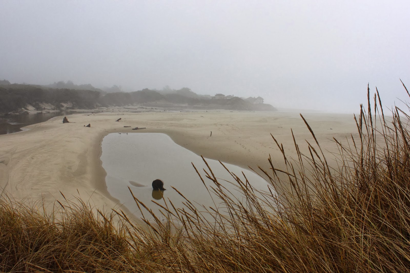
The North Umpqua River


Beginning at the historic Mott Bridge (no kids, I was not alive when it was built), a short road walk over Steamboat Creek brought us to the Riverview Trail trailhead where the the trail headed quickly up to the cliffs overlooking the North Umpqua Highway. We were walking on the old road bed of the historical and since decomissioned highway. The ups and downs were gentle and the roadway had recently been graded so it was easy walking for the two of us.

Pretzel, anyone?
Apart from a bridged crossing and picnic table at Williams Creek, there weren't a lot of big-ticket highlights, just a pleasant walk through absolutely frigid woods. Oh, one item of interest was a wet poop, left by a small carnivore in the shape of a perfectly made pretzel. We spent the next two miles discussing and speculating on the intricate butt geometry and machinations required to create that particular piece of trailside homage to the lowly pretzel. In case anyone was wondering, neither Lane nor I attempted to emulate the anonymous pretzel maker.

All signs point to Lane
At Bogus Creek, we left the Riverview with a "Bogus, dude" done in our best California surfer accent where "dude" sounds like "du-u-u-u-u-de!" Cutting across the Bogus Creek campground, we exited onto the North Umpqua Highway where it would be a mile long walk along the road before crossing over to the other side of the river on the Wright Creek bridge. From there, it would be 6 miles on a real trail.

Blue and cold are one and the same
Now on the North Umpqua Trail's Mott Section, the trail was 6 miles of moss, creeks, trees, mushrooms, and cold air. Oh, and always the North Umpqua River, running a pretty but lethal turquoise color. I think if I were to fall in, my body would be that same turquoise color within seconds.


Fisher Creek


We crossed over several creeks on rustic bridges as the creeks rushed madly on their way to the North Umpqua. Fisher Creek is notable in that Zane Grey had a fishing camp there back in the day. A railed bridge provides a nice view of the creek and an opportunity to set a camera on the rail and take a slow shot in the dim forest light.


Sunlight, and it's so beautiful
Speaking of light, we didn't get any. The other side of the river was bathed in sunlight but at the bottom of the river canyon it was cold shade where puddles were frozen solid. If we weren't walking, we'd have been frozen solid too. After enjoying an overlook at the picturesque cascades at Steamboat Inn, we actually felt sunlight on our skin for all of about 10 feet of trail. We didn't feel warm.

Skating rink next to the river
However, car heaters and hot chocolate restores warmth in cold fingers, toes, ears, and noses, and in the end this was a perfectly enjoyable 12'ish mile hike. It just goes to show flattery on occasion will indeed get us somewhere!


British soldiers
For more pictures of this hike, stop by and see the Flickr album.


Wednesday, December 25, 2013

North Umpqua Trail - Panther Section

Christmas is a time for doing the things you enjoy with the people you love the most and that's why I went hiking by myself on the North Umpqua Trail on Christmas Day. Between having a Christmas breakfast and an impending Christmas dinner, I took advantage of the in-between down time to get in a short hike on the North Umpqua Trail's Panther Section.

I repeat:  Dang, it's cold!


This time of year, not much sun gets down to the North Umpqua River canyon floor and my first thought was "dang, it's cold!" My second thought was "dang, it's cold!" Maple leaves, left over from autumn, were frosted solid and the icy ground crunched noisly underneath my boots like peanut shells on the floor of a Texas barbeque joint.


Did I mention it was cold?
About a quarter mile into the hike, the trail dropped down next to the North Umpqua River along a mossy cliff that was notable for the thick icicles hanging from the rocky wall. Similar icicle formations were hanging from my nostrils, no doubt. The rocky trail was littered with icicle debris and the going was treacherous, I should have brought my crampons. Much photography ensued and no hikers were harmed while negotiating the slippery trail.

The North Umpqua Trail
The basic pattern of the trail, typical of most sections of the 78 mile long North Umpqua Trail, was a climb up and away from the river followed by a descent to the river. Up and down was the theme of the Panther Section experience, apart from the Christmas theme thing overlaying the entire day. While going up and down, lots of pictures were taken of moss, mushrooms, trail, river, creeks, etc.

Rare water bead that wasn't frozen solid
Since there were only a couple of hours to kill, this wound up being a short 4 mile exercise session. Oddly enough, I saw no other hikers, didn't even see Santa Claus; apparently I was the only jolly old guy out and about on the trail. I'll have to come back and hike the entire Panther Section later on.


Blue and green
Ho, ho, ho...Merry Christmas, everybody!  For more pictures of this hike, stop by and see the Flickr album. 


Decaying biomass in many forms


Saturday, December 21, 2013

Sutton Creek (club hike)

A week before, I had hiked in the Sutton Creek area and the weather had been sunny but cold. A week later, it was warmer but wetter. And where I had traipsed through the dunes and marshes by myself with only the voices in my head for company, this time I was leading a Friends of the Umpqua Hiking Club venture. My group consisted of Edwin, John, and Lindsay, apparently my only 3 friends left in the world. But that's OK, because in spite of the poor weather and wet trail conditions this wound up being a superlative hike, one of the best I've taken this year.

Splish-splash, I'm taking a bath
I'm not going to rehash the blow-by-blow trail narrative because that's all in my previous blog post. Suffice to say, the boys were impressed by the two feet of water covering the trail as we left the dunes. Lindsay opted for sandals, John and I abused our boots, and Edwin opted for plastic bags over the shoes. Three out of four is a passing grade with Edwin's plastic bag rig working as well as suntan lotion in a snowstorm. It was a spectacular failure that provided great jocularity among us onlookers.

John wants to kill the hike leader


My own personal observation from one week to the next was that the water was deeper and colder.  There was plenty of opportunity to ponder the quality and quantity of water as it was about a half-mile of splashing through the water standing on the badly overgrown trail.  At some point, all you can do is laugh and it was all giggles as we made our way to the sandy banks of Sutton Creek under gray sky.

There's the beach...sort of


Up to the top of the beach foredunes we went where last week a spectacular overlook of the ocean was enjoyed. On this day, however, clouds partially occluded the views and the promised view was underwhelming. Oh well, it was on to a resigned beach walk in a light drizzle where the beach was littered with sand dollars and slimy bits of jellyfish.

Sutton Creek
The mouth of Sutton Creek was wide as the creek apparently goes on periodic rampages there. On this day, it approached the ocean in a series of S-curves and there were all manner of tidal flats, lagoons, and brackish ponds near the mouth. In the middle of the mouth was a dune island, cut off from the rest of the dunes when Sutton Creek's mouth had migrated south about a mile. The island was  a logical lunch spot with an overlook of  the creek's spectacular egress to the ocean.

...and then the rains came
Of course, the very second we sat down the rain started and we ate soggy sandwiches that had not been soggy a minute before. Black clouds floated in and it looked like a prolonged soak was in the offing so lunch was eaten quickly and hiking resumed in equally quick fashion. For variety's sake, our return route to return was a bushwhack along Sutton Creek instead of backtracking by way of the beach.

Marshy grassland next to Sutton Creek
Actually, it wasn't too bad hiking along the creek, most of the walk back took place through knee-high grass on the marshy banks.  At one point, we had to beat our way through a willow thicket before the flat bank disappeared into a massive sand dune.


Slippin' and slidin'
On the contour around the sand dune, our feet paddled frantically to prevent sliding down into the creek below.  John cheated and hiked up and over the dune; sensible, to be sure, but not nearly as much fun.  Around that point, the cloud cover broke, the sun shone it's wonderful sunny shiny goodness upon us as a marvelous rainbow arced majestically overhead.  That's why we hike and we were absolutely grateful for the fantastic scenery.

Why we hike
When I got home, some of my Friends in the hiking club expressed their good fortune in missing this hike because the only thing they heard was "wet feet". This hike was so much more than cold water in the boots and we know we were the lucky ones.


Waterlogged
For more pictures, see the Flickr album.


Wednesday, December 11, 2013

Sutton Creek (all by myself)


Anyone who experienced the week that was the Oregon Tasty-Freeze will know that winter has come to visit, about as welcome as a fart in a crowded elevator. Who'd a thunk 32 degrees would be the new warm? After a sunny (but not warm) stretch last week, it finally got so the roads were mostly clear of ice so it was time to brave the elements and go hiking.

This was the nice part of the drive!
Oops. Turned out Roseburg was in its own little bubble of warmth (in the 30's) and once out of town, everything was still frosty and icy.  Nice to look at but it was a pretty tense car-ski trip up and over the coastal range on my way to Florence.  The trip took way longer than normal (40 miles per hour top speed will do that) but at least the temperature was 41 degrees at Dune Lake which, in these wintry times, was almost tropical.

Crossing a small dune area
I'm leading an upcoming Friends of the Umpqua hike in the Sutton Creek area and was looking for a way to jazz the hike up a bit. The trail is only about 5'ish miles long and is even paved in places. It's nice but tame and the very antithesis of a Richard Hike. A mid-week exploration was called for in a search for a route around Sutton Creek's pronounced bend south of Baker Beach.  The problem is that there are no trails in that area and that sounded pretty much like a dare and a good reason to try it.

Wind patterns
After a half mile walk on the official trail from Dune Lake to Sutton Creek, I hung a right on a sketchy path through tangled woods and climbed up a short but steep sandy wall; the hike was on at that point. The path had spit me out onto a small dune area and a faint footpath headed straight across the sands.


Snow in the dunes ??!!


The beachgrass has really taken over the small dunes in this area with a young forest seriously encroaching at the edges. The dunes will fade in time, like a maple leaf decaying on a fern frond; it's a shame but that's what happens when mankind imports invasive species. The sun was out but snow from the prior week's storms lay across the path in the shady parts. Strange to see snow in the sand dunes, it's kind of like seeing polar bears in the Sahara.

Hey, I felt that!
The problem foreseen from a midnight satellite photo research session was the dark forest between the two sand dune areas on the intended route. However, at ground level a sketchy trail led through the forest with the only travail of note being the encroaching gorse on the trail. The spiny thorns on the hardy gorse made me well aware of it's invasive presence.

It's a Richard Hike!


The path petered out in the second dune but by following the edge of the dune and forest, a muddy trail was found leading into the marshlands. Unfortunately, my feet sank deep into the mud despite the hard ice on top. While retreating to the dune, the mud and I wrestled for possession of my boots with the mud making loud sucking noises like my brother nursing his Budweiser bottle. It was close but the boots stayed on my feet as they should.

Trail through the pervasive standing water
Another trail leading off the dunes was found and I was back in business, at least until a large pool of swampy bilge water about two feet deep covered the trail.  However, it looked like someone had laid some branches across and the water contributed more branches, mud, and other assorted debris until it formed a dam of sorts.  I stepped tentatively on the dam and promptly sunk all the way into the water with cold swamp liquid pouring into my boots.  At that point, it's "oh, well" and full splashy speed ahead, no sense trying to keep wet feet dry.

Sutton Creek
The next half mile or so on a badly overgrown path was a water wade and my boots were grateful when we traded forest and marsh for sand and sun. The trail (I had joined up with the Baker Beach Trail, unbeknownst to me) followed copper colored Sutton Creek, running deep and fast as it snaked through the grassy marshes behind the beach foredunes. At my arrival, the creek exploded in furious feathered panic as a flock of ducks fled the scary hiker.  

I had the whole place to myself
A short walk up some really tall foredunes gave me a delicious view of an empty beach on a beautiful winter day. It was low, low, low, low, low tide and entire cities could fit on the sandy acreage exposed by the retreating ocean. My only company was the occasional gull flying by on an urgent gull errand.


Bird tracks


There was a large break in the dunes leading to the presumption that the dunes had been bulldozed in an attempt to help the endangered snowy plover survive. Wrong! Actually, it was the former site of Sutton Creek's mouth which evidently had migrated another mile south, this little factoid discovered when perusing maps post-hike.


Hiking as the sun set
I could see the blue ribbon of the creek but did not walk all the way there. Remember the long trip to the coast? There were two hours of daylight left and that was just about enough time to get back to the car before the sun set. Walking back in the dark without proper trails would have been as welcome as a spider at an arachnophobe convention and not nearly as much fun.

One of the few dry things found on this hike
One last note:  That elevator fart was not my doing. Just for the record, I was unjustly accused.  And for the rest of the pictures, please visit the Flickr album.


Thursday, December 5, 2013

South Jetty hike

As I write this (Star Date: 12/5/2013), the temperature has dropped below 20 degrees and snow is on the way. The cold outside smacks my cheeks like a slap from a half-thawed squid. I would have used "outraged diva" instead of the squid but that simile was used a couple of postings ago and I don't want to plagiarize myself, ergo the squid. Anyway, it's cold and I'd be happy to spend all my indoor time next to the living room fire but Dollie would get mad because we don't have a fireplace.  So, as I type this, desperately wrapped tightly inside 4 bathrobes like a weenie in a corn dog, I seek warmth by embracing happier and warmer memories from times long ago...like last weekend!

Head in parking instead of head in....?
Life's a beach, or so they say, and it had been many years since I last hiked on the coast south of Florence so it was time for another visit. The weather prediction tended towards cloudy and dark (just like me!) with a 30% chance of rain...so, naturally there wasn't a cloud in the sky when I parked on the South Jetty Road and began my hike on a sunny and brisk morning.

On top of the beach world
After climbing the grassy foredune on a well used track, I dropped down onto the beach. The tide was a couple of hours past high tide and the beach was wide and flat (just like me!). It seems the foredunes are taller every time I get out to the coast and these grassy dunes were about 30 feet high or so, maybe even higher.

Kindred spirits except for the distance walked


There was another hiker about a half-mile ahead of me and we hiked at the same pace for a mile or so, at which point she turned around and headed back to the parking lot. At the various parking lots along the jetty road, other beachgoers were out enjoying the crisp autumn day but nobody else besides me hiked all the way to the jetty.

Fly away from the guy with the clicky thingy

After several miles, the only company I had were seagulls, helicopter patrols, and my own idle thoughts. It was peaceful and I was happily spending the morn in my "nothing box", that comfy little place men have where they think about nothing at all. The steady roar of the waves was a soothing and steady sonic background to the rhythm of the hike. Clouds formed overhead, occasionally blocking out the sun but the predicted storm never materialized.


The Siuslaw River
At just over 4 miles, the South Jetty hove into view, with small waves splashing on the jetty rocks. The Siuslaw River was contained between the north and south jetties and fathers were teaching the fine art of fishing to their children, their fishing lines arcing gracefully with each cast. The jetty is a happy place and the laughter of delighted children filled the air as future cherished family memories were created. The river was carrying a pretty good flow and the war between outgoing river current and incoming ocean was fun to watch what with random waves forming in the river.

The best sand for walking
After a lollygag and lunch at this happy place, it was time to head back down the beach. The sun had gotten lower in the sky and in the afternoon light the sea glinted silver like an anchorman's hairpiece under studio lights. The tide had receded even more and there were acres of sand between the water line and the foredunes. The next 4 plus miles were spent picking out the hard sand (and easier hiking) near the retreating sea. Occasionally waves chased me back up the beach. Lots of photography ensued.

A family enjoys the beach
Seagulls waded in the shallow water near the shore or just simply contemplated the restless sea, content in their own little vapid seagull "nothing box." Occasionally, sloppy piles of crab parts indicated where a gull feast took place, and yes, crabs were harmed in the process. At the 8.5 mile mark, the well-used track to the parking lot made an appearance as the clouds became a little more persistent. Winter would come but not on this fine day.  That's it for this report and now it's back to the hunt for warmth and please pass me the kindling and matches.

Tidal flats
For more pictures of this hike please visit the Flickr album.


Create Routes or find more routes in Florence from millions at MapMyHike