Showing posts with label Glide. Show all posts

Saturday, May 14, 2022

North Bank Habitat (Best Hike Ever!)


In what was definitely not truth in advertising, this hike was dubbed the Best Hike Ever. Back on New Year's Day, Brad, our hike leader, had led a North Bank hike  that will forever live in club lore as The Worst Hike Ever because of formidably steep trails. Flash forward a few more months to the present and now we were going to do the same route, but this time in reverse, exchanging the incredibly steep Powerline Road for the incredibly steep East Boundary Road. Because this hike was the opposite of the Worst Hike Ever, it acquired the rather Orwellian title of Best Hike Ever.

Rheo commences the Best Hike Ever

The hike began with an easy amble down the Habitat's entrance road and we gaily skipped along, a song in our hearts, if not on our lips. We made a left turn onto the trail and all happy songs immediately died in mid-trill, supplanted instead by a chorus of horrified shrieks sounding like so many Aztec death whistles. In front of us, looming like a grassy Great Wall of China (but way taller) was the East Boundary Road, seemingly rising straight up to Mars or beyond. Yikes, legs quivered and ached before we even began the dismal trudgery of hiking The Best Freaking Hike Never.

Photo of the trail, taken while I was not resting

About halfway up the first major slog, I think my calves began to cramp up, followed in short order by hamstring pulls, respiratory distress, hives, and maybe dilated pupils. Whew, this was hard work and I did lots of photography because I was NOT resting, no matter how much it may have looked like I might have been. 
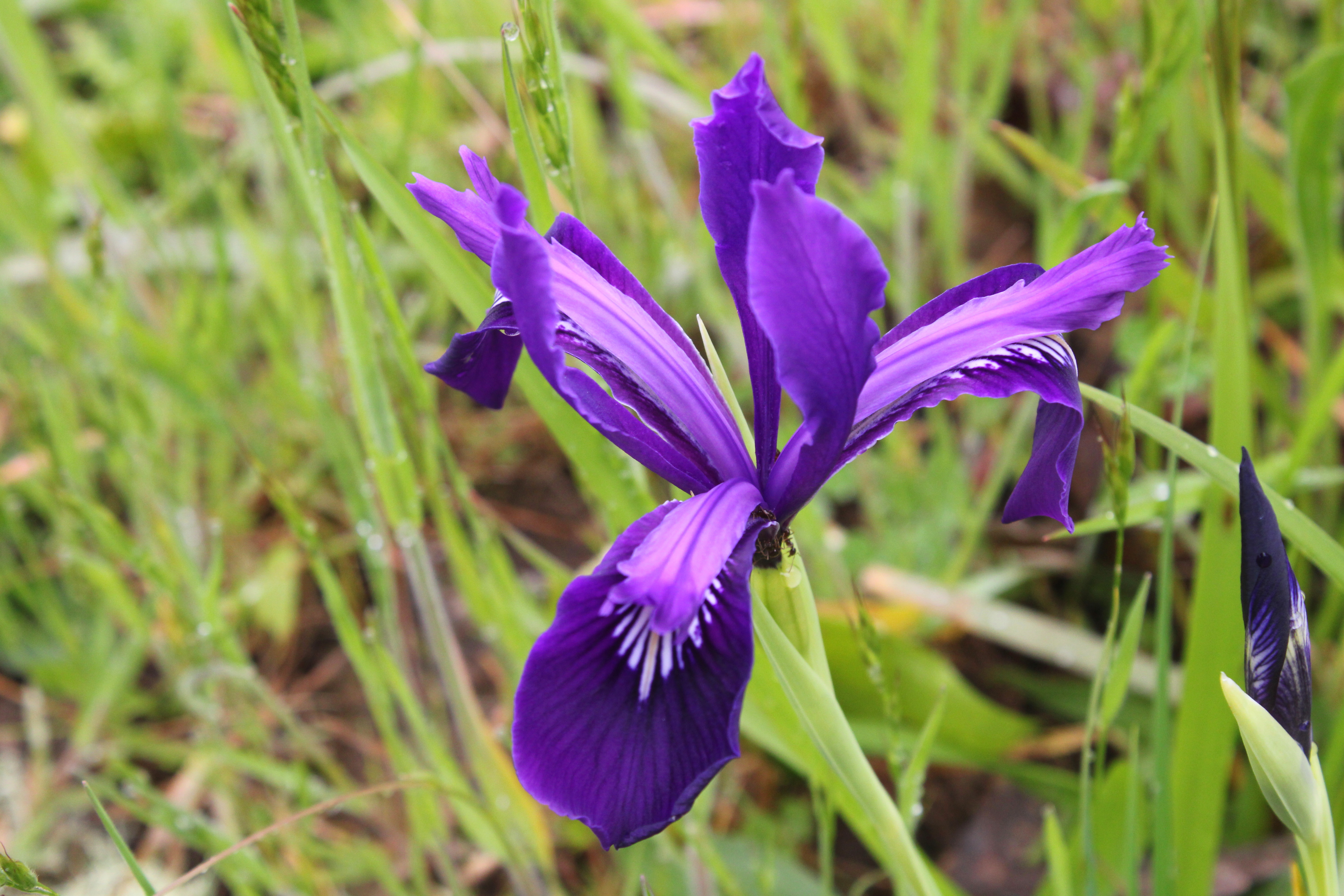
Douglas' iris decorated the grassy slopes

But if you are going to flame out on your Last Hike Ever, you might as well do it where it's scenic and this North Bank Medieval Torture Chamber Trail fit the bill. Spring was in full song and the vertical walls (oops, I meant to say "rolling hills") were covered with lush green grass. And if I were tempted to plop down on the ground in total exhaustion, the colorful red and oily leaves of the ever-present poison oak were more than adequate deterrent, the fear of itchy rash being sufficient motivation to remain upright, if not necessarily to keep walking. 

What a changing forget-me-not looks like

The wildflowers were putting on a show, best admired when bent over with hands on knees, lungs heaving mightily. Fiddleneck, wild iris, and Indian pink were all abloom, just to name several species from a cast of thousands. During one of my photo-ops while NOT resting, I spotted an odd little flower resembling a fiddleneck that sported flowers ranging from blue to yellow to white, all on the same flower head. It was a changing forget-me-not (Myosotis discolor), whose flowers start out blue but like my hair, turn white with age. I'd never seen this wildflower before, so that was kind of cool. 

Vista to a neighboring ridge

As we slogged on ever upward, crying for our Mamas all the while, the views began to entertain, expanding in direct proportion to the hard-won elevation we were gaining. Directly below the East Boundary Ridge, lay a quilted picnic blanket of farmlands extending all the way to the small town of Glide. Nearby and in the Habitat, were the wooded crest and grassy mounds of Middle Ridge, and we could peer directly down into the valley of Blacktail Basin, whose trail was a much easier route up to North Boundary Ridge than our current route, Brad.

Yay, the grade is merely uphill!

At about a mile and a half of hiking up a wall with a trail on it, the grade eased and the path morphed into what charitably could be called a "merely uphill" route. The dirt road undulated up and down a series of high points on the ridge and we all rejoiced at the newfound normalcy of the grade.
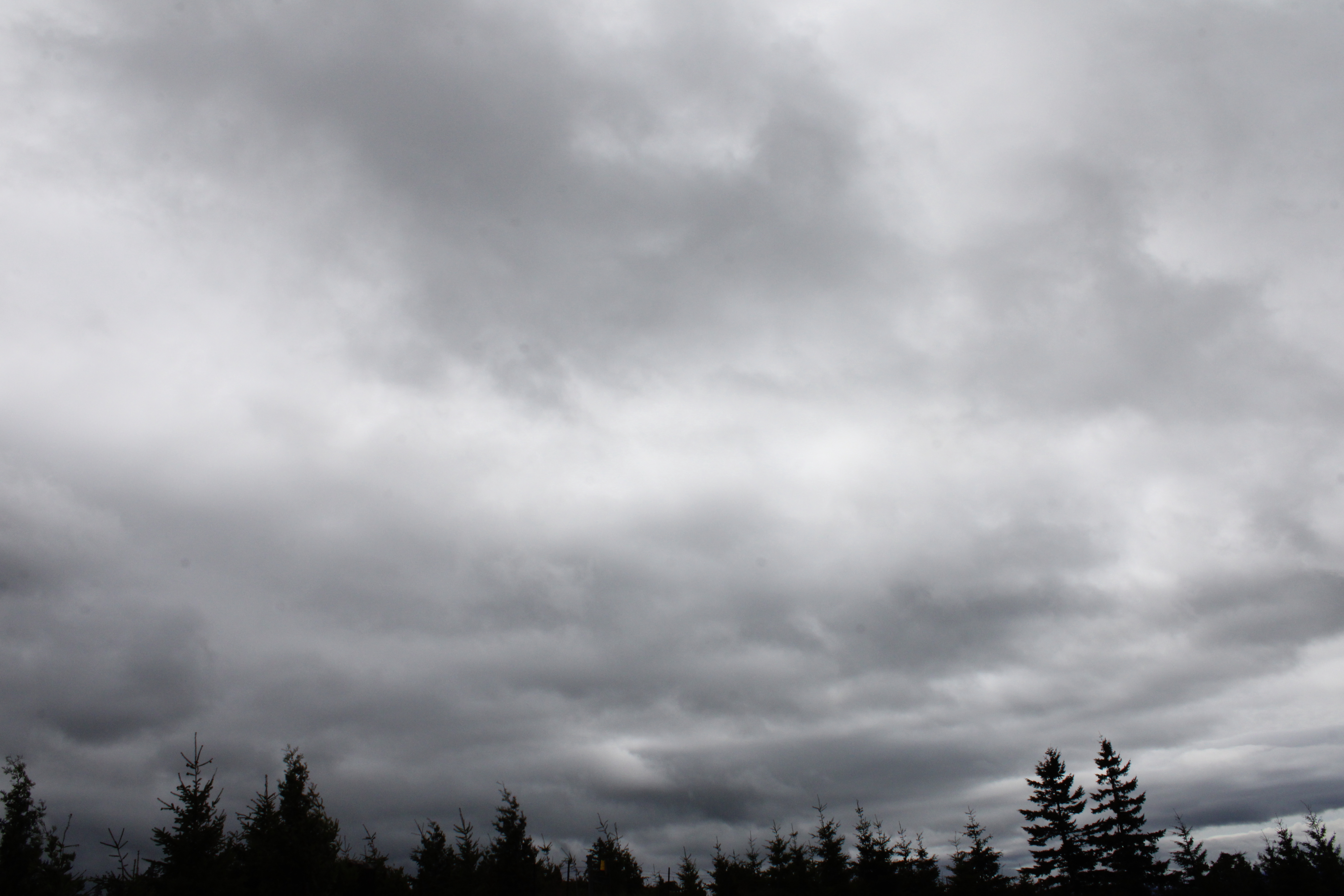
Fortunately, it never rained on us, despite the threat

At about the four-mile mark, the trail attained North Boundary Ridge which also served up its own daunting up-and-down route on its grassy crest. But if you hiked up the East Boundary Ridge Road to get there, well then it almost seemed like you were hiking downhill as the grade was nowhere near as demanding. On top of North Boundary Ridge, we availed ourselves the opportunity to snack, rest, regroup, and curse all things Brad.

Just when you didn't think the
hike could get any "better"

On the New Year's Day Worst Hike Ever venture, our foe back then had been Powerline Road. However, we'd be hiking down Powerline today and Brad assured us it was all downhill. I reminded him that no, there actually was a pretty good uphill pull to perform before we could say it was all downhill. At least there was no snow this time, although there was mud, wildflowers, and views as we descended. Some of us lay in the mud in protest when we gave up on the aforementioned steep climb on Powerline Road.

Pastoral scene on the steep
descent down Powerline Road

After a leg-braking, knee-taxing, soul-sucking descent down lush grassy slopes, we plopped down in exhaustion at the pavilion area, some of us face first. Brad served us lunch and snacks, if only to prevent us from kicking him in the rear for coming up with this hike. My own opinion is that he should have doled out ibuprofen instead of food to stay in our good graces.

What's a North Bank hike without poison oak?

For more photos of this hike, please visit the Flickr album.

Wednesday, April 6, 2022

North Bank (West Loop)


I went with some friends the other day on a mid-week hike at our frequent hiking haunt, the North Bank Habitat. Our route of choice was the loop which I have always unimaginatively and directionally referred to as the West Loop, but today I heard it cited as the Boot Camp Loop. It sort of fits because the steepness of the trails that wind up and down the various high points on the north ridge will have your wishing for an honorable discharge in no time at all.

Simply a beautiful spring day at the Habitat

It didn't take long for the seven of us to separate into two distinct hiking cadres: me and Penny, and everybody else. Guess which two hikers had cameras? At any rate, the morning was crisp and clear, the hills were bathed in green grass, and the floral end of the gene pool was in full spring symphony, be it in flowers or leaves. So we walked slow and enjoyed the scenery while our comrades marched in double-time up and down the hills at some unseen distance ahead of us. Just so they wouldn't wonder whether or not we had carked it on the trail, we sent a text message advising the speedsters not to wait for us.

Maple trees were in full flower

The first part of the route initially followed a gravel road through ranch pastures where bemused cows placidly chewed cud as we hiked by. A right turn put us on a dirt road accompanying barely trickling Chasm Creek flowing through some peaceful and serene oak woods, the trees still bereft of any leaves. Branches were draped with long strands of lichen that swayed with the slightest air current while birds musically chirped their mating calls in feathered hopes of scoring an avian romp in the woods. Wild iris, shooting stars, henbit, buttercup, and Oregon grape bloomed amok in the green grasses reposing under a vibrant blue sky, making bees and butterflies happy. Life was good and colorful here.

One steep trail in a Habitat full of them

The colorful beauty was soon forgotten though, supplanted instead by the immediate urgency of  burning leg muscles when the trail headed uphill in earnest, seemingly in a hurry to get up to North Boundary Ridge. Didn't anybody ever hear of a switchback?  But, if you are going to struggle on a hike, you should have beautiful things to look at, and we did. As we gained elevation, white baby blue-eyes populated the grassy parts, while flower friends desert parsley and purple sanicle aided and abetted. Penny and I spent more than one occasion crawling through the aforementioned green grass like human sheep, just to photograph the flowers.

The dark leaves of Satan's favorite shrub 

Spring is the optimal season to visit the Habitat in my opinion. As mentioned, the hills were wrapped in a vivid shawl of green grass; that is, if you ignore the dark bloodshot leaves of poison oak. Ignore at your own risk, though, for the plant is quite profuse and is ever ready to award rashes to inattentive hikers. The accursed plant was everywhere, and while I have issues with its itchy malevolence, the new red leaves do impart a splashy, flashy, yet rashy burgundy vibe to the hike. 

Gentle and rolling

As we gained elevation, the trees thinned out and then it was all gentle and rolling green hills dotted with small stands of oak trees. I've often said the gentle rolling hills are only gentle when you don't have to hike up them and that wry observation still holds true. At any rate, the more we climbed, the more we were treated to some amazing views of the peaks and valleys surrounding the North Umpqua River, ever flowing below our North Boundary Ridge aerie in a series of serpentine bends with the water glinting silver in the noonday sunlight. 

Trail on top of the North Bank world

Part of the reason we could see so far was that the weather was perfect. It was never too hot, the sun was out, and the sky was blue and cloudless. The clarity of the air meant that we could see many leagues in every direction, although the air did haze up a bit as the day wore on. As an example, the distant peaks of the Siskiyou Wilderness, located just over 100 miles away in California, were faintly visible to the naked eye on the southwestern horizon.

It's all (not!) downhill from here

Once on North Boundary Ridge, the Boot Camp aspects of the hike were on full display as the trail went up and down, always steep, and never level. The trail summited what felt like 5,532 high points and promontories, the only saving grace being the totally awesome views of the terrain flanking the North Umpqua River. But once we hit Middle Ridge, it was mostly downhill, the irony being there were still several steep uphill pitches on the descent, even though the trail was generally pointed downward. In the North Bank, even the downhill hiking can qualify as a Boot Camp Hike.

Butter cups by the cupful

All good Boot Camp Hikes do come to an end though, and this one ended at a noteworthy field of buttercups at the trailhead. One buttercup does not an awesome sight make, but cram millions of them into a grassy pasture then you then have a visual buttered French Toast ready to be slathered in sticky syrup. The sight of that golden parcel of pasture was more than adequate reward for the Boot Camp trials and tribulations on the day for us two plebes.

An agoseris blooms in the low grass

For more photos of this hike,
please visit the Flickr album.

Saturday, January 1, 2022

Powerline Road


2021 was the year I entered the white-haired pantheon of senior-citizenhood. Even though I've celebrated at least 65 birthdays in my lifetime, in each instance I calmly accepted my new age with equanimity and grace. But then that damn Medicare card arrived. The ponderous bulk of the federal government has officially designated me an old person. No longer of any use to society, I might as well turn myself in to the Soylent Green factory, which is a dated reference that old people with Medicare cards will understand.

Winter wonderland

Along with advancing age comes advancing health problems too and in my case, hernias (two of them!) and diabetes reared their ugly heads and I have the statistics to prove it. Last year, I hiked a mere 181 miles with a per hike average of 5.7 miles, both all-time Richard Hikes lows. But on a positive note, I did manage to shed 25 pounds in 2021 and I now weigh a svelte 190 pounds, so why not start the new year by getting my slimmer and trimmer tail totally kicked on a New Year's Day hike?

The Powerline Road is not always this attractive

Brad had billed this North Bank Habitat outing as "The Worst Hike Ever". The Powerline Road route is probably the steepest trail in the North Bank Habitat, becomes overly muddy in wet weather, and if you like miles and miles of looking at power lines, pylons, and other accoutrements of the power grid, then this is your hike. This hike had already been elevated to Worst Hike Ever status before we even set foot on the trail, but snow and ice guaranteed this hike to be completely memorable for all the wrong (and a few right) reasons.

Hi ho, hi ho, through the snow we go

Fourteen hikers (and dog friend Gus, who thought this was the Best Hike Ever) passed through a livestock gate and began the slog up a bare ridge covered with snow. Critter tracks crisscrossed the ranch road as our feet crunched in the icy snow. We were walking in a winter wonderland as everything as far as the eye could see was cloaked in white, most unusual for the Habitat. Snow muffled all sounds except for noisy footsteps, heavy breathing, and the omnipresent buzzing of power lines.

At least we amused the cows

I had hiked this route once (and only once!) with Mrs. O'Neill and amazingly enough, our marriage survived the experience. However, on this second go-round, it didn't seem like it was all that bad. The really steep part was only about a mile or so, after which the trail actually levelled off before heading downhill. The problem with the downhill part though, was the relatively warm sunlight was melting the snow in an exposed swale, rendering the trail muddy and wet. Our choices were either sinking in the mud or sinking in the snow next to the mud and with bemused expressions, a small herd of cattle watched us physically wrestle with that not-so philosophical question.

View as we arrived at North Boundary Ridge

There was one more short uphill push before the route reached the hallowed destination of the North Boundary Ridge. Ostensibly, the ridge was the high point of the hike but in the North Bank, the downhill inevitably comes with intermittent uphill stretches, so there was no real rejoicing at arriving at the ridge. The snow was several feet deep here and hikers sunk up to their knees. The post-holing was taxing and tedious, especially since not one of us "experienced" hikers had ever thought to bring snowshoes. To be frank, I'd had enough at that point, so I grabbed the Blacktail Basin Road for a shorter route while my friends continued on the miserable North Boundary Ridge.

Amazing vista on Blacktail Basin Road

Blacktail Basin may have been shorter but it still was not easy. The Habitat's caretaker had driven some kind of all-terrain vehicle up here and the tire treads were nasty icy, forcing me to walk off the road and wade in the snow. Slogging in the slush was sheer trudgery, but at least it was safer than the icy road. No complaining though, because the views from high above the basin were fantastic, especially with bright blue sky looming over the snow-covered world.

This hike was half snowshoe trek, half wade

At the bottom of the basin, the thaw was in full swing and all manner of creeks and runoffs were carrying the melted snow down into Jackson Creek. Boots and feet were soon wet, of course. Your leaky garden spigot generally has more water flowing than Jackson Creek, yet on this day the creek was roaring like the nearby North Umpqua River, making several fords of the rushing stream somewhat sketchy. However, I'm glad to report that while feet got wet, I didn't slip and my ancient body remained upright for the duration.

The snowy headwaters of Jackson Creek

As the route worked its way down the basin, the basin walls shaded the wet trail, turning all moisture to ice. While the wet stuff was annoying and inconvenient, the frozen path was downright treacherous. Again, my superannuated (much cooler word than "ancient") body remained upright but it had been a close call at several junctures. At the trailhead, my companions straggled in behind me by an hour or so. Their faces were haggard, with fatigue etched onto their now wizened visages. Rheo looked like she had aged 15 years and Corinna said "I should have gone with you!" before plopping face-down in the snow in total exhaustion. Gus however, was all glee and joy and asked if we could do that again. Despite the arduous nature of the day's venture, it was all good because any hike where you don't have to use your Medicare card afterward is a good hike.

A great way to start the new year

For more photos of this hike, please visit the Flickr album.

Monday, November 9, 2020

North Bank Habitat (Soggy Bottom/Blacktail Basin Loop)


Because the North Bank Habitat is only about a half-hour drive from my home, it gets a lot of use by your merry blogster. My frequent hikes in this particular locale have allowed me to experience all sorts of different aspects of the Habitat, which apparently has more emotional states than a mood ring. I've hiked there in winter when the rolling hills were coated with snow, having to watch my step because of icy trails. Been there in several rain storms too, leaving me wondering why I was out there in the first place when I could have stayed warm and dry at home. I've also slogged up the steep trails in triple-digit heat like a bug slow-crawling up a rock wall, also wondering why I was out there, albeit for the opposite temperature-related reason. And from personal experience, if you can catch a fogbound morning along the North Umpqua River, then the fog-filled valley vistas are absolutely stunning and well worth the toil and labor to hike above the cottony-looking fog cover. But up until now, in all my visits to the Habitat, I'd yet to really appreciate the Habitat's autumn garb.

The brown and bare terrain of the North Bank Habitat

The Habitat's terrain falls generally under the term "oak savannah" due to the stately and regal oak trees dotting the grassy slopes and pastures. Oak, like maple, does shed its leaves in the fall season but they just sort of brown out and drop off the tree without any of that color folderol and hoo-hah so favored by their flashy maple cousins. As a result, autumn will generally find me hiking in more flamboyant maple environs instead of the comparitively dull North Bank Habitat, where even the green grasses fade into an unnoteworthy brown color. So, imagine my surprise when this early November hike marvelously turned out to be all about autumn.

Enjoy the blue sky while it lasts, maple trees!

The morning was cool but the sky was gloriously blue as I started. It had gotten cold enough to freeze the night before, so ice crunched under my boots in the shady parts of the trail. A small creek flowed on the left side of the gravel road (all the trails in the habitats are old ranch roads), with small icicles dangling off of branches and rocks in the stream. Encroaching blackberry brambles sported bright red leaves here and there and I seemingly attempted to photograph each and every one. The oak trees had already dropped their leaves, leaving naked trees with bare scraggly branches clawing at the sky above.

Return of the fuzzy white stuff

A short walk on Soggy Bottom Road delivered me to Soggy Bottom and while the bottom was not all that soggy, frost accrued on grass blades and fallen leaves like beard stubble on a certain old and grizzled hiker. The track was covered with an increasingly thick and frosted layer of oak and maple leaves. While oak trees rule the Habitat, interspersed bigleaf maple trees do make an obvious yellow-leaved appearance among the denuded oaks. 

The golden road

So, this hike became all about autumn, thanks mostly to the maple trees. The trees were still adorned with plenty of leaves glowing golden yellow like so many marshmallow peeps in a microwave (Mom is still mad about that, thirty years after the fact!). The maples had been busy dropping leaves too, and the dirt road was carpeted with a healthy layer of fallen leaves that pleasantly swished as I waded through. Just follow the Yellow Leaf Road! This section of trail was absolutely sublime and I quickly became a dedicated convert to the cause of hiking at the North Bank in autumn.

Rain cometh, it has been foretold

As I gained elevation on the leaf-littered trail, a looming storm scudded in overhead and there'd be no more blue sky on this day. The Habitat's mood ring changed from bright blue to dark gray as befitting its new "it will rain today" emotional state. Virtually all trails in the Habitat, a former cattle ranch, go uphill at some point. On the plus side though, the thinning forest gave way to open grassy slopes and stunning views as the trail gained elevation. The trail contouring the relatively bare slopes served up expansive vistas of the North Umpqua River valley below, with the river glistening under the ever darkening sky. Much resting (oops, I meant to say photography!), ensued while hiking out of Soggy Bottom up to North Boundary Ridge.

The meeting place

As the trail neared Grumpy's Pond (named after Mrs. O'Neill, unless she's within earshot), the maples gave way to a thick stand of oaks with a heavy layer of dead leaves hiding the normally visible grasses growing underneath. I could just picture deer gathering here on moonlit nights to plot the overthrow of mankind "Let's have a hunting season for humans and see how they like it!" It's probably a good thing deer don't have opposable thumbs.

Just one blackberry leaf in a universe full of them

On North Boundary Ridge the terrain is fairly treeless and cold air currents upwelling from  surrounding valleys vigorously swept cold air across the crest, the breeze cutting right through this hiker's clothing. Where things had previously been cool or chilly, it was now officially downright cold. Fortunately though, the trail dropped down into sheltered Blacktail Basin and out of the arctic air currents. Once on the bottom of the basin, my pace slowed as I stopped frequently to admire the trickling creeks, bright  ochre-colored madrone berries, and dried teasel heads rustling in the wind like so many witch giggles. Occasional maple trees among the plentiful oaks were nearly bare, but a circle of golden leaves lay underneath each tree like dandruff on the shoulders of a co-worker. Bringing things full circle, colored blackberry leaves became a photography subject again, as the hiking festivities came to a close. I probably took pictures of exactly the same old leaves, too.


Oaks just have the gall!

For more photos of this hike, please visit the Flickr album.

Saturday, June 27, 2020

North Bank Habitat (Blacktail Basin/East Ridge Loop)

When you volunteer to lead a hike, you do copious research to sort of figure out which route to take, what weather conditions might be like, what condition the trail is in, and then consider stamina and determination of potential participants. And after all that meticulous planning, there's hikes like this one at the North Bank Habitat, where nothing turns out like you planned but it all works out anyway.

Busy as a bee in a blackberry patch
Normally, you try to come up with a route that satisfies the average fitness of the hiking group, with options for more or less mileage, depending on the fortitude of each individual hiker. Basically, the core hike will tend to be an easy or moderate six to eight mile route with trail steepness also being somewhat moderate, although in the North Bank all trails are unavoidably steep.

Elegant brodiaea purpled up the dry grasses


However, when your group consists of only Brad and Coreena, well then, let's go for a good long hike, shall we? Those two certainly weren't going to show me any mercy! The planned route up Soggy Bottom was tossed into the mental garbage can and totally on the spur of the moment, I changed the route to go up Blacktail Basin with a return by way of North Boundary Ridge, Middle Ridge, and Thistle Ridge. Plenty of miles and uphill steps on that route to hold our collective interest. 

It was easy hiking in Blacktail Basin
The first mile and a half at Blacktail Basin were relatively level and served as a nice little warm-up for the upcoming lung-busting quad-burning endeavors. The sky was overcast, the temperatures were mild as we strolled lazily through the stately oaks dotting the pastures next to the small creek coursing at the bottom of the basin. The surrounding hills were just starting to brown but there was still plenty of grassy greenery surrounding the trail as we hiked in easy companionship.

Some of that moderate uphill grade
The levelness of the trail inclined toward the uphill side of things when we reached the basin's terminus and began hiking up the headwaters wall. Actually, "wall" is a bit extreme, for in all reality the uphill pull out of the basin was not all that bad. We were reminded that the North Bank is also a working cattle ranch for the trail was bordered by electric fencing that effectively discouraged any off-trail hiking. Besides which, on the other side of the electric wire were dense stands of head-high poison oak bushes, which also effectively discouraged any off-trail hiking. Plus, there were probably thieving deer lurking in the itch-spreading vegetation, just waiting to steal hiking poles, which would also discourage any off-trail hiking.

Why we hike
As we climbed, the views and panoramas expanded into that stunning scenery which is the main reason we hike here. We had attained the rolling windswept grass-covered North Boundary Ridge and were peering down the twin valleys of Jackson Creek's two forks as the small creek beelined for the North Umpqua River. Farmlands dotted the river plain and the North Umpqua River valley could be visually traced all the way to nearby Winchester. Beyond river and creeks were layers of hills and rounded peaks, marching into the distance like some hazy blue geologic army on its way to battle.

What "mostly sunny" looks like in Oregon


Part of my copious research duties required for planning this hike was checking the weather forecast, which called for "mostly sunny" weather. A forecast of "seldom and hardly ever" sunny would have been closer to the mark as the sun was about as rare and elusive as an albino Sasquatch. The air was welling up and out of the valleys which translated to a chill breeze wafting over the broad ridge we were hiking on, and windbreakers and extra clothing layers were quickly donned. 

Astounding view from North Boundary Ridge
There was a barbed-wire fence going across the trail and I didn't recall that being there before. We wanted to be good citizens and not trespass on private property so we turned back and made an impromptu decision to return by way of the East Boundary Ridge Trail. On the way back, we quizzed some hikers coming up from Blacktail Basin about the route and they said you have to hop over two fences to continue on the North Boundary Ridge, a fact that was later borne out when I read my notes from the last time I had hiked there. I guess my memory is as sharp as a watermelon these days.

Glad to be going down instead of up!
The East Boundary Ridge is a pretty cool hike on its own merits as it provides epic views of the surrounding terrain while going downhill. I've hiked up the East Boundary Ridge before and did take in the views during frequent rest stops where I huffed and puffed while bent over, hands resting on knees, majorly exhausted from the daunting uphill grade. Going downhill like we did today allows hikers to actually enjoy the scenery just for being scenery and not as an excuse for stopping to rest.

View down to Soggy Bottom
Brad is probably the fastest hiker in this spiral arm of our galaxy and mere mortals like me and Coreena cannot keep up with him. Hiking at Brad speed would be akin to keeping up with a cheetah on speed. Suffice to say, he couldn't stand walking with us slower folks (and were weren't THAT slow, either) and he soon disappeared from sight on the way down. When we reunited at the trailhead after this ten mile hike, his excuse was that he thought we were going to shorten the hike by hiking straight downhill to the trailhead instead of taking the longer trail. Nothing like that had ever occurred to me before but now it will, thank you very much Brad. I'll have to do some copious research to come up with a downhill shortcut for the next time I lead a hike here.

The East Boundary Ridge was our return route
For more photos of this hike, please visit the Flickr album.