Friday, June 23, 2017

Clear Lake

"Now, let me make one thing perfectly clear..." I may be dating myself by quoting Richard Nixon but the irony is that Richard Nixon's downfall was that he did not make things perfectly clear when he should have. But, if there is one thing perfectly clear in this world, it is Clear Lake. The lake is fed by an underground river that is filtered by miles and miles of porous lava, leaving the lake's waters clearer, purer, and more pristine than any presidential cover-up could ever hope to be.

Warm, but not yet hot
This was late June and it was hot, but not as hot as it was going to get in a few days hence. The temperature topped out somewhere in the high 90's which is plenty warm when exercising under a blazing sun. However, on the west side of Clear Lake, the trail was wonderfully shaded by tall trees, warding off some of that high-90's heat.

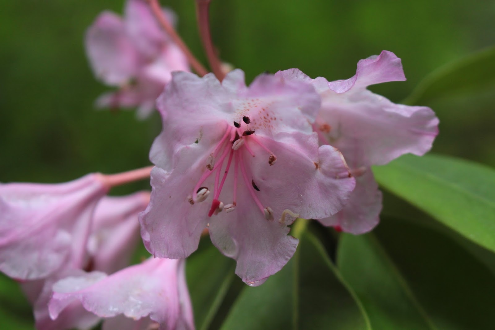
Columbia windflower was a common sight
I'm also glad to report the mosquitoes were virtually non-existent. We had more snowfall than normal this last winter; I've been expecting an onslaught of insectile vampiritude with the advent of melting snow. Spring was in full song, what with the forest carpeted with Columbia windflower, lupine, huckleberry. and queen's cup all abloom. Both Fish Lake Creek and Ikenick Creek were flowing fast and clear with spring runoff, and the forest was filled with the musical tinkling of the streams. So, with spring going at it the way it was, I'm not sure why no mosquitoes but hey, I'll take it. 

What, you were expecting a bikini photo?
Other hikers were out and about, too, I ran into one young lady hiking in a bikini. Because I looked into her eyes the entire time I chatted with her, I didn't really notice the bikini was a Pink Mink product manufactured in Bangladesh, with orange, white, and yellow polka dots on a brown background;, and also sporting a white frill edged in red and brown stripes with little yellow daisies having green centers in between the stripes. I also ran into a guy hiking barefoot, he said he just felt more comfortable hiking shoeless. Yikes. Later in the hike, I would run into him in the middle of the jagged lava fields, as we had each hiked around the lake in opposite directions. The slacker had his shoes on too, apparently hiking barefoot through sharp and jagged rocks is not all that comfortable.

Fish Lake Creek
The basic loop around Clear Lake is fairly short, being just over 5 miles long. So, for some extra mileage, at Fish Lake Creek I made a left turn onto the McKenzie River Trail with the intent of hiking a couple of miles to Fish Lake. This section of the McKenzie River Trail was a pleasant amble through lovely shaded forest with the rushing creek always heard and occasionally seen just off trail.

Just gotta love those vine maples
And now a word about the vine maples. The ubiquitous vine maples were all leafed out and a virtual galaxy of seven-pointed leaves were lit up by the sun while I enjoyed the deep shade underneath. The trail had that green illumination from the light of a million little green stars and my progress was slow as I obsessively photographed the glowing canopy.  

Just a gorgeous day for a hike


A short mile of hiking brought me to the Upper McKenzie River Trailhead and I walked down a gravel road to the McKenzie Highway. My planned (if you can call it that!) route to Fish Lake required a cross-country bushwhack from the highway. However, the harsh reality was that I was confronted with a rushing creek, thick brush, and water in a standing marsh; all between me and hidden Fish Lake. Just call me defeated; it was back to the trailhead for me.

Swimming hole on Fish Lake Creek
The McKenzie River Trail officially begins at the upper trailhead and the iconic trail is famed as a mountain bike ride. Accordingly, there was a group of bikers lazing in the shade, eating lunch and chatting animatedly. My ears perked up, because they were speaking my other native language. Turned out they were from Guanajuato, Mexico and were on a mountain biking vacation in the Pacific Northwest. 

First clear look at Clear Lake
At the north end of Clear Lake, the lake finally made an appearance and the tips of Belknap Crater, the Three Sisters, and Mount Washington all made brief cameo appearances over the far end of the lake. Clear Lake is the source of the McKenzie River, which comes up out of the ground, fully formed, at the Great Spring. Filtered by porous lava soils, the water is as pure and as clear as Richard Nixon was not. The water also comes up a uniform 36 degrees all year so the lake never freezes over during winter.

"Let me make one thing perfectly clear..."
The Great Spring would be cool enough as simply being the source of the McKenzie River, but oh, that blue color! The spring, besides being remarkably clear, is a deep sapphire hue, probably in relation to both the purity and the minerals from the lava soil. Clear Lake inherits the clarity of the spring and I daresay you could drop a dime in the middle of the lake and be able to tell whether it comes up heads or tails on the bottom of the lake.

Clear Lake, perfectly clear
Now on the east side of the lake, it was time to say goodbye to the cool shade and experience the heat that can only be experienced when hiking on a hot day in acres of black lava rock. These lava flows emanate from Mount Washington and the sunlight ricocheting on all the dark rock made it feel like it was 150 degrees. On the plus side, great views of the lake were to be had as there was no forest to get in the way.

King of Clear Lake
There was a tall snag with ghostly fingers reaching up to the blue sky; it seemed photogenic so I pointed the camera at it. But wait a minute, what is that thing on top that I was looking at through the viewfinder? It was a bald eagle, looking all regal like he was the self-proclaimed King of Clear Lake. It's always a thrill to see one of these magnificent creatures in the wild, and I had no one to share the experience with. But at that moment, a hiking couple came up the trail and I pantomimed "shhh..." and then pointed up to the tree. They saw the eagle and made silent hand-claps in my direction, that was my good deed for the day.

Where Clear Lake ends and the McKenzie River starts
Just as I was really beginning to hate the hot sun, the trail dropped back into the forest and rounded the south end of Clear Lake. A stout footbridge crossed over the lake's outlet, also known as the McKenzie River. It was amazing to watch the water flow of the river and realize that same flow (plus a creek or two) came from the Great Spring.

CCC Shelter at the trailhead
By now, it was late afternoon, and the sun slanted through the trees while the shadows lengthened. And best of all, the temperature was dropping, making the hiking eminently pleasant. Arrival at the rustic CCC shelter, now a picnic area, wrapped up this hike which wound up being mostly a pleasant heat-beater on warm sunny day.

The trail sliced through all the greenery
In closing, Richard Nixon once said "Let me make one thing perfectly clear..." Now, he could very well have been referring to Clear Lake but the full quote is "Let me make one thing perfectly clear, I wouldn't want to wake up next to a lady pipefitter". Way harsh, and in defense of all my lady pipefitter friends, Nixon wasn't a very nice man and the truth of that little factoid is as clear as the clear waters of Clear Lake.

I only took several thousand vine maple photographs
For more pictures of this hike, please visit the Flickr album.


Saturday, June 17, 2017

Golden Stairs

The first time I hiked Golden Stairs, it was with Dollie and on that day it was hot and the trail was shadeless and uphill. The second time, I was leading the hiking club and on that day it was hot and the trail was shadeless and uphill. Now, Lane was leading the hike this time, and the day would be hot while the trail was still shadeless and uphill. Some things just don't change! As I was headed out the door, Dollie asked me where I was going to hike and when I replied "Golden Stairs", she replied "I remember that trail, it was hot and uphill!" Some things make an impression, too.


Dude, there's a napping ferret on your head!
Grandson Issiah was tabbed as the companion du jour, and he seemed kind of sad. Seems he lost his pet caterpillar but not to worry, I found it napping on his head, which is my way of saying he showed up with a mohawk haircut and Grandpa did not approve! On the plus side, Issiah did provide Grandpa with material for a steady stream of bad haircut jokes, which Issiah took good-naturedly. And just to clarify, that was "bad haircut" jokes, not bad "haircut jokes", although Issiah might disagree.

Steep trail on a warm day
In no time at all, 11 hikers (including one dog and a boy with a chinquapin seed pod on his head) were all huffing and puffing as the trail charged straight up a forested slope to eventually attain a bare and rocky ridge crest. The trail charged straight up the ridge crest, too. The basic pattern on the ridge was that the route alternated between shady forest and barren lava every half mile or so. Mosquitoes pestered us a bit and this would be the first (but not the last!) time I found it necessary to apply Deet this year. Issiah didn't get bit as much, probably because his sea urchin haircut, no doubt, confused the mosquitoes a bit.

Lupines colored the barren slopes
The hiking was slow for me, not only because it was steep, but also because rock gardens on the rocky crest entranced the camera. Stuffed in the cracks between the rocks were penstemon, stonecrop, blue-headed gilia, and pussy paws. The slopes were covered with lupine and Indian paintbrush. Much photography ensued.


Ezgi just had to climb that rock
The ridgecrest narrowed quite a bit and the trail ran on top of the serrated knife-edge of the crest. One step off the trail in either direction would definitely send a hiker on a scree slide. Lava formations, dikes, and pillars flanked the trail, providing some geologic points of interest. At one notable rock thumb, Ezgi just had to climb it, horrifying all the nervous parents and grandparents in the group as she slid down to the thumb. I'm glad to say she made it back to the trail, in spite of the best efforts of the loose rock to effect a different outcome.

View to Crater Lake Rim
The open areas provided ample views of the Abbott Creek and Woodruff Creek drainages. Beyond the creek valleys, the snow-covered peaks of Crater Lake, bookended by the pointed spires of Union Peak and Mount Thielsen, rose up to in a vain attempt to touch the sky. To the west were Abbott Butte and Elephant Head; each a familiar hiking destination on the Rogue-Umpqua Divide crest. To the south was the symmetrical and prominent cone of Mount McLaughlin, with Mount Shasta clearly visible on the horizon from 100 miles away.

Mount Shasta, on the horizon
The Golden Stairs doesn't really have a destination, per se, so we sat down and ate lunch in a slightly forested meadow after several miles of hiking.  On the way back, we got to enjoy the views all over again, but with the bonus of all that grueling uphill hiking turning into pleasant downhill hiking. Funny, I didn't remember that from my previous visits to the Golden Stairs. Some things just don't make that big of an impression, I guess.

Some things just don't change
By the way, I'm changing Issiah's trail name to "Spiny Hedgehog". For more pictures of this hike, please visit the Flickr album.


Friday, June 16, 2017

Mildred Kanipe Park

Well, it can't all be hiking, boys and girls, gotta take care of business sometime. And on a Friday morning Luna and I drove around, performing errands, shopping, and doing other non-fun non-hiking activities. But since we only used up the morning and a small part of the afternoon, we both decided to sneak in a short hike in Mildred Kanipe Park on a sultry and overcast day. In an amazing coincidence, in the back of the Jeep were my hiking boots, poles, and daypack...now how did all that stuff get in there?

View to English Settlement
Luna seemed to understand the peacocks at the trailhead were off limits, so as a reward. she got to hike off leash once we were out of sight of the beautiful hooting, but dog-tempting, birds. The park has 7 loop trails that are named, but in between the 7 loops, a spider web of smaller, unnamed trails connect them all. We grabbed one such trail and immediately charged uphill to join up with the Oak Savannah Trail. The Oak Savannah Trail is both appropriately and inappropriately named.

Oaks, both poison and benign varieties
Yes, the trail undulates through grassy savannahs dotted with regal and stately oaks, newly leafed out against a (on this day, at least) gray sky. The trail also undulates through grassy savannahs where the "other oak" grows in overwhelming profusion. I, of course, am referring to poison oak, Satan's favorite plant. There I was in shorts, too, with copious fronds of the progenitor of itchy rashes waving across the trail, caressing my exposed legs with malevolent tenderness. I could almost hear the snarky laughter of the poison oak gods every time a poison oak plant swiped one or both of my legs. However, I am glad to report that somehow, I did avoid getting a rash, apparently I was under the benevolent protection of the Great God of Technu.

Guardian of an oxeye daisy
Spring was in full song and the grassy slopes were abloom with white hyacinth, ookow, self-heal, wild iris, and wild rose, just to namedrop a few. Oxeye daisies grew close together, turning slopes and meadows white. I found some blackberry bushes blooming an uncharacteristic pink color and elegant brodiaea elegantly lived up to its elegant name.


Luna leads the way
As the Oak Savannah Trail descended gently through rolling grassy swales dotted with stately oaks, we grabbed the Fern Forest Trail to add a little more distance to a short hike. The trail dropped quickly through a lush forest carpeted with ferns and poison oak, but mostly poison oak. The path was muddy and treacherously slippery and I daresay I tripoded it a couple of times, silently praying as I headed earthward that I would not land in the poison oak bushes flanking the trail. Luna didn't care, she had no mud-sliding issues, plus she'd gladly romp off trail in the poison oak entirely of her own volition if I'd let her do such a thing.

Pink blackberry blossoms
Once out of the forest and into the meadowy bottom lands we made a side-trip to Bachelor Creek for the sole purpose of affording Luna the opportunity to splash and frolic in the water. While she cavorted, I took lots of pictures of wild roses and pink blackberry blossoms. We each play in our own singular fashion.

Trail through the poison oak jungle
From Bachelor Creek, the loop hike was closed off by hiking on a combination of footpaths and gravel roads through some more of the parklike oak savannahs and poison oak. Poison oak is such an evil and highly adaptable plant. I saw it sprawled on the ground in a thick ivy-like ground cover, in dense upright bushes four feet high, and even vining to the top of an 80 foot tree! There is no stopping that accursed itch-spawning plant!

A peacock performs, ever hopeful of receiving a treat
Back at the parking lot, peacocks came by to mooch handouts, displaying their ample feathery foliage as an enticement. Leashed to the car Luna could only think about chasing them while I took pictures freely. All in all, a nice way to reward ourselves for a job well done running errands.


Ben More Mountain rises above the trail
For more pictures of the hike, please visit the Flickr album.


Sunday, June 11, 2017

Tamolitch Blue Pool

For all the hiking I've done on the McKenzie River Trail, I had never set foot on the section that sported the famed blue pool at Tamolitch Falls. My friend Heidi had gone last winter and all I've heard since is "Have you gone to the Blue Pool yet? Why not? What's wrong with you?" I'm not sure the last question was specifically related to the Blue Pool, either. But since I committed the cardinal sin of not showing up for a Friends of the Umpqua Hiking Club planning meeting, I was involuntarily slated to lead a hike to the famed Blue Pool. Since I had never been, I enlisted my trusty sidekick Lane to join me on a scouting expedition on the McKenzie River Trail.

Vine maples rule!
The weather had been warming up as spring slipped into summer, but on this day the sky was overcast and the temperature was cool, just perfect for hiking. At Carmen Reservoir we were lacing up our boots when a hiking couple popped out of the woods from the north. They asked me how to continue south on the McKenzie Trail and I pointed out the trailhead and told them to turn right at the intersection. They looked at me with confused expressions "Shouldn't we be turning left?" I held up my hands "This the one I write with so that's right, the one left over is left" Somewhat abashed, I corrected my erroneous directions "Yup, I meant the other right!" And I'm to lead the club hike, good luck in following me!

One of many bridge crossings over the dry river
The trail followed the McKenzie River but alas, the river was dry. There are two factors at work in the disappearance of the river: one natural, and one manmade. Eons ago, Belknap Crater buried the McKenzie River under lava flows and volcanic ash. Since the soil here is lava-based and porous, much of the river tended to run underground anyway. But in 1963, Carmen Reservoir was constructed as part of a hydroelectric project on the McKenzie River. The volume of diverted water was sufficient to ensure nearly permanent dryness for the river between Carmen Reservoir and Blue Pool. This year however, the winter rains were so heavy that the river flowed and tumbled over Tamolitch Falls into the Blue Pool for the first time in decades.

Queen's cup
However, on this day, although there were swampy pools in the river channel, the river was dry. But that's OK, because this section of the McKenzie River Trail was all about the forest anyway. Vine maples grew in thick profusion and the trail tunneled through a veritable galaxy of leafy stars. Massive old-growth Douglas firs and cedars disappeared up into the leafy canopy. On either side of the path, the forest floor was carpeted with queen's cup, bunchberry, starflower, and Columbia windflower.

Lane demonstrates the proper bridge-crossing technique
The trail switched sides of the river often, and I have a lot of pictures of rustic log bridges to prove it. The McKenzie River Trail is a popular mountain biking trail and we got to heckle the bikers as they walked their bikes across the bridges, "Real bikers would ride across!" Some bikers don't have a sense of humor, we found out.

The Blue Pool
So far, it had been a pleasant hike through quiet woods but that all changed at the Blue Pool. Here, the McKenzie River emerges from its underground journey from Carmen Reservoir, filling a deep bowl ringed by tall cliffs. The water is a stunning blue color and the only appropriate thing to do is to walk to the edge of the cliff and utter an awestruck "wow!". Unfortunately, the trail from the south is short and hordes of what Lane and I semi-derisively refer to as "casuals" ringed the cliffs. I say unfortunately, because some of the hikers weren't really hikers, being clad in flip-flops, Birkenstocks, and the occasional bikini bottom.  Many had trundled up wagons full of food and drink, while little children played next to the cliff's edge. And they were there by the dozens.

Future Search and Rescue client
It is testament to the splendor of the Blue Pool that it retains its awesomeness and beauty despite being so loved to death. Lane and I spent a leisurely stop admiring the pool's blue color and seeming tranquility. Of course, that tranquility was interrupted when a young man jumped off the cliff and into the pool. He swam to the other side and had to execute a barefoot climb up a steep rocky slope-cum-cliff to return to the trail. Yikes, no small wonder people get killed and injured here (no exaggeration) every year.

We got to spend some quality river time
Anyway, after a lengthy photo shoot and lunch overlooking the pool, we resumed hiking down the McKenzie River Trail. The trail went rocky here as it followed the river on a forested lava flow and we frequently stepped aside for a steady stream of hikers heading up to the Blue Pool. From several cliffy viewpoints, we enjoyed nice views of the McKenzie River cascading at the bottom of the canyon.

Still some rhododendrons abloom in the forest
Eventually, the trail descended to river level for a close-up view of the river. Across the river, blackened snags from last year's fire dotted a fire-singed slope. When this fire was burning, the trail was closed but people were still hiking to the Blue Pool anyway, so law enforcement resorted to ticketing anybody that parked at the trailhead. You could almost call the citations "Darwin Awards". But on this overcast day, there was little or no danger of forest fire.

Tumbling McKenzie River
So, now Lane and I are both familiar with the trail, so we shall make the proper left turns when I lead the hike in a few weeks. "What could possibly go wrong?" and I should never give voice to that question.

A slightly calmer McKenzie River
For more pictures of this hike, please visit the Flickr album.


Saturday, June 10, 2017

Natural Bridge - Rogue River Gorge

When you hike, you tend to be very focused on weather forecasts; some would say obsessed, even. Weather-appropriate clothing can be the difference between enjoying a hike or not. And, if you hike often enough, you learn to parse the weather report to determine what the weather really is going to be like. For instance, "showers" means rain on, rain off, but usually it's mostly off. "Rain" of course, means always on and never off. In dramatic contrast to the recent run of hot weather, the forecast called for showers with cool temperatures. Since it would be mostly dry weather with occasional rainfall, I thought it'd be mighty grandfatherly of me to take Aiden and Coral Rae hiking on the Upper Rogue River Trail. I wonder if they are still mad at me.

The Rogue River pours into the gorge
The reality was that, as forecast, it was cold, but it was all rain and no showers. And not just mere rain, either: it was constant rain with raindrops as fat and juicy as waterlogged raisins. And my darling grandchildren brought no raingear with them either. So what to do? Why, make them go hiking anyway, of course?


At least Luna looks happy
What kind of grandfather do you think I am, anyway? Like I would really do that! As we drove up the highway, windshield wipers set on "fastest", waiting and hoping in vain for the rain to let up, we decided that unless things changed markedly, we would pretty much scrap the hiking and just make this a car trip. And that's exactly what happened.


The swollen river overwhelms Natural Bridge
At Natural Bridge, the Rogue River funnels into a collapsed lava tube. But there is a stretch of lava tube that still has a roof overhead and the Rogue River disappears into the tube only to reappear about 75 yards further downstream. However, in the middle of a spring flood and torrential downpour the river overwhelms the natural bridge and it looks like just another angry river in a slot canyon. Anyway, the kids, Luna (my dog), and I walked on the short paved section of trail replete with fenced viewpoints overlooking the rampaging river below. Occasionally the clouds lifted and we could see snow in the hills above; we probably were just several hundred feet below where rain became snow.

River fury inside Rogue Gorge
From there, we drove up the highway and stopped at the Rogue Gorge. Here, it's the same sort of geology that occurs at Natural Bridge, the main difference being the collapsed lava tube is narrower and there is no section of the lava tube that is fully intact. The river chafes and seethes at being so constrained and the white water roiling between the rock walls is pretty spectacular. Despite the incredible vista, we didn't stay very long as cold rain trumped scenery.

The leaf understands how we feel
It was a long drive for a couple of car stops but we were all OK with that, with maybe the exception of Luna who is always eager for more. But the day was saved when we stopped at Beckie's Restaurant for jalapeno burgers. Aiden avowed it was the best hamburger in the entire universe so the day was not a total loss.

The Upper Rogue River
For more photos, please visit the Flickr album.