Showing posts with label Crater Lake National Park. Show all posts

Monday, September 5, 2022

Red Cone Spring


Crater Lake is Oregon's one and only National Park. The lake is awesome and visitors flock by the thousands to see the amazing sapphire color of the lake. But, to procure a viewing spot from the many crowded overlooks of the iconic landmark, you have to brandish pointed elbows and wield a sharp tongue. However, in the park's backcountry, you are not liable to see anyone and can best put your elbows, salty language, and dirty looks to better use.

A forest mix of live and dead trees

I am particularly fond of the section of the Pacific Crest Trail that bends north and east through the northwest corner of the park. Here, the terrain is harsh because the soil is comprised of nutrient-poor pumice and volcanic ash. Water doesn't collect above ground, seeping instead into the dusty soil so the whole feel of the terrain is dry, dusty, and arid. Lodgepole pine thrives in poor soils but here, the trees are stressed by a lodgepole beetle infestation, and plenty of dead trees abounded near the trailhead.

All the burnt wood you could ever want to photograph

As we (Cleve and I) commenced hiking, Red Cone rose up in front of us like a volcanic angry red zit. Our route would basically buttonhook around to the other side of the notable cinder cone, where we'd then turn back at Red Cone Spring. The area had been burned in 2017 by either the National Creek Fire or Spruce Lake Fire, which were each part and parcel of the High Cascades Complex Fires. The name of the exact culprit doesn't matter, but what does matter is that most of the hike would be in the burn zone of whichever fire it was.

We enjoyed hiking though a a brief
patch of forest untouched by fire

There is one section of trail that goes through a green forest untouched by either fire or beetle, providing a poignant look at what a healthy lodgepole forest could look like. The shade felt nice too, particularly as the forecast called for a fairly warm day. As an added bonus, the trail angled gently downhill through the shady forest, although we'd experience the opposite effect on the return leg.

The ancestors kept watch over us

The fire boundary is quite abrupt, for one second we were in dark and shady forest, and the next instance we were blinking myopically in the bright sunlight like a pair of exposed cave crickets. Virtually no trees had survived the conflagration here, and miles and miles of ghostly white snags stood watch in cadaver-like testament to the fire's ferocity.

Late summer is pussypaw season, apparently

However, life finds a way and the terrain was carpeted by a thin green layer of sedge grass forming new meadows amongst the dead trees. Rabbitbrush, pussypaws, aster, and fireweed were still blooming away in late summer and bees and butterflies were buzzing or flitting from flower to flower. Small birds twittered and flittered and woodpeckers could be heard hammering tree trunks in search of insects and grubs to eat. There were plenty of scuff marks on the ground from the hooves of either deer or elk and we came across one dubious wet spot on the trail, left not too long before our arrival, courtesy of some mammal of the non-hiker variety that had a full bladder.

We hike through beautifully stark scenery

There were signs along the trail stating dispersed camping for backpackers was allowed, "dispersed" meaning there are no established campsites so you just camp wherever you can. However, camping was prohibited in the Red Cone Spring area because of the danger of falling trees. That made little sense to me because the whole trail was surrounded by dead trees but apparently it's ok if one falls on you as long as it's not at Red Cone Spring. Maybe they don't want your rotting carcass to foul up the spring water.

A small slice of the ample meadows
surrounding Red Cone Spring

Despite the closure, Cleve and I hiked to the spring and ate lunch there. The spring isn't all that much to look at but water is life and this was the only water source around for many a mile. The spring is surrounded by a large expanse of meadows (which you could safely camp in, just sayin') and the usual stands of dead trees. Small birds gathered en masse and the collective chirping was nigh cacophonous. However, the avian merriment soon changed to screams of alarm when a small peregrine falcon came swooping in, attempting to snag just one small bird for lunch. It failed to do so and in short order, it was just me, Cleve, and one hungry falcon at the suddenly quiet spring.

Woodpeckers and termites think
this is the best forest ever!

So, back we went on the Pacific Crest Trail, as the day warmed up considerably. The good news was that for the most part, the trail was level so the hiking was not overly laborious. However, the trail did incline uphill over the last several miles at a gentle grade, the degree of difficulty being the soft pumice soil. Think hiking in sand and you get the idea. The hike may not have left a mark but we felt it.

The Pacific Crest Trail heads north to Canada

This is one of my favorite hikes. Like me, the terrain is harsh yet beautiful. But mostly, it's quite different from the other regular normal hikes we do and its very uniqueness is the main attraction, in my view. Both Cleve and I were happy with the day's venture, especially after replenishing electrolytes with Gatorade (drink of the gods!) afterward.

A hole-some dead tree

For more photos of this hike, please visit the Flickr album.


Wednesday, July 20, 2022

Stuart Falls


In 2017, the Blanket Fire burned around 5,000 acres of the southwest corner of Crater Lake National Park, along with a much larger tract of the Rogue River National Forest. Flash forward five years and the area is well on its way to recovery and is beautiful in its own stark way. However, the lack of viable forest meant that much of our thirteen-mile hike to Stuart Falls was done in open sunlight, which can get pretty warm in this summer of global warming. And surprise of surprises, the heat got to me.

"But Richard said this hike was easy!"

There is a shorter route to Stuart Falls that approaches from the west but I'm not sure if that trail or trailhead is open, given the fire that wreaked so much havoc in the area in 2017. Besides which, there's so much more glory to be gained by hiking the thirteen mile route beginning from Crater Lake National Park. I enticed Cleve, Terry, Edwin, and Missy to come along by telling them it was only ten miles long and it was all downhill, purposely omitting the part about having to walk uphill in the hot sun on the way back.

The Pumice Flat Trail was flat and full of pumice

We started out on the Pumice Flat Trail, which basically follows an old roadbed through some relatively thin forest. In keeping with its name though, the one overriding feature of the Pumice Flat Trail is that it is virtually flat for three miles in what is a rather utilitarian route to the Pacific Crest Trail.

Typical forest scene on the Stuart Falls Trail

We'd only be on the PCT for a hiker's minute though, as we'd peel off onto the Stuart Falls Trail and basically commence the real hike. Here, the PCT runs along a ridge perched above the headwaters of Red Blanket Creek and the Stuart Falls Trail would then drop us several miles down into the creek’s canyon. The fire damage was readily apparent as the Stuart Falls Trail was surrounded by a vast expanse of dead trees.

Paintbrush livened up the rock gardens

Despite the death and destruction surrounding the faint (at times) trail, the hike was eminently beautiful. Green grass, fireweed, and bracken fern carpeted the ground beneath the tree skeletons in vegetative homage to the increased post-fire sunlight. Rocky outcroppings cropped up above the trail, and rock gardens abounded. Stuffed into cracks between individual boulders were stonecrop, blooming pale yellow; and paintbrush with its eye-scalding bright red color. 

If the trees were living, we wouldn't be
able to see Tom and Jerry Mountain(s)

I'm beginning to sound like an advocate of burn areas as I continue to extol the virtues thereof, and one of those virtues was increased visibility due to the dearth of live trees. Readily visible, the nearest peak to us was the symmetrical volcanic cone of Goose Egg. There was a complex of more rugged peaks to the west that were Tom and Jerry Mountain, located in the Seven Lakes area. And let us not forget the disturbingly-named Bald Peak looming on the north side of Red Blanket Creek's canyon.

Sketchy trail, to put it mildly

Because of the abundance of meadows and flourishing vegetation, the trail was overgrown and very sketchy, to state it charitably. But while it was challenging to stay on course, it never got to the point where the tread completely disappeared. More concerning was the continual loss of elevation as we hiked. It was nice to hike downhill but we all knew that an arduous hike back up to the PCT awaited us on the return leg. 

Stuart Falls was simply beautiful

Finally, we arrived at a backpacking campsite next to Red Blanket Creek. And just upstream was Stuart Falls itself, delicately fanning white across a cliff comprised of dark black rock. Much oohing and aahing took place and we all scrambled upstream to the base of the falls, happy to bask in the cool mist emanating from the cascade.

All those trees and no shade

After a lengthy lunch and general all-around gawkery at the picturesque waterfall, it was time to begin the slog back up to the PCT. By now the day had warmed up considerably and with no shade to shelter us from the sun, the hiking became as scorching as an illicit affair. I noticed that my legs felt tired and my mouth was as dry as the dust my listless feet were kicking up, no matter how much water I drank. My real cause for worry came when the dry heaves started. The struggle was real but I hiked piecemeal, making frequent stops along the way. So not fun.

Life flourishes at the feet of dead trees

I was so glad to reach the PCT, for it would be flat and slightly downhill to the trailhead. Even though the forest surrounding the trail was thin and sparse, faint shade is better than no shade at all, like in the tree graveyard within Red Blanket Creek's canyon. The hike was closed out in the lengthening afternoon shadows and despite the travails of the heat, I really did enjoy the beauty of the scenery I had been retching in.

Typical scenery along the trail

At the trailhead, Missy doled out seltzer water from an ice chest she had hidden in her car. My recovery was immediate and total upon drinking the precious liquid, although I think we would have all been better served if she would have toted the ice chest down to Stuart Falls.

Red Blanket Creek, below Stuart Falls

For more photos of this hike, please visit the Flickr album.

Saturday, September 5, 2020

Boundary Springs


The Great Oregon Burn Zone Tour of 2020 continued on a bright summer day in early September with this hike to Boundary Springs. The lodgepole forest surrounding Boundary Springs had perished in the same fire that had immolated the Red Cone area, the locale of my prior hike. But hey, I often say there is great beauty in a burn zone so apparently this has been one especially beautiful summer!

A new forest sprouts under the bones of the old one

The thin lodgepole forest surrounding the Boundary Springs Trail was absolutely decimated in 2015's Crescent Fire. No tree survived, the destruction was utter and complete and all that remains of the forest are countless acres of ghostly white snags standing upright, resembling on a larger basis so many porcupine quills in a dog's snout. I still can't fathom how fire can irrevocably and completely destroy an entire forest, yet spare all the mosquitoes.
The adult trees were left lifeless as a statue but life always finds a way and hundreds of little lodgepole seedlings were already taking root at the feet of their deceased parents. 

A mid-hike regroup at a trail junction

Life also abounds in the form of a hiking club and eleven of us set foot on the Boundary Springs Trail, mouths collectively agape at the terrible yet 
awesome sight of a totally destroyed forest. Also in keeping with this summer's theme of hiking in lodgepole forests (be they dead or alive) in volcanic soils, those of us at the tail end of the hiking line ate everybody else's dust kicked up by scuffing boots.

We cross a creek flowing on the bottom of a ravine

It didn't take long for a ravine to appear on the left side of the trail with a small creek coursing at the bottom. Soft soils are no match for moving water and this small creek was eagerly engaged on its short journey to join up with the nearby Rogue River. Be it small, nonetheless the creek had cut a sizeable canyon in all the soft pumice and volcanic ash that surrounds nearby Crater Lake.
 

Boundary marker as we entered the National Park

Without preamble or ceremony,  the trail dove down into yet another canyon, crossed the adolescent Rogue River, and then climbed up to the opposite side of the canyon. Boundary Springs is so named for its proximity to the north boundary of Crater Lake National Park and before long, we passed a sign commemorating entry into the park, but we had no issues getting past customs.
 

Lush pastures thrived next to the Rogue River

Because the moist air next to the river offered some protection from the wildfire, there is ample greenery flourishing right next to the Rogue. Small 
grassy meadows were interspersed between tall healthy trees sporting green leaves and needles, the vegetation being most alluring to hikers slogging away in the hot and dusty environs above the canyon. Good thing then, that the trail began a steady descent down to river level and subsequently, to Boundary Springs itself. 

This waterfall is hard to get close to

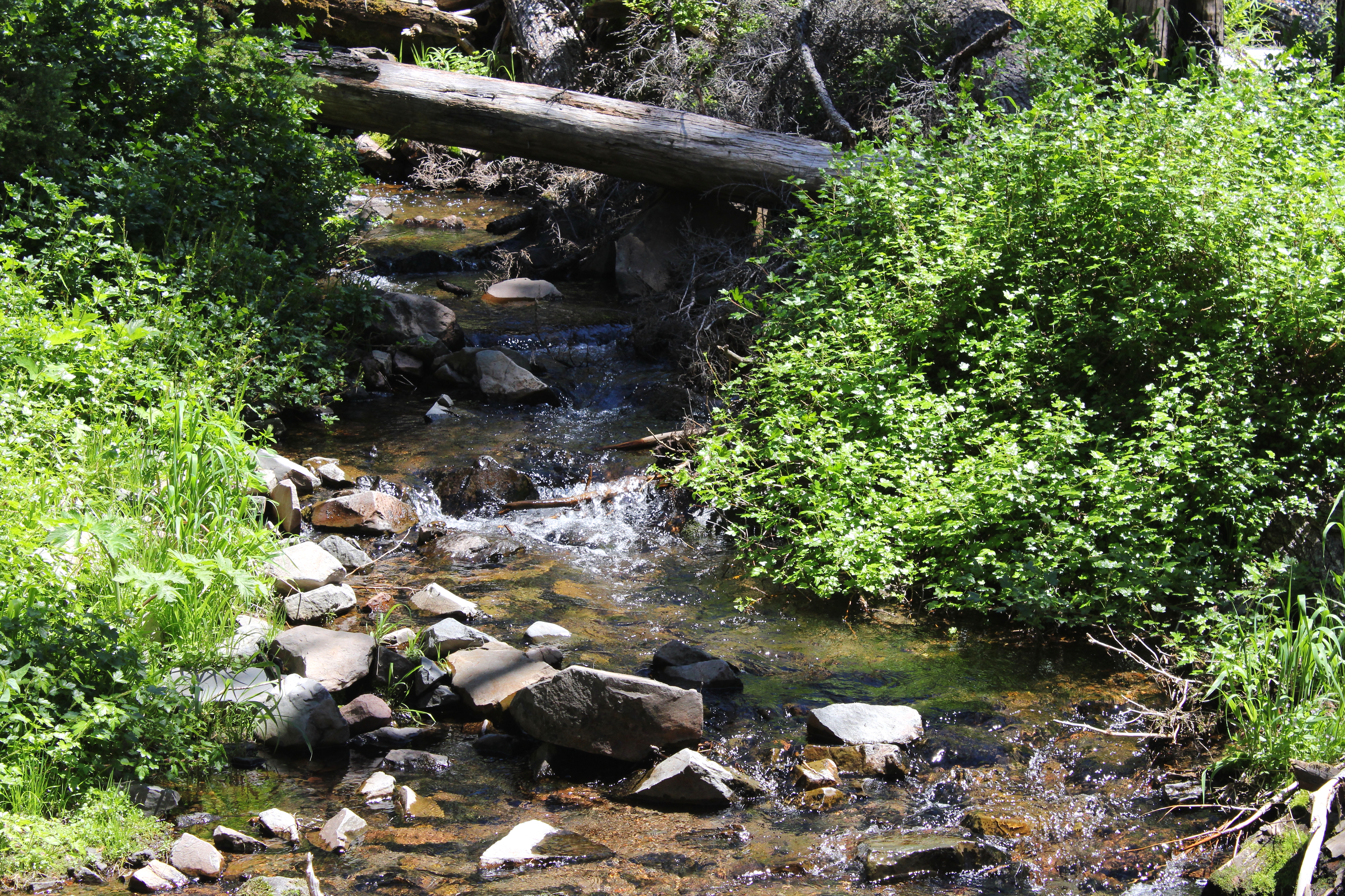
The river was shallow and a multitude of fallen trees and logs clogged the flowing water, creating a series of natural fish weirs. I'd be tempted to say the logs fell into the river because of the fire, but the river channel has been log-littered since long before my first pre-fire hike here, so maybe it's just a Rogue River thing that occurs naturally. Despite the relative shallowness of the river, there are a few places where the river had to funnel into a narrow chute, giving rise to several photogenic cascades and waterfalls. As a precursor to Boundary Springs, all manner of seeps and springs began to gush forth next to the trail with ever increasing frequency. Moss and other assorted greenery flourished next to all the seeps, taking full advantage of the free water available just for the taking.
 

Boundary Springs gushes forth

Boundary Springs is a special place because it's just not every day where a full flowing river emerges from the ground. You can stand on top of the springs, look downstream, and the Rogue River will look just like a genuine river should. Turn around and look u
pstream though, it's a different story: nothing but dry ground and burned forest with nary a drop of water to be seen. Apparently there's no stream in upstream! Because the water has been filtered clean during its long underground journey, there is nothing like a gulp of fresh Boundary Springs water. All life should be just like that drink of water.

The Rogue begins here

While the Boundary Springs Trail continues deeper into Crater Lake Park, becoming part of the Bald Crater Loop (described in the previous blog about Red Cone Spring), our business here was finished for the most part. Some of us went to visit West Lake while others just hiked straight back but all wound up eventually at the Boundary Springs Trailhead. The parking lot was full because apparently everybody wants to be outdoors during a pandemic and the trail had been noticeably busier than normal. Evidently we were not the only people out and about on a Great Oregon Burn Zone Tour.
 

First comes fire, then comes fireweed

For more pictures of this hike, please visit the Flickr album
.

Friday, September 4, 2020

Red Cone Spring


On my radar is an end-to-end hike from Boundary Springs to the Crater Lake Highway, the route being part and parcel of the 25'ish mile long Bald Crater Loop. I figure the hike would be about 12 miles with most of it passing through the remote backcountry of Crater Lake National Park. I have yet to persuade someone with a car (needed for the shuttle) to join me but I'll keep pestering my friends, someone will eventually crack. The cool part for me is that virtually all of the hike will be on trail that I've never been on, a rarity in southern Oregon. If I can't sweet talk anybody into coming with me, then I may just backpack the Bald Crater Loop as a solo venture.

The unassuming fount of Red Cone Spring

In 2015, the Crescent Fire burned up the north end of Crater Lake Park and pretty much the entire Bald Crater Loop lies within the burn zone. Because forest gets burned up in a wildfire, it stands to reason that much more sunlight reaches what was once the shady forest floor. Accordingly, sun-loving life bursts at the seams and vegetation quickly gets to work on claiming trails as their own. Over the years following a fire, dead standing trees become dead fallen trees that hikers have to clamber over. All of this plays havoc with trails, of course. With finances and resources being what they are, trails are often abandoned to the elements until such time as a trail crew can be mustered up to repair the damage. So, while I definitely would like to hike or backpack the Bald Crater Loop, the point is that I had no idea if the the trails were in hikeable shape or not. Clearly, a scouting trip was called for.

Life is tough for trees here

The damage from the Crescent Fire was readily apparent during the drive through the north entrance of Crater Lake National Park, mostly in the form of several miles of blackened forest. Next to the roadway, no trees that I could see survived the conflagration but at the Pacific Crest Trail, the trailhead was surrounded by a patchwork of both living and dead trees. The dead trees here were not deceased from the fire but from a lodgepole beetle infestation. Whether dead by fire or by beetle, either way the forests here are highly stressed by the effects of climate change.

Red Cone dominated the scenery near the trailhead

The Pacific Crest Trail was dry and dusty as a witch's cackle as it headed directly towards Red Cone. The ground was mostly bereft of  ground cover which would explain the dust being kicked up by my feet as I scuffed along. Next to the trail, a few specimens of low growing buckwheat bushes were already going autumnal red while rabbitbrush was reaching the end of its yellow-flowered blooming season. The top of Red Cone was mostly visible above the trees and yes, it was indeed colored a dark red. 

Trees with anatomical appendages

For the first mile or so I was visually entertained by dead lodgepole trees sporting burls and tumors resembling so many butt cheeks or other body parts of unknown purpose. I'm not entirely sure what causes burls to form and after doing some research it seems like nobody else does either. Take your pick, burls either form because of genetic predisposition, viruses, bacteria, beetle infestation, or all-around general forest stress. Whatever the cause, I found myself hiking in a forest full of misshapen trees that surely had to have originated from some other planet.

Window on a burn zone

Just as the route buttonhooked around the north side of Red Cone, a patch of forest flanked either side of the trail in a poignant reminder of what forests around here used to look like. The trees were uniformly well-foliaged and green, and the shade was cool, all of which had been up until now, in very short supply. But it was too good to last and after an enjoyable half-mile, the Pacific Crest Trail entered the burn zone.

Carnage

The conflagration of 2015 must have been hotter than my homemade salsa (and that's hot!) for virtually all trees here had perished. The remainder of this hike would pass through several miles of stand after stand of dead trees. Skeletal snags stood straight and tall in the spot where they stoically met their demise. The younger trees that succumbed in the fire were all bent over in nearly the same direction, giving the appearance of a frantic and futile crawl to flee their impending death by fire. There were a few young seedlings sprouting here and there, but only just a few. This forest will be a long time in recovering to its once and former glory. 

Deer and/or elk left scuff marks all over bare ground

Life won't be denied though, and apparently the first order of business was for grasses to form a wide-ranging ground cover underneath the tree graveyard. Birds twittered and flittered while jackhammering woodpeckers were heard but not seen. Apparently elk and deer congregate here too. Although I did not see any, nor did I see any fresh scat thereof, the soil on and around the trail were full of scuff marks and hoof prints. It looked like a somnivalent army of zombie deer had marched through here, dragging their feet as they wearily trudged to battle. 

Beautiful meadows surround Red Cone Spring

Red Cone Spring is an important water stop for Pacific Crest Trail through-hikers, since there is little water available in the dry volcanic soils that so populate this section of the Cascades. The spring also made for a logical turnaround point so I left the PCT and ambled through some large, gorgeous, and grassy  meadows as I made my way to the spring. The trailside oasis was barely trickling but water is life and the weak current is more than enough to sustain both hikers and local wildlife. Lunch and relaxation at this peaceful spot in the middle of a tree graveyard was had before turning around and heading back.

This way to Boundary Springs!

At a trail junction on the way back, I went up the Boundary Springs Trail for a bit just to explore. The trail is somewhat on the sketchy side but if it doesn't get any worse, it will be followable which is my main concern. On the return leg, I did run into two backpacking parties who were doing the full 25'ish mile long Bald Crater Loop so people are hiking it, which gives me further hope for doing the same. But for now, it had been a pleasant day hike in the Crater Lake backcountry and that was enough.

Commemorative lichen bouquet on a dead tree

For more photos of this hike, please visit the Flickr album.


Thursday, March 12, 2020

Crater Lake Rim


What a difference a week or two makes! Glen and I had gone snowshoeing at Crater Lake nearly two weeks prior and the weather was so bad that I left the camera in the car and just snowshoed. That's like only the second time ever I intentionally left the camera behind to protect it from the elements, so you know the weather had to be dire. On that day, the wind was howling, wet snow filled the air, and the lake was hidden from view by inclement weather. It was a great and awesome hike! Because we were both properly clad in snow gear, we were actually quite toasty warm as we trudged in the wind and snow that day.

Paige is prepared for cold weather
Flash forward to this mid-March day and the sun was up, the sky was that deep blue that seems to hover only over Crater Lake, and the crater rim was cloaked in several feet of snow. Oh yeah, there was that lake thingy reposing in the crater itself, the sapphire blue of the water having its own reserved parking spot, so to speak, in the color spectrum parking garage. Lulu enjoyed the snow so much she had to eat it every time we paused in our walk along the crater rim. Of course, Lulu is a dog but there were two other humans in our party besides your merry blogster: Glen and his daughter Paige, who continually referred to Lulu as Wuwu. 

Whitebark pine against an amazing blue sky
Despite the sun, we remained clad in snow clothing and layers as the wind blowing on the rim was downright arctic. The problem was that every time our route dropped down below the actual rim, the wind was blocked and we roasted in the bright sun. However, we mostly kept our gear on because that wind was present at every viewpoint along the rim. Hot, cold, hot, cold, and no happy medium in between. 

Wizard Island, afloat in the lake
Our route was Rim Drive, quite free of tour buses, RVs, and other touristy means of transportation this time of year. In winter, the erstwhile road is well used by snowshoers and skiiers alike and following the well-trod route was eminently easy. The snow was old, having gone through the melt, freeze, remelt, and refreeze process many times over during the winter. For us, that meant the snow was hard and sort of icy, making for easy snowshoeing. You almost didn't need the snowshoes and we did see one couple actually hiking in their boots atop the crusty surface of the snow.


The Watchman and Hillman Peak
rule the western side of the rim
After a mile or so, we hit the first of two main viewpoints, the first being Discovery Point, so named to commemorate the place (sort of) where John Hillman discovered Crater Lake. I get sort of cheesed by the "discovery" of Crater Lake being attributed to Hilllman because the native tribes in the area were well aware of the existence of the lake, but they don't count, apparently. Also, nobody really knows the exact spot that Hillman first spotted the lake but since it could have been at Discovery Point, a plaque commemorating the event marks the hypothetical spot. All this silly and irritating history aside, Discovery Point has an awesome view that was worth the snowshoeing effort to get there.

The peaks of the south end of the lake
Discovery Point lies on the southwestern corner of the lake ("corner" he said, ignoring the fact that the lake is round and doesn't have any corners) and a series of snowy and rugged peaks (Garfield Peak, Applegate Peak, Dutton Cliffs, and Mount Scott) marched in stately procession with Mount Scott leading the charge on the eastern side. To the north was our immediate neighbor The Watchman with fraternal mountain Hillman Peak parked right next to The Watchman. Down in the lake itself was Wizard Island, permanently afloat in the Crater Lake stewpot, with the imposing cliffs of Llao Rock looming over the north side of the lake. Beyond the lake, the tops of Timber Crater and Mount Thielsen were just visible. And always, the stunning sapphire color of Crater Lake itself. Amazing vista and this is why we hike, boys and girls.

Rock 'n roll!
After a round of appropriate oohs and ahs, we continued on up and over a ridge to the next viewpoint. This portion of the snowshoe trek is my favorite non-Crater Lake related part of the short hike. Rim Drive curves up and over the ridge with a steep slope on either side of the road cut. It probably doesn't look like all that much in summer but in winter it's a snow-covered canyon in miniature, replete with cornices, flutings, and other wind-driven snow formations. Rocks had rolled down from above, leaving tracks in the snow that culminated with the body of the culpable party just sitting there, with nowhere else to roll.

Perfectly smooth, like me!
The second viewpoint has a similar vista as Discovery Point, the view changing only in angle of orientation, due to our being a mile further along the rim. Wizard Island was a lot closer though, and we raptly gazed at the magical cone, totally enchanted and entranced at the spellbinding island. Behind us, on the landward side of the rim, was a snowy expanse that I refer to as the "Ski Bowl". Normally, this area is criss-crossed with ski tracks and you can almost feel the skiers' joy as they play in this wintry wonderland. However, today there were no tracks at all, just rolling hills of snow with the most perfect texture. It would have been a shame to mar the perfect smoothness of the snow with our snowshoes so we just looked and did not touch.

Mount McLaughlin and Union Peak have a staredown
After a windy laze taking in the awesome view while one of our quartet ate snow, we turned around and headed back towards Rim Village. Since we had hiked mostly downhill on the way out, it naturally was mostly uphill on the way in. But the grade was not severe, and legs did not complain too much about having to transport our respective torsos to a higher elevation. We stared at jagged and cragged Garfield Peak on the way in, with a nice view of Union Peak and massive Mount McLaughlin well off the crater's rim to the southwest. 

What a difference from nearly two weeks ago!

After the trip ended, we enjoyed a restorative lunch at the Crater Lake restaurant in Rim Village. This would be like the last "normal" activity we'd do for a while as the coronavirus pandemic came in a day or two later for an extended and unwelcome stay. It makes me wish for things as they were, even if it means snowshoeing in severe weather. What a difference a week or two can make, indeed.

Texture on a snow drift
For more photos of this hike, please visit the Flickr album.