Friday, July 25, 2014

Alta Lake (via King Spruce Trail)

Alta Lake owed me one. Five weeks ago, Ray and I camped in snow, rain, and endured a cold night that was somewhere in the 20s, temperature-wise. A mere five weeks ago, but what a difference! The intervening weeks have since been as warm as a barbecue grill set on high and presumably the snow and ice is so yesterday, just like last year's teen idol. Hopefully, Alta Lake has wisely used the five weeks to feel contrition and a desire to atone for her rude treatment of Ray and I.

Rough trail


I've hiked to Alta Lake like a million times already and while nice, this hike needed a little something different added to the mix. About 0.7 miles into the hike from the Seven Lakes Trailhead, the trail forks and the left fork has a sign tacked onto a tree that faintly reads "King Spruce Trail" with the intersection with the Alta Lake Trail following a mere 3 miles away. I'd always bypassed the King Spruce because the guidebooks used words and phrases like "seldom used", "sketchy", "faint trail", "lost hikers", "never seen again", and "next of kin".


"Why not?", Tiger Lily?
Okay, I made the last three up, but the fact remained I'd never been on the King Spruce, so with a "why not?" I set out to add the King Spruce Trail notch on my hiking pole by doing the loop hike by taking the King Spruce and the Alta Lake Trails, and then returning by way of the Seven Lakes Trail. Half of the hike would be familiar and half would not.

I can relate to the bald-headed coneflower

The Seven Lakes Trail heads relentlessly uphill on its way to Alta Lake but the King Spruce Trail was much more agreeable as it politely lost elevation in the first half-mile. Despite the downhill, the hike was some work as the trail was badly overgrown by huckleberry, one has to stay alert so as to not lose the trail tread. And speaking of trail treads, the tread was very rough and rocky and it was hard to get a hiking rhythm going. 

Tall delphiniums
The trail did eventually quit going downhill but still remained fairly level as it contoured around a large meadow. The path was circling the lush meadow but remained in the forest all the while. A short bushwhack down to the meadow revealed the meadow was not grass so much as it was a dense thicket of willow trees. Amazingly, delphinium was poking up and out of the willow trees making these plants somewhere around 8 feet tall. On the map, this area was marked as "King Spruce (site)" and I never saw anything that looked like a formal site of whatever this used to be site of. You might say I hiked around the meadow, site unseen.

Gah! What is that thing that landed on my shirt?
As previously stated, the Seven Lakes Trail heads relentlessly uphill to Alta Lake. Since the King Spruce was also going to to Alta Lake, I was perhaps a little naive in thinking that the lake would be reached by hiking downhill or on a level path. Never fear, the King Spruce Trail quickly disavowed me of that notion by climbing around a forested ridge that leaked spring after spring after spring. Small trickles ran down the trail in their quest to eventually become Sumpter Creek and small pools just off trail supported an entire nation of bullfrogs. Bog orchid, monkshood, paintbrush, columbine, and tiger lilies all contributed to the floral rainbow surrounding the springs. An amusing moment of disconcertment occurred when a black winged insect landed on my shirt; it was large with long antennae and certainly came from another planet. Good thing no one was around to see my spastic hand-waving "gah!" moment.

Wet trail


Just like me, things dried out as the trail headed uphill. The trail had been alternating between shady forest and sunny meadow until it rounded a ridge and turned towards the northeast. The trail continued to gain elevation, with the lush vegetation morphing into a thin and stunted forest of hemlock with no ground cover underneath. The trail really became faint at this point, and fallen trees complicated the routefinding. Enterprising hikers had stacked rocks on the fallen trees on the trail and I was most appreciative of the markers. 

Typical scene on the King Spruce Trail
The trail was nowhere as steep as the Seven Lakes Trail but it went on and on. The philosophical question among hikers about hiking uphill is which is better: More pain for a shorter distance or less pain for a longer distance. I've never been able to emphatically resolve that question and my answer always tends towards the opposite of what I am currently hiking on. So, after nearly three miles of slogging ever upwards, I could only enviously ruminate on the fact that the Seven Lakes Trail would have been heading downhill by now.

It was longer than 3.5 miles
It was somewhat surprising to find the intersection with the Alta Lake Trail clearly and prominently marked, considering the overall sketchiness of the trails. It was hard to tell while walking through viewless forest, but I had attained the ridgecrest that would eventually become Violet Hill. I turned right and immediately continued uphill; if I would have walked (without a trail to follow) straight ahead and downhill, I could have reached Lake Ivern in the Seven Lakes Basin. I'm filing that one away for a future cross-country venture.

Boulder Pond
The next item of interest was Boulder Pond, a small stagnant pond below a prominent pile of rocks. The pond was not your basic glamour destination, but the dragonflies flitting around seemed happy enough with the tepid water. From the the rock pile, a pika called out a warning to all his pika friends that a big scary hiker was coming. Through the trees and in the distance, I caught a brief glimpse of Mount Thielsen peeking over the shoulder of Crater Lake's Llao Rock.


View to Middle and Grass Lakes
Once the trail crested the ridge, it dropped rapidly to the north end of long and narrow Alta Lake. It was interesting to compare the then and now of this hike versus the winter expedition of five weeks prior. The lake was blue under a blue sky and nary a patch of snow was seen either around the lake or on the nearby peak of Venus. A brief side trip to our formerly icebound campsite provided a magnificent view of Middle, Grass, and Cliff Lakes reposing below prominent Devil's Peak.

Devils Peak
By this point, I was tired and most grateful that the trail headed downhill all the way to the car.  The trail basically is a rock-filled chute all the way down to the end and the hiking was still fairly slow, no sense twisting an ankle by trying to speed walk. Up until this point, this hike had been basically mosquito-free but the little buggers pestered me from Frog Lake on forward, that's just another reason to hike to Alta Lake via the (mosquitoless) King Spruce Trail.

Meadow at the King Spruce site
For more pictures of this hike, please visit the Flickr album. 


Thursday, July 24, 2014

Mary's Peak


It's been hot lately in Roseburg and I've been asking the weather gods to send us some cool weather and rain. So my pleas have been heeded and as I got soaked by the occasional rain shower and the wet vegetation encroaching the trail, I began pleading for another heatwave. Some people just can't be pleased. The response to my plea for heat was a cold wind blowing through my wet clothing on a recent hike to Mary's Peak. Some people just don't get heeded, either.


Wet and cold columbine
Mary's Peak tops out at a modest 4,097 feet and while she may be a small peak in the larger scheme of things, Mary does have the honorable distinction of being the highest peak in the Coast Range. Her proximity to Corvallis, Salem, and Eugene ensures she gets a lot of foot traffic and a road rambling round the mountain provides multiple trailheads and distances: the hikes range from the he-man 12.2 miler (2,000 feet of elevation gain), to the namby-pamby 1.2 mile (with a paltry 300 feet of elevation gain) version. I opted for the middle distance hike, but since it gained 1,600 feet anyway, I'm kicking myself a little bit for not doing the he-man hike.

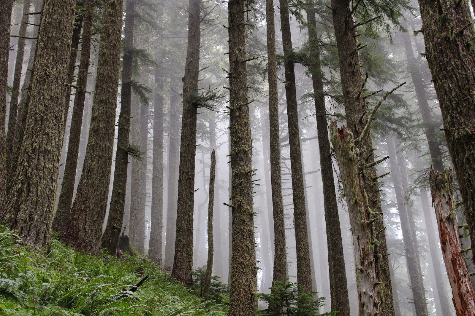
Forest on Mary's Peak
As I laced up my boots at the Connors Camp trailhead, the soft hiss of rainfall permeated the forest. The top of Mary's Peak was hidden in the clouds and I crossed my fingers, hoping the clouds would clear as the day wore on. The forest was absolutely lush what with vine maples arching over the trail while salal, ferns, and Oregon grape drooped over the trail, making sure my legs got wet. As previously stated, Mary's Peak sees a lot of use but on a rainy mid-week day, not so much; I ran into only two other hikers on the trail and pretty much had the entire mountain to myself.

"I'll keep an eye out for you, maybe two!"
Although the trail gained 1,600 feet, the grade was never overwhelming and tendrils of fog wrapped their moist fingers around mossy tree trunks. Occasionally, the cloud cover would momentarily break, the blue sky and bright sun was jarring but the warmth was welcomed by this cold and wet hiker. All the moisture in the air, ground, and vegetation pleased the slugs which were on the trail in slimy sluggishness.


View from the summit meadow
The payoff on this hike came about a mile before the summit when the forest abruptly ended and the trail sidehilled across a grassy slope. The clouds were still hanging around but at an elevation higher than the peak. The patchwork farmlands surrounding Philomath and Corvallis were visible, resembling a quilt tossed over the sleeping earth by Mary herself. You are supposed to be able to see the Cascades all the way up to Mount Ranier on a clear day, but I was glad to be able to see as much as I did on this dreary and mostly gray day.

Incoming cloud
The actual summit of Mary's Peak was somewhat anticlimactic as it had several microwave relay dishes on top. A trail led away from the electronic gear to the summit meadow and I headed down to the meadow loop trail in search of some extra mileage. After a short walk through a forest comprised of bluish Noble fir, the trail crossed the Mary's Peak Road and now I was confused. Per my map, there should be no road crossing and I had somehow wound up where I originally crossed the road when I neared the summit. In hindsight, I needed to take the trail that was marked "campground" for the meadow tour; oh well, now I'll have to pencil in a return visit.

The summit was all about the meadows


Now that I was reoriented, I grabbed the trail leading up and over a grassy hill and dropped down to the observation area.  The observation area is as far as one can drive a car and sports a northward viewpoint, a picnic bench, and an overlook of a very large meadow. Of course, when it's cold and wet, the parking lot is bare and bereft of cars and hikers. Still looking for extra miles, I grabbed the trail dropping down to the Tie-in Trail, a trail connecting the North and East Ridge trails.


Salal flowers
The trail was predictably lush and if you like the color green, then you'll just love the Tie-in Trail. Even though it was mid-afternoon, the light had darkened considerably, that statement being empirically proven by the fact I had to crank up the ISO settings on my camera. Walking through a wet and lush forest was the sum and total of my existence for the next three miles before arrival back at Connors Camp.

Green was the color of the day
This was a neat hike and my first visit to Mary's Peak was most enjoyable. I think next time, I'll do the he-man hike and hopefully it'll be warmer than it was on this day. Oops, there I go again about the weather!

Indian pipe
For more pictures, please visit the Flickr album.


Sunday, July 20, 2014

Erma Bell Lakes

Fully prepared for yet another hike in the hot sun, I opened the door and much to my pleasant surprise, there was a slight chill in the air. The air was crisp and clear and small clouds dotted the perfectly blue sky. It felt and looked like a mild winter morn and that was a nice change from the deep fat fryer that has been Oregon of late. By the time I hit Cottage Grove on the drive to the Erma Bell Lakes Trailhead, clouds had covered up the sky which was now its normal gray color, just like sky is supposed to be. Of course, by the time I reached the trailhead, the clouds had dissipated and it was quite warm again, but there had been a crack in the weather molar and we have a pending appointment with a dentist of hope.

Just a beautiful day in the vine maples


Located in the southwest corner of the Three Sisters Wilderness, the lakes are closer to Waldo Lake than they are to the Three Sisters. Allegedly, this is a popular trail but there was only one other car at the trailhead when I arrived. Because there were no other hikers, this meant I experienced a higher per capita ratio of hungry mosquitoes. However, they were nowhere near as bad as the clouds of mini-vampires at Island Lake several weeks ago.  A quick spray of Deet held off the bloodsuckers for the time being.


Prince's pine


After crossing Skookum Creek, the trail headed into a superbly lush forest. Tall trees loomed overhead like the ribs of a Gothic cathedral and the forest floor was covered by a shag carpet of ferns, vanilla leaf, and prince's pine. Huckleberry bushes were festooned with red berries, all looking like small cherry tomatoes. The trail was wide, well-defined, and covered with pine needles, my footfalls were as silent as a sleeping cat as I walked through the trees. The trail became a little bit less civilized when I took the left turn on the Irish Mountain Trail after 0.6 miles.


There otter be a lake!
Angling uphill, the trail wandered through the woods, beargrass, and small hopping tree frogs for 0.5 miles before arriving at Otter Lake. The lake is just gorgeous, sitting below the forested slopes of unseen Irish Mountain. Lily pads floated serenely in the lake's waters along with a couple of ducks paddling slowly in the middle of the lake. After a quick photo-shoot, it was off to Williams Lake.

Fungus thingy
It was nearly 3 miles further to Williams Lake and its namesake trail wandered through forest interspersed with meadows. The meadows were all abloom with columbine, lupine, tiger lily, and spirea while the boggier meadows sported white feathers of bog orchid. Of course, the meadows were incredibly humid and I was soon as sweaty as a Sumo wrestler playing racquetball in a steam bath. 

Williams Lake
The trail had been climbing steadily and the forest changed from lush to scrawnier and more open as I neared Williams Lake. The lake arcs in a "C" and I got to experience it twice as the trail hit each leg of the "C". Dragonflies flitted over the lake while puffy clouds formed and reformed over the water. It was a nice stop for a lunch and lollygag and I obliged.


Whats up, Tiger Lily(s)?
Williams Lake was the high point of this hike, everything else was all downhill. Of course, I mean that quite literally as the trail descended off the high bench, switchbacking down into the basin containing the Erma Bell Lakes. I thought a lake spotted through the trees was Upper Erma Bell Lake but it turned out to be the unappealingly named Mud Lake.


Upper Erma Bell Lake
Upper Erma Bell Lake, was later spotted in similar fashion and I followed a faint use trail down to the lake. The lake was ringed with vegetation and fish jumped here and there. While there was some blue sky, it looked like the overcast from this morning was returning.


Steep scramble down to Middle Erma Bell Lake
The trail passed several hundred feet above Middle Erma Bell Lake and I took another faint trail down to the lake, cursing my fate as I would have to climb back up on the return. Across an arm of the lake, the lake disappeared around a forested peninsula with a marsh of aptly named marsh marigolds greening up the shoreline.

Waterfall between two lakes
As the path left Middle Erma Bell Lake, a huge roar carried through the forest. You could almost throw a rock from Middle Erma Bell Lake to Lower Erma Bell Lake, unless you have a partially fused wrist like your intrepid blogster. At any rate, the lakes are quite close together and are connected by a massive waterfall. Another sketchy side trail provided a cliffy view of the waterfall and much photography ensued.

Lower Erma Bell Lake
Lower Erma Bell is large and round with forest encroaching upon the rocky slopes surrounding the lake. At all the other lakes, the trend had been to take a faint use trail down a steep slope to see the lake and Lower Erma Bell Lake was no different. By this time, the day was well into overcast and it even felt like it might rain. After the dry clambake that has been July 2014, it felt good to be chilled.


Fringed pinesap
Leaving Lower Erma Bell Lake, the hike's 9.1 mile long loop was closed by walking the last 2 miles through that incredibly lush forest I had started out in. Sunlight slanted in between the overcast periods and through the trees I could see the vast and deep canyon of the North Fork Middle Fork Willamette River, or the Fork Fork as I like to call it.


Unnamed creek
On the way back, I ran into a party of 6 backpackers, headed towards Lower Erma Bell Lake. Not only were they carrying their packs but each hiker carried two armfuls of gear, including full 5 gallon water jugs. They were going to camp at a lake but were packing in water, what the....? That's a good recipe for hating backpacking and several of the women in the party already had the "hate this" look on their faces. Oh well, I enjoyed the hike and the mosquitoes enjoyed me.

You should eat more mosquitoes
For more pictures of this hike, please visit the Flickr album.


Saturday, July 19, 2014

Tipsoo Peak

On the hike up to Tipsoo Peak I wondered what I would write about. The trail switchbacks through a singularly uninteresting forest with no plants or flowers growing underneath the trees. There weren't even mosquitoes buzzing in the shade. The trail is writer-unfriendly and has only one purpose in life, and that's to deliver hikers to the summit of Tipsoo Peak without ceremony or preamble. I could probably come up with more wit and witticisms writing about a half-hour workout on the treadmill than 6 miles of the Tipsoo Peak Trail. So, why bother hiking at all to Tipsoo Peak? It's simple: the view of the highlands surrounding pointy Mount Thielsen are first-rate and well worth the tedium.

Let's go hiking!
Joined by about 20 Friends of the Umpqua-ites, I headed up the aforementioned drab forest and took like two pictures in the first three miles. Those of you who regularly hike with me know that never happens. However, there is always something to see on any hike and this was no different. For instance, I saw a number of four-legged carnivores prowling the trail but fortunately they were all leashed to their respective owners. I heard several birds tweet. I took several drinks of water. I may have tied my shoes, but if I did, it wasn't in my notes. Yup, not a lot happens on the Tipsoo Peak Trail.

Break out the snowshoes!
Once the trail attained the high ground after a couple of miles, then things got pretty cool. The trees thinned out and sparse meadows tried to thrive in the dry pumice. In the shady parts, a few snow drifts were still hanging around despite the heatwave baking our little corner of Oregon like a ripe spaghetti squash.


Howlock Mountain
Tipsoo Peak is actually a pair of rather nondescript cinder cones surrounded by several larger volcanic brethren and sisterns. The area near the peak is all tortured red rock with a large snowdrift on it. However, no crampons were required and at the summit we all predictably oohed and aahed at the views. Jagged Howlock Mountain is Tipsoo's nearest neighbor and was all bristly with sharp edges and jagged rock. Just beyond Howlock was the prominent spire of Mount Thielsen.

World-class view
Below Tipsoo Peak, lies a sparsely vegetated pumice plain. The Pacific Crest Trail runs right between Howlock Mountain and Tipsoo Peak and as a matter of fact, the dusty saddle between the two peaks is the highest point on the PCT in either Oregon or Washington. Several backpackers were spotted from our 8,000 foot high perch, presumably they were on their way to Canada.

Diamond Lake and Mount Bailey
To the west of Thielsen was the round mound of Mount Bailey, it's round unless you are hiking to the summit, it's incredibly jagged up close. Below Bailey were the sapphire waters of Diamond Lake. Miller Lake, on the east side of the Cascade Mountains, also had blue waters but Maidu Lake and Lake Lucille were both colored an unappealing green. Maidu is the source of our North Umpqua river. Nice to visit this time of year but don't drink the water.

View towards Diamond Peak


Beyond the two small lakes rose the two lesser peaks of Sawtooth Peak and Cowhorn Mountain. I've hiked to both summits and at the time they didn't seem lesser, but from Tipsoo Peak they were both dwarfed by the snowy Diamond Peak massif. Beyond Diamond Peak, and hazy in the distance were South and Middle Sister, Mount Bachelor, and Broken Top. There was some debate whether the tip of North Sister was visible or not, count me in as one of the naysayers. The view in that direction was hazy due to the wildfires burning near Bend.


Dried up wet spot
On the way back, for variety's sake a number of us took a side trip through a pumice meadow just off trail. A dry depression showed where a temporary pond resides during thawing time. A few mats of pink heather were blooming along with partridge feet in the rock gardens. That was all the excitement we experienced before re-entering the mind-numbing forest.


Tipsoo Peak, or the tip thereof
For more pictures, please visit the Flickr album.


Sunday, July 13, 2014

Bandon Beach

It's hot. Very hot. So very hot. I'm melting like a spit out piece of used bubble gum on a hot sidewalk. Ants will die in my gooey puddle and passerbys will wonder what was that sticky stuff they stepped in as they scrape their shoes clean on the concrete curb baking in the oppressive heat. I can only open the freezer door and stick my head in the ice bucket, dreaming of a world where life is wonderfully cooler...like Bandon!

How to beat the heat
So, while the Umpqua Valley stands in front of the heater vent of the universe, Bandon (and the Oregon coast, in general) enjoys perfect weather: overcast, some rain, and temperatures topping out at 60 degrees. I'm as jealous as my dog watching me pet the cat. Just to clarify, I only actually pet the cat when Dollie is watching or just to annoy the dog. But anyway, I was glad to park the car next to the Coquille River in Bandon on a delightfully cool morning where clouds were wonderfully gray, water occasionally fell from the sky, and a cool breeze caused me to don a light jacket.

One lone seal causes a stir
The beach was fairly busy next to the river jetty and I couldn't help but suspect all the beachgoers were Roseburg heat refugees like myself. The beach sand was soft as I walked past the numerous rock islands that make hiking on Bandon Beach so special. The map says I hiked past Black Rock but they all looked black to me. Further up the beach, a small crowd gathered excitedly in front of an island close to the shore. The cause of all the hubbub was a lone seal sitting on a rock. Well, to be technical seals don't sit, it was propped up on its flippers in sealy repose, fully entertaining the easily entertained masses.

Crop circle, beach style
The beach seemingly ends in a rock wall at Coquille Point, but the wall is really a collection of individual  islands, rocks, and stacks and there is a path through the maze. On the other side of the point was a bay with a beach adorned by crop circles, sans crops, of course. A man with a stick was creating the impermanent works of art and children big and small were walking in the mazes inscribed in the circles. It sure was embarrassing when I couldn't find my way out!

Face Rock
Just opposite Grave or Gravel Point (it depends which map is consulted, I've seen both names used) is an island known as Face Rock. Legend has it (this is the short version) an angered sea god froze the Princess Ewauna who had entered the sea carrying a cat and kittens in a basket. As a reluctant cat owner, all I can say is "r-i-i-i-i-i-ight..." about the idea of successfully carrying a cat, much less one with kittens, in a basket into the ocean. At any rate the angry sea god tossed all the mewling felines into the ocean and froze the the princess. My feeling is that the cats probably were to blame for the whole incident somehow. The princess is now Face Rock, forever gazing up at the moon. A nearby collection of islands lined up in a row are now collectively known as the Cat and Kittens. I do find the idea of cats permanently soaking in the wet surf quite amusing. As an aside, the princess entered the sea with her dog but the dog managed to avoid being turned to stone, thereby proving dogs are smarter than cats, kittens, and princesses.

Four-legged tourists
This is not your basic wilderness hike what with inns, hotels, and luxury homes perched atop the cliffs and in some cases, halfway down the cliffs. The beach here is a tourist attraction and there were many tourists out enjoying the scenic beach. Several creeks crossed the beach and the warm waters were steaming in the cooler air. A posse of horseback riders passed by and there was more stuff steaming on the beach, if you get my meaning.


It's steamy in the Oregon tropics
At Devil's Kitchen, which incidentally could be an alternate name for Roseburg right now, the houses petered out and the wild beach began. The 15 mile stretch of beach from Bandon to Port Orford is undeveloped and is Oregon's longest stretch of wild beach. Fellow hikers were few and far between after I passed Haystack Rock, the last island on Bandon Beach.


Find the snowy plover in this picture
As wild as the beach is, a rope fence keeps hikers off of the dry sand. This is snowy plover territory and the small bird is endangered. The plover spends it's entire life on the sand and it is easy for hikers to step on camouflaged eggs and chicks. In Oregon, the protection offered the plover is nothing new for me but for the very first time I observed a plover sprinting ghostlike across the sand. All I can say, is the birds are well camouflaged on the light colored sand.

Get the flock out!
Periodically, flocks of sanderlings flew by like airborne schools of fish, all turning in the same direction at the same time. If I was a sanderling, I'd be the one turning left when all turned right, causing a spectacular mid-air high speed pileup. I'd also probably get excommunicated from the flock at some point, too. There were also a number of vultures on the beach, just watching me...just watching...they made me nervous. 

As good as new
At just under 6 miles, the New River hove into the view. The map says the New River mouth was about 6 more miles ahead of me so if the large river running in front of me was not the New, then it was good as New. Sorry, I can't help it. The New was running wide and deep and like me, was not going to be crossed today. Besides which, I still had a 5.5 mile hike to get back to the car at this point.

An oystercatcher sneaks away
A nice little lunch 'n laze was enjoyed at the river's edge, the time spent observing the chaotic clash of watery titans where the New River collides with the Old Ocean. But all New things come to an end and back I went for the long walk to the car. I got to observe the gulls and sanderlings again while the vultures disconcertingly observed me like hungry patrons watching an approaching waiter bring their meal.


Why I hike on Bandon Beach
It was pleasantly cool and overcast on the drive home until I reached Camas Valley. There, the clouds dissipated and the sun was a big ball of way too hot fire. Normally, it's good to be back home but not when you're a figurative chestnut roasting on an open fire.

This hike rocks!
For more pictures of this coastal escape, please visit the Flickr album.