Showing posts with label Diamond Lake. Show all posts

Wednesday, February 26, 2020

Diamond Lake


I've often said hiking is my mental health therapy and never have I needed hiking and therapy more than the present time. My world ended with an early morning phone call that began with "Aislinn died last night". With those four words life as I knew it was shattered and my youngest daughter was gone, leaving behind wonderful memories and broken hearts that will probably never heal in this lifetime. I could certainly write so much more about Aislinn, her life, her passing, and my feelings on the subject and while I recognize this is a hiking blog and not a blog about grief, a sadness this profound will inevitably bleed into all that I do for a bit. Just four days removed from that awful morning, I was feeling pretty raw but the idea of spending another despondent day at home just did not feel very healthy, it was time for some trailside therapy in the nurturing company of John, Jennifer, and Diane, who are some really awesome friends.

The lake was calling and we must go
The original plan was to snowshoe to Boundary Springs but since I'm unable to concentrate much these days, I naturally forgot to bring my snowshoes. So, Plan B was to swing by Diamond Lake Resort and rent some snowshoes and then continue on. However, one look at the frozen beauty of Diamond Lake changed our collective minds and we, by unanimous consent, opted to hike on the lake instead.

Diamond in the rough
The day was sunny, the sky was a deep blue color, and groups of ice fishermen dotted the lake's frozen surface like flakes of pepper on a pile of mashed potatoes. Despite the seemingly warm weather (even though it was sunny, it was still pretty chilly), the ice felt solid enough under our shoes as we left the cabins, restaurant, store, and other civilization accouterments behind at Diamond Lake Resort.

View south towards Crater Lake National Park
Basically, we just followed the lake's eastern shore, eschewing the campground road running through the forest along the lake. It wasn't too long before the sharp needle of Mount Thielsen made an appearance over the eastern shore, its pointed white spire seemingly intent on poking a hole in the sky. Straight ahead were some low hills located in Crater Lake National Park, one of which I recognized as the disturbingly named Bald Crater. It was Mount Bailey on the western shore, however, that dominated the mountain scenery surrounding the lake.

Mount Bailey, ever and always
The mountain was cloaked in white and no matter where we went, there was Mount Bailey, reposing in all its snow-covered awesomeness. We had all hiked to the top of Bailey at one time or another, so we periodically stopped to admire the view and call out some of the landmarks seen on the rugged trail to the summit.


Fissures in the ice cap
As we walked, we stepped over some cracks and fissures in the ice cap covering the lake. None of us were well versed in ice and lakes or the dangers thereof, so naturally we were somewhat concerned for our safety as we hiked. All of us, at differing times, poked our hiking poles into the fissures only to find hard unyielding ice below, apparently the crack had since frozen back shut. But visually, it still was disconcerting.

We took the campground road to the pizza restaurant
After a couple miles of lake-top walking, we edged toward the large campground on the lake's east side. Grabbing the campground road and after veering to and fro for a bit, we hit the well-used road which in winter time, does double duty as the Pizza Connection Trail, so named because it connects the South Shore Pizza Parlor to Diamond Lake Resort. In winter, or at least the times I have snowshoed there, the pizza parlor is open despite there not being any clear driveable road to the restaurant, serving warm pizza to snowmobilers, Nordic skiers, and lowly snowshoers such as ourselves. From prior experience, the smell of hot pizza wafting through the snow-covered trees is its own heavenly experience.

A great place for lunch
Alas, on this day the pizza parlor was closed (it was mid-week after all, so maybe it's only open on weekends) so no sublime pizza experience for us. Bummer, but we resorted to lunch consisting (in my case) of oranges, beef jerky, and nut bars while bittersweetly contemplating the silent lake and mountain majestically reposing before us under a cobalt blue sky.

It was stark and windswept on the lake
We decided that snowshoeing across the lake was way more interesting than following the campground road, fissures be damned. By this time it had warmed up enough that most of us figured on shedding jackets and just walking in our base layers. However, upon immediately striding out onto the lake, an arctic wind blowing in our faces quickly and emphatically dissuaded us of that notion. It was cold! As we walked across the barren surface of Diamond Lake, John remarked he felt as if he was walking across a Russian steppe in the middle of winter and I pretty much agreed with him.

Mount Thielsen on the east side
There wasn't a lot of variety on the way back, just us making our way across a frozen lake with Mount Bailey on one side and Mount Thielsen on the other. The only thing that was different was that since we were facing north on the return leg, we could see the snow-covered massif of distant Diamond Peak. On the walk back, I took the occasion to bend each of my companions' ears in turn, talking about the horrible event of four days prior. They should have packed a couch so I could lie down and unburden my troubles while they take notes. However, I'm eminently grateful for having such good, kind, and understanding friends; I'd be lost without them.

Where sun and contrail intersect
I did do some thinking about where I go from here and where this new journey may take me and I did come to some resolution, which is as follows. My daughter had taken critically ill for no reason at all three years ago but managed to survive that, although it was very close to the other outcome. It was not very realistic to expect her to emerge unscathed from such a close call and the price she had to pay was that her legs were amputated. Just imagine being 28 years old and losing your legs. I know I would have had a lifelong pity party for myself but not my girl. In the three years after that catastrophic life change, not once, not ever, did I hear her complain about her lot in life or feel sorry for herself. She was amazing, incredibly strong, and utterly resilient: she unflinching stared Fate right in the eye until Fate blinked first.

Fishing party straight ahead

In a way, Aislinn embraced the whole living-without-legs experience, doing things like rowing on a competitive dragon boat team, exercising with yoga, and putting on a short dress whenever she'd go out in public. We had even talked about hiking at some point in the future! So, there's her legacy for me: look your problems (like overwhelming grief) in the eye and fully embrace the challenge and experience.

Peaceful aspen grove
There'll be ups and downs in the near future, such a huge and tragic loss cannot be so easily disposed of. But trail therapy definitely helps and rest assured I will be OK in the end: this is a journey, after all, and it will be amazing. Thank you all for listening.

We head straight to Diamond Lake Resort
For more photos of this hike, please visit the Flickr album.


Saturday, September 7, 2019

Thielsen Creek


This is another hike that was done in 2019 and since I'm writing this in 2020 and knowing what I know now about events that transpired in 2020, I can say this trail was in the middle of the Thielsen Fire that nearly burned down the resort at Diamond Lake. Certainly, the trailhead complex was right inside that mess and may not be accessible for quite some time. The southeastern boundary of the Thielsen Fire reached out to the Timothy Meadow locale so who knows what that area will look like next year. It's pretty much a no-brainer that there will be no hiking allowed on the Thielsen Creek or Howlock Mountain Trails in 2020 and beyond. But anyway, our 
(me, Patti, Coreena, and Terry) visit here was done during less disastrous times and this is the tale thereof. 

The fourth Mouseketeer was the one taking the photo

The hike began by going underneath Highway 138 and every hike should begin with a walk through a dark and dank tunnel, just to set the right tone. After some mugging for the camera, we headed up the trail which began inscribing an uphill route that was nowhere near as cool as hiking in the the tunnel. The steep trail wiped the smile right off our faces, it did. But speaking of cool, the day was just that, being overcast by ominous clouds that threatened rain, and that was either a good or bad thing depending whether you are forest or hiker. However, in spite of the cloud menace, the rain held off for the duration of our hike.
 

We hiked under threat of rain

Several days before, in a harbinger of things to come in 2020, a lightning storm had started many small fires in the Crater Lake and Diamond Lake area and the Forest Service had frantically dispatched crews to scramble and find the fires, and then extinguish them. Accordingly, it had been very smoky days before this hike. However, the evening prior to the hike brought rain with little or no lightning, thereby putting out the fires and scrubbing the smoke from the sky, both of which we were most appreciative of as we hiked into the Mount Thielsen Wilderness. 
 

A beautiful friendship between moth and groundsel

In relatively short order, we hiked past the green pasture of Timothy Meadow and then stopped for a snack and rest break where clear flowing Thielsen Creek crossed our trail. Groundsel was blooming next to the creek and an en masse gathering of small brown moths alit upon the flowers. The moths seemed tame, for they were not at all concerned at all about my taking close-up photos of them.
 

We hike through dusty pumice

After crossing Thielsen Creek, the path commenced a mad charge upward through forest interspersed with pumice barrens. My legs were feeling tired and wobbly (damn diabetes, anyway) so I turned around at the five-mile mark while everybody else hiked 1.5 miles further to the intersection of the Thielsen Creek and Pacific Crest Trail(s).
 

A salamander and I mutually surprised each other

Left to my own devices as I hiked down to the car, my photography muse was well indulged as I took pictures of most everything. Coral fungus was pushing up through the earth, lifting up clods of dirt and forest duff and I lifted one such clod up to see what was growing underneath. Well it wasn't fungus emerging from beneath the earth but I did surprise a large brown salamander. Because the soil is so dry and dusty here, it was surprising to me to find a large amphibian living in this relatively arid biome. I'm no expert in salamander species but I'm thinking it might be a Northwestern Salamander (Ambystoma gracile)
. Per Wikipedia, the Northwestern Salamander lays eggs in a firm mass that "Feels much like a brain with a jelly layer around (it) ". In other words, the salamander lays eggs in a mass that feels much like Richard's brain although my jelly layer covers a mass of porridge according to my Probability Theory professor when I was back in college.

A burl on a burly tree

Because I'm so easily entertained, my photo album from this hike has lots of photos of knobby lodgepole burls that resembled tumors, boils, goiters, and other assorted anatomical appendages. Many of the trees along the trail were dead, so these malformations were on full display since the snags generally no longer had any bark covering to hide the burl formations. 
 

Dead wood, just waiting for a lightning strike

Not as surprising as a salamander under a dirt clod were dense stands of dead lodgepole trees, fallen where they stood before getting slain by lodgepole beetles. Other parts of the forest were a mix of both live and dead trees. Clearly, the forest here is highly stressed and in reviewing my Flickr album of this hike, there were plenty of what in hindsight, were prescient remarks about so much fuel in the forest just waiting for a lightning strike. I called it, but sure wish I would have been wrong in my assertion. I hate it when I'm right about forest fires.


A tree decomposes, one wood chip at a time 

For more pictures of this hike, please visit the Flickr album.


Sunday, July 21, 2019

Timothy Meadow

This was a hike whose purpose was twofold. First, I wanted to scout the Howlock Mountain Trail, since I was due to lead a hike there in about a month's time. Second, I just needed to get my green meadow fix. Well, I guess the purpose of this hike is actually threefold when you consider I like hiking in general, but that purpose can usually be left unstated as it applies to every hike. While I have hiked in the Timothy Meadow vicinity before, I had only laid eyes on the grassy meadow which is just partly visible from the trail, my boots had never entered the actual meadow. So, this was the hike and today the day to do that very thing for the first time!

Every hike should be hot and dusty...not really!
Leaving the Diamond Lake horse corrals, the trail ducked under the Diamond Lake Highway via a dark tunnel and then immediately began to angle uphill through a thin lodgepole pine forest. Lodgepole grows in poor soils, where no other tree will and as a result, a lodgepole forest tends to comprised of thin and scrawny trees, and this forest was no exception. The day was hot, the lodgepole did not provide much in the way of shade, and my feet kicked up small clouds of volcano dust that hung motionless in the still air as I trudged ever upward on the trail while thinking about returning to the cool tunnel and just staying there until the sun set.

Damage done by lodgepole beetles
Despite the seeming aridity of the terrain, low growing and thin patches of grass grew next to the trail, providing some semblance of greenery. The trees were misshapen as their trunks sported carbuncles and boils, probably from overexposure to the sun, if this hot hike is any indication of the customary summer conditions at the foot of Mount Thielsen. In all seriousness though, the warming climate has caused an increase in bark beetle populations and in the form of dead trees, their handiwork was strewn haphazardly about the forest floor, .

Thielsen Creek flows down below he trail
At the three mile mark, Timothy Meadow made a brief and limited appearance below the trail. Hints of meadowy goodness were visible through the trees but mostly Timothy Meadow was hidden from view. Thielsen Creek also made an appearance at the edge of the meadow, snaking back and forth like a watery oscilloscope readout. I really had thought it was a longer hike to the meadow so for a little extra mileage, I continued on to the trail crossing of Thielsen Creek.

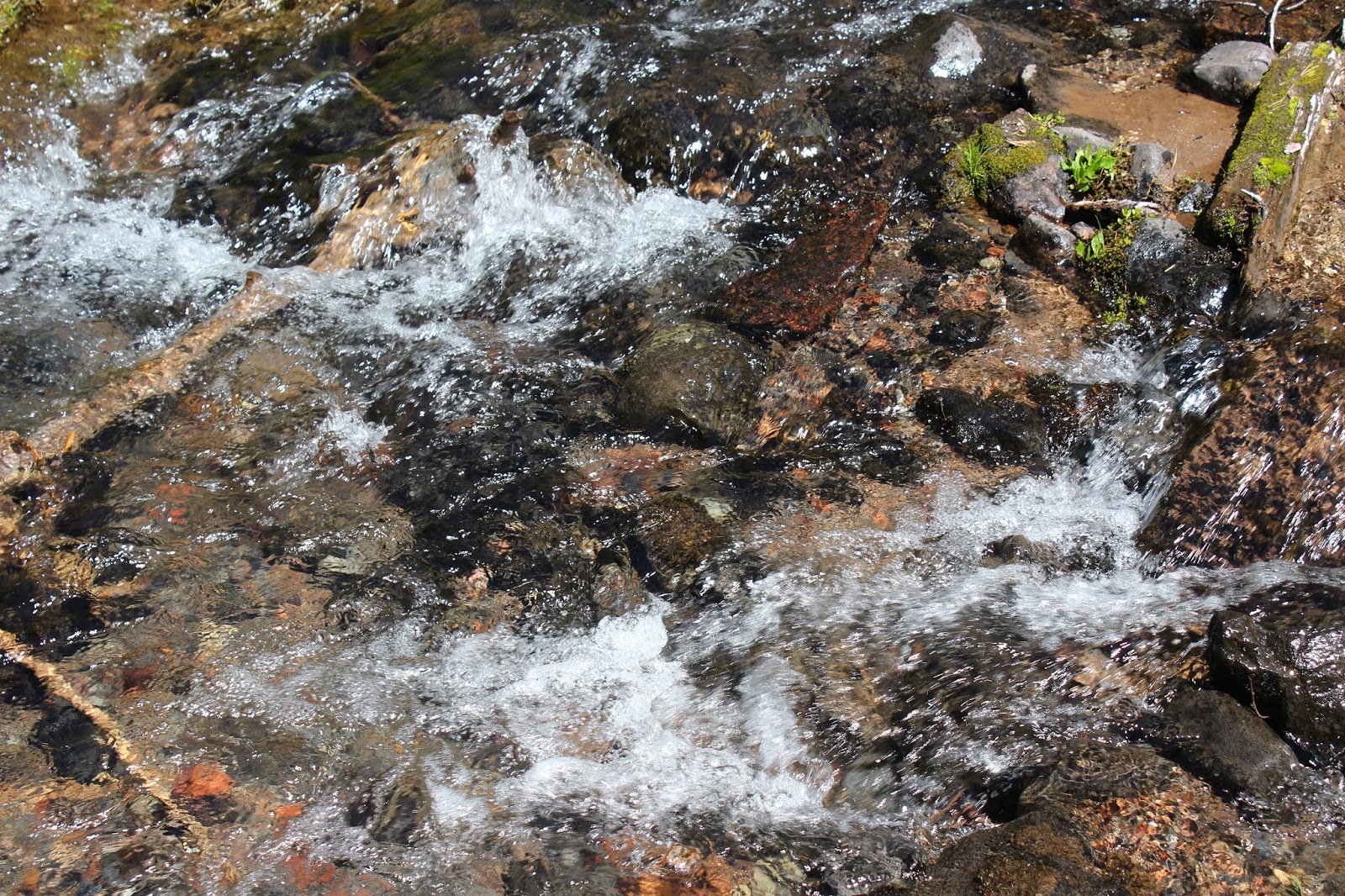
Sparkling clear and fresh off the snow melt
Where the trail meets Thielsen Creek, the Howlock Mountain Trail splits into two, the right fork becoming the Thielsen Creek Trail heading to the base of Mount Thielsen, while the left fork continues to the base of Howlock Mountain. The Pacific Crest Trail connects the two trails but I didn't feel up to a fifteen mile hike (with plenty more uphill hiking) today.  

A dusty path through Timothy Meadow
One little item of intrigue though, was an unmarked but well defined trail heading downhill on a forested ridge well above Thielsen Creek. It wasn't on my map or GPS, so where did this enticing trail go? Inquiring boots want to know! Later on, while exploring Timothy Meadow, I noticed a trail emerging from the trees and entering the high side of the meadow, that just had to be the other end of the same trail! However, on this day the trail was left in play, but a future visit on this mystery path is certainly in order.

Thielsen Creek zigs and zags to and fro
Anyway, I backtracked down the Howlock Mountain Trail and grabbed a side-trail leading down into the meadow where I was perfunctorily attacked by vicious predators. In the lodgepole pines, mosquitoes were mildly annoying but apparently Timothy Meadow is the center of the mosquito universe and they were all overjoyed to see me enter the grassy pasture next to burbling Thielsen Creek. Many of them died by my hand that day but many were also well fed before I was able to obtain safety and shelter behind a thick and frantic applique of Deet. Mosquito survival is a numbers game and you just can't slap all of them.

A beautiful scene, except for the ravenous mosquitoes
Down in the meadow proper, my mystery path from before followed the lush and green grass growing next to the clear running creek as it meandered through the meadow. Actually, the meadow is not as large as I had previously thought, but would make a nice place for a backpack camp, just not during mosquito season. Anyway, I wandered through the green meadow, enjoying the pleasing color contrast with the blue sky above.

The hot and dusty trail back home
Because of the relative shortness of the hike, I decided Timothy Meadow would not be the end destination for my upcoming group hike but on this sweltering day, a short hike to a green meadow next to a babbling creek was just fine fine with me. After my arrival back at the trailhead, with me all tired, hot, sweaty, and covered with an unholy slather of perspiration, blood, sunscreen, mosquito repellant, and pumice dust, I was eminently thankful I didn't do the full 13ish mile hike to Thielsen Creek. Although, a restorative dip in the creek might have been just the thing, given my post-hike dirty and overheated state of being.

It was a nice visit to Timothy Meadow
For more photos of this hike, please visit the Flickr album.


Saturday, September 8, 2018

Lemolo Lake Loop

Last year, the Forest Service installed a brand new trail around Lemolo Lake and I wasted no time hiking on the trail to see what it was like. On that August day, there were two fires burning nearby: the Spruce Lake and Red Blanket Fires. Smoke from the two conflagrations hazed up what could have been a magnificent day for hiking. This year, I led a group on this same hike and of course, there was a fire burning nearby: the Miles Fire. Smoke from that fire hazed up what could have been a magnificent day for hiking. See a trend? Sheesh, finding a clear day is beginning to be like finding a snipe on a snipe hunt. If this keeps up, when I'm older I'll be telling my awestruck great-grandchildren "When I was a boy, the sky was blue..." However, in both renditions of the Lemolo hikes, my complaining about the haze is somewhat tempered by the fact it was nowhere as bad as it had been before and after each hike.

At the start of the hike


Eight of us saddled up, so to speak, at the Lemolo Lake Dam and we headed off on a dusty but well-defined trail that perfunctorily wandered through the lodgepole pines before spitting us onto the asphalt parking lot at the boat ramp. A brief walk on the resumption of the trail took us past busy Poole Creek Campground and up the campground roadway, where a trailhead marked the commencement of the "real' hike. 

Nobody fell, darn it
The trail gets a fair amount of use from the mountain biking crowd and to a lesser extent, a smaller number of hikers. But the path had that real trail feel as it meandered through the forests surrounding the lake. There were several intersections with trails that bypassed the numerous arms of Lemolo Lake, making for a shorter and more concise route around the scenic body of water. It also made for a less scenic route around the lake, too. Accordingly, every time we hit an intersection (which were all unsigned, seeing as how this is a new trail) we took the left turn that kept us closest to the lake but also made our hike longer.

The narrow Lake Creek arm of Lemolo Lake


Lemolo Lake has more arms than North Korea and we hiked around the Poole Creek arm and two lesser arms, proving hiking distance is always more than the proverbial straight line between two points. The Lake Creek arm is what makes the loop a long hike, adding about three miles to the total distance. Although the arm is fairly narrow, there is no way to shortcut across without a boat, airplane, rocket launcher, or catapult. 

...and the crowd went wild!
The arm is probably the most remote section of trail on this hike and we pretty much had the place to ourselves. There was a couple fishing from a boat in the middle of the bay, happily plying their avocation, totally unaware they were being watched by hikers hidden in the forest. The lady hooked a fish and we observed the epic contest between fisherwoman and fish. The fish put up a valiant but losing fight and the triumphant fisherwoman was startled when a round of applause emanated from deep within the forest! She was a good sport though, and proudly posed with her catch; the fish did not share equally in the joy of the moment.

Julie and Chelsea pick their way carefully past a landslide
The trail crossed over Lake Creek right next to paved Forest Road 2614 before ducking back into the forest and following the creek's marshes back to Lemolo Lake. In a couple of places, the lapping waters of the lake had eaten into the soft volcanic soils surrounding the blue body of water, and our trail was either completely eroded or one more storm away from permanently disappearing into the lake. But hey, what's a hike without a scramble or bushwhack or two or three? Despite the precarious position we were in, perched high above the lake on loose and shifting earth, nobody made a gravitational detour down to the lake.

Why we hike
The south side of Lemolo Lake sports some awesome campsites and beaches for backpacking and we visited several before stopping for a lunch and view-soak. Across the lake, forested Bunker Hill reposed under a blue sky and yes, the smoke was clearing up a little bit.

The club hikes through a dead forest
Continuing on, we entered a "forest" comprised of dead lodgepole trees that had met their collective demise in a forest fire from several years ago. No doubt, the East Lemolo Campground had been empty when that fire was ongoing but on this day, it was fairly busy with campers enjoying the lake in spite of the haze. A short section of trail took us from the campground to paved Forest Road 2614 again. 

The clear waters of the North Umpqua River
A road bridge took us over and across the North Umpqua River, which feeds Lemolo Lake, and we stopped to gawk and take photos of the peaceful and photogenic river. From there, it was an uphill walk on a tie-in trail which connected to the venerable North Umpqua Trail and the final leg of our loop hike. 

Why you should always use sunscreen
This section of the North Umpqua Trail is not really my favorite section of the NUT as the road circumnavigating the lake is nearby and you never really get away from the sight and sound of of cars whizzing by below the trail. However, on this day, the road was fairly quiet and as we walked through shady forest, it was easy to pretend we were far away from the uncivilized world. 

Fireweed, going all fiery on us

Shadows lengthened in the afternoon sunlight as we walked through the trees, and as the miles continued to add up, it seemed like there was less and less happy chatter between us. There were a few hints of autumn here and there in the form of bright red fireweed leaves and other small plants going red and yellow. Near the end of the hike, Edwin and his group left the trail and bushwhacked down to the road leading to the dam. Judy, Chelsea, and I continued on the trail because we are good hikers that follow the rules about shortcutting and we wound up right behind the slackers anyway.  

Hazy view of Lemolo Lake
At the dam, we could barely see Mount Thielsen in the haze. I'm going to have to snowshoe around the lake to catch Lemolo Lake on a clear day, apparently. For more pictures of this hike, please visit the Flickr album.

It's just not a hike if no one bleeds
  

Saturday, June 23, 2018

Boundary Springs

Last year, wildfires by the dozens swept through the southern Cascades, covering Roseburg with a smothering acrid blanket of sour smoke. It was kind of like sticking your head up the exhaust pipe of a car with a blown head casket, not that I really know what that is like. Anyway, one of those many fires had burned north of Crater Lake and wouldn't you know it, Boundary Springs was right in the middle of that mess. But that was last year, and curious, I headed out to the trailhead with grandsons Daweson and  Issiah in tow, wondering what was left of the trail.

After the fire
Well, as it turned out, the trail was still there but pretty much everything around it was gone. But really, it's not all that much of a loss and I'd better explain. Previously, the trail had ambled through a viewless lodgepole pine forest before reaching the fabled springs. Lodgepole forests can be singularly tedious and dull to hike through as the spindly trees all kind of look the same after just a step or two on the trail. Lodgepoles grow in poor soils so they are the only show in town in dry dusty pumice-based soils. Because of the poor soil, there isn't much in the way of lush undergrowth or heaven help us, maybe even another tree species. The trees are scrawny and spindly and do not provide much shade, yet despite their spindliness, they manage to block all views of the Rogue River coursing below the trail. So, a fire burning up a monotonous lodgepole forest and all the mosquitoes contained wherein, is not necessarily all that bad of a thing.

Miniature lupine was a common sight
Another demerit for Boundary Springs gets awarded for being a short hike with a long drive to get there. Throw in the dull lodgepole forest and this hike naturally does not hang in my Hall of Favorite Hikes of All Time; but with two kids grumbling after the aforementioned long drive, a short hike seemed the way to go. We set out on the trail which wound its way through an austere forest of silver snags starkly etched against a cobalt sky. No trees had survived this fire yet amazingly, lodgepole seedlings were sprouting in hopeful profusion on the ground. Lodgepole needs fire to germinate as the heat from the conflagration opens up the pine cones and scatters the seeds and obviously, the fire had done its job. Just a year after the fire, and already life was returning to the forest.

The squabblers
Not only were there baby trees returning to the forest, the forest floor (or what would be the forest floor, if there were a forest) was thinly carpeted with lupines and fireweed with twittering birds flitting about the dead trees. Didn't see or hear any woodpeckers though, but just give it time. And speaking of babes in the forest, my two young charges didn't waste any time insulting and irritating each other, their whiny voices carrying through the dead forest and still air. Oh, this was going to be a long hike, despite the short distance!

Doing "The Daweson"
Ah, but the forest served up weapons of mass distraction, and the boy's seemingly incessant scathing put-downs and slashing ripostes were soon terminated by millions of voracious mosquitoes arriving to feed upon two grumpy boys. Fortunately, Grandpa was well prepared with a bottle of Deet and peace was restored to the forest after a healthy application thereof. 

Issiah the Fearless
As mentioned, the trail was without shade and it was fairly warm and we were soon sweating from a combination of endeavor and hot sun, our feet kicking up small clouds of dust that hung motionless in the still air. It was too hot for the boys to resume unfinished arguments and one outnumbered grandfather was grateful. 

The Rogue River flowed below the trail

One positive note to a wildfire wreaking death and destruction upon a forest is that views get opened up, with that annoying clutter previously referred to as "the forest" no longer getting in the way of observing the surrounding landscapes. For most of this hike, the Rogue River was eminently visible at the bottom of its canyon. Based on previous hikes in this area, I was like "There's a river down there! Who knew?"

Boundary Springs, the new version 
Because the scenery was so different from past pre-fire hikes to Boundary Springs, and because the side trail to the springs had been rerouted, I nearly didn't recognize Boundary Springs when we arrived. Following an increasingly faint path, I stepped across a creek and headed uphill where the path finally petered out. Wait a minute, that small creek I stepped over was actually Boundary Springs, without all the trees surrounding the famed fount of the Rogue River. I'm going to have get used to the new treeless look for this trail and destination!

Issiah appreciated the
refreshing qualities of the spring...
...while Daweson enjoyed the hair
curling properties of the icy waters
Anyway, as advertised, there was the Rogue River gushing out of the ground and the boys were impressed with the crystalline purity of  the water. They also were impressed with the cooling properties of the nascent river, seeing as how it was a hot day and all. In short order bandannas, shirts, pants, and boys were soon soaked in the restorative waters of Boundary Springs.

A dusty road led to West Lake
Daweson and Issiah wanted to swim but alas, the shallow river did not provide any quality swimming holes. I wanted to go on a longer hike so in a confluence of our two respective goals, we decided to strike toward West Lake. At the point where the trail crossed both the river and a forest road, we grabbed the sere road for the extra two-mile round-trip hike to the lake.

West Lake, an oasis in the middle of a burned forest
Trudge, trudge, trudge, the road was incredibly dusty, the day had become unabashedly hot, mosquitoes pestered us in spite of the Deet, and the boys began annoying each other all over again. But there in the middle of all the burned trees, was the surprisingly intact shelter at West Lake and let's give a tip of the hat to the fire crews for expending the successful effort to save the rustic cabin. Clothes were shed and moods quickly improved when the boys waded into the blue lake ringed by dead trees. If Daweson and Issiah ever form a band, they'll have to call themselves either the Skinny Dippers or the Underwear Boys. But if they ever did start a band, they'd surely start arguing about which one of them would be the lead singer. Anyway, they enjoyed swimming and verbally sniping at each other while I enjoyed taking incriminating photographs for the sole purpose of embarrassing them at a future high school graduation slide show.

Friendly spirits
Spirits restored by a backcountry swim, we resumed trudging through the dead forest under the warm sun as the mosquitoes buzzed in our faces. Yet, despite all of these travails I've been grumbling about, in my opinion the hike had been nonetheless improved by the ravages of the last year's fire. Now if only the firefighters could put out those red-hot embers of smoldering sibling rivalries!

Hoverfly, hovering as only a hoverfly can
For more photos of this hike, please visit the Flickr album.