Saturday, December 15, 2018

Tahkenitch Dunes and Creek

When the weather is bad and I really don't feel like hiking, yet I'm slated to lead the hike, I tell Mrs. O'Neill "I hope nobody shows up but you just watch, three morons will be there!" Kind of a smart-aleck remark to be sure, but it's happened consistently enough to qualify as a truism. One would assume the weather to be near catastrophic for only less than three hikers to show up. Yet, on this hike to Tahkenitch Creek, Brad was the only hiker brave enough to face the elements with your merry blogster (and moron #2).

An all-around gloomy day at the coast
The weather had been dreadful in the intervening two weeks since the last Friends of the Umpqua hike, what with steady and constant rain soaking the countryside of southern Oregon. But on this morn, while the day was overcast the rain had abated, maybe we'd have a dry hike after all. One can hope, can't we? 

"Wait for it, wait for it..."
The drive to the coast was dry and we decamped at the trailhead, thinking "Wait for it...wait for it...." But we actually started the hike in rainless conditions although the clouds overhead were clearly pregnant with stored water. But hey, we had rain gear in our packs so being dressed with somewhere to go, Brad and I set out onto the Tachkenitch Dunes Trail.

Mushrooms sprout high in a tree
The first mile or so of trail wandered up through a lush coastal forest and progress was painstakingly slow, what with the hike leader (me!) stopping to photograph mushrooms, ferns, moss, trees, trail, and lichen like every two feet or so. But hey, they wouldn't make the trail so pretty if they didn't want people to take photographs of every little thing.

No hiking across Tahkenitch Creek today
After a mile of forest hiking, the trail spit us out onto the dunes which we crossed in short order, returning to a second forest. More photography and exceedingly slow hiking ensued. Brad is a patient guy. After crossing the forest, we hiked up and over the beach foredunes and arrived at the mouth of Tahkenitch Creek.

It was a moody day at Tahkenitch Beach
The intended route for today called for us to wade across the creek, follow the beach north for several miles, return by way of the Oregon Dunes, re-wade the creek, and then close the loop back to the trailhead. However, it had been raining lately, as I had already stated, and Tahkenitch Creek looked a lot like the mighty Mississippi River. Wide and deep, like an overweight philosopher, the creek effectively barred our way north as neither one of us wanted to go swimming across, especially when the sky promised rainfall in the near future.

Path through the woods
Adlibbing it, we backtracked to the intersection with the Tahkenitch Creek Trail and hung a left. I had been on parts of the Tahkenitch Creek Trail but never the whole two'ish miles of it so today was the day. My first impression was "Hey, I should backpack here!" as the forest was thin with sandy or grassy patches between, just perfect for setting up camp. Of course, water would be a problem as there were no creeks or running water easily accessible but that can be resolved easily enough by carrying extra water and/or dry-fooding it.

Tahkenitch Creek was running deep
The trail bobbed and weaved through a couple of miles of peaceful forest before we arrived at a crossing of Tahkenitch Creek further inland. This crossing had been the intended return route on our aborted longer loop hike. Again, the brown creek was running pretty deep, so both of us self-congratulated on the wisdom and sagacity of our decision to cut the hike short.

Fellow slimy hiker out for a stroll
The return on a sandy track through the dunes was fairly uneventful, although the clouds became more foreboding. Slugs were a common slight, leaving their own slimy tracks on the sandy surface. Much photography ensued with me lying down on the sand, staring the slugs in their twin eyes through the viewfinder. I think I said this before, but Brad is a patient guy.

Mushrooms sprout in abundance
The heavens finally did cut loose with a torrential downpour but by that time, we were halfway home, the wipers dutifully keeping the windshield clear. Things could have easily been worse though, we both felt lucky that we got a dry hike in.

Sunday, November 18, 2018

Cape Arago 11/2018

I've hiked Cape Arago like a million times. Now, it's not as much fun to hike the same trail over and over again, so I've tried to make each sortie different somehow. Accordingly, I've hiked the rugged coast near Charleston several times in each of the four seasons and in all kinds of conditions, weather, and routes. I've hiked to Cape Arago from Sunset Bay, Bastendorff Bog, or the Perimeter Trail. I've hiked while grazing on salmonberries and studiously avoiding ingesting poisonous fly amanita mushrooms. I've hiked in sun, rain, and fog denser than the center of a black hole. I've hiked the trails in broad daylight and on both a moonlit and pitch-black night. The only thing left to do is hike backwards on a pogo stick singing "There's no Business Like Show Business" at the top of my lungs. Oh wait, there is one thing I haven't done yet: while I have spent many a trail mile dodging spray from the massive waves that pummel the Oregon coast, I have yet to see the Cape Arago environs on a day where nothing really happens, wave-wise. And yup, you guessed it, this was the day!

Photography was nearly a contact sport
The sun was out in full ineffective glory when we started. Like an ex-spouse, it was beautiful to look at but still left one cold. But hey, we were all thankful for the blue sky and bright light, seeing as how it had rained for a solid two decades (or so it seemed) right before the hike. The ocean was a colorful blue-green in the open sunlight and lazily lapped at the shore, like ripples in a freshwater lake on a languid day. Periodic breaks in the forest cover provided awe-inspiring views of the rugged Oregon coast and the stillness of the day was broken by the sounds of camera-toting hikers pushing and shoving each other just to get an optimal photo of all the peace and tranquility below the trail.

Rock formations at Shore Acres
When we reached Shore Acres State Park, we noticed we were short two hikers: Jay and Catherine. Turned out they had gotten off trail somehow and wound up on the inland short-cut to the park, arriving just as we were dithering about what to do about our missing people. Once back to our full complement of hikers, we continued on to Simpson Beach and then the Simpson Reef overlook where we observed dozens of sea lions basking and lazing in the sun, totally in keeping with the calm ocean.

Just gotta love that coastal forest!

From the overlook, we normally hike up the Cape Arago highway to the cape itself. However, John was leading the way and John does not like road hikes. So, we crossed the highway and grabbed the tie-in trail to the Cape Arago Pack Trail and in short order legs were screaming and lungs were bursting as that short-cut trail is a little on the steep side, to put it mildly. But at least, it wasn't a long uphill distance before the path met up with the Pack Trail.

View south towards Bandon
There were a couple of newbies that were really struggling with the uphill so I hung back with them to offer words of encouragement. The trail ambled through coastal forest where thin sunlight slanted through the trees. Mushrooms and fungus sprouted from the forest duff in abundance and much photography ensued. Once on the Pack Trail (which is a gravel road, actually), we headed downhill to the cape. At this point, I could see John and several other hikers ahead of me, but after several of us availed ourselves of the public restrooms in the picnic area atop the cape, John and his contingent had all disappeared somewhere to parts unknown.

Our lunchtime view
I assumed everybody had hiked down to the picnic tables at North Cove so I herded my charges down to the North Cove and...no John, no hiking friends. We waited a bit, eating lunch while the sweet intoxicating scent of sea lion ordure permeated the forest and took a little epicurean luster off our respective meals. After lunch was summarily dispatched, we retreated to the Cape itself and relaxed a bit, enjoying the sun reflecting off the vast ocean spreading out before us.

South Cover, at beach level
Turned out John had gone down to the South Cove for lunch and while there, had realized we were missing in action. A "lucky" hiker was designated to walk up to the cape to let me know where they were. However, my peeps were not too keen about hiking down the cove with the steep climb back up waiting afterward. So, down to South Cove I went all by myself and I was glad my version of the hike was a two-cove special, because the view of the southern coastline below South Cove was awesome. The imposing coastal cliffs stretched out all the way to Coquille Point and a light mist was forming where land met sea. Much photography ensued once again.

My church
An afternoon mist was coalescing in the woods on the way back and the humidity pervaded clothing as well as trees. However, the mist imbued the sunlight slanting through the coastal jungle just the right bit of heft, photographically speaking. I was working on filling up the photo card in my camera and soon found myself at my customary position bringing up the rear. I made Jay and Catherine stay in view though, as they both were in my car and we didn't need another impromptu wander through the woods.

Enticing, but definitely not good to eat!
So, we enjoyed this hike on an unusually calm ocean day at the cape. Now, to prepare for my next venture here, I'll have to start practicing on the pogo stick! For more pictures of this hike, please visit the Flickr album.


Sunday, November 11, 2018

Yachats

In my view, one of Oregon's biggest mysteries is why Yachats is pronounced YAH-hahts but spelled like it should sound like YAH-chats. A cursory research conducted over the Internet (because if it's on the Internet, it MUST be true) revealed that the name possibly comes from the Siletz language and means "dark water at the foot of the mountain". OK, Cape Perpetua looms to the south of the small town so I get how that name could have originated. But when the first European first encountered the Siletz people and asked "What is the name of this place?", he probably got the answer "Yah-hahts". So then, said European writes in his journal "Yachats" and then from that point on, generations of Oregonians had to explain to their non-Oregon friends that the "c" is silent and as useful as a bubble-gum machine in a tetanus ward. Makes no sense to me at all, but there you go.

Abstract art found on the beach
Yachats is a quaint small town on the Oregon coast and because of the fantastic coastline scenery, hotels and house preside over shoreline vistas because we all know magnificent natural wonders need more hotels and tall buildings to enhance the view. At any rate, to get some mental health therapy that can only come from being out in nature and wilderness, I set out onto the Oregon Coast Trail and beneath my boots, welcomed the trail tread which felt a lot like...asphalt?

A churn erupts
OK, so this is not your wilderness hike. But one can look to the west and see rugged coast line and spouting churns, or one can look east and see Yachats. I prefer the view to the west. This hike began at Yachats State Park, where one can contemplate Cape Perpetua overlooking a small bay that is the estuary of the Yachats River. Immediately below were some fine tide pools with families enjoying the marine life contained within. Tidepooling is fun but I had a hike to do, so it was off on Ocean View Road, my hiking poles clacking metallically upon the pavement. 

Some of that Yachats shoreline
If I had looked closer at a map of the town, I could have ducked up 4th Street and added a park to my route but as it was, I just followed the Oregon Coast Trail signs which had me walking on public roads.  Suddenly, a dirt track appeared to the left and I grabbed it, thinking this surely must be the Oregon Coast Trail. Wrong, it was just a path down to the rocks and a small beach. Still thinking I was on the OCT, I continued over the rough shoreline terrain where a rambunctious churn at Agency Creek prevented me from safely continuing north. Still, the scenery was enjoyable so I didn't mind the wrong turn.

Yes, this really is the Oregon Coast Trail
The OCT continued north on roads until it became a paved trail that wandered behind backyards and houses. Beyond the Sea, a large hotel, loomed straight ahead but on the plus side, the trail followed the shore at this point without any asphalt being involved. I thought the hotel was oddly named because Beyond the Sea is Japan, which is easier to spell. Beyond Beyond the Sea was an even larger resort by the name of Adobe Resort which was strange, seeing how there are no adobe bricks within several time zones of Yachats. 

A perfect place for yoga and meditation
By the way, a brief moment of thanks to the two aforementioned hotels for allowing the Oregon Coast Trail to cruise between their imposing edifices and the Oregon coast. They didn't have to do that and sharing is appreciated. The next item of interest was Smelt Sands State Recreation Area, with some wild rock formations and picturesque tide pools filling up every dimple in the rocks. I can't say that I smelt anything unusual at Smelt Sands, though. Especially since Lane was not hiking with me, just sayin'.

The beach stretched all the way to Waldport
The trail left a lot of the urban feel behind when it ducked into a forest and dropped down on a beach that stretched out all the way to Waldport, about 10'ish miles away. The only hiking obstacle between me and Waldport was a wet ford across Starr Creek. From here on in, it would be a beach walk all the way to Tillicum Beach, my turnaround point. 

An ocean of silver
The beach was flanked inland by tall cliffs with imposing homes on them and after 4 miles, I had reached my beach saturation point. On the way back, the sunlight reflecting on a silver sea entertained and enthralled the camera, I have millions of photographs to support my claim of entrancement by the glimmering sea.

Boom!
I had been hiking in a rising tide and apart from an occasional wave chasing me up the beach every now and then, there was so much beach to hike on that that I was pretty much unaware of the incoming ocean. However, once back above the coast at Smelt Sands, the churns were very active with throngs of appreciative observers enjoying the show. Waves would surge up the narrow churns only to seemingly erupt out of the black rock at the end of the churn. It was quite a show and I soon forgot I was walking on an urban trail.

Shadow Man enjoyed the hike, too
All good things come to an end though, and I was tired and happy when I reached the parking lot at the end of the hike. Spending the day on the coast is always a good thing. For more photos of this hike, please visit the Flickr album.


Wednesday, November 7, 2018

Rogue River Trail

I was sort of playing hooky from work (although it's not really playing hooky if you have permission from your employer) and joined friends John, Jennifer, Lindsay, and Penny on a mid-week hike. This was the day after the 2018 mid-term elections and already the sonic space that had previously been filled up with toxic political ads was blissfully quiet. Given our politics these days, the reflexive cacophony will soon resume, the relative silence being fleeting and ephemeral. Just a thought: Let's suppose I am going to vote for Candidate A. At the halftime break of a Portland Timber's game, while I'm assembling a taco in the kitchen, a commercial runs and the narrator says with snark and condescension dripping off of every hanging syllable, "Candidate A: Bad for you, bad for America". Am I supposed to think to myself "Wow, I had no idea Candidate A was bad for me, thanks for letting me know!. And bad for America too? Why, I'd be unpatriotic if I voted for him or her so I'm switching to Candidate B!" Does that ever really happen? And what happens to my vote when next I see an anti-Candidate B ad? Yeesh, my mind yearns for more intelligent discussion and a world with no election ads of any sort.

A photographic metaphor for elections
Speaking of more intelligence, we were out hiking on the Rogue River Trail. The trail showed signs of recent use but not by people avoiding election commercials. Nope, the frequent piles of dark black/purple poop evidenced fitness-oriented bears also enjoy hiking on the cliffs above the Rogue River. Or maybe they were expressing in their own bear way, their opinion of all the "Vote for Smokey" ads. Not that I am a poop connoisseur or poopologist, but many of the piles were seemingly just a few minutes old and answered the age old question "Do bears poop in the woods?", the answer being "No, but they do poop on the trail!" At any rate, I'm glad to report that no live bears were encountered by live hikers on this hike. I daresay there'd be a few more piles of poop on the path if that were that to happen.

The mountains were mist-covered
before the morning burn-off
It was a chill morning but the day was mostly sunny. The tall peaks surrounding the river all had their noses up in the clouds but after a mile or so of hiking, the clouds had burned off. The river was running a dark green but still had a little silt due to the rains from the week prior. The air had that pre-winter snap to it and we all hiked in jackets, despite the sun.

A weak sun filters through the trees
I tend to hike this trail in the early spring so it was a little surprising to see the small tributary creeks either dried up or just barely trickling, Sunlight trickled through the maze of tree leaves and branches arching over the trail, illuminating some of the autumnal-colored leaves and warming the hearts of hikers, if not their actual bodies.


The iPads of yore


We hiked as far as the historic Whiskey Creek Cabin where we took in the artifacts and rusting mining equipment surrounding the rustic abode. After the cursory visit to the backwoods museum, we plopped down in cool sand by the river at Whiskey Creek Camp. Jennifer, John, Lindsay, and I had all previously hiked full 40 mile length of the Rogue River Trail, and we regaled Penny with tales of our respective ventures, some of which were surely embellished.

Madrones, with some winter fur
Penny and I were both taking photographs and we soon lagged behind the front three of our small group. But hey. the river was ensconced deep in it's canyon with tranquil pools that reflected nicely in the shade, and each pool just had to be photographed. The big-leaf maples still had yellow leaves hanging off their limbs, further adding to our lagging behind.

Candidates A and B
After taking photos of everything we could think of, which included bear poop, we eventually arrived at the trailhead and our patiently waiting comrades, It had been a pleasant day and we all averred we had enjoyed the chilly weather, if only for the rare sunlight between rainy days. As we left the parking area, we spotted some goat creatures that for some reason, reminded me of Candidate B.  At least the they didn't bleat "Vote for me-e-e-e-...!"

I'm likin' the lichen
For more pictures of this hike, please visit the Flickr album.


Saturday, November 3, 2018

North Umpqua Trail - Panther and Mott Segments

On a hike several years ago, our group was debating whether to return or continue on for a more lengthy and arduous hiking endeavor. One of our hikers said "Is it farther? Is it steeper? Good, then I will hike it!" Those are good words to live by but not everybody agrees with me on that. That's why, on a recent hike I led for the Friends of the Umpqua Hiking Club, it was most gratifying when all but two hikers opted to take the longer option on the North Umpqua Trail, which consisted of stringing together both the Panther and Mott segments of the 78 mile trail, affectionately referred to as the NUT. Yay all ye hikers, and a tip of the hat to the hiking newbies who dared to challenge themselves by hiking the full route.

Tiny mushroom sprouted on a fallen tree
It had been raining off and on all week, but fortunately this day was all off. It still was fairly brisk, though, the air had that cold snap that hinted at the coming winter. The forest was damp but the encroaching vegetation was not all that encroaching so there was no repeat of the leg-soaking that was an issue on my last hike. At least not the leg-soaking related to rain on shrubbery and I shall say no more on this subject. 

A hikin' we will go
Beginning at the eastern terminus of the Panther Segment, we wasted no time gaining elevation as the trail charged up a densely forested slope. The group quickly separated into two canps: athletic uber-hikers in the front and huffers and puffers bringing up the rear. Not totally uncoincidental, the two groups also were without and with cameras, respectively.

Just gotta hike uphill, always
The trail, once it gained peak elevation, then spent a lot of time going up and down; the net effect was that it felt like we were constantly walking uphill. You tend to pay more attention to the slope when your legs are burning with exertion. The North Umpqua River flowed several hundred feet or so below the trail but was only occasionally visible through the dense forest comprised mostly of Douglas fir with a thin interspersing of big-leaf maple and madrone.

I can still hear the swish of the
eaves as we walked through
There wasn't much in the way of leaf color but the trail still had that autumn vibe due to a thick blanket of maple leaves covering pretty much all of the ground on the forest floor. I can still hear the swish of dead leaves as we waded through the autumnal detritus.


Small creeks crossed the trail
Periodically, small streams would cross the trail and moss-covered rocky outcrops would flank the path on the uphill side. And always, ferns fought through the dead leaves to grace the trail with their ferny greenery. you might say this was a "frondly" hike for the Fronds of the Umpqua. I've got a million of them, folks.


The North Umpqua River, seen from its namesake trail
After several miles well above the river, the trail lost elevation, eventually winding up on the banks of the North Umpqua River. And that's where it would stay for the duration of the hike as we closed out the Panther Segment when the trail spit us out on the roadway over the historic Mott Bridge. As mentioned, everybody was feeling walky and willing to tack on another five miles by hiking the Mott Segment of the NUT.

Steamboat Falls
The Mott Segment is one of my favorite sections of the NUT, for virtually all of its five-ish miles are spent within close proximity of the river. With the recent run of rain, the river was swollen, alternating between tranquil and languid pools to seething and roiling rapids. Steamboat Falls, more wide than high, was putting on a show as it made a short drop into a series of noisy whitewatered chutes. 

Red-head in the forest


About halfway through the Mott, several hikers began walking slower and slower, feeling the unaccustomed miles on their legs. No problem, since I was leading from the rear anyway. Much of this segment was spent photographing lichen, moss, and mushrooms; all of which were found in ample quantities on trees both standing and fallen. Waxing professorial, I was able to show my newbies what a wild ginger, British Soldier, and a drum tree was.

Decaying leaves made bridges treacherous
There were several creeks crossing the trail, each big enough to warrant a footbridge across. The bridges were coated with decaying maple leaves which can be treacherously slippery. After admonishing my people to "walk like a penguin", I'm glad to report all hikers remained in an upright position as we carefully waddled across the bridges and boardwalks on the slippery boards.

Leaves upon leaves
The hike ended at the small campground at Wright Creek and we all gratefully hopped into automobiles full of that wonderfully warm air emanating from heater vents. All our newbies were suitably impressed with themselves at tossing off a ten-mile hike on their first attempt.

A zen garden of leaves and logs
For more photos of this hike, please visit the Flickr album.


Saturday, October 27, 2018

Castle Creek Trail

So, when I get behind in posting my hikes, I set up a skeleton post and type in a few words to help jog my memory for when I do get around to writing about the hike. Accordingly, on my last hike on the Oregon coast I typed in the notes:


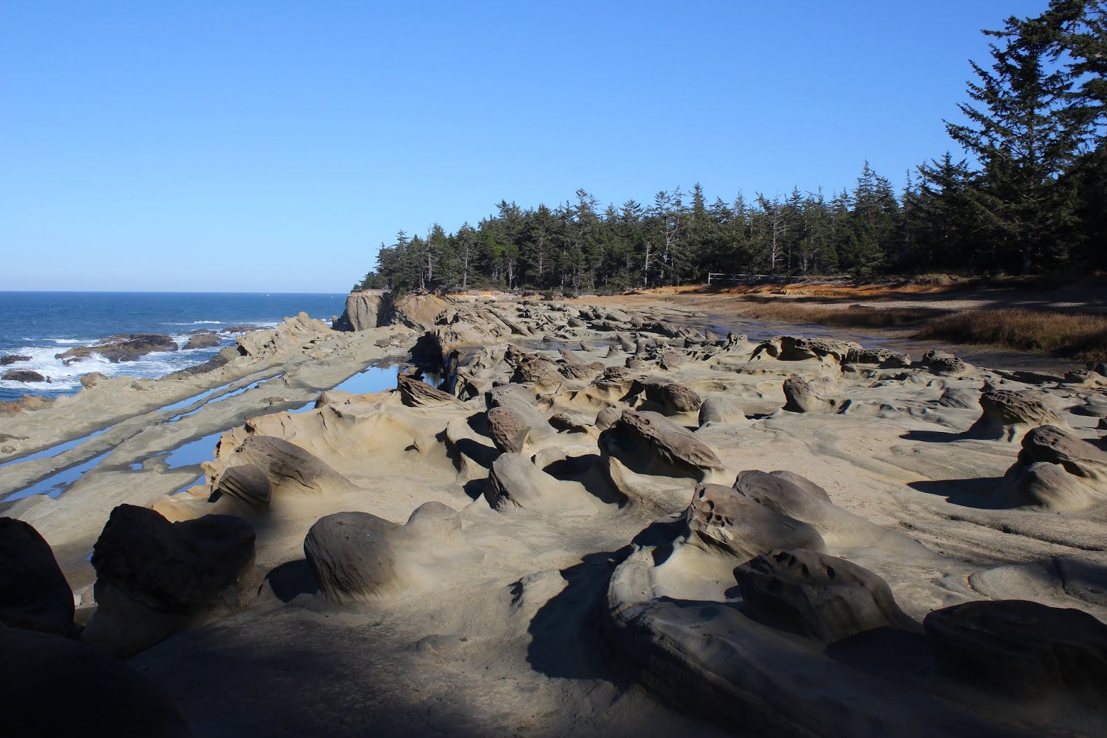
Angry ocean, high surf warning
Got caught by a sneaker wave
Incoming storm

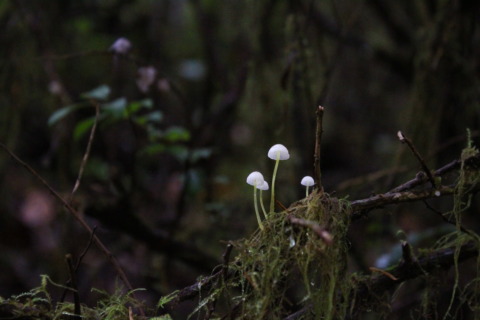
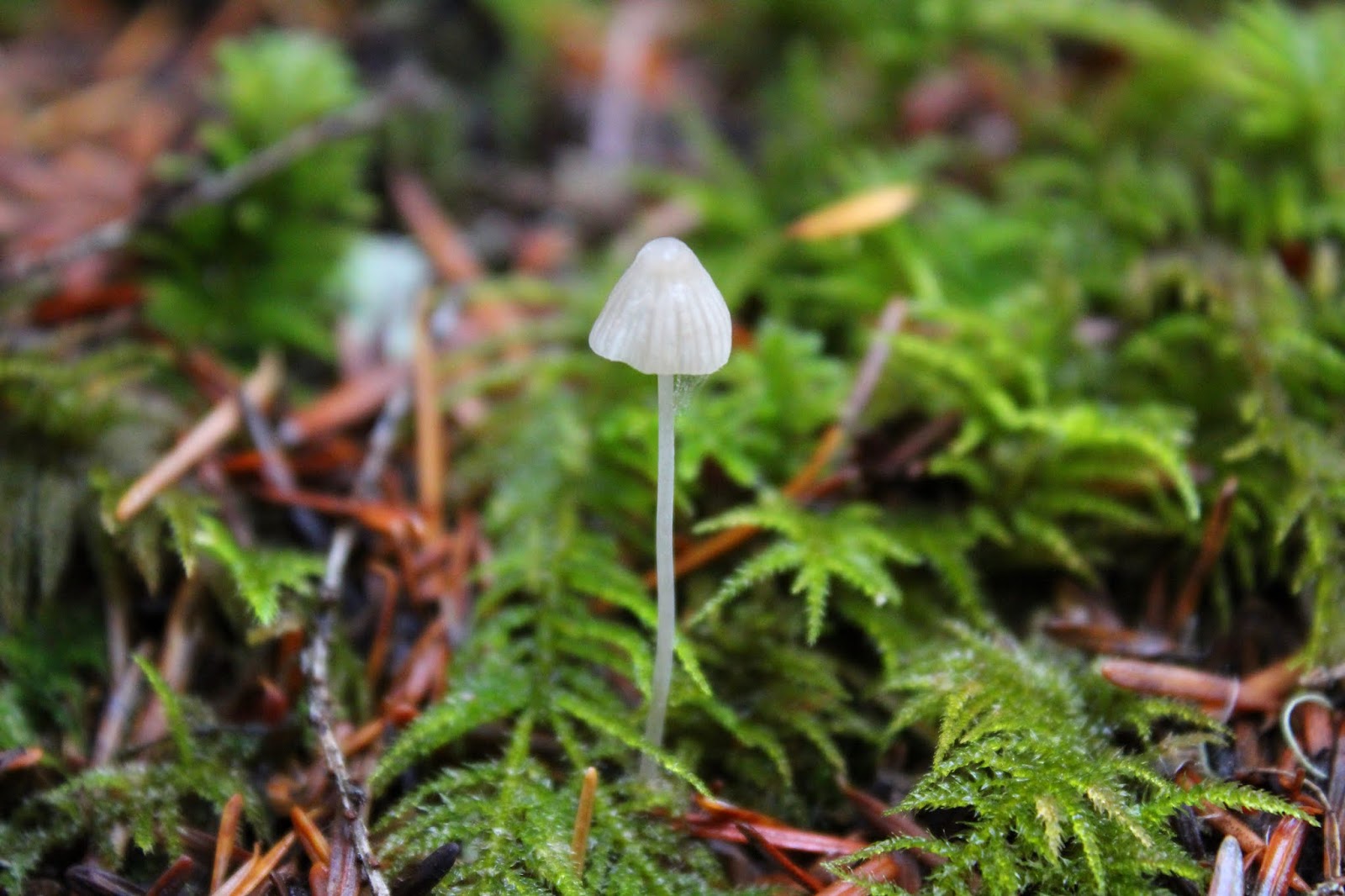
Fungi, reclaiming some of that
decaying biomass in the forest

Sounds like a moody poem or almost a haiku, except the number of syllables don't quite meet the definition of haiku. But after I wrote those memory-jogging notes to myself, I inadvertently pressed the "Publish" button and that dire and gloomy missive posted directly to my blog. I had no idea until several weeks later, Glenn and/or Carol asked me if I was OK and if I managed to outrun the wave and make it back safely home.


A day damp and dreary
My first inclination was to wax sarcastic and say "No, I was swept to sea as I was typing what you read. I couldn't finish because the ocean water ruined the laptop I always take with me when I hike, and besides which, I'm dead!" But because I generally try to mimic socially acceptable behavior, I instead thanked Glenn and/or Carol for their concern, and promptly deleted the very strange blog post.

Water drops, just waiting to soak my legs
Now, there are several ways to look at this situation. First, only one person follows my blog and cares about me. Or, many people follow my blog but only one person cares about me. Or, that person follows my blog and since he and/or she waited a couple of weeks to perform a welfare check, he and/or she doesn't care about me at all but does have a delayed morbid curiosity. Things to ponder, to be sure, but the one truth in all this is that there is not much point in having a blog if you are not going to blog in it so here we go about my hike on the Castle Creek Trail, located in the Rogue-Umpqua Divide Wilderness. Right now, as I type this, it is early February and this hike was done in late October. I do have some catching up to do now, don't I?

Trail through a slightly singed forest
I had hiked the Castle Creek Trail several years ago and the trail was faint and sketchy back then. After several years of neglect and after a large forest fire swept through the area in the smoky summer of 2017, I harbored no expectations of following a wide and well-maintained trail. Not surprisingly, my low expectations coincided exactly with the sketchy and overgrown reality on the ground.

The forest was quiet...too quiet
One surprise though, was that while the fire (part of the North Umpqua Complex Fires) singed the trees and cleared out the underbrush, the forest was pretty much left as it had been before the fire. In fact it was pretty hard to see in places whether a fire had actually been here or not. But it had, and already vegetation had robustly grown back over the trail, adding to one of the recurring themes of this hike.

Plenty of opportunities to hone the
fine art of water-drop photography
It had rained on the drive up but it never would rain on me during the hike. However, the vegetation was soaked, and since the vegetation encroached the trail, water was then transferred from bush to hiker via the mechanism of wet hiking pants. On the positive side though, I got to practice and further hone my skills at photographing water drops on leaves.

Tried to see sunlight but I mist it


Besides my wet legs, one other overriding impression was how quiet it was in the forest. Normally, there is an aural backdrop of animals pitter-pattering and chitter-chattering, but not on this cold and damp day. The forest was quieter than a classroom during a vector calculus final, but with much less mental anguish. The reason probably had to do with the local fauna either starting to hibernate or perhaps migrating to lower elevations in advance of the impending winter.

I wet my pants!
And winter it was, for any hopes I had of continuing my run of spectacular autumn hikes were quickly dashed by a splash of cold water from a near leafless but twiggy bush brushing up against my pant legs. Apart from a few dogwood trees with a handful of orange leaves fluttering with the slightest air current, autumn had already come and gone. I really couldn't dwell on the changing of the seasons though, as much of my attention was intently focused on discerning where the footpath was ahead of me.

See the trail?
Me, neither!
In some places, the trail tread was eminently visible and in others it was as faint as the runes carved on a prehistoric monolith. At least it was all downhill as the trail gradually dropped down into the Castle Creek canyon, the creek becoming more and more audible along the way. But it was getting cold. And wet. My pants were so soaked that when I brushed against encroaching shrubbery,  I could feel rivulets of water running down my legs. I hadn't felt that sensation since that time in kindergarten and the liquid was a lot warmer back then, and enough said about that. At any rate, I was beginning to feel the chill so I turned around at the 3-mile mark, about a mile short of actually reaching Castle Creek.


Peace like a forest
Of course, no sooner than I started walking back to the car, the sun did break out for a bit, simultaneously taking care of both excess moisture and cold temperature. Still the same old uphill trail to the car, though. Despite all the my sniveling about wet vegetation and cold temperatures, I really did enjoy this hike. The forest was beautiful and peaceful, two of my favorite reasons for hiking.

The morning rain made sure
this hike would be a wet one
As far as whether I escaped the sneaker wave or not, my readership (apparently consisting of just Glenn and /or Carol) will have to read my blog at some future unspecified date to find out. For more pictures of the Castle Creek Trail, though, please visit the Flickr album.

Despite the rain, I was really lichen this hike