Showing posts with label siuslaw national forest. Show all posts

Saturday, April 30, 2022

Kentucky Falls


They say what goes down must go up and vise versa. I'm not sure who "they" are or why we put so much stock in what they say but I bet they haven't ever hiked with the Friends of the Umpqua to Kentucky Falls, because we've always happily hiked eight downhill miles to the North Fork Smith River Trail terminus. Unfortunately though, the bottom half of that route currently lies under a bunch of trees knocked down by a severe storm, so on this day, we'd be hiking down to Kentucky Falls and right back up again, I guess "they" might have really known what they were talking about...this time.
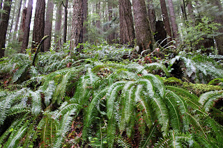
Random snippet of a saturated forest

At least it was raining when we started walking. You'd think we were hiking in Oregon or something. It never really rained hard during our visit to Kentucky Creek but hours of hiking in a continual downpour soon rendered us as sodden and soaked as the forest we were hiking though. Puddles lay on the trail and encroaching ferns were only too happy to transfer water from frond to clothing. Suffice to say, our raingear was put to the test today. 

A veritable carpet of false lily-of-the-valley

The noisy rat-a-tat-tat on hat brims from the steady rainfall would be a constant throughout the hike. However, no complaining allowed because rain makes the forest green and we do enjoy hiking below tall trees with a healthy understory of ferns, salal, and other assorted vegetation growing underneath. Moss claimed all that did not move and cliffs, boulders, and fallen trees alike were covered by a soft mossy blanket. Green was the watchword here as we hiked in a verdant forest beneath a brooding sky.

Kentucky Creek was always heard and/or seen

Once raindrops roll off trees, branches, leaves, and hikers, they eventually find their way into Kentucky Creek. Rain makes creeks flow and a very wet spring had Kentucky Creek coursing along in rather vigorous fashion. The stream tumbled through its creek bed of mossy rocks, the whitewater seemingly luminous amongst the dark trees under the dark clouds on a dark day. Several small unnamed waterfalls dropped over several equally unnamed ledges in what was a prelude to the Kentucky Falls main event.

Translucence in a trillium flower

Rain renders trilliums soggy, too. Like some people, trillium flowers tend to show their age by changing color from pale white to dark maroon as they get older. The current rainstorm pelted tired pink trillium flowers with an incessant deluge and the semi-transparent petals became quite saturated with water, folding over on themselves like wet crepe paper lying in a spilled drink on the dance floor.

My favorite fungus-bearing footbridge

About halfway down to the upper falls, the trail crossed Kentucky Creek on a rustic footbridge that seemed to be more moss than wood. On the bridge, bird's nest fungus grew in prolific bunches on the rails and posts of the span. Normally, I find this particular fungus on the ground and am always grateful to see them flourishing on this bridge, for I don't have to lie down on the ground like normal to get a photograph, especially on a wet day when the ground is muddy,

Upper Kentucky Falls

A roar sounding like the world's largest fire hose advertised the presence of Upper Kentucky Falls. The trail made several switchbacks from above the falls down to the cascade's splash basin, each switchback providing an opportune vista point from which to admire the photogenic cascade. Just like me, the falls were impressive and noisy, and that only stood to figure because the creek was so full of water. The mist emanating from the waterfall blew into our faces but from our standpoint, it was just more water in the air and no different from our hiking experience up to this point.

North Fork Smith River Falls (left)
and Lower Kentucky Falls (right)

Another mile or so of hiking down the forested creek canyon delivered us to Lower Kentucky Falls where it was more of the same but twice the fun. Here, Kentucky Creek plunges over a ledge to create Lower Kentucky Falls. Approximately 25 yards to the left, the North Fork Smith River does the same so you have two large waterfalls thundering next to each other for all of perpetuity. It's not often you get to see two waternal-twin waterfalls tumbling side-by-side in such close proximity to each other.

A fern asks for a peanut

We tarried at the lower falls for a bit to admire the view but mostly to postpone the hike up and out of the canyon for as long as possible. It had been all downhill to this point and we'd regrettably "enjoy" the uphill yang to the downhill yin on the return leg. Good thing I brought the uphill legs! I actually felt walky and pretty much power-hiked my way up the canyon in the rain.

Bird's nest fungi on a footbridge post

I was trying out a new raincoat and it was waterproof for most of the hike. However, by the time I reached the trailhead, the coat had given up the fight and I was soaked thanks to the fabric's acquiescence to the elements. The temperature was pretty chill too, and I gratefully partook of the car heater while I waited for my comrades to straggle back to the trailhead. Good things come to those that wait, they say, and there I go again, giving credence to what "they" say.

Smith's fairybells were seen on occasion

For more photos of this hike, please visit the Flickr album.

Saturday, April 2, 2022

Tahkenitch Dunes


John stated he wanted to partake of "King Neptune's Pedicure". I speak John, so I'll translate: He wanted to hike barefoot in the surf. Since he was the designated leader for the Friends of the Umpqua this particular weekend, we were totally at his mercy as to the destination of the hike. Given his proclaimed desire for wet feet, the destination was Tahkenitch Dunes, the loop rendition of this hike serving up a mile or so of beach walking or in John's case, surf hiking.

The clouds would eventually burn off

After the long drive through foggy conditions that had 15 or so hikers wondering if they would ever see the sun on this day, we laced up our boots at the trailhead and set out on the trail, which immediately inclined up through the forest. The constant coastal fog keeps things well watered and accordingly, the forest here is healthy and lush with a vibrant understory of coastal huckleberry, ferns, and rhododendron thriving underneath the spruce trees and Douglas fir. Moss covered all that did not move and fungus, ever nature's recycler, was busy decomposing the ample decaying biomass on the forest floor.

The club emerges from the deep dark woods

The short and wooded trail soon spit us out onto the bright and sandy dunes like so many cave salamanders, our eyes blinking myopically in the comparatively bright light. It wasn't full-on sunny though, as heavy gray clouds still blocked the sun, but blue sky in between hinted at the clouds' eventual dissipation and demise. 

All the soft sand you could ever want to walk on

The trail leading away from Tahkenitch Campground heads straight to the beach but before we could get John his saltwater pedi, a left turn was made onto the dunes trail. Here, it was all sand and beachgrass and too bad John didn't want to partake of Queen Sandy's pedicure instead. At any rate, we hiked among the hummocks of beachgrass while calves complained about hiking in soft sand and despite my usual and customary whining, I actually felt walky and enjoyed both the exertion of the hike and scenery.

Epic view of Threemile Lake

At the intersection with the Threemile Lake Trail, we made another left turn and headed uphill in the shifting sand, beelining toward an overlook of Threemile Lake. The viewpoint serves up an epic vista of the lake, which normally dries itself into two separate bodies of water. On this day though, it was its three-mile-long single self, sited and sighted in a long and slender bowl sunk in a forested basin. Clouds artistically reflected on the mirrorlike surface and we slid down a long sandy hill like so many Jacks and Jills to eat lunch on the lakeshore.

The beach portion of this hike commences

After a lakeside lunch and laze, we hiked over to the beach where the clouds finally melted away and all beach hikes should take place under a blue sky and springtime sun. John took off his shoes and proffered his crusty feet to poor King Neptune. I'm surprised that gagging King Neptune didn't hurl tidal waves in our direction in response to John's effrontery. But he didn't, and everybody happily hiked along, with or without hiking boots and smelly socks.


We went as far north as Tahkenitch Creek, which was mostly roped off to protect the endangered snowy plover. The water flowed across the pristine sand at its delta and we could clearly see the tide forcing itself upstream like a watery proctologist's probe, not that I really know what that is like. Disgusting and gross simile aside, the incoming tide and wide creek was our cue to lace up our boots (in John's case) and grab the sandy trail heading inland.

"Back in the day..."

Tahkenitch Dunes used to be one of my favorite weekend backpack camping places. Here, one could pitch a tent at the edge of the creek and observe creek, beach, and sunset from the campsite. But now, the migrating creek has gobbled up the camping spots and forest service rangers have roped off the creek's banks. Sigh, all I have left are memories. On the plus side, there were some nice views of the creek as we hiked while I bored younger hikers with "Back in the day..."


The loop was closed off by hiking through the same emerald forest we had started on. But now, sunlight filtered through, or tried to filter through, the thick forest cover, infusing the very air with a soft green glow. Palmate leaves of tall rhododendrons spread their leafy fingers out like so many green monkey hands begging for handouts, while salal bushes filled up the spaces underneath, their leaves totally devoid of any anthropomorphic metaphor. This green section of trail was a good way to close off the hike.

It's so hard to be humble!

I was feeling pretty proud of myself at the end, for I had felt energetic and walky throughout. Maybe I was finally able to kick Covid to the curbside, although I don't want to get too cocky about this, I don't really need a viral comeuppance for my conceit. Stay humble, Richard, even though it's so hard, you can do it because you're the best and everybody basks in the glow of your bestness. I think I just failed at being humble. 

They say imitation is the sincerest form of
flattery but in this case, they'd be wrong!

For more photos of this hike,
please visit the Flickr album.

Saturday, August 21, 2021

Siltcoos Lake


It's a mad, mad, mad world out there, full of yelling, shouting, fist shaking, spittle-spitting, and all-caps rage tweets, and that's just my family! The rest of the screaming part of the world is about as warm and fuzzy as a cave full of buzzing rattlesnakes too. Hiking has always been an escape from that particular riled-up fire ant nest of venom and vitriol but this year, it's been pretty hard to hike. The mountains have been basically off limits because of numerous forest fires and besides which, health problems have slowed me up a bit. Even the reliable coast has been hiker-unfriendly, with valleys and coast cuddling under a blanket of air foul, smoky, and acrid. But on the Siltcoos Lake Trail on a blessedly clear day, it was a joyful healing time spent in "peace like a forest".

Peace like a forest

This particular hike was a Friends of the Umpqua Hiking Club operation and about 10 like-minded friends set foot on the Siltcoos Lake Trail on a pleasant Saturday mid-morning. Almost immediately, you could hear a collective sigh of relief and grateful appreciation from all participants. The path headed uphill through a dense forest mostly comprised of tall conifers. At ground level, it was luxuriously cool and shady, and leaves in the rampant vegetation bobbed gently up and down with the slightest provocation of the slightest stirring of air. Small birds were mostly heard as they twittered and flittered through the nearly impenetrable greenery and we all hummed "Kumbaya" in accompaniment.

Fairybell fruits were a common sight

This time of year lies in that amorphous seasonal netherworld lurking between late summer and early autumn (summumn?). Didn't see any colored leaves but fairybell plants were sporting bright orange fruits that caught the attention of hikers and cameras alike. I don't think the fruits are toxic but they are probably tasteless and/or unpalatable as my ex-wife's cooking so I just left them where they dangled, especially since I wasn't sure if they were indeed toxic. Tastier and definitely not toxic, were vibrant red thimbleberries and yes I did indulge.

Conks endeavor to recycle a dead tree

Our little world under the forest canopy was dark green (it was deeply shaded, after all) and it stood to reason that the perpetually decaying biomass on the forest floor would support a healthy population of mushrooms and other fungi. Seemingly, every color, size, shape, and type were represented, ranging from diminutive parasols sprouting in a bed of moss to tough tinder fungus reposing in pine needle duff to woody conks staking their claim on dead tree trunks. Internally I labeled all the fungal denizens as "poisonous" and thereby resisted the temptation to partake thereof. I'm no mushroom expert so it's just safer that way.

Just a beautiful trail all day long

With so many things to photograph, it wasn't long before I assumed my customary place at the rear of the hiking queue. And before long, I found myself hiking all alone in the woods. A moment of consternation came when the trail intersected the loop portion of the hike. Do I go north or south? Which way did everybody else go? Not having the answers to those questions, I recalled from my last hike here that hiking out on the south trail was really steep and taxing so I opted to go down the south trail this time out. Good move!

C'mon sun, dispel those dark clouds!

Enjoying the downhill hiking, I soon caught up to Ceresse and the two of us hiked in easy companionship at our usual turtle'ish speed. When we arrived at the southern backpacking campsites next to the lake, our comrades had already eaten their lunch and were wrapping up dessert. As our friends impatiently waited, held hostage by Ceresse and I leisurely eating our lunch, we all enjoyed a nice view of Siltcoos Lake from the campsite. Although, the sky was covered up by a layer of ominously dark clouds. It wasn't going to rain, was it?

Gnome plant, macro version

Near the campsite were a couple of saprophytic plants, not to be confused with mushrooms or fungi. A small patch of pink fleshy-colored gnome plants and pale white vampiric-looking Indian pipe vied for ownership of the same fertile patch of earth. Since we spotted both sets of specimens growing next to the trail, we'll call it a draw. Saprophytic plants lack chlorophyll to make nutrients from sunlight, so they partner with certain fungi to parasitize on certain plants, like salal. Professor O'Neill expounded on these amazing plant specimens while his captive pupils fidgeted restlessly, hoping the bell would ring soon.  

It sure looked like it might rain

After lunch, we made the short walk over to the northern set of backpacking campsites. I really must come and spend a weekend here, the hike would be short but those relatively luxurious campsites are an attraction in and of themselves. The north campsites provide better access (and views) to Siltcoos Lake and we stopped for a moment to gawk once again at the lakeside scenery. The clouds had gotten darker and despite an optimistic weather forecast, the foreboding dark cloud cover made us wonder once again if rain was indeed in the offing. 

Logging scar from yesteryear

The hike out on the northern loop trail was not bad at all, the grade was gentle and easy on the quads, unlike its southern loop sibling. The sun came out and dispersed most of the clouds and some sunlight filtered down to trail level. The mottled light in the forest was entrancing and we could only imagine what it had been like before the original old growth forest had been logged back in the day. Massive stumps from the former forest still bore the scars of the cuts where buckboards had been inserted to support a burly lumberjack on either end.  

Everybody should hike like a slug!

It's a shame this hike is so short because its tranquil forest vibe left us replenished and sated, but yet wanting more of the same. I'd gladly trade in uncivilization for the forest and spend the remainder of my days there, but then I'd have to give up watching concerts and soccer games. Besides which, the deer would eventually get me.

Hedge nettle, up close and personal

For more photos of this hike, please visit the Flickr album.

Saturday, March 27, 2021

Kentucky Falls


It's not funny if you have to explain the punchline. As we were lacing up our boots at the Kentucky Falls Trailhead, I offered up the factoids that Kentucky Creek was flanked on either side by Roman Nose Mountain and Mount Popocatépetl, adding that the three place names were a geographic tribute to primitive cultures and incomprehensible dialects. What I got back, instead of wry chuckles, were perplexed looks and several earnest and sincere "Wow, really?" questions. My hiking companions got it when I, my voice laden and dripping with sarcasm, answered a question with a question "Have you ever spoken to anybody from Kentucky?" I may have lost my entire Kentuckian readership with that one but hey, it's probably only one guy anyway.

All life should be like a walk in the forest

Even though Kentucky Falls was the main reason for our outing, this hike was mostly all about the forest. The morning sunlight was slanting through a cathedral-like grove of tall trees arching overhead like so many ribs in a Gothic basilica. You couldn't help but tilt your head heavenward like an awestruck pilgrim entering Notre Dame (or any other cathedral of the era) for the first time. The green glow from the trees, ferns, and moss was pervasive and small thumb-sized birds made fist-sized twitterings as they scolded hikers celebrating a decidedly green spring day. Below all the tall trees and twittering mini-birds, tri-petaled trillium flowers added their own special grace and elegance to the reverential scene.

A small but boisterous piece of Kentucky Creek

We were hiking nearly at the bottom of a canyon carved over the epochs by Kentucky Creek. When not in a truly sublime forest, we found ourselves hiking on a trail etched onto exposed cliff faces, all colored green by the ever ubiquitous moss. Initially, the stream pleasantly coursed through the trees before picking up speed. In a practice run for the big leap at Upper Kentucky Falls, the creek jumped off several ten-foot ledges, each a worthy cascade in its own right. And speaking of big leaps, I didn't do any. Eventually, Upper Kentucky Falls hove into view as the path switchbacked down to the waterfall's splash basin.

In all its Kentuckian glory

Roughly about 100 feet tall, Upper Kentucky Falls was carrying a large volume of water, seeing how Kentucky Creek was swollen with spring runoff. The sound of the falls echoed throughout and we all stopped to contemplatively admire the picturesque cascade roaring in the shady canyon. Here on the west side of the distant Cascades Mountain Range, waterfalls are about as rare as a mosquito in late July, which is to say they are not rare at all. But even so, Kentucky Falls is arguably one of the better ones.

Moss rules this forest

After the requisite Upper Kentucky Falls view-soak and photo-op combo, it was more of the same as the trail continued to descend down toward the confluence of Kentucky Creek and the North Fork Smith River, our intended turnaround point. The forest was still eminently sublime, the morning light remained poetic, and the trail was flanked with elegant and graceful pale white trillium flowers to go along with yellow woodland violets, and white-to-pinkish oaks toothwort blooms. All of the floral colorations were but mere specks against a green backdrop of either moss, ferns, or salal.

Bird's nest fungi, en masse

Roughly halfway between the upper and lower falls, the trail crossed over a small creek via a rustic wooden bridge covered with bird's nest fungus. Generally seen on the ground or on decaying twigs, these tiny fungi are actually shaped like a bird's nest, sometimes containing small brown "eggs" which actually are spore capsules. 
Because of their small size, these fungus are not readily spotted when we hike by them, but the bridge here was absolutely covered with the diminutive fungi and much macro-lens photography ensued.

A beetle takes a pollen bath

About a mile below the upper falls, Kentucky Creek drops off another rocky ledge at Lower Kentucky Falls, made further notable that the lower falls and North Fork Smith River Falls tumble side-by-side over the same ledge. The scene is epic and I had every intention of hiking down there until a large chest-high log blocked the way with no means of bushwhacking around it, seeing as how it was sited on a steep near-vertical slope, and at right angles to the trail. The idea of swinging my leg and fresh hernia surgery incisions over that daunting obstacle made my "little boys" crawl back up into my abdomen in cold dread, so uncharacteristically I did the right thing and called my hike over at that point, darn hernia anyway.

Rustic footbridge over a small creek

This would be the last hike under the stultifying restrictions of the surgeon's dictates. After today, me and the boys are free to hike as we see fit, although I've been warned to listen to my body which doesn't really work, because so much of hiking is ignoring what your body tells you anyway. So, while my legs felt a little unfulfilled, I still wound up following the doctor's orders without really meaning to, thanks to a wayward log. 


For more photos of this hike, please visit the Flickr album.


Saturday, January 9, 2021

Dellenback Dunes (Hall Lake Route)


At December's commencement, I was well poised to reach my yearly goal of 500 miles but unfortunately, sort of ran out of gas due to weather, sore knees, and life stuff. Still, I wound up with 469 miles hiked in 2020 and that's respectable. But here we are in a brand new year and this was the first hike of the year. Brand new year but still some travails, apparently. On this particular hike at Dellenback Dunes, I felt a sharp pain somewhere "down there" that left me feeling teste, pun intended. After a post-hike round of tests and stuff, turns out I am the proud father-to-be of a brand new baby hernia which would explain the burning pain in my groin. And just to clarify, this particular burning in the groin is the kind you get when you are sixty-four years old and not the cool burning in your groin you get at say, age twenty-four. Anyway, I dispiritedly erased my 2021 goal of 500 miles off of the message board hanging in the kitchen. Hernia surgery and the requisite period of post-surgery recuperation will do that to a mileage goal.

Across the dunes we go!

Dellenback Dunes is one of those places I seem to hit pretty regularly and since I've been hiking eons, I've visited the sandy expanse an eon's worth of times. To keep from getting bored, I try to find a different route to keep the dunes interesting and while I had done the version that connects the John Dellenback Dunes Trailhead with Hall Lake several times, most of the attendees on this Friends of the Umpqua hike had not, allowing me to experience the freshness of the hike by listening to their complaints about the endless mountains of sand we were hiking up and down.

This hike provided lots of quality "Whee!" time

There are basically like five mountain ranges of sand running between trailhead and lake and the first slope is one of the steeper ones. The day was overcast, but we were all soon quite warm from the exertion of hiking up steep slopes of soft sand. On the plus side, the steep drop-off on the other side of the crest was fun to watch as hikers ran down the slopes in ebullient glee like first-graders exiting the classroom for recess. Although, nobody could match the exuberance and joy of canine friend Gus, who ran back up the slope solely for the delirious pleasure of running back down again. Me, I just calmly walked down the sandy slopes because like the day, I too am gray and chill.

Spirits of forests past

Our second "little" hill was through a ghost forest, a highlight of the hike. It's hard to imagine a forest growing in what seems to an entire Arabian peninsula of sand in Oregon. Yet, there they are, the bones of several dozen dead trees half buried in an arborescent graveyard, with the top half of the trees serving as grave marker and headstone. This arboreal necropolis is a reverential place and we stopped to mourn the trees' loss of life and generally just ponder the meaning of it all. I'm not sure how a mini-forest of evergreen trees ever managed to grow tall in the middle of all that sand but you can't argue with the spirits of the dead manifested on the crown of this sandy crest.

Our lunchtime view of Hall Lake

After several more ups and downs on several more tall alps of sand, we arrived at the slope overlooking Hall Lake and stopped to admire the vista for a bit. Hall Lake sits on the dividing line between coastal forest and stark dune and accordingly, the east side of the lake was heavily forested while on the west side, the tall dune we were eating lunch on sloped directly down to the dark waters.     

Not looking at any dang yardangs!

The Hall Lake overlook was the culmination of the 4th climb up a steep slope of sand so several of our party opted to hike return by way of that dune crest while the rest of us tackled Dune Number 5, which was the meanest one out of the whole bunch. But Dune 5 is the coolest, scenery-wise, for the combination of rain and wind had carved the damp sands on the dune crest into all sorts of sculptures (known as yardangs) resembling random pyramids and temples. Those with cameras explored the yardangs while those without lowered their heads and toiled up the steep sandy inclines, oblivious to the splendors of the sandy ramparts and revetments sited just below.

Linda leads the mad charge across the dunes

After the dune descent, we were happy to be hiking along the edge of the behind-the-beach marshes until the main body of our group grabbed the trail to the beach. Linda, Don, and I opted to return directly to the trailhead at this point. Don and I have each recently lost a close family member, so naturally in the middle of this celebration of nature and life, the main subject of our conversation was death and dying. But it was therapeutic and helped mute the increasing pain in my lower side. Stupid hernia, anyway.

A veritable Mount Rainier of sand looms on the horizon

For more photos of this hike, please visit the Flickr album.