Showing posts with label waterfalls. Show all posts

Wednesday, August 10, 2022

Fall Creek Falls and Susan Creek Falls


At the trailhead and right next to our vehicle, somebody had spray-painted an outline of a human figure on the asphalt, like something right out of a homicide investigation. Somehow that was apt, for we had most definitely hiked in a mass casualty scene. You see, in 2020 the Archie Creek Fire had swept through this area, leaving behind charred carcasses of what once had been live trees. Because of the extensive fire damage, the Fall Creek Falls Trail had been closed for over a year, but on an overcast weekday morn, Rheo, Dianne, Jane, and I went out for a an investigative look-see at the newly reopened trail to the falls.

Fall Creek is a little worse for the wear
Prior to the fire, the walk to the falls had been the quintessential green hike. Back then, Fall Creek burbled next to the trail, nearby boulders were heavily mossed, and ferns ruled the creek banks. What a difference a catastrophic forest fire can make, for now the boulders were moss-free and bore the scorch marks of the rampaging conflagration. Tall and very dead trees flanked the trail, and debris choked Fall Creek.

Queen Anne's lace 
However, not all was lost, for beneath the many acres of dead trees, thrived a healthy population of sun-loving plants and late-season bloomers such as fireweed, pearly everlasting, thistles, and Queen Anne's lace. The vibe is not as green as in years prior, but these new vegetative populations are doing their best to prettify the trail.

Maple beetles are thriving in the burn area
Insect life has returned to the burn zone too, mostly in the form of numerous maple beetles crawling on the trail and on most of the aforementioned plants and flowers. Ladybugs were also spotted huddling together for shelter on the underside of common yarrow flower heads. 

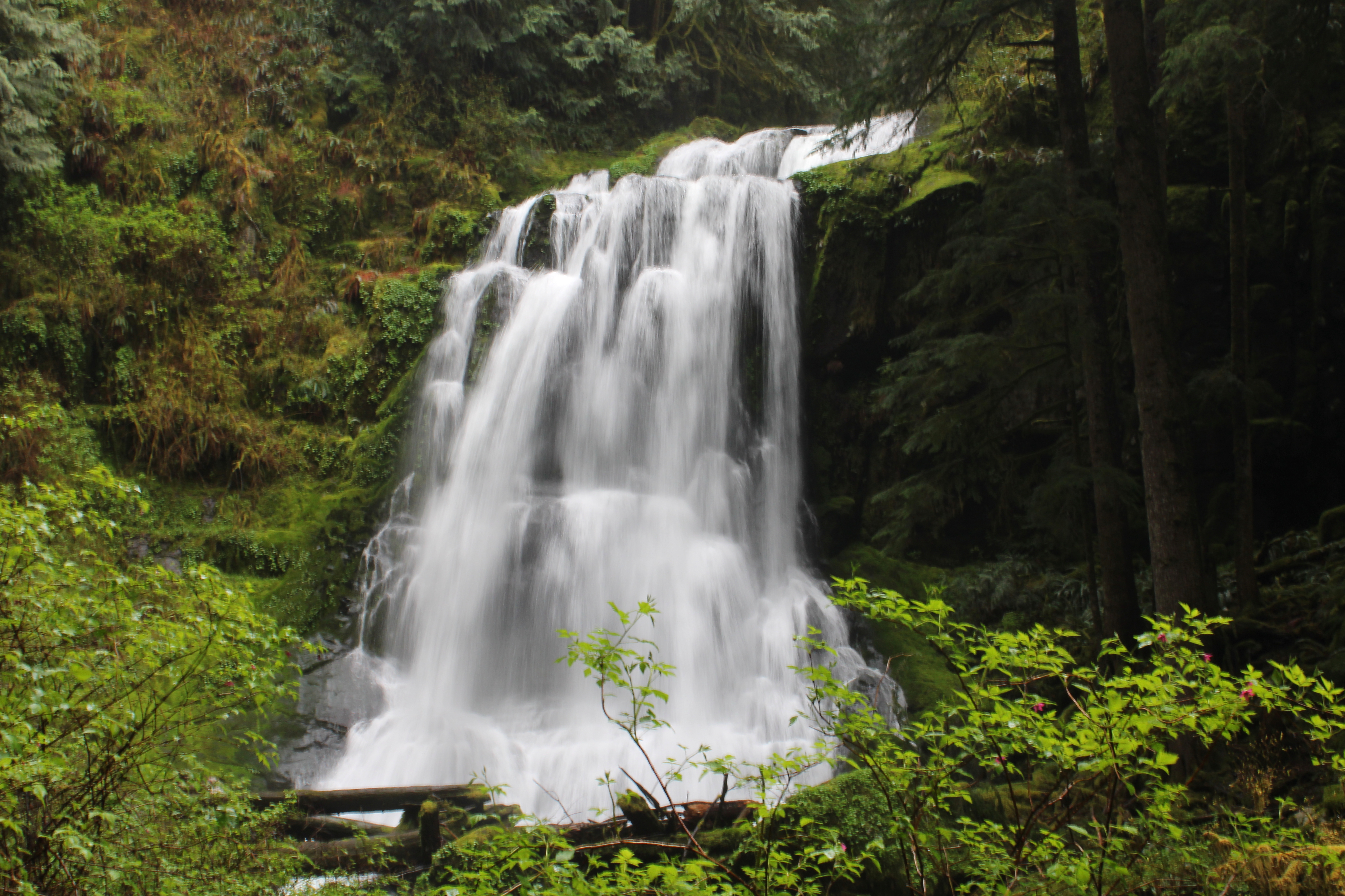
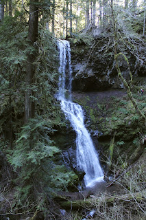
Lower Fall Creek Falls
Because of the lack of foliage, we could actually now observe both upper and lower falls at the same time from a fair distance away. Even though the picturesque cascade was fully visible, it still was much cooler to admire the lower falls from the splash basin and the upper falls from a railed overlook, and we obliged both.

It was a berry nice hike
The hike to the falls is pretty short, which is one reason I haven't hiked there all that much. So, for some extra mileage we explored the forest road at the top of the cascade. The homes that had been here before had also been lost to the fire and the road was clearly sagging, ready to slide downhill at the slightest provocation, like hikers walking on it. The atmosphere up here among all the death and destruction was somewhat on the forlorn side, although the blackberries growing here were delicious.

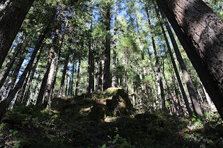
The "forest" at Susan Creek
Susan Creek was likewise ravaged by Archie but it was conveniently located on the way home, so we stopped there for another short hike to another spectacular waterfall. Just like at Fall Creek, the hike took place among the charred skeletons of trees past. But at least there was no coroner's pictograph on the parking lot pavement.

Pretty to look at but common tansy is not welcome
There were the same type of wildflowers seen at Fall Creek but there were some different ones too. The yellow daisy-like flowers of common tansy were pretty to look at but are most unwelcome, since tansy is a prolific invasive species. Pale blue wild chicory and lavender-tinted aster were more abundant here than they had been at Fall Creek.

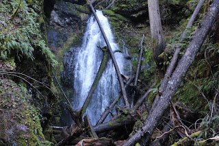
Susan Creek Falls
Susan Creek Falls tumbles over its rocky ledge in spectacular fashion, although it's still a bit odd for us old-timers to see the falls in bright daylight instead of in its former mossy and shady basin. Get used to it Richard, it's not going to change much during your remaining time on this planet. We lunched at the picnic area below the falls and enjoyed the scene as we ate our respective fruits, snacks, hot peppers, and gummy worms.

Stink bug gendarmes escort the St. John's wort beetle prisoner
As at Fall Creek, insect life abounded on the surrounding vegetation. Shiny black St. John's wort beetles thrived not on St. John's wort, but on fireweed instead. Stink bugs wandered among the St. John's wort beetles, trundling along like insectile armored tanks warring over the same patch of fireweed. Not willing to engage hostile bug forces in combat over fireweed apparently, maple beetles crawled all over thistle plants and not on maples as their name would suggest. 

Western tailed blue butterfly
Not all of the insects were of the beetle variety as numerous butterflies danced from flower to flower. Of note were some brilliant sulfur-colored butterflies that would not stay still long enough for stealthy photographers. Oh well, I had to settle for a photo of a gray butterfly thingy but the fun was all in the chase.

One small piece of Fall Creek Falls
All of us on this outing are long-time (also known as "old") hikers and are quite familiar with how things used to be along this section of the North Umpqua River. To keep sane, which is a relative term, one just needs to accept the basic fact that things will never be like they were, at least during our lifetime. However, it's not necessarily a bad thing and these two short hikes proved the point that there is still great beauty along the river post-fire, it's just a different kind of beauty than what used to be.

Upper Fall Creek Falls
For more photos of the Fall Creek hike,
please visit this Flickr album.

Not the trail it used to be
For more photos of the Susan Creek hike, please visit this Flickr album.

Wednesday, January 26, 2022

Trestle Creek Falls


It had been a while since I had visited either of Trestle Creek's two waterfalls. The last time I was here, it was right after a hernia surgery and it was really slow slogging uphill through the forest while simultaneously trying to keep my guts contained within my abdominal cavity, or so it felt like. Flash forward to 2022 and after two more hernia surgeries within the last year, I found myself slogging post-surgery uphill through the forest again. At least I'm mostly healed and my organs did not feel like they would leak out of the surgical incision this time out. You might say I had enough guts and intestinal fortitude to stomach hiking into the belly of the forest to satisfy my hiking appetite.

It was cold down at the bottom of Brice Creek's canyon

While it is a bit of a grind, the 4.5 mile hike around Trestle Creek and its pair of picturesque cascades is not particularly long or adventuresome. The adventure, however, was reserved for the drive to the trailhead on Brice Creek, for the road was hoary with frost and ice and I found myself driving slower and slower so as to avoid going straight when the road didn't. But all was well and the six of us made it to the trailhead without any mishap. Should have brought gloves though, as my fingers quickly went numb in the frozen air.

Hi ho, hi ho, it's up the hill we go

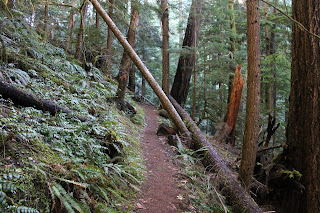
However, the cold was sort of welcome on the slog up. It kept body temperatures and energy fresh, which sure beats becoming a sweatier and smellier version of myself. The path departed Brice Creek and switchbacked to and fro, ever upward through a lush and ferny forest, eventually cresting a ridge before reaching Trestle Creek itself.

First snow queen I've seen this year

Winter had stopped by for a visit lately, as evidenced by the ice and frost to go along with isolated snow patches here and there. Plenty of trees had been knocked down too, like so many bowling pins of the gods, but trail crews had done a great job of clearing the trail. We only had to scramble over a fallen tree just a time or two. Spring is on the way though, and I spotted some snow queen blooming beneath some imposing rocky cliffs.

The trail was a bit of a cliff hugger here

All "good" uphill slogging comes to an end however, and as stated, the path dropped down into the Trestle Creek drainage. Here, the trail (and some hikers) hugged a rock wall while spectacular Upper Trestle Creek Falls commanded attention. Because of the winter storms and melting snow, the creek was carrying a fair amount of water, making the waterfall more boisterous than usual.

Little people(far right) hike
behind Upper Trestle Creek Falls

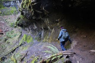
The cascade is quite the sight but as an added point of interest, the trail circled the canyon and then ducked behind the waterfall itself. We not only got to get an up-close look at the waterfall like so many green-skinned amphibians mating in the mist, but we also got to experience the wet spray on a cold day. Sarcasm intended, but we didn't really mind as we were still pretty warm from the hike to get up here.

It became a beautiful day in the forest

I had hiked this loop in the clockwise direction years ago and my recollection was that the trail had been very steep. Now after hiking in the reverse direction, I pretty much agreed with myself, which in itself is a rare and wondrous occasion. The trail dropped quickly and I retroactively pitied my younger fool self for daring to hike up this. However, the hike was eminently enjoyable, not only because it was downhill, but because the sun had come out, thawing frost, and hikers' fingers, noses, and ears alike. Not only was it a few degrees warmer but the mottled sunlight and long winter shadows is how a forest gives hugs.

Lower Trestle Creek Falls

After meeting up with the Brice Creek Trail, we grabbed the path leading to Lower Trestle Creek Falls. There was no walking around the lower falls, though. Here, the trail ends at a debris-clogged bowl with the lower cascade presiding over the watery honors. Two waterfalls on one hike is twice the fun as one waterfall on two hikes, so we stopped for a bit to merely enjoy the scene, sound, and poetic grace of a tumbling cascade on a winter day.

Brice Creek just looks cold

From the lower falls, it was a return to the trailhead via the Brice Creek Trail, a magnificent hike in its own right. The larger (when compared to Trestle Creek) creek was swollen with winter runoff at the bottom of its deep, dark, and icy canyon. As Brice Creek tumbled photogenically over and around large boulders and other immovable objects, we hiked past, moving quickly to stay warm. Fortunately, all that hoarfrost on the road heading out had melted off, making the drive less sketchy than it had been earlier in the day.

Some of that winter downfall

Reminiscing back on that memorable first hike after surgery, my hiking speed had been exceedingly slow and Mrs. O'Neill and I soon found ourselves way behind everybody else. Exasperated at hiking at the pace of a lethargic snail, Dollie rudely shouldered her way past me and charged ahead, eventually passing all other hikers in her perpetual zeal to end the hike as soon as possible. Good thing I was nowhere near as slow this time out!

Nice try sun but you need to work
on the warmth aspect of sunlight

For more photos of this hike, please visit the Flickr album.


Sunday, March 4, 2018

North Umpqua Trail - Swiftwater Segment

Bit by bit, springtime is coming! Sometimes its hard to believe, like when copious amounts of rain fall on the deck outside. Drive up the North Umpqua Highway to about 3,500 feet of elevation while your car slips and slides in the ice and snow, and it'll still feel a lot like winter. But in between the ample precipitation leaking from the sky, there are signs here and there that winter is on the way out. Occasionally, sunlight breaks out and the temperatures are at least 10 degrees warmer than it had been most of February. Twittering birds commence constructing nests in the branches while underneath the trees along the North Umpqua Trail, the diminutive lavender blooms of snow queen carpet the florest floor. Yes, I know that winter will have a thing or two yet to say about the arrival of it's seasonal arch-nemesis, but it sure was nice to hike on the North Umpqua Trail without getting frozen or soaked for a change.

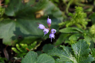
Woodland violet
So, the day was not great but on the other hand it wasn't raining...too much, anyway. That was good enough for Luna and I, we saddled up and drove over to the Susan Creek Day Use Area for some winter/spring hiking. As we started, the trail was blocked by a large fallen tree lying across the trail. After a quick scramble over the dearly demised tree, we had to stop again to take pictures of some of the many clumps of snow queen blooming next to the trail. Oh, and there was some woodland violet and twinflower too, which required more lying prone in wet vegetation, snapping a few dozen photos of every flower. Well, to be exact, Luna waited patiently for me while I did my photography thing and I could sense much rolling of eyes behind my back when I wasn't looking.

Tick-harvesting hiking companion
A half-mile and a half-hour later (thanks to the snow queen), we crossed the North Umpqua River on the always picturesque Tioga Bridge, the orange wood of the bridge contrasting nicely with the turquoise waters of the rain-swollen river. Luna too contrasted with most everything, since she is entirely black except for the one patch of white on her throat and chest.

Moss creeps over a bald spot
Once across the river, there were two options for hiking: right turn or left turn. The left-turn version would be on the Tioga Segment of the North Umpqua Trail, but a sign warning of a trail closure several miles ahead cinched the deal. "Not Closed": I like that in a trail, so right on the Swiftwater Segment it was. The Tioga Segment had been ravaged by wildfire last summer and the Forest Service is rightly concerned about landslides and falling trees, plus no doubt most of the wooden bridges were burned up in the fire, too. I'm not averse to getting my feet wet but some of those little ravines would be quite tedious to get across without a bridge spanning them. And as tempting as it is to hike past the closure signs and explore the wild post-fire scenery, there is a hefty fine involved if you happen to be caught and cited. In my post-retirement budget, there is not enough room for a "stupid-tax".

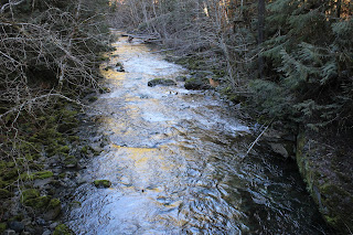
Lots of water in the forest


The Swiftwater Segment was fine though, as it angled gently uphill on an old gravel road bed for most of the first three miles. The vegetation was lush and water soaked, my legs would have been sopping wet had we had to hike on a real trail with encroaching vegetation. We had to endure several short rain showers and I had plenty of opportunity to take photographs of water drops dangling off of branches, leaves, and runny noses.

A small creek crosses the trail
With all the rain coming down in the last week, it stood to reason there'd be plenty of water running in all the seasonal unnamed creeks crossing the trail. And yup, there certainly was and I have hundreds of photographs to prove it. At this rate, we'd spend all day on the trail just to attain one mile of hiking distance!

Moss creeps over a rock


The forest bryophytes (that would be a fancy term for moss, dearies) were on full display here on the shady side of the river. Between the lush vegetation and the ample quantities of mossage (bryophytage?), green was the operative color on the North Umpqua Trail. Moss covers all that does not move, so Luna had no worries, but I had better put the camera away and hie myself smartly down the trail lest I too become just another indistinct green mossy lump in the forest.

So many creeks on the trail
As stated before, the trail was angling up and away from the river and the forest did a pretty good job of hiding the river from view. In several openings in the dense woods, we got rained on and we could see the bright turquoise color of the river water down below through the trees. Nonplussed by the rain, small birds flitted in the damp shrubbery like so many feathered ping-pong balls, attracting the attention of one easily distracted dog.

Snow queen


At about the three mile mark, we came across an area that had been logged right next to the trail. I have to think that the logging activity probably had some connection to last summer's wildfires, although the logging seemed to have occurred more recently than last summer. Civilization further intruded when the trail separated from the old roadbed and followed a not-so-attractive clear-cut beneath some power lines before ducking back into yet another lush forest.

Bob Creek
A short drop through the thick lichen-encrusted woods brought us to Bob Creek, it's footbridge still intact and untouched by fire. That was a logical turnaround point and we rested a bit and ate treats before turning back. On the way back the rain ceased and the sun broke out. There is a saying about Oregon "if you don't like the weather, just wait five minutes" There should also being some saying about experiencing summer, spring, fall, and winter all in one day, but that's just me whining.

Susan Creek
At any rate, in keeping with the adage cited in the previous paragraph, the rain returned by the time we reached the car at the end of a shortish 5.5 mile hike. More mileage was called for, so rain notwithstanding, we crossed the highway and resumed hiking on the Susan Creek Falls Trail, a short but heavily used path to the spectacular falls.


Susan Creek Falls on a rainy afternoon
The trail had been graded, graveled and fence-railed into submission and I get a little peeved when comparing this path to my normal ankle-twisting trail tread. But then it wouldn't really be hiking if all trails were like that, either, so I'll stop with the complaining. At any rate, Susan Creek Falls were predictably spectacular, particularly with the spring runoff increasing both the aural and water volume of the cascade. We didn't tarry long at the falls, for the rain was a little more insistent by now, it was just as well we turned back for the wonderful and heavenly warm air that can only be obtained from a car heater on a cold and wet, yet fine spring day.
.
The color of the river is amazing
For more pictures of this hike, please visit the Flickr album.


Saturday, December 10, 2016

North Umpqua Trail - Swiftwater Segment

It rained for 40 days and and 40 nights and from the building of Noah's ark hereafter, a 40 day rain is said to be of "biblical proportions". However, here in the damp Pacific Northwest, it's just another storm and we just shake our heads and wryly note "Only 40 days?"  No ark building is necessary in the continual rain, but if you want to stay somewhat dry on yet another rainy day hike, then good rain gear is essential.

Rain on a cedar
I have tried various so-called waterproof jackets but have yet to find a breathable soft shell that effectively keeps the water out. I do have a hard shell that repels the rain but the problem with that is all my hiking perspiration is trapped by the impermeable fabric so it sort of rains underneath the jacket...plus it smells like an unventilated gym. Maybe two unventilated gyms, even. Maybe even three unventilated gyms full of sumo wrestlers doing aerobics on treadmills. With the heat turned up and the rafters full of farting pigeons, too.

Misty view to Bob Butte
I recently read an article about hiking long-distance trails on the cheap and Frogg Toggs were cited as the favorite rain gear for frugal hikers. A short Internet session later, a set of Frogg Toggs Ultra-Lite2s were purchased and on their way. The Frogg Toggs are amazingly inexpensive, a mere pittance at $25, especially when compared to other rain gear. When the package arrived several days later,  a rainy day was all that was needed for some gear-testing, like that would be a problem!

Somebody liked the water on the trail


Rainy day and rain gear in hand, Luna and I headed out to the Susan Creek Recreation Area. The rain was light enough I didn't feel the need to go all Gorton's Fisherman and put on the rain pants, too. However, Luna was on her own, although if I would have bought her a pet raincoat, you might refer to her as a Frogg Togg Dogg. And since she likes to play keepaway in the back yard with a huge tree branch, you might even call her a Frogg Togg Logg Hogg Dogg. Sorry, I'll quit now.

A tiny mushroom sprouts on a tree trunk
The Emerald Trail connects the Susan Creek picnic area to camera-friendly Tioga Bridge. However, the trail is not emerald at all, it's mostly black as in pavement and coarse gravel. No complaining though, for the civilized nature of the trail tread allows our alter-abled hiking friends to also enjoy Tioga Bridge.


Graceful arch on Tioga Bridge
Tioga Bridge was built in 2013 and you can still smell the fresh creosote on the stout span. The North Umpqua was running wide and fast, rushing noisily underneath the photogenic bridge. Normally the river water is a beautiful turquoise color but on this day the water was a milky chocolate brown tint as the river was running near flood stage. The day was cold, wet, gray, with low cloud cover rendering nearby Bob Butte barely visible in the mist overhead.

A cascade on a temporary creek
Once across Tioga Bridge, a thundering waterfall on a nameless creek made for an impressive start to the Swiftwater Segment of the North Umpqua Trail. About 100 yards later, a second waterfall on a nameless creek likewise impressed. All the rain was causing the streams to put on a show with winter runoff splashing where there normally would have been no running water at all, like on the North Umpqua Trail.  My feet stayed dry due to my happily waterproofed boots, while barefooted Luna was deliriously overjoyed to wet her feet in all the water streaming across the trail.


Boots got wet on this hike


The North Umpqua Trail is on an old logging road for much of the Swiftwater Segment, so we avoided the whole vegetation wetting pant legs thing. The grade was easy on the legs as the uphill slope was as kind and gentle as a grandmother. Life was good as we hiked while photo-stopping frequently due to all the seasonally hydrologic wonders occurring next to or on the trail. After about 3 miles, the road passed under some power lines and that was our cue to leave the road and start hiking on a real trail.


Mossy branches reach to the sky
The footpath dropped straight down the hill for a short bit, as it followed a clearing underneath the power lines. Not the most scenic part of the hike, to be sure. From there it was another steep drop down through a forest with a thundering creek that was mostly heard and not seen in the canyon below the trail.

Bridge over Bob Creek

I don't know who Bob was but he has a butte and a creek named after him. His creek was pretty full of Bob so to speak, as the rambunctious torrent was absolutely raging in an intimidating display of raw water power. Fortunately, no wade across Bob Creek was required as a nicely constructed footbridge made for both a safe crossing and yet another photo stop. Bob Creek literally was growing larger before my eyes as dozens of runoffs and tricklers poured off the canyon slope, each contributing to the mighty Bob's cause.

Bob Creek was much larger than normal
A brief uphill walk on a trail doing double duty as a creek bed brought us to the base of Bob Butte. There is a really nice view of the North Umpqua canyon from the butte but on this day, the butte was well hidden in the foggy cloud cover just above us. No point in walking up a steep trail just to see gray mist, so we sat down and I ate lunch while Luna mooched.

Orange cup fungus


On the return, the rain really poured just when we had to go up the steep open section underneath the power lines. I'm glad to report the Toggs kept me comfortably dry, just as promised. The breathability of the fabric means air flows both ways so on a cold day, one does need to wear warm clothing underneath. Once we returned back to the forest, the rain gave up, bowing down in acquiescent homage to the amazing water-repelling powers of the Frogg Toggs. With only one hike notched on our rainy day belt, durability remains an open question but so far, the Toggs definitely get more than a passing grade.

Slightly misted trail shot
For more pictures of this hike, please visit the Flickr album.