Saturday, January 29, 2022

Jacksonville Forest Park


So I sort of volunteered Lane to lead a hike in Jacksonville Forest Park. Of course, the one drawback to my diabolical plan was that Lane had never been to the park and I'd been only once. Clearly a scouting trip was in order so Glenn, who is quite familiar with the park's network of trails, was enlisted to show us the way. But Lane called in sick, so it wound up just being me and Glenn, and we all see what Lane did there.

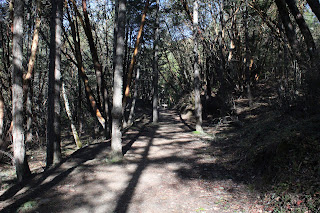
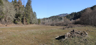
The Rail Trail ambled through the pleasant woods

Starting from the trailhead below smallish Jacksonville Reservoir, our route crossed the dam on a footbridge and set out on the Rail Trail. In short order, we arrived at the ruins of an actual railway trestle. Here, the bridge abruptly ended in mid-air and lest I be tempted to come up with a bunch of jokes about this, a plaque somberly reminded us that in 1917, one Denver Marsh perished in a train accident here. 

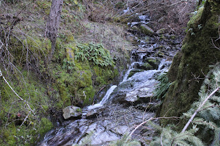
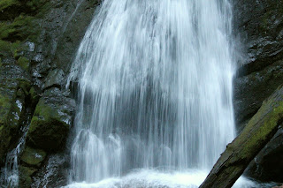
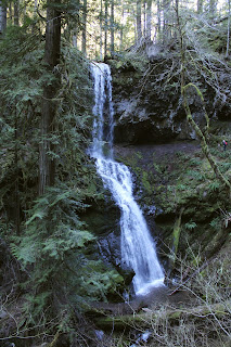
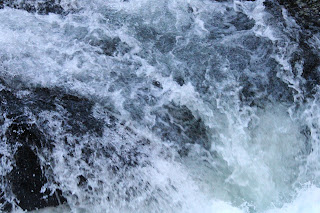
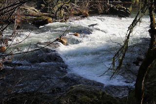
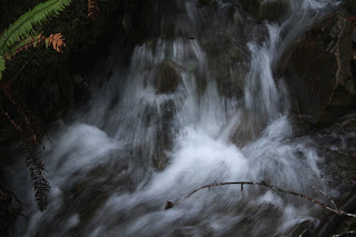
Jackson Creek needs more water

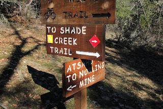
The Norling Trail ran next to Jackson Creek and to see the creek in its full glory, you need to be here right after a rainstorm (or during, maybe). On this day, the creek was barely trickling but the sound of water burbling through the trees was reward enough. At Confluence Bridge, where creeks Cantrell and Jackson meet, trails scatter in different directions like so many dandelion seeds floating in a breeze. Here, hikers have to decide in which direction they are going. For us, it would be a continuation on the Norling Trail up Jackson Creek. Norling is a popular name in the park as there is a road, creek, mine, and trail that all carry the name, the oddity being that the Norling Trail does not go to any of the other Norling-named features.

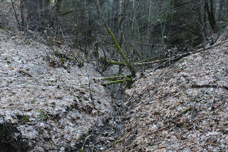
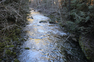
Norling Creek cuts a swath through leafy duff

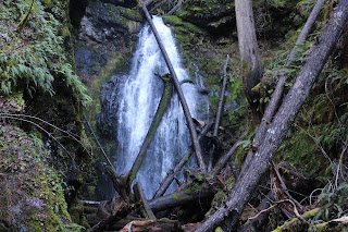
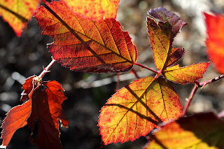
There were no falls on the Canyon Falls Trail either, although there was a bench that was labeled "Canyon Falls" that offered a look at lethargic Norling Creek desperately trying to make it as far as Jackson Creek before running dry. The hike was a steady uphill endeavor but never overly so, and offered a pleasant walk through woodlands carpeted with a thick layer of decomposing maple leaves. 

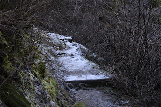
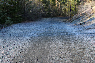
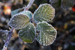
Watch your step, the trail is icy!

Small isolated snow patches flanked the trail, which was heavily frosted in places. Virtually all of this hike took place on the shady side of Jackson Creek's frigid canyon and even though the day was sunny, extra clothing layers were an all-day requirement, thanks to the chilly air and general all-around lack of sunlight on our route.

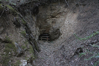
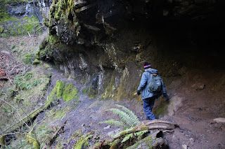
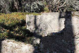
The entrance to Norling Mine was barred shut

This park's history is heavily interwoven with historical mining activity around the rustic town of Jacksonville. Accordingly, our route sideswiped several mines, the first of which was Norling Mine. The mine entrance was just a small hole on a wooded slope, the entrance barred shut to prevent silly people from crawling into the mine and never being heard from again, or maybe to keep pallid cave deer from slithering out.

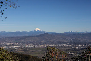
View of Mt. McLaughlin and Bear Creek Valley

The Atsahu Trail was on an old roadbed that angled upwards through woods increasingly trending to madrone before cresting at an open saddle. At the saddle, we made a hard right turn and Glenn gaily skipped up the path to Upper Twin Peak while I trudged step by painful step, darn younger people anyway. Our reward for all the toil and trouble was a rest on a strategically sited bench with an awesome view of Bear Creek Valley, Mount McLaughlin, and Grizzly Peak, all covered with white snow under a vibrantly blue sky.

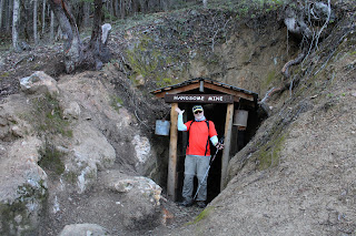
No Richard, the hike was named after ME!

It was all downhill from here, thankfully and we switchbacked down the Owl Hoot Trail, passing El Patron (a huge madrone tree) along the way. Hoot man, the downhill was certainly a lot more fun than the slog up Upper Twin Peak! The Owl Hoot met up with the Boulder Trail which in turn led to the Handsome Mine entrance, triggering a lively discussion between Glenn and I over which one of us the mine was named after. This mine was also doored shut, although a tap on a window pane turned on lights inside of the mine, illuminating railway tracks disappearing into the inky black bowels of the very earth itself.

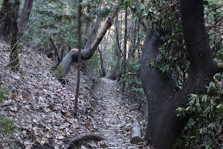
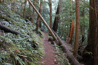
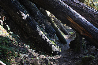
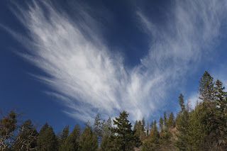
Narrow trail in the deep and cold shade

The Ol' Miner's Trail could have triggered another lively argument between Glenn and I but neither one of us had any real interest in claiming the moniker of Ol' Miner. If it were Handsome Ol' Miner, then maybe. At any rate, after wandering past an old hydraulic mine site littered with rusting mining equipment, the trail spit us out onto Jacksonville Reservoir Road near the trailhead parking lot and just like that, the hike was over. Many thanks to Glenn for helping us out with planning our upcoming hike.

Map of our route

So, I ran into Lane a couple days later and let me tell you, he did not look sick at all. Far be it from me to say he pulled a fast one, but his recovery was a medical miracle on the face of it. However, since I am now the only one with knowledge of the route, I'll probably get stuck leading the hike for him but then again, I could call in sick!

Even the trails have trails

For more photos of this hike, please visit the Flickr album.

Wednesday, January 26, 2022

Trestle Creek Falls


It had been a while since I had visited either of Trestle Creek's two waterfalls. The last time I was here, it was right after a hernia surgery and it was really slow slogging uphill through the forest while simultaneously trying to keep my guts contained within my abdominal cavity, or so it felt like. Flash forward to 2022 and after two more hernia surgeries within the last year, I found myself slogging post-surgery uphill through the forest again. At least I'm mostly healed and my organs did not feel like they would leak out of the surgical incision this time out. You might say I had enough guts and intestinal fortitude to stomach hiking into the belly of the forest to satisfy my hiking appetite.

It was cold down at the bottom of Brice Creek's canyon

While it is a bit of a grind, the 4.5 mile hike around Trestle Creek and its pair of picturesque cascades is not particularly long or adventuresome. The adventure, however, was reserved for the drive to the trailhead on Brice Creek, for the road was hoary with frost and ice and I found myself driving slower and slower so as to avoid going straight when the road didn't. But all was well and the six of us made it to the trailhead without any mishap. Should have brought gloves though, as my fingers quickly went numb in the frozen air.

Hi ho, hi ho, it's up the hill we go

However, the cold was sort of welcome on the slog up. It kept body temperatures and energy fresh, which sure beats becoming a sweatier and smellier version of myself. The path departed Brice Creek and switchbacked to and fro, ever upward through a lush and ferny forest, eventually cresting a ridge before reaching Trestle Creek itself.

First snow queen I've seen this year

Winter had stopped by for a visit lately, as evidenced by the ice and frost to go along with isolated snow patches here and there. Plenty of trees had been knocked down too, like so many bowling pins of the gods, but trail crews had done a great job of clearing the trail. We only had to scramble over a fallen tree just a time or two. Spring is on the way though, and I spotted some snow queen blooming beneath some imposing rocky cliffs.

The trail was a bit of a cliff hugger here

All "good" uphill slogging comes to an end however, and as stated, the path dropped down into the Trestle Creek drainage. Here, the trail (and some hikers) hugged a rock wall while spectacular Upper Trestle Creek Falls commanded attention. Because of the winter storms and melting snow, the creek was carrying a fair amount of water, making the waterfall more boisterous than usual.

Little people(far right) hike
behind Upper Trestle Creek Falls

The cascade is quite the sight but as an added point of interest, the trail circled the canyon and then ducked behind the waterfall itself. We not only got to get an up-close look at the waterfall like so many green-skinned amphibians mating in the mist, but we also got to experience the wet spray on a cold day. Sarcasm intended, but we didn't really mind as we were still pretty warm from the hike to get up here.

It became a beautiful day in the forest

I had hiked this loop in the clockwise direction years ago and my recollection was that the trail had been very steep. Now after hiking in the reverse direction, I pretty much agreed with myself, which in itself is a rare and wondrous occasion. The trail dropped quickly and I retroactively pitied my younger fool self for daring to hike up this. However, the hike was eminently enjoyable, not only because it was downhill, but because the sun had come out, thawing frost, and hikers' fingers, noses, and ears alike. Not only was it a few degrees warmer but the mottled sunlight and long winter shadows is how a forest gives hugs.

Lower Trestle Creek Falls

After meeting up with the Brice Creek Trail, we grabbed the path leading to Lower Trestle Creek Falls. There was no walking around the lower falls, though. Here, the trail ends at a debris-clogged bowl with the lower cascade presiding over the watery honors. Two waterfalls on one hike is twice the fun as one waterfall on two hikes, so we stopped for a bit to merely enjoy the scene, sound, and poetic grace of a tumbling cascade on a winter day.

Brice Creek just looks cold

From the lower falls, it was a return to the trailhead via the Brice Creek Trail, a magnificent hike in its own right. The larger (when compared to Trestle Creek) creek was swollen with winter runoff at the bottom of its deep, dark, and icy canyon. As Brice Creek tumbled photogenically over and around large boulders and other immovable objects, we hiked past, moving quickly to stay warm. Fortunately, all that hoarfrost on the road heading out had melted off, making the drive less sketchy than it had been earlier in the day.

Some of that winter downfall

Reminiscing back on that memorable first hike after surgery, my hiking speed had been exceedingly slow and Mrs. O'Neill and I soon found ourselves way behind everybody else. Exasperated at hiking at the pace of a lethargic snail, Dollie rudely shouldered her way past me and charged ahead, eventually passing all other hikers in her perpetual zeal to end the hike as soon as possible. Good thing I was nowhere near as slow this time out!

Nice try sun but you need to work
on the warmth aspect of sunlight

For more photos of this hike, please visit the Flickr album.


Monday, January 24, 2022

Elk Creek Wild and Scenic River


Last year, I hiked along Elk Creek but you'd never know it. On that particular day, I had forgotten to charge batteries and as a consequence, the hike was done without a working GPS or camera. It was as if the hike had never happened, the only supporting evidence being several angry blisters on my feet. Apart from the frustration of inoperable electronic gadgetry, I really did enjoy the hike and made sure to put it on the Friends of the Umpqua's April calendar. I figure if I forget my batteries again on the club hike, at least there will be corroborating witnesses.

This view, all hike long

The inception of Elk Creek's current designation as a Wild and Scenic River began in the late 1960s, when Congress approved the construction of several dams to control flooding on the Rogue River. However, for the next subsequent set of decades, the Elk Creek Dam project became mired in a figurative stinging nettle patch of acrimony and litigation. While the matter was being disputed, the dam was actually built and a new Elk Creek Road was constructed above the would-be lake level. Eventually, the project was scrapped and nowadays the BLM is letting Elk Creek return to its natural state while the decommissioned roadway serves as an easy hiking and biking trail. 

The hike got off to a frosty start

On the morning of this scouting expedition to Elk Creek, the old road at Homesteader's Trailhead more resembled an ice skating rink than hiking trail. The paved surface was colored white with heavy frost, and I made sure to step carefully on the slick pavement, so as not to fall and hurt valuable body parts. The good news through, was that the morning sun would quickly render the frost short-lived, thereby increasing my chances of being long-lived.

A cascade on Elk Creek

Close to the trailhead, Elk Creek is more wild than scenic. The hard-to-see stream, silted and cloudy with winter runoff, burbled and babbled through stands of maple and alder trees. Game trails and sketchy use-paths allowed a certain lone hiker to brave thorny blackberry brambles for a closer look at the enthusiastic stream while getting scratched up in the process.

Blackberry leaf in the morning sun

Speaking of blackberry brambles, their leaves had been bronzed and colored by cold temperatures, frost, and maybe some snow. A veritable rainbow of frosted leaves dangled just so in the morning sunlight and all hiking came to a screeching halt while I practiced my photographic art, seemingly taking photos of every illuminated leaf.

Hoary, just like me!

Just like me, some of the leaves were photogenically frosted and several hundred photos later, rimed leaves became in short supply. The morning sun had melted most of the frost, thawing out leaves, roadway, and at least one incredibly handsome hiker. The lack of frosted leaves compelled me to wade out of the scratchy bramble patch and resume walking on the historic roadway.

I felt like I was being watched

After about a half-mile or so of hiking, the valley floor opened up to a series of pastures that I assume belonged to some old homesteads and ranches that had more than likely been condemned and consigned to the bottom of the would-be lake. Ruins, some graffitied with macabre and occult runes, dotted the pasture lands on the valley floor like so many Oregon-style Roman ruins.

Swimming hole, come summer

A gravel track led to a large swimming hole on Elk Creek. Here, the water was as deep as a philosopher's pondering and the current flowed past a rock cliff that surely must be a diving platform come summer. From leafless trees, crows squawked at me like a flock of ex-wives as I stopped to admire the creek scene, eventually leaving the swimming hole to the black birds and their other animal friends.

Celestial feathers

It was a glorious day along Elk Creek, the blue sky accentuated by green pastures and general lack of trees. Across the valley floor, Tatouche Peak was the obvious high point on a forested ridge. The trees on the valley floor, mostly oak, maple, and alder, were all still bare-branched, rendering their woods austere and stark. Wispy clouds formed in feathery profusion in the sky above, the white contrasting nicely with the deep blue sky. Just a nice day, all around.

Pastures sprawled in the Elk Creek valley

Elk Creek Road is only 5 miles long end-to-end, making 10 miles the maximum possible distance. However, I turned around at the Alco Creek bridge, where a sign warned of a 7 ton weight limit. Hey I've been trying really hard to keep my diet, there's no need to mock me like that! When I hiked here last year, the crumbling pavement had really blistered my feet and today, they were starting to feel hot and that was a pretty good reason for turning a 10 mile hike into a 7 miler. Fortunately, my ego is sufficiently big enough for me to withstand any cruel mockery that might be directed my way by friends and barbarians alike.

Some large rocks (not these) had rolled onto the roadway

So it was back the way I had come and on the way back I ran into the only two people I'd see all day: a cyclist and a skateboarder. We exchanged pleasantries and each of us continued on our way, happy to be walking, cycling, or skateboarding on a trail next to Elk Creek instead of gurgling at the bottom of the intended lake. Afterward, I successfully uploaded my GPS route and photos, which meant this hike really did happen!

Bare trees against a bare sky

For more photos of this hike, please visit the Flickr album.

Saturday, January 8, 2022

Oregon Coast Trail (From Humbug Mountain day use area)


Ah, there is nothing like the feel of rough trail beneath your boots to make you feel alive and well. But then again, near prominent Humbug Mountain, there's a segment of Oregon Coast Trail that's on a section of old highway, replete with old asphalt. Nonetheless, this little piece of the OCT is a favorite of mine in spite of its paved shortcomings, especially since at least half the hiking route is on a real trail with dirt, roots, rocks, and everything. The Friends of the Umpqua had never been here before so as sole keeper of the knowledge of this trail, I was tapped to lead this hike.

Brush Creek flows by the brushy banks

Setting out on a cool but sunny winter morn, we crossed a manicured lawn at the Humbug Mountain day use area and found the path running under a Highway 101 bridge. For the first part of the hike, the route followed Brush Creek, which brushed by Highway 101 (see what I did there?) on the other side of the brush-lined creek. There used to be a fish hatchery here and the trail sideswiped the crumbling ruins, giving us a look-see at what once had been in the aqueous world of fish rearing.

Typical vibe hiking in the myrtle groves

The hike was a pleasantly level amble next to the burbling creek for maybe a mile or so before turning a bit less pleasant. The route was basically going up and over a densely wooded ridge and while the uphill was work, the tedium fortunately did not last very long. The woods here were sumptuous and lush, being primarily comprised of myrtle trees, whose pleasantly aromatic leaves dispelled any other odors that may have been left behind by the odiferous hordes hiking ahead of me.

The once and former proud Coast Highway

Once the forested ridge was crested, it was a quick drop down to a gravel road, followed by a short walk on the campground road proper. Fortunately, Oregon Coast Trail markers significantly cut down on any would-be confusion and I'm glad to say no hikers (other than Brad!) were lost or misplaced. From the campground road, it was now time to grab the historical highway heading upward through the woods.

Small creeks flowed everywhere

Dry Creek isn't very dry and a stout bridge spanned the noisy stream tumbling down its ferny canyon. While the day was pleasant and sunny, the week prior it had not been. High winds and heavy rains had pummeled the coast and accordingly, all manner of creeks and seasonal runoffs were tumbling down the steep slopes next to the old road. Fortunately, because of the trail's previous incarnation as a major highway, functioning culverts made sure to run the water underneath the roadway and not across.

Wind-littered trail

As the paved trail climbed away from Humbug Mountain Campground, we traded in myrtle groves for mixed stands of maple and conifer. The winds from the prior week's storms had left behind a carpet of small branches and leafy debris on the roadway, making us sort of feel like we were walking on real trail tread after all. Fortunately, no trees had toppled onto the old road, making for an obstacle-free stroll through the coastal woods.

Autumn all year round?

I had hiked here once before during autumn and maple trees had then put on a colorful show. Now in the middle of winter's embrace, such as it is in these days of global warming, there were still some vestigial remnants of autumn. Bare-limbed alder and maple trees still clung to a yellow leaf or two, or maybe vice versa. Blackberry vines also displayed some colorful leafy plumage, the photography of which soon caused me to fall further behind my speedier comrades.

Perfect!

Our turnaround point was at a scenic overlook of the magnificent Oregon coast stretching in either direction, the view ranging from Humbug Mountain to Port Orford. In between, Redfish Rocks and other assorted islands bobbed in the blue sea shimmering and sparkling in the mid-day sun. Of course, to get to the overlook you had to grab an unofficial trail peeling away from the historical roadway. We all enjoyed the view, except for Brad, who had madly and blindly charged past the path both coming and going, much to everybody's amusement.

Shadows lengthened on the hike back

This was an out-and-back route, so we got to enjoy the same pleasant woods all over again on the way back. Even though it was mid-afternoon, the sun dropped behind towering Humbug Mountain, casting our route into deep shade and cooler temperatures. It felt like nightfall was nigh, even though sunset was still many hours away from happening, and I think we all quickened our pace just a bit as a result.

Slippery bridges were crossed with care

This hike had ticked off all the things I had hoped to accomplish this day. After the last couple of weeks of rain, we got to enjoy a relatively balmy day, the sunlight replenishing our depleted Vitamin D reserves. Also, I am now no longer the club's sole keeper of the knowledge and lore when it comes to this trail, there are now 14 new initiates ready to spread the gospel about the pleasant wonders to be experienced on this section of the Oregon Coast Trail.

Hikes and life are just water flowing under the bridge

For more photos of this hike, please visit the Flickr album.

Saturday, January 1, 2022

Powerline Road


2021 was the year I entered the white-haired pantheon of senior-citizenhood. Even though I've celebrated at least 65 birthdays in my lifetime, in each instance I calmly accepted my new age with equanimity and grace. But then that damn Medicare card arrived. The ponderous bulk of the federal government has officially designated me an old person. No longer of any use to society, I might as well turn myself in to the Soylent Green factory, which is a dated reference that old people with Medicare cards will understand.

Winter wonderland

Along with advancing age comes advancing health problems too and in my case, hernias (two of them!) and diabetes reared their ugly heads and I have the statistics to prove it. Last year, I hiked a mere 181 miles with a per hike average of 5.7 miles, both all-time Richard Hikes lows. But on a positive note, I did manage to shed 25 pounds in 2021 and I now weigh a svelte 190 pounds, so why not start the new year by getting my slimmer and trimmer tail totally kicked on a New Year's Day hike?

The Powerline Road is not always this attractive

Brad had billed this North Bank Habitat outing as "The Worst Hike Ever". The Powerline Road route is probably the steepest trail in the North Bank Habitat, becomes overly muddy in wet weather, and if you like miles and miles of looking at power lines, pylons, and other accoutrements of the power grid, then this is your hike. This hike had already been elevated to Worst Hike Ever status before we even set foot on the trail, but snow and ice guaranteed this hike to be completely memorable for all the wrong (and a few right) reasons.

Hi ho, hi ho, through the snow we go

Fourteen hikers (and dog friend Gus, who thought this was the Best Hike Ever) passed through a livestock gate and began the slog up a bare ridge covered with snow. Critter tracks crisscrossed the ranch road as our feet crunched in the icy snow. We were walking in a winter wonderland as everything as far as the eye could see was cloaked in white, most unusual for the Habitat. Snow muffled all sounds except for noisy footsteps, heavy breathing, and the omnipresent buzzing of power lines.

At least we amused the cows

I had hiked this route once (and only once!) with Mrs. O'Neill and amazingly enough, our marriage survived the experience. However, on this second go-round, it didn't seem like it was all that bad. The really steep part was only about a mile or so, after which the trail actually levelled off before heading downhill. The problem with the downhill part though, was the relatively warm sunlight was melting the snow in an exposed swale, rendering the trail muddy and wet. Our choices were either sinking in the mud or sinking in the snow next to the mud and with bemused expressions, a small herd of cattle watched us physically wrestle with that not-so philosophical question.

View as we arrived at North Boundary Ridge

There was one more short uphill push before the route reached the hallowed destination of the North Boundary Ridge. Ostensibly, the ridge was the high point of the hike but in the North Bank, the downhill inevitably comes with intermittent uphill stretches, so there was no real rejoicing at arriving at the ridge. The snow was several feet deep here and hikers sunk up to their knees. The post-holing was taxing and tedious, especially since not one of us "experienced" hikers had ever thought to bring snowshoes. To be frank, I'd had enough at that point, so I grabbed the Blacktail Basin Road for a shorter route while my friends continued on the miserable North Boundary Ridge.

Amazing vista on Blacktail Basin Road

Blacktail Basin may have been shorter but it still was not easy. The Habitat's caretaker had driven some kind of all-terrain vehicle up here and the tire treads were nasty icy, forcing me to walk off the road and wade in the snow. Slogging in the slush was sheer trudgery, but at least it was safer than the icy road. No complaining though, because the views from high above the basin were fantastic, especially with bright blue sky looming over the snow-covered world.

This hike was half snowshoe trek, half wade

At the bottom of the basin, the thaw was in full swing and all manner of creeks and runoffs were carrying the melted snow down into Jackson Creek. Boots and feet were soon wet, of course. Your leaky garden spigot generally has more water flowing than Jackson Creek, yet on this day the creek was roaring like the nearby North Umpqua River, making several fords of the rushing stream somewhat sketchy. However, I'm glad to report that while feet got wet, I didn't slip and my ancient body remained upright for the duration.

The snowy headwaters of Jackson Creek

As the route worked its way down the basin, the basin walls shaded the wet trail, turning all moisture to ice. While the wet stuff was annoying and inconvenient, the frozen path was downright treacherous. Again, my superannuated (much cooler word than "ancient") body remained upright but it had been a close call at several junctures. At the trailhead, my companions straggled in behind me by an hour or so. Their faces were haggard, with fatigue etched onto their now wizened visages. Rheo looked like she had aged 15 years and Corinna said "I should have gone with you!" before plopping face-down in the snow in total exhaustion. Gus however, was all glee and joy and asked if we could do that again. Despite the arduous nature of the day's venture, it was all good because any hike where you don't have to use your Medicare card afterward is a good hike.

A great way to start the new year

For more photos of this hike, please visit the Flickr album.