Showing posts with label Oregon Coast Trail. Show all posts

Saturday, September 10, 2022

Lola Lake Loop (Oregon Coast Trail)


Because Facebook knows everything about me, on my feed I received a blurb about a coastal birding club (it may have been the Audubon Society) going on a short 2.5 mile nature walk around Lola Lake, located somewhere on the coast near Pistol River. They may have even called it a hike. Anyway, I'm all like "Birds? Meh!" followed by "NEW TRAIL!!!" After a short investigatory consult with the Internet, I ascertained that it was possible to reach the beach from Lola Lake, and thereby accrue a more proper hike mileage by walking north to the mouth of the Pistol River. A
t that point, I was all in.

You need to keep an eye out for this guy to find the trailhead

The trailhead was not that easy to find, and I initially drove past without realizing it. Coming back the other way, though, a post with a blue Oregon Coast Trail marker affixed to it was clearly visible by the side of the roadway and in short order, I found myself hurriedly lacing up my boots at the trailhead, eager to get started.

A well-maintained path wanders through the forest

The Oregon Coast Trail quickly left the busy highway behind, dipping into a typical lush and shady coastal forest. My initial impression was how nicely maintained the trail was. The brush had been cut back from the trail, there were no fallen trees to step over, and clearly legible and informative signs were posted at every intersection. I'm so not used to this!
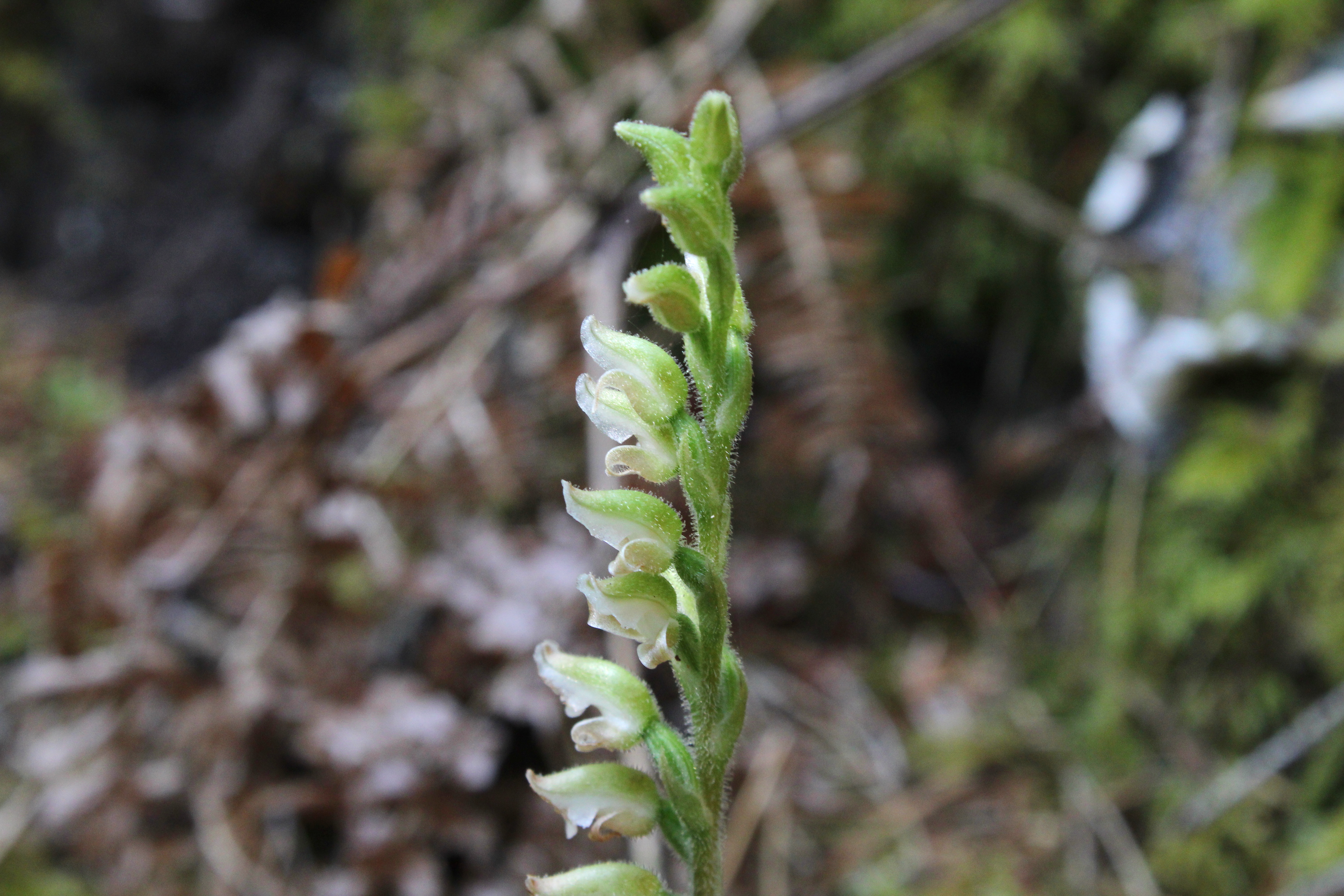
Wintergreen was clearly in blooming season

The first intersection offered the choice of hiking to the beach or looping around Lola Lake. Since I'd never been, Lola Lake it was. The forest on the loop trail was heavily mossed and a healthy population of ankle-high wintergreen was busy flowering on the forest floor, enthusiastically hoisting aloft stalks of white flowers like so many football fans waving their pennants. Mushrooms, ferns, and moss likewise abounded, feasting on the decaying biomass so prevalent in a coastal forest.

Lola Lake in all its grassy glory

If Lola Lake were to be the sole reason for this hike, then I'd be bitterly disappointed. The lake had dried up and gone to meadow. Presumably, the lake is actually a lake when the spring rains fall but this late in summer, there wasn't any water. That wasn't a deal-breaker though, for the erstwhile lake still was a nice meadow and there's no complaining when you hike to a brand new place anyway.

The trail begins to transition from woods to dunes

After executing the lake loop, it was then a right turn onto the beach trail which continued the wander through dense coastal woods. Eventually though, the dirt path became a sandy track and the trees thinned out, giving way to beachgrass and dunes. Common yarrow and pearly everlasting were in bloom among the omnipresent beachgrass, the wildflowers busily entertaining bees, butterflies, small wasps, and incredibly handsome hikers-cum-photographers.

View to distant Cape Sebastian

Odd and totally out of place amid the sand and beachgrass was a large castle-like rock formation. The rock was adorned with striations and layers of tan and ocher hues and tints. A short scramble to the tip of the rock yielded a view to distant Cape Sebastian so I had to stop for a bit and do some photography before continuing on.

Sand Creek snakes across the sand

The trail reached the beach just north of Crook Point, whose rocks and islands are an effective deterrent to hiking further south via beach. Sand Creek snaked out of the grassy dunes to sassily sashay across the beach to become one with the ocean. The surf crashing onto the craggy rocks of the scenic point entertained and to the north, stretched a long beach with Cape Sebastian looming many miles beyond.

View to the north

I never made it to Pistol River like I had intended. Unfortunately, the wind could be best characterized as belligerent, bellicose, and brawly. I'd venture to guess that I was getting cuffed about by a steady 40 miles-per-hour blow. The stiff breeze peeled spindrifts off the incoming waves and I felt fortunate it was blowing at my back. However, at some point on the return, I'd be hiking into it, my incredibly handsome face bearing the brunt of the wind-driven sand. The question was whether I wanted to endure Mother Nature's free dermabrasion and exfoliation treatment for 2.5 miles, 1 mile, or some distance in between. I eventually chose to turn around after a mere mile of beach walking.

An incoming wave wants to eat me

As anticipated, it was a stinging and bracing walk back to Crook Point with eyes all teary, but on the plus side, I don't have acne anymore if only because you can't have acne without having facial skin. Needless to say, it was much appreciated when the trail left the beach and entered the sheltering woods.

Low growing fleabane prettified the sand dunes

I really didn't any pay attention to any birds on his hike. In fact, I'm not even sure there were any birds for me to pay attention to. However, I'm nonetheless grateful to the birds for exciting the birding crowd to the point they put on the hike I had mentioned earlier. My first visit to this particular section of the Oregon coast would not have happened without the birds and birders. Happy squawks, chirps, and keening cries to all concerned.

Islands near Crook Point

For more photos of this hike, please visit the Flickr album.

Tuesday, April 5, 2022

Shore Acres/Sunset Bay State Parks


Last time I was here at Sunset Bay during a high surf event, I wound up running for my life when a big wave tried to eat me. However, at low tide you do have a little bit more time to recognize a man-hungry wave roaring in from the sea, and thereby avoid that ungainly panicked sprint to high ground and safety.

A ferny trail took us atop the coastal bluffs at Sunset Bay

I'm happy to report no danger-filled episode took place on this outing in the Cape Arago area. The sea roared and seethed well offshore and politely stayed away from fragile hikers and beachgoers at Sunset Bay. However, the nearby rocky islands were receiving a royal and personal pummeling from King Neptune himself. High tide was several hours away yet, so hiking buddy Dianne and I felt quite safe as we commenced hiking up to the forested coastal high ground overlooking the bay.

Qochyax Island guards the gates

The first little highlight of this hike occurred when we grabbed the unofficial path to Qochyax Island, forever standing guard (and taking serious surf abuse, too) at the entrance to Sunset Bay. The island was bare and rocky, the only adornment a sad little stand of long-dead trees that imparted a forlorn and mangy kind of air to the island eternally standing resolute and stalwart in the middle of an unappreciative ocean. 

What's that skunky smell?

The hike was mostly about the waves but not entirely. The coastal forests were lush and green and spring was on the way in form of pungent skunk cabbage flowers (the odor of which I unjustly blamed Dianne for), dangling bells of salal blooms, and blossoming heads of coltsfoot calling in bees and butterflies alike. Dianne is as camera-afflicted and addicted as I am, so our hiking pace was properly slow and contemplative as we clicked the day away.

Dianne unhappily hikes in my elements

On the way to a coastal vantage point, the trail became quite muddy and boots were tasked in keeping us upright and from sinking up to neck level in cold muddy goo. I enjoyed this part of the hike but Dianne did not. Enterprising hikers had fashioned a primitive walkway by tossing a series of branches into the mire. The crude walkway was slipperier than a boogery eel but it did the trick as we did not sink higher than an ankle or two.

Boom!

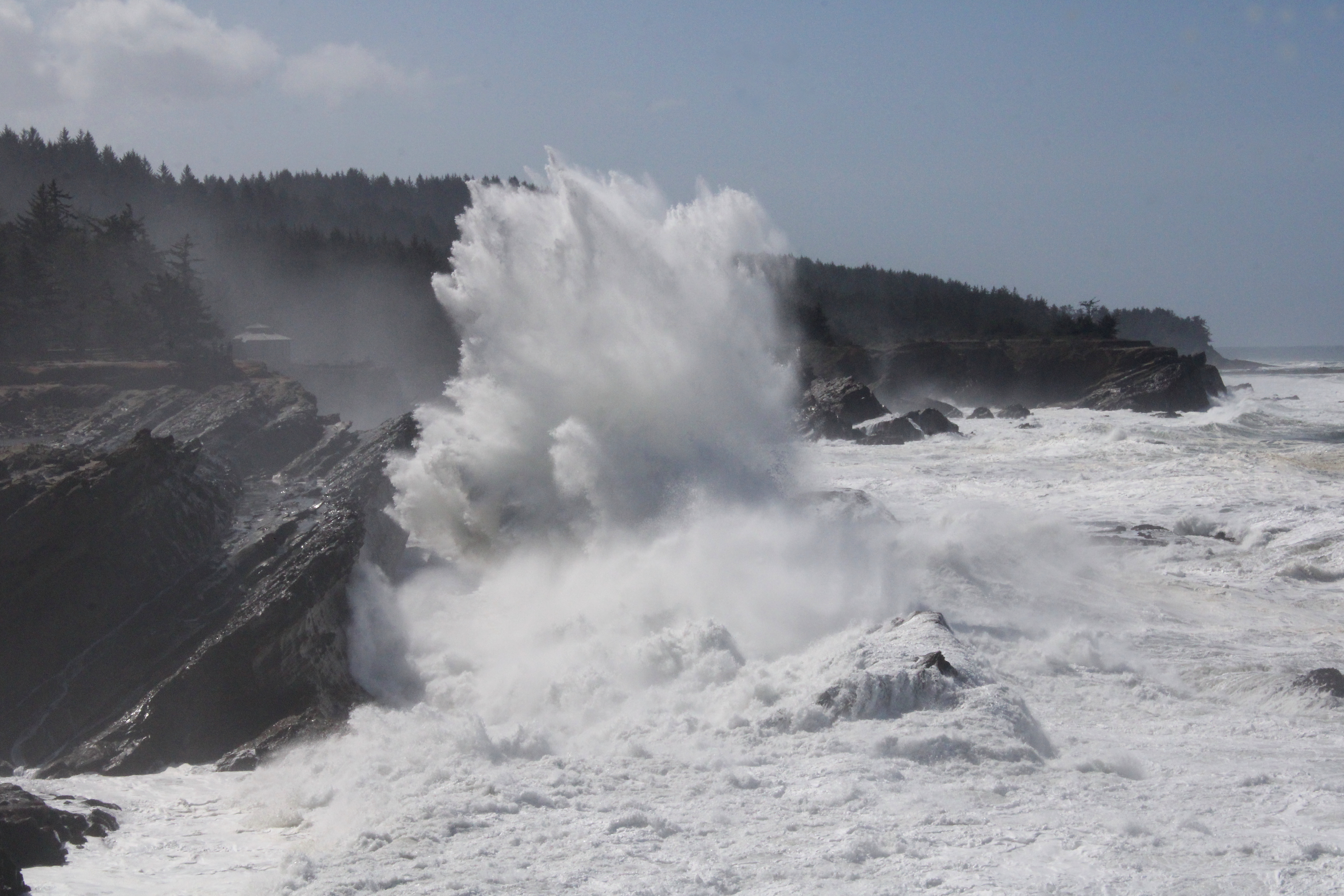
Once we entered Shore Acres State Park proper, the waves began to really put on a show. Here, the waves collided with exposed sedimentary layers inclined at a uniform 45 degrees by ancient seismic processes. When an unstoppable force meets an immovable object, a huge amount of angry energy gets released in the form of massive white-watered explosions. As we walked, walls of white water rose 20 feet or so above us, while the beautiful clear day was rent with a roaring cannonading blast of sound and fury.

The waves were spectacular as the tide came in

I daresay we tarried there quite a bit, happy to be close (but not too close) to the raging chaos. Our next stop for the wave fun was at the observation area at Shore Acres. Here we could see from a short distance, the same waves that we had earlier been craning our necks skyward at in order to comprehend the full breadth and scope. From the cliffside vantage point, we could see and appreciate the awesome perspective of massive wave in comparison to the little ants that were actually people doing what we had been doing just a short while prior.

Sound and aqueous fury

After sideswiping idyllic Simpson Beach, not quite as idyllic on a raging high-surf day, we grabbed a series of use trails that led us to the edge of several bluffs that were a little bit on the wild side, as they don't see as many people as Sunset Bay and Shore Acres do. Same old gigantic waves though and we spent another fair amount of time watching the perpetual war between sea and land. Plus, we had a good view of the Oregon coast to the north getting hammered over and over again by the relentless ocean. We tried to find a short-cut or bushwhack route back to the proper trail but the coastal shrubbery was too thick to make our way through. Defeated by plants, we hiked out on the same old trail we had come in on, our heads hanging in shame.

Not your basic native plant

On the way back, we swung by the formal gardens at Shore Acres and enjoyed the geometric contours of the formal garden and bricked paths, while appreciating the cultured beauty of the flowering daffodils and azaleas. Here, we rejoined with Connie who had been hanging out in the gardens all day while Dianne and I hiked along the coast.

Coltsfoot kept the bees and butterflies entertained

This had to be the slowest hike ever. Basically, we hiked 7 miles and it took us nearly 5 1/2 hours, a pace of 46 minutes per mile. To put it in more understandable terms, we walked slower than a narcoleptic sloth, slower than a Jeep with a broken transmission (personal experience, here), slower than a teenager getting ready to mow the lawn, etc. But can you blame us? There was just too much to savor and appreciate on this fine day.

Things calmed down when the tide began receding

For more photos of this hike, please visit the Flickr album.

Saturday, April 2, 2022

Tahkenitch Dunes


John stated he wanted to partake of "King Neptune's Pedicure". I speak John, so I'll translate: He wanted to hike barefoot in the surf. Since he was the designated leader for the Friends of the Umpqua this particular weekend, we were totally at his mercy as to the destination of the hike. Given his proclaimed desire for wet feet, the destination was Tahkenitch Dunes, the loop rendition of this hike serving up a mile or so of beach walking or in John's case, surf hiking.

The clouds would eventually burn off

After the long drive through foggy conditions that had 15 or so hikers wondering if they would ever see the sun on this day, we laced up our boots at the trailhead and set out on the trail, which immediately inclined up through the forest. The constant coastal fog keeps things well watered and accordingly, the forest here is healthy and lush with a vibrant understory of coastal huckleberry, ferns, and rhododendron thriving underneath the spruce trees and Douglas fir. Moss covered all that did not move and fungus, ever nature's recycler, was busy decomposing the ample decaying biomass on the forest floor.

The club emerges from the deep dark woods

The short and wooded trail soon spit us out onto the bright and sandy dunes like so many cave salamanders, our eyes blinking myopically in the comparatively bright light. It wasn't full-on sunny though, as heavy gray clouds still blocked the sun, but blue sky in between hinted at the clouds' eventual dissipation and demise. 

All the soft sand you could ever want to walk on

The trail leading away from Tahkenitch Campground heads straight to the beach but before we could get John his saltwater pedi, a left turn was made onto the dunes trail. Here, it was all sand and beachgrass and too bad John didn't want to partake of Queen Sandy's pedicure instead. At any rate, we hiked among the hummocks of beachgrass while calves complained about hiking in soft sand and despite my usual and customary whining, I actually felt walky and enjoyed both the exertion of the hike and scenery.

Epic view of Threemile Lake

At the intersection with the Threemile Lake Trail, we made another left turn and headed uphill in the shifting sand, beelining toward an overlook of Threemile Lake. The viewpoint serves up an epic vista of the lake, which normally dries itself into two separate bodies of water. On this day though, it was its three-mile-long single self, sited and sighted in a long and slender bowl sunk in a forested basin. Clouds artistically reflected on the mirrorlike surface and we slid down a long sandy hill like so many Jacks and Jills to eat lunch on the lakeshore.

The beach portion of this hike commences

After a lakeside lunch and laze, we hiked over to the beach where the clouds finally melted away and all beach hikes should take place under a blue sky and springtime sun. John took off his shoes and proffered his crusty feet to poor King Neptune. I'm surprised that gagging King Neptune didn't hurl tidal waves in our direction in response to John's effrontery. But he didn't, and everybody happily hiked along, with or without hiking boots and smelly socks.


We went as far north as Tahkenitch Creek, which was mostly roped off to protect the endangered snowy plover. The water flowed across the pristine sand at its delta and we could clearly see the tide forcing itself upstream like a watery proctologist's probe, not that I really know what that is like. Disgusting and gross simile aside, the incoming tide and wide creek was our cue to lace up our boots (in John's case) and grab the sandy trail heading inland.

"Back in the day..."

Tahkenitch Dunes used to be one of my favorite weekend backpack camping places. Here, one could pitch a tent at the edge of the creek and observe creek, beach, and sunset from the campsite. But now, the migrating creek has gobbled up the camping spots and forest service rangers have roped off the creek's banks. Sigh, all I have left are memories. On the plus side, there were some nice views of the creek as we hiked while I bored younger hikers with "Back in the day..."


The loop was closed off by hiking through the same emerald forest we had started on. But now, sunlight filtered through, or tried to filter through, the thick forest cover, infusing the very air with a soft green glow. Palmate leaves of tall rhododendrons spread their leafy fingers out like so many green monkey hands begging for handouts, while salal bushes filled up the spaces underneath, their leaves totally devoid of any anthropomorphic metaphor. This green section of trail was a good way to close off the hike.

It's so hard to be humble!

I was feeling pretty proud of myself at the end, for I had felt energetic and walky throughout. Maybe I was finally able to kick Covid to the curbside, although I don't want to get too cocky about this, I don't really need a viral comeuppance for my conceit. Stay humble, Richard, even though it's so hard, you can do it because you're the best and everybody basks in the glow of your bestness. I think I just failed at being humble. 

They say imitation is the sincerest form of
flattery but in this case, they'd be wrong!

For more photos of this hike,
please visit the Flickr album.

Saturday, February 5, 2022

Cape Arago


The signal light turned green and I stepped on the gas. In response, my Jeep gave a small shudder and feebly inched forward as fast as a beetle with two legs. After hearing the prognosis from the vehicle's physician, we made the hard decision to authorize a death warrant for our long-term faithful servant. Naturally, I was devastated, so much so that Dollie and I happily purchased a brand new vehicle the very same day. And as I parked my new ride at the trailhead on what will be the first of many such drives, I cheerily sung to myself "I'm a Soul man!" mostly because I'm now the proud owner of a brand new Soul.

Heigh ho, it's hundreds of hikers we go

Hiking and the driving-to thereof, are good for both my soul and Soul, and we parked with a bright cherry red splash at Sunset Bay State Park. This hike to Cape Arago and back was a South Coast Friends of the Umpqua Striders venture, which is what you call a cooperative effort between Friends of the Umpqua and sister hiking club South Coast Striders. The superb weather and scenery ensured a large turnout and all hikers present at the trailhead had plenty of old and new hiking friends with whom to bond with.

A secret beach at low tide

I've hiked in the Cape Arago area when the weather's been nasty and belligerent but on this day, it was downright balmy as the day dawned as sunny and bright as a granddaughter's smile. Lest we get too comfortable though, a chill breeze made sure to ruffle both windbreakers and the ocean's surface and at the start, I didn't see anybody hiking without jackets or extra clothing layers.

Norton Gulch lured some hikers down for a visit

With so many hikers (around 30!) what could possibly go wrong? Plenty really, but the worst of it came when the hikers in front, who did not know the route like us grizzled vets, made a right turn at the first junction and began to head down into Norton Gulch and I figured everybody just wanted to visit the gulch where it meets the sea. They made it about halfway down before stopping and asking me which way we should go. So amusing to see approximately 30 hikers turn around and backtrack on a narrow trail.

Low tide

High tide

It was low tide at the Cape Arago environs, the retreating ocean exposing reefs and rocky shoals to the airy elements. The booming waves at nearby Shore Acres are famed the world over but on this morning, they were barely making a ripple. The wind-driven whitecaps out to sea were larger than the waves lapping against the shore like a thirsty cat at a water dish. However, the ocean patiently bides its time and will once again rampage against the coastal ramparts come high tide.

Panorama of Simpson Reef 

From the gardens and viewpoints at Shore Acres, the coastal trail dipped in and out of the forest, sideswiping iconic landmarks such as Simpson Beach, before winding up at Simpson Reef Overlook. At the viewpoint, tourists and hikers alike can observe the sea lion bacchanalia and debauchery taking place on Shell Island. Replete with fishy smell, all that barking, belching, and farting was kind of like a gathering of through-hikers, but without the backpacks or hiking poles.

The forested path heading up to the Pack Trail

I'm not bragging (oh, but I am!) but I've lost weight lately and where I really notice the difference is when I'm hiking uphill. There is no direct trail from Simpson Reef Overlook to Cape Arago and one can either walk along the road to the cape, or cross the road and take the forested path leading to the Pack Trail. That particular path is a steep one but my lighter new and improved self just charged uphill, nearly as quick as a brand new Soul when the light turns green. Whew, did that ever feel good!

Lunchtime view

The coastal woods, fed by the perpetual fog at the cape, were predictably lush and verdant. The earthen track wound through the trees while numerous clumps of green ferns flanked the footpath. After reaching the Pack Trail, which is actually a gravel road, it was a short drop to Cape Arago herself, where we ate lunch while admiring the view of the sparkling sea and the rugged Oregon coast running to the south.

The sea was a bit more agitated on the way back

On the hike back to the trailhead, high tide was beginning to roll in and the waves were now a lot more entertaining than they had been earlier. We (John, Merle, and I) would see a huge wave break in spectacular explosive fashion, so cameras would be readied and then we'd wait...and wait...and wait for the next large wave. It apparently is a Cape Arago truism that waves are only spectacular when you aren't pointing a camera at them.

Pictorial definition of whitewater

The cool part about going home after the hike is I got to drive my new car all over again. Unfortunately, John and Merle took the occasion to pepper me with technical questions that I did not know the answers to, other than "Yeah, I'm pretty sure it has a motor". My ignorance of all things automotive was further exposed at my first fuel purchase when the attendant asked me to pop the gas tank lid open. Crap, how do I do that? Shaking his head in condescension and with a smirk on his face, the dude showed me where the lever was down on the floor by the seat. Hiking is so much easier!

A wall of solid rock, exposed by the low tide

For more photos of this hike,
please visit the Flickr album.

Saturday, January 8, 2022

Oregon Coast Trail (From Humbug Mountain day use area)


Ah, there is nothing like the feel of rough trail beneath your boots to make you feel alive and well. But then again, near prominent Humbug Mountain, there's a segment of Oregon Coast Trail that's on a section of old highway, replete with old asphalt. Nonetheless, this little piece of the OCT is a favorite of mine in spite of its paved shortcomings, especially since at least half the hiking route is on a real trail with dirt, roots, rocks, and everything. The Friends of the Umpqua had never been here before so as sole keeper of the knowledge of this trail, I was tapped to lead this hike.

Brush Creek flows by the brushy banks

Setting out on a cool but sunny winter morn, we crossed a manicured lawn at the Humbug Mountain day use area and found the path running under a Highway 101 bridge. For the first part of the hike, the route followed Brush Creek, which brushed by Highway 101 (see what I did there?) on the other side of the brush-lined creek. There used to be a fish hatchery here and the trail sideswiped the crumbling ruins, giving us a look-see at what once had been in the aqueous world of fish rearing.

Typical vibe hiking in the myrtle groves

The hike was a pleasantly level amble next to the burbling creek for maybe a mile or so before turning a bit less pleasant. The route was basically going up and over a densely wooded ridge and while the uphill was work, the tedium fortunately did not last very long. The woods here were sumptuous and lush, being primarily comprised of myrtle trees, whose pleasantly aromatic leaves dispelled any other odors that may have been left behind by the odiferous hordes hiking ahead of me.

The once and former proud Coast Highway

Once the forested ridge was crested, it was a quick drop down to a gravel road, followed by a short walk on the campground road proper. Fortunately, Oregon Coast Trail markers significantly cut down on any would-be confusion and I'm glad to say no hikers (other than Brad!) were lost or misplaced. From the campground road, it was now time to grab the historical highway heading upward through the woods.

Small creeks flowed everywhere

Dry Creek isn't very dry and a stout bridge spanned the noisy stream tumbling down its ferny canyon. While the day was pleasant and sunny, the week prior it had not been. High winds and heavy rains had pummeled the coast and accordingly, all manner of creeks and seasonal runoffs were tumbling down the steep slopes next to the old road. Fortunately, because of the trail's previous incarnation as a major highway, functioning culverts made sure to run the water underneath the roadway and not across.

Wind-littered trail

As the paved trail climbed away from Humbug Mountain Campground, we traded in myrtle groves for mixed stands of maple and conifer. The winds from the prior week's storms had left behind a carpet of small branches and leafy debris on the roadway, making us sort of feel like we were walking on real trail tread after all. Fortunately, no trees had toppled onto the old road, making for an obstacle-free stroll through the coastal woods.

Autumn all year round?

I had hiked here once before during autumn and maple trees had then put on a colorful show. Now in the middle of winter's embrace, such as it is in these days of global warming, there were still some vestigial remnants of autumn. Bare-limbed alder and maple trees still clung to a yellow leaf or two, or maybe vice versa. Blackberry vines also displayed some colorful leafy plumage, the photography of which soon caused me to fall further behind my speedier comrades.

Perfect!

Our turnaround point was at a scenic overlook of the magnificent Oregon coast stretching in either direction, the view ranging from Humbug Mountain to Port Orford. In between, Redfish Rocks and other assorted islands bobbed in the blue sea shimmering and sparkling in the mid-day sun. Of course, to get to the overlook you had to grab an unofficial trail peeling away from the historical roadway. We all enjoyed the view, except for Brad, who had madly and blindly charged past the path both coming and going, much to everybody's amusement.

Shadows lengthened on the hike back

This was an out-and-back route, so we got to enjoy the same pleasant woods all over again on the way back. Even though it was mid-afternoon, the sun dropped behind towering Humbug Mountain, casting our route into deep shade and cooler temperatures. It felt like nightfall was nigh, even though sunset was still many hours away from happening, and I think we all quickened our pace just a bit as a result.

Slippery bridges were crossed with care

This hike had ticked off all the things I had hoped to accomplish this day. After the last couple of weeks of rain, we got to enjoy a relatively balmy day, the sunlight replenishing our depleted Vitamin D reserves. Also, I am now no longer the club's sole keeper of the knowledge and lore when it comes to this trail, there are now 14 new initiates ready to spread the gospel about the pleasant wonders to be experienced on this section of the Oregon Coast Trail.

Hikes and life are just water flowing under the bridge

For more photos of this hike, please visit the Flickr album.