Showing posts with label cape arago. Show all posts

Saturday, February 5, 2022

Cape Arago


The signal light turned green and I stepped on the gas. In response, my Jeep gave a small shudder and feebly inched forward as fast as a beetle with two legs. After hearing the prognosis from the vehicle's physician, we made the hard decision to authorize a death warrant for our long-term faithful servant. Naturally, I was devastated, so much so that Dollie and I happily purchased a brand new vehicle the very same day. And as I parked my new ride at the trailhead on what will be the first of many such drives, I cheerily sung to myself "I'm a Soul man!" mostly because I'm now the proud owner of a brand new Soul.

Heigh ho, it's hundreds of hikers we go

Hiking and the driving-to thereof, are good for both my soul and Soul, and we parked with a bright cherry red splash at Sunset Bay State Park. This hike to Cape Arago and back was a South Coast Friends of the Umpqua Striders venture, which is what you call a cooperative effort between Friends of the Umpqua and sister hiking club South Coast Striders. The superb weather and scenery ensured a large turnout and all hikers present at the trailhead had plenty of old and new hiking friends with whom to bond with.
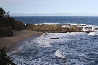
A secret beach at low tide

I've hiked in the Cape Arago area when the weather's been nasty and belligerent but on this day, it was downright balmy as the day dawned as sunny and bright as a granddaughter's smile. Lest we get too comfortable though, a chill breeze made sure to ruffle both windbreakers and the ocean's surface and at the start, I didn't see anybody hiking without jackets or extra clothing layers.

Norton Gulch lured some hikers down for a visit

With so many hikers (around 30!) what could possibly go wrong? Plenty really, but the worst of it came when the hikers in front, who did not know the route like us grizzled vets, made a right turn at the first junction and began to head down into Norton Gulch and I figured everybody just wanted to visit the gulch where it meets the sea. They made it about halfway down before stopping and asking me which way we should go. So amusing to see approximately 30 hikers turn around and backtrack on a narrow trail.

Low tide

High tide

It was low tide at the Cape Arago environs, the retreating ocean exposing reefs and rocky shoals to the airy elements. The booming waves at nearby Shore Acres are famed the world over but on this morning, they were barely making a ripple. The wind-driven whitecaps out to sea were larger than the waves lapping against the shore like a thirsty cat at a water dish. However, the ocean patiently bides its time and will once again rampage against the coastal ramparts come high tide.

Panorama of Simpson Reef 

From the gardens and viewpoints at Shore Acres, the coastal trail dipped in and out of the forest, sideswiping iconic landmarks such as Simpson Beach, before winding up at Simpson Reef Overlook. At the viewpoint, tourists and hikers alike can observe the sea lion bacchanalia and debauchery taking place on Shell Island. Replete with fishy smell, all that barking, belching, and farting was kind of like a gathering of through-hikers, but without the backpacks or hiking poles.

The forested path heading up to the Pack Trail

I'm not bragging (oh, but I am!) but I've lost weight lately and where I really notice the difference is when I'm hiking uphill. There is no direct trail from Simpson Reef Overlook to Cape Arago and one can either walk along the road to the cape, or cross the road and take the forested path leading to the Pack Trail. That particular path is a steep one but my lighter new and improved self just charged uphill, nearly as quick as a brand new Soul when the light turns green. Whew, did that ever feel good!

Lunchtime view

The coastal woods, fed by the perpetual fog at the cape, were predictably lush and verdant. The earthen track wound through the trees while numerous clumps of green ferns flanked the footpath. After reaching the Pack Trail, which is actually a gravel road, it was a short drop to Cape Arago herself, where we ate lunch while admiring the view of the sparkling sea and the rugged Oregon coast running to the south.

The sea was a bit more agitated on the way back

On the hike back to the trailhead, high tide was beginning to roll in and the waves were now a lot more entertaining than they had been earlier. We (John, Merle, and I) would see a huge wave break in spectacular explosive fashion, so cameras would be readied and then we'd wait...and wait...and wait for the next large wave. It apparently is a Cape Arago truism that waves are only spectacular when you aren't pointing a camera at them.

Pictorial definition of whitewater

The cool part about going home after the hike is I got to drive my new car all over again. Unfortunately, John and Merle took the occasion to pepper me with technical questions that I did not know the answers to, other than "Yeah, I'm pretty sure it has a motor". My ignorance of all things automotive was further exposed at my first fuel purchase when the attendant asked me to pop the gas tank lid open. Crap, how do I do that? Shaking his head in condescension and with a smirk on his face, the dude showed me where the lever was down on the floor by the seat. Hiking is so much easier!

A wall of solid rock, exposed by the low tide

For more photos of this hike,
please visit the Flickr album.

Monday, December 23, 2019

Cape Arago night hike


Pop! Hissssss... Those are the sounds of a murder. In this case, the helpless and hapless victim was the right rear tire on my Jeep and the perp was a hollow metal tube that impaled itself at right angles to the tire wall, neatly allowing the air contained within to escape in a mere minute. At least I know the tire sensor and dashboard indicator work. At any rate, Coral Rae, Daweson, and I were temporarily stranded in Myrtle Point by the slain tire, wondering if we'd even be able to do our night hike at Cape Arago.

My hiking companions

Bad weather had raised havoc with my plans to formally lead a group on a night hike and eventually the whole project was given up on because there was no way to get a weekend hike in this close to Christmas. The whole point of the night hike was to see the Christmas lights at Shore Acres State Park which is why the hike needed to be done before Christmas. Anyway, the weather eased up briefly on the Monday before Santa's arrival and spurred on by some friends associated with the South Coast Striders, a hiking group based in Coos Bay, I decided to go and secured the attendance of grandchildren Coral Rae and Daweson.

We started out later than intended

However, the Striders were beginning a bit later than I wanted to, so the kids and I left early, fully intending to hike by ourselves, ahead of our Strider friends. But a strategically placed metal tube in a comparatively soft rubber tire put paid to that idea and the end result was that because of time lost by the tire repair, we wound up at the trailhead at the same exact time that buddy Tom and his Strider companions were beginning their hike. It was like it was meant to be!

And so it begins

Starting at the unusual time of 4:00 pm, a half-dozen hikers or so set foot on the trail beginning at Sunset Bay State Park. The afternoon already had that pre-sunset burnished glow about it and despite the sunlight, it was what could charitably be referred to as "chilly". And, after a mile or two of casual hiking, the sun and sky looked more like sunset than afternoon. By the time we arrived at Shore Acres State Park, the Oregon coast was definitely basking in the last hurrah of daylight. The golden glow was perfect for photography and we mingled with the hordes of sunset shutterbugs gathered at the whale watching station, most armed with cameras at the ready with which to capture the sunset.

Christmas lights, courtesy of Mother Nature

Hiking quickly, we dropped onto relatively quiet Simpson Beach, and then walked through some dark woods to reattain the coastal bluffs overlooking the restless ocean. Grabbing a faint path took us atop a secluded rocky point where we all plopped down on grass to ooh and aah at the coming sunset. The day's denouement was mere minutes away so we didn't have to wait very long before day slipped into night to the accompaniment of the roaring surf. The orange sun coloring sky and clouds was Mother Nature's own version of Christmas lights.

Even the lights have lights at Shore Acres

Once the sun was down, it was time for the true "night" portion of this night hike. We whipped out the headlamps and flashlights and backtracked down to Simpson Beach, the waves barely visible in the fading light. And from there, it was just a short walk to the bright lights of Shore Acres State Park, the glow in the inky black forest advertising the Christmas light display from afar like the neon lights of Las Vegas do as you approach on a lonely desert highway.

Shore Acres at its Christmas finest

Shore Acres State Park goes all out for Christmas and the formal gardens were flamboyantly adorned with all manner of lights, colors, and Christmas motifs. The grounds were a fairyland of glowing colors and a choir serenaded visitors from a brightly lit pavilion. Neon frogs jumped from lily pad to lily pad in the reflecting pond and heron statues eternally stalked but never caught a school of koi statues that never swam away. And, as is its wont, the reflecting pond contained a mirror world of light and color living their lives underneath the surface. As far as the kids were concerned though, the highlight of the Shore Acres gardens was free hot cider and a peek at Santa enjoying a bubble bath in the caretaker's cottage.

Excuse me, I'm taking a BATH here!
(How we got on the naughty list)

I've been night-hiking in the Cape Arago area for many years now and often felt like I was the only one adventurous enough to do such a thing. However, in recent years, it has been a more common occurrence to encounter hikers walking from Sunset Bay to Shore Acres, their presence announced in advance by headlights bobbing and weaving like drunk fireflies in the forest. There's a really good reason to night hike, beside the fact that night hiking in general is an awesome experience, and that is because the traffic into Shore Acres is horrendous, often backing up for several miles. But the train of cars were nice enough to us to let us make a left turn out of the parking lot and we felt grateful and maybe a little bit smug at having avoided the long line of vehicles moving slower than we could hike in the dark.

Season's greetings!

For more photos of this hike, please visit the Flickr album.


Sunday, December 17, 2017

Cape Arago Night Hike 12/2017

Merry Christmas, everybody! Of course, it's late January as I type out this missive so a very, very, very belated "Season's Greetings!" to all my readers (assuming I have any). I suppose I could take the position that I am seasonally greeting far in advance of next Christmas but everybody knows I'm not that organized. Anyway, the reason Christmas came up is that the hike I'm writing about today is my semi-annual Christmas night hike to Shore Acres and Cape Arago. And by "semi-annual", I mean not quite every year, it sort of depends on my mood, the weather, and whether my followers have sufficiently sung enough laudatory praises and accolades. Whining helps, too.

Cape Aragaliens
This year, enough sycophantic-toned requests for this hike rolled in, and it looked like the weather was going to give us a break. Since I was in the mood too, it was a perfect storm of proper hiking conditions and this hike was quickly penciled onto the hiking calendar. Unlike years past, the Roseburg contingent showing up for the hike was sparse, consisting of me, Daweson, Diana, and Brad. However, a like-numbered crew from Coos Bay showed up, bringing our numbers up to a more proper 8 hikers.

The spectacular coast at Cape Arago
Strange though, when we arrived at Sunset Bay at the duly appointed hour, it was just us Roseburgians. Turned out, some of the Coos Bayliens (ha, just made that up!) had parked further up the large parking lot and Rachel, who was parked right next to where we would park, wandered over there to talk to them. While they were all prattling their Coos Bay prattle, we were industriously lacing up our boots and setting out on the trail. Thinking we were running late, our Coos Bay friends waited another half-hour before Rachel took charge and led them on a very fast hike to catch up with us, which they did at Cape Arago. I believe that was the very first time Rachel ever led a hike and she did such a fine job, she earned a spot on the "list" of upcoming hike leaders. Of course, her biggest fear was that we would not be at the cape and she'd have to lead her people back in the inky black of night. 

Phatasmagorical rock formation
My grandson Daweson is a growing lad, so his boots fit too tight and he popped some debilitating blisters. Darn kid needs to stop growing so fast! Because of the blisters, he had to put out at Shore Acres and Diana stayed with him, so it was just me and Brad continuing on to Cape Arago. As we hiked along the rugged coast, the sun was sinking low in the late afternoon and waves lapped up against the shoreline cliffs. Brad made some comment about large waves and I responded with a dismissive "Pssh", explaining to him that this was low tide and he should come back during high tide to see what real waves looked like.

Simpson Beach was a sea lion sick bay
Simpson Beach was under quarantine as a sick sea lion was recuperating on the sand. Apparently there is an outbreak of leptopirosis affecting sea lions all along the Oregon coast. Respecting the wishes of the park, we merely sideswiped a corner of the beach as we continued hiking south to Cape Arago. And by the way, the following Monday I called in sick with leptopirosis and they bought it!

"You go first!"
The weather gods were so very kind to us at Cape Arago. It had been a semi cloudy, semi-sunny day and a raft of clouds hovered overhead, ready and fully prepared to squelch a would-be spectacular sunset. But when the sun slipped below the clouds, the sky and sea turned brilliant orange while appreciative hikers oohed and aahed. I was fully engrossed taking pictures of the sunset show when somebody smacked me in the back of my head and said in a British accent "There you are!" And a "Happy Trails!" to you too, Rachel. 

Ooh...aah!
There is no sunset like an Oregon coastal sunset and we enjoyed the show as we pieced together the events that led us to hike in two separate groups. As the sun dropped behind the horizon, we gathered up our gear and headed back the way we had come. We enjoyed the view of the coast as day morphed into night and finally, I whipped out my puny headlamp and officially commenced the night hike portion of this hike.

Rachel models the proper night hike attire and attitude
Suddenly, behind me, there was a huge blinding light that illuminated virtually all of southern Oregon. In fact, the astronauts in the space lab orbiting the planet reported an unusual "light event" on the west coast of the United States. Jets were scrambled to find the source and Area 51 went to threat level "Bright Light". Well, it was just Brad and his atomic-powered headlamp. I'm not sure how many lumens it was putting out, but it was bright as a miniature sun, overpowering all the headlamps in front of him. Plus, it kept us warm as we hiked through the cold night.

One small piece of the Shore Acres gardens
Besides a spectacular Cape Arago sunset, one other reason for doing this hike at night during Christmas season is to cruise through the Shore Acres gardens. Shore Acres was once the baronial estate of timber magnate Louis J. Simpson. The actual lordly mansion at Shore Acres burned down and no longer exists but the caretaker's cottage is still there, presiding over some stately gardens. And this time of year, the gardens are bedecked with Christmas lights of every color possible within the visible light spectrum. A plethora of kinetic light displays offer up flying pelicans, leaping frogs and splashing orcas while Christmas carolers serenade visitors from a brightly lit pavilion. I was still wearing my headlamp (turned off) and a woman asked me where the cave was. Seriously, that really did happen.

Fierce creatures
After enjoying the lights in the garden it was time to head back. There is a point where you have to cross a road and find a faint path to the main trail but with the assistance of Brad's atomic light, it was unusually easy to find. As we walked through a pitch-black forest I was telling Daweson about how you can often see eyes reflecting back at you when you wear headlamps. And right on cure, four eyes were floating in the forest ahead of us. Upon closer inspection it was a mother deer and her fawn. They disappeared in a puff of smoke when Brad shined his atomic light beam on them.

Daweson models his teenager's angst
Anyway, a good time was had by all, except for maybe Daweson's right foot. We'll have to do that again in a couple of years and Merry Christmas, everyone!

Merry Christmas!
For more photos of this hike, please visit the Flickr album.


Saturday, October 7, 2017

Merchants Beach

Seems like the Friends of the Umpqua hiking schedule was about as solid and permanent as a sand castle at high tide. The wildfires this summer had us all scrambling and rearranging destinations due to closures, smoke, and outright fire on or around our favorite trails. The upcoming hike was scheduled for Rattlesnake Mountain but the Rattlesnake Fire kind of got in the way of that. What an amazing coincidence to have Rattlesnake Fire burning on Rattlesnake Mountain, what were the odds of that happening? Naturally, there wasn't going to be any Rattlesnake hiking but the Forest Service made it official when they closed not only the Rattlesnake Trail, but the entire Rogue-Umpqua Divide Wilderness.

One misty moisty morning...
Hike leader Diana was incommunicado while enjoying a fire-free vacation in Spain, so yours truly made an executive decision and changed the destination to Sacchi Beach. I'd been there a few weeks earlier but the club hadn't hiked there that I knew of, Sacchi Beach would be a new destination for most hikers. Plus, the odds of a Sacchi Fire taking hold on the beach were pretty slim. In hindsight, I should have checked the tide tables first, but what's a Richard Hike without a little chaos involved?

Morning constitutionals
Fifteen hikers, one dog, and one drone showed up on a misty morning for a nice beach walk. Turned out, high tide was due to crest in about 90 minutes but there was plenty of sandy beach as we started. There are three beaches involved when hiking from the Seven Devils State Recreation Area: Merchants Beach lies north of Fivemile Point with Twomile Creek roughly marking where Agate Beach begins. Agate Beach ends at an unnamed point, with Sacchi Beach laying on other side of the point. Got it? There's going to be a pop quiz in the morning, kids, so be ready.

The hike north ends here
At any rate, we traversed Agate Beach, reaching the unnamed point in short order. The waves were already lapping at the base and a quick climb up some rocks revealed the bad news: there would be no hiking on Sacchi Beach today. At best the water was near knee deep and of course, it was much deeper when the waves rolled in. 

C'mon sun, you can do it!
So back south we went, as the mist lifted and returned, seemingly ebbing and waning with the waves. However, the trend was generally heading towards a sunny day. The hike back to Seven Devils was pretty short so most hikers continued on south towards Fivemile Point. A flock of vultures watched us from a stand of dead trees, licking their beaky lips as they watched their lunch walk by. It always makes me nervous when the vultures do that, what do they know about my life expectancy that I don't?

The hike south ends here
When Issiah and I hiked to Fivemile Point earlier this year, we scrambled over Fivemile Point by clamboring over the rocky point. While hands were required, the scramble up and over wasn't too difficult, although Issiah seemed to have less difficulty climbing over than I did.  But with the incoming tide clasping the point in a watery embrace, we couldn't even reach the point where the climb over began. What we were left with were damp and sheer cliffs, and the realization we weren't going to get past Fivemile Point either.

Who says an old dog can't teach new tricks?
A long and leisurely lunch break was enjoyed at the point, the seaside scenery entertaining us as the sky morphed from gray to blue. Oddly enough, a rusting engine block lay in the sand at the base of the point, leading to much speculation as to how that block got here in the first place. My theory is that it was dropped there by the world's strongest osprey.

Beach treasure, in the form of petrified wood
All good things come to an end and reluctantly, we strolled back to the car, having to be satisfied with an easy 6 mile hike. Maybe next time I'll check the tide table before deciding on a beach hike. But it could have been worse, we could have been hiking in the middle of a wildfire on Rattlesnake Mountain.

Sure beats walking in a forest fire
For more pictures of this hike, please visit the Flickr album.


Friday, September 1, 2017

Sacchi Beach

I've never felt the need to smoke. In my view, there's just no appeal in burning a stinky weed in your mouth. The whole allure of smoking simply baffles me, I just don't get it. I try not to get too judgmental about those who do smoke because I have friends and family members who smoke and apart from that one fault, are generally pretty nice people. But I do think second-hand smoke is pretty rude because somebody else's smoking habit is being imposed on me against my will. So, imagine my discomfiture when in the month of August and early September, I had to unwillingly inhale unfiltered smoke all day and every day. I'll probably wind up with some lung disorder later on in life, directly attributable to the fire smoke that filled up the valleys of western Oregon in summer of 2017.

Mid-morning in Winston
Near Roseburg, we had the North Umpqua Forest Complex fires vaporizing thousands of acres of trees along the North Umpqua River. The complex included the Happy Dog Fire happily burning up the forest in the Boulder Creek Wilderness area. Bad doggie! Poor little Boulder Creek is like Lightning Central when the summer storms commence and can't even get a baby forest started due to the frequent fires in the area. Yet, despite the lack of live trees, the fires somehow still find plenty of fuel to burn.

Cough!
However, the North Umpqua Forest Complex was not alone and had plenty of flaming company: The Falcon Complex and High Cascade Complex fires managed to shut down the Rogue-Umpqua Divide Wilderness and the north and west sides of Crater Lake National Park. Further south was the Miller Complex, gloriously denuding the slopes of Red Buttes Wilderness and Grayback Mountain. Nearer to home, the Horse Prairie Fire chewed up the oft-burned Lower Cow Creek area near Riddle. But the star of the smoke show was the Chetco Bar Fire which at the time of this writing (September 19th) was rapidly approaching 200,000 acres of ashy terrain as its legacy. 

Our view, for six straight weeks
During late August and early September, the weather had been hot and dry, with little or no wind movement. So, the fires churned and burned and the resulting smoke filled up all the low-lying valleys. The smoke had no other place to go, yet the fires continued to pump more smoke into the already smoke-filled low areas to the point where the sun was not visible at all in the dirty brown sky. The vibe and atmosphere was apocalyptic and I'm going to start smoking whether I like it or not.

Twomile Creek, on a fine day a the coast
However, the weekend forecast did call for some relief at the coast with winds predicted to sweep the Chetco Bar Fire smoke and ash in a northeastern direction. The city of Bend was the lucky recipient of our smoke, but I was OK with that, even though Bend wasn't, as I headed out to the coast to see if blue sky was what I remembered it to be. On the drive over the Coast Range, the air near Coquille was nearly solid with fresh particulate matter that left parked cars coated with ash.

Agate Beach beckons
At Seven Devils State Recreation Site on the Oregon coast, there was some blue sky, although there was still plenty of smoke graying up the sky to the south with a noticeable layer of smoke hanging high over the ocean. Given the recent six-week long nastiness of the air quality (or lack, thereof), I'll take it. As I set out on Merchants Beach, a chill wind blew into my face, it was so good to feel air movement, too.

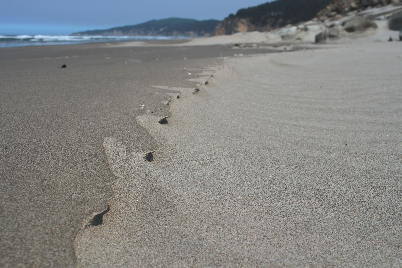
Sand art
This hike would be a tale of three beaches: Merchants, Agate, and Sacchi. Merchants and Agate Beach are basically the same strip of sand with Agate Beach kind of hanging around Threemile Creek and Merchants Beach hanging around Twomile Creek. An unnamed rocky point keeps Sacchi Beach pent up in its own little beachy corner of the Oregon coast.

Miniature wind hoodoos
Heading north to Agate Beach, it was several miles of a lonely strand of sand arcing towards a distant Cape Arago, with only gulls and sand crabs to keep me company. The wind had created miniature formations out of the numerous pebbles on the beach, from an ant's-eye view, they probably resembled hoodoos and balancing rocks. Occasional rocky cliffs sported interesting rock formations and one rock in particular resembled the fossilized skull of the Aztec god Mictlantecuhtli.

Eroded rock at Sacchi Beach
The tide was receding at the unnamed point, so there were no interesting wet-footed tales to tell: just a simple dry-footed stroll around barnacle encrusted rocks to secluded Sacchi Beach. After a mile of walking along the sand, the beach abruptly ended at a formidable cliff that delineated where Sacchi Beach ended and Cape Arago sort of started. The tide was way out, exposing some phantasmagorical rock formations. More dear to my heart, a sandy maze of a route through the rocks provided a way to explore further north along the shore, leading me to a secret cove.

The secret cove was a wild place
This is not the place to be in high tide and even though it was low tide, a wave rolled in and left me stranded atop a rock, waiting for the water to recede so I could safely leave the secret cove. While waiting, I availed myself of the opportunity to take pictures of the rocks, islands, and a notable amphitheater carved into a massive cliff by the waves. This little piece of Sacchi Beach was my favorite part of the hike.

Creepy ball of sand crab babies
On the way back, the tide had receded farther than a middle-aged man's hairline, exposing acres of beach glistening under the afternoon sun. The scenery was pretty and all, but this portion of the hike soon became all about the sand crabs. As waves ebbed, dozens of sand crabs emerged from the sand and scurried after the retreating water line before hurriedly burrowing back into the sand. Large balls of baby sand crabs rolled in the shallow water, creepily scattering hither and yon at my arrival.

Rock warts


At about the 5.6 mile mark, I had made it back to Twomile Creek and the picnic area at the Seven Devils Recreation Site, but I wasn't done yet. For more mileage, I walked to Fivemile Point and back. The sun was getting low and the restless sea glinted silver in the afternoon sunlight. Fivemile Point was totally exposed by the low tide and I was able to take photographs of concretions and eroded honeycomb formations on the rock.

My route 
From Fivemile Point, it was a lean-into-the-wind hike back to Seven Devils picnic area, as a flock of rather nonchalant and blase seagulls blithely watched me walk by. There was a critter track that ended abruptly in the wet sand, so I started digging to see what made the track. When some wiggling wormy creature from the depths started flipping around in my hand unexpectedly, I may have screamed a little.

Behold the fossilized skull of Mictlantecuhtli!
It was nice to spend at least one day this summer under semi-blue sky and I was a happy hiker on the drive home. Well, I was happy, until I reached Coquille and the smoky air. The Horse Prairie Fire was still burning and more smoke was being pumped into the Coquille River valley. Looks like I picked the wrong day to quit smoking!

Sacchi Beach rocks!
For more pictures of this hike, please visit the Flickr album.