Saturday, September 23, 2017

Floras Lake

Hiking with grandson Liam went like this:

Mile 1: Grandpa, I'm tired, can we stop now?

Mile 2: Now I'm tired AND hungry, can we go back pleeeeeze?

Mile 3: I want my mommy!

Mile 4: No more words, just lots of tears

Where there is water, there is Luna
Well, if truth be told, none of those things happened but I did mention (or threaten) to Liam that I would write in my blog that he cried the whole time. So, there it is, I kept my promise and put it in the blog, but now here's the real story about our hike in the Floras Lake area.


My peeps
Liam had relocated from Spokane, Washington to Grants Pass, Oregon a couple of summers ago, and while we see him fairly regularly, the sad fact remained that up until this hike, we had only talked about hiking together. Well, when you have a grandson that politely nags you vicariously through his mother, plans get made. And so it came to be that on a cool mid-September morning, Liam and I headed out to the Oregon coast for a moderate hike. Other strenuous routes had been considered, but in the end Liam decided to take it easy on me.

Open-mouthed joy


The other hiker in our little trail party was my dog, Luna. Hiking festivities commenced with a tiring trudge in the soft soils comprising the sandy shore of Floras Lake, but Luna wasted no time running at breakneck speed through the lake's water. It is impossible for anybody else to ever have as much fun hiking as Luna does. Liam and I did not run at breakneck speed, as our inadequate human legs were already feeling the sweet-hot muscle burn that comes with hiking in soft sand.

Spooky trail
Once the lake was left behind, the Oregon Coast Trail entered a deep dark forest comprised of gnarly trees that so resemble the spooky trees surrounding witches's houses in fairy tale books. Unlike Hansel and Gretel, though, we did not get lost in the forest. As an aside, Hansel and Gretel could have avoided a lot of witch-generated stress if they would have simply consulted their GPS on a more frequent basis.

Much of the hike was through beautiful forest
Not that it was a hot day or anything like that, but the forest was luxuriously shaded and the absence of light was eminently enjoyable. After several miles of this, the trail dropped down to a languid creek which required a long jump across, Luna being seemingly happier to simply wade through the still water. There used to be a wooden boardwalk spanning the knee-deep water but winter floods have since swept it downstream and it is probably a thousand pieces of kindling by now.

One of several view-stops
After leaving the creek, the path climbed up to the forested coastal bluffs and would remain there for the next mile or so. Periodic bushwhacks led to the cliff's edges with awesome views of the untamed Oregon coast being our ample reward. At one such viewpoint, a rock arch on a beach below provided a notable point of geologic interest.

Why we hike
There used to be a faint path through the scratchy coastal scrub to a particular overlook that provides my favorite view in all of Oregon. However, over the years, robust vegetation has overgrown the trail and the last time I hiked here, I led a group literally inching on our backs underneath all the thick growth. But today, coming in from the north, a faint path angled away from the main trail and we followed it to see where it went.

It's a Richard Hike!
It led, as all faint paths do here, to the edge of the cliffs. The good news though, was that it was low vegetation and grass all the way to my favorite viewpoint, about a quarter-mile away. A wade through knee-high salal was performed by the two humans while the dog contingent joyfully leapfrogged over all the scratchy and pokey growth.

A flock of seagulls
From the orange-colored bluff, the cliffs stretched for several miles to the north, while the coast arced beyond until it could be seen no more. Below, the surf seethed and churned, throwing itself onto the dark sandy beach in an endless succession of waves. A large flock of seagulls flew out over the ocean and "I Ran" (gratuitous 80's synthpop band Flock of Seagulls reference).

Imposing Battleship Bow
Immediately below and to the south of our cliff-top perch, waves crashed upon the rocky wall of Battleship Bow while a small waterfall splash-landed at the feet of the craggy point. Life is good when surrounded by such stupendous scenery, especially when properly spiced up by a jalapeƱo sandwich, although I noticed Liam's sandwich contained an appalling lack of jalapeƱos.

The side trails were faint and overgrown
After a nice long lunch 'n laze, it was time to pack up and bushwhack back to the trail. Upon our return to the languid creek, we opted to drop down an overgrown path to the beach. This beach is kind of on the wild side, with tall cliffs forcing hikers to have to hike near the water's edge on a narrow strip of sand. The shore slopes away rather steeply from the cliffs, which means the waves crash noisily upon the shore but do not run inland much at all. But it can be dangerous, though, slipping down the sandy slope will drop you down into an unforgiving ocean churn, and if waves roll up all the way to the cliffs, there is no place to run and hide. 


Imposing cliff, seen from beach level
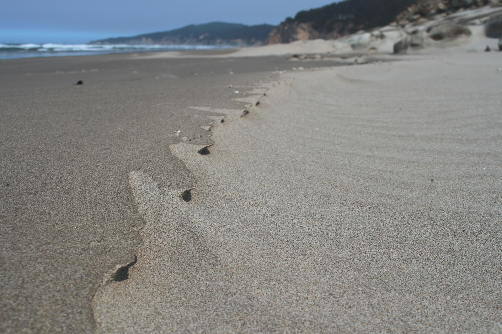
Naturally, our progress along the cliffs was painstaking and careful, we walked as close as we could to the the tall wall of orange rock. After a half-mile or so, the beach widened and all thoughts of mortal danger were left behind on the narrow beach. Piles of kelp, stranded by waning tides, littered the beach and resembled giant green spaghetti noodles on a sandy dinner plate. Continuing further along the beach, the cliffs became less and less imposing: either we were getting taller or they were getting shorter. I'm guessing it was the latter.  And just like that and without ceremony, the cliffs disappeared altogether underneath the sand, leaving a long sand-only beach stretching out into the distance under a blue sky.

Liam on the return, by way of Floras Lake
A short walk along Floras Lake finished off this hike while Luna ran mindlessly in the water all over again. I said nobody can enjoy a hike like Luna does, but I think Liam and I came close. We both agreed we will have to do this again, soon.


Zen moment
For more pictures of this hike, please visit the Flickr album.


Saturday, September 16, 2017

Dellenback Dunes (Hall Lake version)

My life is not complete until I purchase a shoulder-season sleeping bag with all of these features: 850-fill water-resistant goose down, 15-dernier ripstop nylon shell, variable baffle spacing locates, an insulated yoke to prevent heat loss at the shoulders, and an internal anti-snag zipper strip combine to prevent that awkward moment when your trap yourself inside your own sleeping bag. And that is just one little item on my very large list of stuff that I absolutely have to have.

Why we hike!
Unfortunately, reality butts heads with wants, like two rutting bighorn sheep crashing into each other on the high mountain ridge of I'm-Not-Working-Anymore. So, despite my best efforts to retire and stop working altogether, I find myself gainfully employed on a part-time basis because I have full-time needs. And despite my best efforts to live the remainder of my life as a reclusive hermit, I now find I must interact with co-workers too, darn it. And despite my best efforts to introduce my colleagues to the wonderful little avocation of hiking, my sofa-bound workmates politely decline my invitations. Until now, that is. Newly hired Jay has recently come to Roseburg by way of Massachusetts and India, and when he opined he wanted to go hiking with me, I happily seized the opportunity to take him on a hike before he actually read my blog.

An incoming fog bank was cause for concern
Normally, my go-to hike for newbies is the Rogue River Trail but the worst fire season ever was still smoking out southern Oregon, so it was off to the coast for cleaner and clearer air. Good news had arrived in the form of light rain during the week prior, and all of western Oregon rejoiced at the tamping down of the fires. However, there was no blue sky waiting for Jay and I at the John Dellenback Dunes Trailhead, just a bleak overcast of gray clouds. Still, that was better than the bleak overcast of dirty brown clouds of acrid smoke and ash that we had been contending with for the last six weeks.

Portal to Dellenback Dunes


The trail to the dunes is fairly civilized at the start, heading through coastal woods after crossing Eel Creek on a picturesque wooden bridge. This was mid-September, so the coastal huckleberries were in season and we partook as we walked through the damp woods. Eventually, the well-maintained path morphed into a sandy track and Jay was quite taken with the smooth red limbs of manzanita, as the unique shrub does not grow in Massachusetts or India, apparently.

Singing "The first hill is the steepest..."
Once the trail spit us out onto Dellenback Dunes proper, we quickly walked uphill in soft sand to the top of the "Great Dune". After admiring the view of the vast sandy expanse stretching out towards the ocean, we discussed our hiking options. The normal route is to hike on the "Great Dune" to the beach trail, follow the beach to Tenmile Creek, and then bushwhack back for an 8'ish mile loop. For a shorter distance, we could walk to the beach and back for a 6'ish mile and relatively easy hike. Then there was the wildly up and downer to Hall Lake. While short in mileage, this little hike is mighty in climbing up and down some rather large mountains of sand. Jay opted for the last route, so short and sweet our hike would be.

Jay finds out downhill in soft sand is better than uphill


As we dropped down the "Great Dune", I remarked to Jay this would be easy! But what goes down, must come up and we soon quit talking to each other as we struggled up a large sand alp, the soft sand making it hard to work our way up to the top.  Once at the dune summit, we again admired the views while waiting for our respiration rate to return to normal as our heaving lungs worked overtime to catch up. Only 4 more dunes to go!


Grubs live int the sand
While going up and down a successive series of giant sand dunes, I noticed small bug tracks weaving hither and yon on the sand. Once such track ended abruptly so I dropped to my knees and dug carefully around the end point. I was rewarded for my efforts when a grub rolled into my hands.  Mystery solved! I had always wondered creature had made those tracks.

Seed beetles were out for a hike, too
Another mystery was solved when I spotted a red-and-black seed beetle crawling on the sand. For years, I had observed a particular set of tracks that consisted of short little feet, like a centipede, with a tail-dragging mark in between. It always looked to me like a lizard track, except there are no lizards in these sand dunes. Well, turns out that tail-drag is the mark that a beetle butt makes when it's dragged through the sand. The next great mystery concerns why the beetle is out there in the first place, there's not much out there in the way of vegetation apart from beachgrass.

The dearly departed
One of the highlights of this route is the ghost forest atop the third dune we climbed over. At one point, there had been a thriving forest of trees growing here. My theory is that the sand encroached the trees and smothered the life out of them. At any rate, all that is left of the trees is a stand of ghostly white snags etched against the skyline. The sand is littered with tree parts and before long, the snags will crumble into little itty-bitty pieces and the ghost forest will be no more. The wind soughing through the trees imparted a forlorn air about the place. Jay and I walked reverently past the tree graveyard, paying utmost respect to the deceased.

Let's walk up that!
The fifth dune was the toughest one, seemingly more sandy wall than dune. We angled across the face of it because going up would never work. As it was, it was two steps up and one down and if you stopped to take a picture, admire the view, or simply rest, you were liable to lose all that hard-won elevation as the sand collapsed under your feet.

Hall Lake
Our reward for this dune, though, was a nice overlook of scenic Hall Lake, its dark waters half in the sandy dunes and the other half in densely wooded forest. As we had been walking we had noticed a large bank of clouds and fog  rolling in and just before we got to the lake, the fog arrived, carried in by a stout breeze. The temperature dropped and we put on some extra clothing as we shivered while eating lunch.

The fog paid a brief visit
We didn't tarry because of the chill breeze, so after lunch, we headed back to the crest of the large dune we had hiked in on. The wind was brisk but on the positive side, it blew that nasty fog bank all the way to Kansas, and it became a sunny day all of a sudden.


Free skin exfoliation at Dellenback Dunes
This particular dune was acutely defined on its crest and the wind was blowing sand over it, blurring the sharp lines of the dune. I had shorts on and my shins can painfully testify to the sandblasting properties of windblown sand. Once we dropped off the dune, we were sheltered from the wind and it became what legitimately could be called a warm day.


There were numerous little ponds in the dunes still
I was trying to get to the flats behind the deflation plain forest but it seemed no matter how much we angled towards the flats, deep canyons and brushy oases forced us away from the sandy flats. So, once we got out of that mess, we simply followed guide posts back to the "Great Dune". And from there, it was back to our car via the sandy track.


Boys will be boys
Before this hike, my boss had sent me a text message, warning me that I had better return Jay in the same relative condition I had found him in. So, I texted her back (after the hike) that Search-and-Rescue were optimistic they could find him before nightfall. But the truth of the matter is I didn't harm him, unless you count shoes full of sand as being harmful.


Tiger beetles were flitting all over the sands
For more pictures of this hike, please visit the Flickr album.


Friday, September 1, 2017

Sacchi Beach

I've never felt the need to smoke. In my view, there's just no appeal in burning a stinky weed in your mouth. The whole allure of smoking simply baffles me, I just don't get it. I try not to get too judgmental about those who do smoke because I have friends and family members who smoke and apart from that one fault, are generally pretty nice people. But I do think second-hand smoke is pretty rude because somebody else's smoking habit is being imposed on me against my will. So, imagine my discomfiture when in the month of August and early September, I had to unwillingly inhale unfiltered smoke all day and every day. I'll probably wind up with some lung disorder later on in life, directly attributable to the fire smoke that filled up the valleys of western Oregon in summer of 2017.

Mid-morning in Winston
Near Roseburg, we had the North Umpqua Forest Complex fires vaporizing thousands of acres of trees along the North Umpqua River. The complex included the Happy Dog Fire happily burning up the forest in the Boulder Creek Wilderness area. Bad doggie! Poor little Boulder Creek is like Lightning Central when the summer storms commence and can't even get a baby forest started due to the frequent fires in the area. Yet, despite the lack of live trees, the fires somehow still find plenty of fuel to burn.

Cough!
However, the North Umpqua Forest Complex was not alone and had plenty of flaming company: The Falcon Complex and High Cascade Complex fires managed to shut down the Rogue-Umpqua Divide Wilderness and the north and west sides of Crater Lake National Park. Further south was the Miller Complex, gloriously denuding the slopes of Red Buttes Wilderness and Grayback Mountain. Nearer to home, the Horse Prairie Fire chewed up the oft-burned Lower Cow Creek area near Riddle. But the star of the smoke show was the Chetco Bar Fire which at the time of this writing (September 19th) was rapidly approaching 200,000 acres of ashy terrain as its legacy. 

Our view, for six straight weeks
During late August and early September, the weather had been hot and dry, with little or no wind movement. So, the fires churned and burned and the resulting smoke filled up all the low-lying valleys. The smoke had no other place to go, yet the fires continued to pump more smoke into the already smoke-filled low areas to the point where the sun was not visible at all in the dirty brown sky. The vibe and atmosphere was apocalyptic and I'm going to start smoking whether I like it or not.

Twomile Creek, on a fine day a the coast
However, the weekend forecast did call for some relief at the coast with winds predicted to sweep the Chetco Bar Fire smoke and ash in a northeastern direction. The city of Bend was the lucky recipient of our smoke, but I was OK with that, even though Bend wasn't, as I headed out to the coast to see if blue sky was what I remembered it to be. On the drive over the Coast Range, the air near Coquille was nearly solid with fresh particulate matter that left parked cars coated with ash.

Agate Beach beckons
At Seven Devils State Recreation Site on the Oregon coast, there was some blue sky, although there was still plenty of smoke graying up the sky to the south with a noticeable layer of smoke hanging high over the ocean. Given the recent six-week long nastiness of the air quality (or lack, thereof), I'll take it. As I set out on Merchants Beach, a chill wind blew into my face, it was so good to feel air movement, too.

Sand art
This hike would be a tale of three beaches: Merchants, Agate, and Sacchi. Merchants and Agate Beach are basically the same strip of sand with Agate Beach kind of hanging around Threemile Creek and Merchants Beach hanging around Twomile Creek. An unnamed rocky point keeps Sacchi Beach pent up in its own little beachy corner of the Oregon coast.

Miniature wind hoodoos
Heading north to Agate Beach, it was several miles of a lonely strand of sand arcing towards a distant Cape Arago, with only gulls and sand crabs to keep me company. The wind had created miniature formations out of the numerous pebbles on the beach, from an ant's-eye view, they probably resembled hoodoos and balancing rocks. Occasional rocky cliffs sported interesting rock formations and one rock in particular resembled the fossilized skull of the Aztec god Mictlantecuhtli.

Eroded rock at Sacchi Beach
The tide was receding at the unnamed point, so there were no interesting wet-footed tales to tell: just a simple dry-footed stroll around barnacle encrusted rocks to secluded Sacchi Beach. After a mile of walking along the sand, the beach abruptly ended at a formidable cliff that delineated where Sacchi Beach ended and Cape Arago sort of started. The tide was way out, exposing some phantasmagorical rock formations. More dear to my heart, a sandy maze of a route through the rocks provided a way to explore further north along the shore, leading me to a secret cove.

The secret cove was a wild place
This is not the place to be in high tide and even though it was low tide, a wave rolled in and left me stranded atop a rock, waiting for the water to recede so I could safely leave the secret cove. While waiting, I availed myself of the opportunity to take pictures of the rocks, islands, and a notable amphitheater carved into a massive cliff by the waves. This little piece of Sacchi Beach was my favorite part of the hike.

Creepy ball of sand crab babies
On the way back, the tide had receded farther than a middle-aged man's hairline, exposing acres of beach glistening under the afternoon sun. The scenery was pretty and all, but this portion of the hike soon became all about the sand crabs. As waves ebbed, dozens of sand crabs emerged from the sand and scurried after the retreating water line before hurriedly burrowing back into the sand. Large balls of baby sand crabs rolled in the shallow water, creepily scattering hither and yon at my arrival.

Rock warts


At about the 5.6 mile mark, I had made it back to Twomile Creek and the picnic area at the Seven Devils Recreation Site, but I wasn't done yet. For more mileage, I walked to Fivemile Point and back. The sun was getting low and the restless sea glinted silver in the afternoon sunlight. Fivemile Point was totally exposed by the low tide and I was able to take photographs of concretions and eroded honeycomb formations on the rock.

My route 
From Fivemile Point, it was a lean-into-the-wind hike back to Seven Devils picnic area, as a flock of rather nonchalant and blase seagulls blithely watched me walk by. There was a critter track that ended abruptly in the wet sand, so I started digging to see what made the track. When some wiggling wormy creature from the depths started flipping around in my hand unexpectedly, I may have screamed a little.

Behold the fossilized skull of Mictlantecuhtli!
It was nice to spend at least one day this summer under semi-blue sky and I was a happy hiker on the drive home. Well, I was happy, until I reached Coquille and the smoky air. The Horse Prairie Fire was still burning and more smoke was being pumped into the Coquille River valley. Looks like I picked the wrong day to quit smoking!

Sacchi Beach rocks!
For more pictures of this hike, please visit the Flickr album.