Friday, July 29, 2016

Park Meadows (and Golden Lake)


Fire is nature's haircut for forests. A fire will take care of that unkempt shaggy look and the green hair coloring your daughter said would make you look cool. The destruction and regrowth of forests are all part of the circle of life and we hikers should be more understanding and accepting when our favorite hiking haunts disappear in a roiling column of ashy smoke rising up into a dirty brown smoke-filled sky. Hard to do, I know, but periodic wildfires are very much the natural order of things.

Golden tree trunk
I generally don't mind hiking in a burn zone (after the fire has been extinguished, of course), because a burn zone has a special kind of stark beauty all its own. True, there are acres of dead trees, their skeletal fingers raised to the sky in supplication and you can almost imagine them writhing with agony as the flames licked their trunks. Wow, that was an overly dramatic sentence! But life bursts forth on the forest floor, usually in the form of sun-loving vegetation such as groundsel, sedge grass, lupines, and fireweed. Jackhammering woodpeckers can be heard throughout the ghostly forest while bracket fungus consumes all the dead wood in much quieter fashion. And with the removal of that annoying clutter formerly known as "the forest", views are often wide and expansive.

Middle Sister, North Sister, and one beautiful tarn
There is a notable lack of shade in a dead forest, and I had ample cause to ruminate on all this during a recent hike in the Three Sisters Wilderness. The lack of shade is particularly accentuated when the temperature is close to 100 degrees and when the ruminator (me, in this instance) is toting a fully loaded backpack. It was oppressively hot and volcanic dust mixed with hiker sweat chafed in all those hard to reach places. Plus it was hot. Did I mention it was hot? If I didn't, then let it be known it was hot, hot, hot.

Swimming, anyone?


In 2012, the Pole Creek Fire burned most of the east side of the Three Sisters and I remember at the time not being too overly concerned about it. First of all, the forest on fire was that really dull lodgepole stuff and secondly, it was in a place where I normally don't go hiking, so who cares? Four years later, I did care, namely because it was a five mile slog in the burn zone in order to get to Park Meadows. And while I complain vociferously about the experience, pity the Three Sisters Loop hikers who have to hike two full days in that unpicked scab of a dead forest. 

Day 1

My view, for the next 5 miles
After a nearly 4 hour drive from Roseburg, I parked at a dusty trailhead well populated by dust-covered automobiles. Within 5 minutes, my car too was covered by dust. The trail was dusty and dust clouds erupted from beneath my boots with every step and within 10 yards, my shoes, legs, and the rest of my body were likewise covered in dust. Did I mention the trail was dusty?


Watch Richard melt into the volcanic ash
The trail was surrounded by a forest of ghostly snags but lupines were blooming profusely, bright purple spots in all the tan and black. At about the mile mark, which is where I decided I had become officially overheated, the trees faded out altogether and I lethargically slogged through a dry pumice barren like an ant on a hot sidewalk. North and South Sister loomed over the trees and visions of cool snowdrifts began to dance in my sun-cooked head.

Lewis' monkeyflower
The terrain was dry, dusty, and sere, and it was quite a surprise to have to cross a flowing creek of clear and pristine water. Snow Creek was quite cold but the water restored spirits and removed the dust from my skin. A pair of fallen logs made for a precarious hiker's bridge but I was not so lucky at Squaw Creek, where I simply waded through the shin-deep current. Each creek was flanked by banks of grass and magenta colored Lewis's monkeyflower.

It was a wet ford of Squaw Creek


Shortly after a three-way trail junction, a sign tacked to a tree announced this was where the Pole Creek Fire had stopped burning. The sign really wasn't all that necessary because there was a clear line of demarcation between sun beating hikers insensible, and the cool life-giving embrace of a shady forest. All I could do was sigh an appreciative "aaaaah...." as I entered the dark, as happy as a vampire closing the coffin lid at sunrise.


A paintbrush catches the light at Park Creek


Less than a mile later, the trail, without preamble, entered Park Meadows where I gave another heartfelt "aaaah...." The meadows were huge, about as big as Connecticut, and the jagged peak of Broken Top loomed over everything. Glaciers and large snow patches were draped over Broken Top's shoulders like a moth-eaten ermine stole. And two forks of Park Creek braided their way through the meadow while small fish darted in the amazingly clear water. 

Postcard view of Broken Top and Park Meadows
I set up camp next to the creek and immediately thereafter, soaked my feet in the alpine stream. I immediately took my feet out as the water was ice moving too fast to be frozen, turning my shins into a finely vibrating tuning fork of pain. It was like having a brain freeze in my shins! After the setting up chores were finished, I walked around the meadows for a bit, taking pictures of all the flowers in the grass and about a million pictures of Broken Top. I did find some hooded ladies' tresses, a small orchid that I had never seen before and the day ended with alpenglow turning Broken Hand (Broken Top's lesser neighbor) a brilliant orange color. I'm not sure why, but I felt a certain kinship with Broken Hand, maybe it was because of the name.

Day 2

South Sister started the day right
The hiking got off to an early start the next day, with several million of my mosquito friends also getting off to an early start. The relentless persecution by the school of insectile piranhas had me wishing for the mosquito-free burn zone. However, the reason for the early start was to beat the heat that had me not-wishing for a mosquito-free burn zone. Boy, am I conflicted!
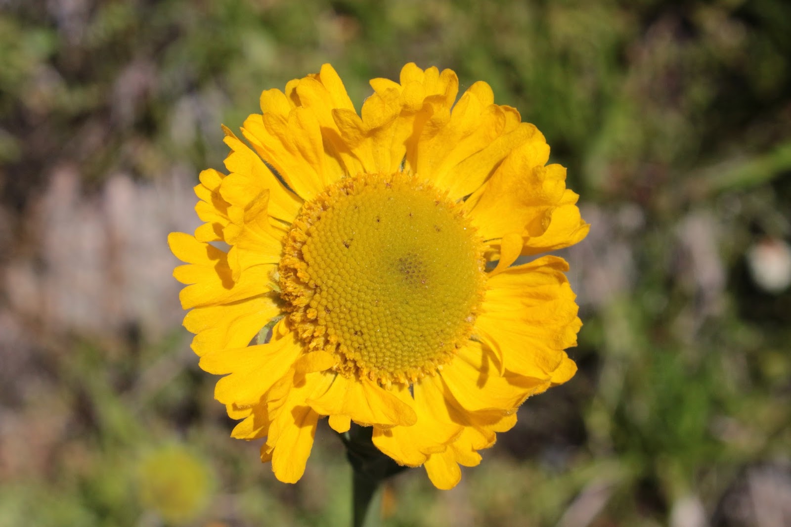
Golden Lake
At any rate, the day's itinerary was a short day hike to Golden Lake on the Green Lakes Trail. The path angled gently uphill, away from Park Meadows until a rock cairn signalled the jump -off point for those going to Golden Lake. The several guidebooks I had read had implied this would be a cross-country venture for hikers experienced with map and compass. However, the reality was that enough people have gone to visit the lake that a de facto trail has formed and was easily followable. 

Snow melt cascades down a rocky slope


Golden Lake sits almost at the base of Broken Top, like an adoring dog at the feet of the master. The small lake is surrounded by a huge meadow with small creeks draining the basin into Golden Lake. Not only was Broken Top eminently visible, but all Three Sisters impressed with their huge volcanic bulks flecked with snow. The lake's surface was mirrorlike and all four peaks reflected nicely from different vantage points on the lakeshore. On the east side of the lake, a small creek tumbled down a noisy series of cascades, eventually winding up in the lake.

Shadowmaker
There was a faint and sketchy path along the creek, it basically followed a steep slope alongside the flowing stream. As I climbed, large patches of snow began to appear alongside the creek. Eventually, the forest along the creek petered out altogether and the terrain became stark and rocky. The vegetation tended towards the alpine what with miniature lupines and paintbrush, partridge feet, and elephant's head louseworts comprising the multicolored rock gardens.

Let the oohing begin!
There were a number of small tarns in the rock basins and the sapphire blue water was simply stunning. Add to the mix the surrounding snow, rocks, blue sky, and volcanoes; and the scenery was beyond epic. And as the path gained elevation along the rocky ridge, Mount Jefferson, Mount Hood, and Mount Adams eventually showed up and joined the Sisters party.


On a clear day, you can see forever
I had joined up with a couple of fellows from Dundee who were also out exploring and all of us were suitably awestruck at the scenery. We had worked our way up a ridge ending at the base of Broken Top, startling a pine marten in the process. From up close, Broken Top was a rocky wall nearly blocking the noonday sun. At the base lay a series of glacial moraines and a rocky basin looking all the world like a moonscape. Perhaps this is where the fake lunar landing was filmed! Snow was melting in the heat and all manner of creeks trickled down into the valleys below. Central Oregon was prominently visible to the east and we picked out Fort Rock, which looked like a small brown pimple on the lava plains below. On the horizon, a layer of mist marked the path of the Columbia River.

The Green Lakes Trail
Bidding adieu to my new friends, I picked my way back down to Golden Lake and then returned to camp by way of the relatively civilized Green Lakes Trail. The rest of the afternoon was spent napping and reading, it's good to laze every now and then!


Day 3

Hot, hot, hot!
The next day I started early in an attempt to beat the heat waiting for me in the burn zone. It worked for a little bit but after an hour or so, it was hot all over again. I just lowered my head and methodically plugged along until like magic, the trailhead showed up. I think I forgot to appreciate the stark beauty of the burned forest all over again!


Park creek forms below Middle and North Sister
For more pictures of this hike, please visit the Flickr album.


Friday, July 22, 2016

Lowder Mountain

So Richard, where did you go hiking?

I said "Lowder! And why are you yelling at me?" Yeah, yeah, I know...weak pun but that's my tortured segue into a discussion about hiking on Lowder Mountain and I'm sticking to it.

Prince's pine
The night before, I had enjoyed some good music at Sam Bond's Garage, which is rapidly becoming a second home away from home now that I'm retired. So while the concert was pretty cool (even though it was Lowd), it made for a very late night by the time I drove back to Roseburg. And since late nights are not conducive to early morning risings, especially in my retirement years, it stood to reason that any hiking done the day after would have to be late in starting, and moderate in length and ambition. Ergo, I began my hike on Lowder Mountain at the shameful hour of 2:00PM, and why are you yelling at me?

Beautifully shaded trail
After just 5 yards of hiking, it was apparent that the main attraction (for the time being) would be the lush forest. Green vegetation and dark shade was the theme and the forest floor was carpeted with green leaves and delicate accents of foamflower sprays. Fragrant heart-shaped leaves of wild ginger hid the ugly brown flowers underneath, but I knew how to find them. Large clumps of pink woodland phlox and prince's pine were abloom on the forest floor and a profound hush permeated through the trees. Yes, I said hush, there was nary a mosquito whine to be heard and I almost missed the little buggers.

Vine maple provides green-colored ambiance
The trail climbed up through the forest in a series of switchbacks but the grade was fairly gentle. The map said I was walking above Quaking Aspen Swamp which I looked forward to exploring. However, the thick forest prevented access and vision thereof, no swamp or quaking aspen for me. But a dense canopy of vine-maple leaves colored the air green and kept the temperature mild; life was good on the trail despite the lack of quaking, aspens, or swamps. Periodically, the trail would enter open meadows clinging to the slopes of Lowder Mountain, where columbine, tiger lily, and coneflower bloomed the day away under a cobalt blue sky. 

Meadow on Lowder Mountain's slopes


As the trail gained elevation, the trend was toward less forest and more meadows. And with the meadows came views of the deep valleys of the South Fork McKenzie River, one of which contained Cougar Reservoir hiding below. One of the mountains on the other side of Cougar Reservoir is called Deathball Mountain and I would love to know the story behind that name! With a moniker like that, I should climb it and just make up the story of how it got its name. It would save me some tedious factual research!

Zen moment


In a grassy meadow, a worn down trail sign marked the intersection with the trail leading to Yankee Mountain and then down to Cougar Reservoir in a knee-taxing descent. I looked on the map and the trail either loses or gains elevation, depending which way you are hiking it. Either way, the elevation change is 3,300 feet in 1.9 miles: whew! With stats like that, that particular trail just got on my list for future hikes!


Just follow the cairns


Anyway, after the intersection, the Lowder Mountain Trail started to climb in earnest, leaving the meadows behind and entering anew a dark and shady forest. Again, switchbacks kept the grade manageable for the most part. Suddenly, the trail spit me out onto an unexpected pumice barren and my eyes squinted myopically in the bright sunlight. The trail became somewhat faint but there were a series of rock cairns to keep me on track.

The Three Sisters


Horsepasture Mountain across the East Fork
South Fork McKenzie River canyon

Karl and Ruth Lakes
Lowder Mountain doesn't seem like much of a mountain when you are hiking on it as the summit is as large and flat as an Arizona mesa. The trail really became hard to follow in the vegetation as it went around a rather large and sparse meadow ringed by trees. The meadow (and Lowder Mountain, too) abruptly ended at a very tall cliff and the view from that rocky perch is why we hike. The snowcapped peaks of Middle Sister and North Sister hugged each other in permanent sisterhood while South Sister stood by her aloof self . Beyond green and forested Horsepasture Mountain rose Mount Jefferson and a cloud bank on the distant Columbia River hid Mount Hood from view. In between were lesser peaks such as Three-Fingered Jack, Mount Washington, Belknap Crater and Broken Top. To the south, the tip of Diamond Peak was visible. And directly below, Karl and Ruth Lakes lay in a forested basin. A view for the ages, once again!

Thimbleberry was everywhere
As I left, another hiker emerged from a nearby viewpoint and I greeted him with a "I thought I had the mountain to myself!" He smiled and replied "Well, I was here first". He was Brian, from Eugene, and we happily talked trails on the way back from the mountain, making the miles go by quickly. When we reached the trailhead I asked him "What was the name of this mountain, again?"

Golden yarrow


"Lowder", he helpfully replied.

"What was the name of this mountain, again?"

He seemed to be such a nice guy too, but he did leave in a hurry for some reason. He didn't even say good-bye but that's OK, his actions spoke Lowder than words. 

Cow parsnip catches some afternoon light
For more pictures of this hike, please visit the Flickr album.

Saturday, July 16, 2016

Mount Ashland Meadows

One of our hiking buddies once commented that given the right mood and ambition, he might go on a Richard Hike. And under the same conditions he might go on a Ray Hike. But he would never, ever go on a Richard and Ray Hike! We took it as a compliment. Sadly, my Trail Brother Ray recently passed away and all I've been thinking about is the wonderful adventures we shared in such a short time. We've hiked not only in beautiful weather but have hiked, camped, and backpacked in rain, sleet, snow, ice, thunder, lightning, and gale-force winds. We hiked not only in our Umpqua National Forest but we also trekked in Washington and California, visiting many a remote wilderness area in the process. We slapped at mosquitoes and blackflies, danced away from rattlesnakes, and fought off marauding deer. We walked on beach sand, rocky trails, snow drifts, volcanic ash, and waded across many a creek or river. Sometimes we hiked where there were no trails at all.  And all the while, a steady dialogue of good natured insults were directed at each other. And of course, there was "The Ray", his signature pose where he raised his arms and hiking poles overhead, usually in triumph and glory atop a mountain summit. It seemed like every hike was epic and most certainly were memorable. 

Mount Ashland
When we did not hike with each other, we hiked where the other had not yet been. Upon returning home, the taunting began with "Guess where I went today?" emails going back and forth. It was a ritual of sorts where the tauntee would complain to the tauntor about tainting the trail for future use. Ray and I had talked about doing a weekend backpack trip on the Pacific Crest Trail from Mount Ashland Meadows to Wrangle Gap but for whatever reason, we never pulled it off. We also talked about hiking to Siskiyou Peak as a 12'ish mile out-and-back day hike. And one particular day I did do that very thing and got to taint the trail for Ray. Later on, he did the same hike and shared his pictures with me and even though I had already been, it still felt like a taunt and taint.

Trail marker on the Pacific Crest Trail
So, when the Friends of the Umpqua went hiking on the slopes of Mount Ashland, I went along not only for the magnificent hike, but also to reminisce and to mourn the loss of a good friend. The Pacific Crest Trail doesn't care about all that though, it just lays on the ground and lets people walk on it from Mexico to Canada or vise versa. The PCT thru-hikers usually hit Oregon late July and we encountered many thru-hikers who were easily distinguished by long beards, unshaven armpits, dirty clothing, and a certain air about them that lingered in the forest long after they passed by. And the men were just as bad!

Monkshood


From the paved Mount Ashland Road, the PCT headed through a beautifully shaded forest comprised of tall conifers of various ilk. At the outset, the route took us through several small meadows in a foretaste of the magnificent meadowy goodness yet to come. The meadows were buzzing with bees harvesting pollen from the flowers. The trail was fairly level with gently rolling ups and downs and I sure love a trail with no mosquitoes on it.


Sneezeweed
After a mile or so, the trail crossed a dirt road and contoured across a rather large meadow clinging to Mount Ashland itself. Hellebore (also known as corn lily) was putting on a show along with sneezeweed, orange agoseris, tiger lily, and mountain owl's clover. Mount Ashland's profile (with a white microwave dome thingy on it) was photogenically etched against a dark blue sky.


Grouse Gap, one of my favorite places
The trail did enter the dark forest again but the trend was towards more meadow and less forest to the point where it would be all meadow and no forest. Grouse Gap is the grassy bowl where the transition to meadow becomes complete. Numerous springs and creeklets ran across the trail and the vista of green  slopes and distant mountains and valleys was pretty awesome. The Siskiyou Mountains figuratively dropped away at our feet, providing nice views of the Shasta Valley with Mount Shasta lording its snow-capped peak over us lesser beings. 

Mount Ashland lupine
John, Edwin, and I said good-bye to the hiking club at Grouse Gap and performed a short bushwhack on a pumice barren back up to the PCT. The Mount Ashland lupine, a miniature lupine endemic to the area and found nowhere else, covered the slope in half-inch high mats of grayish leaves and purple flowers. We made sure not to step on the rare and endangered lupine as we hiked up but the grasshoppers apparently find the plant quite tasty and don't care about the rarity thereof.

The PCT climbs to the Siskiyous crest


From Grouse Gap, the trail charged up a rocky cliff that had snow patches under the trees. However, the slope was relatively short so the uphill agony was short-lived, plus it offered a nice view of Mount McLaughlin's tip. And always, Mount Ashland was eminently visible across Grouse Gap. The three of us thought we were hikers extraordinaire until a young lady passed us by, out for a casual 20+ mile trail run. After bidding her adieu, we old and decrepit hikers adjusted our canes and walkers and bravely continued on, at our aged snail's pace.


John and Edwin explore Peak 7079
We called it good at Peak 7079, which was just short of Siskiyou Peak but still a respectable 10+ mile hike. We scrambled up to the top which sounds impressive until you consider the summit was only about 10 feet higher than the trail. But hey, that's how old mountain climbers roll! The terrain here was sparse and treeless so from the relatively small peak, we enjoyed the ho-hum, rather usual stunning vista to Mount Shasta and the rest of California. The view to the south was new and it was Oregon too, so naturally it was more beautiful. 

The Siskiyous are calling me and I must go


Wagner Butte lay immediately to the south and we could trace our route on nearby Mount Ashland. Several other peaks on the crest of the Siskiyous loomed to the southwest, notably Siskiyou Peak, Big Red Mountain, and Observation Peak. And don't you know I want to backpack the Siskiyou Mountains crest one of these days. Music floated up from a nearby spring in form of tinkling cowbells on a herd of cattle grazing in the hellebore. 

The Ray
On the way back, the shadows lengthened in the forest and the meadows were bathed in the afternoon glow. I'd like to say that I put Ray to rest but that'll be a process that will take a lot longer than a mere 10 miles of trail. Let's just say he was sort of with me this day and wherever he is, he'll swear I tainted this particular section of the Pacific Crest Trail. Miss you, Trail Brother.

Cow parsnip
For more pictures of this hike, please visit the Flickr album.

Monday, July 4, 2016

Sutton Creek

"I'll go with you, but take it easy on me!" says Dollie. What is this? My brother David said the same thing several hikes ago. It's like this vast conspiracy to keep hikes short. And probably downhill too! Well, let it be known I've had enough and will no longer yield to the forces of trail oppression, it is time to stand up and shout to the heavens "We will hike 10 miles uphill and you will LIKE it!"  Yeah, you are all correct, I just bowed my head and meekly said "Yes, dear".

Coastal forest above the trail
Sutton Creek was chosen because it is easy (unless the trail is underwater like the last three times I've been there), on an easy to follow trail (unless you go cross-country and bushwhack like the last two times I've been there), and fairly short (unless you go through Baker Beach Dunes and loop back from the mouth of Sutton Creek, like the last time I was there). Sigh.


Heh, heh, heh
We started at Dune Lake, just off of Highway 101, and immediately headed uphill on a sandy track from the day use area at the lake. The trail was comprised of soft sand that taxed calf muscles and I silently laughed "heh heh heh" at Dollie as we hiked. A faint path took us on a steep climb on soft sand (tee hee, again) up to the Alder Dunes area.


Alder Dunes and me without a trail
Here the trees thinned out and the dunes were pretty much covered in beachgrass. From past experience, there is a faint path that would keep us on the north side of Sutton Creek which would then allow us to get to the beach without having to wade across Sutton Creek. However, I was unable to locate the path so I just faked it and acted like I knew exactly where we were going.


Typical scenery on this hike
So, straight across the dunes we go to the other side where we picked up the Alder Dunes Trail which took us into a thick forest with actual packed dirt for trail tread, darn it. The forest was wonderfully shaded and the mottled light kept a certain camera-toting hiker happy, despite the tame hiking conditions. 

Rhododendron, catching a few rays
Rhododendrons were no longer blooming, but their leaves caught the light nicely for the camera. Besides the tall rhodies, the forest sported a thick and impenetrable undergrowth of salal and coastal huckleberry. The vegetation hulked over the trail and it seemed like we hiked through an endless series of dark tunnels. I'm glad to report that despite the ominous appearance of the tunnels, no deer lay in wait for us innocents. 

Bridge over Sutton Creek
After several miles, the path crossed Sutton Creek on a stout footbridge. The creek flowed languidly in keeping with our hiking pace and the water was stained brown-red by tannin accumulation, or so I presume. For the remainder of the hike, the creek would flow within sight below the trail.


Sutton Creek, near the beach


We rejoined civilization when the trail spit us out into the paved Holman Vista parking lot. From there, a very short walk on a boardwalk provided a look down at the creek. It was much cooler to actually walk in soft sand down to the creek's edge. The forest ended here and a broad marshy plain lay behind the beach foredunes with Sea Lion Point rising above it all to the north. We deliberated about wading across the creek and walking to the beach but a chill wind blowing briskly dissuaded us of that notion. Plus, I was obligated to take it easy on a certain participant.

Shady trail
So back the way we went...well, not exactly. We stayed on trail this time, eschewing the cross-country walk across the dunes in an attempt to finish the hike quicker. Tongue tacos at Los Compadres Taqueria in Florence were calling me from across the sands and that's what I call "taking it easy", unless you consider the hot sauce.


"Come into my parlor" said the deer to the hikers
For more pictures of this hike, please visit the Flickr album.