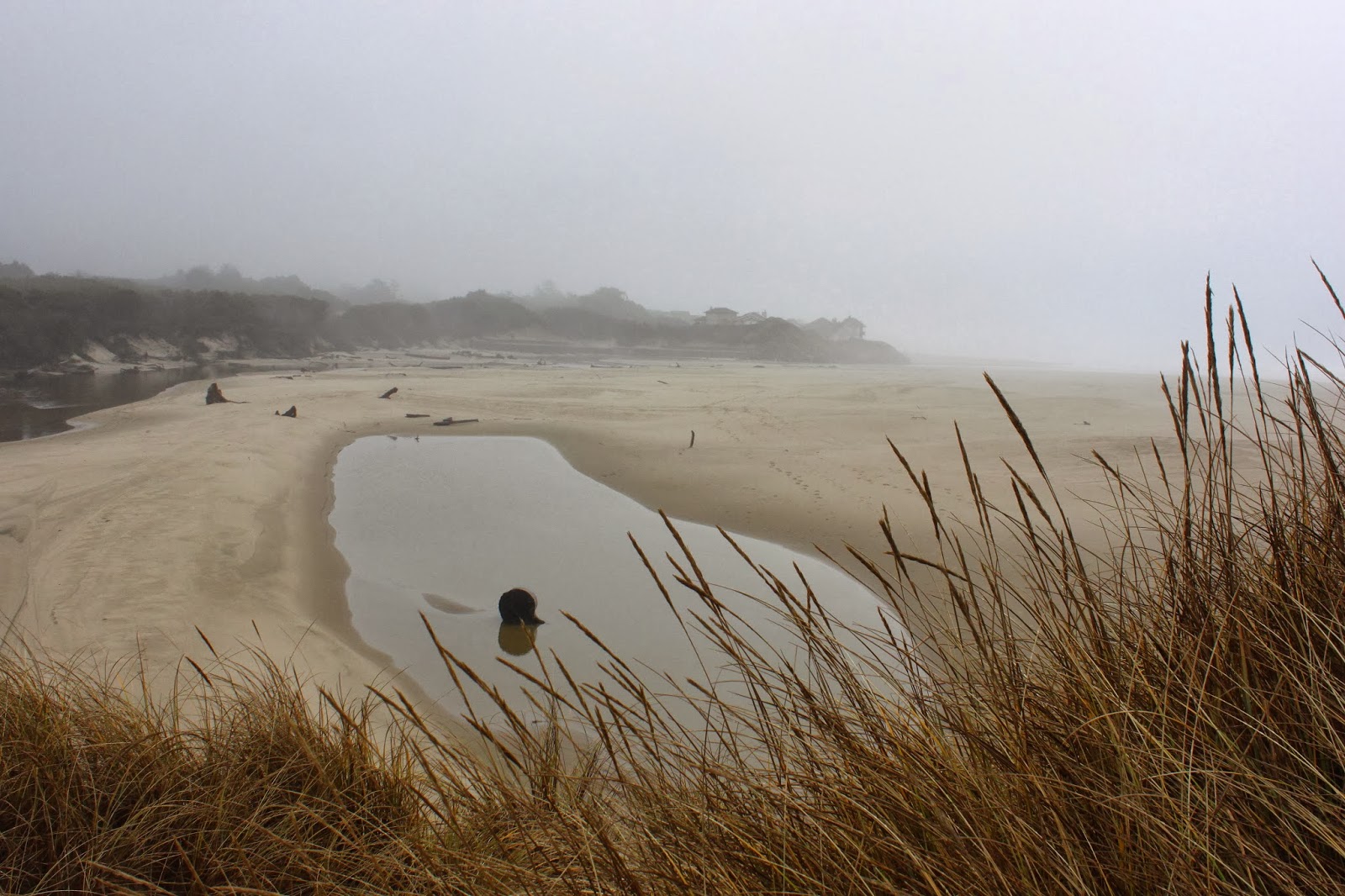
Showing posts with label sutton creek. Show all posts

Monday, July 4, 2016

Sutton Creek

"I'll go with you, but take it easy on me!" says Dollie. What is this? My brother David said the same thing several hikes ago. It's like this vast conspiracy to keep hikes short. And probably downhill too! Well, let it be known I've had enough and will no longer yield to the forces of trail oppression, it is time to stand up and shout to the heavens "We will hike 10 miles uphill and you will LIKE it!"  Yeah, you are all correct, I just bowed my head and meekly said "Yes, dear".

Coastal forest above the trail
Sutton Creek was chosen because it is easy (unless the trail is underwater like the last three times I've been there), on an easy to follow trail (unless you go cross-country and bushwhack like the last two times I've been there), and fairly short (unless you go through Baker Beach Dunes and loop back from the mouth of Sutton Creek, like the last time I was there). Sigh.


Heh, heh, heh
We started at Dune Lake, just off of Highway 101, and immediately headed uphill on a sandy track from the day use area at the lake. The trail was comprised of soft sand that taxed calf muscles and I silently laughed "heh heh heh" at Dollie as we hiked. A faint path took us on a steep climb on soft sand (tee hee, again) up to the Alder Dunes area.


Alder Dunes and me without a trail
Here the trees thinned out and the dunes were pretty much covered in beachgrass. From past experience, there is a faint path that would keep us on the north side of Sutton Creek which would then allow us to get to the beach without having to wade across Sutton Creek. However, I was unable to locate the path so I just faked it and acted like I knew exactly where we were going.


Typical scenery on this hike
So, straight across the dunes we go to the other side where we picked up the Alder Dunes Trail which took us into a thick forest with actual packed dirt for trail tread, darn it. The forest was wonderfully shaded and the mottled light kept a certain camera-toting hiker happy, despite the tame hiking conditions. 

Rhododendron, catching a few rays
Rhododendrons were no longer blooming, but their leaves caught the light nicely for the camera. Besides the tall rhodies, the forest sported a thick and impenetrable undergrowth of salal and coastal huckleberry. The vegetation hulked over the trail and it seemed like we hiked through an endless series of dark tunnels. I'm glad to report that despite the ominous appearance of the tunnels, no deer lay in wait for us innocents. 

Bridge over Sutton Creek
After several miles, the path crossed Sutton Creek on a stout footbridge. The creek flowed languidly in keeping with our hiking pace and the water was stained brown-red by tannin accumulation, or so I presume. For the remainder of the hike, the creek would flow within sight below the trail.


Sutton Creek, near the beach


We rejoined civilization when the trail spit us out into the paved Holman Vista parking lot. From there, a very short walk on a boardwalk provided a look down at the creek. It was much cooler to actually walk in soft sand down to the creek's edge. The forest ended here and a broad marshy plain lay behind the beach foredunes with Sea Lion Point rising above it all to the north. We deliberated about wading across the creek and walking to the beach but a chill wind blowing briskly dissuaded us of that notion. Plus, I was obligated to take it easy on a certain participant.

Shady trail
So back the way we went...well, not exactly. We stayed on trail this time, eschewing the cross-country walk across the dunes in an attempt to finish the hike quicker. Tongue tacos at Los Compadres Taqueria in Florence were calling me from across the sands and that's what I call "taking it easy", unless you consider the hot sauce.


"Come into my parlor" said the deer to the hikers
For more pictures of this hike, please visit the Flickr album.

Sunday, February 8, 2015

Baker Beach Dunes


It's like my grandmother always used to say "When life gives you lots of wind, make wind puppets". Well, to be honest, she probably actually never said that and besides which, I have no idea what a wind puppet is. But that's my segue and I'm sticking to it.

The (not so) aptly named Dry Lake


Originally, the plan called for a rainy day hike out at the coast, the route being a 10 mile loop within the Cape Mountain horse trail system just north of Florence. Unfortunately, the plan would wind up getting blown far and away by the wind. However, wind was not an issue at the start of the hike from the Dry Lake trailhead, although the predicted rain was coming down and Dry Lake was not very dry. As a matter of fact not much was dry at all, including your sodden blogster  It had been raining heavily all week and most of Oregon was dutifully alert, having been rightfully placed on flood watch.


Trail omen


A short uphill walk on a mossy and ferny trail through tangled trees brought me within sight of the crest of Cape Mountain. The walk also brought me within earshot too, as through the trees the wind shrieked annoyingly shrill like an ex-wife. On the crest, tall trees kept time to the wind's music by dancing the lambada, the mashed potato, or the funky chicken. In a clear generational divide, younger trees simply twerked. Several large branches lay strewn across the trail in clear warning to a certain lone hiker with a sounds-like-a-dare mentality.


Time to play in the sandbox


Since it takes just one solitary branch to ruin a good hike, I uncharacteristically did the right thing and turned back. So what's a dressed up incredibly handsome hiker to do? Well, right across Highway 101 from the Cape Mountain turnoff was Baker Beach Road and while I might get sandblasted by the wind, at least falling trees would not be a problem. And on the plus side, prolonged exposure to wind-driven sand might be just the thing for my acne.

Um...not today
You just have to be in the mood to hike on the beach in a wind and rain storm and on this day I wasn't. So, I instead grabbed the trail that headed towards the dunes and within 100 yards it was time to make a decision at a Y-intersection. The left fork headed slightly uphill on a sandy track to Alder Lake and the right fork was under several feet of water.  Hmmm....so many tempting and difficult decisions at the start of a hike. Uncharacteristically again, I opted for the drier and tamer left fork.

Sand art


The dunes were somewhat sheltered behind the tall beach foredunes at Baker Beach, so the wind wasn't too bad and the rain also eased up a bit. I dropped off the path to Alder Lake and stepped out onto the sandy expanse of the dunes. The wind had been busy making art by fingerpainting on a large sandy canvas, leaving dunes decorated and patterned with all manner of swirls, curls, and whirls. It seemed downright sacrilegious to defile the artwork with my footprints so I generally stayed close to the forested edge of the dunes in the hiking equivalent of coloring inside the lines.

Wet spot
Because of the rain, the sand was wet and generally windproof. The lighter grains of sand were driven by the wind but mostly stayed below knee level except for when cresting a dune, at which point my poor face received the stinging brunt of the sand-laden breeze. Below my impromptu route, small lakes and large marshes discouraged cross-dune hiking to the beach. 

Please do not feed the alligators!
Life is tenuous here, and several stands of dead and half-buried trees testified to the terrible cost of war between sand and forest. But life is yin to death's yang and several patches of mushrooms surprisingly thrived in solid sand below the dead trees. The eastern edge of the dunes was bordered by a large unnamed lake surrounded by an abundance of fetid seeps containing black water, each lacking an alligator or two for a proper swamp effect. 

After the Jupiterian death ray
The sands here were different than my more usual sandy haunts (like Dellenback Dunes) in that the lighter and blacker grains of sand pooled around the many dimples on the dune surface, giving the dunes an odd singed look as if the terrain had been blasted by a Jupiterian death ray. If so, then the deer still survived.

The Three Sisters (of the dunes)
After a couple of miles, the southern terminus of the dunes was reached and there was no more walking south. The dunes here ended rather abruptly, overlooking a tangled mess of alder and conifer trees. A nice view of the forested depression of the Sutton Creek drainage was had from the sandy rim. Despite all the trees below me, I just knew there was nothing but standing water underneath the forest canopy, and I base that surmise on past hiking experiences in the Sutton Creek area.

Mushrooms in sand
After eating lunch while rain pitter-pattered on my hat brim, I explored several small fingers of sand dunes before finally running out of sand to walk on. Coming out of the forest onto the dunes was a well-used sandy path that was the trail connecting Sutton Creek to Baker Beach. Remember the right fork submerged under several feet of water?  I did, so I stayed in the dunes, saving the path for a substantially more dry-footed hike in summer.

Oasis in the desert
Bisecting the Baker Beach dunes was a large marsh and on the return leg I went left around the marsh instead of right. Well, right was right and left was wrong in this case as I found myself wading through thicker and thicker brush, my only reward being a wade through deep water if I so chose. So a backtrack was enacted and the correct route around the marsh was taken. 

As the weather turned bad
The weather became decidedly belligerent about 15 minutes away from the trailhead. It was near tornadic conditions as the wind picked up in intensity, the raindrops became fatter and wetter, lightning flashed overhead, and loud booms of thunder spurred a certain lone hiker to hike back to the car spastically fast like a wind puppet.

Test pattern
For more pictures of this hike, please visit the Flickr album.


Saturday, January 18, 2014

Baker Beach


This hike had a couple of little ironies.  First, Lois got a speeding ticket in her haste to begin an activity that takes place at a leisurely 2 miles an hour. The other ironic moment occurred when I stepped in a sinkhole while wading through a marsh, making me the only hiker out of the 21 attendees that experienced a true Richard Hike experience.

What happens when I Google Earth late at night
The genesis for this hike came late one night when perusing Google Earth. Looking at the Alder Dunes area, a faint footpath led from dune to dune, seemingly going all the way to the Baker Beach area. So, a mid-week exploratory scouting trip was penciled in, starting at Dune Lake.

Alder Dunes view
From little Dune Lake, the sandy footpath followed a series of small dunes collectively known as Alder Dunes. On the right side of the trail, the dunes sloped up to where presumably one could have views of lakes Alder, Mussel, and Nott.  Of course, that would involve gaining about 100 feet in steep and soft sand, it was more comfy to stay on the path.

Hiking on what amounts to a game trail


On the satellite photos, the trail passed through seven dunes but it seemed more like four from actual ground level. The trail was always visible but the problem is that the trail braided with other trails and more than once I mentally flipped a coin to decide whether to take the right or left fork. It was more confusing than the federal tax code. I don't think there really was a wrong way or a right way to get from Dune Lake to Baker Beach Campground, but there sure were a bunch of different ways to get there.

Odd little sand formation
Once at Baker Beach Campground, the GPS said I'd been wandering aimlessly in the forest and dunes for a mere 2.8 miles.  Clearly, more miles were required so I added several trail loops that visited Lilly Lake, Berry Creek, Baker Beach, and a massive sand dune that went on for miles; altogether it wound up being a 7.3 mile hike, all of it in soft sand.  My soft sand muscles were softer than the soft sand and this hike felt a lot longer and I was now ready to inflict the same amount of pain on my friends.

Nobody got lost and I like that
Last time I led a Friends of the Umpqua hike, only three friends showed up. Given that backstory, it was shocking to set out on the trail with 20 friends (and one dog) in tow, uttering a silent prayer to the hiking gods to help me arrive with 20 friends (and one dog) at the trailhead at the end of the hike. We cut down our chances of misplacing anybody by using the buddy system and stopping at all trail junctions.

Lake that is small and dry, just like me
In spite of those precautions, Edwin (who was at the front while I manned the rear) managed to lead us in a different direction from my scouting trip and we ended up at a small lake abutting the dunes. No worries, I had been on top of the dune looking down on the lake so we hiked uphill on a sandy path and resumed the proper route.

Reflection at Berry Creek


On the Lilly Lake route (where you really can't get a good look at the lake) we continued on to the banks of Berry Creek.  I walked down to the creek and instructed everyone to put on their wading shoes. Alternatively, I heard cursing, crying, and whining with the phrase "...it's a Richard Hike.." sprinkled liberally throughout. Great fun, and I let them know they'd been pranked and then I heard cursing, crying, and whining with the phrase "...it's a Richard Hike.." sprinkled liberally throughout.

Lunch time at Berry Creek
We ate lunch at Berry Creek, enjoying the sun while shivering in the cold ocean breeze. The canine portion of our group enjoyed swimming in the creek and retrieving large sticks. After lunch we closed the loop where no hikers took the offered option of heading back for a shorter hike.


Sandy cliff at Berry Creek
So, all 20 companions (plus one dog and one hike leader) went to the beach where several members took off shoes and went for a wade in the ocean while the rest of us shivered in the cold ocean breeze. One wave caught John but he seemed to enjoy being wet and cold, to judge from the grin on his face.


Let's hike through the marshes!
We made a short loop by hiking along the mouth of Berry Creek and then bushwhacking through the dunes and marshes to return to the trail. The marshy portion was short and feet got wet briefly.  So, while everybody continued on back to the campground, I backtracked to retrieve John and his wading crew as they had tarried when they put on their shoes after their ocean wade.

Hikers, walking past a hidden sinkhole
Not wanting to get my feet wet again, I took a loop around the edge of the marsh where it looked like it would be drier.  Looks can be so deceiving. I was shocked when my foot sunk into the grass, and sunk and sunk and sunk. I briefly wondered if I was going to wind up in China before I struck solid ground with the cold marsh water nearly up to my neck. Thrashing wildly, I grabbed on to some branches and hauled my now very wet carcass out of the diabolically disguised sinkhole I had stepped into.

Shadows in the late afternoon
It was a chilly walk through the forest after that and I took no more pictures as unfortunately, the camera had gone swimming with me. Concentrating on keeping a brisk pace to keep warm, the two miles back to Dune Lake seemed to go fairly quickly. I'm glad to report, no hikers (dog or human) were left behind, and we all had a great time, unintended swimming sessions and speeding tickets notwithstanding. On the way back, our car passed Lois who was plodding along exactly at the speed limit. It seems she has a newly found religion about obeying speed limits following her morning encounter with the police.  Oh, the irony!

Lichen
For more pictures of the two Baker Beach hikes, see the Flickr album.


Saturday, December 21, 2013

Sutton Creek (club hike)

A week before, I had hiked in the Sutton Creek area and the weather had been sunny but cold. A week later, it was warmer but wetter. And where I had traipsed through the dunes and marshes by myself with only the voices in my head for company, this time I was leading a Friends of the Umpqua Hiking Club venture. My group consisted of Edwin, John, and Lindsay, apparently my only 3 friends left in the world. But that's OK, because in spite of the poor weather and wet trail conditions this wound up being a superlative hike, one of the best I've taken this year.

Splish-splash, I'm taking a bath
I'm not going to rehash the blow-by-blow trail narrative because that's all in my previous blog post. Suffice to say, the boys were impressed by the two feet of water covering the trail as we left the dunes. Lindsay opted for sandals, John and I abused our boots, and Edwin opted for plastic bags over the shoes. Three out of four is a passing grade with Edwin's plastic bag rig working as well as suntan lotion in a snowstorm. It was a spectacular failure that provided great jocularity among us onlookers.

John wants to kill the hike leader


My own personal observation from one week to the next was that the water was deeper and colder.  There was plenty of opportunity to ponder the quality and quantity of water as it was about a half-mile of splashing through the water standing on the badly overgrown trail.  At some point, all you can do is laugh and it was all giggles as we made our way to the sandy banks of Sutton Creek under gray sky.

There's the beach...sort of


Up to the top of the beach foredunes we went where last week a spectacular overlook of the ocean was enjoyed. On this day, however, clouds partially occluded the views and the promised view was underwhelming. Oh well, it was on to a resigned beach walk in a light drizzle where the beach was littered with sand dollars and slimy bits of jellyfish.

Sutton Creek
The mouth of Sutton Creek was wide as the creek apparently goes on periodic rampages there. On this day, it approached the ocean in a series of S-curves and there were all manner of tidal flats, lagoons, and brackish ponds near the mouth. In the middle of the mouth was a dune island, cut off from the rest of the dunes when Sutton Creek's mouth had migrated south about a mile. The island was  a logical lunch spot with an overlook of  the creek's spectacular egress to the ocean.

...and then the rains came
Of course, the very second we sat down the rain started and we ate soggy sandwiches that had not been soggy a minute before. Black clouds floated in and it looked like a prolonged soak was in the offing so lunch was eaten quickly and hiking resumed in equally quick fashion. For variety's sake, our return route to return was a bushwhack along Sutton Creek instead of backtracking by way of the beach.

Marshy grassland next to Sutton Creek
Actually, it wasn't too bad hiking along the creek, most of the walk back took place through knee-high grass on the marshy banks.  At one point, we had to beat our way through a willow thicket before the flat bank disappeared into a massive sand dune.


Slippin' and slidin'
On the contour around the sand dune, our feet paddled frantically to prevent sliding down into the creek below.  John cheated and hiked up and over the dune; sensible, to be sure, but not nearly as much fun.  Around that point, the cloud cover broke, the sun shone it's wonderful sunny shiny goodness upon us as a marvelous rainbow arced majestically overhead.  That's why we hike and we were absolutely grateful for the fantastic scenery.

Why we hike
When I got home, some of my Friends in the hiking club expressed their good fortune in missing this hike because the only thing they heard was "wet feet". This hike was so much more than cold water in the boots and we know we were the lucky ones.


Waterlogged
For more pictures, see the Flickr album.


Wednesday, December 11, 2013

Sutton Creek (all by myself)


Anyone who experienced the week that was the Oregon Tasty-Freeze will know that winter has come to visit, about as welcome as a fart in a crowded elevator. Who'd a thunk 32 degrees would be the new warm? After a sunny (but not warm) stretch last week, it finally got so the roads were mostly clear of ice so it was time to brave the elements and go hiking.

This was the nice part of the drive!
Oops. Turned out Roseburg was in its own little bubble of warmth (in the 30's) and once out of town, everything was still frosty and icy.  Nice to look at but it was a pretty tense car-ski trip up and over the coastal range on my way to Florence.  The trip took way longer than normal (40 miles per hour top speed will do that) but at least the temperature was 41 degrees at Dune Lake which, in these wintry times, was almost tropical.

Crossing a small dune area
I'm leading an upcoming Friends of the Umpqua hike in the Sutton Creek area and was looking for a way to jazz the hike up a bit. The trail is only about 5'ish miles long and is even paved in places. It's nice but tame and the very antithesis of a Richard Hike. A mid-week exploration was called for in a search for a route around Sutton Creek's pronounced bend south of Baker Beach.  The problem is that there are no trails in that area and that sounded pretty much like a dare and a good reason to try it.

Wind patterns
After a half mile walk on the official trail from Dune Lake to Sutton Creek, I hung a right on a sketchy path through tangled woods and climbed up a short but steep sandy wall; the hike was on at that point. The path had spit me out onto a small dune area and a faint footpath headed straight across the sands.


Snow in the dunes ??!!


The beachgrass has really taken over the small dunes in this area with a young forest seriously encroaching at the edges. The dunes will fade in time, like a maple leaf decaying on a fern frond; it's a shame but that's what happens when mankind imports invasive species. The sun was out but snow from the prior week's storms lay across the path in the shady parts. Strange to see snow in the sand dunes, it's kind of like seeing polar bears in the Sahara.

Hey, I felt that!
The problem foreseen from a midnight satellite photo research session was the dark forest between the two sand dune areas on the intended route. However, at ground level a sketchy trail led through the forest with the only travail of note being the encroaching gorse on the trail. The spiny thorns on the hardy gorse made me well aware of it's invasive presence.

It's a Richard Hike!


The path petered out in the second dune but by following the edge of the dune and forest, a muddy trail was found leading into the marshlands. Unfortunately, my feet sank deep into the mud despite the hard ice on top. While retreating to the dune, the mud and I wrestled for possession of my boots with the mud making loud sucking noises like my brother nursing his Budweiser bottle. It was close but the boots stayed on my feet as they should.

Trail through the pervasive standing water
Another trail leading off the dunes was found and I was back in business, at least until a large pool of swampy bilge water about two feet deep covered the trail.  However, it looked like someone had laid some branches across and the water contributed more branches, mud, and other assorted debris until it formed a dam of sorts.  I stepped tentatively on the dam and promptly sunk all the way into the water with cold swamp liquid pouring into my boots.  At that point, it's "oh, well" and full splashy speed ahead, no sense trying to keep wet feet dry.

Sutton Creek
The next half mile or so on a badly overgrown path was a water wade and my boots were grateful when we traded forest and marsh for sand and sun. The trail (I had joined up with the Baker Beach Trail, unbeknownst to me) followed copper colored Sutton Creek, running deep and fast as it snaked through the grassy marshes behind the beach foredunes. At my arrival, the creek exploded in furious feathered panic as a flock of ducks fled the scary hiker.  

I had the whole place to myself
A short walk up some really tall foredunes gave me a delicious view of an empty beach on a beautiful winter day. It was low, low, low, low, low tide and entire cities could fit on the sandy acreage exposed by the retreating ocean. My only company was the occasional gull flying by on an urgent gull errand.


Bird tracks


There was a large break in the dunes leading to the presumption that the dunes had been bulldozed in an attempt to help the endangered snowy plover survive. Wrong! Actually, it was the former site of Sutton Creek's mouth which evidently had migrated another mile south, this little factoid discovered when perusing maps post-hike.


Hiking as the sun set
I could see the blue ribbon of the creek but did not walk all the way there. Remember the long trip to the coast? There were two hours of daylight left and that was just about enough time to get back to the car before the sun set. Walking back in the dark without proper trails would have been as welcome as a spider at an arachnophobe convention and not nearly as much fun.

One of the few dry things found on this hike
One last note:  That elevator fart was not my doing. Just for the record, I was unjustly accused.  And for the rest of the pictures, please visit the Flickr album.