

Because Facebook knows everything about me, on my feed I received a blurb about a coastal birding club (it may have been the Audubon Society) going on a short 2.5 mile nature walk around Lola Lake, located somewhere on the coast near Pistol River. They may have even called it a hike. Anyway, I'm all like "Birds? Meh!" followed by "NEW TRAIL!!!" After a short investigatory consult with the Internet, I ascertained that it was possible to reach the beach from Lola Lake, and thereby accrue a more proper hike mileage by walking north to the mouth of the Pistol River. At that point, I was all in.
 |
| You need to keep an eye out for this guy to find the trailhead |
The trailhead was not that easy to find, and I initially drove past without realizing it. Coming back the other way, though, a post with a blue Oregon Coast Trail marker affixed to it was clearly visible by the side of the roadway and in short order, I found myself hurriedly lacing up my boots at the trailhead, eager to get started.
 |
| A well-maintained path wanders through the forest |
The Oregon Coast Trail quickly left the busy highway behind, dipping into a typical lush and shady coastal forest. My initial impression was how nicely maintained the trail was. The brush had been cut back from the trail, there were no fallen trees to step over, and clearly legible and informative signs were posted at every intersection. I'm so not used to this!
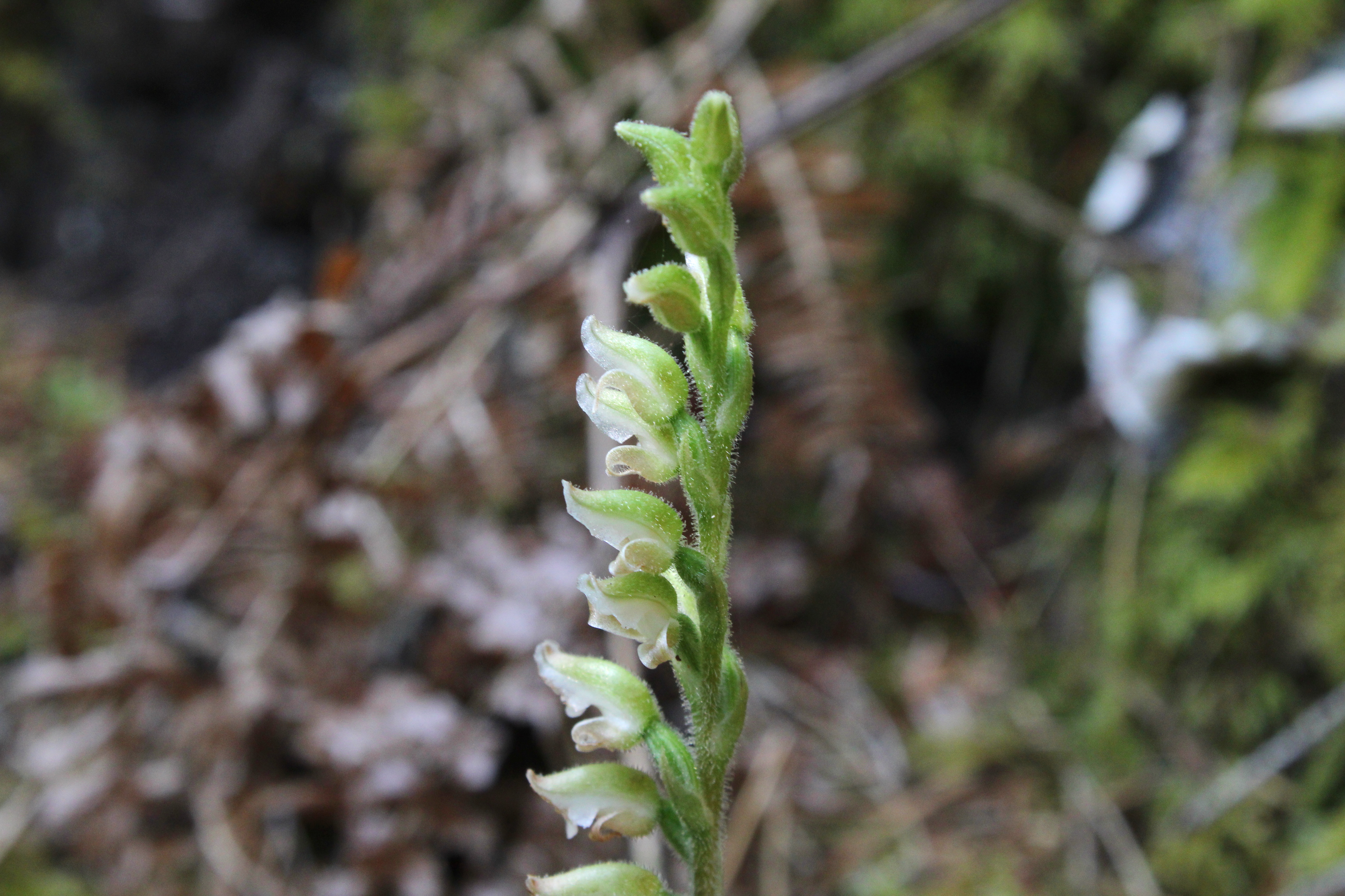 |
| Wintergreen was clearly in blooming season |
The first intersection offered the choice of hiking to the beach or looping around Lola Lake. Since I'd never been, Lola Lake it was. The forest on the loop trail was heavily mossed and a healthy population of ankle-high wintergreen was busy flowering on the forest floor, enthusiastically hoisting aloft stalks of white flowers like so many football fans waving their pennants. Mushrooms, ferns, and moss likewise abounded, feasting on the decaying biomass so prevalent in a coastal forest.
 |
| Lola Lake in all its grassy glory |
If Lola Lake were to be the sole reason for this hike, then I'd be bitterly disappointed. The lake had dried up and gone to meadow. Presumably, the lake is actually a lake when the spring rains fall but this late in summer, there wasn't any water. That wasn't a deal-breaker though, for the erstwhile lake still was a nice meadow and there's no complaining when you hike to a brand new place anyway.
 |
| The trail begins to transition from woods to dunes |
After executing the lake loop, it was then a right turn onto the beach trail which continued the wander through dense coastal woods. Eventually though, the dirt path became a sandy track and the trees thinned out, giving way to beachgrass and dunes. Common yarrow and pearly everlasting were in bloom among the omnipresent beachgrass, the wildflowers busily entertaining bees, butterflies, small wasps, and incredibly handsome hikers-cum-photographers.
 |
| View to distant Cape Sebastian |
Odd and totally out of place amid the sand and beachgrass was a large castle-like rock formation. The rock was adorned with striations and layers of tan and ocher hues and tints. A short scramble to the tip of the rock yielded a view to distant Cape Sebastian so I had to stop for a bit and do some photography before continuing on.
 |
| Sand Creek snakes across the sand |
The trail reached the beach just north of Crook Point, whose rocks and islands are an effective deterrent to hiking further south via beach. Sand Creek snaked out of the grassy dunes to sassily sashay across the beach to become one with the ocean. The surf crashing onto the craggy rocks of the scenic point entertained and to the north, stretched a long beach with Cape Sebastian looming many miles beyond.
 |
| View to the north |
I never made it to Pistol River like I had intended. Unfortunately, the wind could be best characterized as belligerent, bellicose, and brawly. I'd venture to guess that I was getting cuffed about by a steady 40 miles-per-hour blow. The stiff breeze peeled spindrifts off the incoming waves and I felt fortunate it was blowing at my back. However, at some point on the return, I'd be hiking into it, my incredibly handsome face bearing the brunt of the wind-driven sand. The question was whether I wanted to endure Mother Nature's free dermabrasion and exfoliation treatment for 2.5 miles, 1 mile, or some distance in between. I eventually chose to turn around after a mere mile of beach walking.
 |
| An incoming wave wants to eat me |
As anticipated, it was a stinging and bracing walk back to Crook Point with eyes all teary, but on the plus side, I don't have acne anymore if only because you can't have acne without having facial skin. Needless to say, it was much appreciated when the trail left the beach and entered the sheltering woods.
 |
| Low growing fleabane prettified the sand dunes |
I really didn't any pay attention to any birds on his hike. In fact, I'm not even sure there were any birds for me to pay attention to. However, I'm nonetheless grateful to the birds for exciting the birding crowd to the point they put on the hike I had mentioned earlier. My first visit to this particular section of the Oregon coast would not have happened without the birds and birders. Happy squawks, chirps, and keening cries to all concerned.
 |
| Islands near Crook Point |
For more photos of this hike, please visit the Flickr album.


