Showing posts with label Roseburg. Show all posts

Saturday, May 14, 2022

North Bank Habitat (Best Hike Ever!)


In what was definitely not truth in advertising, this hike was dubbed the Best Hike Ever. Back on New Year's Day, Brad, our hike leader, had led a North Bank hike  that will forever live in club lore as The Worst Hike Ever because of formidably steep trails. Flash forward a few more months to the present and now we were going to do the same route, but this time in reverse, exchanging the incredibly steep Powerline Road for the incredibly steep East Boundary Road. Because this hike was the opposite of the Worst Hike Ever, it acquired the rather Orwellian title of Best Hike Ever.

Rheo commences the Best Hike Ever

The hike began with an easy amble down the Habitat's entrance road and we gaily skipped along, a song in our hearts, if not on our lips. We made a left turn onto the trail and all happy songs immediately died in mid-trill, supplanted instead by a chorus of horrified shrieks sounding like so many Aztec death whistles. In front of us, looming like a grassy Great Wall of China (but way taller) was the East Boundary Road, seemingly rising straight up to Mars or beyond. Yikes, legs quivered and ached before we even began the dismal trudgery of hiking The Best Freaking Hike Never.

Photo of the trail, taken while I was not resting

About halfway up the first major slog, I think my calves began to cramp up, followed in short order by hamstring pulls, respiratory distress, hives, and maybe dilated pupils. Whew, this was hard work and I did lots of photography because I was NOT resting, no matter how much it may have looked like I might have been. 

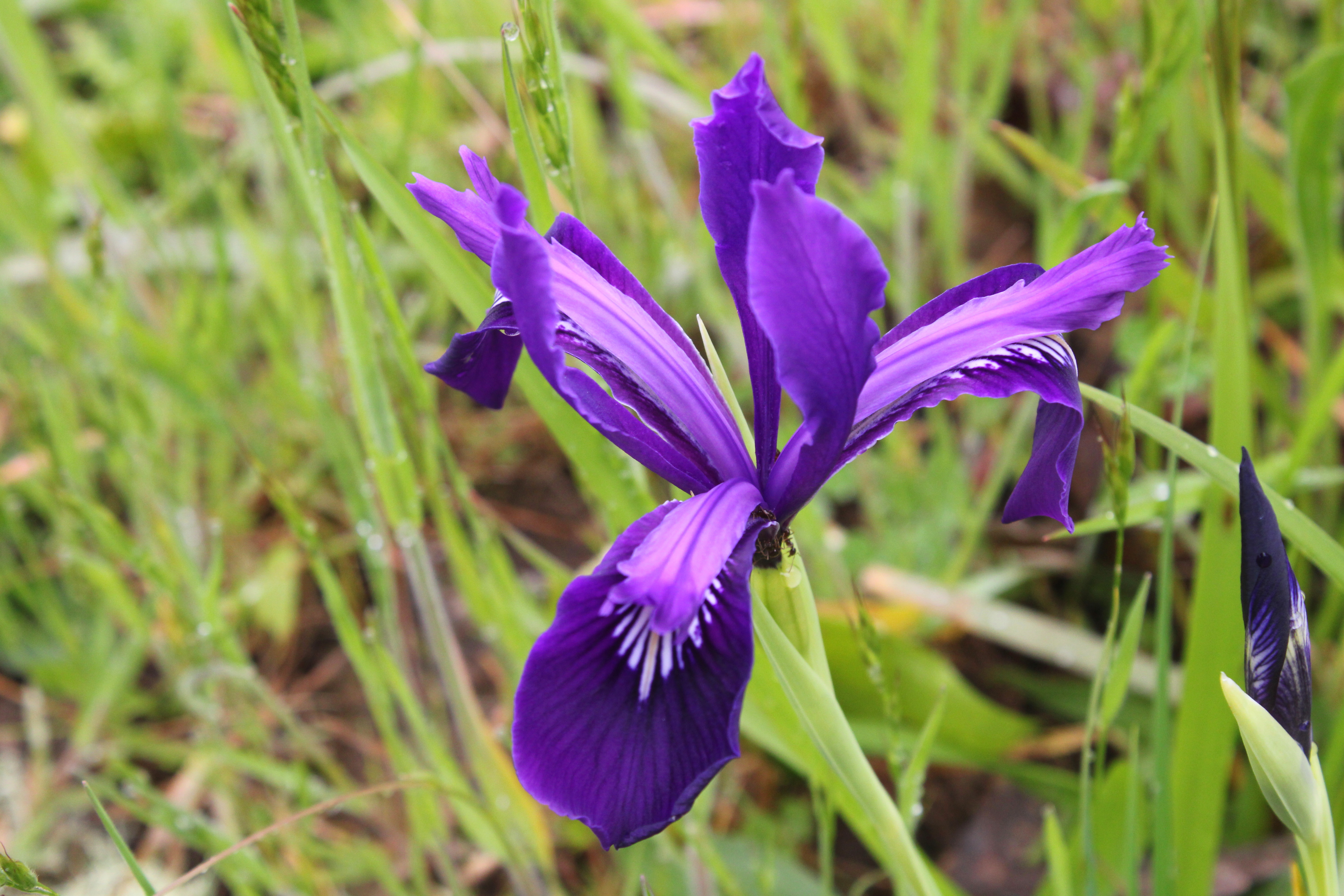
Douglas' iris decorated the grassy slopes

But if you are going to flame out on your Last Hike Ever, you might as well do it where it's scenic and this North Bank Medieval Torture Chamber Trail fit the bill. Spring was in full song and the vertical walls (oops, I meant to say "rolling hills") were covered with lush green grass. And if I were tempted to plop down on the ground in total exhaustion, the colorful red and oily leaves of the ever-present poison oak were more than adequate deterrent, the fear of itchy rash being sufficient motivation to remain upright, if not necessarily to keep walking. 

What a changing forget-me-not looks like

The wildflowers were putting on a show, best admired when bent over with hands on knees, lungs heaving mightily. Fiddleneck, wild iris, and Indian pink were all abloom, just to name several species from a cast of thousands. During one of my photo-ops while NOT resting, I spotted an odd little flower resembling a fiddleneck that sported flowers ranging from blue to yellow to white, all on the same flower head. It was a changing forget-me-not (Myosotis discolor), whose flowers start out blue but like my hair, turn white with age. I'd never seen this wildflower before, so that was kind of cool. 

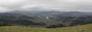
Vista to a neighboring ridge

As we slogged on ever upward, crying for our Mamas all the while, the views began to entertain, expanding in direct proportion to the hard-won elevation we were gaining. Directly below the East Boundary Ridge, lay a quilted picnic blanket of farmlands extending all the way to the small town of Glide. Nearby and in the Habitat, were the wooded crest and grassy mounds of Middle Ridge, and we could peer directly down into the valley of Blacktail Basin, whose trail was a much easier route up to North Boundary Ridge than our current route, Brad.

Yay, the grade is merely uphill!

At about a mile and a half of hiking up a wall with a trail on it, the grade eased and the path morphed into what charitably could be called a "merely uphill" route. The dirt road undulated up and down a series of high points on the ridge and we all rejoiced at the newfound normalcy of the grade.

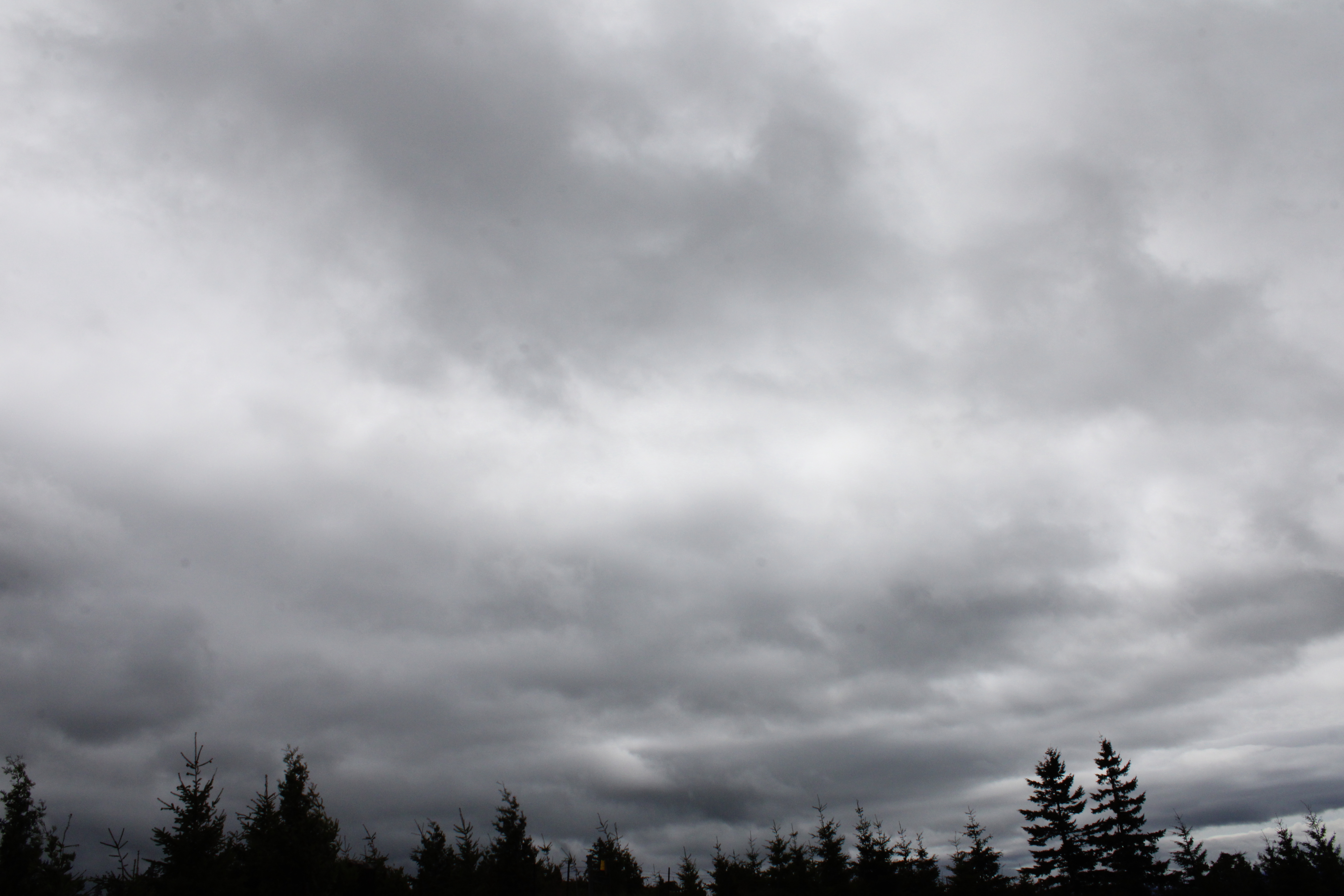
Fortunately, it never rained on us, despite the threat

At about the four-mile mark, the trail attained North Boundary Ridge which also served up its own daunting up-and-down route on its grassy crest. But if you hiked up the East Boundary Ridge Road to get there, well then it almost seemed like you were hiking downhill as the grade was nowhere near as demanding. On top of North Boundary Ridge, we availed ourselves the opportunity to snack, rest, regroup, and curse all things Brad.

Just when you didn't think the
hike could get any "better"

On the New Year's Day Worst Hike Ever venture, our foe back then had been Powerline Road. However, we'd be hiking down Powerline today and Brad assured us it was all downhill. I reminded him that no, there actually was a pretty good uphill pull to perform before we could say it was all downhill. At least there was no snow this time, although there was mud, wildflowers, and views as we descended. Some of us lay in the mud in protest when we gave up on the aforementioned steep climb on Powerline Road.

Pastoral scene on the steep
descent down Powerline Road

After a leg-braking, knee-taxing, soul-sucking descent down lush grassy slopes, we plopped down in exhaustion at the pavilion area, some of us face first. Brad served us lunch and snacks, if only to prevent us from kicking him in the rear for coming up with this hike. My own opinion is that he should have doled out ibuprofen instead of food to stay in our good graces.

What's a North Bank hike without poison oak?

For more photos of this hike, please visit the Flickr album.

Wednesday, April 6, 2022

North Bank (West Loop)


I went with some friends the other day on a mid-week hike at our frequent hiking haunt, the North Bank Habitat. Our route of choice was the loop which I have always unimaginatively and directionally referred to as the West Loop, but today I heard it cited as the Boot Camp Loop. It sort of fits because the steepness of the trails that wind up and down the various high points on the north ridge will have your wishing for an honorable discharge in no time at all.

Simply a beautiful spring day at the Habitat

It didn't take long for the seven of us to separate into two distinct hiking cadres: me and Penny, and everybody else. Guess which two hikers had cameras? At any rate, the morning was crisp and clear, the hills were bathed in green grass, and the floral end of the gene pool was in full spring symphony, be it in flowers or leaves. So we walked slow and enjoyed the scenery while our comrades marched in double-time up and down the hills at some unseen distance ahead of us. Just so they wouldn't wonder whether or not we had carked it on the trail, we sent a text message advising the speedsters not to wait for us.

Maple trees were in full flower

The first part of the route initially followed a gravel road through ranch pastures where bemused cows placidly chewed cud as we hiked by. A right turn put us on a dirt road accompanying barely trickling Chasm Creek flowing through some peaceful and serene oak woods, the trees still bereft of any leaves. Branches were draped with long strands of lichen that swayed with the slightest air current while birds musically chirped their mating calls in feathered hopes of scoring an avian romp in the woods. Wild iris, shooting stars, henbit, buttercup, and Oregon grape bloomed amok in the green grasses reposing under a vibrant blue sky, making bees and butterflies happy. Life was good and colorful here.

One steep trail in a Habitat full of them

The colorful beauty was soon forgotten though, supplanted instead by the immediate urgency of  burning leg muscles when the trail headed uphill in earnest, seemingly in a hurry to get up to North Boundary Ridge. Didn't anybody ever hear of a switchback?  But, if you are going to struggle on a hike, you should have beautiful things to look at, and we did. As we gained elevation, white baby blue-eyes populated the grassy parts, while flower friends desert parsley and purple sanicle aided and abetted. Penny and I spent more than one occasion crawling through the aforementioned green grass like human sheep, just to photograph the flowers.

The dark leaves of Satan's favorite shrub 

Spring is the optimal season to visit the Habitat in my opinion. As mentioned, the hills were wrapped in a vivid shawl of green grass; that is, if you ignore the dark bloodshot leaves of poison oak. Ignore at your own risk, though, for the plant is quite profuse and is ever ready to award rashes to inattentive hikers. The accursed plant was everywhere, and while I have issues with its itchy malevolence, the new red leaves do impart a splashy, flashy, yet rashy burgundy vibe to the hike. 

Gentle and rolling

As we gained elevation, the trees thinned out and then it was all gentle and rolling green hills dotted with small stands of oak trees. I've often said the gentle rolling hills are only gentle when you don't have to hike up them and that wry observation still holds true. At any rate, the more we climbed, the more we were treated to some amazing views of the peaks and valleys surrounding the North Umpqua River, ever flowing below our North Boundary Ridge aerie in a series of serpentine bends with the water glinting silver in the noonday sunlight. 

Trail on top of the North Bank world

Part of the reason we could see so far was that the weather was perfect. It was never too hot, the sun was out, and the sky was blue and cloudless. The clarity of the air meant that we could see many leagues in every direction, although the air did haze up a bit as the day wore on. As an example, the distant peaks of the Siskiyou Wilderness, located just over 100 miles away in California, were faintly visible to the naked eye on the southwestern horizon.

It's all (not!) downhill from here

Once on North Boundary Ridge, the Boot Camp aspects of the hike were on full display as the trail went up and down, always steep, and never level. The trail summited what felt like 5,532 high points and promontories, the only saving grace being the totally awesome views of the terrain flanking the North Umpqua River. But once we hit Middle Ridge, it was mostly downhill, the irony being there were still several steep uphill pitches on the descent, even though the trail was generally pointed downward. In the North Bank, even the downhill hiking can qualify as a Boot Camp Hike.

Butter cups by the cupful

All good Boot Camp Hikes do come to an end though, and this one ended at a noteworthy field of buttercups at the trailhead. One buttercup does not an awesome sight make, but cram millions of them into a grassy pasture then you then have a visual buttered French Toast ready to be slathered in sticky syrup. The sight of that golden parcel of pasture was more than adequate reward for the Boot Camp trials and tribulations on the day for us two plebes.

An agoseris blooms in the low grass

For more photos of this hike,
please visit the Flickr album.

Wednesday, February 16, 2022

North Bank Habitat


While I was researching trails the other day, I ran across a hiking difficulty calculator that dispassionately rated the difficulty of any given hike based solely on empirical data, something that always will seduce my geeky mathematician's heart. Basically, the operative formula is the square root of twice the product of distance in miles and cumulative elevation gained. The number obtained is then matched up to a scale for the rating. There'll be a pop quiz in the morning, kids.

John's army

The destination of choice this day was the North Bank Habitat and surely the steep hills and trails of the habitat would provide some interesting fodder for the arithmetic machinations described above. It'd be interesting to take into account other factors such as weather, trail quality, mosquitoes, and bad puns from those hikers so predisposed. Not that things were particularly dire on the day of our North Bank hike, for the weather was merely chilly and just perfect for hiking in, provided the potential rain remained in abeyance.

Oak trees, yup, lots of oak trees

Our little gang of five enjoyed an easy warm-up walk for the first mile or so. The route was initially on a level working ranch road before peeling off onto an equally level hiking-only trail along the wooded Chasm Creek bottomland. The track there was surrounded by thick stands of oak and madrone, the oak trees being bare of leaves this time of year, but well-bedecked with copious strands of Mesuthelah's beard and other lichen drapery. In the madrone groves, a virtual tabernacle choir of songbirds were chattering and nattering among the leafy trees, nearly drowning out the chattering and nattering of some hikers in our party.

If it's in the North Bank, then it's steep

Heh, heh, the nice level trail was too good to last, seeing as how this is the North Bank we are hiking in. The angle of the trail gradually began inclining steeper and steeper, stopping seemingly somewhere at just marginally less than full vertical, but only just. My new lighter and improved physique felt more like my heavier and unimproved former self in direct proportion to the increasing grade.

Our "reward" for going downhill looms above us

After what felt like an endless death march up through the oaks and grassy slopes of the "gentle" and rolling hills of the Habitat, the North Boundary Ridge was finally reached. None of us overtly celebrated though, as we were all aware that the trail would go up and down in steep fashion along the ridge for the next mile or two and there'd be no respite for weary legs until the hike was pretty much over. There's probably like 10 separate uphill pitches on this section that felt more like 1,183.

A vista like this makes the hard work worth it 

Photo stops are the last refuge of tired hikers and I availed myself of the many opportunities on the up and down ridge. The terrain dropped off at our feet, bottoming out in the nascent valleys of Jackson and Chasm Creeks. The area was surrounded by ridges and lesser peaks, most covered by a dark fuzzy blanket of woods and forest. On the valley floor, the North Umpqua River glinted silver in what little light managed to seep past the heavy cloud cover. The scenery is spectacular on any day but the foreboding weather added a touch of gloomy drama, further enhancing the panorama from the top.

A brief wooded interlude on Middle Ridge

Middle Ridge was our route back down to the trailhead and since this is the North Bank, there were still several steep uphill pitches to contend with, even though we were heading downhill in general. We were all appropriately tired from the hilly exertion so we stopped at a picnic table sited under some madrones for a well-deserved lunch break.

Epic view down to the Whistler's Bend
area on the North Umpqua River

After lollygagging for a bit on the Middle Ridge rest and repast session, we continued with our descent down Middle Ridge. The terrain was generally grassy and treeless, and we continued to enjoy the ever enfolding view as we lost elevation. Cold air was wafting up from the valleys as the temperature dropped, seemingly in concert with the drop in elevation. Precipitation somewhere between a hard drizzle and actual rain splashed both trail and hikers for a few minutes but the sun eventually made a weak appearance at the trailhead. And speaking of weak appearances, I also eventually showed up at the trailhead.

Scratchy

It was somewhat disappointing that the hiking difficulty calculator rated this hike as "moderately strenuous". Even though my admittedly biased and highly subjective hike rating was more like "super-duper strenuously hugely strenuous" you really can't argue with the numbers. As a comparison or point of reference, the empiric calculator had likewise rated my recent hike at Jacksonville Forest Park as "moderately strenuous". But applying the O'Neill methodology, which basically consists of me asking my legs for their opinion, said this North Bank hike was far tougher than what the Jacksonville hike had ever served up. That leaves me where I started from, calculator-wise, in that the difficulty of a hike is still a highly subjective determination based on not just grade and miles, but on the conditioning and overall whineability of the hiker making the determination. My geeky mathematician's heart remains unrequited.

My downhill form

For more photos of this hike, please visit the Flickr album.

Saturday, January 1, 2022

Powerline Road


2021 was the year I entered the white-haired pantheon of senior-citizenhood. Even though I've celebrated at least 65 birthdays in my lifetime, in each instance I calmly accepted my new age with equanimity and grace. But then that damn Medicare card arrived. The ponderous bulk of the federal government has officially designated me an old person. No longer of any use to society, I might as well turn myself in to the Soylent Green factory, which is a dated reference that old people with Medicare cards will understand.

Winter wonderland

Along with advancing age comes advancing health problems too and in my case, hernias (two of them!) and diabetes reared their ugly heads and I have the statistics to prove it. Last year, I hiked a mere 181 miles with a per hike average of 5.7 miles, both all-time Richard Hikes lows. But on a positive note, I did manage to shed 25 pounds in 2021 and I now weigh a svelte 190 pounds, so why not start the new year by getting my slimmer and trimmer tail totally kicked on a New Year's Day hike?

The Powerline Road is not always this attractive

Brad had billed this North Bank Habitat outing as "The Worst Hike Ever". The Powerline Road route is probably the steepest trail in the North Bank Habitat, becomes overly muddy in wet weather, and if you like miles and miles of looking at power lines, pylons, and other accoutrements of the power grid, then this is your hike. This hike had already been elevated to Worst Hike Ever status before we even set foot on the trail, but snow and ice guaranteed this hike to be completely memorable for all the wrong (and a few right) reasons.

Hi ho, hi ho, through the snow we go

Fourteen hikers (and dog friend Gus, who thought this was the Best Hike Ever) passed through a livestock gate and began the slog up a bare ridge covered with snow. Critter tracks crisscrossed the ranch road as our feet crunched in the icy snow. We were walking in a winter wonderland as everything as far as the eye could see was cloaked in white, most unusual for the Habitat. Snow muffled all sounds except for noisy footsteps, heavy breathing, and the omnipresent buzzing of power lines.

At least we amused the cows

I had hiked this route once (and only once!) with Mrs. O'Neill and amazingly enough, our marriage survived the experience. However, on this second go-round, it didn't seem like it was all that bad. The really steep part was only about a mile or so, after which the trail actually levelled off before heading downhill. The problem with the downhill part though, was the relatively warm sunlight was melting the snow in an exposed swale, rendering the trail muddy and wet. Our choices were either sinking in the mud or sinking in the snow next to the mud and with bemused expressions, a small herd of cattle watched us physically wrestle with that not-so philosophical question.

View as we arrived at North Boundary Ridge

There was one more short uphill push before the route reached the hallowed destination of the North Boundary Ridge. Ostensibly, the ridge was the high point of the hike but in the North Bank, the downhill inevitably comes with intermittent uphill stretches, so there was no real rejoicing at arriving at the ridge. The snow was several feet deep here and hikers sunk up to their knees. The post-holing was taxing and tedious, especially since not one of us "experienced" hikers had ever thought to bring snowshoes. To be frank, I'd had enough at that point, so I grabbed the Blacktail Basin Road for a shorter route while my friends continued on the miserable North Boundary Ridge.

Amazing vista on Blacktail Basin Road

Blacktail Basin may have been shorter but it still was not easy. The Habitat's caretaker had driven some kind of all-terrain vehicle up here and the tire treads were nasty icy, forcing me to walk off the road and wade in the snow. Slogging in the slush was sheer trudgery, but at least it was safer than the icy road. No complaining though, because the views from high above the basin were fantastic, especially with bright blue sky looming over the snow-covered world.

This hike was half snowshoe trek, half wade

At the bottom of the basin, the thaw was in full swing and all manner of creeks and runoffs were carrying the melted snow down into Jackson Creek. Boots and feet were soon wet, of course. Your leaky garden spigot generally has more water flowing than Jackson Creek, yet on this day the creek was roaring like the nearby North Umpqua River, making several fords of the rushing stream somewhat sketchy. However, I'm glad to report that while feet got wet, I didn't slip and my ancient body remained upright for the duration.

The snowy headwaters of Jackson Creek

As the route worked its way down the basin, the basin walls shaded the wet trail, turning all moisture to ice. While the wet stuff was annoying and inconvenient, the frozen path was downright treacherous. Again, my superannuated (much cooler word than "ancient") body remained upright but it had been a close call at several junctures. At the trailhead, my companions straggled in behind me by an hour or so. Their faces were haggard, with fatigue etched onto their now wizened visages. Rheo looked like she had aged 15 years and Corinna said "I should have gone with you!" before plopping face-down in the snow in total exhaustion. Gus however, was all glee and joy and asked if we could do that again. Despite the arduous nature of the day's venture, it was all good because any hike where you don't have to use your Medicare card afterward is a good hike.

A great way to start the new year

For more photos of this hike, please visit the Flickr album.

Wednesday, December 9, 2020

North Umpqua Trail (Jessie Wright Segment)


That little in-between season residing twixt autumn and winter is that special time of year spent trying to frantically squeeze in just one more hike on the North Umpqua Trail (NUT) before the winter snows arrive. I offer into evidence recent hikes on the Marsters, Dread and Terror, and Hot Springs segments of the venerable NUT. Of course, this year it's been substantially difficult to even hike on the NUT, what with nearly half of it rendered unusable by last summer's devastating Archie Creek Fire. But who's counting and what's one more hike on the NUT before winter's onset arrives?

Fire-scarred forest surrounded the trail

The day was ostensibly sunny but here on the cold bottom of the North Umpqua River canyon, a thin film of mist occluded the views and I kept rubbing my eyes just in case I was developing filmy vision or something like that. Even the river looked colder than normal, the water running as dark and black as a tyrant's soul as it rumbled underneath Marsters Bridge. In a telling sign that winter is indeed nigh, I wore a jacket for the entire hike.

A goblet of water for the wee folk

Several years ago, fire rolled through this section of the NUT and nowadays, the forest floor is littered with dead trees and limbs to go along with all the normal customary forest detritus. All that decaying lumber on the forest floor just begs for mushrooms and fungi to come dine and they so obliged. There were so many different ilk, color, and specie of mushrooms, ranging from tall parasols large enough to shelter me and other rodents in a rainstorm to tiny fungal caps small enough to shelter just a few individual atoms in that very same rainstorm. Not to mention, there were fungi of the non-mushroom variety ranging from tough and woody tinder fungus to bright yellow dollops of witch's butter. Toss in a healthy population of lichen and moss clinging to tree trunks and you could almost hear the communal munching of dead wood echoing throughout the forest.

The North Umpqua River, all hike long

At roughly halfway between Marsters Bridge and Deer Creek, the river widens considerably where it makes a graceful bend as only a river can. My own personal bends are pretty much limited to beginner's yoga and are nowhere near as graceful. The thick forest cover, which had been doing a pretty good job of hiding the river from view, thinned out and allowed your merry blogster to stop and contemplate the fantastic riverine vista. The water flowing past and over a series of small cascades was perhaps enhanced by the steep terrain rising away from the river, culminating in the rocky spire of Old Man Rock (unseen, from the river's edge), which was not named after me no matter what the grandchildren say.

Snag Rock, living up to its name

The former wooden footbridge crossing Eagle Creek had been vaporized in the wildfire from several years ago and its replacement is wisely made out of metal this time.  After crossing the aforementioned creek and bridge, the trail commenced another stretch of fine river scenery. Here, the river bounds in a series of energetic cascades and rapids that might challenge a river rafter or kayaker. In the middle of all the watery turmoil and roil squats a troll-like boulder aptly named Snag Rock. The huge rock lives up to its name, for it had snagged several snags (another word for dead trees) that had attempted a doomed river float. 

I crawled like the lowly worm I am, and I liked it!

A recent storm had knocked down a bunch of trees onto the trail right near Boulder Creek and I used my well-honed crawling skills to slither past them. Another large, albeit wooden, footbridge spanned Boulder Creek and that was my turnaround point. The creek was running low as it exited its namesake Boulder Creek Wilderness, the water collecting in languid greenish-blue pools. As I ate my lunch by the creek, some large winged insect crawled by, which was strange for it did have those wing things for added mobility. I doubt the wings were just for show, maybe the bug just needed the exercise.

Some of that amazing light and mist on the hike back

The hike back to the trailhead at Marsters Bridge was uneventful but I did get to enjoy the awesome river, forest, and fungal scenery all over again. However, the river fog had thickened considerably, rendering the woods as mysterious and inscrutable as the calculus of complex numbers. As the day waned, the sun finally made it down to the canyon floor, illuminating the mist with ethereal sunbeams that awed this hiker who thankfully, had a camera with which to commemorate the show.   

Fog? What river fog?

At the trailhead, the fog lifted just long enough to put Rattlesnake Rock (which was not named after me, no matter what my wife says) on display against a rare blue sky. If this run of conducive weather continues, maybe I can get in a few more North Umpqua Trail hikes before winter arrives for good.

Vestigial remnant of autumn glory

For more photos of this hike, please visit the Flickr album.