Showing posts with label Whistlers Bend. Show all posts

Saturday, May 14, 2022

North Bank Habitat (Best Hike Ever!)


In what was definitely not truth in advertising, this hike was dubbed the Best Hike Ever. Back on New Year's Day, Brad, our hike leader, had led a North Bank hike  that will forever live in club lore as The Worst Hike Ever because of formidably steep trails. Flash forward a few more months to the present and now we were going to do the same route, but this time in reverse, exchanging the incredibly steep Powerline Road for the incredibly steep East Boundary Road. Because this hike was the opposite of the Worst Hike Ever, it acquired the rather Orwellian title of Best Hike Ever.

Rheo commences the Best Hike Ever

The hike began with an easy amble down the Habitat's entrance road and we gaily skipped along, a song in our hearts, if not on our lips. We made a left turn onto the trail and all happy songs immediately died in mid-trill, supplanted instead by a chorus of horrified shrieks sounding like so many Aztec death whistles. In front of us, looming like a grassy Great Wall of China (but way taller) was the East Boundary Road, seemingly rising straight up to Mars or beyond. Yikes, legs quivered and ached before we even began the dismal trudgery of hiking The Best Freaking Hike Never.

Photo of the trail, taken while I was not resting

About halfway up the first major slog, I think my calves began to cramp up, followed in short order by hamstring pulls, respiratory distress, hives, and maybe dilated pupils. Whew, this was hard work and I did lots of photography because I was NOT resting, no matter how much it may have looked like I might have been. 
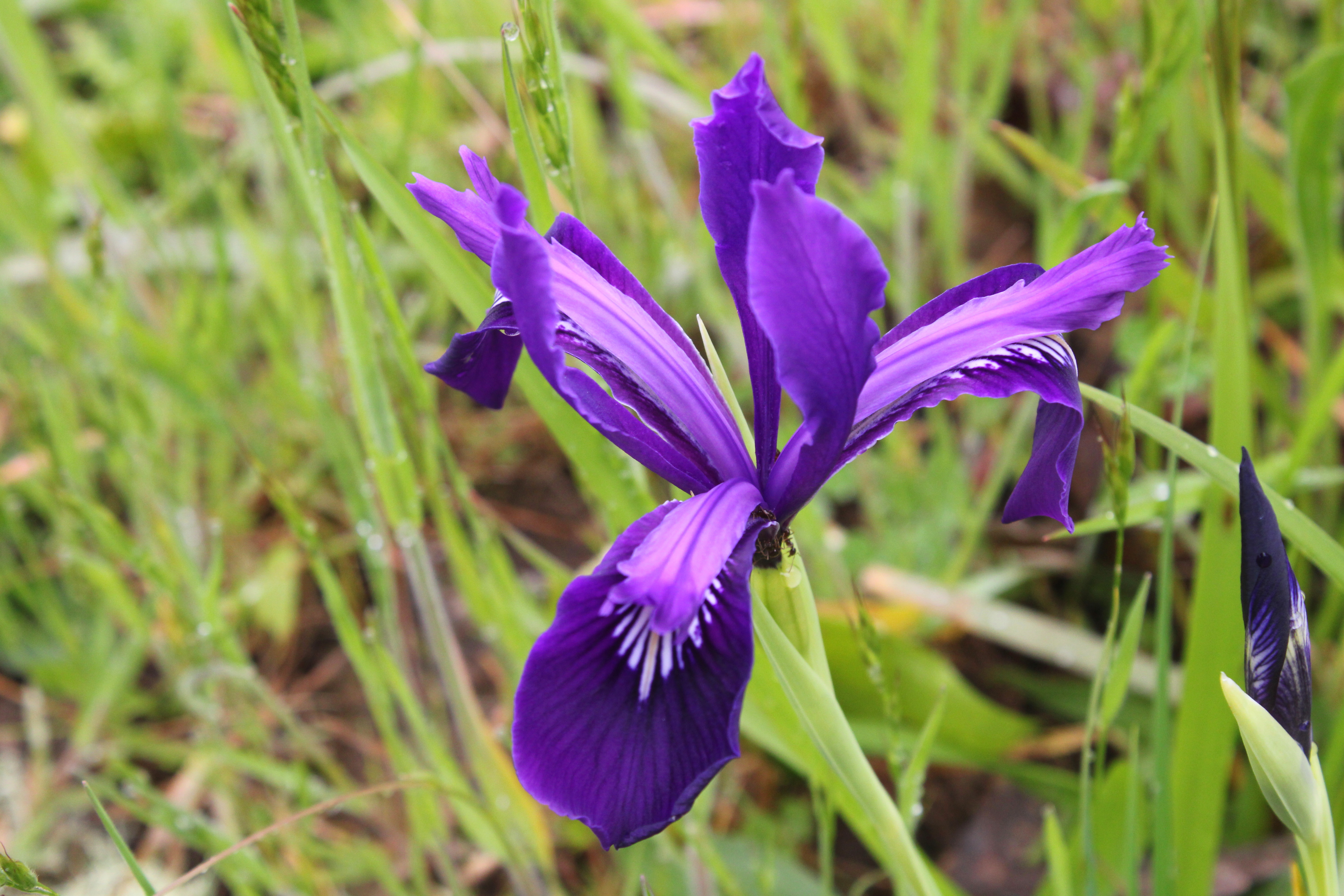
Douglas' iris decorated the grassy slopes

But if you are going to flame out on your Last Hike Ever, you might as well do it where it's scenic and this North Bank Medieval Torture Chamber Trail fit the bill. Spring was in full song and the vertical walls (oops, I meant to say "rolling hills") were covered with lush green grass. And if I were tempted to plop down on the ground in total exhaustion, the colorful red and oily leaves of the ever-present poison oak were more than adequate deterrent, the fear of itchy rash being sufficient motivation to remain upright, if not necessarily to keep walking. 

What a changing forget-me-not looks like

The wildflowers were putting on a show, best admired when bent over with hands on knees, lungs heaving mightily. Fiddleneck, wild iris, and Indian pink were all abloom, just to name several species from a cast of thousands. During one of my photo-ops while NOT resting, I spotted an odd little flower resembling a fiddleneck that sported flowers ranging from blue to yellow to white, all on the same flower head. It was a changing forget-me-not (Myosotis discolor), whose flowers start out blue but like my hair, turn white with age. I'd never seen this wildflower before, so that was kind of cool. 

Vista to a neighboring ridge

As we slogged on ever upward, crying for our Mamas all the while, the views began to entertain, expanding in direct proportion to the hard-won elevation we were gaining. Directly below the East Boundary Ridge, lay a quilted picnic blanket of farmlands extending all the way to the small town of Glide. Nearby and in the Habitat, were the wooded crest and grassy mounds of Middle Ridge, and we could peer directly down into the valley of Blacktail Basin, whose trail was a much easier route up to North Boundary Ridge than our current route, Brad.

Yay, the grade is merely uphill!

At about a mile and a half of hiking up a wall with a trail on it, the grade eased and the path morphed into what charitably could be called a "merely uphill" route. The dirt road undulated up and down a series of high points on the ridge and we all rejoiced at the newfound normalcy of the grade.
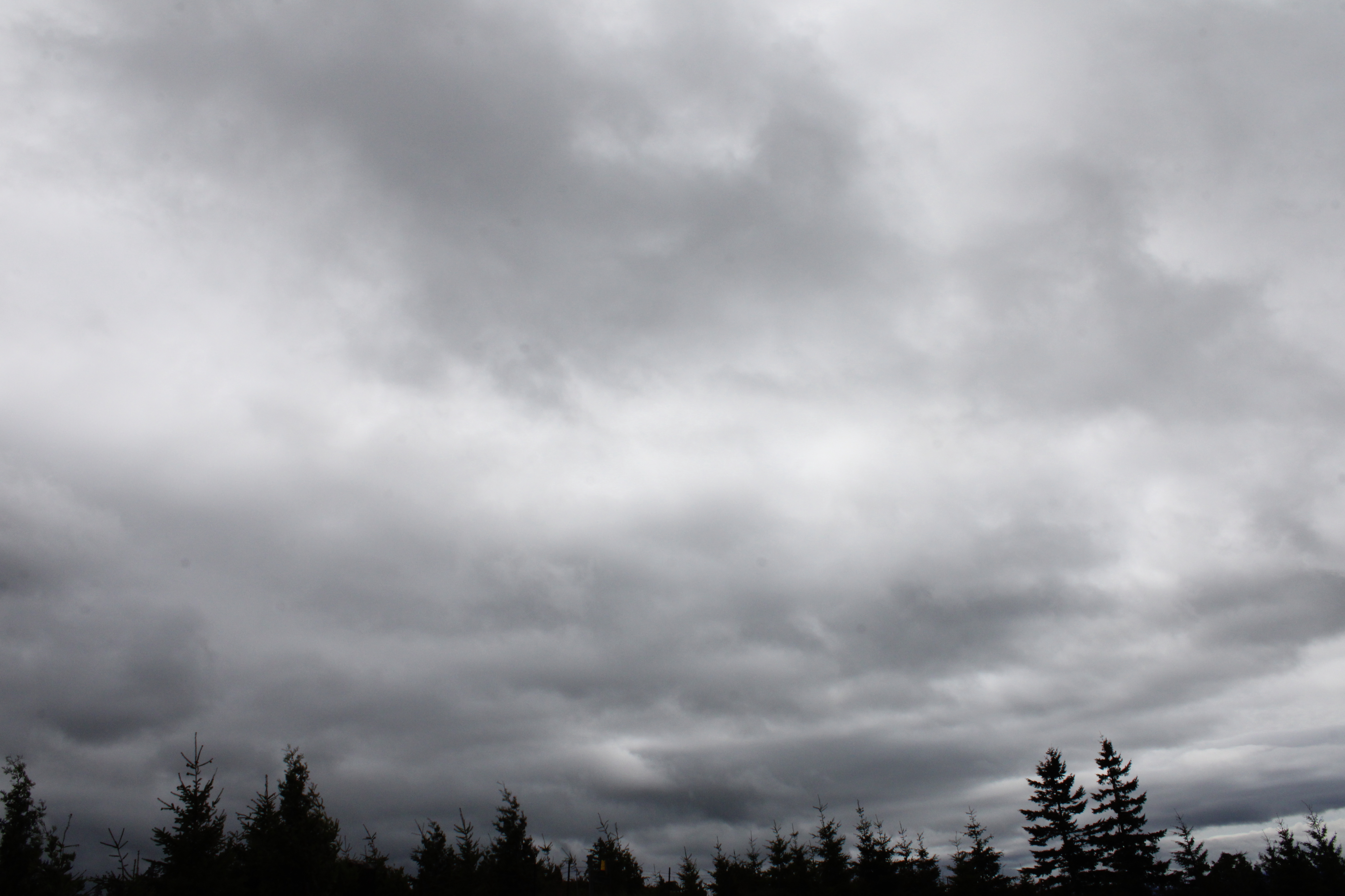
Fortunately, it never rained on us, despite the threat

At about the four-mile mark, the trail attained North Boundary Ridge which also served up its own daunting up-and-down route on its grassy crest. But if you hiked up the East Boundary Ridge Road to get there, well then it almost seemed like you were hiking downhill as the grade was nowhere near as demanding. On top of North Boundary Ridge, we availed ourselves the opportunity to snack, rest, regroup, and curse all things Brad.

Just when you didn't think the
hike could get any "better"

On the New Year's Day Worst Hike Ever venture, our foe back then had been Powerline Road. However, we'd be hiking down Powerline today and Brad assured us it was all downhill. I reminded him that no, there actually was a pretty good uphill pull to perform before we could say it was all downhill. At least there was no snow this time, although there was mud, wildflowers, and views as we descended. Some of us lay in the mud in protest when we gave up on the aforementioned steep climb on Powerline Road.

Pastoral scene on the steep
descent down Powerline Road

After a leg-braking, knee-taxing, soul-sucking descent down lush grassy slopes, we plopped down in exhaustion at the pavilion area, some of us face first. Brad served us lunch and snacks, if only to prevent us from kicking him in the rear for coming up with this hike. My own opinion is that he should have doled out ibuprofen instead of food to stay in our good graces.

What's a North Bank hike without poison oak?

For more photos of this hike, please visit the Flickr album.

Wednesday, April 6, 2022

North Bank (West Loop)


I went with some friends the other day on a mid-week hike at our frequent hiking haunt, the North Bank Habitat. Our route of choice was the loop which I have always unimaginatively and directionally referred to as the West Loop, but today I heard it cited as the Boot Camp Loop. It sort of fits because the steepness of the trails that wind up and down the various high points on the north ridge will have your wishing for an honorable discharge in no time at all.

Simply a beautiful spring day at the Habitat

It didn't take long for the seven of us to separate into two distinct hiking cadres: me and Penny, and everybody else. Guess which two hikers had cameras? At any rate, the morning was crisp and clear, the hills were bathed in green grass, and the floral end of the gene pool was in full spring symphony, be it in flowers or leaves. So we walked slow and enjoyed the scenery while our comrades marched in double-time up and down the hills at some unseen distance ahead of us. Just so they wouldn't wonder whether or not we had carked it on the trail, we sent a text message advising the speedsters not to wait for us.

Maple trees were in full flower

The first part of the route initially followed a gravel road through ranch pastures where bemused cows placidly chewed cud as we hiked by. A right turn put us on a dirt road accompanying barely trickling Chasm Creek flowing through some peaceful and serene oak woods, the trees still bereft of any leaves. Branches were draped with long strands of lichen that swayed with the slightest air current while birds musically chirped their mating calls in feathered hopes of scoring an avian romp in the woods. Wild iris, shooting stars, henbit, buttercup, and Oregon grape bloomed amok in the green grasses reposing under a vibrant blue sky, making bees and butterflies happy. Life was good and colorful here.

One steep trail in a Habitat full of them

The colorful beauty was soon forgotten though, supplanted instead by the immediate urgency of  burning leg muscles when the trail headed uphill in earnest, seemingly in a hurry to get up to North Boundary Ridge. Didn't anybody ever hear of a switchback?  But, if you are going to struggle on a hike, you should have beautiful things to look at, and we did. As we gained elevation, white baby blue-eyes populated the grassy parts, while flower friends desert parsley and purple sanicle aided and abetted. Penny and I spent more than one occasion crawling through the aforementioned green grass like human sheep, just to photograph the flowers.

The dark leaves of Satan's favorite shrub 

Spring is the optimal season to visit the Habitat in my opinion. As mentioned, the hills were wrapped in a vivid shawl of green grass; that is, if you ignore the dark bloodshot leaves of poison oak. Ignore at your own risk, though, for the plant is quite profuse and is ever ready to award rashes to inattentive hikers. The accursed plant was everywhere, and while I have issues with its itchy malevolence, the new red leaves do impart a splashy, flashy, yet rashy burgundy vibe to the hike. 

Gentle and rolling

As we gained elevation, the trees thinned out and then it was all gentle and rolling green hills dotted with small stands of oak trees. I've often said the gentle rolling hills are only gentle when you don't have to hike up them and that wry observation still holds true. At any rate, the more we climbed, the more we were treated to some amazing views of the peaks and valleys surrounding the North Umpqua River, ever flowing below our North Boundary Ridge aerie in a series of serpentine bends with the water glinting silver in the noonday sunlight. 

Trail on top of the North Bank world

Part of the reason we could see so far was that the weather was perfect. It was never too hot, the sun was out, and the sky was blue and cloudless. The clarity of the air meant that we could see many leagues in every direction, although the air did haze up a bit as the day wore on. As an example, the distant peaks of the Siskiyou Wilderness, located just over 100 miles away in California, were faintly visible to the naked eye on the southwestern horizon.

It's all (not!) downhill from here

Once on North Boundary Ridge, the Boot Camp aspects of the hike were on full display as the trail went up and down, always steep, and never level. The trail summited what felt like 5,532 high points and promontories, the only saving grace being the totally awesome views of the terrain flanking the North Umpqua River. But once we hit Middle Ridge, it was mostly downhill, the irony being there were still several steep uphill pitches on the descent, even though the trail was generally pointed downward. In the North Bank, even the downhill hiking can qualify as a Boot Camp Hike.

Butter cups by the cupful

All good Boot Camp Hikes do come to an end though, and this one ended at a noteworthy field of buttercups at the trailhead. One buttercup does not an awesome sight make, but cram millions of them into a grassy pasture then you then have a visual buttered French Toast ready to be slathered in sticky syrup. The sight of that golden parcel of pasture was more than adequate reward for the Boot Camp trials and tribulations on the day for us two plebes.

An agoseris blooms in the low grass

For more photos of this hike,
please visit the Flickr album.

Wednesday, February 16, 2022

North Bank Habitat


While I was researching trails the other day, I ran across a hiking difficulty calculator that dispassionately rated the difficulty of any given hike based solely on empirical data, something that always will seduce my geeky mathematician's heart. Basically, the operative formula is the square root of twice the product of distance in miles and cumulative elevation gained. The number obtained is then matched up to a scale for the rating. There'll be a pop quiz in the morning, kids.

John's army

The destination of choice this day was the North Bank Habitat and surely the steep hills and trails of the habitat would provide some interesting fodder for the arithmetic machinations described above. It'd be interesting to take into account other factors such as weather, trail quality, mosquitoes, and bad puns from those hikers so predisposed. Not that things were particularly dire on the day of our North Bank hike, for the weather was merely chilly and just perfect for hiking in, provided the potential rain remained in abeyance.

Oak trees, yup, lots of oak trees

Our little gang of five enjoyed an easy warm-up walk for the first mile or so. The route was initially on a level working ranch road before peeling off onto an equally level hiking-only trail along the wooded Chasm Creek bottomland. The track there was surrounded by thick stands of oak and madrone, the oak trees being bare of leaves this time of year, but well-bedecked with copious strands of Mesuthelah's beard and other lichen drapery. In the madrone groves, a virtual tabernacle choir of songbirds were chattering and nattering among the leafy trees, nearly drowning out the chattering and nattering of some hikers in our party.

If it's in the North Bank, then it's steep

Heh, heh, the nice level trail was too good to last, seeing as how this is the North Bank we are hiking in. The angle of the trail gradually began inclining steeper and steeper, stopping seemingly somewhere at just marginally less than full vertical, but only just. My new lighter and improved physique felt more like my heavier and unimproved former self in direct proportion to the increasing grade.

Our "reward" for going downhill looms above us

After what felt like an endless death march up through the oaks and grassy slopes of the "gentle" and rolling hills of the Habitat, the North Boundary Ridge was finally reached. None of us overtly celebrated though, as we were all aware that the trail would go up and down in steep fashion along the ridge for the next mile or two and there'd be no respite for weary legs until the hike was pretty much over. There's probably like 10 separate uphill pitches on this section that felt more like 1,183.

A vista like this makes the hard work worth it 

Photo stops are the last refuge of tired hikers and I availed myself of the many opportunities on the up and down ridge. The terrain dropped off at our feet, bottoming out in the nascent valleys of Jackson and Chasm Creeks. The area was surrounded by ridges and lesser peaks, most covered by a dark fuzzy blanket of woods and forest. On the valley floor, the North Umpqua River glinted silver in what little light managed to seep past the heavy cloud cover. The scenery is spectacular on any day but the foreboding weather added a touch of gloomy drama, further enhancing the panorama from the top.

A brief wooded interlude on Middle Ridge

Middle Ridge was our route back down to the trailhead and since this is the North Bank, there were still several steep uphill pitches to contend with, even though we were heading downhill in general. We were all appropriately tired from the hilly exertion so we stopped at a picnic table sited under some madrones for a well-deserved lunch break.

Epic view down to the Whistler's Bend
area on the North Umpqua River

After lollygagging for a bit on the Middle Ridge rest and repast session, we continued with our descent down Middle Ridge. The terrain was generally grassy and treeless, and we continued to enjoy the ever enfolding view as we lost elevation. Cold air was wafting up from the valleys as the temperature dropped, seemingly in concert with the drop in elevation. Precipitation somewhere between a hard drizzle and actual rain splashed both trail and hikers for a few minutes but the sun eventually made a weak appearance at the trailhead. And speaking of weak appearances, I also eventually showed up at the trailhead.

Scratchy

It was somewhat disappointing that the hiking difficulty calculator rated this hike as "moderately strenuous". Even though my admittedly biased and highly subjective hike rating was more like "super-duper strenuously hugely strenuous" you really can't argue with the numbers. As a comparison or point of reference, the empiric calculator had likewise rated my recent hike at Jacksonville Forest Park as "moderately strenuous". But applying the O'Neill methodology, which basically consists of me asking my legs for their opinion, said this North Bank hike was far tougher than what the Jacksonville hike had ever served up. That leaves me where I started from, calculator-wise, in that the difficulty of a hike is still a highly subjective determination based on not just grade and miles, but on the conditioning and overall whineability of the hiker making the determination. My geeky mathematician's heart remains unrequited.

My downhill form

For more photos of this hike, please visit the Flickr album.

Sunday, April 19, 2020

North Bank Habitat - Thistle Ridge/North Gate Loop

I'm actually OK with this socially distant hiking, it melds well with my personality. Or maybe I'm confusing "socially distant" with "socially awkward". At any rate, I spend enough time walking in the woods by myself that I really don't have to make any major adjustments to my hiking style other than frantically bailing off the trail in terror when another hiker appears on the trail, accidentally getting within my social nearness boundary. Come to think of it, that's not all that abnormal a hiking behavior for me, either.

Wild iris purpled up the hike
Staying at home these days has been fairly easy as I'm retired and there's always yard work or no work to entertain me. Besides which, Mrs. O'Neill is working from home so there's always company even though that requires me to mimic socially acceptable behavior. But it's a different story for my friend Jay, however. He too is working from home and he's a programmer so it's just him and the computer screen all day long. Apparently, he's getting cabin fever, for he asked if I could take him hiking, socially-distant style. So off to the North Bank Habitat we went (in separate vehicles) and when I picked up a gopher snake slithering across the trail, we became extremely socially distant when he fled screaming for the next time zone to the east.

Panoramal activity
The original plan percolating in my brain was a loop involving the Middle Ridge Road from the western trailhead. However, the trailhead parking lot was full of vehicles so I made a spur of the moment decision to continue to the eastern trailhead. The Habitat's gate was locked of course, and we added our vehicles to the cars parked outside the gate. The developed trailheads are closed these days to prevent cars and people from congregating in the parking lots but all that happens is people congregate at the point of closure anyway, but there we are.

It it's in the North Bank, it goes uphill
Anyway, to avoid coming into contact with would-be virus spreading people-type persons, we grabbed the Thistle Ridge Road instead of taking the well-used gravel road to the Comstock Day Use Area. Immediately, the trail angled uphill and that was Jay's first exposure (from a socially distant distance of ten to fifteen feet behind me) to what is typical hiking in the North Bank. Initially, the scenery wasn't particularly awesome as we hiked under some buzzing power lines but once we left those behind us, it was all good for the rest of the day.

Blazing star blazes away


After a short and rather utilitarian climb away from the power lines, the junction with the Deer Hollow Tie Trail was reached and I was back on familiar territory, seeing as how I had hiked this same trail just several weeks ago. But what a difference a few weeks can make! On this day, the grass was green and lush instead of just sprouting like a couple of weeks ago, and wildflowers were blooming in rampant profusion.

The prettiest evilest leaf ever
Also growing rampantly but not green, were thick patches of poison oak bushes. I tested Jay quickly, because he is a both a hiking and Oregon neophyte, and I'm proud to say my student passed the exam each and every time by correctly pointing out the poison oak when asked. In the sunny patches of trail, which was about 90% of the hike, the leaves were coming out in shades of dark red, burgundy, and sometimes nearly black in color. I generally try to stay away from Satan's favorite shrub but in this case, I made an exception as I was quite struck by the beauty of the oily itch-spreading leaves. Anyway, I got within the plant's personal space to take some photos of the colorful foliage. Normally, I try to stay at least two miles away from the accursed itch disseminating bushes.

Parallel lines
The trail headed uphill across grassy slopes before ducking into a forest on a relatively level trail. Where I had struggled with the muddy track several weeks ago, the trail was now dry and hard-packed, just like me! And after walking out of the forest, it was time to soak in the totally awesome view down to Whistlers Bend.

The view to Whistlers Bend never gets old
Rain and clouds had been an issue on my prior hike but not today. The sky was a deep blue and there were just a handful of small clouds floating in the sky. While the sun was out, the breeze upwelling from the creek valleys kept us cool and the air had that clarity and crispness normally reserved for a clear day in winter. And below the aforementioned deep blue sky, the North Umpqua River idly circled the peninsula of Whistlers Bend. Surrounding farms greened up the valley with pastures, and the terrain was dotted with farm ponds. Just a magnificent scene and we took a short break just to take it all in for a few minutes.

The Thistle Ridge trail goes through a thicket of oak trees
The kind and gentle grade at the overlook soon became just a distant memory, driven out of our thoughts by burning quad muscles as we continually headed uphill on Thistle Ridge first, then Middle Ridge next, both bereft of shade of any sort. Our leg pain was assuaged somewhat by fantastic views of the North Umpqua River and windblown Middle Ridge looming in front of us. The terrain was all covered in grass, which was well-populated with flowering blue-eyed grass which is in fact, yellow-eyed and not actually a grass. Who names these things, anyway?

Ugh!
At the intersection with the North Gate Road, we availed ourselves of the facilities which consisted of just a picnic table and an awesome view. We spent a little bit of time there to eat lunch, rest, and relax. I had a notion of continuing up to the North Boundary Ridge but once we started up yet another steep section of trail, the whining started and not necessarily from Jay, either! No problem, it was still a beautiful day and hike, so we backtracked and headed down the steep North Gate Road.

A gopher snake on the trail and Jay was nowhere to be seen
Wild iris was in bloom all around the trail and as I was photographing several, I noticed a large gopher snake basking in the warm sunlight. Seconds later, the snake was in my hands hissing and showing its teeth and that's how I found out that not only does Jay really not like snakes, he doesn't even like people picking them up either. I also found out his voice could squeal high enough to drop stunned squirrels out of trees. We were able to resume both hiking and our friendship once the snake was returned to its grassy habitat.  

Blue-eyed grass is yellow-eyed and not really a grass
By this time, we were down in Soggy Bottom, which was no longer soggy, and a short walk on the gravel road returned us to our vehicles. Most of the vehicles were gone and despite all the cars parked there in the morning, we only saw only one other hiker all day, a woman out hiking with her children (candidate for Mom of the Year, in my opinion) on Middle Ridge. Generally, most people probably avoid the steep trails and do the easier hikes to either Soggy Bottom or Blacktail Basin. Me, I'll probably keep going on the steeper routes to maintain that social distancing protocol and avoid people like the socially awkward hiker person that I am.

Just a gorgeous day in the North Bank
For more photos of this hike, please visit the Flickr album


Monday, February 10, 2020

North Bank Deer Habitat - Soggy Bottom/Blacktail Basin Loop

Normally, when I hike in cold weather, I usually start out somewhat underdressed. The reason is that once hiking commences, the exertion soon gets the old body warmed up. So, if I am nice and warm at the outset, then I'm roasting and sweltering underneath all the layers of outerwear within a few minutes. It's more convenient to start out slightly cold and then warm up to a comfortable stasis and avoid all that having to stop and shed clothing while your comrades leave you behind. But then again, there are days like this hike at the North Bank Habitat, where I had to stop in less than a quarter-mile of hiking and hurriedly put on layers because it was freezing cold and starting out with minimal protection was not one of my better moves.

Squish, squish go the boots
Once I was properly clad with ski cap, mittens, muffler, and a down jacket, the hike continued on in earnest to a broad grassy swale known as Soggy Bottom, which was not named to memorialize that time that I ate too many dried apricots. Soggy Bottom is appropriately named however, because a creek runs through it while every other square inch of soil in the swale seeps ample moisture into the creek. They've been doing some habitat restoration lately and the jeep road that serves as the trail had been all chewed up by ATVs. All that seepage had turned the dirt road into a muddy quagmire of boot-sucking doom and that turned out to be one of the main themes of this hike. Much or most of the nearly eight miles of hiking were spent slogging and sliding through the goo. Periodically, the thick mud would accrue on the underside of my footwear, and I lumbered clumsily forward on boots with six-inch soles of thick clay like some incredibly handsome Frankenstein.

Smile for the camera!
A new livestock gate had been installed over the trail at Soggy Bottom and a sign above an electronic gizmo attached to the gatepost advertised the whole setup was part of a wildlife survey. I assumed the gizmo was a trail camera and one must respect the fine work the wildlife biologists do, so naturally I made funny faces and did my one-footed "running man" pose in front of the presumed camera. As I walked, I pondered the form or format of the survey, imagining a clipboard-toting someone polling wildlife about their political preferences. Preliminary results say hooved creatures are all in for Deernald Trump, bears will throw their weight behind Joe Bear-den, and the mountain lions think all candidates taste equally good.

Mud was a recurring theme on this hike


All trails in the Habitat go uphill, it's just a question of gradient. Because hiking in the mud was pretty tedious, I opted for the route of least resistance. Soggy Bottom Road still goes uphill but not as quickly as some of the other pain-filled trails around here. It's kind of like whether you prefer chiltepin chiles over habaneros. Either way, there is same-day and day-after burning pain involved but it's mostly a question of degree and flavor.

Grand vistas are to be had in the North Bank

As the trail climbed up and away from Soggy Bottom, the higher ridges were hidden in the cloud cover. Great, my hike was going to wind up being both cold and foggy. However, as I gained elevation, so did the clouds and by the time I crested at the intersection with Powerline Road, the cloud cover had lifted off the ridges. That was a good thing because one of the main reasons for laboring up the Habitat's steep trails are the views that reward determined hikers. 

View down Soggy Bottom
Accordingly, the drainages of both Jackson Creek and Soggy Bottom lay well below the trail in all their awesome view glory. Grassy hills, forested ridges, and deep creek valleys rolling all the way to the farmlands surrounding the North Umpqua River. It was enough to make me forget I was cold and tired and I daresay I even felt spritually, if not physically, energized and replenished by the superb vistas from the top. More replenishment took place at Grumpy's Pond where a quick meal was consumed. For some reason, the name Grumpy's Pond reminds me of my ex-wife, not sure exactly why that is.

Grumpy's Pond and no frogs
One little oddity I noticed was that when I was coming up Soggy Bottom Road, the frogs were croaking en masse like some amphibian tabernacle choir in the creek canyons running down the grassy slopes. However, at Grumpy's Pond, where there exists an ample and stable water supply, there was nary a croak to be heard. The water was colored an unappealing gray so that might explain it, or maybe the frogs eschewed the acerbically humored pond for waters that were in a better mood.

A thick stand of oak trees
At a trail junction atop North Boundary Ridge, there are several options for a return loop and I grabbed the most gentle way back, that being the descent through Blacktail Basin. The basin is dotted with oak trees, still leafless this time of year, and poison oak growing underneath effectively discouraged any off-trail exploration. Blue jays squawked in noisy abundance and alder trees, leafless like the oaks, sported thousands of dangling flower tassels in a harbinger of spring.

I got "ticketed"
Once the trail descended into basin, it was several miles of mostly level walking next to Jackson Creek running through an oak savanna. After closing the last gate (and making more funny faces at a wildlife survey camera), I entered the parking lot and noticed a white piece of paper fluttering underneath my windshield wiper. A ticket? Here? Really? What on earth for? There's no fee for parking at the Habitat! Turned out it was a note from friends John and Bill who apparently were also hiking in the North Bank Habitat. "Hey Dude, got mud?" it said. I promptly walked back to the trail gate and held it up in front of the wildlife survey camera. I'm so easily amused sometimes.


How to tell it was a good hike
For more photos of this hike, please visit the Flickr album.