Showing posts with label national recreation trail. Show all posts

Sunday, April 3, 2022

North Umpqua Trail (Jessie Wright Segment)


"Water heal my body, water heal my soul.
When I go down to the water, by the water I feel whole"

The River
by Coco Love Alcorn

On the way home from this hike, I switched on the radio and the first thing I heard were the above lyrics. Serendipity, the words perfectly summed up my relationship with the North Umpqua River and its namesake trail. The North Umpqua River is always near the North Umpqua Trail and the constant soothing sound of water moving past the forested slopes is like a metaphysical back rub to the soul, although I am nowhere near as eloquent as Coco Love Alcorn, a statement readily confirmed by a random reading of any of my blog entries.

Lots of plants!

Roll the tape back to the middle of the week when I got a text from young Coral Rae who requested her grandfather (me!) take her hiking. Well, when that rare and wondrous event happens, the only proper response is to make it happen. Coral wanted to hike where there were "lots of plants" so we decided on the Deer Leap Segment of the North Umpqua Trail.

A herd of fawn lilies graced the mouth of a cave

I had been on the Dear Leap several years ago and at Medicine Creek, a ginormous boulder had crushed the bridge spanning the small creek. I held hope that perhaps the bridge had been replaced but once we arrived at the site, my hopes were as crushed as the bridge, which was still in pieces right under the guilty slab of rock. I was game for bushwhacking across rain-swollen Medicine Creek, but Coral's shoes were not sufficiently waterproof for that endeavor. 

Not a lot of plants!

No biggie, though, we hiked back to the car and improvised by driving to the Jessie Wright Trailhead, where Wright was right, as far as giant boulders rolling onto trail bridges were concerned. I assured Coral Rae we would see lots of plants but she had her doubts at the start, for the forest was scorched, charred, and mostly dead. Fire is a frequent visitor here and the Jack Fire had hung out here last summer, leaving the trees worse off for the fiery visit.

This trillium patrolled by guard spider

But, as I've stated before, life still thrives in a burn zone and this blackened forest was no different. The ground was carpeted with trillium plants, all displaying flowers with tri-petaled elegance, except for one double-flowered mutant that sported least three-hundred frizzled petals. Crab spiders lurked within the flowers and I found several of them for Coral to gawk at. However, if you are a flower-visiting insect, death also thrives in a burn zone, meted out by the fangs of hungry crab spiders.

Go see what's inside the cave!

At the intersection with the trail coming in from Illahee Flat, there is a large cave sited at the bottom of a sheer cliff. Impressive, to be sure, but the cave's inky black maw was upstaged by a large patch of fawn lilies blooming right in front, the flowers nodding in unison as if to agree with the wise words that leave my mouth, and I liked that. I sent Coral Rae into the cave to check for bears and am glad to report she did not find any.

Water, heal my soul

As stated, the hike began in a burn zone but within a half-mile of hiking, there was sufficient vegetation and live trees to satisfy Coral Rae's plant-centric criteria for the day's hike. The trail contoured up and down before dropping down to river level at a river viewpoint that is one of my favorite places on the North Umpqua Trail. The river widens out here and fans out over several white-watered stair-steps before disappearing around a scenic bend. 

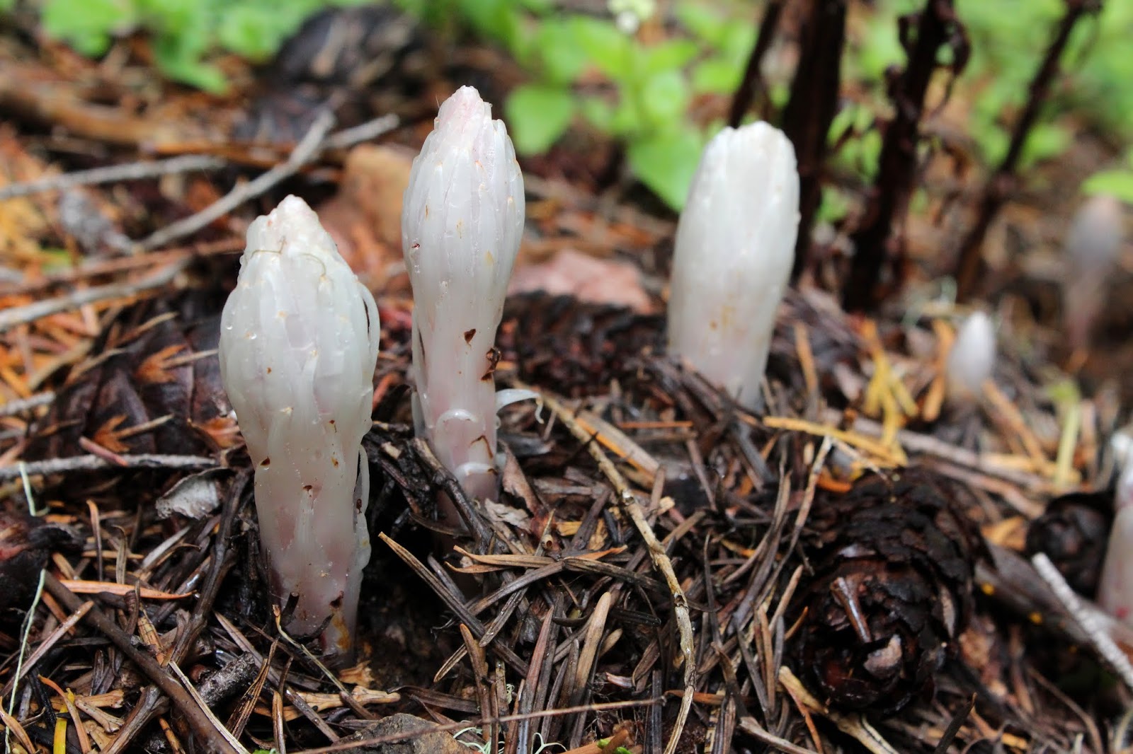
The weirdest flower ever

A sunlit cliff next to the trail provided an opportunity for Grandpa Richard to point out all the plant life clinging to a moist cliff, while Coral Rae surely rolled her eyes behind my back. The flora-based education of Miss Coral continued when I showed her how to find the brown and hairy flowers of wild ginger, and the tiny cups of birds nest fungi. 

Wild strawberry, in its pre-berry phase

This hike was never intended to be an epic test of manhood (or girlhood), so we turned back here. On the way back, we enjoyed the beautiful scenery all over again and the uphill hiking not as much. Coral was excited to find a wild strawberry flower and stated we had to come back to eat the tiny but very tasty berries. Sounds like a good plan to me and like the request to go hiking, it'll be my job to make that happen.

The always scenic North Umpqua River

Inspired by Coco Love Alcorn, I took a post-hike stab at writing beautiful heartfelt lyrics in homage to the river:

"Water heal my back, water heal my knee.
Drink enough water, then I have to pee."

I think I better stick to my day job, even though I don't have one. Plus, I really can't sing either.

The North Umpqua River, 'nuff said

For more photos of this hike, please visit the Flickr album.

Friday, May 22, 2020

North Umpqua Trail (Deer Leap Segment)

A funny thing happened on this hike. The hiking festivities on the Deer Leap Segment of the North Umpqua Trail commenced with a rather rigorous uphill slog and there was nothing to do but lower my head and attack the mad uphill charge. In short order, the trail crested and the hike continued on what would wind up being an up-and-down all-day thing. But, wait just a minute here! What just happened? Who didn't stop for rest breaks on the way up? Who was feeling pretty darn walky on this day? This dude, that's who! I've already managed a round shape so it's about time I started rounding into shape!

Raindrops keep falling on my head...
My retirement had not been going as planned. Initially, my vision was for me to become an uber-fit hiking and biking dude after ceasing engagement in any form of gainful employment. My intentions were good, but once I found out I could just sleep in, wave bye-bye to the uber-fitness regimen and say hello to general all-around slothitude. I did keep up a minimal token hiking schedule though, generally getting out onto the trail at least once a week. But, because of a notable paucity of any physical activity in between outings, my hikes had gradually became shorter and less challenging. Clearly, a change was needed and lately, a mostly every-other-day schedule has been adopted and implemented.

A small waterfall was
the turnaround point
Some mental acuity should be incorporated to go along with the physical exercise program because at the trailhead, it was discovered my socks and liner socks were still sitting on the living-room couch, where they did me no good at all. Additionally, my boots had recently seen duty a couple of days prior on the Briggs Creek Trail, and that particular hike included a wet ford across Dutchy Creek. Not only were my boots still wet, but Dutchy water mixed with stinky feet offal was noisily sloshing inside. Nothing to do but stick my bare feet in cold, wet, and stinky boots and commence hiking. That'll teach me. Maybe.


Rain beads up on a skunk cabbage leaf
Speaking of wet and cold, it was raining as I set out on the Deer Leap segment, beginning from Toketee Lake. Three weeks ago, I had tried to hike this segment from the Medicine Creek side but didn't get very far due to a destroyed bridge, courtesy of a ginormous rock rolling down from above. Hiking west from the Toketee Lake end of the trail segment, there was very little chance of encountering smashed  bridges or deep creeks, so my chances of getting in a decent hike were pretty good, lack of socks notwithstanding.

Eminently green trail
Anyway, up through the forest in the rain I go and yay, my sockless legs were certainly under me today! Once the trail crested, the sun came out and let's have another yay, it might even turn out to be a sunny day. Not really, though, this was "raisun" weather, alternating rapidly between rainy and sunny throughout the day.

Devil's matchsticks light up a rock
Spring was in full song with a lush and verdant forest bursting at the seams with rampant greenery and scenery. If you love a luxuriously green forest, then you will absolutely love this section of the venerable North Umpqua Trail. Wildflowers were also going at it, mostly due to whitish colored species such as Columbia windflower, candy flower, yellowleaf iris, false Solomon's seal, and the like. For a some non-white color variety, I did come across the first pink woodland phlox and rhododendron flowers seen (by me) this year, but not certainly the last.

Candystick emerges from the depths of winter
A moment of hilarity occurred when I ran into the only other hiker I'd see on this day. Her dog was clearly out of its element out in the woods and was jumping nervously, looking over its shoulder at every sound like the city-slicker fraidy-cat canine it was. Throw in a scary but incredibly handsome hiker into the mix and dog therapy was clearly going to be required if the erstwhile household pet was ever going move on from this traumatic and mentally scarring event. That dog was not going to walk by me on the trail at all, no sir, no how, no way. However, when the hiker did go past me and called to the dog the pooch tentatively tip-toed past, breaking out in a terrified run and yelp as two humans laughed in uproarious amusement.

Trail through the rock garden
The middle portion of this hike was the coolest part, though. Apparently a large avalanche occurred so many eons ago, to go along with the formation of basaltic cliffs and other rock formations. During the subsequent epochs, a forest sprung up around the rocks so what you have now is about a mile of huge boulders and forbidding cliffs interspersed with trees, all covered with the ever present blanket of moss. The trail snaked through the rocks and I really enjoyed hiking in this North Umpqua-style zen garden.

There's a river down there somewhere
Although this was the North Umpqua Trail, which in theory follows the North Umpqua River, the truth is the Deer Leap Segment is high, well inland, and ensconced deep within a dense forest above the river. Naturally, the North Umpqua is hidden from view, although it could always be heard through the trees. Besides the usual river noise, a deeper riverine roar emanated from scenic Toketee Falls at one point; too bad the spectacular waterfall was hidden from view. Apparently (later confirmed on the map) the river made a sharp bend for the trail crested at a forested saddle where the river could be heard from both front and rear. Near the saddle, a small break in the trees provided a partial view down the impressive river canyon.

It's about the journey and not the destination
The entire Deer Leap Segment is between eight and nine miles long and I was not going to hike the full segment as an out-and-back. I may have been feeling walky but sixteen-plus miles would have sorely abused my newfound energetic mood. Instead, the basic plan was to hike at least four miles in and then, solely based on weather and/or fatigue, more formally at which arbitrary mileage number to turn around at. The whole of this mileage dissertation is to state that basically, this was a hike without any real sense of destination.

My lunchtime view


All that changed when an unnamed seasonal creek waterfalled down a mossy rock face, landing photogenically into a splash pool next to the trail. This made a nice spot for lunch, relaxation, and peaceful contemplation and I so obliged. And best of all, it met the criteria for a logical turnaround point. After a healthy recharging of soul batteries, it was time to turn around and hike back in the rain or sun, depending on the rapidly changing moods of the sky above.

Life, or at least this water drop, hangs in the balance
After the hike was done, I felt pretty good as my boots were removed at the car. All the ups on this up-and-down hike had not been as daunting as normal. In fact, my legs still had more miles left in them after this 8'ish mile walk. Plus, the sublime forest beauty left me a little more at peace than when I had started. However, my feet did not have a lot more miles in them as they were pretty well chafed after eight miles in wet boots with no socks. I'll have to keep this hiking and mental regimen going because one should not waste an ample mind, but one should mind an ample waist.

The North Umpqua Trail rocks!
For more photos of this hike, please visit the Flickr album.


Friday, August 16, 2019

North Umpqua Trail - Calf Segment


When the alluring siren song of higher elevations call in summer, you’re not likely to find me on the North Umpqua Trail (hereafter referred to as the NUT). There's nothing wrong with NUT's 78 miles of consistent beauty but familiarity breeds contempt so they say, and perhaps that’s why I end up on other trails during the summer. However, when the weather turns wet and cold, it's time to set scruples and high-minded snobbery aside, and let the poor orphaned NUT once again become a favored cool weather go-to trail. Despite my snooty attitude about hiking the NUT in summer, I uncharacteristically found myself on the Calf Segment of the NUT on a late summer day just because and for no other discernible reason.

Autumn cometh!

Autumn was politely rapping on summer’s door with eviction notice in hand, but not so fast with the due process of law there, we're in still in the grace period! There were still plenty of plants around that were not anywhere near finished with summer. For example, water hemlock was still flowering as if it was spring, although the plant also did sport seed heads all knotted up like macramé done by a man with two left hands. Fireweed had already gone to seed though, their fluffy cottony seeds floating on just the slightest breeze provocation. The surrounding vegetation was mostly green but there were some red and yellow colored hints that the coming fall season was just around the corner, mostly in the form of big-leaf maple, vine maple, and poison oak leaves.

Fireweed seeds, ready to sail away on the slightest air current

The weather was pure summer, though. The sun was bright, the sky cloudless, and the temperature bordering on out-and-out hot. All that heat shining down upon a flowing river at the bottom of a canyon, not to mention all that forest and rampant greenery on either side of the river, turned the trail into veritable sauna. It didn’t take long for me to become a wet and drippy mess of sweaty goo as I hiked along the trail.

The deep and shallow end of the North Umpqua River

Silt occludes the river in winter and spring, imbuing the river with a stunning turquoise color. At summer’s arrival however, the river flows clear and the color tends toward a deep and vibrant aquamarine. Because of the clarity, I could clearly (pun intended!) see a deep chute carrying the bulk of the river’s current while a foot-deep covering of water ran over a rocky shallow. Uneasy lies the head that wears a kayaker's helmet but on the plus side, you can certainly see what sunk your kayak.

There were still plenty of scars from the 2002 Apple Fire.

In 2002, the Apple Fire destroyed a lot of the forest that used to occupy the Calf Segment. Nearly twenty years later, the forest is well on its way to recovery but there is a noticeable dearth of shade in the middle of the four-mile Calf Segment. On a positive note, the lack of trees facilitated some nice views of the river flowing on the bottom of its canyon and of the surrounding mountains, some covered with forests and some covered with snags, depending on whether fire had visited that slope or not.

Welcome to Boulderville

In some distant epoch that occurred long before my little visit here, large boulders had rolled down to the bottom of the canyon from some unseen cliff hidden in the forests above. And I do mean large, some of these boulders were as big as a scion’s manor. It must have been a huge noise when the boulders tumbled down from above and I hope to never have to witness such an event unless it’s from a safe distance away. At any rate, many of these boulders are now permanently bathing in the blue-green waters of the North Umpqua River, snagging logs floating down the river during the spring flow. And here's a bit of random babble: In a hip, slangy way it’s kind of cool to refer to the North Umpqua Trail as the NUT but nobody refers to the North Umpqua River as the NUR, which would just sound kind of dumb. Moving on, now.

Vine maple trees provided green shade

The Calf runs end-to-end from Panther Creek to Calf Creek and sideswipes Horseshoe Bend in the process. The trailhead at Calf Creek is the logical turnaround point and a trail sign says the Panther Creek Trailhead is 4.75 miles away. Yet, the sign at Panther Creek says Calf Creek is 4.5 miles away. I have noted this before but there you have empirical proof that the trail is always longer when heading back to where you started from.

A rough-and-tumble section of river

Whatever the mileage, it was back from whence I came and my pace was much more relaxed (or slower, some would say) not just because it was pretty darn hot but also because the sun was now shining directly on the North Umpqua, illuminating and enhancing the clarity and color of the pristine water. The trail goes up and down along the river and there was no shortage of viewpoints from which to stop and snap some photographs and/or wipe the sweat off my brow.

Need another forest fire (not!) to create a view of Horseshoe Bend

The heat was the only downer on the day but on the main, this hike was simply gorgeous, serving up a crystal clear river flowing in a canyon, and ample vegetation and forest growing along the trail in the places that were untouched by fire. I really should make it a point to pencil in a summer NUT hike more often, just not on such a warm day.

Water hemlock seed head, all tied up in knots

For more pictures of this hike, please visit the Flickr album.

Sunday, June 23, 2019

McKenzie River Trail (Boulder Creek to Deer Creek)

This little section of the McKenzie River Trail is one of my summertime go-to hikes. The route is perpetually shaded for most of its eight miles or so, numerous creeks cross the trail, the forest is eminently green, and the McKenzie River makes frequent appearances with each break in the vegetative cover. Because the bottom of the river canyon is well shaded, the temperatures tend to be cooler here than in our urban areas sprawled next to Interstate 5. Also, the trail is blessedly flat for the most part, making the hiking both easier and cooler, especially on a baking warm day. So, let's hike already!

Candystick, flowering away
Despite the allusions to baking hot days, on this day the temperature was fairly mild, so the purpose of this hike rendition tended more towards sheer enjoyment of the river and shade and not at all towards frantic relief from the brain-parboiling heat of summer. Normally, I begin this section of the McKenzie River Trail from the resort at Belknap Hot Springs, but just to do something different this time, this hike commenced from the road bridge spanning the river near Boulder Creek. That way, I could make it as far as Deer Creek, which would be a whole new trail experience for me.

This small creek is actually part of the McKenzie River

Regardless of the new starting point, it was still the same old river, forest, and shade, and it felt wonderful. The path basically followed the river and rustic footbridges crossed several small creeks that were in no real hurry to meet up with the McKenzie, judging by the languid pools reflecting the low light within the forest. The canopy of mostly vine maple leaves let in very little light and the ample leafage imbued the very air with a soft green glow.

Tiger lilies prowled the trailside brush
While the creeks were in no particular hurry, dozens of women were very much intent on speeding down the trail with as much alacrity as they could muster. Seems there was a nearby women's retreat that also involved a trail run event. Me, I would retreat from any retreat that boasted a trail running event, that looked like way too much work. Besides which, I'd be sure to roll my weak ankles at some point, always a miserable occurrence. Also, despite exchanging cheery greetings with me, not all of the participants had facial expressions that said they were enjoying their more frenetic pace along the trail.

The McKenzie River Trail followed a forest road for a bit


At about the mile mark, the trail inscribed a switchback in the opposite direction and headed uphill to a forest road that is the actual McKenzie River Trail, gravel road appearance notwithstanding. After going under some power lines the road then descended back down to the river, that little detour making no sense to me at all. At any rate, the hike returned to the more comfortable milieu of fungus, flowers, and forest.

Bridge, leading from light unto dark
At about the 2.5 mile mark, the trail crossed Frissell Creek on a stout wooden bridge and from here on in, it would be all new trail for me. Underneath the bridge, the small creek flowed on its way to the river, the waters of the creek coursing amazingly clear.


Where the McKenzie divided around an island
After crossing Frissell Creek, the trail tended to stay fairly close to the river. Because of the thick forest and vegetation, it was not always easy to get the "big picture" of what the river was doing. At times, it seemed that the water flowing below the trail and through the trees had to be a creek instead of the river, although no creeks were nearby according to my GPS. The mild mystery was solved when  the river clearly divided around a heavily wooded island, sending a much smaller volume of river water on the trail side of the island just to confuse me.

Backpacking sites called to me
At a large bend in the river which was hidden from sight by the forest, the trail went high into the woods and temporarily left the river behind. At the four mile mark, the trail crossed a paved forest road before sideswiping a nice backpacking campsite next to the bridge at Deer Creek, The campsite was one of several seen on this hike and all of them were fairly luxurious when compared to my usual meager camping spots when backpacking. I really must come back and backpack the full McKenzie River Trail sometime, but I digress.

The well-engineered bridge at Deer Creek
Deer Creek has carved a rather large and deep valley in the surrounding mountains so I really was expecting a creek commensurately sized to match the geological terraforming. However, the reality is that Deer Creek was just a small creek, nothing more than any of the other creeks already encountered on this hike. The wooden bridge crossing the creek was more impressive though, spanning the comparitively wide canyon. Because of the width of the bridge, it shook and swayed in the middle as I walked across.

The texture of Deer Creek
Deer Creek made for a logical turnaround point, and I ate a quick lunch there while meditating upon the reflecting pools of the small creek. After that, it was back the way I had come, with the same enjoyment of forest, shade, river, flowers, and fungi. By this time, the other side of the river was bathed in sunlight and the bright reflections rippled zen-like on the pools of the various creeks running across the trail.

Sparkling clear water on a small creek
By this time, the last trail runner had long passed by but I still had to step aside every now and then for mountain bikers trundling past. Unlike the trail runners though, their facial expressions said they were enjoying their ride. I couldn't see my facial expression of course, but hopefully it was adequately conveying how enjoyable this hike had been.

My view for most of eight miles
For more pictures of this hike, please visit the Flickr album.


Friday, June 14, 2019

Lemolo Falls

Despite the profound enjoyment received from hiking, one should always be aware there is always an ever present element of danger in any given hike. There are so many ways to get into trouble, from falling trees to landslides to being robbed by rude deer. In my view however, the most dangerous part of hiking is the drive to get there. A recent case in point was on the drive to the trailhead near Lemolo Lake. I was tootling along in that happy empty-mind mode of driving when I felt something crawling on my middle finger. WASP!! I tried shaking it off but the lethally armed insect desperately clung to my middle digit. Finally I just sort of rolled it around between my fingers, frantically scraping it off onto the floor before it could sting me. The malevolent bug was indestructible however, and I could see it already crawling up the car seat to reclaim its rightful throne on my finger. At that point I decided to do the smart thing and pull over and deal with the wasp in a more prudent fashion. It was right then and there I noticed the car drifted across the center line but fortunately no onrushing cars were in the vicinity to further complicate an already complicated situation. Come to think of it, the forest might be safer than the real world!

Ho hum, just another spectacular cascade
That's not to say that the great outdoors does not have it's risk, though. But a lot of trail safety involves risk management decisions, with the outcome dependent on those decisions. For instance, one time I was hiking in the desert when a dreaded rattling sound emanated from the dried grasses in my feet. Rather than scream and flail, I stopped and calmly assessed the situation, located the snake, and made the right move to get out of its venomous reach. But then there's times where in hindsight, I have to ask myself what I was thinking of when deciding what to do, and that was the story on this hike. Spoiler alert: not that big of a deal (this time) and all turned out well but I wanted to make the point that smart people can do dumb things sometimes, like on this hike. 

Small springs seeped onto the trail


Dumb people do smart things on occasion too, and the smartest thing done on this day was simply to get out onto the trail on a warm spring day. Wanting some quality river time with an extra large helping of massive waterfall to go along with, I selected the North Umpqua Trail from Lemolo Lake to Lemolo Falls as the lucky trail of of choice. As the footpath descended through lush woods, it quickly became apparent this would be a good photography day.

A twisted stalk flower hangs like a spider from Mars
The trail was dropping down into the North Umpqua River canyon and the slopes on the right were adorned and bedecked with copious amounts of wildflowers and the slopes on the right had a rushing mountain river flowing below the trail. What to to take photos of? Why, everything, of course! And that again is the story of why I hike so slow.

Columbia windflower plays affable host to a longhorn beetle
It was mostly a white flower slow, with star-flowered Solomon's seal, Columbia windflower, vanilla leaf, inside-out flower, and yellowleaf iris all contributing from that end of the color spectrum. For a little variety in color, columbine (orange), candy flower (pink, sometimes), wild rose (pink, again), and rhododendron (eminently pink) contributed to the floral rainbow. I hardly ever see twisted stalk flowers but did run into a couple of flowering specimens on this hike, their spidery looking flowers dangling below their leaves like so many alien pod babies.

This bug was extremely camera shy
Bugs were crawling all over the vegetation and I added longhorn beetles, lacewings, and one strange bug (who was most camera shy) to my photographic inventory of insects great and small. That shy bug clearly could see me and rotated behind the plant it was on, doing his best to hide from camera view. I finally reached around with one hand and got a quick picture when it split the difference between hand and camera. Still don't know what kind of bug it was, though.

The North Umpqua River, all hike long
The North Umpqua Trail is 78 miles long and I have hiked on most (but not all, amazingly enough) of those miles. The river is not always visible for all of those miles but can be seen often in bits and pieces in many trail segments. However, this river section is one of my favorite river views on all the miles of the NUT that my feet have trod. Here, the river leaps from pool to pool, often doing the leaping via the photogenic medium of scenic cascade or noisy white-watered chute. On a warm day (like this one), the cool air emanating from the river and frequent cascades are always appreciated by overheated hikers.

Thundering Lemolo Falls
After a mile and a half or so, a loud roar announced the presence of Lemolo Falls. The river was still carrying the spring volume so accordingly, the falls were at their cascading best. There is a trail on the other side of the river that provides a great and unimpeded view of the falls but the trail is short so I've never seen it from the other side. From the North Umpqua Trail you get a partial view of the upper half of the falls, although you can get a better view by bushwhacking down a steep slope, holding onto trees for support as you do so. Any complaining about the view being less than all of the falls is just whining in my opinion, for the trade-off is you get a longer hike on the beautiful North Umpqua Trail.

The rhodies were putting on a show
The path below the falls was quickly overtaken by tall rhododendron bushes putting on a spectacular show. The trail was festooned with pink rhodie blossoms and an already slow hike remained slow but the photography was fun. Eventually, the trail dropped down to river level downstream of Lemolo Falls and now we get to talk about the bridge crossing the North Umpqua River.

It was a lot worse than it looked
In years past, a stout wooden bridge crossed the river. Over time and floods, logs began to pile up against the bridge supports. First it was one log, then two, then several and then many severals. You could see the bridge flex and cant to the downstream side with all the weight and pressure of the backed up logs and clearly, it would be just a matter of time before the bridge let go.

Time to walk across a very shaky bridge
The Forest Service sent in a crew to remove the logs and build a stronger bridge. It took some time but the new bridge was made out of metal and was indestructible. Well, at least until a tall tree fell on it. So there I am, looking at this mortally wounded bridge with a "Closed" sign on it and really it didn't look that bad, so I decided to go across. In my defense, if you look at the photos, it really doesn't look that bad, but appearances can be ever so deceiving. The closer to the point of impact, the more the bridge leaned toward the river, and it moved and trembled unsteadily under each of my footsteps. Clearly, this was not the smartest decision I've ever made but at least I did get to the other side of the river unscathed. But, boys and girls, please do as I say and not as I do and avoid scrambling across broken bridges that have "Closed" signs on them.

One of many cascades on the river
I only went about a mile further before backtracking and renegotiating the Challenge of the Bridge. By this time the day had warmed up enough to be considered hot, and it was all uphill to the car. It was still a slow hike, but now my snail's pace had little to do with Mother Nature but more to do with Auntie Gravity as I trudged uphill. Before I began the drive home though, I made a thorough inspection of my car for more wasps, just in case. You see, I do practice safety, except for maybe when it comes to bent and broken bridges.

Random whitewater shot of the North Umpqua
For more photos of this hike, please visit the Flickr album.