Showing posts with label steamboat creek. Show all posts

Sunday, June 21, 2020

Wild Rose Point and Devils Stairway

This hike was short and (not so) sweet, but I mean that in a good way. I had never hiked to Wild Rose Point before because it's just a paltry 2.8 mile round trip hike, although you can jack up the mileage to 4 miles by adding the short hike to nearby Illahee Rock. That's still too meager for mileage addicted hikers like myself, though. However, Lane had recently hiked to both Wild Rose Point and a place called Devils Stairway, whose name immediately appealed to me. To a certain extent, the name Wild Rose Point also appealed to me, if only because it used to be my stage name and enough said about that! Anyway, when Lane offered to come along and show me the way to the Stairway, well then it was "hike on!". As it turned out, the ruggedness of the trail made up for the relatively short distance, making it feel like we hiked a lot further than the 5 miles we actually did cover.

A white lupine makes a watery offering to our pants legs


After an interesting drive on a rickety road with epic views down into the Boulder Creek Wilderness, we parked on a saddle between Illahee Rock and Spring Mountain, and commenced hiking from an unmarked trailhead. Immediately, it was duly noted the trail was overgrown and on the sketchy side. It had rained the evening before and the vegetation was still sopping wet and our clothing was glad to ease the burden and take on some of that wetness as we hiked through the brush.

Misty view between Spring Mountain and Harding Butte


The clouds from that rainstorm were still hanging around, meaning the nearby mountains were hidden in the clouds and at times, we were hiking in damp fog. This trail basically followed a high ridge on the west side of Boulder Creek and (allegedly) serves up impressive views of Boulder Creek's formidable gorge. Of course, you need the clouds to go away in order to appreciate the scenery.

The ghosts of forests past


Fire visits Boulder Creek Wilderness frequently, apparently because the wilderness is the designated lightning spot for summer storms. There have been major fires in 1996 (which started on Spring Mountain, where we started from), 2006, and 2012. I'm not sure which of those three fires were responsible for all the charred ghostly snags and general all-around dearth of trees, but suffice to say live trees were in short supply on the foggy slopes of Spring Mountain.

Lane: Where'd the trail go?
Also in short supply was decent trail tread. The soil was rocky and the trail had obviously not been maintained since the Rolling Stones were young. Besides which, rampant greenery severely encroached the path, at times making it hard to see where exactly to safely place feet. The track was contouring across a treeless slope and with the relatively poor condition of the trail, ankles were put to the test as we hiked. However, I'm glad to report that no foot joints flexed in any direction other than the way they were designed to.

Meadowlark nest in the tall grass
So, while the rocky slopes were fire-scarred and totally devoid of trees, they were not devoid of vegetation and life in general. At my feet and in panic, a meadowlark burst out of the grass in startled flight and we pulled the grass back to observe the nest containing a quartet of blue eggs with red speckles. Meanwhile,  from a nearby bush, Mama Lark begged us not to harm her babies. Other life forms, in the form of profuse vegetation, were flourishing in abundance and wildflowers were putting on their annual spring gala. Not that our pace would have been fast anyway, given the roughness of the trail tread, but one of us just had to stop and take photos of everything blooming and twittering.

Ridge crest on Harding Butte


We soon left Spring Mountain behind and began contouring a rugged slope below flat-topped Harding Butte. As we did so, the cloud cover began to lift a bit, giving us teasing, but ever increasing vistas of the surrounding terrain. Rock formations resembling towers and pillars emerged into view on Harding Butte's crest above us and on occasion, we even enjoyed some direct sunlight, even though the warm light never lasted for more than a minute.

The trail was faint, to state the obvious


On a grassy saddle between Harding Butte and Wild Rose Point, Lane said something like "Here's the intersection" and I'm like "Where?". There was a faint path leading to Wild Rose Point next to a fallen tree, but no other trail was in sight, although both our GPSs said we were standing on a three-way trail junction. Lane stepped over the fallen tree and wow, there was indeed a faint path through the ample growth under a stand of what, up until now, had been nonexistent live trees.

I know just how that leaf feels


Basically this trail did a figurative U-turn, taking us round the other side of Harding Butte, eventually coming to contour across yet another treeless slope below the imposing butte. But first, we had to hike through some lush and ample meadows on a wooded slope. We were still fogbound at this point so the moisture in the vegetation had not yet evaporated and our wet pants got even wetter. Shoot, I might as well have just jumped into the North Umpqua River for all the dry that I was.

One misty moisty morning
No complaining though, for the meadows were simply beautiful. Creeks and small runoffs crossed the trail and boot interiors soon became soaked as well. A big pile of bear dooky on the trail was proof that bears do indeed poop in the woods. The forest soon petered out, the trail returning us to that burned forest vibe, although the meadows still remained on the open slopes.

Some of that Devils Stairway scenery
Just as we arrived at the base of Devils Stairway, the cloud cover lifted, sun broke out, and we could see. Hallelujah! Looming above us was imposing and rugged Harding Butte, now visible in its entirety. Across a large valley, rose the Calapooya Mountains with the peak duo of Fairview Mountain and Bohemia Mountain dominating the Calapooya skyline. To the south was Mount Thielsen, Mount Bailey, and other Cascades Mountains friends, the higher peaks still capped with snow. And of course, near and dear to us was the rocky ridge of Devils Stairway, and we picked our way up it, finally stopping to eat lunch amid the spectacular rock gardens on the ridge.

The Calapooyas rose on the other side
of Steamboat Creek's wide valley
After a nice appreciative view-soak and lollygag on our rocky perch, we returned back to the saddle below Wild Rose Point and grabbed the trail leading to the summit. We didn't have to gain much elevation from the saddle so it was an easy walk up to the flat-topped summit. Basically, we had the same view as from Devils Stairway, albeit from a slightly different angle, but which was even more spectacular as the clouds dissipated.

Harding Butte, in all its fire-scarred glory


Below us and to the west was the wide and deep valley carved by little Steamboat Creek, with the Calapooyas rising beyond. However, we could now see Wild Rose Point's nearest neighbors Illahee Rock, Spring Mountain, and Harding Butte, all of whom had previously been hidden in the morning cloud cover, aka fog. All the aforementioned peak neighbors were treeless, each being covered with a plague of dead trees fuzzing up each peak's otherwise sharp contours.

Wild rose on Wild Rose Point
All good things come to an end, especially on a short hike. However, the ruggedness of the trail and the epic scenery made this hike feel a lot bigger than it was. Could have done without the ticks we brought home with us, though, but that's just Lane complaining. I'm not complaining about ticks only because none bit me, neener neener! For more photos of this hike, please visit the Flickr album.


Friday, April 17, 2020

Riverview Trail


The North Umpqua Trail is to the Riverview Trail what the cruel stepsisters were to Cinderella. While the North Umpqua Trail gets the all the recognition, glory, and a prince's love on the south side of the North Umpqua River, the Riverview languishes on the north side, as forlorn and unappreciated as a sooty scullery maid taking out the kitchen swill. Nonetheless, there are several compelling reasons for hiking on the Riverview and I can't think of a single one. And yes, I'm joking, there really are some good reasons to hike on the Riverview, just give me minute to come up with one.

Dogwood lights up the forest
When the weather is sunny but cold, like in winter, then the Riverview is on the sunny side of the river I'm always so envious about when hiking on the North Umpqua Trail. And while the North Umpqua Trail tends to be closer to the river than the Riverview, the Riverview Trail actually does live up to its name, providing much better vistas of both canyon and river from several hundred feet above.

The Riverview Trail, in all its well-shaded glory
I've generally hiked on the Riverview Trail in winter only, and my general impression was that the trail's only purpose in life was to provide year-round hikers a rather utilitarian hike along the North Umpqua River in winter, when snow debars hiking in the higher elevations. There's not as much wow in the views and the trail when compared to other epic hikes, or at least enough to zazz up jaded hikers like myself. On a positive note though, the trail is relatively flat and the hiking easy, what with the level grade and wide trail tread. And I must say that, after hiking this trail in the middle of spring, well I'll just have to concede the trail itself can be exceedingly beautiful given the right time of the year. 

Maple trees conduct a floral symphony
I got off to a late start just because I'm retired and I can. The day had already warmed up to the 80's by the time I began my hike, the trail stair-stepping past a series of rocky cliffs looming over the trail like some unassailable castle redoubt. Big leaf maple was in full flowering song, its dangling clusters of yellow-green flowers contrasting quite nicely against the deep blue sky above. Blue-belly lizards skittered in the dead leaves underneath the trees, the sound of which never fails to startle me in what is a vestigial response from all my rattlesnake encounters over the years.

The walls of the castle
The initial climb was brisk but short before the path ducked into the forest proper. The Riverview Trail in its former incarnation, was the old highway to Diamond Lake, and accordingly remains a wide double-track path through the trees above the river. Because it was spring, everything was green and I did not tire of seeing grass growing on the old roadbed.  While birds twittered and flittered in the forest undergrowth, and brooks (and me) babbled across the trail, the green and shady trail was the real star of the show on this day.

All hail our state flower!
Once the trail crested at the high point attained within the first half-mile of hiking, it gradually descended down to Bogus Creek. Periodically, the trail would break out into the open, contouring through arid patches of scratchy ceanothus perfuming the air under a baking hot sun. Sun loving plant species such as deep purple-blue larkspur, white coastal manroot, and wee-sized pink baby star, were all happily flowering in the open sunlight while bees buzzed from from flower to flower. It was warm out in the open sunlight and a ground beetle trudged wearily in the heat and I knew just how that beetle felt. 

The ever so smooth Mr. Madrone


Good thing for me then, that the trail was mostly shaded. The majority of the hike was done in mottled light and shade, thanks to all the surrounding conifer, big-leaf maple, and smooth-trunked madrone trees. The jungly vegetation was an indicator that things can get fairly moist here and several creeks crossed the trail with Alder Creek being the most picturesque, as the stream seeped down the face of a mossy rock before tumbling into a small pool.

Shadow play upon Williams Creek
Williams Creek was the largest creek of the bunch, requiring a stout footbridge to get across. Just after Williams Creek, the Williams Creek Trail made an appearance, commencing its mad charge straight uphill for virtually all of its four miles of existence. I've hiked that trail just once and once was enough as it was steep with thick stands of poison oak encroaching over the trail. It provided no views of any creeks or any Williams and has no reason to exist at all. If I ever say something like "Hey, I want to hike the Williams Creek Trail!", a sharp rap right on the forehead with a stout hiking pole should do the trick.

Fire is very much a part of this area
Anyway, I hiked past the trail junction on a rare uphill section of trail. This area of the Riverview has seen plenty of forest fires in the recent past and there was plenty of evidence of wildfire damage, both old and recent. Many of the trees were charred but still well alive, while in other places, thick brush grew at the feet of ghostly snags completely devoid of any life whatsoever. 

A river view from the Riverview
After about four and a half miles of hiking, it was beginning to feel like it was getting on to late afternoon, so I turned around just about a half mile short of Bogus Creek. It was the same old attractive forest on the way back but the walk was generally level with the odd uphill part every now and then. Periodic openings in the forest on the trail's downhill side provided great views of the North Umpqua River coursing at the bottom of its well-forested canyon. A roar louder than the usual river noise reaching my ears up on high advertised the presence of Steamboat Falls, although I couldn't ever get a real good look at the noisy cascade.

Left over from a cougar's dinner
Near the end of the hike, I spotted a deer skull lying next to the rest of its skeleton at what had been the obvious site of a cougar kill. As I walked just a little bit faster past the grisly scene of that crime, I still couldn't help but feel that it had been a great hike on what really was a beautiful trail. The near constant greenery, forest, flowers, and shade made the Riverview Trail a most gracious host. The deer probably would disagree with me on that, though.

Mossy maple tree
For more photos of this hike, please visit the Flickr album.


Wednesday, March 4, 2020

North Umpqua Trail, Mott Segment

I learned something new today. For years I had been taking photographs of a certain lichen which looked less like an actual lichen and more like a film of dry green dust of death spores from a science fiction movie. But while the lichen itself looked like dust, the fruiting bodies appeared to be more like small fungi. Because I had never seen the lichen without the fruiting bodies in immediate proximity, I had always assumed they were organs of lichen reproduction but left open the possibility that the bodies might actually be a true fungus living in a symbiotic relationship with the lichen. But while cruising the internet on an unrelated information quest, I accidentally found out the name of the lichen: Fairy Barf. 

What fairy barf looks like
Really, that's the name! I was somewhat disappointed because I always assumed that fairies farted glowing fireflies and barfed glittering rainbows. Another belief from childhood cruelly debunked! But no, fairies apparently hork up an unremarkable green dusty looking lichen. The lichen does have a scientific name and everything: icmadophila ericetorum, and you can even look it up on the Internet. Just to make sure, I did look up "fairy farts" on the Internet and found out there is a cottage industry of children's books on the subject. I wonder where these books were when I was a kid, they would have been a lot more fun to read than Dick and Jane, but I digress.

The river just looks cold
This was a midweek hike with usual suspects John, Jennifer, and Diane on our old friend the North Umpqua Trail's Mott Segment. Besides lichen, we also got to experience the North Umpqua River (from a dry distance) and springtime in a shady forest. A very shady forest. I swear, that no matter which side of the river the trail is on, it is always on the shady side. And in late winter/early spring, it's a deep cold shade.

Reflections were a thing today
All we could do was to stare wistfully at the other side of the river which was bathed in more sunlight than that side could ever need or want. All that sunlit warmth just lying around over there and they don't even share. However, the hills were bathed in sunlight and reflected poetically upon the quieter parts of the North Umpqua glowing goldish due to the second-hand sunlight. The reflections were a thing and I soon found myself behind the gang because I made frequent stops in a never-ending quest for the perfect reflection photo. I suppose I shouldn't complain so vociferously about the sun-stealing north side of the river, but a little warmth to go along with the reflections would have been nice.

Roll up the sidewalk!
There's a part of the Mott Segment that we euphemistically refer to as "The Sidewalk" because it is paved with cement down close to the river. Over time, erosion has kind of left The Sidewalk hanging a little bit higher above the river than originally intended. I don't know the story of why the need to cement this little piece of the North Umpqua Trail but no doubt hikers and mountain bikers are happy not to have to negotiate the ankle-breaking or rim-bending minefield of jagged rocks next the river. 

A saxifrage pushes up through the moss
At this primitive sidewalk a large cliff plunges straight down, landing right next to the trail. Water seeps down the cliff-face and the moist air in the river canyon also contributes to the ample moss and other water-loving vegetation hugging the cliff's facade. Saxifrage and stonecrop were some of the other flourishing plant specimens adorning the cliff in addition to the moss, the saxifrage already displaying it's dainty white flowers with distinctive pink-tipped stamens.

A platoon of British soldiers
A large log had rolled down the cliff and apparently a woodland sprite had puked on it, because a colony of fairy barf was happily thriving on the decaying log. The fairy barf was surrounded by  a rather large army of British soldiers, also a lichen but with distinctive red-caps, who were faithfully executing their duly assigned mission of capturing and arresting the miscreant fairy barf for some perceived offense.

The trail went up and down all day long
Naturally, I tarried at this spot way too long and it was pretty much a solo hike from there on in. I figured I'd walk until I encountered my fellow hikers on their way back to the trailhead. That point turned out to be within a quarter-mile of Fisher Creek, so Zane Gray's fishing camp site would have to wait for another day and another hike.

The color of the river amazes
As the afternoon wore on, the sunlight edged ever so closer to our side of the river. Whereas the river in the morning had that frigid looking slate color in the shade, now in bright afternoon sunlight the river was lit up into that vibrant and distinctive North Umpqua blue-green. During the last mile or so of the hike, some sun actually filtered down to the trail and I stood in a sunbeam, basking in the light and warmth. "It's so...(sniff)...beautiful" he said, wiping away a tear. 

Peace like a forest
Because I had so much alone time on the trail, a lot of the hike was spent pondering and ruminating upon life and the recent loss of my daughter. As I walked, the river was always nearby as it flowed below the trail. The noise of the river all hike long soothed, and I let the sound wash right over me as I walked. There is just something about the rush of a river, it's a figurative massage for the soul, rubbing out all the sore spots in one's psyche. Just call me a grateful customer of the North Umpqua Trail.

Cougar Creek, as it flows under a bridge
For more pictures of this hike, please visit the Flickr album.


Saturday, February 11, 2017

Riverview Trail Loop

Sometimes, real life just gets in the way. At the end of January, a catastrophic illness suffered by my daughter Aislinn gave our family all the intrusion and reality one could ever not want. Naturally, hiking was not a priority during this ordeal but after several weeks, I took a temporary break from the whirring, beeping, and clicking of hospital machinery to hit the trail with my friends for some badly needed trail therapy.

Singing "Walk This Way" (Thanks Jesi, for that line)
One of Douglas County's many attractions is the North Umpqua Highway, an incredibly scenic and curvy road linking Diamond Lake and Roseburg. However, prior to 1964, travel to Diamond Lake took place on gravel North Umpqua Road. Whew, 70-plus miles of gravel road, that certainly was not a casual trip! Naturally, with the construction of the paved North Umpqua Highway in 1964, the old road sort of disappeared, either paved over by the new highway, consigned to the USFS forest road system, or simply swallowed up by the forest.

My people
An otherwise abandoned section of the old road now does duty as the Riverview Trail, currently delighting hikers and mountain bikers alike. The Riverview Trail generally stays high above the river and in places, provides even better views than the North Umpqua Trail on the other side of the river. The planned route on this Friends of the Umpqua hike was to follow the Riverview Trail to Fall Creek Falls for a moderate 8'ish mile hike. However, I had a lot of stress to work off so my plan was to depart the Riverview Trail at Bogus Creek Campground and return by way of the Mott Segment of the North Umpqua Trail for a more reasonable 12 mile hike. Mileage-addicted friends Lane and Kevin agreed to accompany me on the longer loop with dog Wish likewise agreeing to come along. 

Basaltic cliffs above the trail


The weather has been awful this winter but it was a rare sunny day that presented itself for this venture. The Riverview Trail is on the north side of the river so we actually walked in sunlight, a rare and wondrous occasion. Of course, the sunlight was for show only, as noses still ran in the wintry chill. The trail wasted no time in climbing a hundred feet or so above the river but once the altitude was gained, the path remained happily level for the most part.

Boots got wet at Alder Creek
Cliffs and basaltic pillars rose above the trail and moss filled in all the cracks in the imposing rock walls.  There was a large blue thing overhead and somebody thought it might actually be sky. I didn't think so because everybody knows the sky is gray. Occasionally, we enjoyed views down to the river and to the snow-dusted hills above. With all the recent rains, a fair number of creeks ran across the trail and boots got wet as we waded across. The route was open and exposed for the most part and we really enjoyed the delightful sensation of sunlight on skin.

So dark and cold at the bottom of the canyon
At approximately the four mile mark, Lane, Kevin, and I bid adieu to our friends and peeled off the Riverview, taking a path down to Bogus Creek Campground, currently closed for the winter. With a chorus of "Me, too!" we were joined by eager and naive newcomers Ezgi, Levi, and Ana. Welcome to a Richard Hike, kids! 

Where there is water, there is dog
A short road walk along the North Umpqua Highway delivered us to Wright Creek Bridge and just like that, we were on the other side of the river, ready to begin hiking on the Mott Segment of the North Umpqua Trail. We'd now be hiking on a real trail with dirt and everything, unlike the wide gravelly doubletrack of the Riverview Trail. It wasn't all happy miles however, as we were now on the shady south side of the river and the air was icy cold. Not much sun gets down to the bottom of the river canyon and mittens and extra layers of clothing were soon donned.

Fisher C
It was a pleasant six miles on the Mott, which spends most of its miles close to river level. I played professor to our three novices and had them all chewing on fragrant wild ginger leaves before long. At Fisher Creek, I pointed out Zane Grey's Camp and asked "Do you know who Zane Grey is?" With blank looks, the guesses I received in response were "Our new Vice-President? A Marvel Comic Book hero? Plays for the Chicago Cubs?" Sigh. The correct answer by the way is "...the world famous author who wrote novels of the American West". I'm glad nobody asked me what a novel was.

Small creek, large waterfall
About nine miles in, the bridge at Steamboat Creek hove into view on the other side of the river. Our car was parked there and it was so cruel to see the end of the hike so near but yet so far. We still had three miles of hiking to go because the trail crossed the river on the historic Mott Bridge, several miles upstream. It was here or thereabouts that I realized I had lost a little bit of my hiking trim with the month-long layoff. I perhaps should have eased back into the 12 mile thing instead of jumping all in at once.  

Sun on the North Umpqua
It was a pretty tired bunch that staggered to the finish, excepting Wish maybe. But on the plus side, I slept very well that night and it was nice to divest some stress and worry on a restorative hike.

The sun was so near, yet so far away
For more pictures, please visit the Flicker album.


Saturday, November 5, 2016

Fairview Peak (fail)

Not every hike gets to be an epic, but not too many turn out to be an outright fail, either. However, a recent Friends of the Umpqua hike turned out to be pretty much a fail. At least it was a happy fail as we all were in a good mood throughout; but happy or not, it was a fail.


Fireweed dreadlocks
The failure wasn't our fault though, sometimes Mother Nature just has a way of squelching all hiking hopes and dreams for the day. Our Fairview Peak misadventure started with the weather as the forecast was pretty dire, calling for heavy rain and high winds. In deference to the gloomy prediction, the hike to Fairview Peak was scratched and the lower-elevation Calf Segment of the North Umpqua Trail was penciled in as a replacement. However, on the drive to the Calf, the weather really wasn't all that bad so the six hardy hikers on this trip made an impromptu decision to go to Fairview Peak after all. Oops.


All dressed up and nowhere to hike


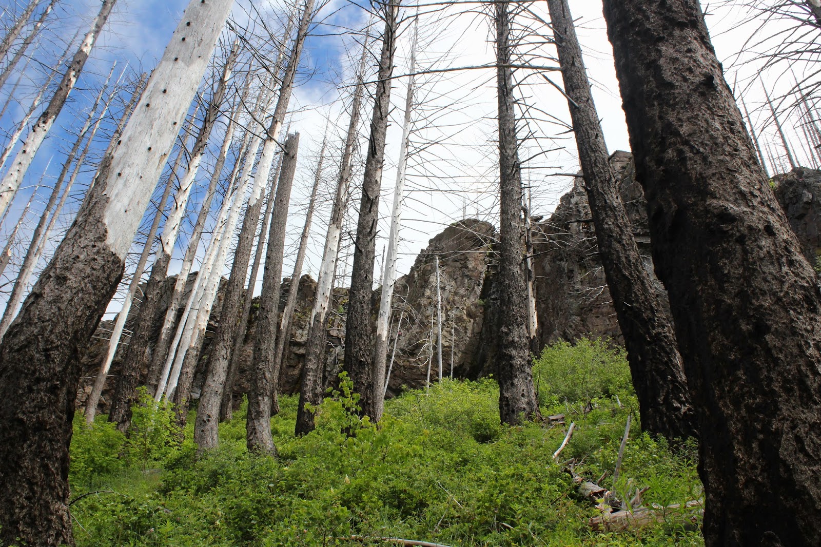
So, instead of driving to the Calf Trailhead, up Steamboat Creek on paved Road 38 we went for many miles, before making the left turn onto gravel Forest Road 3831. And after more miles we rounded a curve and were suitably awestruck at some massive cliffs above the road. And then we were suitably dismayed to see quite a bit of those cliffs lying across the road in a large rockslide comprised of boulders about the size of my KIA. There would be no hiking to Fairview Peak on this day.

"Trail" shot
Since we were all dressed up and ready to go with legs all quivery with eager anticipation, what to do? Well, in the hiking equivalent of making lemonade when you have lemons, we scrambled past the rockslide and started hiking up the road.
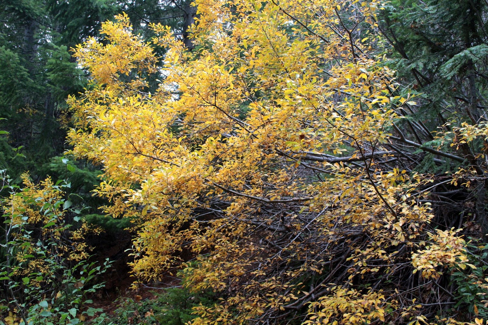
It's still autumn!
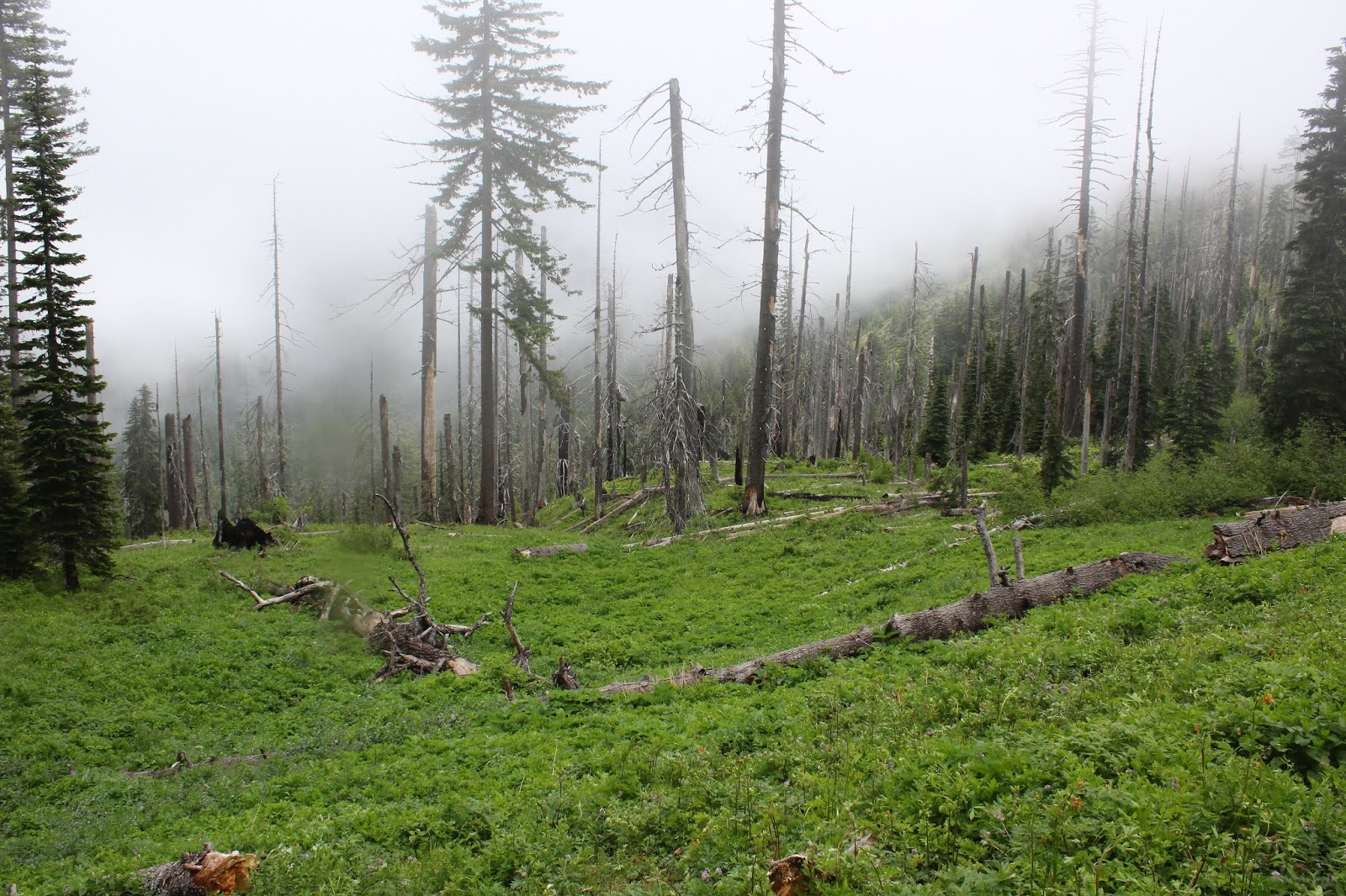
Basically, we were walking to nowhere and there was not a lot to see. The willows were turning yellow and we had intermittent views of a mountainous skyline to the southwest. The day was overcast, as befits a day forecasted for rain, and as we gained altitude a brisk wind blew as the temperature dropped. Periodically, a light rain would fall and it felt like snow was only a few less degrees away. Winter and snow are definitely coming, so we were happy with just a light rain..

View to unreachable Fairview Peak
At about the 2.5 mile mark, we arrived at a T-intersection on the Calapooya Divide. We had a nice view to imposing Fairview Peak, another 7 road miles of hiking away. Well, since 5 miles isn't really a hike, we hung a left turn for no other reason other than it would take us in the direction of Fairview Peak. Several miles later, at a saddle below Peak 4909 we sat down and ate lunch, shivering in the wintry breeze.

Eerie sunlight to the southwest
To the north and on the skyline, there was a bright white object that had us all pondering whether it was a snowy peak or a cloud. Turned out it was a cloud, but there were a few other white thingies that actually were mountains and that had us all speculating which peaks we were looking at. The consensus was we were looking at the tips of Diamond Peak and Broken Top but after consulting MapMyHike, I can definitely rule out Diamond Peak. It may have been Broken Top but the other hitherto unknown peak was probably South Sister.  

Thimbleberry leaves
So back down the road we went and the wind abated while the temperature climbed a few degrees as we descended. On the way down, we could see the snowy tips of Mount Thielsen and Mount Bailey to the south. A scramble back over the landslide ended the hike to nowhere.


Time for the second hike of the day


At the finish, we were all feeling unfulfilled, even though we had hiked 7 miles. Not having a real destination will do that to you. On the drive to the landslide earlier, at a road intersection we had noticed a road sign with the magic words "McKinley Rock Trailhead" on it. In a desperate search for a proper destination, we drove the 7 miles to the trailhead and disembarked from our vehicles. It was only a mile to the rock so how hard could it be?


Oof!
Yikes, the trail was as merciless as Attila The Pilates Instructor. It headed straight up a forested mountainside and about a half-mile in, I bonked. It was a slow and steady trudge on tired legs by myself as my apparently fitter and haler comrades practically ran up the trail, singing happy songs as they went.

McKinley Rock

You really can't see all of McKinley Rock as it rises out of a thick forest. The trail ended at the base and we craned our necks to the sky, looking up a sheer cliff of gray rock. Despite the partial view, one could sense its largeness and we were impressed. 

Generally I approve of places with the
words "Long" and "Ridge" in the name
Down was definitely easier than up and quick work was made of the descent. At least, now we could say we had hiked somewhere that had a name and we all felt fulfilled. For more pictures of this hike, please visit the Flickr album.