 |
A white lupine makes a watery offering to our pants legs
|
After an interesting drive on a rickety road with epic views down into the Boulder Creek Wilderness, we parked on a saddle between Illahee Rock and Spring Mountain, and commenced hiking from an unmarked trailhead. Immediately, it was duly noted the trail was overgrown and on the sketchy side. It had rained the evening before and the vegetation was still sopping wet and our clothing was glad to ease the burden and take on some of that wetness as we hiked through the brush.
 |
Misty view between Spring Mountain and Harding Butte
|
The clouds from that rainstorm were still hanging around, meaning the nearby mountains were hidden in the clouds and at times, we were hiking in damp fog. This trail basically followed a high ridge on the west side of Boulder Creek and (allegedly) serves up impressive views of Boulder Creek's formidable gorge. Of course, you need the clouds to go away in order to appreciate the scenery.
 |
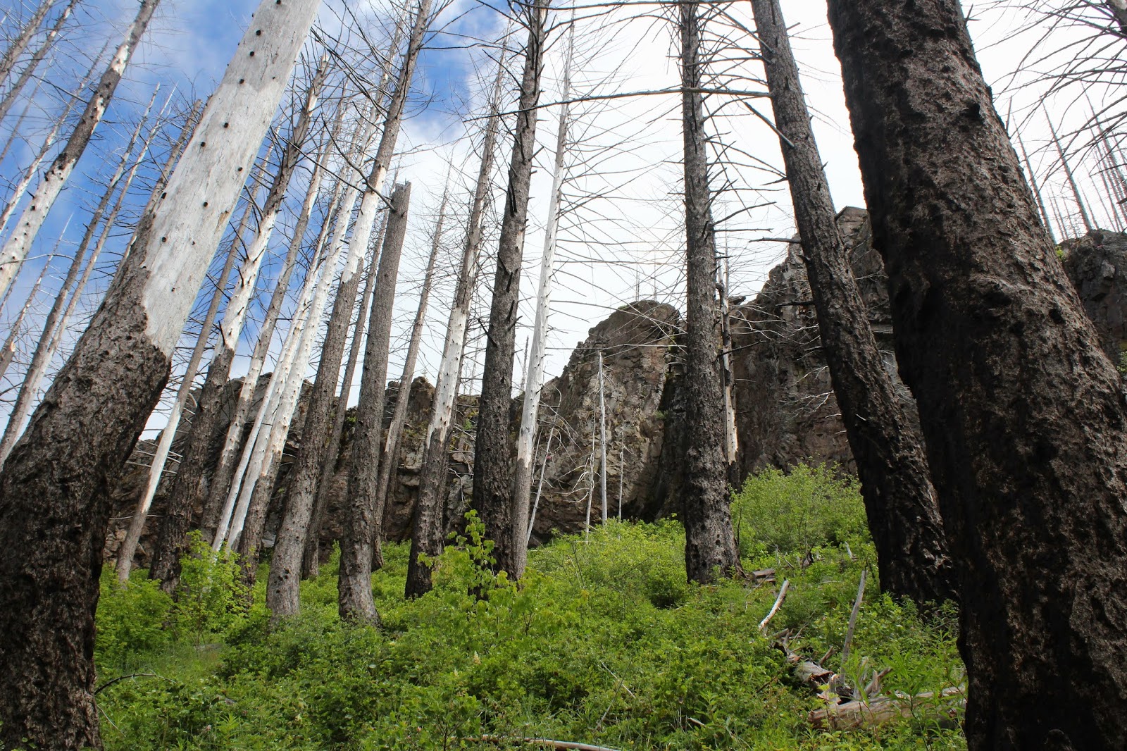
The ghosts of forests past
|
Fire visits Boulder Creek Wilderness frequently, apparently because the wilderness is the designated lightning spot for summer storms. There have been major fires in 1996 (which started on Spring Mountain, where we started from), 2006, and 2012. I'm not sure which of those three fires were responsible for all the charred ghostly snags and general all-around dearth of trees, but suffice to say live trees were in short supply on the foggy slopes of Spring Mountain.
 |
| Lane: Where'd the trail go? |
Also in short supply was decent trail tread. The soil was rocky and the trail had obviously not been maintained since the Rolling Stones were young. Besides which, rampant greenery severely encroached the path, at times making it hard to see where exactly to safely place feet. The track was contouring across a treeless slope and with the relatively poor condition of the trail, ankles were put to the test as we hiked. However, I'm glad to report that no foot joints flexed in any direction other than the way they were designed to.
 |
| Meadowlark nest in the tall grass |
So, while the rocky slopes were fire-scarred and totally devoid of trees, they were not devoid of vegetation and life in general. At my feet and in panic, a meadowlark burst out of the grass in startled flight and we pulled the grass back to observe the nest containing a quartet of blue eggs with red speckles. Meanwhile, from a nearby bush, Mama Lark begged us not to harm her babies. Other life forms, in the form of profuse vegetation, were flourishing in abundance and wildflowers were putting on their annual spring gala. Not that our pace would have been fast anyway, given the roughness of the trail tread, but one of us just had to stop and take photos of everything blooming and twittering.
 |
Ridge crest on Harding Butte
|
We soon left Spring Mountain behind and began contouring a rugged slope below flat-topped Harding Butte. As we did so, the cloud cover began to lift a bit, giving us teasing, but ever increasing vistas of the surrounding terrain. Rock formations resembling towers and pillars emerged into view on Harding Butte's crest above us and on occasion, we even enjoyed some direct sunlight, even though the warm light never lasted for more than a minute.
 |
The trail was faint, to state the obvious
|
On a grassy saddle between Harding Butte and Wild Rose Point, Lane said something like "Here's the intersection" and I'm like "Where?". There was a faint path leading to Wild Rose Point next to a fallen tree, but no other trail was in sight, although both our GPSs said we were standing on a three-way trail junction. Lane stepped over the fallen tree and wow, there was indeed a faint path through the ample growth under a stand of what, up until now, had been nonexistent live trees.
 |
I know just how that leaf feels
|
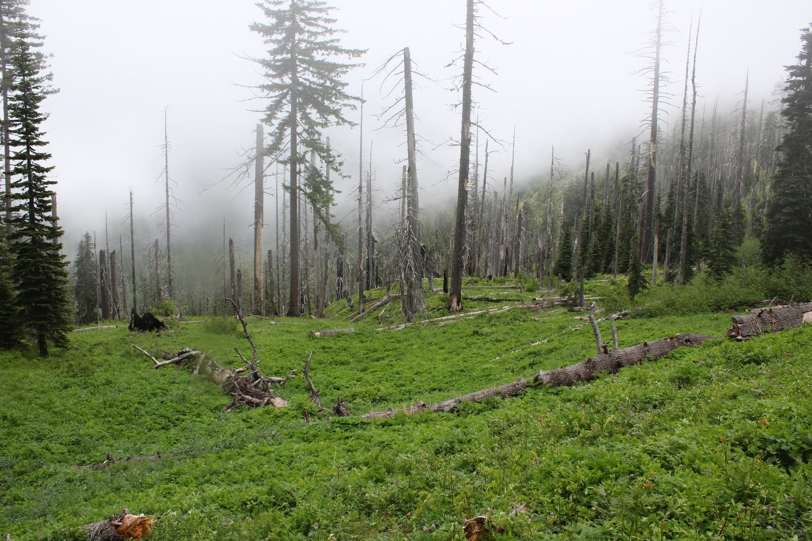
Basically this trail did a figurative U-turn, taking us round the other side of Harding Butte, eventually coming to contour across yet another treeless slope below the imposing butte. But first, we had to hike through some lush and ample meadows on a wooded slope. We were still fogbound at this point so the moisture in the vegetation had not yet evaporated and our wet pants got even wetter. Shoot, I might as well have just jumped into the North Umpqua River for all the dry that I was.
 |
| One misty moisty morning |
No complaining though, for the meadows were simply beautiful. Creeks and small runoffs crossed the trail and boot interiors soon became soaked as well. A big pile of bear dooky on the trail was proof that bears do indeed poop in the woods. The forest soon petered out, the trail returning us to that burned forest vibe, although the meadows still remained on the open slopes.
 |
| Some of that Devils Stairway scenery |
Just as we arrived at the base of Devils Stairway, the cloud cover lifted, sun broke out, and we could see. Hallelujah! Looming above us was imposing and rugged Harding Butte, now visible in its entirety. Across a large valley, rose the Calapooya Mountains with the peak duo of Fairview Mountain and Bohemia Mountain dominating the Calapooya skyline. To the south was Mount Thielsen, Mount Bailey, and other Cascades Mountains friends, the higher peaks still capped with snow. And of course, near and dear to us was the rocky ridge of Devils Stairway, and we picked our way up it, finally stopping to eat lunch amid the spectacular rock gardens on the ridge.
 |
The Calapooyas rose on the other side
of Steamboat Creek's wide valley |
After a nice appreciative view-soak and lollygag on our rocky perch, we returned back to the saddle below Wild Rose Point and grabbed the trail leading to the summit. We didn't have to gain much elevation from the saddle so it was an easy walk up to the flat-topped summit. Basically, we had the same view as from Devils Stairway, albeit from a slightly different angle, but which was even more spectacular as the clouds dissipated.
 |
Harding Butte, in all its fire-scarred glory
|
Below us and to the west was the wide and deep valley carved by little Steamboat Creek, with the Calapooyas rising beyond. However, we could now see Wild Rose Point's nearest neighbors Illahee Rock, Spring Mountain, and Harding Butte, all of whom had previously been hidden in the morning cloud cover, aka fog. All the aforementioned peak neighbors were treeless, each being covered with a plague of dead trees fuzzing up each peak's otherwise sharp contours.
 |
| Wild rose on Wild Rose Point |
All good things come to an end, especially on a short hike. However, the ruggedness of the trail and the epic scenery made this hike feel a lot bigger than it was. Could have done without the ticks we brought home with us, though, but that's just Lane complaining. I'm not complaining about ticks only because none bit me, neener neener! For more photos of this hike, please visit the Flickr album.


Don't neener neener the ticks....remember what happened in the past when you mocked the ticks!
ReplyDeleteYou'd think I'd learn, but no!
Delete