Showing posts with label diamond peak wilderness. Show all posts

Saturday, August 20, 2022

Salt Creek Falls to Fall Creek Falls


Salt Creek Falls is Oregon's second tallest waterfall, eclipsed only by iconic Multnomah Falls. Situated approximately halfway between Eugene and Bend, the falls receive a lot of visitors who generally take a very short walk to a paved overlook. However, there are two other falls in the area with actual trails that go to them and once you leave the viewing area, it's a quiet walk on a real trail with few people on it.

Mist and sun had a baby and called it "Rainbow"

From the viewing platform, a dirt trail takes hikers down for a closer look at impressive Salt Creek Falls. The path does not go all the way down to creek level (unless you illegally hop the barrier and do the dangerous scramble down) but it was close enough for the eight of us to soak in the majesty and splendor of the falls. We also got to soak in the cool mist swirling off the cascade and admire the resultant rainbow spanning the Salt Creek's canyon.

The epitome of "rickety bridge"

There's no pavement in hiking, or so I've often said, but you do have to hike a paved path to a long and saggy wooden bridge spanning Salt Creek above the falls. Diamond Creek Falls Trail officially commences at the bridge and once we crossed the rickety span, we were off hiking through a lush forest on our way to Diamond Creek

One small facet of Diamond Creek Falls

It was a steady uphill slog to the path leading down to Diamond Creek Falls. The muddy track was steep and you had to watch your step. A complicating factor was a vertically oriented log with notches cut into it, serving as a rustic one-railed stairway. The cascade is what is termed a "fan waterfall" and I'm definitely a fan! However, "fan waterfall" probably has more to do with the way the creek delicately fanned out across the face of its cliff and less to do with any ardent admirer. In my modest but totally correct opinion, Diamond Creek Falls were the best of the waterfalls we'd visit today.

The irony of crossing tracks in
order to enter a wilderness area

If there's no pavement in hiking, then there probably shouldn't be any trains, either. But there they were, a set of railroad tracks for us to walk across, which we did, nervously looking both ways for any train speeding in our direction. Make fun of me if you will, but I saw the movie "Fried Green Tomatoes" and I know that feet getting stuck in rails in front of an onrushing train is a calamity best avoided. 

A moment of reflection on Diamond Creek

After the railroad crossing, our route entered the Diamond Peak Wilderness via the Vivian Lake Trail, which went totally steep on us.  Huff, puff, we were soon gasping for breath like beached carp while admiring the beautiful forest we were trudging through. There were a number of small creeks and bogs on the trail but decaying boardwalks got us through and across. The forest did provide some fruity succor in the form of huckleberry, salmonberry, and thimbleberry and I partook thereof.

What little we could see of Fall Creek Falls

By comparison to splendid Salt Creek Falls and Diamond Creek Falls, Fall Creek Falls was rather mundane and ordinary. Because of the way the trail was perched on a cliff next to the cascade, you could only see the top half of the falls. I'm sure the cascade would be a lot more spectacular if you could see it completely from top to bottom but if you tried to bushwhack down, you'd be one of those "never heard from again" people.

Much of the Diamond Creek
Falls Trail looked like this

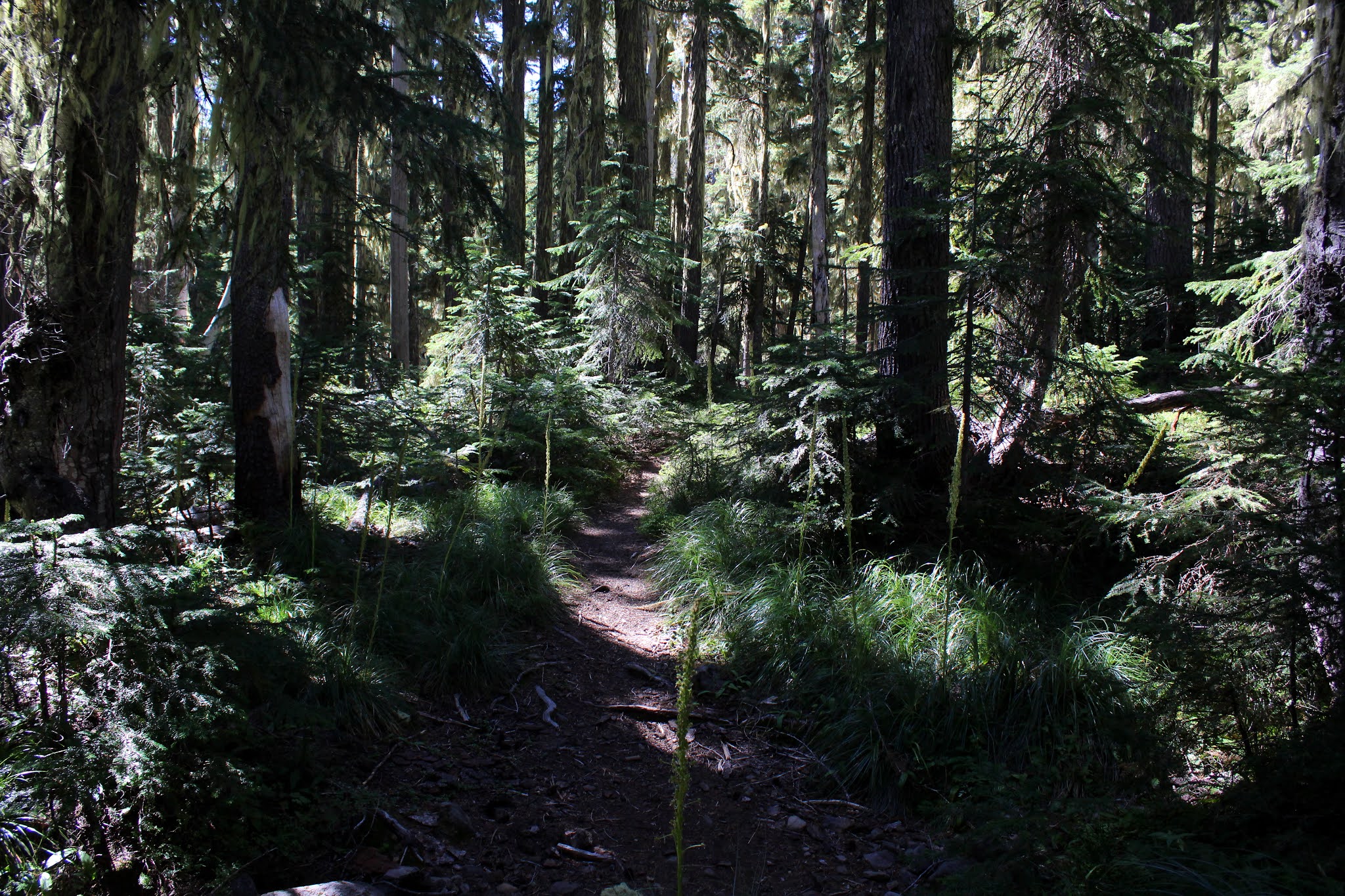
My legs quit on me at that point, having given their all to get me up to Fall Creek Falls. So while everybody continued on to Vivian Lake, I called it good and headed back down the trail to return to Diamond Creek. This time I'd head past Diamond Creek's waterfall and continue on the loop route back to Salt Creek Falls. At this juncture, most of the route went through some lovely shaded forest that felt cool on an increasingly warm day. While Diamond Creek was not seen much, it was always heard as the trail paralleled the creek's path.

Salt Creek has carved a deep and massive gorge

Diamond Creek eventually joins up with Salt Creek and the two creeks then conspire to carve out a deep and spectacular canyon. Periodic openings in the forest cover provided impressive vistas of the gorge with Salt Creek flowing way below the trail. Being prudent in my dotage, I did not venture too close to the rim's edge, it could be a quick trip down, for sure.

Too Much Bear lake was "unbearable"

There is a small lake in the area by the name of Too Much Bear Lake but you could only reach the lake from one particular side trail. I did go down to see the lake and snap a few photos and I "enjoyed" the steep but short hike back to the main trail when done. I didn't see any bear so on this day at least, the lake was quite misnamed.

Salmonberry provided some hiking sustenance

While waiting for my comrades to return to the trailhead, I took a pleasant nap next to Salt Creek, the sound of the rushing stream dropping me into a peaceful slumber. When I woke up to the sound of Lane's squeaky voice permeating the otherwise peaceful air between the trees, I was fully refreshed and sated. A waterfall hike (and nap) will do that to you and this had been one of the better ones.

Mike and Missy on the "trail"
down to Diamond Creek Falls

For more photos of this hike, please visit the Flickr album.

Saturday, August 29, 2020

Fawn and Stag Lakes


Forgive me if I start fawning over Fawn Lake. Sometimes, it feels like mountain lakes in the Cascades are a dime a dozen but Fawn Lake is arguably one of the better ones. Situated in a high mountain pass at the base of several cragged and jagged peaks, the postcard view of the lake is a ready made advertisement for hiking in the Diamond Peak Wilderness. To top it off, there is a large rocky bench overlooking the lake with just the perfect backpacking campsite atop it. Be it day hike or backpack trip, Fawn Lake is most definitely a worthy destination. 

These guys!

Doe Lake is nowhere to be found but never fear, Fawn Lake is not an orphan because a protective and nurturing Stag Lake keeps watch from nearby. I can relate to that because I single-parented my kids for seven years, and how about a tip of the hat to all the stags out there raising fawns all on their own. Anyway, after hiking to Stag Lake, I'm all about stagging over Stag Lake because Fawn Lake comes in a close second best, scenery-wise. And if you think I overplayed the cervine puns and references, “Oh, deer!” is all I’ve got to say. By the way, my mother's sister Lerna has always gone by the name of Ler for short, but us kids just call her Aunt Ler. Oh, deer, once again.

Let's go hiking!

This was the final day of our campout at Odell Lake so it stood to reason that our last hike had better be a good one. We disembarked from our vehicles at the Crescent Lake boat ramp parking lot and in a hiking oddity, we had to hike a short distance to the actual Fawn Lake Trailhead. In other words, we had to hike from the trailhead to the trailhead, and that made about as much sense as the Electoral College. We were going to Fawn Lake of course, but the Metolius-Windigo Trail also departs from the same trailhead. Curious about this trail, I did a little research and found out the MWT is about 100 miles long and runs from the Mount Jefferson Wilderness to Windigo Pass in our own Umpqua National Forest. I'm game, who's with me on this? 

An easy walk through gorgeous woods

But back to the subject at hand, I'm supposed to be writing about the hike to Fawn Lake and not about enticing 100 mile long trails that call to me. In keeping with the volcanic legacy of the Diamond Peak Wilderness, the trail was dry and dusty and surrounded by a lush and healthy forest that gradually transitioned to a forest of scrawny lodgepole pine trees as we gained elevation. The grade was always uphill but never what I would call steep so it was a pleasant walk through the woods and volcanic dust on the way up to Fawn Lake. 

The gawking begins at Fawn Lake

After three miles of easy hiking, we arrived at peaceful Fawn Lake. The lake reposed poetically in a forested bowl surrounded by tall mountains. At the opposite end of the lake, loomed craggy Lakeview Mountain, Peak 6892, and Redtop Mountain which was mostly tucked around a corner of the lake. The air was fairly still so all the aforementioned peaks reflected nicely on the lake's surface. I had been here before but none of my ducklings had been, so it did my heart good to hear all the oohing and aahing from my appreciative brood. 

Part of the hike up to Stag Lake

After a requisite stop for a view soak, we grabbed the Crater Butte Trail which rounded the north shore of Fawn Lake. The path climbed steadily through thin woods and low scrub, the view of the lake improving until it eventually receded from view. The trail was seemingly heading straight to Peak 6892 but before we crash landed on the peak, so to speak, we made a right turn onto the Stag Lake Trail. 

The Stag Lake impostor

"Is that all there is?" we collectively wondered as we gazed at a very unimpressive semi-stagnant pond with lily pads floating on the surface. All that work to get here and it was sad indeed to get so disappointed by an underwhelming pond until John noticed a continuation of the trail. And me with a GPS that I didn't even think to consult with! Fortunately, the trail did continue to a lake that just had to be Stag Lake. Just to be sure, I checked my GPS this time. 

All the magnificent scenery still cannot
prevent me from acting like an idiot

Stag Lake sits right at the foot of craggy and impressive Lakeview Mountain, the gray rock looking as formidable and unassailable as a medieval redoubt. The symmetrical cone of Peak 6892 was also looking down upon Stag Lake, just not from front and center like Lakeview Mountain was doing. Lake, mountains, and forests were all reposing under a clear and deep blue sky spread out above. Such magnificent scenery just demanded a lengthy and reverential contemplation stop and we so obliged. 

Missy hikes through a lodgepole forest

After an hour-long view soak, lunch, and general all-around lollygaggery spent lazing in the sunshine with maybe a nap or two by a hiker or two, it was back the way we had come. On the way back, we made sure to retrieve some of our friends who stayed behind at Fawn Lake for a shorter hike and I’m glad to report we finished the hike with the same amount of hikers we started out with. I’m also glad to report that the weather was absolutely glorious, unlike my only other outing here where I had to run down the trail dodging lightning bolts hurled by weather gods using me for target practice. Some experiences don’t need to be relived. 

Part of that great campout at Odell Lake

All present agreed this had been a grand hike and the whole campout at Odell Lake had been an unqualified success. For more photos of this hike, please visit the Flickr album.
 

Thursday, August 27, 2020

Yoran Lake to Midnight Lake


Mount Yoran is a comparitively smallish pinnacle that has the misfortune of eternally standing next to massive Diamond Peak. Anywhere else, Mount Yoran would be an impressive peak in its own right but whatever stature it may have had gets eclipsed by the imposing geologic marvel that is Diamond Peak. At the feet of both Diamond Peak and Mount Yoran lies Yoran Lake, and all things Yoran have the misfortune of being so named because I always trot out the hackneyed one-liner “That one’s Yoran and that one’s his’n!” I’ve got a million of them folks, and that’s why I hike alone a lot.

Penny demonstrates a case of the eebie-jeebies

We (Friends of the Umpqua) began hiking from the Trapper Creek Trailhead, where signs advised that the log bridge over Trapper Creek was damaged and as a consequence, closed. Naturally, we all hiked past the sign and across the one-railed bridge, some of us sure-footed as mountain goats and others as wobbly as dizzy drunks fresh off a merry-go-round. The bridge did have some damage but did not particularly look or feel structurally unsound. It spanned rushing Trapper Creek coursing about fifteen feet below, and the exposure engendered by the narrowness of the log and the lack of a handrail on the right side gave some hikers the eebie-jeebies but we all made it safely across without incident.

The forest sublime

Once past Trapper Creek, our route inclined uphill through a lush forest and that was the story for the next four miles or so. Also a theme of the hike were ripe grouseberries. These small red berries are a member of the huckleberry family and although the berries are much smaller than their delicious cousins, I daresay the grouseberries have a much sweeter flavor. I can say this because along with my friends, grazing and sampling the berries growing on the low plants was a thing for the entire hike.

Just another lake next to the trail

At about the three-mile mark, a side trail took us to an unnamed lake near the trail. I’m not sure why the lake has been deemed unworthy of a name, for it was fairly large, blue-watered, and somewhat photogenic. It was the first of many such lakes seen on this hike, most of which were also unnamed. It was here that mosquitoes began to make their pestering presence known, which stands to reason, given all the water just standing in the forests below Diamond Peak.

Perfect view of Yoran Lake and Diamond Peak

Next up was Karen Lake and after a brief visit there, it was just a short walk over to Yoran Lake, the crown jewel in the day’s lake tiara. What Yoran Lake has that all the other lakes don’t is a postcard view of Diamond Peak looming over the blue lake. A steady breeze ruffled up the lake’s surface so there was no photography of the mountain reflecting upon the surface today, but the view was awesome nonetheless. In tribute to the lakeside vista, we all plopped down on the sloping banks and ate lunch while also partaking of the incredible scenery.

Penny becomes a temporary PCT through-hiker

Several years ago, Kevin, Dale, and I backpacked in this area and we at this point, had to bushwhack cross-country to reach Lils Lake and the Pacific Crest Trail. Nowadays however, a maintained and bonafide trail connects lakes Yoran and Lils so I'm sad to say no navigational challenges presented themselves on this day. Once we hit Lils Lake with Mount Yoran looming high on the western ridge line, it was just a short walk up to the Pacific Crest Trail.

The Hidden Lake inspection crew

There were all manner of small ponds, wet spots, swamps, lakelets, and other erstwhile mosquito hatcheries next to the trail, too numerous to mention even though I just mentioned them. The first lake worthy of a name was Hidden Lake and after taking the short path to the lake, I wondered why it was named Hidden Lake, because we easily found it.

Message board of sorts at a PCT backpack campsite

The next several miles were a pleasant descent through a very well shaded forest, increasingly appreciated as the day warmed up. Also, as we lost elevation, the mosquitoes became less and less of a nuisance, which was also appreciated. There were two more named lakes, Arrowhead and Midnight, and we paid a visit to each in turn. Arrowhead Lake is so named because it does resemble an arrowhead when seen on the map and Midnight is so named because of some reason unbeknownst to me. Maybe it’s shaped like midnight.

Shoreline at Karen Lake

It is possible to return to Trapper Creek from the Pengra Pass Trailhead via trail, making for a 12ish mile loop hike but we did this as a shuttle, ending our venture at Pengra Pass. Still, we got in nearly eleven miles of hiking, six mountain lakes with a name, and something like sixteen hundred six lakes without. Not bad for a day’s work. Plus, I got to use the “That one's Yoran and that one’s his’n!” line on some unsuspecting hikers who had to put up with me since I had the car and keys.

Midnight Lake in broad daylight

For more photos of this hike, please visit the Flickr album.


Tuesday, July 25, 2017

Fawn Lake

I really detest deer, I've had my hiking poles stolen one too many times and have suffered through about 40 too many camp raids at 2 A.M. to feel anything but hate in my heart for the cervine larcenists. My antipathy towards the antlered devils even triggers involuntary conniption fits whenever I hear the phrase "North Bank Deer Habitat", even though I hike there often. 

Gnome plant emerges 
"But fawns are cute" I am told. Well, you shouldn't have kittens if you don't like cats. As a person who regularly gets tormented by a singularly annoying cat that I can't hurt because it belongs to my wife, I don't have kittens. And following that same logic, I don't have fawns, either, because they are sure to grow up to be hiking-pole stealing adult deer. So deep is my loathing of all things deer, that I nearly didn't want to ever hike to Fawn Lake ever, just because of the name.

Wispy clouds foretold the arrival of a thunderstorm
But what's in a name, anyway? Not much, in the case of Fawn Lake. The lake is an absolute gem of a lake sparkling in the midst of all the scrawny lodgepole trees and dusty pumice soil so prevalent on the east side of the Cascades. I'd even go there again, in spite of its titular homage to baby deer.

Most of the hike was inside the wilderness
Starting at the Crescent Lake boat ramp parking lot, the trail went dusty at the outset as it wandered through sparse woods before crossing paved Forest Road 60. Once across the road, the trail entered the Diamond Peak Wilderness and became a real hike, with mosquitoes and everything. Deet was quickly slathered on to ward off the airborne school of six-legged piranhas.

Yup, my view for nearly 4 miles
Angling gently uphill for all of its 3.7 miles, the trail passed through viewless forest consisting of mostly spindly lodgepole pine trees. At just under the one mile mark, the Fawn Lake Trail intersected with the Pretty Lake Trail. My guidebook said the Pretty Lake Trail was unmaintained and sketchy but it looked like it's seen the love lately as it was wide, clear of fallen trees and brush, and with trail tread well tromped out by lots of hiker boots. I think I just found my return route back from Fawn Lake!

Lodgepole trees in all their scrawny glory
There wasn't a lot to see on the way up. It was hot and the forest was full of mosquitoes so mostly, I kept my head down and just trudged uphill. It was quite jarring when the trail, without warning or preamble, just bumped into Fawn Lake, where I plopped down to enjoy the view and eat lunch while slapping at mosquitoes brave enough to drill past the thick layer of Deet on my skin.

Time to ooh and aah at Fawn Lake
This lake really is a jewel. At the far end of the lake, rose the scenic and craggy twin peaks of aptly named Lakeview Mountain and generically named Peak 6892. To the left, was cliffy Redtop Mountain. A soft breeze blew and sunlight sparkled on the on the rippled surface. Dragonflies and butterflies flitted to and fro, alighting occasionally on the shoreline vegetation. The cold water was amazingly clear and a myriad of water boatmen (a small aquatic bug) paddled their oars just underneath the lake's surface. Unbelievable that such a pretty lake could actually be named after devil deer spawn.

Peak 6892 and Lakeview Mountain
Speaking of pretty lakes, after lunch I resumed hiking along Fawn Lake's southern shore with the intent of hiking to nearby Pretty Lake and then returning on the steep, but downhill, Pretty Lake Trail back to the Fawn Lake Trail. Hiking was slow along Fawn Lake because each new bend in the trail provided yet another different look at the lake and each time, I just had to bushwhack down to the lake for a look-see.

Clouds form as the storm arrives
The far end of Fawn Lake was particular scenic, providing a closer look at Lakeview Mountain. Fawn Lake was visible in its entirety, and puffy white clouds formed in a blue sky above the lake. Much photography ensued.

The day went dark in about 15 minutes 
Boom! A loud clap of thunder got my immediate attention. Seems those puffy white clouds were the precursors to thunderheads that were blowing in from behind me while I had been distracted by Fawn Lake. It took like only 10 minutes for the day to switch from hot and sunny, to hot and stormy. The rumbling of thunder was now a constant and it was like hiking in the bowling alley of the gods. I'm not sure who Prudence is but prudence dictated I seek lower elevation immediately. Since Pretty Lake was higher in elevation than Fawn Lake, rather than loop it back on the Pretty Lake Trail, it was back the way I came on the Fawn Lake Trail. There's no real upside, that I can think of, to getting pretty electrocuted at Pretty Lake.

Trail, through the lodgepole forest
Lodgepole forest is not particularly scenic. Lodgepole trees tend to grow in poor soils where no other tree will grow, so a lodgepole forest will invariably consist of trees that are thin, scrawny, and spindly. Because of the poor soil, there generally is not a lot of undergrowth. I didn't take a lot of pictures of the forest because there really isn't much to take pictures of in a lodgepole forest. Plus. coming up the trail I had mostly focused on trudging uphill while sweat, sunscreen, and Deet dripped onto my stinging eyes as I cursed mosquitoes. But on the easier hike downhill, I discovered there really was a lot to see.

A healthy clump of pinesap
The heterotrophic plant community was having a heyday, emerging from the pumice soils in abundance. Pinesap was everywhere, sprouting in dense clumps while less common pinedrops were scattered here and there in comparatively more stately and elegant stalks. Much rarer were the seldom-seen gnome plant and I was fortunate to find a couple of clumps flowering pretty much upon emergence from below. In all my years of hiking, I had never seen gnome plants and now this was the second summer in a row I've run into these little oddities.

Help meeeeee.....!
"What is a heterotroph?" you ask? Well, maybe you didn't ask, but I'll tell you anyway. Heterotrophs are plants that lack chlorophyll and hence, are unable to make food from sunlight. Therefore, they must obtain nutrients by parasitizing upon nearby tree roots, probably lodgepole trees in this case. Anyway, I spent a lot of time at ground level, taking pictures of pinesap, pinedrops, gnome plants, and candystick. On one candystick, a crab spider had ambushed a bee and I got a cool picture of the insectile murder. The bee didn't think it was all that cool, though.

Mammatus clouds
Boom! Dang thunder interrupted my photo shoot! The rumbling was getting louder and louder so I walked pretty fast down through the forest. Fairly often, I'd stop to take a photo of something and the electricity gods let me know their displeasure by startling me with a loud clap of thunder. But at least they weren't hurling thunderbolts...yet. At the parking lot, the cloud formations were truly spectacular.

The lighting and clouds were on the eery side
Mammatus clouds are, according to Wikipedia, "sagging pouch structures" on a cloud. Basically, mammatus clouds are the soft dark sagging underbelly pouch-structure of a thunderhead cloud. My thought, on seeing these clouds, were that they were less sagging pouch structures (I have a few of those too, by the way) and more like celestial bubble wrap. That would explain how thunder gets made, too: Thunder is merely the sound of gods popping bubble wrap.

A stalk of pinedrops gets ready to flower
At any rate, this was a nice little hike in spite of the deer-based name. For more pictures of this hike, please visit the Flickr album.


Saturday, June 20, 2015

Diamond Peak Loop

Many years ago, I went on my first backpack trip as a mature adult. Well, the "mature" part might be debatable but anyway, I showed up with a pack that must have weighed at least as much as a blue whale, or so it seemed. Overly heavy to be sure, but I was prepared for every conceivable calamity ranging from earthquakes to a rabid moose bite. My friend Ned Landis, with nothing but kindness in his heart, went through my pack and offloaded a lot of that unnecessary weight. Even so, the pack was too damn heavy. From that fateful trip, I did learn one lesson that still stays with me to this day: weight does matter!

Dinner is a dehydrated dragonfly head
Nowadays, I get mad at myself if my pack is over 30 pounds and just like Ned did so many years ago, I go through newbie's packs and remove stuff and preach the gospel learned on that fateful trip "Weight does matter!" Newbies tend to overpack just as I did on that fateful first trip, it is up to us grizzled veterans to demonstrate our lighter packs and total backpacking knowledge and general all-around awesomeness. That's why it was disconcerting when newbie Kevin showed up with a lighter pack than both mine and Dale's. We were both showed up by a rookie!

Day 1

Bridge over Trapper Creek
Although this trip consisted of five days in the Diamond Peak Wilderness, the hike got off to a decidedly non-wilderness feel when right at the start we crossed several railroad tracks, our heads swiveling back and forth as we kept a watchful eye out for any speeding trains. The tracks concluded the civilized portion of the hike as just on the other side, a wooden sign marked our entry into the wilderness.
Beargreass


The Yoran Lake Trail initially climbed gently through a beautifully greened out forest. Trapper Creek was full of water and was running fast with spring snow melt. The mosquitoes weren't too bad and we enjoyed our nice little forest stroll. 

Diamond Peak, from Yoran Lake
After several miles, the uphill slant increased in severity as the trail gained elevation. Pretty much all 8 miles of the first day's hike was spent plodding uphill. Just as we were starting to get bored with viewless forest, the trail did a walk-by past an unnamed lake, Karen Lake, and then Yoran Lake, each lake larger than the one before. Yoran Lake in particular provided us some wow with a great view of snowy Diamond Peak looming over the body of water. The mosquitoes increased in number and became generally annoying but not voracious enough (yet) to make us lose our sanity.

I'm following Richard, I better check my GPS!
We had been hiking on the Yoran Lake Trail and the trail ended at its namesake lake. It was a little bit of a problem because our route required us to be on the Pacific Crest Trail which ran almost a mile to the north and was slightly uphill from Yoran Lake. Armed with compass and GPS we left the trail, following Yoran Lake until there was no more Yoran Lake to follow. Continuing northward beyond the lake, we bushwhacked through the forest, placing an inordinate faith in all our electronic navigational gadgetry.

Lils Lake
Exactly according to plan, we popped out of the forest at scenic Lils Lake and one short uphill bushwhack spit us out of the forest and onto the Pacific Crest Trail. All total, the day's hiking would gain over 2,100 feet of elevation with a substantial amount of the total gain taking place on this section of the PCT. In short, it was a tedious slog up to a pass below Mount Yoran, Diamond Peak's immediate neighbor. 

Mount Yoran, above an unamed lake near Divide Lake
All that uphill became a very steep drop to the base of Mount Yoran and Divide Lake, our home for the night. Just a small, seemingly unremarkable lake but Divide Lake is all about location, location, location! The lake is strategically situated at the base of Mount Yoran and the view of both lake and mountain was breathtaking.

The mosquitoes were kind enough
to share Divide Lake with us
Camp was pitched on a rocky bluff overlooking Divide Lake, to the accompaniment of thousands of buzzing mosquitoes. Dale discovered he had forgotten not only his cool hat with the neck shade, but he had also forgotten his spoon. Improvising, he used his Deuce of Spades trowel (which he swears had only touched dirt during its lifetime) much to the perpetual amusement of Kevin and I. If I had forgotten anything, I'm not telling because its my blog and I can write whatever I want to. Newbie Kevin, on the other hand, had not forgotten a thing. Anyway, much merriment ensued along with puns about the trowel doing double doody and how Dale could really shovel the food down, etc.


Day 2

Grandeur
All that steep drop down to Divide Lake made for a big climb back up to the Pacific Crest Trail; might as well get the hard stuff done first thing in the morning. Our reward for returning back to the PCT was a relatively level trail and some world-class scenery as the venerable trail contoured below the massive rock wall of Diamond Peak. The easier walking was much appreciated, coming as it did after a tough hiking day.

Our view for most of Day 2
This was my favorite part of the trip. The PCT undulated gently in slow rolling ups and downs through an alpine rock garden. Snow drifts covered the trail and small tarns collected snow melt just off trail. Penstemon and partridge foot bloomed between rocks as we walked through miles of delightful rock gardens. Nascent streams trickled musically across the trail, the crystalline clarity of the water entrancing passing hikers. And always, Diamond Peak, its rocky crags flecked with snow, loomed above the trail. Kevin admitted that on the Day 1 slog, he wondered why he had volunteered to come along, but it all made sense on Day 2.

We could see all the way to Mount Shasta
We pretty much had the PCT to ourselves although we did run into two scrawny ladies doing a marathon trail run and one backpacker who'd been hiking since starting at Mount Shasta about a week prior. Speaking of Mount Shasta, amazingly we could see the peak on the horizon as we rounded the south end of Diamond Peak. The sky was cloudy and it felt like rain was coming, yet there was Shasta, faintly visible from a mere 145 miles away! Other peaks nearer and dearer to us Oregonians were eminently visible from the PCT: Middle and South Sister, Maiden Peak, Cowhorn Mountain, Sawtooth Mountain, Union Peak, Mount Thielsen, and Mount Bailey.  Sounds like a roster of my blog posts over the years!

Colorful Rockpile Lake
A trail junction past the southern end of Diamond Peak was our cue to jump off the PCT and take a side trail to Rockpile Lake. Nearby Marie Lake gets a lot of backpacking love as it's the logical starting point for those climbing up to the top of Diamond Peak. However, stunningly colored Rockpile Lake is much more scenic and we had the place to ourselves, although the mosquitoes drove us into our tents well before the sun went down.


Day 3

Celebrating Clean Underwear Day
Day 3 of a 5 day trip marks the halfway point and as such, is that cherished and special day euphemistically referred to as Clean Underwear Day! Clean underwear is not overrated and let's just say we left Rockpile Lake with buoyant enthusiasm engendered by the wonderful sensation of freshly laundered clothing "down there", to put it delicately.

Mountain View Lake view
It was an uphill trudge for the first couple of miles on the hike away from the Pacific Crest Trail. After cresting a broad rise, a rest break was taken at the aptly named Mountain View Lake. There was a mountain, there was a view, and there was a lake. Seriously, the little lake provided an awesome vista of snowy Diamond Peak rising above the waters. After a short view soak, it was then all downhill for the rest of the day. As the trail lost elevation, the scenery transitioned from all that wonderful alpine wonderland to dull, drab, and dusty lodgepole forest that was singularly uninteresting. The main excitement on this part was reaching the Whitefish Trail which then delivered us to Diamond View Lake, our home for the next two nights.

A perfect ending
It had been a short 6.7 mile hike to Diamond View Lake so there was plenty of time to kill. Kevin and I sat by the lake all afternoon, cameras clicking all the while,  If anything, the view here of Diamond Peak was even more scenic than the view at Mountain View Lake. The sun eventually sank behind the mountain and more camera clicking took place with the advent of a spectacular sunset.


Day 4

Why we hike
There's a "Leave it to Beaver" episode where Ward Cleaver takes Wally, Beaver, and friends to the movies. When they exit the theater, they find Beaver is still in the theater. Lumpy goes back into the theater to find Beaver but Beaver comes out and now where's Lumpy? So Wally goes to find Lumpy and Lumpy comes out and then someone has to go find Wally, and so on so forth for 30 minutes. Well, we were ready to start our day hike to Saddle Lake and Dale has to go back and get his GPS. But wait, I have to go back and get my hiking poles. Now, are we ready, guys? Whoops, I forgot my GPS. Even Kevin got into the act, having to go retrieve a hiking pole. Cue the laugh track and cut to commercial!

Saddle up, Kevin, we're going to Saddle Lake!
Anyway, Day 4's festivities got off to a great start (once we actually started!) with Diamond Peak reflecting on the mirrored surface of Diamond View Lake in a quintessential postcard view. If every day of the rest of my life started out like that, I'd probably be much easier to get along with. Our itinerary  for Day 4 was a short day-hike to aptly name Saddle Lake, which sits on a forested saddle between Peak 6982 and Redtop Mountain. It was a brisk climb away from Diamond View Lake and we were all glad we weren't toting fully loaded backpacks. Most of the day hike was spent in forest but here and there the crest of Diamond Peak appeared between the trees on the climb up to Saddle Lake.

Bug with a heart-shaped butt
It was a lengthy and enjoyable lollygag next to Saddle Lake, the time spent watching mothy little bug things swim across the surface of the lake. Periodically, large armored beetles with heart-shaped carapaces crawled on us, triggering the occasional "Gah!" moment. The day and lake water were each on the cool side, otherwise we may have gone swimming with the mothy things.


Dale and his amazing Sooper Dooper Pooper Scooper spoon

Back at camp, we shared Diamond View Lake with some Pacific Crest Trail thru-hikers whose trail names were Bubba Gump and Smiley. Pleasantries were exchanged from a safe distance as they had that certain air about them that comes from way too many miles on the trail between showers, even the mosquitoes laid off of them. And speaking of showers, Day 4 was Bath Day and all members of our party at various junctures waded into Diamond View Lake (sorry, fishies!) to remove trail dust and that certain air about us.

Night light
Just like the night before, the sunset at the lake was spectacular, albeit cloudier. Much photography ensued while slapping at mosquitoes. Back at camp, our sleep was interrupted by a sick sounding croak emanating from the trees. Dale was sleeping in his hammock and although the croak sounded a lot like Dale, the croaking originated from a point much higher in the trees than his hammock. It was probably a dyspeptic crow, expressing displeasure with our uncommonly clean camp.

Day 5

Not the most interesting trail ever
Day 5 was getaway day and the hike out was about 5 downhill miles. As the path dropped down towards Odell Lake, Trapper Creek showed up next to the trail again as the forest morphed from dull lodgepole to a verdant forest draped with old man's beard. Lupine and beargrass bloomed next to the trail, providing a colorful counterpoint to all the greenery.


As usual, we had to step over the odd tree that had fallen across the trail, nothing new there. However, there was a large patch of downed trees that made the trail darn near impassable and we had to snake our way through the branches and trunks, passing our packs forward hand to hand like a bucket brigade from a 19th century house fire. Kevin's pack was still the lightest, darn it.


Back to civilization!
As we continued to lose elevation next to Trapper Creek, the trail tread widened, the ground well-tamped by frequent use in an indication we were nearing the trailhead. And sure enough, after a perfunctory 5 miles, we crossed the railroad tracks that had an Amtrak passenger train parked on a railway siding, waiting idly for no apparent reason. From there, it was off to a real breakfast at Odell Lake Resort where we ate outside so as not to "perfume" the restaurant. And I'm both happy and sad to report Kevin did not fall for the "guy with the lightest pack buys the meal" trick.

Sunset at Diamond View Lake
For more pictures of this hike, please visit the Flickr album.