

It was such a beautiful day. The sun was out with nary a cloud in the clear blue sky, manzanita bushes were in bloom, bees were buzzing, and the temperature was a wonderfully mild 70 degrees. So, why so glum, Richard? Despite absolutely the near-perfect spring-like weather, my inner Chicken Little was screaming "BUT IT'S FEBRUARY, WHERE'S THE #$@& SNOW??!!!" So yeah, it was a delightful hike in the fine weather conditions along historical Sterling Mine Ditch, yet there had been a sense of unease and foreboding about what promises to be a hot, dry, and fiery summer because of "winter" days just like this one. So, I just lived in the moment and enjoyed the hike anyway, much as a lemming would enjoy the run approaching the cliff.
 |
| Just a trail and its ditch |
And speaking of environmental disasters, back when Jacksonville was experiencing its mining boom in the mid to late 1800's, the Sterling Mine Company employed Chinese laborers to dig a 25'ish-mile ditch to divert water from the Applegate River to the mine's hydraulic operations. Along with the prodigious mining scars, the remains of the old ditch still exist. The good part about the ditch is that the downhill-side berm makes for a handy-dandy hiking and mountain biking trail. And simply because I'd never been there, today's hike began on the Deming Gulch Trailhead.
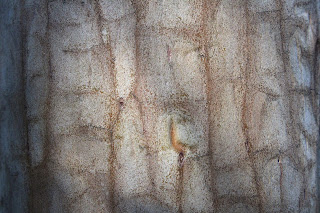 |
| Tats on a madrone trunk |
Right from the get-go, the hike had that distinctive Siskiyou foothill vibe. The terrain and atmosphere were clearly drier than our comparatively sodden Cascades, and the thin woods and forests were populated with madrone, oak, cedar, Ponderosa pine, and other assorted conifer. The oak trees were currently bare, stark, and leafless but the plentiful lichen adorning the scraggy trees didn't seem to mind. Madrone and Ponderosa pine each added some color to the hike, mostly in the form of orange trunks like so many ex-presidential limbs. Poison oak was a thing too, but let's give thanks to the wide and well-maintained Sterling Mine Ditch Trail for letting us avoid the itchy madness that Satan's favorite shrub can engender.
 |
| A sparse forest as the trail rounds Peak 3259 |
The route was rounding a combo of Peaks 3214 and 3259 on the northwest side and as a result, much of the first part of the hike was in shade. Armstrong Gulch sort of cleaves the peaks in two, bending them into a U-shape and once we rounded a ridge and entered Armstrong Gulch at the mile and a half mark, the sun was screened from view and we'd have to wait just a little bit longer for that 70 degree weather. Green and grassy vegetation grew in the shady forest even though the gulch was dry, thanks to a mostly rainless February.
 |
| Manzanita ushers in spring and the bees are happy |
Once the track rounded Peak 3259, the slopes were totally exposed to the sun and harsher elements. Tall shade-giving trees were in short supply here, although that may be ameliorated when the oak trees leaf out and provide some shady succor to perspiring hikers, bikers, and trail-runners. The vegetation was increasingly dominated by manzanita shrubs sporting bee-attracting umbels of pale pink tubular bell-like flowers.
 |
| View of the terrain surrounding the Little Applegate River |
It goes without saying that the sparse tree cover allowed for some expansive vistas of the surrounding landscape. The dry slopes of Peak 3214 sloped down into the Little Applegate drainage, which could be observed running all the way to the much wider Applegate Valley, near the small town of Ruch. The lesser peaks of the Siskiyou foothills could be seen all round, most notably being those of Woodrat Mountain, Burton Butte, Mount Baldy, and Ben Johnson Peak.
 |
| Nearby Woodrat Mountain |
As the hike continued in a southerly direction, the snow-covered Siskiyou Mountains became more and more visible, increasingly commanding attention and respect. In particular, the prominent peak of Grayback Mountain presided over the landscape sprawling beneath a vibrantly-colored blue sky. Closer to the trail, Peak 3214 rose high above, aspiring to be a mountain worthy of a name other than the current numeric identifier.
 |
| This was as "hilly" as the trail got |
This was one of those hikes that was all about the journey, particularly since it lacked a clear and logical destination. Accordingly, I made the decision to turn around at the 5 mile mark and as luck would have it, that happened to be right at Cantrall Gulch, which actually had a few puddles of water as evidence a creek sometimes flows here. From there, it was back the way I had come, in increasing warmth, sunlight, and longer shadows (where there were trees).
 |
| Lichen takes over a small branch |
At the end of the day, it was with a sense of accomplishment that the hike ended. It had been quite some time since I had last walked 10 miles or better. Plus, this section of the Sterling Mine Ditch Trail was a new trail for me, a rarity since it seems like I've hiked everywhere there is to hike in southern Oregon. And the spring day was superb with mild temperatures, clear sky, and generally glorious weather, EVEN THOUGH IT'S FEBRUARY!!!
 |
| Oak trees and blue sky, all hike long |
For more photos of this hike, please visit the Flickr album.


