Showing posts with label Little Applegate River. Show all posts

Saturday, February 12, 2022

Sterling Ditch Mine Trail (From Deming Gulch)


It was such a beautiful day. The sun was out with nary a cloud in the clear blue sky, manzanita bushes were in bloom, bees were buzzing, and the temperature was a wonderfully mild 70 degrees. So, why so glum, Richard? Despite absolutely the near-perfect spring-like weather, my inner Chicken Little was screaming "BUT IT'S FEBRUARY, WHERE'S THE #$@& SNOW??!!!" So yeah, it was a delightful hike in the fine weather conditions along historical Sterling Mine Ditch, yet there had been a sense of unease and foreboding about what promises to be a hot, dry, and fiery summer because of "winter" days just like this one. So, I just lived in the moment and enjoyed the hike anyway, much as a lemming would enjoy the run approaching the cliff.

Just a trail and its ditch

And speaking of environmental disasters, back when Jacksonville was experiencing its mining boom in the mid to late 1800's, the Sterling Mine Company employed Chinese laborers to dig a 25'ish-mile ditch to divert water from the Applegate River to the mine's hydraulic operations. Along with the prodigious mining scars, the remains of the old ditch still exist. The good part about the ditch is that the downhill-side berm makes for a handy-dandy hiking and mountain biking trail. And simply because I'd never been there, today's hike began on the Deming Gulch Trailhead.
Tats on a madrone trunk

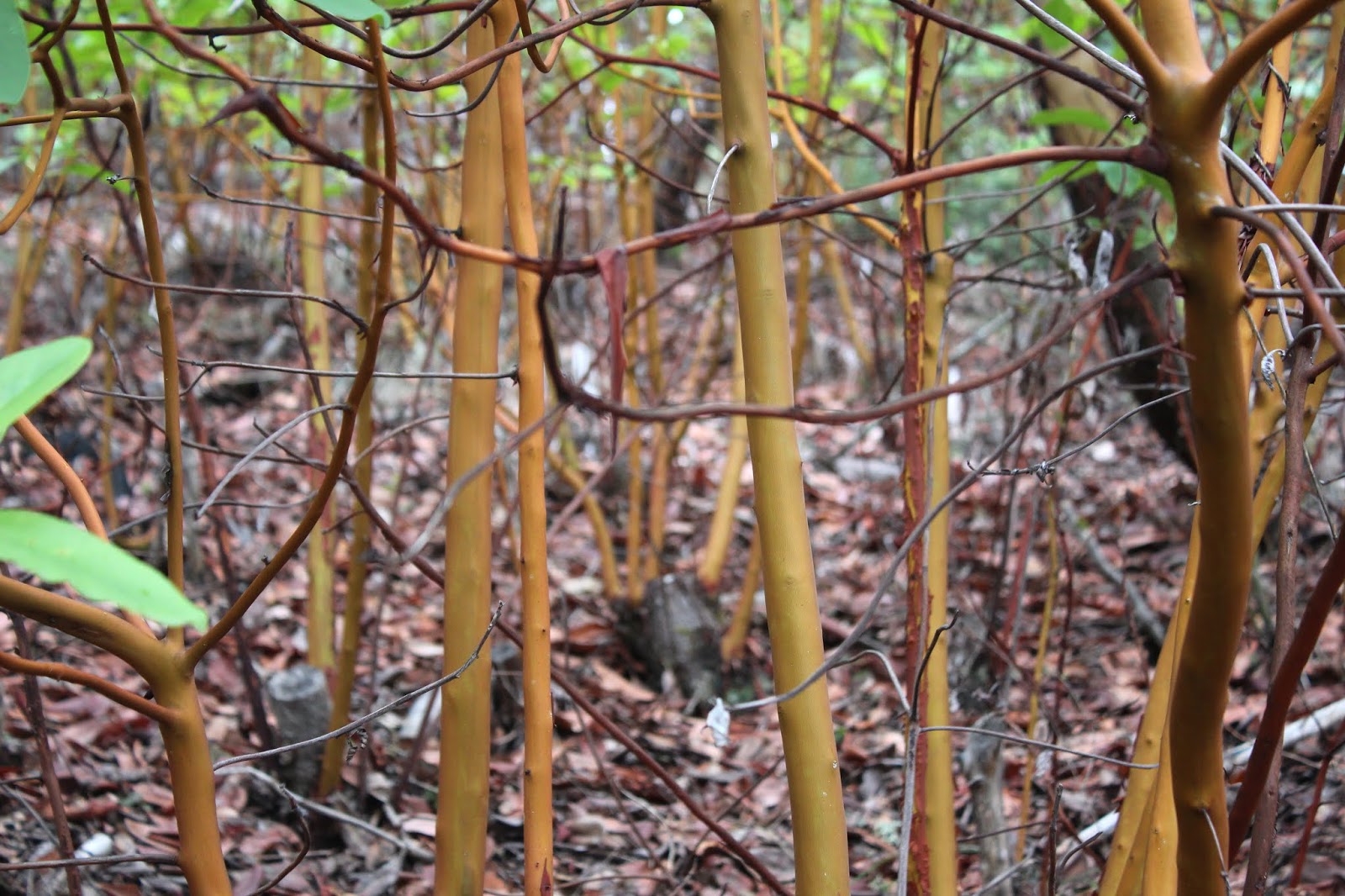
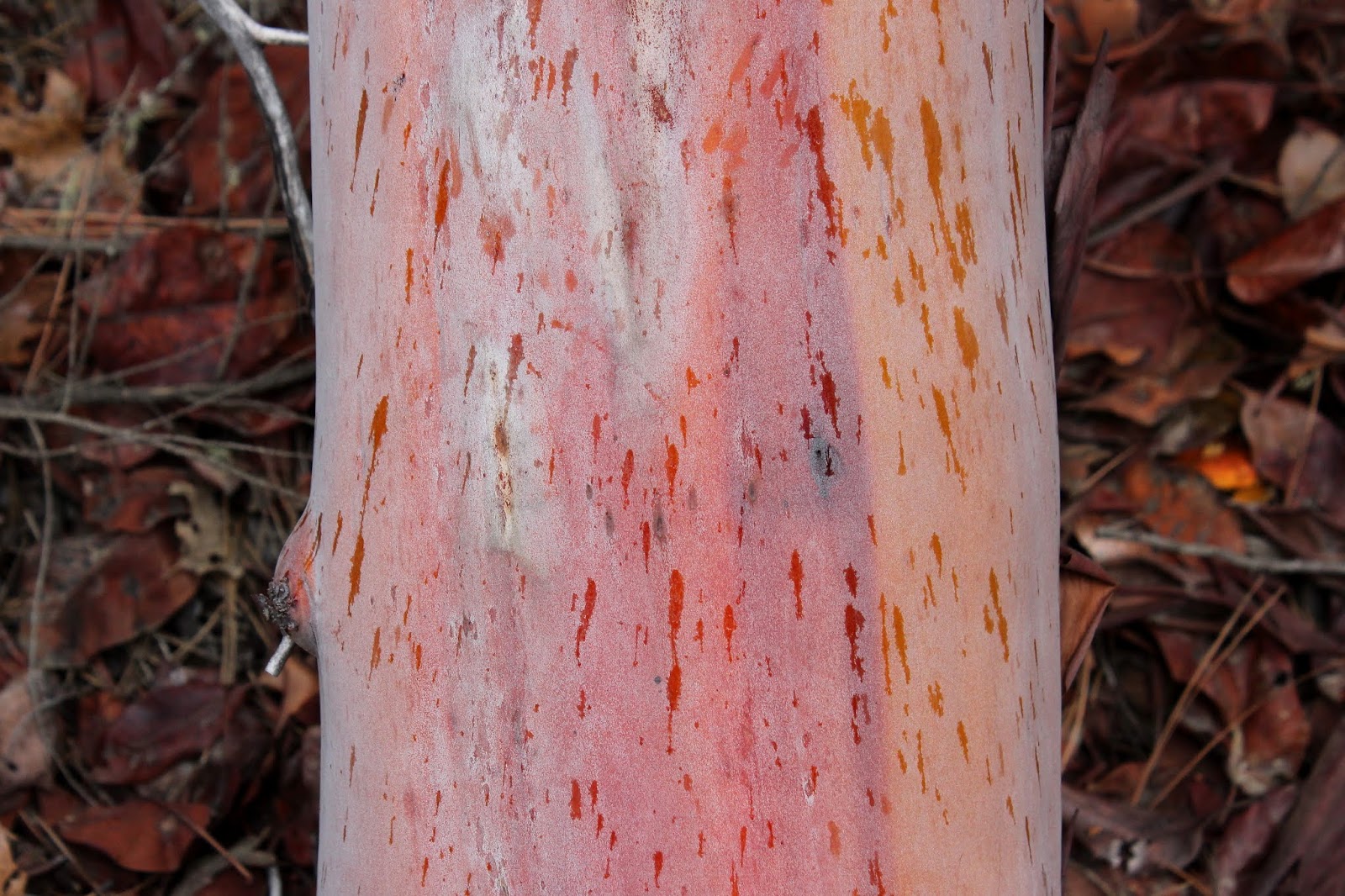
Right from the get-go, the hike had that distinctive Siskiyou foothill vibe. The terrain and atmosphere were clearly drier than our comparatively sodden Cascades, and the thin woods and forests were populated with madrone, oak, cedar, Ponderosa pine, and other assorted conifer. The oak trees were currently bare, stark, and leafless but the plentiful lichen adorning the scraggy trees didn't seem to mind. Madrone and Ponderosa pine each added some color to the hike, mostly in the form of orange trunks like so many ex-presidential limbs. Poison oak was a thing too, but let's give thanks to the wide and well-maintained Sterling Mine Ditch Trail for letting us avoid the itchy madness that Satan's favorite shrub can engender. 

A sparse forest as the trail rounds Peak 3259

The route was rounding a combo of Peaks 3214 and 3259 on the northwest side and as a result, much of the first part of the hike was in shade. Armstrong Gulch sort of cleaves the peaks in two, bending them into a U-shape and once we rounded a ridge and entered Armstrong Gulch at the mile and a half mark, the sun was screened from view and we'd have to wait just a little bit longer for that 70 degree weather. Green and grassy vegetation grew in the shady forest even though the gulch was dry, thanks to a mostly rainless February.

Manzanita ushers in spring and the bees are happy

Once the track rounded Peak 3259, the slopes were totally exposed to the sun and harsher elements. Tall shade-giving trees were in short supply here, although that may be ameliorated when the oak trees leaf out and provide some shady succor to perspiring hikers, bikers, and trail-runners. The vegetation was increasingly dominated by manzanita shrubs sporting bee-attracting umbels of pale pink tubular bell-like flowers. 
View of the terrain surrounding the Little Applegate River


It goes without saying that the sparse tree cover allowed for some expansive vistas of the surrounding landscape. The dry slopes of Peak 3214 sloped down into the Little Applegate drainage, which could be observed running all the way to the much wider Applegate Valley, near the small town of Ruch. The lesser peaks of the Siskiyou foothills could be seen all round, most notably being those of Woodrat Mountain, Burton Butte, Mount Baldy, and Ben Johnson Peak. 

Nearby Woodrat Mountain

As the hike continued in a southerly direction, the snow-covered Siskiyou Mountains became more and more visible, increasingly commanding attention and respect. In particular, the prominent peak of Grayback Mountain presided over the landscape sprawling beneath a vibrantly-colored blue sky. Closer to the trail, Peak 3214 rose high above, aspiring to be a mountain worthy of a name other than the current numeric identifier.

This was as "hilly" as the trail got

This was one of those hikes that was all about the journey, particularly since it lacked a clear and logical destination. Accordingly, I made the decision to turn around at the 5 mile mark and as luck would have it, that happened to be right at Cantrall Gulch, which actually had a few puddles of water as evidence a creek sometimes flows here. From there, it was back the way I had come, in increasing warmth, sunlight, and longer shadows (where there were trees).

Lichen takes over a small branch

At the end of the day, it was with a sense of accomplishment that the hike ended. It had been quite some time since I had last walked 10 miles or better. Plus, this section of the Sterling Mine Ditch Trail was a new trail for me, a rarity since it seems like I've hiked everywhere there is to hike in southern Oregon. And the spring day was superb with mild temperatures, clear sky, and generally glorious weather, EVEN THOUGH IT'S FEBRUARY!!!

Oak trees and blue sky, all hike long

For more photos of this hike, please visit the Flickr album.

Saturday, April 6, 2019

Sterling Mine Ditch Trail


Back in 1854, a pair of miners (James Sterling and Aaron Davis) discovered gold in Sterling Creek. Word leaked out, the gold rush was on, and the boomtowns of Sterlingville and Buncom sprung up to service the miners. A couple of brothels also sprung up (pun intended) for a different sort of servicing of the miners, but that's a topic best not further explored in this blog. Pity the bypassed Aaron Davis, who had nothing named after him in spite of his co-discovery; all the glory instead went to Mr. Sterling. In 1877, the Sterling Mine Company constructed the 28 mile long Sterling Ditch to transport water from the Little Applegate River to the hydraulic mining operations. The mining activity eventually dwindled beginning in 1883, as the gold and chromite ran out and although the mine reopened from 1933 to 1957, the towns of Buncom and Sterlingville were abandoned and only a few buildings remain in Buncom from that era. Sterlingville was destroyed and nothing remains from that town which had reached a peak population of over 1,500 in its heyday. 

Trail, at the high point of the hike
Unfortunately, the post-Depression resurgence of hydraulic mining devastated and ruined the surrounding landscape and terrain. To this day, we still feel the effects from the damage caused by the mining. I'm not sure where the site of the actual Sterling Mine is or was, but Sterling Ditch and the Little Applegate are full of rocks and gravel, thanks to the mine. Accordingly, the water quality of the Little Applegate is poor but a stressed run of salmon do manage to make the spawning journey each year. And speaking of epic spawning journeys, Sterling Ditch has proved to be a great boon to hikers and mountain bikers alike in  our present time.

The rain never did materialize
In April of 2019, the weather forecast prognosticated floods for southern Oregon, thanks to a very wet weather system blowing in. That may be why only two hikers showed up to my hike, or else maybe nobody likes to hike with me; both possibilities are equally probable. However, the rain was due to arrive the following day, giving us a day to sneak one in before the deluge arrived. Medford hiking buddies Glenn and Carol thought likewise and met us at the trailhead under an overcast sky. Despite the gray sky above, the rain held in abeyance throughout the day.

Sterling Ditch Tunnel, in all its tunnely glory

The main attraction on the Sterling Mine Ditch Trail is the Sterling Ditch Tunnel which is basically a hole bored completely through Tunnel Ridge. A historical point of interest, to be sure, but for me the main attraction is the oak-dotted hilly countryside surrounding the ditch rather than the actual ditch or tunnel. At any rate, this hike was set up as an end-to-end shuttle hike from Little Applegate Trailhead to Tunnel Ridge Trailhead.

Shooting stars brightened up the trail
The climb up from the Little Applegate River to Sterling Ditch was fairly brisk but thankfully short as it gained about three hundred feet in about half a mile. On the way up, it was readily apparent that it was the onset of spring with white-colored oaks toothwort and magenta shooting stars doing their flowery best to distract hikers with cameras. 

The trail wanders through the oak trees
Once we joined up with Sterling Ditch, the left bank of the former canal became the actual trail and the path was either level or just slightly downhill, both grades being equally pleasant to walk on. Hey, this hike was going to be easy and whatever could go wrong? Well, private property boundaries, as it turned out. After a mile or so, the ditch and trail parted ways due to the aforementioned private property parcel, with the ditch continuing its pleasantly level journey while us hikers performed an agonizing uphill slog through a stand of leafless oak trees. Well, of course I'm exaggerating about the agonizing part, but it was uphill and did provide some leg-based discomfort as we climbed. 

Panoramic of the Little Applegate River valley
The slow uphill pace did allow us to enjoy views of the surrounding countryside, though. Above us was bare and grassy Goat Cabin Ridge with Point Mountain rising further above and beyond. Point Mountain was still covered with some snow, but it was patently obvious that the spring thaw was on. To the northwest was the large and deep valley of the Little Applegate River, which abruptly ended in the distance when it ran into the much larger and deeper Applegate River valley. In front of us, laying like the insurmountable object it turned out to be in the late 1800s, was the forested wall of Tunnel Ridge, so named in honor of the tunnel drilled through it by the Sterling Ditch construction crew. 

The ever so elegant grass widow
Underneath the oak trees were patches of grass widow, one of the more elegant wildflowers to ever bloom in southern Oregon. Flanking the trail, manzanita bushes were not only graced with interesting smooth burgundy colored trunks and limbs, but also graced with dangling umbels of pink flowers as is customary this time of year. Needless to say much photography ensued, doing double duty as rest stops too.

The trail and Sterling Ditch were one and the same
What goes up must come down, and once the trail crested a grassy ridge, it plunged at a rate inversely equal to the uphill portion we had just hiked. Clearly, we were on our way down to rejoin Sterling Ditch, our wayward friend. And that's exactly what happened when the trail entered a relatively lush forest in Muddy Gulch, which was not particularly muddy at all.

Tunnel Ridge looks straight ahead of Glenn and Carol
The trail was pleasantly level again, and there was much rejoicing. We were now on the slopes of Tunnel Ridge, and a small and underwhelming hole in the ground was the former entry point of Sterling Ditch's water flow where it had poured into the renown and famed Sterling Ditch Tunnel. It was more impressive to round Tunnel Ridge on the trail and observe the much larger tunnel exit where the ditch emerged from its brief underground journey through Tunnel Ridge. It's really amazing to think that the tunnel was hand-hewn through solid rock by Chinese laborers in the late 1800s, although Katie (Glenn and Carol's dog) seemed more amazed by the banana I offered her as we gazed at the tunnel.

The trail sidehills across Tunnel Ridge
After a lunch, view-soak, and regrouping of our small hiking party, we left the Sterling Ditch Mine Trail for the descent down to the Tunnel Ridge Trailhead. This portion of the route was all new trail for me as I had never been, and I must say it was probably my favorite part of the whole hike.

Manzanita trunks, smooth as the
burgundy they are colored after
The path contoured across steep grassy slopes dotted with sparse oaks as it switchbacked down to the Little Applegate. The mazanitas were huge here, being less like shrubs and more like trees and I stopped periodically to admire the distinctive smooth dark red trunks. When there were not manzanita bushes or trees there was oak, and where there was oak, there was Henderson's fawn lilies growing underneath in lavender profusion.

A veritable herd of Henderson's fawn lily
Henderson's fawn lily rivals grass widow for elegantness, in my opinion. The flowers are fairly large and imbued with a classy and stately pinkish lavender color and there were hundreds, if not thousands, of these floral beauties blooming right next to the trail.


The trail descended off Tunnel Ridge through some oaks


As the trail dropped down at a fast rate, I gave silent thanks to the trail gods that I wasn't hiking up this, that would have been a pretty good workout. But downhill it was, and eventually the trail spit us out onto the trailhead parking lot. From there, we piled into our respective cars, each giving silent thanks to the Sterling Mining Company for having had the wisdom and foresight to create such a great trail at the same time it was destroying the environment.

A clump of manzanita blossoms
For more photos of this hike, please visit the Flickr album.


Friday, February 1, 2019

Payette Trail

Rain, rain, go away; please come back another day. It had been raining quite a bit, and that's no big surprise in February. But the whole upshot from a hiking standpoint, was that I really didn't feel like hiking in the wet stuff, but I had to. You see, I was scheduled to lead a group on the Payette Trail, and that was a trail that I had never been on. Clearly, some pre-hike reconnaissance was required and this was the wet weekend to do that very thing. While I'd be leading a group in a few weeks hence, on this day it would be a solo venture, chiefly because all my so-called hiking buddies conveniently found something else to do, like stay warm, dry, and rain-free inside in a house.

Fish shelters, exposed by the low water level

The Payette Trail follows the shoreline of Applegate Lake which sits just north of the Oregon-California border. Since I'd be hiking in Oregon the entire time, no passports would be required. Applegate Lake has more arms than two dozen angry octopuses and this hike would be embraced by two of them: the French Gulch and Squaw Creek arms. Basically, the Payette Trail would contour the peninsula between the two.

View to Mule Mountain and Little Grayback Peak
Despite the proximity to the lake, much of the hike was spent walking in forests above the body of water. At the start, the woods were quiet enough to highlight the various bird calls emanating from our feathered friends. Cawing crows, quacking ducks, honking geese, and keening hawks all contributed their own little song to the avian choir. Tempo was kept by the soft staccato rhythm of a light rain falling onto my hat brim. 

Madrone teenagers
This forest consisted of a madrone, pine, and oak mix. Someone had attempted to cut down a patch of madrone, as evidenced by the old stumps, but madrone has a rather unique survival mechanism. When a tree is damaged, be it by wildfire or chain saw, the tree sends up dozens of shoots to continue the species. That's why it's common to see five to seven fully grown madrone trees growing in a circle. So, whoever cut down these trees only encouraged the reestablishment of the madrone patch, for each stump had like ten saplings replacing what had been one tree.

View to Applegate Lake's dam
Applegate Lake is a man-made lake and this time of year, the lake is drawn down, exposing an ugly lake scar.  A "bathtub ring" of brown soil surrounded the lake while the water contained therein reflected the dark sky above. Despite the ugliness, it was also impressive to see how deep the lake is, something you really don't think about when the lake is full.


Fruiting bodies on a lichen


Being alone as I was, I could hike at my own speed which was slow because when I hike solo, much photography is involved, or at least much more than usual. Accordingly, I was happily photographing lichen and culling photographic samples from an ample supply of fungi growing on trees standing and fallen. Obviously, this was mushroom season, but spring was also on the way, as evidenced by flower buds dangling from still leafless alder branches. 

Abney Butte in the doom and gloom
There was one short but steep pitch on the trail but the route was mostly and relatively level. As I rounded the peninsula between the lake arms, manzanita grew in profusion along the trail with raindrops splotching their burgundy colored limbs. A large bird, probably an osprey but maybe a bald eagle, patrolled the sky above the drawn-down lake. Breaks in the vegetation offered views of the nearby Siskiyou Mountains underneath an increasingly foreboding cloud cover. Despite the light rain, I was reasonably comfortable as I hiked on the trail, which by now had morphed into a gravel road.

Where Squaw Creek meets Applegate Lake
Not being familiar with the Payettte Trail, I inadvertently passed a junction where the trail left the gravel road and contoured the road in the woods above. The road had better views anyway, and I had a good look at the tortured landscape in the dry Squaw Creek arm of the lake. I also had a good look at the incoming storm but just in case I couldn't see it, the rain naturally picked up in intensity when I was out in the open and at the farthest point from the car. It seemed like a good idea to turn around at that point.

Rain spatter on a madrone trunk
So back to the trailhead I go, enjoying the day despite of, or maybe because of the rain. The return leg turned into a photo shoot, as I happily snapped photos of everything that attracted my attention. The skies became more and more ominous but fortunately, any heavy rain that was forthcoming was held in abeyance. Before long, the hike ended with a crossing of French Gulch on a rustic footbridge. No sooner had I crossed the bridge when a large tree fell about 20 yards behind me, the vibration felt from the ground beneath my feet.That had to have registered in all the seismographs and no doubt the evening news would report a small earthquake in the Applegate Lake area. They probably wouldn't mention the required change of underwear by a certain hiker at the epicenter of the seismic event, though.

A dollop of witch's butter
 For more photos of this hike, please visit the Flickr album.


Monday, January 19, 2015

Sterling Ditch

Where have you been all my life, Sterling Mine Ditch Trail? Why have I never hiked you before? Why all the questions? And who am I talking to? So many questions to ponder in that that internal dialogue that takes place when one spends way too many miles alone in the woods.

Picturesque madrone
So much of the Siskiyou Mountains culture and landmarks involve mining in one way or another. The tectonic processes that created the Siskiyous also extruded heavy metals to the surface. The shiny metals embedded in the mountains were then (and are still being) harvested although nowadays we are somewhat more environmentally circumspect than in the days of yore.


A squadron of oaks
There already had been mining in the area of the Little Applegate River but when gold was discovered on Sterling Creek in 1854, the boom town of Sterlingville sprung up to support the sudden influx of prospectors. The town went bust about 50 years later but hydraulic mining continued another 50 years or so, much to the detriment of the Little Applegate River and surrounding topography. To facilitate the mining, in 1877 a 26.5 mile long ditch was dug to divert water from the Little Applegate to the Sterling Mine operations.

Part of the uphill walk up to the ditch
Nowadays, the ditch no longer carries water but the overgrown ditch still is in evidence today and the downhill-side bank makes for a wonderfully level trail for hikers and bikers. Of course the ditch is halfway up Goat Cabin Ridge which meant a brisk walk uphill from the Little Applegate River was required to reach the ditch. But then again, it's just not a hike unless it goes uphill.

View to Bald Mountain
Even though we (my internal dialogue avatar and I) were hiking in the Siskiyou foothills and not the mountain range proper, tall peaks still surrounded the Little Applegate valley. Open and grassy (read: treeless) slopes provided ample views thereof all during this walk. To the west were grand vistas to Point Mountain and the disturbingly named Bald Mountain. Further up the Little Applegate Valley was the tall snow-dusted mountain of Wagner Butte, a totally awesome hike in its own right. 

It was simply a gorgeous day
For the first couple of miles, the trail ambled alongside the ditch but alas, private property intruded into all the pleasant walking. In order to contour around the property line, the trail parted ways with the ditch and headed several miles uphill through grassy slopes studded with leafless oaks, orange-trunked madrone, and equally orange colored ponderosa pines, all situated under a gloriously blue sky.

A tree clings to life on a steep slope
What goes up most come down or so they say. And who are "they" anyway? Why do we care what "they" say? More mindless questions with which to ponder away the miles, but I digress. Anyway, at a wooded saddle, the trail plunged precipitously down into Muddy Gulch, trading sunlit grassy slopes for murky woods. At the bottom of the trail plunge our friend Sterling Ditch rejoined the trail, giving me something to share rambling soliloquies with.  

Trail, next to Sterling Mine Ditch
Most hikers on the Sterling Ditch Trail begin at the Tunnel Trailhead. When the ditch was constructed, a tunnel was bored through the aptly named Tunnel Ridge. The historical oddity of the tunnel is the main destination for hikers but I had started from the Little Applegate Trailhead, about 6 miles away from the tunnel trail. At this point, I had about 5 miles in but the shadows through the trees were getting longer. Unless I wanted to hike back to the car in the dark, I'd have to turn back soon.

The tunnel was a little underwhelming
Fortunately, at the 5.3 mile mark, a small little hole in the ground marked the seemingly insignificant tunnel entrance.  That was good enough for me and I turned around and began walking quickly back to the car. Well, I walked quickly until the trail and ditch split ways again. Remember that steep plunge down Muddy Gulch? Now it was a steep climb out of the canyon, gaining about 500 feet in 0.6 miles.  At least it was short, distance-wise.

The afternoon glow on the way back
It was a magnificent next few miles as afternoon headed into twilight. Shadows lengthened across the grassy slopes while I re-enjoyed the expansive views of the Little Applegate Valley and the surrounding peaks on Goat Cabin Ridge. Isn't Goat Cabin Ridge a cool name? Do goats really build cabins? More questions, I know, and while I don't have the answer as to why I've never hiked the Sterling Mine Ditch Trail before, rest assured I'll be back to further explore this superb hiking destination.

Conversations I have
with myself when I hike
For more pictures, please visit the Flickr album.