Showing posts with label Applegate Lake. Show all posts

Saturday, June 18, 2022

Da-Ku-Be-Te-De Trail


Da-Ku-Be-Te-De just nicely rolls off the tongue, doesn't it? Well, maybe not. I was watching a YouTube video by some dude who hiked on the Da-Ku-Be-Te-De Trail and boy, did he ever struggle to pronounce the trail's name. He eventually gave up after he sprained his tongue and suffered severe mouth contusions. Speaking from personal experience though, it's pretty simple to say when your other native language is Spanish. Fortunately for the linguistically challenged, pronunciation and elocution are not a prerequisite for enjoyment of the hike. Just let your boots do the talking, the trail will always understand.
"Once upon a morn so dark and dreary,
while I hiked, weak and weary..."

It had been raining the week prior to this hike along the shore of Applegate Lake. When I began walking, the sky was overcast, dark, and dreary, matching my mood perfectly. Stepson Carl had been badly injured in a work accident and the worry about his well-being definitely harshed my mellow. Hopefully the sun would just stay hidden behind the moody clouds, no need to unduly mellow my harsh. However, as I hiked along the trail, the day would eventually bifurcate into equal parts sunny and cloudy, improving my mood and overall outlook, despite my best intentions to do otherwise.

Not your basic wilderness hike

The Da-Ku-Be-Te-De Trail is part of a trail network that circumnavigates Applegate Lake and this hike began at Hart-tish Park which boasts a campground, picnic area, boat ramp, small general store, and hundreds of squealing children recreating in the lake's cold waters. The civilized start to the hike continued as I walked past the campground, especially since the trail was paved at that point.

Mirrory

After several years of minimal precipitation and maximal wildfires, it was nice to receive a lot of rain last winter, leaving Applegate Lake full to the brim with water, as every lake should be. The air was quiet and still, and the lake reflected the gray clouds in the sky on its mirrory surface and I don't think "mirrory" is really a word, but I'm still going with it. In general, the body of water sported an alpinesque vibe, seeing how the narrow fiord-like lake is surrounded by tall craggy peaks still flecked with snow.

Mule Mountain rises beyond the lake's dam

Even though the trail closely followed the shore, dense woods surrounded the track and at times, it was like there was no lake at all. But periodic openings in the tree cover allowed me to observe some of the surrounding lakeside topography, like Little Grayback Mountain, whose tip-top generally hid somewhere within the low cloud cover. Across the lake was Elliot Creek Ridge with Stein Butte being the most prominent high point on the forested ridge. Not all the scenery was mountain-centric though, as the pronounced bay of Squaw Creek's arm reposed on the opposite shore below Elliot Creek Ridge.

Golden yarrow brightened up the trail

Wildflowers were a thing on this hike, too. Much of my time was spent bent over or lying prone on the trail, photographing small plants with colorful blooms representing all colors of the rainbow. Many of the plant species were regular Siskiyou denizens, seemingly exotic to this particular denizen of the Oregon Cascades country. Elegant brodeaia, ookow, checkermallow, golden yarrow, and paintbrush all did their part in colorizing the hike and much photography ensued.

The ticks await my presence on the trail

Intermittently, the woods gave way to small meadows and open grassy fields. Somewhat paranoid about the small biting creatures that lurk in the grass, I performed frequent tick checks, particularly right after a round of photo-grazing at grass level. I'm glad to report only one eight-legged vermin was found crawling on my pants leg, and luckily that was before it found its way to the delicious O'Neill blood flowing underneath my preciously soft and tender skin.
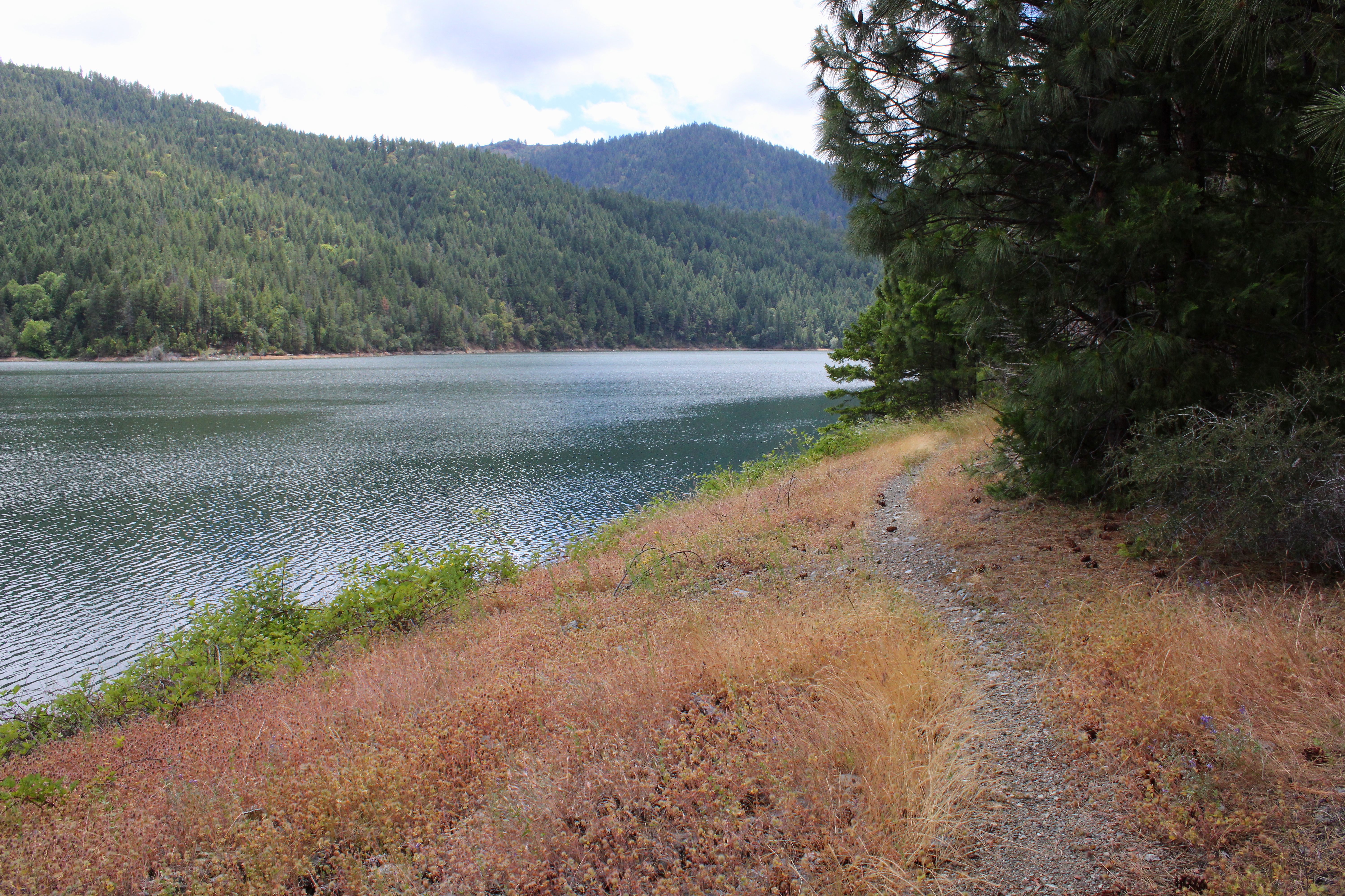
The Da-Ku-Be-Te-De Trail follows
the shore of Applegate Lake

As the miles slowly accrued, the lake's dam, eminently visible at the beginning of the hike, soon receded from view and it was easy to pretend Applegate Lake was then a natural body of water. On a clear day, the high peaks of the Red Buttes Wilderness, most notably those of the Red Buttes themselves, are an impressive sight from the shore. Unfortunately though, all that sumptuous snow-capped mountain scenery was hidden from sight by the brooding cloud cover on this latest visit.

Trail intersection near Watkins Campground

After about four miles of pleasant and mostly level hiking, a wooden footbridge and trail intersection marked my arrival at Watkins Campground. To continue hiking further around the lake required a fairly lengthy road walk, which made the campground my logical turnaround point. If I wanted to hike on pavement, I would have just walked back and forth a bunch of times on the campground path at Hart-tish Park.

I can see most of the Red Buttes

On the way back, the whole semi-stormy vibe completely changed as the clouds began to break up and dissipate. More and more, blue sky began to hold sway above the lake, but the clouds resisted mightily while I hiked below, fully entertained by the meteorological contest of wills. At the end of the hike, the Red Buttes, looming large on the Siskiyou crest, did finally make a brief appearance.

Blue sky began to rule the day, come afternoon

This hike had been another exercise in mental health, allowing me to assimilate myself back into civilization and generally mimic socially acceptable behavior. Totally enjoyable it was and I'll probably return to this trail in the future, for the backpack trip around Applegate Lake is on my to-do list. Because the trail around the lake is relatively level, it would be a pleasant backpack trip and probably is as easy as pronouncing Da-Ku-Be-Te-De.

Easy for you to say!

For more photos of this hike, please visit the Flickr album.

Saturday, March 23, 2019

Payette Trail 3/2019


A month prior, I had hiked the Payette Trail to familiarize myself with the route and thereby imbue myself with a certain air of infallibility that comes with knowing where you are going. But then again, my comrades know me already and their opinions of my leadership, good, bad, or indifferent had been cemented into their minds long ago. At any rate, this was the day to actually lead a group on the hike. 

Good weather to start with


The weather gods were not kind to me. A pretty good rainstorm was forecast and accordingly, only three hikers (regulars Diane, Brad, and Lindsay) decided to go on a Richard Hike. Well, at least that made carpooling a whole easier. However, when we arrived at the trailhead, patches of blue sky appeared here and there in the cloud cover and the air was decidedly dry. Would our good fortune hold out?

It's a beautiful day, for the time being
Well, for the lakeside contour portion of the hike, yes it would. We had a rather enjoyable hike in dry weather and I daresay, we even enjoyed that wonderfully warm sensation of sunlight on skin here and there. Unfortunately, the weather forecast came to fruition just as we sat down for lunch at the intersection of the Payette and Osprey Trails.

Here comes the rain!
As we ate, the blue sky disappeared, overtaken by a fast-moving wall of ominous looking clouds. A gusty breeze announced the presence of the rainstorm and we'd have a steady rain falling on us for the rest of the hike. Accordingly, we all opted for a shorter route back by grabbing the Osprey Trail and now I was back in unfamiliar territory. So much for preparing the route ahead of time!

Totem in the middle of the forest
The Osprey Trail basically climbs up and over the peninsula lying between the French Gulch and Squaw Creek arms of Applegate Lake. Accordingly, the trail headed uphill at a moderate grade, which warmed us up sufficiently enough to ward off any cold from the inclement weather. After a mile or two, we arrived at Dagelma Trailhead, the parking lot empty because apparently, we were the only people in all of Oregon out for a hike on this wet day.

Lindsay hops over a trail obstacle


At least all the bad uphill stopped at the Dagelma Trailhead and it was all downhill from there. Our only travail (besides the steady rain) were a couple of large trees lying across the trail and we got to practice our clambering skills getting over them. At least no trees fell nearby, like in my previous outing on the Payette Trail. We unanimously agreed it had been a fine walk and we pitied all our friends who didn't go hiking out in the rain on this day.

Spiders from Mars
For more photos of this hike, please visit the Flickr album.


Friday, February 1, 2019

Payette Trail

Rain, rain, go away; please come back another day. It had been raining quite a bit, and that's no big surprise in February. But the whole upshot from a hiking standpoint, was that I really didn't feel like hiking in the wet stuff, but I had to. You see, I was scheduled to lead a group on the Payette Trail, and that was a trail that I had never been on. Clearly, some pre-hike reconnaissance was required and this was the wet weekend to do that very thing. While I'd be leading a group in a few weeks hence, on this day it would be a solo venture, chiefly because all my so-called hiking buddies conveniently found something else to do, like stay warm, dry, and rain-free inside in a house.

Fish shelters, exposed by the low water level

The Payette Trail follows the shoreline of Applegate Lake which sits just north of the Oregon-California border. Since I'd be hiking in Oregon the entire time, no passports would be required. Applegate Lake has more arms than two dozen angry octopuses and this hike would be embraced by two of them: the French Gulch and Squaw Creek arms. Basically, the Payette Trail would contour the peninsula between the two.

View to Mule Mountain and Little Grayback Peak
Despite the proximity to the lake, much of the hike was spent walking in forests above the body of water. At the start, the woods were quiet enough to highlight the various bird calls emanating from our feathered friends. Cawing crows, quacking ducks, honking geese, and keening hawks all contributed their own little song to the avian choir. Tempo was kept by the soft staccato rhythm of a light rain falling onto my hat brim. 

Madrone teenagers
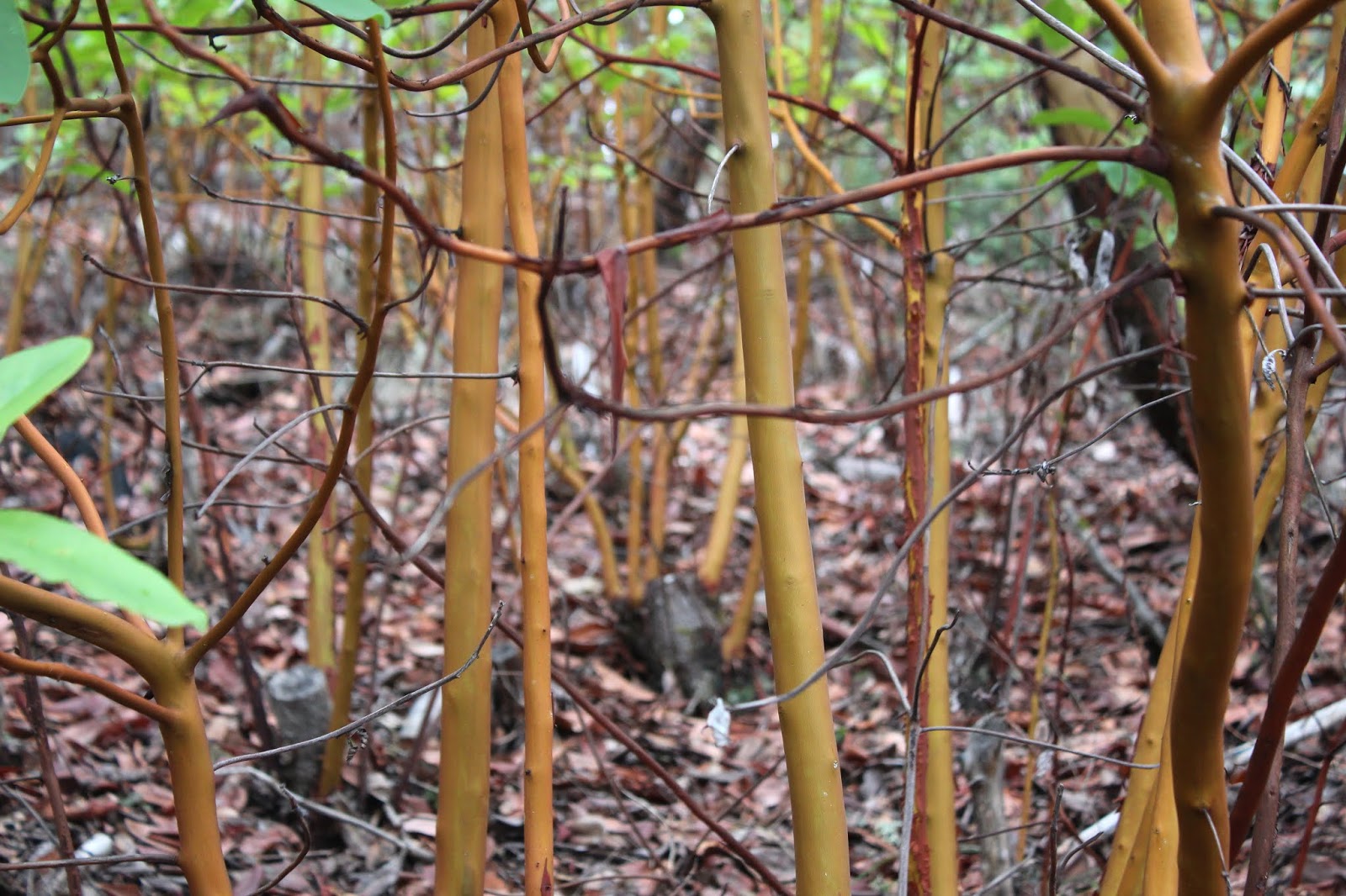
This forest consisted of a madrone, pine, and oak mix. Someone had attempted to cut down a patch of madrone, as evidenced by the old stumps, but madrone has a rather unique survival mechanism. When a tree is damaged, be it by wildfire or chain saw, the tree sends up dozens of shoots to continue the species. That's why it's common to see five to seven fully grown madrone trees growing in a circle. So, whoever cut down these trees only encouraged the reestablishment of the madrone patch, for each stump had like ten saplings replacing what had been one tree.

View to Applegate Lake's dam
Applegate Lake is a man-made lake and this time of year, the lake is drawn down, exposing an ugly lake scar.  A "bathtub ring" of brown soil surrounded the lake while the water contained therein reflected the dark sky above. Despite the ugliness, it was also impressive to see how deep the lake is, something you really don't think about when the lake is full.


Fruiting bodies on a lichen


Being alone as I was, I could hike at my own speed which was slow because when I hike solo, much photography is involved, or at least much more than usual. Accordingly, I was happily photographing lichen and culling photographic samples from an ample supply of fungi growing on trees standing and fallen. Obviously, this was mushroom season, but spring was also on the way, as evidenced by flower buds dangling from still leafless alder branches. 

Abney Butte in the doom and gloom
There was one short but steep pitch on the trail but the route was mostly and relatively level. As I rounded the peninsula between the lake arms, manzanita grew in profusion along the trail with raindrops splotching their burgundy colored limbs. A large bird, probably an osprey but maybe a bald eagle, patrolled the sky above the drawn-down lake. Breaks in the vegetation offered views of the nearby Siskiyou Mountains underneath an increasingly foreboding cloud cover. Despite the light rain, I was reasonably comfortable as I hiked on the trail, which by now had morphed into a gravel road.

Where Squaw Creek meets Applegate Lake
Not being familiar with the Payettte Trail, I inadvertently passed a junction where the trail left the gravel road and contoured the road in the woods above. The road had better views anyway, and I had a good look at the tortured landscape in the dry Squaw Creek arm of the lake. I also had a good look at the incoming storm but just in case I couldn't see it, the rain naturally picked up in intensity when I was out in the open and at the farthest point from the car. It seemed like a good idea to turn around at that point.

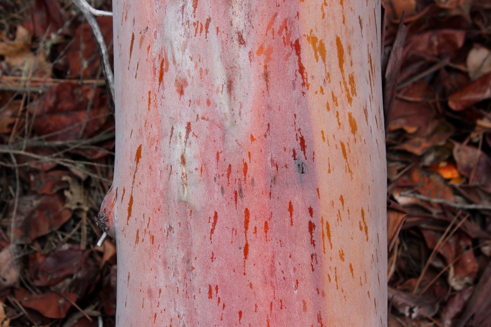
Rain spatter on a madrone trunk
So back to the trailhead I go, enjoying the day despite of, or maybe because of the rain. The return leg turned into a photo shoot, as I happily snapped photos of everything that attracted my attention. The skies became more and more ominous but fortunately, any heavy rain that was forthcoming was held in abeyance. Before long, the hike ended with a crossing of French Gulch on a rustic footbridge. No sooner had I crossed the bridge when a large tree fell about 20 yards behind me, the vibration felt from the ground beneath my feet.That had to have registered in all the seismographs and no doubt the evening news would report a small earthquake in the Applegate Lake area. They probably wouldn't mention the required change of underwear by a certain hiker at the epicenter of the seismic event, though.

A dollop of witch's butter
 For more photos of this hike, please visit the Flickr album.


Sunday, October 18, 2015

Sucker Creek Gap


Every year the seasons change. Summer folds into fall, fall slips into winter, and winter usually takes 13 months to morph into spring. Such is nature's cycle, and every late summer, I hike knowing that each upcoming hike may be the last foray into the mountains until the snow melts the following year. And this year's nominee for the Forget-About-It-Winter-Is-Here Award is a mid-October hike to Sucker Creek Gap.

A peak at Pyramid Peak
On this dubious award winning day, the weather had called for partly cloudy/partly sunny weather which sounds like one of those philosophical glass full or glass empty ponderings. But the weather question is somewhat more significant as the answer usually relates to what clothes to wear, how far to hike, the destination or trail of choice, or even whether to go hiking at all. 

Some of that morning rain, pre-pants
So, it was partially sunny at the Steve's Fork Trailhead, although the clouds did their fair share of blotting out the sun. Extra layers of clothing were quickly donned due to a distinct chill in the air. It had rained earlier and the vegetation was damp which meant my pants were likewise dampened by means of bush to pants transfer of water. 

Brewer's srpuce is the Droopy Dawg of trees
Ray and I had backpacked here years ago, but the trail now was somewhat overgrown and sketchy. Obviously, the trail does not get all that much use. Brewer's weeping spruce, a distinct Siskiyou specie, sadly drooped their branches just off trail. Intermittent openings in the forest provided views to Lake Peak rising above the trail. Despite the cool and wet, it was good to be out for a hike.

View to Lake Peak


About halfway up the brisk climb to Sucker Creek Gap, I met Ken and Denise, a pair of fellow hikers who like me, were engaged in our wonderful little hobby on a chilly morning. Ken sort of does what I do except he posts videos of his hikes instead of writing about them. If you ever thought about going somewhere in the Siskiyous, chances are there is a Trailken1 video of it, After trailside introductions and pleasantries were exchanged, I continued on. Pretty much at the trailhead, I had crossed into California but Homeland Security had the day off and passports were not needed. Somewhere near a cirque lake, I re-entered Oregon and it sure felt good to be back home.

The cirque lake
On our backpack trip from years ago, Ray and I had camped at the unnamed cirque lake sited below one of Pyramid Peak's ridges and I left the trail to visit my old lake friend. I was a little disappointed because the lake was colored a dark brown and the surrounding meadow was dry and dessicate with the advent of the coming winter. I had to remind myself that we had camped in spring and the water was then fresh off the spring thaw, nearly as pure as the driven snow itself. 

Trail at Sucker Creek Gap
At Sucker Creek Gap, I took the Boundary (spelled "Boundry" on the USFS trail sign) Trail towards Swan Mountain with the idea of summiting the prominent peak. Before that feat could be accomplished, an uphill stretch through viewless forest had to be negotiated. The trail was sketchy here with plenty of fallen branches and trees to keep things challenging. Once out of the forest, thick (and wet!) brush encroached the trail and I waded through, grateful we were past tick season. 

I so wanted to climb Swan Mountain


Swan Mountain was eminently visible and it would be less than a mile to the summit. However, on the crest of this portion of the Siskiyous, it was obvious that clouds were forming on the mountain range itself. Cloud shadows and sunlight danced upon the valleys below, but where I was at was ominously gray with the temperature getting colder by the minute. A brisk breeze upwelling from the Sucker Creek canyon freezingly reminded me my pants were still soaking wet from the brush wade. Apart from a few desultory rain drops, it didn't really rain but it sure felt like the weather see-saw was tilted towards winter.

Swan Mountain and Craggy Mountain


Rapidly losing my enthusiasm for climbing Swan Mountain, I turned back and enjoyed views of Pyramid Peak, the Sucker Creek drainage, and the distant Red Buttes as clouds formed and reformed over the mountains. At the intersection with the Sucker Creek Trail, I ran into Ken and Denise again as they were returning from the Sucker Creek Shelter. The last three miles to the trailhead were then spent talking trails with Ken and it seemed like we finished off the hike in no time at all. It was nice to sneak in a hike before winter's thirteen months of rain conspires to keep us out of the mountains.

Clouds form above the mountains
For more pictures of this hike, please visit the Flickr album.


Sunday, May 3, 2015

Mule Mountain


Consider the enchilada from the enchilada's perspective. Roasting in a hot oven, the stuffed tortilla cooks and swelters in the oven pan until the cheese inside melts. I only offer this brief discussion about Mexican cuisine because on a recent hike on the Mule Mountain Trail, I felt exactly like an enchilada with the cheese running out of it.

Shade is NOT overrated
At the start of the hike, the trail ambled underneath shady oaks and later through a mixed conifer forest. While the trail headed unrelentingly uphill, the grade wasn't too bad and the shade kept things quite pleasant. Mule Mountain is a great wildflower hike in spring and there were so many things to take pictures of. The thick and tangled undergrowth was vibrantly green and jungly. Unfortunately, the jungle underneath the trees was mostly comprised of lush stands of poison oak, I did not lie down on the ground to take pictures of low-growing flowers as is my usual custom.

A litter of cat's ears


So at this point, my cheddar was still sharp, so to speak. That would begin to change when the trail attained a ridge crest near the junction with the Mule Creek Trail. The trees thinned out and the vegetation morphed from dense jungle to open stands of oak, manzanita, poison oak, and thorny ceanothus bushes. Along the trail were all the cat's ears you could ever want to take pictures of. These small lilies are fuzzy on the inside, allegedly just like a cat's ear. I can't say that for a fact because my cat does not let me peer down into his ears and he has sharp claws.

Glen dutifully clears the trail
The Mule Mountain Trail basically contours the slopes of its namesake mountain and then leaves the mountain behind altogether, making a mad charge upward to Baldy Peak. The trees simply don't grow here and if you like baking in the hot sun, then you will love the Mule Mountain Trail. Based on past experience, Glen is a tick magnet so we sent him ahead to clear the trail. We need not have taken that precaution because the tick multitudes normally prevalent on this trail were a non-factor.

Some of that 2,581 feet of elevation gain
So it's been a hot and treeless hike so far but on the plus side, the trail gradient now ratcheted up about 30 degrees. Yes, I'm being sarcastic. It was about here where my cheese began to melt and ooze out both sides of the rolled tortilla, figuratively speaking. Like my metaphoric enchilada, I was thoroughly cooked, slather on some hot sauce and call me a chimichanga. The hike became a slow laborious trudge even though we could see up ahead the one lone tree that marked the turnaround point below Baldy Peak. The tree was so close, yet so far.


View from the top
The slopes on Baldy Peak are steep and drop precipitously away from the trail, providing nice views to the valleys below and the mountains above. Of course, the views were only appreciated once we plopped down in the shade under that one lone tree below the Baldy Peak summit. An impressive 2,581 feet below, our car was waiting for us somewhere in the Applegate River valley. Next-door mountain neighbor Little Grayback Mountain raised its forested head over nearby Mule Creek Canyon. Further in the distance stretched a chain of Siskiyou Mountain mountains all the way from Grayback Mountain to Dutchman Peak. The Red Buttes were snowless and glinted a dull orange in the slight haze. The vista was enjoyed as we ate sandwiches while waiting for blood and sensation to return to our legs.

Lupines add colorize the Mule Mountain Trail
Once our cheese was reconstituted by the lunchtime rest, it was a quad-burning, leg-braking, toe-jamming descent on the way down, the exertion being nearly as tough as the climb up. However, silver leaved lupines were putting on a purple flowered show and camera stops provided occasional rest breaks. Once we hit the bottom of the trail, we all agreed it had been a great, albeit difficult, hike. Glen did remark "Now we know why Dollie doesn't hike with you anymore" I laughed, even though it was true.

Naked broomrape
For more pictures of this hike, please visit the Flickr album.

Carol and Glen lead the way (no camera!)


Sunday, April 6, 2014

Little Grayback Mountain Trail

Sometimes, two words just go together just right, like "mountain" and "trail". So, Little Grayback Mountain Trail gets my attention after reading just half the name. However, the name Little Grayback actually refers to the lice that drove early gold rushers batty, which goes to show you need to read the fine print when looking at a trail name.


A perfect day for hiking


After meeting up with Medford hiking buddies Glen, Carol, and Katie the banana-eating dog in the itty bitty town of Ruch, we set our 10 feet on the Little Grayback Mountain Trail. The contrast between this hike and the North Umpqua Trail from the day before was illustrative of the difference between hiking in the Cascades and hiking in the Siskiyous. Where I had to contend with water in all its liquid states on the North Umpqua, there was nary a drop to be found on the steep slopes of Little Grayback Mountain.


Shady forest


The trail alternated between shady forest and sunny slopes covered with stunted or dead growth. In the shady parts, snow queen, shooting star, avalanche lily, and Oregon grape were all blooming away.  The shade was cool but just as we started to shiver with exposure, the trail would spit us out onto dry and warm slopes. And just as we started to get overheated, the trail would take us into the shade again.  It sort of reminded me of a long car trip with Mrs. O'Neill and I cranking up the heater or turning on the air conditioning every 5 minutes or so, only with considerably less discord.

View to the Red Buttes 
The Little Grayback Mountain Trail is a close relative of nearby Mule Mountain Trail and the Stein Butte Trail, except the Little Grayback Trail angles uphill at a steady but never overwhelming grade. No blood gets shed, unlike the other two trails, and the scenery is remarkably similar what with open slopes with great views all day long of the snowy Red Buttes and other Siskiyou Mountain friends.


Lunchtime panorama


We ate lunch at a meadowed slope dropping steeply away from us into the Squaw Creek Basin. At the bottom of the valley lay the larger Squaw Lake, nestled in a forested bowl among the surrounding mountains. Snowy peaks surrounded us and the warm sun made us feel all fuzzy and mellow. Katie was happy too, although her happiness had more to do with shared sandwiches and bananas than with the awesome vista.


My trail name is Runs From Ticks
So there we were, totally relaxing when Glen found a tick on his pants leg. After rolling up the seam on the zipper (not that zipper!) halfway up his pants leg, several dozen ticks dropped out of where they had been surreptitiously hiding. Glenn apparently had not paid enough attention in Man School, erroneously hearing "tick magnet" instead of "chick magnet". Carol found a couple too but I had nary a one on me, thankfully. On the hike out, Glenn continued to harvest the eight-legged disgusting little buggers no matter if he hiked first, last, or any point in between. Apparently ticks find him to be quite the tasty Glennchilada and please pass the hot sauce.

Oregon, the Tick State!
Well, back to us relaxing at lunch: After Glenn found tick after tick after tick after tick, I could just feel little tick feet crawling all over me. Eeeh! After we performed a tick check, removing clothing and searching bodies as much as decorum allowed, we vacated the meadow and headed back, relaxation time over. Walking  in shady forest and on open slopes with awesome views just hammered the point home that we live in one of the most beautiful places on our planet. Aw, who am I kidding, I can still feel imaginary ticks crawling on me!

Intruder alert!  California red bell, in Oregon
For more pictures of this hike, please visit the Flickr album.