Showing posts with label jacksonville. Show all posts

Tuesday, February 23, 2021

Jacksonville Forest Park


How did Jacksonville Forest Park ever escape my attention? Why have I never hiked here? The short answer is that I'd never heard of the place. I had heard of the nearby Jacksonville Woodlands trail system which is basically just across Highway 238 from Forest Park but I had never been on those trails either, my preconceived notion being that the Woodlands trails generally lack adequate mileage. But Forest Park has many trails and so many possible routes that are most hike-worthy in terms of both mileage and scenery. Actually, I have no idea if the trails are scenic or not as I have never been on them but based on my first time out, they probably are.

A tree gets a mossy hug

This was not going to be a long hike, thank my hernia very much! I did put together a route involving the Ol' Miner's, Owl Hoot, Atsahu, Arrowhead Pass, Shade Creek, Canyon Falls, Norling, and Rail Trails. It did not escape my attention there is also a Legburner Trail in the park which could be either good or bad, depending on the mood or inclination of a certain hernia. Anyway, like a couple of urban(ish) trail systems I've been on lately, like Cathedral Hills, a good map is essential to make sense of the numerous trail junctions encountered on most any hike in the park. There also are plenty of trail signs to orient hikers unfamiliar with Forest Park who, despite having a map and decades of experience, still managed to get a little misplaced while hiking here. 

Some of that local attraction on the Ol' Miners' Trail

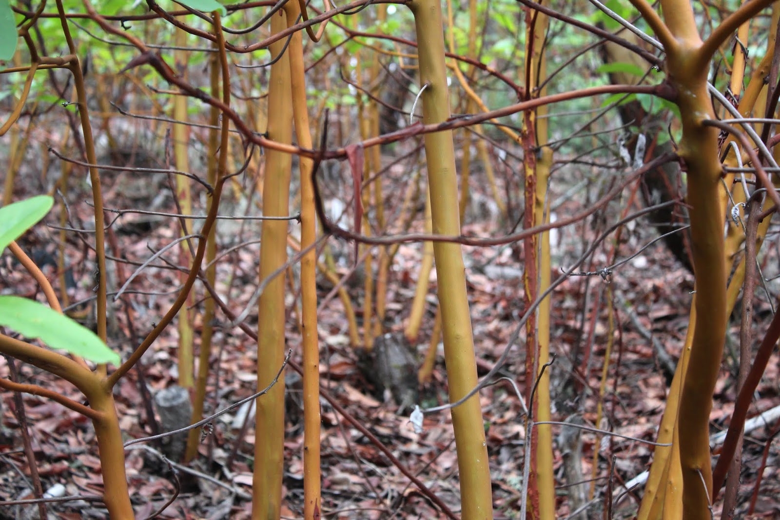
After a short climb through a thick forest of young madrone, the Ol' Miners' Trail entered a hydraulic mining site, which consisted of a grassy area littered with rusting mining machinery. From there, the route continued uphill to a gold mining site that was off limits with an official detour around the site. The trail was probably closed here because quite obviously, a large number of trees had fallen on the trail. It was probably easier to create a detour than remove them all, or maybe there is some other compelling reason for the reroute. However, following the detour is where and how I got myself "misplaced", despite having a good map on hand.

It was this sign's fault!

My plan was to take the Owl Hoot Trail which would be intersecting my current trail from the left. So, when I ran into an unsigned but very clear trail that surely must be Owl Hoot Trail, a left turn was duly executed. Wow, this trail did not even pretend to be nice, heading straight up an exceedingly steep ridge crest forested with hardwood trees of various ilk, some of which were sprawled in fallen profusion across the trail. To make things worse, after nearly a mile of this, the path just ended. Just like that, with no fanfare or any other proclamation of Customer Appreciation Day. After some irritated "Hoot, mon!" utterances (or some salty variations thereof), there was nothing to do but return back to the junction that had originally led me astray.

Tall madrone trees surrounded the trail

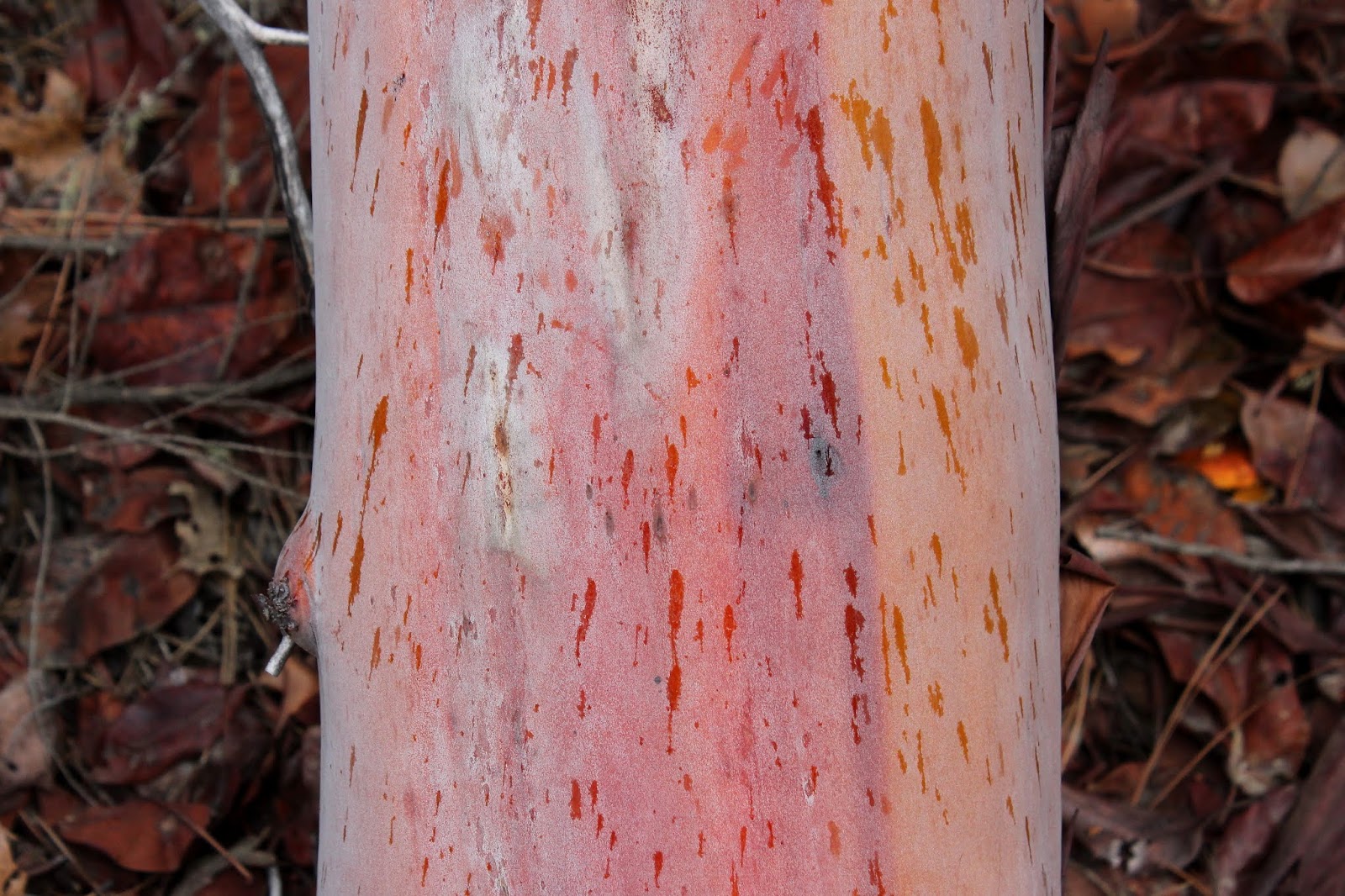
Back on the Boulder Trail, in short succession I ran into the resumption of the Ol' Miner's Trail and the real Owl Hoot trail angling to the left. My legs and hernia had given their all on the Buzzard Fart Trail (my name for that Owl Hoot Trail imposter) and they now couldn't give two hoots about the Owl Hoot Trail. So, stay on the Boulder Trail it was, and that was fine for it was a nice and mostly level walk through woods of moss-covered trees interspersed with smooth-trunked madrones.

One of many small cascades on Jackson Creek

The sound of Jackson Creek trickling through the woods became more pervasive near a nexus of several trails intersecting near the rushing stream. After briefly exploring Norling Gulch, I beat a retreat back down to Jackson Creek and began the next phase of this little woodland sortie. The pleasant Canyon Falls Trail followed the creek on down the canyon. The vibe was somewhat canyonish and there were a number of noisy cascades that bordered on waterfall status. I'm not sure if any singular one of these falls were the famed and elusive Canyon Falls or whether the entire collection is referred to as Canyon Falls, but the walk along the bounding creek was my favorite part of the whole hike.

Bridge to nowhere

The loop hike was wrapped up by way of the Rail Trail, which sports an actual railway trestle that abruptly ends halfway across a ravine. Didn't see any pile of rusting train carcasses laying at the bottom of the ravine from which I deduced the missing trestle half probably disappeared long after mining trains last ran here. The hikers' footbridge crossing semi-stagnant Jacksonville Reservoir's outlet and dam looked very much like a trestle but at least it went all the way across, unlike its railroad bridge cousin.

This way to Rattlesnake Gulch

My hiking buddies Glenn and Carol had both given me sagacious advice not to hike up Rattlesnake Gulch, despite that alluring and enticing name. Seems like it's like a Richard Hike with none of the benefits. Well, with an endorsement like that, don't you know I just wanted to hike up Rattlesnake Gulch? Especially since the trail leaving the junction with the Rail Trail didn't look all that tough as it inclined up into the oak-dotted gulch. But for today, I listened to Glenn, Carol, and my hernia and decided to save that one for later, for I will be back to this charming little park.

Mossy tree trunks were a thing on the Canyon Falls Trail

For more photos of this hike, please visit the Flickr album.

Saturday, April 6, 2019

Sterling Mine Ditch Trail


Back in 1854, a pair of miners (James Sterling and Aaron Davis) discovered gold in Sterling Creek. Word leaked out, the gold rush was on, and the boomtowns of Sterlingville and Buncom sprung up to service the miners. A couple of brothels also sprung up (pun intended) for a different sort of servicing of the miners, but that's a topic best not further explored in this blog. Pity the bypassed Aaron Davis, who had nothing named after him in spite of his co-discovery; all the glory instead went to Mr. Sterling. In 1877, the Sterling Mine Company constructed the 28 mile long Sterling Ditch to transport water from the Little Applegate River to the hydraulic mining operations. The mining activity eventually dwindled beginning in 1883, as the gold and chromite ran out and although the mine reopened from 1933 to 1957, the towns of Buncom and Sterlingville were abandoned and only a few buildings remain in Buncom from that era. Sterlingville was destroyed and nothing remains from that town which had reached a peak population of over 1,500 in its heyday. 

Trail, at the high point of the hike
Unfortunately, the post-Depression resurgence of hydraulic mining devastated and ruined the surrounding landscape and terrain. To this day, we still feel the effects from the damage caused by the mining. I'm not sure where the site of the actual Sterling Mine is or was, but Sterling Ditch and the Little Applegate are full of rocks and gravel, thanks to the mine. Accordingly, the water quality of the Little Applegate is poor but a stressed run of salmon do manage to make the spawning journey each year. And speaking of epic spawning journeys, Sterling Ditch has proved to be a great boon to hikers and mountain bikers alike in  our present time.

The rain never did materialize
In April of 2019, the weather forecast prognosticated floods for southern Oregon, thanks to a very wet weather system blowing in. That may be why only two hikers showed up to my hike, or else maybe nobody likes to hike with me; both possibilities are equally probable. However, the rain was due to arrive the following day, giving us a day to sneak one in before the deluge arrived. Medford hiking buddies Glenn and Carol thought likewise and met us at the trailhead under an overcast sky. Despite the gray sky above, the rain held in abeyance throughout the day.

Sterling Ditch Tunnel, in all its tunnely glory

The main attraction on the Sterling Mine Ditch Trail is the Sterling Ditch Tunnel which is basically a hole bored completely through Tunnel Ridge. A historical point of interest, to be sure, but for me the main attraction is the oak-dotted hilly countryside surrounding the ditch rather than the actual ditch or tunnel. At any rate, this hike was set up as an end-to-end shuttle hike from Little Applegate Trailhead to Tunnel Ridge Trailhead.

Shooting stars brightened up the trail
The climb up from the Little Applegate River to Sterling Ditch was fairly brisk but thankfully short as it gained about three hundred feet in about half a mile. On the way up, it was readily apparent that it was the onset of spring with white-colored oaks toothwort and magenta shooting stars doing their flowery best to distract hikers with cameras. 

The trail wanders through the oak trees
Once we joined up with Sterling Ditch, the left bank of the former canal became the actual trail and the path was either level or just slightly downhill, both grades being equally pleasant to walk on. Hey, this hike was going to be easy and whatever could go wrong? Well, private property boundaries, as it turned out. After a mile or so, the ditch and trail parted ways due to the aforementioned private property parcel, with the ditch continuing its pleasantly level journey while us hikers performed an agonizing uphill slog through a stand of leafless oak trees. Well, of course I'm exaggerating about the agonizing part, but it was uphill and did provide some leg-based discomfort as we climbed. 

Panoramic of the Little Applegate River valley
The slow uphill pace did allow us to enjoy views of the surrounding countryside, though. Above us was bare and grassy Goat Cabin Ridge with Point Mountain rising further above and beyond. Point Mountain was still covered with some snow, but it was patently obvious that the spring thaw was on. To the northwest was the large and deep valley of the Little Applegate River, which abruptly ended in the distance when it ran into the much larger and deeper Applegate River valley. In front of us, laying like the insurmountable object it turned out to be in the late 1800s, was the forested wall of Tunnel Ridge, so named in honor of the tunnel drilled through it by the Sterling Ditch construction crew. 

The ever so elegant grass widow
Underneath the oak trees were patches of grass widow, one of the more elegant wildflowers to ever bloom in southern Oregon. Flanking the trail, manzanita bushes were not only graced with interesting smooth burgundy colored trunks and limbs, but also graced with dangling umbels of pink flowers as is customary this time of year. Needless to say much photography ensued, doing double duty as rest stops too.

The trail and Sterling Ditch were one and the same
What goes up must come down, and once the trail crested a grassy ridge, it plunged at a rate inversely equal to the uphill portion we had just hiked. Clearly, we were on our way down to rejoin Sterling Ditch, our wayward friend. And that's exactly what happened when the trail entered a relatively lush forest in Muddy Gulch, which was not particularly muddy at all.

Tunnel Ridge looks straight ahead of Glenn and Carol
The trail was pleasantly level again, and there was much rejoicing. We were now on the slopes of Tunnel Ridge, and a small and underwhelming hole in the ground was the former entry point of Sterling Ditch's water flow where it had poured into the renown and famed Sterling Ditch Tunnel. It was more impressive to round Tunnel Ridge on the trail and observe the much larger tunnel exit where the ditch emerged from its brief underground journey through Tunnel Ridge. It's really amazing to think that the tunnel was hand-hewn through solid rock by Chinese laborers in the late 1800s, although Katie (Glenn and Carol's dog) seemed more amazed by the banana I offered her as we gazed at the tunnel.

The trail sidehills across Tunnel Ridge
After a lunch, view-soak, and regrouping of our small hiking party, we left the Sterling Ditch Mine Trail for the descent down to the Tunnel Ridge Trailhead. This portion of the route was all new trail for me as I had never been, and I must say it was probably my favorite part of the whole hike.

Manzanita trunks, smooth as the
burgundy they are colored after
The path contoured across steep grassy slopes dotted with sparse oaks as it switchbacked down to the Little Applegate. The mazanitas were huge here, being less like shrubs and more like trees and I stopped periodically to admire the distinctive smooth dark red trunks. When there were not manzanita bushes or trees there was oak, and where there was oak, there was Henderson's fawn lilies growing underneath in lavender profusion.

A veritable herd of Henderson's fawn lily
Henderson's fawn lily rivals grass widow for elegantness, in my opinion. The flowers are fairly large and imbued with a classy and stately pinkish lavender color and there were hundreds, if not thousands, of these floral beauties blooming right next to the trail.


The trail descended off Tunnel Ridge through some oaks


As the trail dropped down at a fast rate, I gave silent thanks to the trail gods that I wasn't hiking up this, that would have been a pretty good workout. But downhill it was, and eventually the trail spit us out onto the trailhead parking lot. From there, we piled into our respective cars, each giving silent thanks to the Sterling Mining Company for having had the wisdom and foresight to create such a great trail at the same time it was destroying the environment.

A clump of manzanita blossoms
For more photos of this hike, please visit the Flickr album.


Saturday, March 23, 2019

Payette Trail 3/2019


A month prior, I had hiked the Payette Trail to familiarize myself with the route and thereby imbue myself with a certain air of infallibility that comes with knowing where you are going. But then again, my comrades know me already and their opinions of my leadership, good, bad, or indifferent had been cemented into their minds long ago. At any rate, this was the day to actually lead a group on the hike. 

Good weather to start with


The weather gods were not kind to me. A pretty good rainstorm was forecast and accordingly, only three hikers (regulars Diane, Brad, and Lindsay) decided to go on a Richard Hike. Well, at least that made carpooling a whole easier. However, when we arrived at the trailhead, patches of blue sky appeared here and there in the cloud cover and the air was decidedly dry. Would our good fortune hold out?

It's a beautiful day, for the time being
Well, for the lakeside contour portion of the hike, yes it would. We had a rather enjoyable hike in dry weather and I daresay, we even enjoyed that wonderfully warm sensation of sunlight on skin here and there. Unfortunately, the weather forecast came to fruition just as we sat down for lunch at the intersection of the Payette and Osprey Trails.

Here comes the rain!
As we ate, the blue sky disappeared, overtaken by a fast-moving wall of ominous looking clouds. A gusty breeze announced the presence of the rainstorm and we'd have a steady rain falling on us for the rest of the hike. Accordingly, we all opted for a shorter route back by grabbing the Osprey Trail and now I was back in unfamiliar territory. So much for preparing the route ahead of time!

Totem in the middle of the forest
The Osprey Trail basically climbs up and over the peninsula lying between the French Gulch and Squaw Creek arms of Applegate Lake. Accordingly, the trail headed uphill at a moderate grade, which warmed us up sufficiently enough to ward off any cold from the inclement weather. After a mile or two, we arrived at Dagelma Trailhead, the parking lot empty because apparently, we were the only people in all of Oregon out for a hike on this wet day.

Lindsay hops over a trail obstacle


At least all the bad uphill stopped at the Dagelma Trailhead and it was all downhill from there. Our only travail (besides the steady rain) were a couple of large trees lying across the trail and we got to practice our clambering skills getting over them. At least no trees fell nearby, like in my previous outing on the Payette Trail. We unanimously agreed it had been a fine walk and we pitied all our friends who didn't go hiking out in the rain on this day.

Spiders from Mars
For more photos of this hike, please visit the Flickr album.


Friday, February 1, 2019

Payette Trail

Rain, rain, go away; please come back another day. It had been raining quite a bit, and that's no big surprise in February. But the whole upshot from a hiking standpoint, was that I really didn't feel like hiking in the wet stuff, but I had to. You see, I was scheduled to lead a group on the Payette Trail, and that was a trail that I had never been on. Clearly, some pre-hike reconnaissance was required and this was the wet weekend to do that very thing. While I'd be leading a group in a few weeks hence, on this day it would be a solo venture, chiefly because all my so-called hiking buddies conveniently found something else to do, like stay warm, dry, and rain-free inside in a house.

Fish shelters, exposed by the low water level

The Payette Trail follows the shoreline of Applegate Lake which sits just north of the Oregon-California border. Since I'd be hiking in Oregon the entire time, no passports would be required. Applegate Lake has more arms than two dozen angry octopuses and this hike would be embraced by two of them: the French Gulch and Squaw Creek arms. Basically, the Payette Trail would contour the peninsula between the two.

View to Mule Mountain and Little Grayback Peak
Despite the proximity to the lake, much of the hike was spent walking in forests above the body of water. At the start, the woods were quiet enough to highlight the various bird calls emanating from our feathered friends. Cawing crows, quacking ducks, honking geese, and keening hawks all contributed their own little song to the avian choir. Tempo was kept by the soft staccato rhythm of a light rain falling onto my hat brim. 

Madrone teenagers
This forest consisted of a madrone, pine, and oak mix. Someone had attempted to cut down a patch of madrone, as evidenced by the old stumps, but madrone has a rather unique survival mechanism. When a tree is damaged, be it by wildfire or chain saw, the tree sends up dozens of shoots to continue the species. That's why it's common to see five to seven fully grown madrone trees growing in a circle. So, whoever cut down these trees only encouraged the reestablishment of the madrone patch, for each stump had like ten saplings replacing what had been one tree.

View to Applegate Lake's dam
Applegate Lake is a man-made lake and this time of year, the lake is drawn down, exposing an ugly lake scar.  A "bathtub ring" of brown soil surrounded the lake while the water contained therein reflected the dark sky above. Despite the ugliness, it was also impressive to see how deep the lake is, something you really don't think about when the lake is full.


Fruiting bodies on a lichen


Being alone as I was, I could hike at my own speed which was slow because when I hike solo, much photography is involved, or at least much more than usual. Accordingly, I was happily photographing lichen and culling photographic samples from an ample supply of fungi growing on trees standing and fallen. Obviously, this was mushroom season, but spring was also on the way, as evidenced by flower buds dangling from still leafless alder branches. 

Abney Butte in the doom and gloom
There was one short but steep pitch on the trail but the route was mostly and relatively level. As I rounded the peninsula between the lake arms, manzanita grew in profusion along the trail with raindrops splotching their burgundy colored limbs. A large bird, probably an osprey but maybe a bald eagle, patrolled the sky above the drawn-down lake. Breaks in the vegetation offered views of the nearby Siskiyou Mountains underneath an increasingly foreboding cloud cover. Despite the light rain, I was reasonably comfortable as I hiked on the trail, which by now had morphed into a gravel road.

Where Squaw Creek meets Applegate Lake
Not being familiar with the Payettte Trail, I inadvertently passed a junction where the trail left the gravel road and contoured the road in the woods above. The road had better views anyway, and I had a good look at the tortured landscape in the dry Squaw Creek arm of the lake. I also had a good look at the incoming storm but just in case I couldn't see it, the rain naturally picked up in intensity when I was out in the open and at the farthest point from the car. It seemed like a good idea to turn around at that point.

Rain spatter on a madrone trunk
So back to the trailhead I go, enjoying the day despite of, or maybe because of the rain. The return leg turned into a photo shoot, as I happily snapped photos of everything that attracted my attention. The skies became more and more ominous but fortunately, any heavy rain that was forthcoming was held in abeyance. Before long, the hike ended with a crossing of French Gulch on a rustic footbridge. No sooner had I crossed the bridge when a large tree fell about 20 yards behind me, the vibration felt from the ground beneath my feet.That had to have registered in all the seismographs and no doubt the evening news would report a small earthquake in the Applegate Lake area. They probably wouldn't mention the required change of underwear by a certain hiker at the epicenter of the seismic event, though.

A dollop of witch's butter
 For more photos of this hike, please visit the Flickr album.


Sunday, June 3, 2018

Jack-Ash Trail

Regular readers (if there are any) of my blog will have duly noted that I have a new love-affair going, the object of my affections being the East Applegate Ridge Trail (ART). Ambitious in scope, the ART will hopefully connect Grants Pass and Jacksonville via hiking trail. However, there is a companion to the ART project in the Jack-Ash Trail, whose ambition is to connect Jacksonville and Ashland via another dirt trail for hikers. To hike the two trails would be an epic backpack trip, although water is in short supply along the trail. Anyway, I've hiked and fallen in love with the first installment of the ART but had not yet hiked the first installment on the Jack-Ash Trail. Well, it was about time!

Spotted coralroot
Lane is due to lead a hike here so we headed down south to perform a scouting foray for his upcoming hike. Medford hiking buddy Glen joined us so we were three Jack-Ashnees out for a first-time hike, always an exciting venture. Sad to say though, the dirt road leading to the trailhead was lined with trash. I'm shocked but unfortunately, not really surprised at the depravity of low-lifes who think it's OK to dump their garbage on public lands instead of paying the landfill fee. I'd love to pick up the garbage and re-dump it inside their squalid homes but enough ranting, we have a hike to do.

What a pair of Jack-Ashes!
The original plan was to start at the Griffin Gap Trailhead but the "trail" between Griffin Gap and Greenstone Trailhead (the next trailhead in line) was the very same gravel road we had driven up on. So we hopped back into the car and decamped at Greenstone, eager to set foot on this brand new trail with signs already shot up by some target-practice cretins.

Star-flowered Solomon's seal
The well-marked trail soon put uncivilization behind us and we strolled through grassy meadows underneath an uncrowded stand of tall fir trees. In the grass were blooming clumps of Siskiyou iris, along with other flowers such as salmon polemonium and star-flowered Solomon's seal. All of us were camera-toting Jack-Ashers so the hiking was stop-and-go depending what was catching the interest of who's viewfinder. Our attention was pulled from meadows, trees, and flowers by occasional hints of the surrounding Siskiyou Mountains. The views of the mountains would definitely improve later on in the hike.

A happy sign!
We hiked steadily up through the woods and meadows, basically contouring around Anderson Butte. When we crested at a saddle west of the butte, a sigh enticed us...er, I mean warned us of a narrow trail with rocky outcrops and my thought was "be still, my beating heart, I'm in love!" At the crest, all the nice shade stopped and we began a sidehill traverse on the south-facing and exposed sunny slopes of Anderson Butte. The terrain dropped steeply away at our feet, bottoming out at the Little Applegate River.

The views impressed 
Without saying, the lack of trees allowed for some impressive views of the nearby Siskiyous. A prominent peak rose up on the other side of the Little Applegate canyon, I theorized the peak might have been Scraggy Mountain but an at-home perusal of an area map showed we were looking right at Stein Butte. The larger peaks of the Siskiyou crest were more easily identified: Kangaroo Mountain, the Red Buttes, and Grayback Mountain, just to name-drop a few. Closer to our hill-hugging trail were a pair of forested ridges separating Gulches Muddy, Deming, and Grub.

Farewell-to-spring
The mid-day heat had enticed all the bluebelly lizards to caper and frolic on the aforementioned rock outcrops and they watched us pass by, comically doing push-ups like little scaly Arnold Schwarzeneggers. A whole new cast of flowery characters were blooming in the drying grasses and spring azure butterflies had their choice of sipping nectar from California poppies, western flax, fiddlenecks, ookow, farewell-to-spring, and elegant cat's ear. Although, I don't think sipping nectar from a cat's ear would be all that elegant, but then again, I'm not a butterfly and don't have butterfly tastes.

Stein Butte on the horizon
After a mile and a half of angling downhill across Anderson Butte, we arrived at a trailhead with the obvious name of Anderson Butte Trailhead and that was a good place to seek shade, sit down, eat lunch, and deliver a constant stream of bad jokes and atrocious puns from two of us. If it's any consolation Glenn, Lane and I are sorry. All our friends...well, people who know us... offer their condolences. On an interesting side note, there was a register at the trailhead and the noted hiking guidebook author William Sullivan had been here the day prior. But at any rate, after a nice bit of relaxation, it was time to head back the way we came.

Glenn and Lane clear the path of ticks
Because we had lost elevation since the west-facing saddle on Anderson Butte, it stood to reason it would be all uphill to the saddle. But really, it wasn't too bad, we'd only gain a mere 200 feet over the 1.5 miles back to the high point of the hike. Lane and I had wanted to hike this trail earlier in the year but had to scratch due to snow, which was nigh impossible to imagine as we hiked in bare naked sunshine. But at least it wasn't as hot as it can get in the Siskiyou foothills, and for that we were grateful.

Pretty faces
It is possible to make a nice little 8 mile hike by leaving cars at Anderson Butte Trailhead and at Griffin Lane. Apart from the 1.5 mile section of uphill hike that we just did, it would be all downhill for the next 6.5 miles or so, the very antithesis of a Richard Hike. But if we were to hike it in the opposite direction however, my hiking friends (assuming I have any) might refer to me as a Jack-Ash and not in the good way, either.

I want a T-shirt with this logo
For more photos of this new trail, please visit the Flickr album.