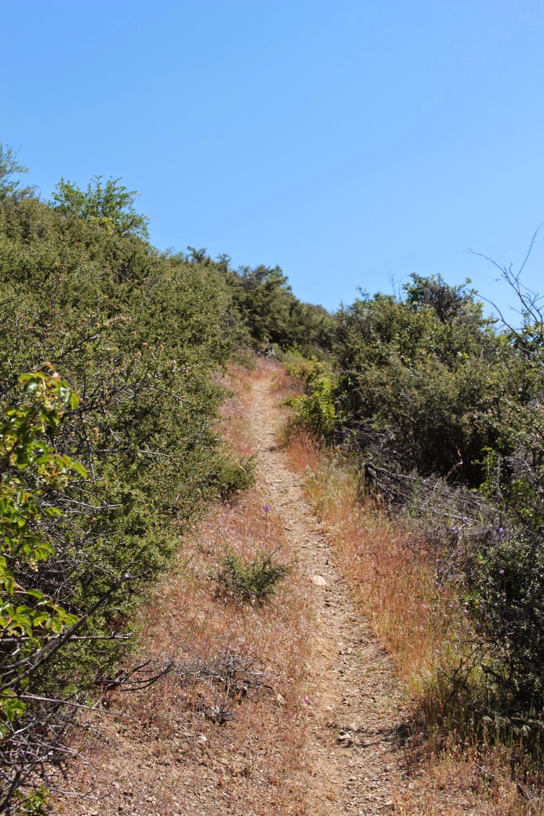
Showing posts with label applegate river. Show all posts

Saturday, June 18, 2022

Da-Ku-Be-Te-De Trail


Da-Ku-Be-Te-De just nicely rolls off the tongue, doesn't it? Well, maybe not. I was watching a YouTube video by some dude who hiked on the Da-Ku-Be-Te-De Trail and boy, did he ever struggle to pronounce the trail's name. He eventually gave up after he sprained his tongue and suffered severe mouth contusions. Speaking from personal experience though, it's pretty simple to say when your other native language is Spanish. Fortunately for the linguistically challenged, pronunciation and elocution are not a prerequisite for enjoyment of the hike. Just let your boots do the talking, the trail will always understand.
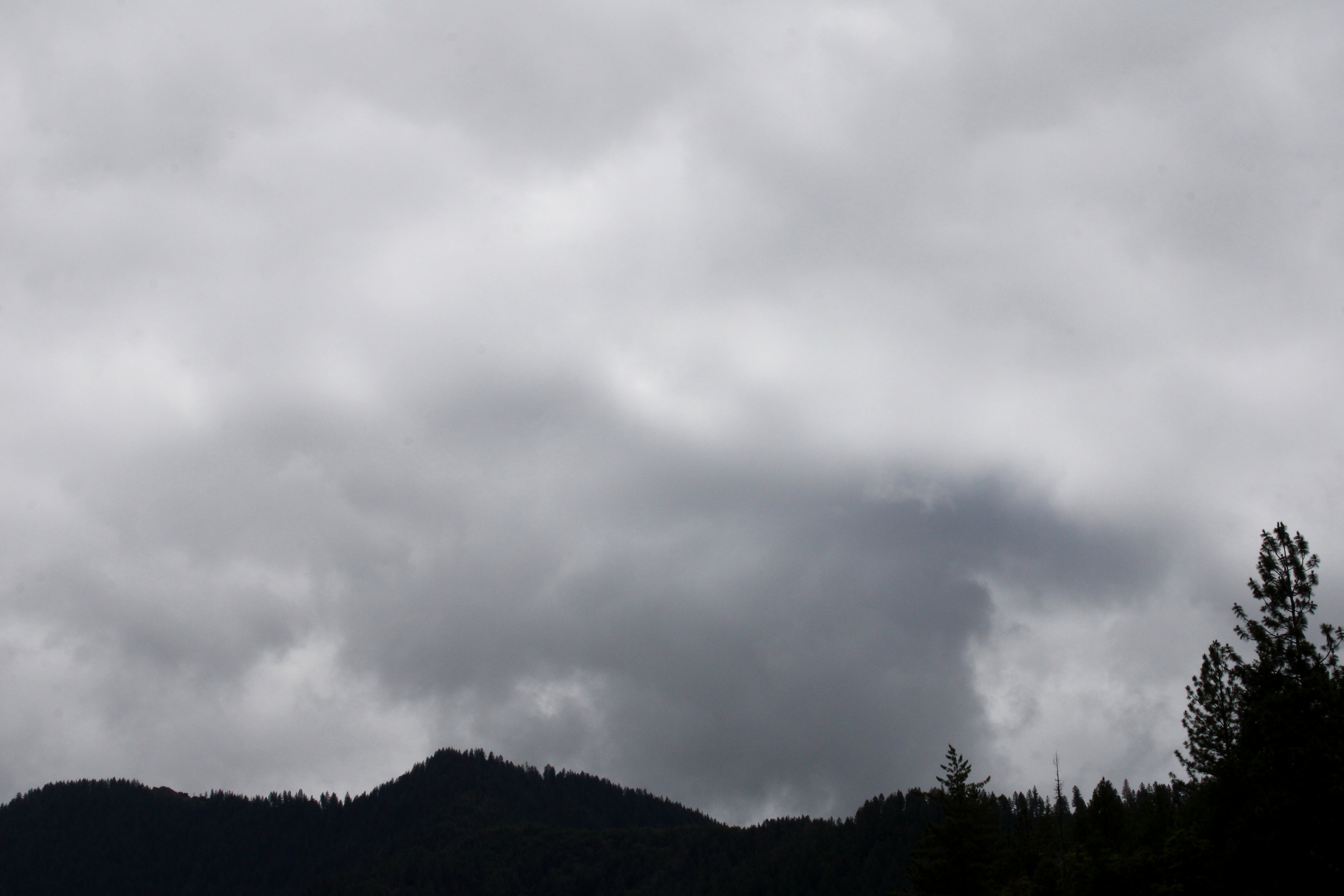
"Once upon a morn so dark and dreary,
while I hiked, weak and weary..."

It had been raining the week prior to this hike along the shore of Applegate Lake. When I began walking, the sky was overcast, dark, and dreary, matching my mood perfectly. Stepson Carl had been badly injured in a work accident and the worry about his well-being definitely harshed my mellow. Hopefully the sun would just stay hidden behind the moody clouds, no need to unduly mellow my harsh. However, as I hiked along the trail, the day would eventually bifurcate into equal parts sunny and cloudy, improving my mood and overall outlook, despite my best intentions to do otherwise.

Not your basic wilderness hike

The Da-Ku-Be-Te-De Trail is part of a trail network that circumnavigates Applegate Lake and this hike began at Hart-tish Park which boasts a campground, picnic area, boat ramp, small general store, and hundreds of squealing children recreating in the lake's cold waters. The civilized start to the hike continued as I walked past the campground, especially since the trail was paved at that point.

Mirrory

After several years of minimal precipitation and maximal wildfires, it was nice to receive a lot of rain last winter, leaving Applegate Lake full to the brim with water, as every lake should be. The air was quiet and still, and the lake reflected the gray clouds in the sky on its mirrory surface and I don't think "mirrory" is really a word, but I'm still going with it. In general, the body of water sported an alpinesque vibe, seeing how the narrow fiord-like lake is surrounded by tall craggy peaks still flecked with snow.

Mule Mountain rises beyond the lake's dam

Even though the trail closely followed the shore, dense woods surrounded the track and at times, it was like there was no lake at all. But periodic openings in the tree cover allowed me to observe some of the surrounding lakeside topography, like Little Grayback Mountain, whose tip-top generally hid somewhere within the low cloud cover. Across the lake was Elliot Creek Ridge with Stein Butte being the most prominent high point on the forested ridge. Not all the scenery was mountain-centric though, as the pronounced bay of Squaw Creek's arm reposed on the opposite shore below Elliot Creek Ridge.

Golden yarrow brightened up the trail

Wildflowers were a thing on this hike, too. Much of my time was spent bent over or lying prone on the trail, photographing small plants with colorful blooms representing all colors of the rainbow. Many of the plant species were regular Siskiyou denizens, seemingly exotic to this particular denizen of the Oregon Cascades country. Elegant brodeaia, ookow, checkermallow, golden yarrow, and paintbrush all did their part in colorizing the hike and much photography ensued.

The ticks await my presence on the trail

Intermittently, the woods gave way to small meadows and open grassy fields. Somewhat paranoid about the small biting creatures that lurk in the grass, I performed frequent tick checks, particularly right after a round of photo-grazing at grass level. I'm glad to report only one eight-legged vermin was found crawling on my pants leg, and luckily that was before it found its way to the delicious O'Neill blood flowing underneath my preciously soft and tender skin.
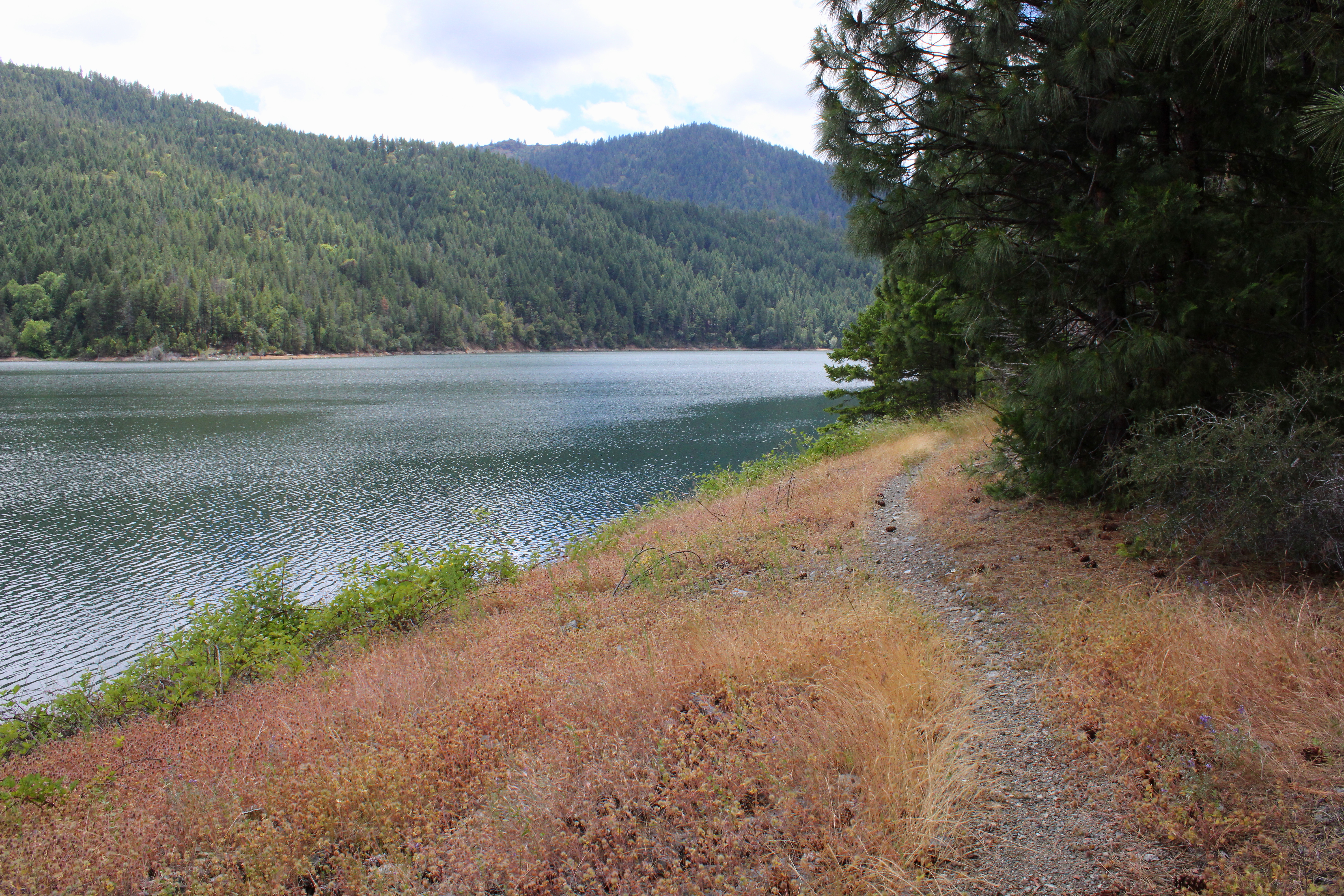
The Da-Ku-Be-Te-De Trail follows
the shore of Applegate Lake

As the miles slowly accrued, the lake's dam, eminently visible at the beginning of the hike, soon receded from view and it was easy to pretend Applegate Lake was then a natural body of water. On a clear day, the high peaks of the Red Buttes Wilderness, most notably those of the Red Buttes themselves, are an impressive sight from the shore. Unfortunately though, all that sumptuous snow-capped mountain scenery was hidden from sight by the brooding cloud cover on this latest visit.

Trail intersection near Watkins Campground

After about four miles of pleasant and mostly level hiking, a wooden footbridge and trail intersection marked my arrival at Watkins Campground. To continue hiking further around the lake required a fairly lengthy road walk, which made the campground my logical turnaround point. If I wanted to hike on pavement, I would have just walked back and forth a bunch of times on the campground path at Hart-tish Park.

I can see most of the Red Buttes

On the way back, the whole semi-stormy vibe completely changed as the clouds began to break up and dissipate. More and more, blue sky began to hold sway above the lake, but the clouds resisted mightily while I hiked below, fully entertained by the meteorological contest of wills. At the end of the hike, the Red Buttes, looming large on the Siskiyou crest, did finally make a brief appearance.

Blue sky began to rule the day, come afternoon

This hike had been another exercise in mental health, allowing me to assimilate myself back into civilization and generally mimic socially acceptable behavior. Totally enjoyable it was and I'll probably return to this trail in the future, for the backpack trip around Applegate Lake is on my to-do list. Because the trail around the lake is relatively level, it would be a pleasant backpack trip and probably is as easy as pronouncing Da-Ku-Be-Te-De.

Easy for you to say!

For more photos of this hike, please visit the Flickr album.

Saturday, April 6, 2019

Sterling Mine Ditch Trail


Back in 1854, a pair of miners (James Sterling and Aaron Davis) discovered gold in Sterling Creek. Word leaked out, the gold rush was on, and the boomtowns of Sterlingville and Buncom sprung up to service the miners. A couple of brothels also sprung up (pun intended) for a different sort of servicing of the miners, but that's a topic best not further explored in this blog. Pity the bypassed Aaron Davis, who had nothing named after him in spite of his co-discovery; all the glory instead went to Mr. Sterling. In 1877, the Sterling Mine Company constructed the 28 mile long Sterling Ditch to transport water from the Little Applegate River to the hydraulic mining operations. The mining activity eventually dwindled beginning in 1883, as the gold and chromite ran out and although the mine reopened from 1933 to 1957, the towns of Buncom and Sterlingville were abandoned and only a few buildings remain in Buncom from that era. Sterlingville was destroyed and nothing remains from that town which had reached a peak population of over 1,500 in its heyday. 

Trail, at the high point of the hike
Unfortunately, the post-Depression resurgence of hydraulic mining devastated and ruined the surrounding landscape and terrain. To this day, we still feel the effects from the damage caused by the mining. I'm not sure where the site of the actual Sterling Mine is or was, but Sterling Ditch and the Little Applegate are full of rocks and gravel, thanks to the mine. Accordingly, the water quality of the Little Applegate is poor but a stressed run of salmon do manage to make the spawning journey each year. And speaking of epic spawning journeys, Sterling Ditch has proved to be a great boon to hikers and mountain bikers alike in  our present time.

The rain never did materialize
In April of 2019, the weather forecast prognosticated floods for southern Oregon, thanks to a very wet weather system blowing in. That may be why only two hikers showed up to my hike, or else maybe nobody likes to hike with me; both possibilities are equally probable. However, the rain was due to arrive the following day, giving us a day to sneak one in before the deluge arrived. Medford hiking buddies Glenn and Carol thought likewise and met us at the trailhead under an overcast sky. Despite the gray sky above, the rain held in abeyance throughout the day.

Sterling Ditch Tunnel, in all its tunnely glory

The main attraction on the Sterling Mine Ditch Trail is the Sterling Ditch Tunnel which is basically a hole bored completely through Tunnel Ridge. A historical point of interest, to be sure, but for me the main attraction is the oak-dotted hilly countryside surrounding the ditch rather than the actual ditch or tunnel. At any rate, this hike was set up as an end-to-end shuttle hike from Little Applegate Trailhead to Tunnel Ridge Trailhead.

Shooting stars brightened up the trail
The climb up from the Little Applegate River to Sterling Ditch was fairly brisk but thankfully short as it gained about three hundred feet in about half a mile. On the way up, it was readily apparent that it was the onset of spring with white-colored oaks toothwort and magenta shooting stars doing their flowery best to distract hikers with cameras. 

The trail wanders through the oak trees
Once we joined up with Sterling Ditch, the left bank of the former canal became the actual trail and the path was either level or just slightly downhill, both grades being equally pleasant to walk on. Hey, this hike was going to be easy and whatever could go wrong? Well, private property boundaries, as it turned out. After a mile or so, the ditch and trail parted ways due to the aforementioned private property parcel, with the ditch continuing its pleasantly level journey while us hikers performed an agonizing uphill slog through a stand of leafless oak trees. Well, of course I'm exaggerating about the agonizing part, but it was uphill and did provide some leg-based discomfort as we climbed. 

Panoramic of the Little Applegate River valley
The slow uphill pace did allow us to enjoy views of the surrounding countryside, though. Above us was bare and grassy Goat Cabin Ridge with Point Mountain rising further above and beyond. Point Mountain was still covered with some snow, but it was patently obvious that the spring thaw was on. To the northwest was the large and deep valley of the Little Applegate River, which abruptly ended in the distance when it ran into the much larger and deeper Applegate River valley. In front of us, laying like the insurmountable object it turned out to be in the late 1800s, was the forested wall of Tunnel Ridge, so named in honor of the tunnel drilled through it by the Sterling Ditch construction crew. 

The ever so elegant grass widow
Underneath the oak trees were patches of grass widow, one of the more elegant wildflowers to ever bloom in southern Oregon. Flanking the trail, manzanita bushes were not only graced with interesting smooth burgundy colored trunks and limbs, but also graced with dangling umbels of pink flowers as is customary this time of year. Needless to say much photography ensued, doing double duty as rest stops too.

The trail and Sterling Ditch were one and the same
What goes up must come down, and once the trail crested a grassy ridge, it plunged at a rate inversely equal to the uphill portion we had just hiked. Clearly, we were on our way down to rejoin Sterling Ditch, our wayward friend. And that's exactly what happened when the trail entered a relatively lush forest in Muddy Gulch, which was not particularly muddy at all.

Tunnel Ridge looks straight ahead of Glenn and Carol
The trail was pleasantly level again, and there was much rejoicing. We were now on the slopes of Tunnel Ridge, and a small and underwhelming hole in the ground was the former entry point of Sterling Ditch's water flow where it had poured into the renown and famed Sterling Ditch Tunnel. It was more impressive to round Tunnel Ridge on the trail and observe the much larger tunnel exit where the ditch emerged from its brief underground journey through Tunnel Ridge. It's really amazing to think that the tunnel was hand-hewn through solid rock by Chinese laborers in the late 1800s, although Katie (Glenn and Carol's dog) seemed more amazed by the banana I offered her as we gazed at the tunnel.

The trail sidehills across Tunnel Ridge
After a lunch, view-soak, and regrouping of our small hiking party, we left the Sterling Ditch Mine Trail for the descent down to the Tunnel Ridge Trailhead. This portion of the route was all new trail for me as I had never been, and I must say it was probably my favorite part of the whole hike.

Manzanita trunks, smooth as the
burgundy they are colored after
The path contoured across steep grassy slopes dotted with sparse oaks as it switchbacked down to the Little Applegate. The mazanitas were huge here, being less like shrubs and more like trees and I stopped periodically to admire the distinctive smooth dark red trunks. When there were not manzanita bushes or trees there was oak, and where there was oak, there was Henderson's fawn lilies growing underneath in lavender profusion.

A veritable herd of Henderson's fawn lily
Henderson's fawn lily rivals grass widow for elegantness, in my opinion. The flowers are fairly large and imbued with a classy and stately pinkish lavender color and there were hundreds, if not thousands, of these floral beauties blooming right next to the trail.


The trail descended off Tunnel Ridge through some oaks


As the trail dropped down at a fast rate, I gave silent thanks to the trail gods that I wasn't hiking up this, that would have been a pretty good workout. But downhill it was, and eventually the trail spit us out onto the trailhead parking lot. From there, we piled into our respective cars, each giving silent thanks to the Sterling Mining Company for having had the wisdom and foresight to create such a great trail at the same time it was destroying the environment.

A clump of manzanita blossoms
For more photos of this hike, please visit the Flickr album.


Sunday, October 1, 2017

East Applegate Ridge Trail

"New trail!" That's all I need to hear before responding "I'm in!". I don't even need to ask where it goes. The new trail could lead into a pit of venomous deer and it wouldn't make any difference, I'm still in. Fortunately, when Medford hiking buddies Glenn and Carol extended an invite to hike on the brand new East Applegate Ridge Trail, it didn't lead to any deer pit, although it did drop down into a valley.

Epic views, all day long
The Applegate Ridge Trail (ART) is the brainchild and pet project of the Applegate Trails Association and when complete, the 50'ish mile ART will connect Cathedral Hills (located south of Grants Pass) to the general vicinity of the quaint town of Jacksonville. But wait, it gets even better!

Glenn hikes through the madrones, oak, and conifer
The Siskiyou Uplands Trails Association is also at work making the Jack-Ash Trail happen. They already have installed a 12 mile section of trail connecting both ends of the Sterling Ditch Trail. When complete, the Jack-Ash Trail will make it possible to hike from Jacksonville to Ashland on continuous trail. But still, it gets better yet! Both the ART and the Jack-Ash Trails share the same terminus in Jacksonville so it will be possible to hike from Cathedral Hills all the way to Ashland. I can hardly wait!

Taking care of traihead formalities
The East ART is a 5.6 mile section of what will eventually be the full-length ART, and it contours above Bishop Creek and Poormans Creek's drainages and naturally, there is a trailhead at either end of the trail. So our choices were to start low and go high, or start high and go low. It really didn't matter all that much, because we were hiking this trail as an out-and-back and we would experience both the best and worst this trail had to offer, with respect to elevation gain and loss.

Didn't take long for the views to show up
Before we started experiencing that elevation loss however, the route was remarkably level for nearly the first three miles. The first view came maybe a quarter-mile from the trailhead and the epic vistas continued for most of the hike. Clouds covered up the sky for the most part but sunbeams leaked through and spotlit the bald grassy ridge we were contouring across.

Look, but don't touch!
Poison oak covered the hillsides in thick clumps, their presence quite striking due to the autumn colors of the accursed itch-spawning plant contrasting with the golden grasses waving in a soft breeze. Other colorful items were the dark red trunks and limbs of manzanita, and ditto for madrone trees, except that their trunks are colored orange just like the President's. Plus, a few oaks were letting the odd leaf here and there turn yellow. The lavender end of the spectrum was represented by a few specimens of coyote mint still in bloom.

I can see the town of Ruch from here!


The autumn plumage of (mostly) poison oak was nice and all, but really this hike was all about the stunning panoramas laid out before us. The hike started out peering down the deep canyon of Bishop Creek running into the much larger Applegate Valley. Looking like some out-sized quilt, the Applegate Valley was covered by a patchwork of farm pastures, some reposing luxuriously in a sunbeam while the rest shivered under a cloud's dark shadow.

Peaks of the Siskiyou foothills
Surrounding the valleys were a series of prominent peaks in the Siskiyou foothills. The geography of this area is not my strong suit but I believe we were looking at Miller Mountain, Mount Isabelle, and Woodrat Mountain. And as a personal slight to me, the Oregon peak-namers made sure that I also was looking at Mount Baldy AND Baldy Mountain. Ouch, they sure know how to rub it in! Behind the foothills rose the Siskiyou Mountains, their presence more felt than seen as they were mostly hidden in the clouds. The view of the valleys constantly changed, shifted, and ever exquisitely evolved as the trail twisted and turned on the grassy ridge.

Madrones reach for the sky
At the end of the level portion of trail, a strategically placed bench provided a place to contemplate the peaks and valleys laid out before us, and we took the opportunity to do that very thing. Just after the bench, the trail dropped down through a forest comprised of a mishmash of conifer, madrone, and oak. We almost mourned the loss of epic views but we were soon out of the forest within a half-mile and back in our happy place: hiking while oohing and aahing at the scenery. Much photography ensued.

Katy enjoyed taking her humans for a walk
Eventually the footpath morphed into an old roadbed, the downhill grade increasing markedly as the road had originally been designed for automobiles and not for hikers. We were nearing Highway 238 and as we sunk down into the valley, the vistas and panoramas were hidden from sight. But hey, at least there was lots of red-leaved poison oak to look at, sarcasm intended. We sat down and ate lunch about a half-mile from the lower trailhead. Katy (Glenn and Carol's dog) was well-fed as she successfully mooched from all hikers in our party.

Rain falls on neighboring mountains
I didn't know it at the time, but I was in the process of getting a flu bug. I had started out with a light headache and sniffles, but I definitely felt ickier once we started toiling uphill. Good thing I was hiking with friends who waited patiently for me as I trudged uphill, feeling like my head was an overfilled water balloon about to pop. Some relief came about halfway up, when the heavens opened up with about a 30 minute rainstorm. The rain felt good though, as it cooled off hot (and feverish) hikers walking uphill.

Autumn is the only time I like seeing poison oak
After a series of uphill switchbacks, we reached the scenic bench and sat down, watching the storm clouds break up after the rain ceased falling. The good news was that the next three miles were relatively level and we got to enjoy the awesome views all over again. From neighboring Woodrat Mountain, paragliders were floating around the summit, looking like multicolored gossamer-winged pterodactyls in search of hikers to eat.

Glenn and Carol hike on the edge of the world
This was an awesome hike and a shout-out to Glenn and Carol for expanding my hiking horizons. If the remaining sections of ART and Jack-Ash are anything like this hike, it will be one epic backpack trip. For now, my hiking list just got a few hikes larger: the completed section of the Jack-Ash trail is on tap, as is the full route when both trail projects are completed. Whoo!

Fellow hiker on the trail
For more pictures of this hike, please visit the Flickr album.


Sunday, May 3, 2015

Mule Mountain


Consider the enchilada from the enchilada's perspective. Roasting in a hot oven, the stuffed tortilla cooks and swelters in the oven pan until the cheese inside melts. I only offer this brief discussion about Mexican cuisine because on a recent hike on the Mule Mountain Trail, I felt exactly like an enchilada with the cheese running out of it.

Shade is NOT overrated
At the start of the hike, the trail ambled underneath shady oaks and later through a mixed conifer forest. While the trail headed unrelentingly uphill, the grade wasn't too bad and the shade kept things quite pleasant. Mule Mountain is a great wildflower hike in spring and there were so many things to take pictures of. The thick and tangled undergrowth was vibrantly green and jungly. Unfortunately, the jungle underneath the trees was mostly comprised of lush stands of poison oak, I did not lie down on the ground to take pictures of low-growing flowers as is my usual custom.

A litter of cat's ears


So at this point, my cheddar was still sharp, so to speak. That would begin to change when the trail attained a ridge crest near the junction with the Mule Creek Trail. The trees thinned out and the vegetation morphed from dense jungle to open stands of oak, manzanita, poison oak, and thorny ceanothus bushes. Along the trail were all the cat's ears you could ever want to take pictures of. These small lilies are fuzzy on the inside, allegedly just like a cat's ear. I can't say that for a fact because my cat does not let me peer down into his ears and he has sharp claws.

Glen dutifully clears the trail
The Mule Mountain Trail basically contours the slopes of its namesake mountain and then leaves the mountain behind altogether, making a mad charge upward to Baldy Peak. The trees simply don't grow here and if you like baking in the hot sun, then you will love the Mule Mountain Trail. Based on past experience, Glen is a tick magnet so we sent him ahead to clear the trail. We need not have taken that precaution because the tick multitudes normally prevalent on this trail were a non-factor.

Some of that 2,581 feet of elevation gain
So it's been a hot and treeless hike so far but on the plus side, the trail gradient now ratcheted up about 30 degrees. Yes, I'm being sarcastic. It was about here where my cheese began to melt and ooze out both sides of the rolled tortilla, figuratively speaking. Like my metaphoric enchilada, I was thoroughly cooked, slather on some hot sauce and call me a chimichanga. The hike became a slow laborious trudge even though we could see up ahead the one lone tree that marked the turnaround point below Baldy Peak. The tree was so close, yet so far.


View from the top
The slopes on Baldy Peak are steep and drop precipitously away from the trail, providing nice views to the valleys below and the mountains above. Of course, the views were only appreciated once we plopped down in the shade under that one lone tree below the Baldy Peak summit. An impressive 2,581 feet below, our car was waiting for us somewhere in the Applegate River valley. Next-door mountain neighbor Little Grayback Mountain raised its forested head over nearby Mule Creek Canyon. Further in the distance stretched a chain of Siskiyou Mountain mountains all the way from Grayback Mountain to Dutchman Peak. The Red Buttes were snowless and glinted a dull orange in the slight haze. The vista was enjoyed as we ate sandwiches while waiting for blood and sensation to return to our legs.

Lupines add colorize the Mule Mountain Trail
Once our cheese was reconstituted by the lunchtime rest, it was a quad-burning, leg-braking, toe-jamming descent on the way down, the exertion being nearly as tough as the climb up. However, silver leaved lupines were putting on a purple flowered show and camera stops provided occasional rest breaks. Once we hit the bottom of the trail, we all agreed it had been a great, albeit difficult, hike. Glen did remark "Now we know why Dollie doesn't hike with you anymore" I laughed, even though it was true.

Naked broomrape
For more pictures of this hike, please visit the Flickr album.

Carol and Glen lead the way (no camera!)