

Da-Ku-Be-Te-De just nicely rolls off the tongue, doesn't it? Well, maybe not. I was watching a YouTube video by some dude who hiked on the Da-Ku-Be-Te-De Trail and boy, did he ever struggle to pronounce the trail's name. He eventually gave up after he sprained his tongue and suffered severe mouth contusions. Speaking from personal experience though, it's pretty simple to say when your other native language is Spanish. Fortunately for the linguistically challenged, pronunciation and elocution are not a prerequisite for enjoyment of the hike. Just let your boots do the talking, the trail will always understand.
 |
| "Once upon a morn so dark and dreary, while I hiked, weak and weary..." |
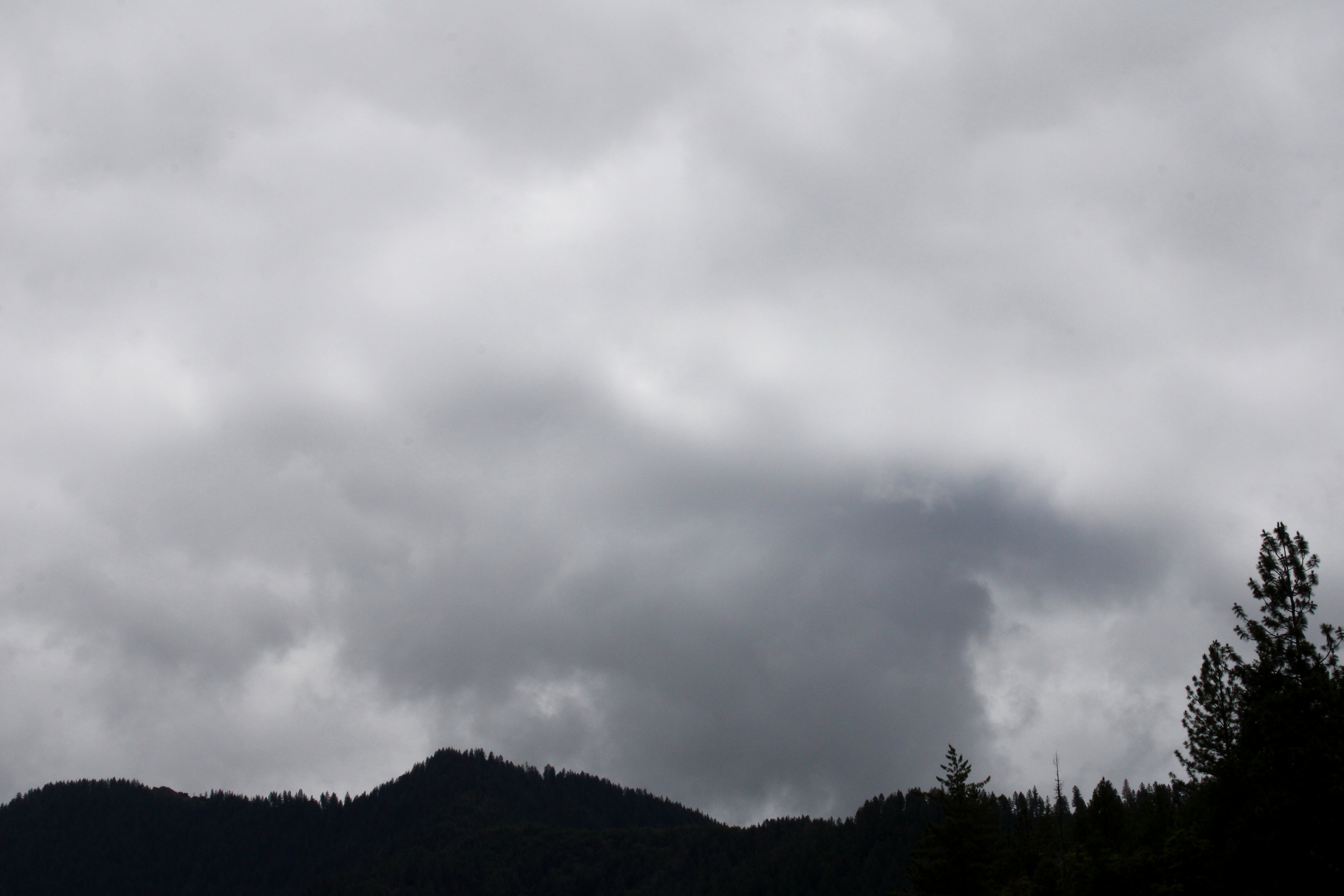
It had been raining the week prior to this hike along the shore of Applegate Lake. When I began walking, the sky was overcast, dark, and dreary, matching my mood perfectly. Stepson Carl had been badly injured in a work accident and the worry about his well-being definitely harshed my mellow. Hopefully the sun would just stay hidden behind the moody clouds, no need to unduly mellow my harsh. However, as I hiked along the trail, the day would eventually bifurcate into equal parts sunny and cloudy, improving my mood and overall outlook, despite my best intentions to do otherwise.
 |
| Not your basic wilderness hike |
The Da-Ku-Be-Te-De Trail is part of a trail network that circumnavigates Applegate Lake and this hike began at Hart-tish Park which boasts a campground, picnic area, boat ramp, small general store, and hundreds of squealing children recreating in the lake's cold waters. The civilized start to the hike continued as I walked past the campground, especially since the trail was paved at that point.
 |
| Mirrory |
After several years of minimal precipitation and maximal wildfires, it was nice to receive a lot of rain last winter, leaving Applegate Lake full to the brim with water, as every lake should be. The air was quiet and still, and the lake reflected the gray clouds in the sky on its mirrory surface and I don't think "mirrory" is really a word, but I'm still going with it. In general, the body of water sported an alpinesque vibe, seeing how the narrow fiord-like lake is surrounded by tall craggy peaks still flecked with snow.
 |
| Mule Mountain rises beyond the lake's dam |
Even though the trail closely followed the shore, dense woods surrounded the track and at times, it was like there was no lake at all. But periodic openings in the tree cover allowed me to observe some of the surrounding lakeside topography, like Little Grayback Mountain, whose tip-top generally hid somewhere within the low cloud cover. Across the lake was Elliot Creek Ridge with Stein Butte being the most prominent high point on the forested ridge. Not all the scenery was mountain-centric though, as the pronounced bay of Squaw Creek's arm reposed on the opposite shore below Elliot Creek Ridge.
 |
| Golden yarrow brightened up the trail |
Wildflowers were a thing on this hike, too. Much of my time was spent bent over or lying prone on the trail, photographing small plants with colorful blooms representing all colors of the rainbow. Many of the plant species were regular Siskiyou denizens, seemingly exotic to this particular denizen of the Oregon Cascades country. Elegant brodeaia, ookow, checkermallow, golden yarrow, and paintbrush all did their part in colorizing the hike and much photography ensued.
 |
| The ticks await my presence on the trail |
Intermittently, the woods gave way to small meadows and open grassy fields. Somewhat paranoid about the small biting creatures that lurk in the grass, I performed frequent tick checks, particularly right after a round of photo-grazing at grass level. I'm glad to report only one eight-legged vermin was found crawling on my pants leg, and luckily that was before it found its way to the delicious O'Neill blood flowing underneath my preciously soft and tender skin.
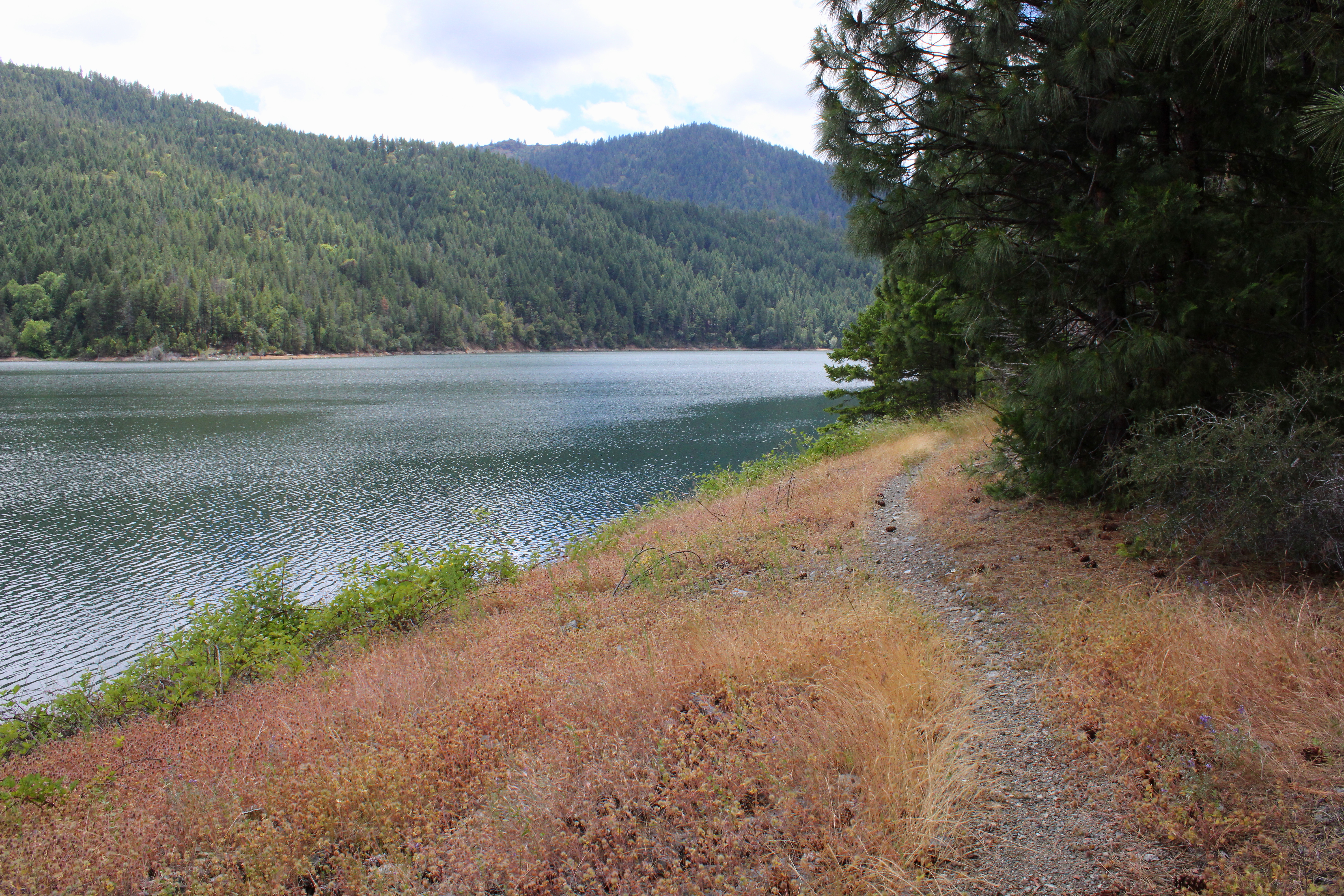 |
| The Da-Ku-Be-Te-De Trail follows the shore of Applegate Lake |
As the miles slowly accrued, the lake's dam, eminently visible at the beginning of the hike, soon receded from view and it was easy to pretend Applegate Lake was then a natural body of water. On a clear day, the high peaks of the Red Buttes Wilderness, most notably those of the Red Buttes themselves, are an impressive sight from the shore. Unfortunately though, all that sumptuous snow-capped mountain scenery was hidden from sight by the brooding cloud cover on this latest visit.
 |
| Trail intersection near Watkins Campground |
After about four miles of pleasant and mostly level hiking, a wooden footbridge and trail intersection marked my arrival at Watkins Campground. To continue hiking further around the lake required a fairly lengthy road walk, which made the campground my logical turnaround point. If I wanted to hike on pavement, I would have just walked back and forth a bunch of times on the campground path at Hart-tish Park.
 |
| I can see most of the Red Buttes |
On the way back, the whole semi-stormy vibe completely changed as the clouds began to break up and dissipate. More and more, blue sky began to hold sway above the lake, but the clouds resisted mightily while I hiked below, fully entertained by the meteorological contest of wills. At the end of the hike, the Red Buttes, looming large on the Siskiyou crest, did finally make a brief appearance.
 |
| Blue sky began to rule the day, come afternoon |
This hike had been another exercise in mental health, allowing me to assimilate myself back into civilization and generally mimic socially acceptable behavior. Totally enjoyable it was and I'll probably return to this trail in the future, for the backpack trip around Applegate Lake is on my to-do list. Because the trail around the lake is relatively level, it would be a pleasant backpack trip and probably is as easy as pronouncing Da-Ku-Be-Te-De.
 |
| Easy for you to say! |
For more photos of this hike, please visit the Flickr album.
No comments :
Post a Comment