Sunday, January 13, 2013

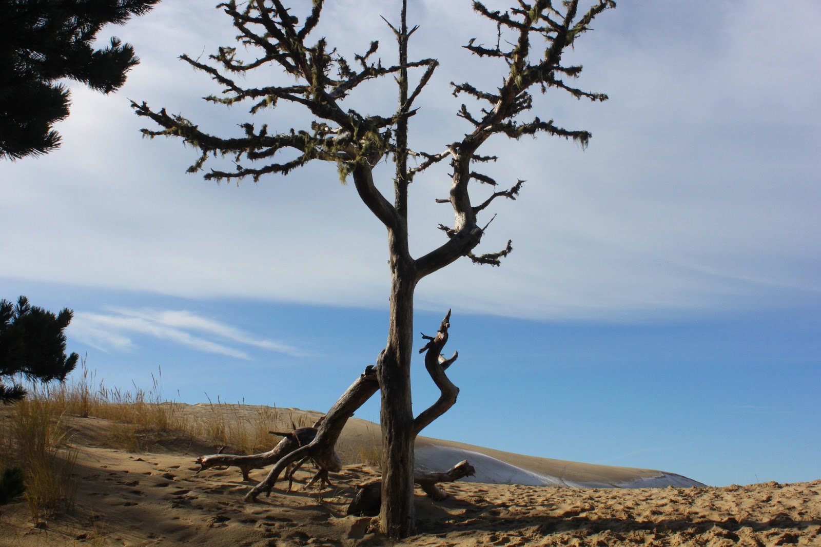
Dellenback Dunes

It's not too often I hike a mere 3 miles and it's even less often I tell the world that I did so. Three miles is not a Richard Hike and, besides which, it's embarrassing. However, several weekends ago I had were two good reasons for hiking short: Grandchildren Aiden and Coral Rae, ages 9 and 5 respectively. Aiden had hiked with me before but this would be Coral Rae's first hike with Grandpa.

"Wow!", personified
Dellenback Dunes are, in my humble opinion, the best of the dune hikes and this hike no doubt would impress young impressionable minds. So, after several hours in the car listening to "I'm bored", "Are we there yet?", and "Can we stop and eat?", it was eminently gratifying to hear them say with all the awe in the world, "Wow!" at their first gander at  the dunes.

Death welcomed us to the dunes
It was a cold frosty morning and the temperature would never rise over the mid-30's; ice and frost rimed the leaves on all the bushes and trees when we started. The first half-mile wandered through coastal woods, lakes, and marshes before suddenly spitting us out onto the dunes. There was sand everywhere with large dunes undulating up and down with the sea on the horizon. Aiden was already off and running, which would be a recurring theme on this hike. A friend noted Aiden hikes like Maggie (the Hiking Dog) and I couldn't agree more.

Little girl on a big dune

Alas, Coral Rae's stubby little legs did not let her keep pace with her older brother, although she gamely tried. What she did do, however, was hike. The path we took required we climb atop a large dune, no easy task in soft sand, and she did so without complaint. From there, we stayed on top of what I euphemistically refer to as the "Great Dune".


Coral Rae art


It was probably unfair to plop Coral Rae in the world's biggest sandbox and ask her to walk without interruption; she periodically dropped to her knees to run sand through her fingers and make sand paintings. We were heading to a tree island and while Aiden scampered up and down and to and fro like a dog chasing scents, we walked at Coral Rae speed. Slowly and surely, we covered the miles as she prattled on about princesses and unicorns, not the usual topic of discussion I encounter on the trail.

This is how I walk downhill
We ate lunch overlooking a small pond where rainwater had collected. I had warned Aiden about quicksand and unclear on the concept, he wanted to find some and walk in it to see what it was like. To that end, he explored a grassy peninsula in the pond. The pond was well below us and Coral Rae wanted to join Aiden at the pond so she butt-scooted down the sandy dune and proceeded to play in the sand while singing songs to herself, lost in her own little girl world.

What passes for a desert in Oregon
It had been a gloriously sunny but cold day and as we ate, a small breeze began to blow with the temperature dropping noticeably so we trudged back up to the top of the dunes; well, to be clear, Coral Rae and I trudged while Aiden ran. Coral Rae found a small plant that she wanted to take to her Mommy and at every camera stop she would sink to her knees to obtain damp sand for her plant. Cute, but it was slow going.


Oregon Dunes ski resort
The north side of the dune was in shade and a layer of ice frosted the dunes. Visually, it was strange to see white where normally there would be shade. The allure of icy dunes called to the kids and they slid down the slopes sledlessly. 

Nobody else will hike with me
After a well-deserved dinner and pie in Reedsport, we headed back to Roseburg. When I returned the children to their home, they both gushed excitedly about the hike and then asked me "Can we do that again?" I think I have two new recruits!

For more pictures of this hike, please visit the Flickr album.

Saturday, January 12, 2013

Oregon Dunes

There are certain questions that a wife will ask that a husband will never answer truthfully. We all know about the iconic question "Do these pants make me look fat?" but "How much further are we going to hike?" is another one of those questions guaranteed to lead an otherwise honest husband down the Trail of Untruthful Exaggerations.

Trust me, this hike is easy
Case in point was a recent hike into the Oregon Dunes that Dollie and I did several weekends ago. She had a slightly tweaked back but bravely agreed to go hiking with me. According to the guidebook, the loop trail through the dunes was something around 5 miles.


"Whee!" in dog talk
So off we go, and after a short walk on a paved trail through the woods, we descended down into the dunes. Maggie the Hiking Dog was off and running as the recent rains had created some ponds in the random depressions in the sand. We had been on the dunes for all of two seconds and already there was a dog splashing mindlessly with sheer exuberance in a pond.

This is the proper way to hike on a wet trail
There are no trails in the dunes but the route was easy to follow from marker post to marker post. Besides which, there were lots of footprints forming an ad hoc trail to lead us in the right direction. The last post in the dunes marked the beginning of the forest section of the hike and the first little introduction to marital discord.


I am so in trouble
The sandy path through the forest happened to be under a foot or two of water. Dollie did not appreciate the watery goodness unlike Maggie who thought all the water was more fun than a bag of cats. We spent some time stepping on logs and bushes in a vain attempt to keep feet dry for the Dainty One.  


Could be worse, it could rain
Eventually, we worked our way out of the marshy forest and hit the beach. It was a grey day with a high tide, both earning two more demerits for me. We headed south on the beach and although it was high tide we had plenty of beach to hike on. There were not a lot of logs on the beach but there was plenty of tsunami debris in the form of water bottles and large plastic floats.


(Not) "Almost there!"

After a mile and a half, a sign post atop the grassy beach foredune marked the beach egress and the loop trail back through the dunes. I was feeling good and really wanted to walk further, so the walk down the beach to Tahkenitch Creek and back was suggested. In response to Dollie's query about how much further, I glibly answered something along the lines of "...not far, we are almost there as we speak!"


Soldiering bravely on
To be honest, I didn't deliberately intend to misconstrue the mileage. The guidebook indicated that the mouth of Tahkenitch Creek was a mere mile or so down the beach. The reality, however, is that Tahkenitch Creek had migrated further south, demonstrating a large creek can go wherever it wants to. And a migrating creek meant over 2 more miles of beach walking before reaching the creek's mouth. And math majors such as myself, will note the round trip to the creek it added another 4 miles to our hike.

Oyster shells
Still, there were lots of cool stuff to see as we plodded along in the soft beach sand. The smaller floats entertained Maggie who kicked them along like a soccer ball. Atop a dune, we found an old oyster bed that had been uncovered by high surf. And the overcast sky was wonderfully moody and dramatic, just like a 15 year old daughter who has just been told she can't go with her friends to the movies. Dead jellyfish decayed on the beach, emitting noxious gas bubbles just like my brother does after spaghetti dinner.

Tahkenitch Creek, in sight
As we walked, the clouds gradually turned to blue skies to the north of us. And just as we finally arrived at Tahkenitch Creek, the sun broke out and the creek glinted silver in the sun. We enjoyed a nice little lollygag along the creek as we ate lunch there while the sun restored good humor to tired hikers.


It's a Richard Hike!
After lunch, it was a 2.5 mile walk back to the trail marker and we left the beach on a sandy track. Back in the dunes proper now, the sand was soft as an unused pillow. Shortly after an overlook of Tahkenitch Creek, we hit the sands and were unable to find a trail post marker. Despite there being no trail per se, we somehow had managed to make a wrong turn.


Pain and beauty, but mostly beauty
Our route had taken us into the marshes and ponds and we spent some time working our way through all that before getting onto the more open sands with the magic markers, so to speak.  The last few miles were spent trudging painfully through some of the most beautiful dune scenery around. Pain and beauty, nothing quite sums up a hike like those two words.


Bye, Oregon Dunes
Our hike wound up being 8.6 miles that felt like a lot longer than that, but walking in soft sand will do that. I don't think Dollie will ever ask me again how much further the hike will be, though. 


For more pictures of this hike, please visit the Flicker album.


Tuesday, January 1, 2013

North Bank Deer Habitat

Statistics, statistics, I love statistics; here are mine for 2012:

I hiked 52 days in 3 states and 2 countries, averaged 7.2 miles per hike, and hiked a total of 373.5 miles. My shortest hike was 2 miles to Castle Rock and my longest was a 13.6 miler up to Mount Kit Carson (near Spokane, Washington) which also involved my scariest bear encounter ever.

Happy New Year!
So, moving on to 2013, the Friends of the Umpqua Hiking Club hiked in the  North Bank Deer Habitat in what is fast becoming our traditional New Year's Day event. Just as in years past, the hike began in bitterly cold fog, the kind of cold that slaps your cheeks like an outraged diva throwing a tantrum.


Soggy feet but no soggy bottoms at Soggy Bottoms


Starting on the Soggy Bottom Road, the trail lived up to its name as some of us splashed our way through a soggy bottom while others waded through frosty grasses striving vainly to keep boots dry. Those of us in front briefly saw the distinctive white rump (stop with the jokes, already) of a Columbia white-tailed deer, the reason for the Habitat's existence. A left turn onto the North Gate Trail took us off Soggy Bottom and then the "fun" began.


Human suffering and glory on the trail

It is difficult to avoid hiking uphill when hiking in the Habitat and one of the steepest trails is the accursed North Gate Trail which so happened to be our route. The North Gate is cruel as the trail taunts hikers by forecasting the pain and misery yet to come as the route ahead is demoralizingly visible in all its burning leg pain glory. And just when you think it can't get any steeper, it does. I don't think the deer even hike up the North Gate.

This is why we hike!
Blessings do get bestowed on hikers staggering up the North Gate in the form of magnificent views of the North Umpqua River valley. It was foggy in the valley but we were above all that so what we got to see were fingers of cloud cover with muntain tops poking through, all wonderfully illuminated by the winter sun.

All hail Year 2013!


An unfortunate byproduct of my injured wrist is that I haven't been able to play racquetball for the last 4 months and an unfortunate byproduct of not playing racquetball is getting out of shape. So when we got to the Middle Ridge, most hikers in the group headed downhill while a few hardier members opted for the uphill and longer route to the North Boundary Ridge. I waited for my trembling legs to quit trembling but they didn't so, uncharacteristically, I opted for the shorter downhill hike. I felt so unworthy.


On a clear day, you can see forever


The ignominy of passing up a Richard Hike opportunity was short lived as the views while we descended Middle Ridge were too sumptuous not to enjoy. The air was crisp and clean, a clear blue sky floated above, and we were hiking on windswept grassy hills above cloud cover. The winter air was crystal clear and we speculated what distant and large peak we could see on the horizon. I thought it was Mount McLaughlin but after consulting Google Earth, I now have to conclude that we were looking at Prescott Peak in California's Siskiyou Wilderness, a mere 100 miles away.

Return to the mist
As we lost elevation, we got closer and closer to the cloud cover, eventually entering the clouds, or fog as we like to call it. But, the fog was burning off, providing for a nice view of the North Umpqua River as we arrived at the trailhead. It was a nice way to start the new year, although we'll have to do something about that out-of-shape thing.  


For the rest of the pictures, please visit the North Bank album in Flickr.


The route

Saturday, December 29, 2012

Cape Blanco

The weather had been wet and cold and it'd been three weeks since I'd last set foot on the trail. The need to hike was fast becoming a medical condition. Fortunately, the weather gods decided to bestow favor upon us waterlogged Oregonians by giving us a sunny, albeit cold, day on the last weekend of 2012. Not wanting to appear impolite by spurning the sunny gift, Maggie The Hiking Dog and I headed to Cape Blanco to work off some post-Christmas dinner calories with an 8.7 mile hike.
Castle Rock, seemingly sitting in a field
The shadows were still long in the morning sun as we got off to an early start. Sallying forth from the historical Hughes House at Cape Blanco State Park, we strode across a grassy pasture alongside the Sixes River. Castle Rock, a prominent rocky island, appeared to be sitting in the middle of all the grass as the ocean was not yet visible. Maggie, totally in her element, splashed happily in the large puddles on the trail.

View to the Sixes River
We eschewed the beach walk on this particular hike, heading instead uphill on the Oregon Coast Trail. A muddy climb up a wooded bluff took us to a nice view of the mouth of the Sixes River. It was interesting because two months earlier, John and I had camped at the mouth of the Sixes and we had crossed back and forth across  the Sixes on a sand bar damming the river. However, that was then and now the Sixes was carrying a lot of roaring water through the demolished sand dam.

Trail tunnel
Staying in some incredibly dark woods atop the ocean bluffs, the trail basically cut across the neck of Cape Blanco. After a mile or two, the trail spit us out of the coastal forest and offered us a nice view of windswept and grassy Cape Blanco jutting out into the ocean with the famed lighthouse affixed atop the cape like a New Year's party hat on a drunk reveler.


Beauty at the campground
Bypassing the lighthouse (been there, done that) because we had more miles to hike, we crossed the headlands, covered with a dense growth of wind-stunted salal, before re-entering the woods. A short walk brought us into the hiker and biker camp at the Cape Blanco Campground. Maggie and I walked through the campgrounds where campers exclaimed "How cute!" followed by much head patting and chin scratching. I think Maggie was jealous I was getting all the attention.

The only thing needed for a beach hike was a beach
Disappointment awaited us at the beach as the tide was high with waves rolling up all the way to the end of the paved road from the campground. The beach was covered with an ankle-breaking pile of logs and debris at least 10 yards wide, leaving no sand to walk on.  Would this be a prematurely ended hike or would this be instead a Richard Hike? That was the question.

Maggie explores an upside-down stump
I answered the question by waiting for a wave to recede and then running or walking fast before the next wave rolled in. As the next wave came in, Maggie and I would then seek safety on top of the log piles and then repeat the whole process over again when the wave receded. While the going was slow, we did manage to cover about half a mile before finding easier going on the dunes behind the log piles.

Tsunami debris
There has been so much driftwood piled on our beaches this year, it may be from the tsunami in Japan. There was plenty of obvious tsunami debris such as pop and water bottles but most of the debris consisted of logs, indeterminate pieces of lumber, and a gazillion little pieces of plastic. Some of the debris, like flip-flops, plastic baseballs, and baby rattles, were profoundly poignant and tragic. I picked up a water bottle, imagining a pair of hands placing the bottle into a shopping cart, the hands' owner at the time being totally unaware of the disaster that would befall northern Japan. Just an ordinary household item, lying on an Oregon beach, brought here by such a horrible tragedy.

Incoming!
So, between dune-walking, wave-dodging, and log-hopping we made slow and steady progress on the beach towards a tall and sheer cliff. At the cliff the sand petered out altogether, marking an unexpectedly early encounter with the Elk River.

Let's hike across the Elk!
According to my maps and guidebooks, the mouth of the Elk River should have been further south. But a water laden river goes where it wants to go, and the Elk has migrated north by running right under the cliffs paralleling the shore line. A sandy island across the way was not an island at all; upon closer inspection the island instead was the spit of sandy beach on the other side of the river.

The Elk River meets the ocean
The official Oregon Coast Trail calls for walking across the Elk River to which I reply "Are you freaking kidding me?" The river was wide, deep, turbulent, and running fast and strong. No way. Maybe in the summer, but there'd have to be a lot less water in it.

The beach is made entirely of wood


The river clashed violently with the ocean, causing waves to form with no rhyme or reason. The waves came ashore unpredictably from all angles and directions and I kept my head on a swivel as there was precious little sand to stand on. A large wave erupted forth for no apparent reason and I hopped atop the driftwood pile. The wave kept coming and the pile began to shift and move with ominous cracking sounds.  I learned a new skill: doing a speedy 50 yard dash atop moving logs. When the wave receded, it was time to leave: the mouth of the Elk River was indeed a very dangerous place.

Cape Blanco at the end of the day
The trip back was pretty uneventful as the tide had receded enough to allow us to walk on the beach with just the occasional wave chasing us up into the logs. As we headed back to the car, the shadows lengthened and we enjoyed views of the cape, Castle Rock, the Sixes River and all points in between. It was a nice way to close out 2012.

For more pictures of this hike, please visit the Cape Blanco photo album in Flickr.


Saturday, December 8, 2012

Cape Arago

It's weird starting a hike at 2 P.M. 
We've been hiking at Cape Arago so much that one December day several years ago, Dollie and I changed it up a little by beginning the hike at 2 P.M. in order to catch the sunset at the cape. Whipping out our headlamps after an awesome sunset, we detoured through the famed Shore Acres garden, festooned with lights during the Christmas season.


The crew, B.H (before headlamps)
The next year, I heard a chorus of "Take me, take me" and this hike has wound up being sort of an annual event, depending on the weather and whether enough praises have been sufficiently sung to me. The latest installment took place this last December when 9 hardy headlamped adventurers set out on the trail at Sunset Bay State Park.


The hike is shorter, now

Seeing as how we started mid afternoon, the sun's rays were already slanting through the forest as we started. The trail followed the cliffs along the rock shore and much gawking ensued at the scenery. Suddenly, we came across a fence barring our way...huh?


The cliffs were wowier
I don't know whether it is from climate change or from heavy storms, but our cliffy trail was now in the ocean as there has been quite a bit of land loss in the ever shrinking state park. What remains of the former trail lies on the other side of the fence and a new trail system runs through the woods and is nearly not as "wowy"  (is that even a word?) as the old trail.


Looks like petrified sea lions
Minor quibble though, as the trail eventually worked it's way out on top of the cliffs but at a reasonably safe distance from the edge. We could still enjoy the mild waves (it was low tide) rushing over the shoals and the rock formations below.
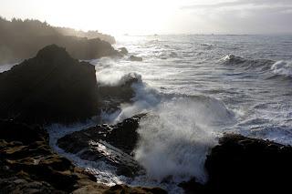


The wave show
The waves were putting on a better show as we entered Shore Acres State Park; we paused briefly to check out the scene from the whale watching observation building. Further south along the shore, we could see the rocks and islands of Simpson Reef, the barking of the sea lions carrying faintly on the sea breeze.


Spring Break for sea lions
After some ups and downs from cliff to beach and back to cliff again, we reached the parking lot of the Simpson Reef overlook. The sea lions were congregating on Shell Island for a sea lion bacchannal and other pinniped debauchery. They were probably having a wet-flipper contest, judging by all the raucous barking on the island. 

Kyle Bush fans
The sun was getting low, so we hightailed it to the cape, walking down to the North Cove overlook for a closer look at the sea lion colony. There was plenty of barking, grunting, belching, and farting; it was kind of like a NASCAR race without the race cars. And the slightest breeze wafted the pungent aroma of "eau de sea lion" into our unsuspecting nostrils.

End of the day
The sunset show was now beginning, so we killed time watching the day come to an end. There was a bank of clouds that diminished the sunset somewhat but nonetheless nobody felt disappointed, or if they did feel disappointed they were kind enough not to complain to the hike leader.  


Good nighty
Heading back to Shore Acres as the night became more nighty, headlamps were eventually donned. From my vantage point at the rear of our group, we looked like giant fireflies dancing in a conga line. An orange glow in the trees ahead signaled our arrival at Shore Acres and the other reason for doing this hike at night.


Welcome to Shore Acres
Shore Acres is the former estate of timber magnate Louis Simpson, no relation to Bart or Homer. What remains of the estate are the formal gardens and the caretaker's cottage. And this time of year, the place is decked out in full Christmas light glory.

Reflecting pond
Every branch on every plant, bush, shrub, and tree was wrapped by lights of every color. The brown muddy waters of the reflecting pond were transformed into a mirrored wonderland of twinkling lights while neon frogs hopped across the pond. The cottage was equally bedecked with lights and offered hot cider to cold visitors.

Walking through the gardens while breathing sideways
We regrouped at the entrance and took a short cut that, most unusually, was a kinder and gentler short cut. The temperature had dropped and our breaths hung visible in the cold air. Those of us with headlamps learned that the beam of light lit up our vapor and, in effect, blinded us. Lois stated that she learned a new skill:  breathing sideways.


Cottage at Shore Acres
Arriving at our cars at Sunset Bay, we snickered at the long line of cars on the Cape Arago Highway, each waiting their turn to enter the parking lot and see the lights at Shore Acres. Avoiding the traffic would be another reason for hiking to the Shore Acres gardens.

For more pictures of this scenic hike, please visit the Flickr album.