Sunday, May 3, 2015

Mule Mountain


Consider the enchilada from the enchilada's perspective. Roasting in a hot oven, the stuffed tortilla cooks and swelters in the oven pan until the cheese inside melts. I only offer this brief discussion about Mexican cuisine because on a recent hike on the Mule Mountain Trail, I felt exactly like an enchilada with the cheese running out of it.

Shade is NOT overrated
At the start of the hike, the trail ambled underneath shady oaks and later through a mixed conifer forest. While the trail headed unrelentingly uphill, the grade wasn't too bad and the shade kept things quite pleasant. Mule Mountain is a great wildflower hike in spring and there were so many things to take pictures of. The thick and tangled undergrowth was vibrantly green and jungly. Unfortunately, the jungle underneath the trees was mostly comprised of lush stands of poison oak, I did not lie down on the ground to take pictures of low-growing flowers as is my usual custom.

A litter of cat's ears


So at this point, my cheddar was still sharp, so to speak. That would begin to change when the trail attained a ridge crest near the junction with the Mule Creek Trail. The trees thinned out and the vegetation morphed from dense jungle to open stands of oak, manzanita, poison oak, and thorny ceanothus bushes. Along the trail were all the cat's ears you could ever want to take pictures of. These small lilies are fuzzy on the inside, allegedly just like a cat's ear. I can't say that for a fact because my cat does not let me peer down into his ears and he has sharp claws.

Glen dutifully clears the trail
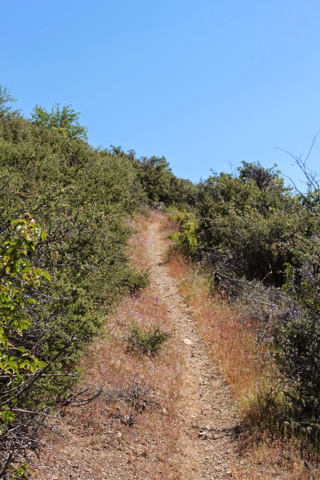
The Mule Mountain Trail basically contours the slopes of its namesake mountain and then leaves the mountain behind altogether, making a mad charge upward to Baldy Peak. The trees simply don't grow here and if you like baking in the hot sun, then you will love the Mule Mountain Trail. Based on past experience, Glen is a tick magnet so we sent him ahead to clear the trail. We need not have taken that precaution because the tick multitudes normally prevalent on this trail were a non-factor.

Some of that 2,581 feet of elevation gain
So it's been a hot and treeless hike so far but on the plus side, the trail gradient now ratcheted up about 30 degrees. Yes, I'm being sarcastic. It was about here where my cheese began to melt and ooze out both sides of the rolled tortilla, figuratively speaking. Like my metaphoric enchilada, I was thoroughly cooked, slather on some hot sauce and call me a chimichanga. The hike became a slow laborious trudge even though we could see up ahead the one lone tree that marked the turnaround point below Baldy Peak. The tree was so close, yet so far.


View from the top
The slopes on Baldy Peak are steep and drop precipitously away from the trail, providing nice views to the valleys below and the mountains above. Of course, the views were only appreciated once we plopped down in the shade under that one lone tree below the Baldy Peak summit. An impressive 2,581 feet below, our car was waiting for us somewhere in the Applegate River valley. Next-door mountain neighbor Little Grayback Mountain raised its forested head over nearby Mule Creek Canyon. Further in the distance stretched a chain of Siskiyou Mountain mountains all the way from Grayback Mountain to Dutchman Peak. The Red Buttes were snowless and glinted a dull orange in the slight haze. The vista was enjoyed as we ate sandwiches while waiting for blood and sensation to return to our legs.

Lupines add colorize the Mule Mountain Trail
Once our cheese was reconstituted by the lunchtime rest, it was a quad-burning, leg-braking, toe-jamming descent on the way down, the exertion being nearly as tough as the climb up. However, silver leaved lupines were putting on a purple flowered show and camera stops provided occasional rest breaks. Once we hit the bottom of the trail, we all agreed it had been a great, albeit difficult, hike. Glen did remark "Now we know why Dollie doesn't hike with you anymore" I laughed, even though it was true.

Naked broomrape
For more pictures of this hike, please visit the Flickr album.

Carol and Glen lead the way (no camera!)


Saturday, May 2, 2015

Buck Canyon

On June 6th, the hiking club is going to camp out at Redwoods National Forest for a multi-day hiking extravaganza. Alas, because of a prior commitment, I will be unable to go. Because of that, I volunteered to lead the sad Redwood exiles and other non-participants on a hike up Buck Canyon where slapping at mosquitoes will take our mind off of bucolic trails underneath majestically tall trees. Edwin is one of 'them" that will be camping at Redwoods and he had expressed mild consternation at missing the Buck Canyon hike in June. It had been several years since I last hiked in Buck Canyon so in order to refamiliarize myself with the trail and also to assuage Edwin's would-be disappointment, we set out on the Hummingbird Meadows Trail on our way down to Buck Canyon.


Avalanche lily, sporting a windblown look
This hike has great scenery and a small creek as constant companions, but mostly it's all about the meadows. The first meadow popped up as soon as we entered the Rogue-Umpqua Divide Wilderness, our thin path weaving its way past all the cow hoofprints in the grass. The growth was only inches high but already dwarf larkspurs and blue-eyed Marys were providing color.

Edwin ponders the mystery that is the East Fork ford
Several hundred yards past the first small meadow, the East Fork Muir Creek provided the first (and only) challenge as our trail disappeared into the flowing stream. We tried to be clever and step across on rocks but in the end, we each wound up splashing through water slightly deeper than boot height. It's just not a hike unless ice-cold water pours into your boots.


It emerges from the depths
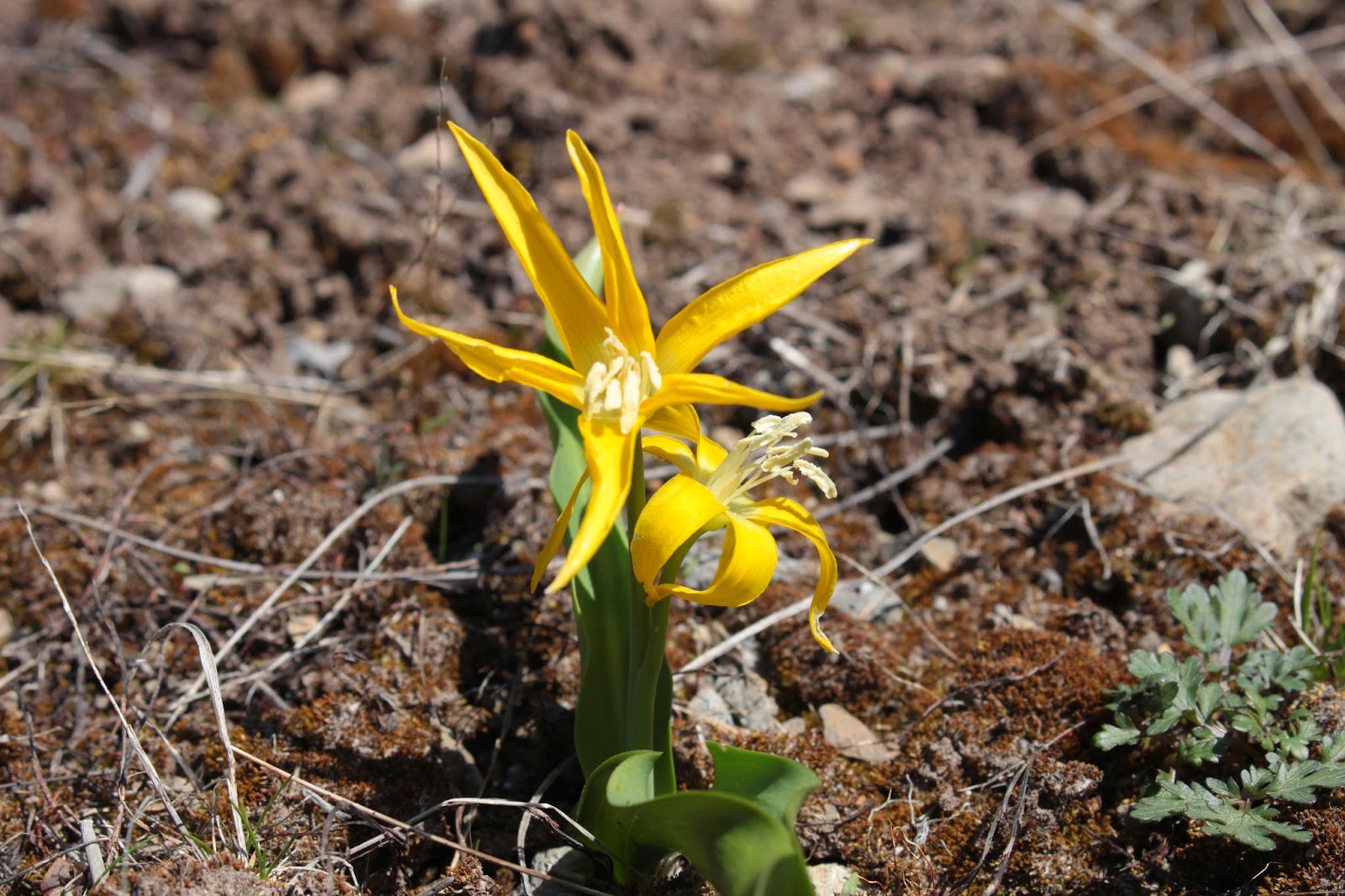
Once on the south side of the East Fork, Hummingbird Meadows hove into view.  Large and expansive, the meadows seemingly go on and on and on and...etc. We were a bit early for the spectacular flower displays that attract the hummingbirds that give the meadows their name. In testament to the recent arrival of spring, tiny yellow glacier lilies and white avalanche lilies were blooming away in the low grasses. Nubs of hellebore were sprouting forth, giving the meadows a somewhat unshaven look,

Glacier lily

Continually angling uphill at a gentle rate, we continued on up Buck Canyon. At all the open spots in the meadows, we enjoyed the blue sky above the green meadows. Buckneck Peak and several other unnamed peaks comprised Buck Canyon's rim with the canyon culminating in the sheer wall that is Fish Mountain. Edwin had to frequently wait, with all the patience of a parent indulging a child, for me to put my camera away and resume hiking. 

The debris pile from Devils Slide
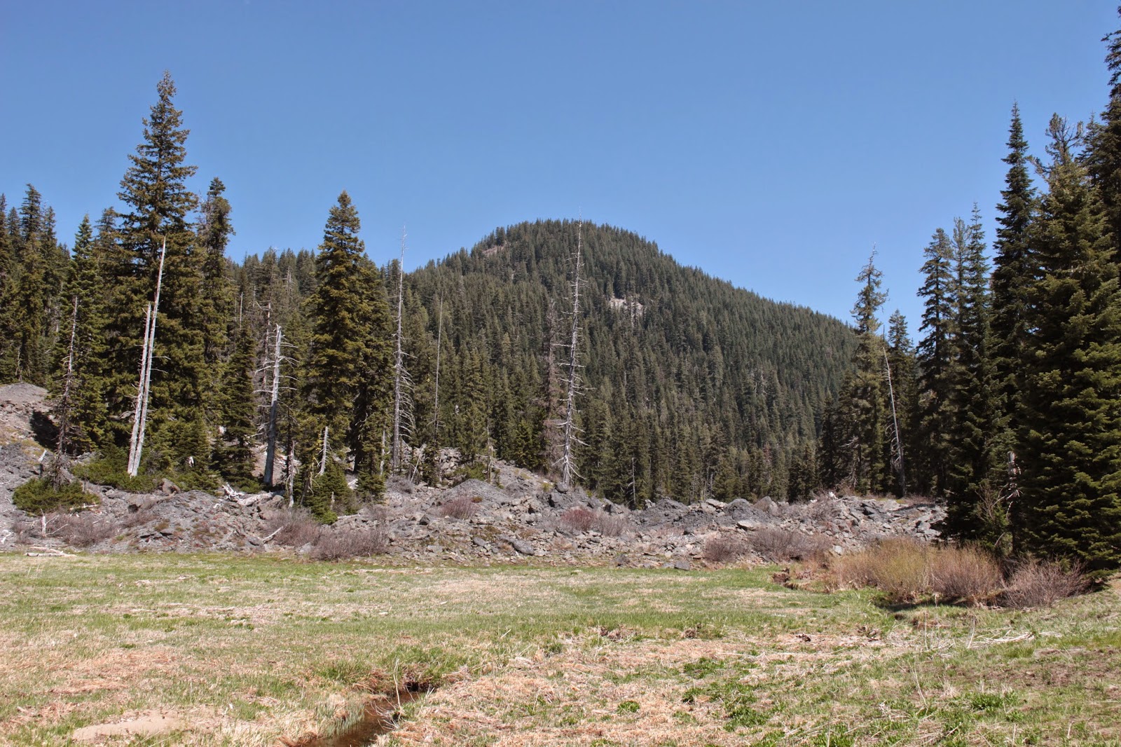
Eons ago, a piece of Peak 6172 broke off and roared down into Buck Canyon, damming the East Fork.  Over time, the resulting lake filled up and became a scenic little meadow with the East Fork lazily snaking its way to and fro in the grass. With the ramparts of Fish Mountain looming overhead, a longer view-soak of this meadow was required so we plopped down on a log and ate lunch there.


This used to be a shallow lake millenia ago
The scars of Devils Slide (the landslide discussed in the previous paragraph) are still visible despite the long passage of time, and we crossed the meadow and explored the rock pile for a bit. Muir Creek tumbles over the rock dam in a noisy little waterfall that was hard to get to and hard to see. In the still waters of the creek, millions of mosquito larva joyfully somersaulted in an omen of things to come.


One of thousands of meadows
On the way back to the trailhead, we took a few side trips to explore some scenic little meadows. We also took a side trip down to Wiley Camp, a small backpacking campsite that was not named after me but could have been. The map shows the trail leaving Wiley Camp and heading directly up and over Buck Canyon's north rim on the way to Fish Creek. We could see the trail charging straight uphill and it looked like it'd be work, especially with a backpack on. Sounds like a dare!

Alligator lizard
Well, we had a buckin' good time at Buck Canyon and I'll be back in June, leading the non-campers here. The mosquitoes await us....

Mushroom of the chartreuse variety
For more pictures of this hike, please visit the Flickr album.


Saturday, April 25, 2015

Pine Bench (with Boy Scouts)

Once it was discovered Daweson's grandfather is the "hiking dude" that writes for the News-Review, it was only a matter of time before I'd be asked to help his Boy Scout Troop 82 with a hike or two. Pine Bench was suggested as a destination because it is a short hike and the trailhead is fairly close to Roseburg. Of course, the last time I was there a couple of weeks ago, I wandered off trail and lost the trail altogether, so I'm not sure that I may not have been best choice to lead newbies into the wilderness. But they did not know that....

All hail Lord Daweson!
Because the scouts were a relatively inexperienced bunch, I gave them a speech about what to do when lost, showed them what poison oak looked like, crossed my fingers, and uttered a silent prayer to the hiking gods asking that I be allowed to return with the same amount of scouts we started out with. And with that invocation, we ducked under the large water pipes below Soda Springs Dam and headed up the trail. I was glad to see the fallen tree that had sent me astray several weeks ago had been cleared off the trail.

Uphill through a forest


Because my young charges were inexperienced, they were quickly huffing and puffing as the trail headed uphill to Soda Springs. Along with the huffing and puffing came the "How much further?" type of questions and along with the questions came my stock answer "we're halfway!" no matter whether we were halfway or not. Daweson and Issiah know the drill as they have hiked with me a time or two and they were just happy to be out on the trail. They also knew (from past experience) not to ask me how much further to go.

Stormy view down to the North Umpqua
All the bad uphill stopped after crossing a burn zone with the trail leveling off in the pastoral woods atop Pine Bench. The day was overcast and the skies were threatening, making for a moody and portentous view into the North Umpqua River canyon.


Pinnacle overlooking Boulder Creek
We ate lunch at the spring which had a nice overlook of the Boulder Creek chasm. Across the canyon, Illahee Rock was dusted with snow. As we ate and as the boys explored a nearby rocky pinnacle, the temperature dropped, a brisk breeze rolled in, and then it started to hail. Lunch was officially over and we headed back in the suddenly less than optimum conditions.


There's snow in them hills
I was bringing up the rear and noticed part of the group had missed the left turn at a trail junction.  I yelled at them and then we counted heads once everybody came back. We were one scout short: my Issiah. In his quest to be first back to the trailhead, he didn't get the message to turn back and now he was somewhere on his way down to the North Umpqua Trail.

Little Boy Lost
Remember my little lecture about getting lost?  Well, Issiah paid attention and once he figured out he was by himself, he did what his grandfather said to do: he stayed put! He did hedge his bets a little bit by taking his bright red poncho out of the pack and draping it over a small tree off trail for added visibility.  And sure enough, Scoutmaster Dave spotted the poncho well below us. I was quite pleased with Issiah's coolness under duress, that can make all the difference sometimes.

Witch's butter
So now that we had the proper number of scouts, we returned to the trailhead under blustery conditions but at least the rain held off for the most part. After it was all said and done, the boys were openly appreciative of the experience. I think we're halfway there!

We're halfway there!
For more pictures of this hike, please visit the Flickr album.


Saturday, April 11, 2015

North Umpqua Trail - Swiftwater Section

The Swiftwater Section of the North Umpqua Trail begins at the like-named Swiftwater County Park where on a rainy April morn, the North Umpqua River's swift waters were rivaled by the copious amount of swift water falling from the sky. I'm not too sure why I felt compelled to hike in the rain but hey, nobody will ever accuse me of being too swift in my decision making.

Thank you!
At Swiftwater Park, a commemorative plaque gives a tip of the hat to those responsible for the completion of the 78 mile North Umpqua Trail. The trail was finished in 1996, I never realized it was that recent a trail. At any rate, a silent nod of appreciation was given to those fine visionaries whose gift I have partaken of over the years.


Feed it some peanuts
In the park, the trail is well-manicured and quite civilized, what with gravel tread and nary a sprig of poison oak to be seen. Trillium, snow queen, and calypso orchid were prevalent along the trail and the flowers and fern fronds danced with each strike from a raindrop. I didn't dance (at least any that I'll admit to) but hiked along at a steady pace as I grabbed a side trail that took me to the river's edge below Deadline Falls.


Deadline Falls
Deadline Falls is only a 10 foot drop, but what makes the falls impressive is the sheer power on display as the rain-swollen North Umpqua careens over the drop. The river's roar was loud but did not faze the ouzels (a small bird which, just like me, 'swims" underwater in search of water bugs to eat) twittering and bathing in the shallows below the cascade.


Feed it some peanuts
Once back on the North Umpqua Trail, the going was slow but steady on the resumption of my eternal quest for the perfect calypso orchid photo. As I either knelt or laid down on the muddy ground, the North Umpqua River coursed below the trail, the turqouise color of the river nicely contrasting with the dark clouds above.


Fern Falls
At little over a mile, the trail crossed a small stream on one of many footbridges. Above the bridge was a small cascade known as Fern Falls. While there were indeed ferns flanking the stream, the falls seemed kind of cluttered due to all the tree debris falling into the creek's gully over the years. Some of the forest driftwood had been there a while and were well mossed over, but there were a number of new members of the Fern Falls Log Club.


Wild ginger bloom
Once the North Umpqua Trail left the confines of Swiftwater County Park, the trail behaved more like a real trail should as it ambled up and down on uneven tread that alternated between rocky and muddy. Encroaching the path were the deliciously pungent wild ginger plants, each festooned with brown and hairy blossoms. The flowers are so very odd-looking that my camera quickly abandoned the search for the perfect calypso orchid.

Oregon bleeding heart
I turned around as the heavens opened up right before the big climb up Bob's Butte. Across the river, the mountains disappeared into the gray clouds, there just wasn't much point in walking uphill in the rain just to see gray mist. Bob and his Butte can wait for another day, preferably a sunny one. 

Feet got wet, anyway
As I walked the 3.7 miles back to the trailhead, the rain abated and the sun made a valiant try to shine through the tree branches. Evaporating water filled the forest with steam and it was mostly a dry walk back. Despite the rain, life was good on the trail today, and maybe hiking was a swift decision after all. 

The special color of the North Umpqua River
For more pictures of this hike, please visit the Flickr album.

Saturday, April 4, 2015

North Umpqua Trail - Tioga Section


The only time I had ever hiked the Tioga Section from the east end was on a frozen January morning where Dollie slipped and fell into a small creek, taking an impromptu swim in the icy water. While I was deeply indebted to her for providing me hilarious fodder for an upcoming newspaper story, she failed to see the humor in the whole situation. So you can imagine my disappointment when Dale nimbly stepped across the same creek without a single misstep while I pointed my camera in eager anticipation. O photography unrequited!

Trillium rules!
The weather had been fairly wet in March and it looked like April would be more of the same. But we had a fairly dry forecast for most of the day so Dale and I seized the opportunity to hike on the venerable North Umpqua Trail. At the start, it was readily obvious that this would be a proverbial spring hike as the usual spring flowers were coloring the ample fernitude lining the trail. Not sure if fernitude is a real word but it is an apt descriptor along with the equally apt mossage.

The snarky commenter
Anyway, the trilliums, calypso orchids, and snow queen were happily blooming away. Dale made some snarky comment about my being compelled to take a picture of every flower. In order to avoid more injurious remarks, I tried to limit my photography to every other flower.


Thunder Creek
When not enjoying the fauna of the North Umpqua River, we crossed (without incident, darn it) several creeks that were all busy tumbling down the slopes in their mad quest to join up with the much larger river. Waterfalls abounded and I tried to limit my photography to every other waterfall.

Life on the edge
A couple of miles in, the trail climbed to the top of some cliffs that provided a dizzying view to the turquoise river down below. On the opposite side of the river ran the North Umpqua Highway and tiny cars inched along like ticks crawling up a hiker's leg. One rocky point actually had a backpacker's campsite replete with fire ring and wooden bench. Someday I will camp here but this site is not the place for sleepwalkers what with sheer cliffs dropping off next to the tent.

Fox Creek
From the rocky point, the trail undulated in a series of ups and downs before arriving at Fox Creek. The winter storms had knocked down a number of trees and we got to practice our tree scrambling techinques. Fortunately, there were no incidents or pratfalls, darn it. As we ate lunch at Fox Creek next to a footbridge, clouds from an incoming storm system started blocking the sun.

Tree climbing
So back we go, enjoying the cool weather, sort of. While it's always good to hike in cool weather, we couldn't help but be jealous of the north side of the river which was bathed in sunlight.  The last time I hiked on the north side, the sun was shining on the south side. It must be some kind of Umpqua truism that the other side of the river will always be sunny. But no complaining allowed, except for Dale complaining about me taking too many pictures and me complaining about him not falling into a creek.

Dale does a little bit of off-trail exploring 


Sunday, March 29, 2015

Pine Bench

Robinson Crusoe was lost and until he made friends with his man Friday. The Lost Boys were just that in Neverland until Peter Pan and his Tinkerbell showed up. America got "Lost" every week until ABC ended the show. Will Robinson, Robbie the Robot, and the simpering Dr. Smith took a wrong turn just past Mars and became lost in space in what has to be the worst navigating job ever. The Donner Party got lost and ate each other. Lost happens. While I don't ever like to say I've been lost, I have been location challenged, or misplaced, a time or two. I just didn't expect to be lost...er, make that "alternately located"...on a trail that I've hiked a million times. But hey, lost happens.

Bird's nest fungus
The night before, Dollie and I had gone to Eugene for a Kitty, Daisy, and Lewis concert. By the way, here's my plug: Great band! Since we rolled into into Winston around 2 AM with ears still buzzing from the show, it made for a late start for the next day's hike. Gotta get my beauty rest, you know. Because of the much needed sleep-in, it stood to reason it'd have to be a short drive to do a short hike and Pine Bench fit the bill.

Spring fed water for your health
Beginning at the ungodly hour of high noon, a short walk away from the North Umpqua River brought me to Soda Springs. The rust colored waters seep from a steep hillside and in spite of the rather putrid looking water, the grasses surrounding the springs were green and lush. Little froggies hopped frantically in front of me as they fled the big scary, yet incredibly handsome, hiker. Deer tracks were visible in the orange muck but hey, deer will drink anything. I don't know if the water is drinkable or not, but the springs do support an abundance of flora and fauna. I wasn't going to try the water because I generally like my water clear and sparkling, and not rusty orange.

What a bushwhack looks like
Rejoining the trail after visiting the springs was where I went wrong. The clearly defined trail paralleled a large waist-high fallen tree before crossing a small creek and then disappearing altogether. This particular area is in a burn zone from the 2008 Rattle Fire and the undergrowth was brushy and full of brambles. Fallen trees littered the slope in chaotic profusion. I made the incorrect assumption the trail had been lost to the fire regrowth, something that happens all too often in fire-scarred Oregon.

So glad to see the poison oak!
I knew if I kept walking uphill, I'd eventually hit the Bradley Trail so I struggled uphill in all the junk. I kept going and going and going and going and....but never did find the Bradley Trail. My visual tether was a small creek canyon way below; the GPS also helped. When the creek canyon disappeared from view, it was time to turn back before I became lost for real. Later, after looking at the map, I discovered that I was basically paralleling the Bradley Trail. While I would have eventually reached it by walking uphill, it would have been another mile or more. Glad I turned back.


A good trail is not overrated
So back down I go to the burbling creek, stepping over the trickling waters.  And just on the other side of the creek was the well-defined Soda Springs Trail. Turned out, that tree next to the trail was actually lying upon the trail. All I had needed to do was clamber over the tree trunk and continue on my merry way. The path I had taken was probably a side trail that provided a brief look at the small creek. Once I stepped over the creek, there was no more trail and the bushwhacking commenced.

View towards Mount Bailey
Now on a real trail, I merrily skipped uphill towards the burn zone from not one, but two fires in proof that lightning does strike twice. But lightning requires clouds and there weren't any on this day, making this a pleasant electricity-free hike. In between the ghostly snags, nice views were had up the North Umpqua River canyon with snowy Mount Bailey reposing above. The peaceful view was interrupted by a noisy roar from a presumably large rockslide that lasted about 10 to 15 seconds. I could not see the slide and the cars on the North Umpqua highway inched forward like ants on a kitchen countertop; clearly the slide had not covered the busy road.

View across the Boulder Creek chasm
The trail leveled out on Pine Bench and I followed the grassy path under the pines and firs to the intersection with the Boulder Creek Trail. After a nice lunch at a grassy lea overlooking the chasm containing Boulder Creek, I headed down a short distance towards the North Umpqua Trail but began imagining the route below covered by that unseen and mysterious rockslide. I didn't want to discover an impassable trail below and then have to backtrack back for a long and arduous hike in the little daylight that was left. I'd done enough bushwhacking and backtracking for one day. So back on the Bradley Trail I go, plucking off the occasional tick crawling on me. I made it back to the trailhead without getting misplaced again.

Snow queen
For more pictures, please visit the Flickr album.