Showing posts with label Fish Mountain. Show all posts

Saturday, May 2, 2015

Buck Canyon

On June 6th, the hiking club is going to camp out at Redwoods National Forest for a multi-day hiking extravaganza. Alas, because of a prior commitment, I will be unable to go. Because of that, I volunteered to lead the sad Redwood exiles and other non-participants on a hike up Buck Canyon where slapping at mosquitoes will take our mind off of bucolic trails underneath majestically tall trees. Edwin is one of 'them" that will be camping at Redwoods and he had expressed mild consternation at missing the Buck Canyon hike in June. It had been several years since I last hiked in Buck Canyon so in order to refamiliarize myself with the trail and also to assuage Edwin's would-be disappointment, we set out on the Hummingbird Meadows Trail on our way down to Buck Canyon.


Avalanche lily, sporting a windblown look
This hike has great scenery and a small creek as constant companions, but mostly it's all about the meadows. The first meadow popped up as soon as we entered the Rogue-Umpqua Divide Wilderness, our thin path weaving its way past all the cow hoofprints in the grass. The growth was only inches high but already dwarf larkspurs and blue-eyed Marys were providing color.

Edwin ponders the mystery that is the East Fork ford
Several hundred yards past the first small meadow, the East Fork Muir Creek provided the first (and only) challenge as our trail disappeared into the flowing stream. We tried to be clever and step across on rocks but in the end, we each wound up splashing through water slightly deeper than boot height. It's just not a hike unless ice-cold water pours into your boots.


It emerges from the depths
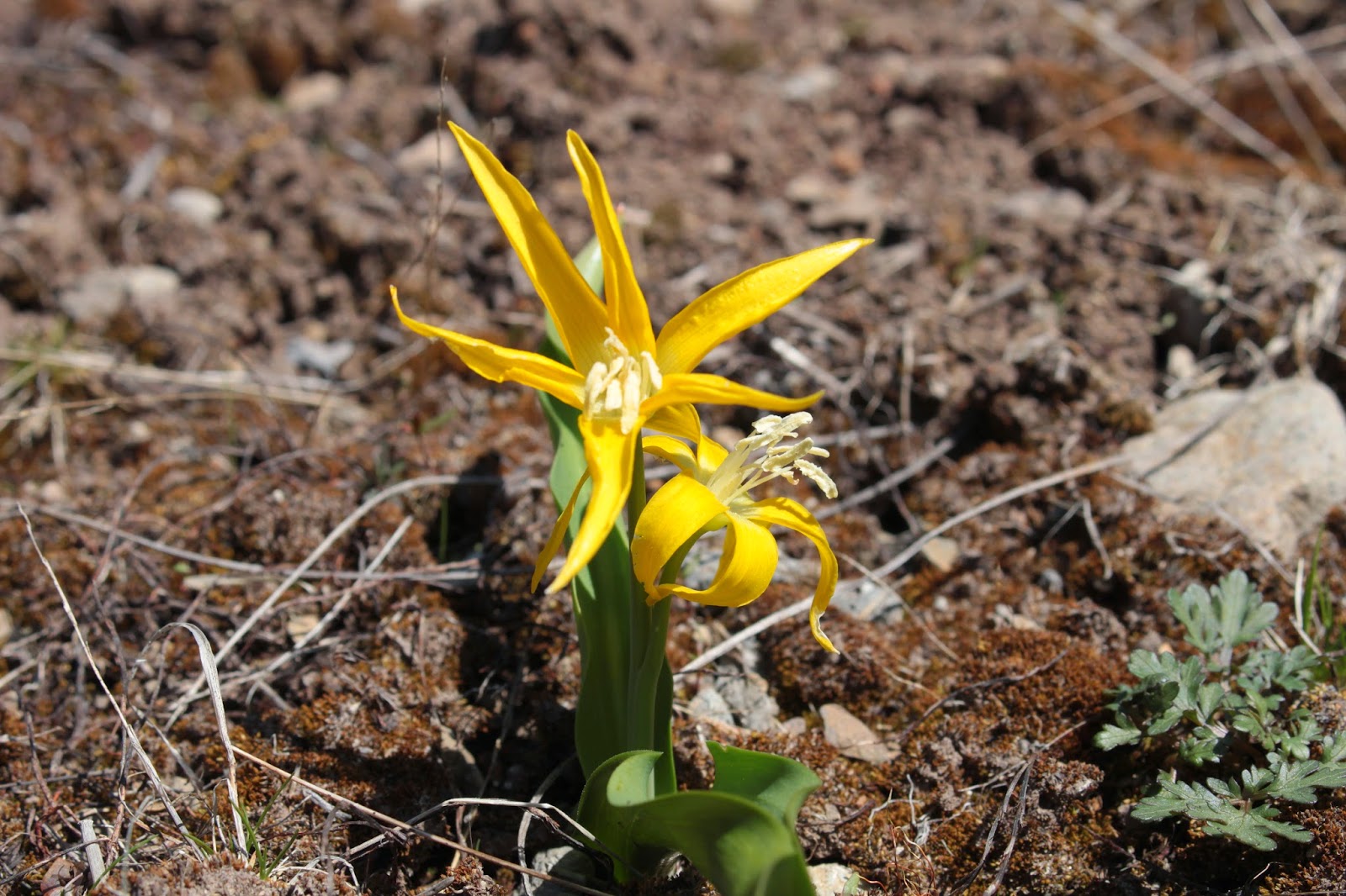
Once on the south side of the East Fork, Hummingbird Meadows hove into view.  Large and expansive, the meadows seemingly go on and on and on and...etc. We were a bit early for the spectacular flower displays that attract the hummingbirds that give the meadows their name. In testament to the recent arrival of spring, tiny yellow glacier lilies and white avalanche lilies were blooming away in the low grasses. Nubs of hellebore were sprouting forth, giving the meadows a somewhat unshaven look,

Glacier lily

Continually angling uphill at a gentle rate, we continued on up Buck Canyon. At all the open spots in the meadows, we enjoyed the blue sky above the green meadows. Buckneck Peak and several other unnamed peaks comprised Buck Canyon's rim with the canyon culminating in the sheer wall that is Fish Mountain. Edwin had to frequently wait, with all the patience of a parent indulging a child, for me to put my camera away and resume hiking. 

The debris pile from Devils Slide
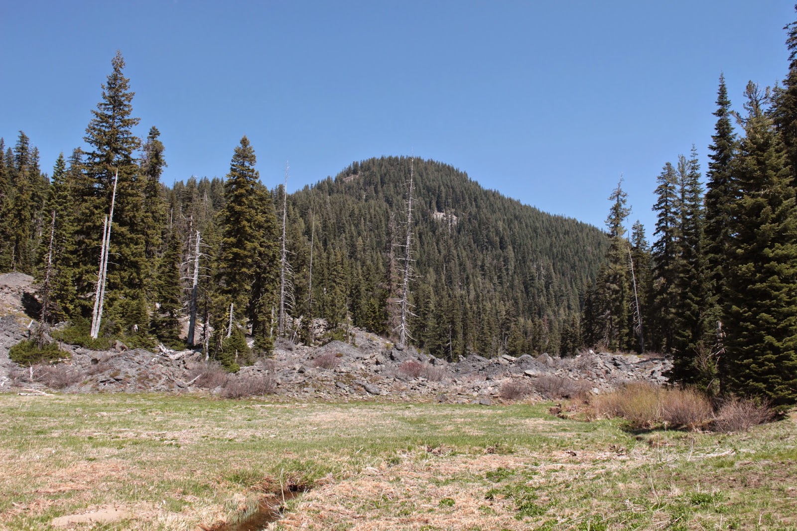
Eons ago, a piece of Peak 6172 broke off and roared down into Buck Canyon, damming the East Fork.  Over time, the resulting lake filled up and became a scenic little meadow with the East Fork lazily snaking its way to and fro in the grass. With the ramparts of Fish Mountain looming overhead, a longer view-soak of this meadow was required so we plopped down on a log and ate lunch there.


This used to be a shallow lake millenia ago
The scars of Devils Slide (the landslide discussed in the previous paragraph) are still visible despite the long passage of time, and we crossed the meadow and explored the rock pile for a bit. Muir Creek tumbles over the rock dam in a noisy little waterfall that was hard to get to and hard to see. In the still waters of the creek, millions of mosquito larva joyfully somersaulted in an omen of things to come.


One of thousands of meadows
On the way back to the trailhead, we took a few side trips to explore some scenic little meadows. We also took a side trip down to Wiley Camp, a small backpacking campsite that was not named after me but could have been. The map shows the trail leaving Wiley Camp and heading directly up and over Buck Canyon's north rim on the way to Fish Creek. We could see the trail charging straight uphill and it looked like it'd be work, especially with a backpack on. Sounds like a dare!

Alligator lizard
Well, we had a buckin' good time at Buck Canyon and I'll be back in June, leading the non-campers here. The mosquitoes await us....

Mushroom of the chartreuse variety
For more pictures of this hike, please visit the Flickr album.


Tuesday, August 28, 2012

Rattlesnake Mountain


On my last hike, to Whitehorse Meadows a couple of days ago, I gazed upon Rattlesnake Mountain and then turned around as the mountain was a mile or two ahead and about 1,500 feet above me. Forgoing an eighteen miler and being quite content with my eleven miles, Rattlesnake Mountain was filed away as a future destination. When on vacation, the future is now, so Rattlesnake was visited a couple of days later.


When on vacation, sleeping in is a luxury to be enjoyed so a late start brought me to the trailhead just a few minutes short of high noon. Unbelievably, the temperature in late August at mid-day was a chilly 50 degrees. I tell you, winter is coming!

Gooseberry
Rattlesnake Mountain was majestically reposed under a blue sky above one of the many meadows that make the Rogue-Umpqua Divide Wilderness one of my favorite haunts. The meadows had overgrown the faint path but a series of rock cairns kept me on track as I crossed diminutive Fish Creek before entering a forest.

Leaf with a designer fungus
Heading downhill for a bit above the creek hidden below me, the trail suddenly turned back the way it came and now headed uphill in earnest. The burning in my legs was assuaged as the forest thinned out and I was able to take lots of pictures of the many small meadows and numerous late-summer floral delights as only a camera-toting flower geek can.

Ugh, it's steep!
At forested Windy Pass, the Rattlesnake Mountain Trail headed uphill, making what I previously thought was uphill seem as flat as a pug's face. Complaints about the grade aside, the scenery was pretty cool as the terrain became more open and grassy interspersed with jagged lava formations. Fish Mountain, Rattlesnake's immediate neighbor began to take shape as the trail climbed above the trees on the mountain's lower reaches.


Rocky things


Back and forth the trail went, always relentlessly uphill.  Every time I looked up, the top of the mountain remained hidden from sight somewhere way up there. On the southeast side of the mountain, the forest had been burned by the mountain's namesake Rattlesnake Fire of last year. Grasshoppers flitted about, the clicking of their wings sounding like airborne rattlesnakes, perhaps that is how Rattlesnake Mountain got its name.

This is why we hike


All "good" things come to an end and eventually the trail petered out in a grassy slope; a short walk uphill brought me to the wide ridge that is Rattlesnake's summit. Striding past concrete piers and other remnants of the lookout that once graced the summit, I walked to the western edge and enjoyed an expansive view of the Rogue-Umpqua Wilderness.

Fleeing rattlesnakes


Nearly 3,000 feet below me, Castle Creek had carved out a significant canyon as it wended its way into the South Umpqua River. Across the canyon rose the formidable Rocky Ridge which is my favorite hike in the whole Umpqua National Forest. On my side of the canyon, the turreted fortress of Castle Rock kept watch over Castle Creek. The peaks of the wilderness stretched south in a rocky chain and  I said hello to some old friends such as Hershberger Mountain, Standoff Point, Jackass Mountain (which, contrary to public opinion, is not named after me), and Highrock Mountain.

Nothing but gray skies in my future
Gone were the blue skies as a weather system had blown in while I was sniveling on the climb up. A chilly wind was blowing briskly and I estimate the temperature had dropped down into the mid to low 40's.  Yup, winter is coming, and it nearly felt like today would be the day.

Castle Rock with Rocky Ridge in back

After descending in blustery weather, at Windy Gap I grabbed the tie-in trail from the gap to the Rogue Umpqua Divide Trail for a little variety, closing the loop on this short but strenuous 6 mile hike. While I enjoyed the hike, there was a underlying bittersweet flavor to the trek as one of these weekends will be my last sojourn into the mountains until next year due to the winter snows that are coming.

For more pictures, please visit the photographs in Flickr.