Showing posts with label tioga bridge. Show all posts

Friday, September 30, 2022

North Umpqua Trail (Swiftwater Segment)


The lower half of the North Umpqua Trail (NUT) used to be so beautiful. A jungle of lush vegetation thrived everywhere and deep shade kept the trail cool even in the warmest of summer days. But in the summer of 2020 the catastrophic Archie Creek Fire went on a fiery rampage and voila, nearly half of the NUT's 78 miles disappeared under landslides, fallen trees, and vigorous regrowth, all inevitable consequences of a large forest fire. In a small sign of progress however, a three-mile segment of trail between Susan Creek and Bob Creek has been restored and that's the subject of today's blog missive.

This part of Susan Creek escaped Archie's wrath

Despite Archie's best efforts to completely blacken the world, the Emerald Trail leading from Susan Creek Day Use Area to Tioga Bridge was still aptly named. The evergreen trees displayed their green foliage per usual, fern fronds draped over the trail, and green moss covered all that did not move. It was a poignant walk through forest totally untouched by fire, especially in view of the ashy devastation waiting for me across the river.

Fire damage and debris were evident
all along the North Umpqua Trail

Massive Tioga Bridge, still bearing Archie's scorch marks tattooed on the stout timbers, crossed the scenic North Umpqua River and "nice" work you've done here, Archie. The former rampant greenery has been supplanted by stand after stand of burned trees (rampant blackery?). Very few live trees exist here on the south side of the river, where the route followed the river from up on high and through all the charred tree trunks you could ever want to look at.

It must have wooly bear season, they were
in profuse abundance on the trail

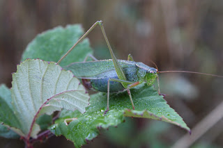
The NUT here is an old roadbed but because of the fire and increased sunlight, grass has taken over the trail, basically converting the roadbed into a narrow singletrack path. As I hiked on the grassy trail, small clouds of panicked grasshoppers fled in front of me. The trail tread was covered with wooly bears (a fuzzy caterpillar, not a real bear with teeth and claws and everything) and I had to watch my step to avoid squishing them. As far as I know, no wooly bears were harmed in the hiking of my hike, or at least no greenish-yellow caterpillar guts were found on a post-hike inspection of my boots.

Falling trees will keep trail crews busy
for at least the next decade

An appreciative round of applause should be directed to our friends at the BLM, for despite the amount of downfall everywhere, the trail had been totally cleared of debris. Sporting fresh cuts in mute testimony to the handiwork of the trail crews, there were several piles of fallen trees heaped next to the trail. It's no easy task keeping trails open after a large fire and the dead trees will continue to fall and create more hard work in the years to come.
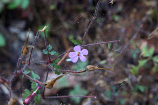
Stinky Bob is a lot prettier
than its name would suggest

If you hike this trail in spring, seasonal creeks and cascades flow across or along the trail. However, hike it in late summer like I was doing, then the creeks had long since gone dry and the nominally green grass and other assorted vegetation were also heading toward that dried-out state of being. However, a small pink geranium known as Stinky Bob was still flowering away in brazen defiance of the coming autumn and winter. Poor Bob, whoever he may have been, his aroma must have been especially notable in view of the fact he has a flower named after him for all of perpetuity.

A grasshopper basks in the early autumn sun

And speaking of autumn, much vegetative elements growing on the dead forest's floor were trending in that direction. Blackberry vines and alder, maple, and dogwood trees were beginning to participate in the autumn beauty pageant by blushing red, orange, yellow, or some hue in between. Most of the leaves were still green but a more colorful hike can be had by hiking here again in a couple of weeks.
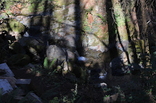
Shadow Man sends greetings from Bob Creek

All that remains of the stout footbridge spanning Bob Creek is a pile of chopped wooden blocks, left over from when the fire-damaged bridge had been dismantled by the authorities. Bob Creek may have been a mere trickle but its defile was a difficult, but not impossible, obstacle to overcome. However, the reward for doing so would be hiking on an unmaintained trail through fire wreckage that is probably officially off limits anyway. I really don't need to pay a fine for hiking on a closed trail, either.
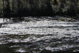
The North Umpqua River sparkles in the sun

So, it was back the way I came, all the way back to the picnic area at Susan Creek. The hike had been an easy 5 miles, so I added a walk to Susan Creek Campground and back for a more worthy distance. The trail to the campground was mostly lush and green, although the woods by the campground had also been burned. In the open sunlight, scarlet poison oak leaves advertised the presence of that accursed plant. Below the path, the North Umpqua River sparkled in the afternoon sun and I couldn't escape noticing thousands of acres of dead trees on the other side of the river, extending all the way up into the surrounding mountains.

Ferns from the Shadow Realm

I've often said there is beauty in a burn zone and I'm really trying hard to love this section of the North Umpqua Trail all over again. But damn, it used to be so beautiful before Archie's sacking and pillage of the once and former live forest. I'll keep working on my attitude, though.

Katydid did it

For more photos of this hike, please visit the Flickr album

Sunday, March 27, 2022

North Umpqua Trail (Swiftwater Segment)


In 2020, the Archie Creek Fire raged along the North Umpqua River, immolating over 130,000 acres of beautiful forest, not to mention numerous homes and businesses. Also falling victim to the massive wildfire, the lower 30 miles or so of our beloved North Umpqua Trail was rendered impassable for hiking. Even if one is inclined to stealth hike on the officially closed trail, the incessant piles of scorched and fallen trees are an effective deterrent. However, rumor had it that part of the Swiftwater Segment of the North Umpqua Trail had been recently cleared and opened, so I just had to go get a look-see.

Here, the trail was untouched by fire

The fire scars and damage were eminently visible from the Susan Creek day use area, the starting point for today's venture. However, the day use area itself was relatively untouched by fire but just after the Susan Creek crossing, trees proudly bore their scorch marks like so many tribal tats. The fire did not get very far into the picnic area, although it did hop-scotch up into the surrounding slopes after jumping the North Umpqua River.

Snow queen bloomed in purple abundance

From the first step onto the trail, it was eminently obvious that spring was very much happening along the North Umpqua River. The forest floor was carpeted with healthy layers of snow queen, woodland violet, and trillium flowers. Also playing their part and vying for the Miss Supporting Wildflower sash were oxalis, bittercress, spring beauty, and candy flower. With all the flowers to photograph, this was not a very fast hike.

Here bee, bee, bee!

There's something insidious about spiders and trilliums. Here, you have an elegant and stately wildflower to entice bees, photographers, and other invertebrates. And yet, cream-colored crab spiders lurk among the pistils and stamens within the flower's interior and on more than one occasion, I have caught the conniving arachnids in flagrante delicto, happily dining on their victim. It just doesn't seem fair, from the bees' perspective, it'd be like a lion ambushing you as you ate a steak at Applebee's. Predictably enough, crab spiders were spotted on the abundance of trillium flowers blooming away on the forest floor and pity the bees.

Tioga Bridge now has battle scars

After a short walk along the North Umpqua River, the trail crossed over the river via photogenic Tioga Bridge. Built on the piers of an old roadway washed out by a 1964 flood, the stout bridge has become a local landmark since its restoration in 2012. The Archie Creek Fire had swept over the river here and while the bridge survived, scorch marks now adorn the wooden beams and trusses. However, the structural integrity of the bridge remained intact and I hiked across, safe and secure on the stout span.

What this part of the Swiftwater Segment
looks like for most of the three miles

Just after the bridge, there is a T-intersection with the North Umpqua Trail where one can go left on the Tioga Section or right on the Swiftwater Segment. The Tioga was clearly closed although the trail showed obvious signs of having been worked on. The Swiftwater at this end is an old road bed which means it's much wider than a footpath and presumably easier to clear fallen trees from. Despite some strong inner temptations to hike the Tioga Segment, closure notwithstanding, I made the right turn onto the Swiftwater.

Seasonal creeks kept things fresh

Seasonal creeks soon became a thing, as they flowed in abundance across the trail. Because the forest is now bare and stark, the noise of flowing water clearly carried all along the route. The small gullies that contained water were green and overly mossed while moisture-loving plants, such as spring beauty and candy flower, happily flourished as if there had never been a fire in the first place.

Life abounded on the forest floor

The forest was mostly dead and if not completely dead, then on life support. However, despite the arboreal skeletons standing everywhere, a veritable choir of songbirds were twittering and tweeting among the charred trees. On the ground, grass, moss, and wildflowers thrived, the vivid green vegetation in sharp contrast to the surrounding tree graveyard.

Wreckage at Bob Creek

After a couple of miles, the North Umpqua Trail morphed into a real footpath and descended steadily down to Bob Creek. The trail used to cross Bob Creek on a stout bridge but the fire ruined the bridge, the remnants of which were haphazardly piled up next to the creek. It would be indeed a strenuous and sketchy endeavor to scramble up and down the creek's formidable and bridgeless defile, only for the privilege of bushwhacking on what appeared to be an unmaintained continuation of the scorched North Umpqua Trail. I called it good here, and headed back the way I had come.

A halo of woodland violet

This section of the North Umpqua Trail used to be one of my favorite hikes because of the lush and verdant greenery flanking either side of the trail. Naturally, things are markedly different than before and during my remaining time on this planet, the forest here will never be like it was. However, I still enjoyed this walk and found it quite beautiful in its own ashy way. Forest fires are part of life, although they don't really need to be as destructive as the Archie Creek Fire had been, and life abounded among the bones, carcass, and general air of death of what once was a vibrant forest. It's just a different kind of beauty and despite the carnage, it's still very much a pleasant hike.

If you like charred wood, then this is your hike

For more photos of this hike, please visit the Flickr album. 

Saturday, July 11, 2020

North Umpqua Trail (Swiftwater Segment)

This was my fourth hike in eight days. Two of those hikes had been plenty rigorous, working out those leg muscles via plenty of uphill grade coming on the way to a mountaintop summit. So, when the daunting climb up and over Bob Butte on this hike on the North Umpqua Trail presented itself, my legs were plenty up to the challenge, scoffing "So, what about Bob?" Wow, it seems like if you exercise regularly then your body responds in kind by improving muscle stamina and strength while shedding some of those unnecessary pounds too. Who knew?

Thimbleberry contributed some fruity goodness
Because this has been the year of Covid-19, I've been mostly hiking alone. However, Oregon had recently modified the restrictive stay-at-home order and accordingly, the Friends of the Umpqua Hiking Club cobbled together a small schedule of outings, with some limitations so as to comply with the new guidelines. Accordingly, it was kind of nice to (legally) hike with people again. Since one of the limitations voluntarily implemented by the club was to keep hikes fairly close to home, it only stood to reason that the North Umpqua Trail would make it onto the roster of upcoming hikes.

Woodland phlox graced the forest floor
There were several options for hiking distances and routes but about half of our rather large (given the club's self-imposed group limit) and enthusiastic group opted for a straight-through hike on the Swiftwater Segment of the North Umpqua Trail. Rheo had graciously agreed to ferry us back to our cars at the end of the hike, hauling us in the back of her pickup like so many sacks of garbage on their way to the dump. We didn't complain (within earshot of Rheo) because the shuttle allowed us to experience the eight-mile segment in its entirety.

Just gotta love that shade on a warm day
It was obvious early on that this hike would be mostly about the lush forest growing next to the North Umpqua River. For the majority of the first four miles, the trail was mostly level and the vegetation lush, with tall trees providing plenty of shade which was appreciated on a warm summer day. The river was mostly heard but seldom seen as the forest cover did a pretty good job of obscuring the view much like the broad-shouldered dude wearing a cowboy hat that always manages get the seat in front of you at the movie theater.

Fireweed took over the burn zone
This area had been ravaged by fire several summers ago and after a couple of miles, the green forest was replaced by a dead forest with acres of ghostly snags reaching up to the blue sky above as if to send their forest fire anguish up to the heavens. However, death is part of life and vise versa, and the forest was already well on its way to recovery from the conflagrations of summers past. Because of the increased sunlight in direct proportion to the increased number of dead (ergo, shadeless) trees, sun-loving vegetation was flourishing in rampant exuberance. Fireweed, and thimbleberry were the main culprits but there were also plenty of young big-leaf maple trees taking root, in a sure sign that the forest will return at some point. 

Fern Falls, not feeling the wildfire love
In winter and spring, there are a number of seasonal creeks that cross the trail but on this summer day, the temporary creeks had pretty much all dried up. One exception was the creek at Fern Falls, a highlight of the hike that shows up at just under the two-mile mark. The fire has done a number on the formerly photogenic cascade, for now the small creek gully is choked and littered with fire debris such as trunks, limbs, and tree parts, generally. The increased sunlight supports a healthy layer of vegetation that further obscures the waterfall. While the hike is enjoyable and beautiful, the small cataract is not as impressive as it used to be.

Trail through the rampant greenery
Shortly after crossing on a footbridge spanning a nameless creek flowing in a deep gully, the live forest returned and just as we were beginning to overheat in the sun like lozenges melting on a hot sidewalk, we returned to the shade and there was much rejoicing. The cool forest was very much appreciated and the whole vibe was ferny thanks to sword ferns brandishing their fronds on the hillsides and over the trail as we hiked by.

Groundsel represented the yellow end of the color pool
At the four mile mark, the easy level walking ended as the trail inclined upward and began the climb up and over forested Bob Butte. From a technical aspect, I've never understood why the trail designers engineered this taxing section of trail this way, for it seems to me that the route could have just continued along the river like it had been doing for the first four miles. But obviously, it does prove that trail designers don't ever hike on the trails that they create, at least in this world. Although, they may forever have to hike on them on a warm eternal day, if you get my drift. However, after this week of constant hiking, my legs were more than up to the would-be daunting task of climbing up and over the butte. As I hiked, I contemptuously sneered at the uphill grade except for when nobody was watching.

Farewell-to-Spring put on a summery show
However, despite Bob Butte's lone failing of having a steep trail on it, the mostly wooded mountain did provide one of the main highlights of this hike. After cresting the high point of the hike, the venerable North Umpqua Trail then drops down to Bob Creek. On the descent, the slope sheds the trees and goes all rocky and grassy on us, with just a few odd oak trees scattered here and there. Accordingly, the open slopes provide a nice view up the North Umpqua River canyon, but on this day that vista was upstaged by a flowering clarkia known as Farewell-to-Spring, so named because the blooming clarkia is a sure sign that summer has arrived. The grass on the open slope was all dull and drab, having browned out weeks prior. However, the ample quantities of Farewell-to-Spring absolutely colorized the brown slopes in a spectacular display of pink interspersed with purple, thanks to some elegant brodiaea flowering in between all the clarkia. It was truly stunning and wondrous.

We ate lunch at Bob Creek
However, it was a bit too sunny and warm to comfortably lunch and laze in the rocky meadow, flower display notwithstanding, so our little hiking subset consisting of me, Wendy, Coreena, Misty, and canine pal Arlie walked just a bit further to the bridge crossing of Bob Creek. I don't know who Bob was but he certainly has stamped his brand on all named things in this area. At any rate, we enjoyed the rest, the shade, the rushing creek, and ghost pepper infused sandwiches. Well, maybe just one of us enjoyed that last item.

Wendy leads the way on the old roadbed section
From Bob Creek, a short uphill push took us up and away from the creek bounding in its ferny forested canyon and once the trail crested it was all gradual downhill at that point, and legs were thankful. The trail is an old forest road here and it was plenty wide enough for us to walk abreast as we hiked in easy companionship. Normally, I hike this section in the winter and on this summer day, all the seasonal creeks and cascades were just an evaporated memory, as fleeting and impermanent as a wisp of steam rising from a teapot spout. However, the forest was still lush and plenty green and it was a pleasant and shady walk before we polished off the hike with a crossing of the North Umpqua River on Tioga Bridge, where a short and breezy return shuttle in the bed of Rheo's truck awaited us.

Shadow play
All in all, another great hike on the North Umpqua Trail and for more photos of this hike, please visit the Flickr album.


Monday, January 20, 2020

North Umpqua Trail (Swiftwater Segment)


Three weeks into the new year and I finally get in my first hike of 2020. Wow, that puts me on pace for a whopping 130 miles for the year! If I want more miles than that, and I do, I guess I really need to hike more often.


It didn't rain, looks can be deceiving
Weather, concerts, and just a wee bit of laziness had all conspired to keep me from my perennial New Year resolution of hiking more. However, enough is enough and it was time to confront my inner slothfulness and whatever weather was lying in wait for me on the trail. There was a high likelihood of precipitation as it had been raining all week but as it turned out, the only weather issue was that it was cold, getting close to but not quite freezing. But thankfully, no water fell from the sky during my short visit to the North Umpqua Trail. There was plenty of water on the ground though, and all the little creeks along the North Umpqua Trail were running as full and noisy as a constipated goat. Boots did get wet, but, that's a lot more preferable than atmospheric rivers waterfalling from the sky, drenching me from above.

White staghorn fungus was plentiful next to the trail
The Swiftwater Segment was chosen as the destination du jour simply because a friend of mine had posted a photo of the view from Bob Butte and what Tim can do, so can I. Setting out from the Susan Creek Day Use Area, I grabbed the Emerald Trail which is a short connector trail to Tioga Bridge. Emerald was the key color of the forest, as anything not moving fast enough was cloaked and covered with copious layers of moss. I spent a few minutes crawling through the forest cover in search of snow queen, one of the first wildflowers to bloom. While I found many budding out, none were displaying the small lavender flowers that I wanted to photograph. At least my hands and knees got dirty.
Lichen on a tree trunk
It was kind of a slow walk on the Emerald Trail, for there were so many standing trees with small (tiny, even) mushrooms, lichen, and moss thriving on the trunks: much photography ensued. Below the trail, the turquoise'ish waters of the North Umpqua River coursed by, swollen with rain runoff this time of year. Leafless maple trees provided some color what with their mossy branches and trunks contrasting against the dark gray of the sky.

The Tioga Bridge is like the 12th Wonder of the World
The Tioga Bridge was constructed in 2012 and it amazes me that you can still smell the creosote on the stout timbers. The arched bridge is not only stout, but scenic as well and a few minutes were spent taking pictures of the span and the river flowing underneath. On the other side of the river, a T-intersection with the North Umpqua Trail heralded the beginning of the real hike, but not before I stopped to photograph a creek cascading right next to the trail junction. Whew, with so many things to appreciate and look at, it sure was hard to commence hiking in earnest.

The creeks were in full torrent on this day
This portion of the North Umpqua Trail is on a gravel road bed and the grade was gentle as it angled uphill away from the river. Cedar fronds waved over the trail, and mushrooms along with  the ever ubiquitous moss consumed dead trees both standing and fallen. The forest ground cover was a dense and sodden green knee-high carpet of fern, salal, and Oregon grape. Periodically, rustic footbridges spanned the frequent creeks running across the trail. Hikers who like to photograph really appreciate the rustic bridges because the rails allow one to take those exquisite slow creek shots without having to pack a tripod.  

The "real" trail enters the forest
After several miles of this, the trail departed the road bed and became a real trail with rough tread. Unfortunately, this led to the only un-scenic portion of the hike when the path ran underneath some power lines for a brief bit. Much photography did not ensue. Once past the buzzing power lines, the trail entered the forest and I was back in business with the camera.

Bob Creek flows below the footbridge
The path was dropping rapidly in the forest and Bob Creek came into view with plenty of white water shining through the trees. I might not have been able to see the creek much, but I sure could hear it. Running full, the stream was loud as it rambunctiously tumbled over boulders in the bottom of its canyon. At yet another stout footbridge over the boisterous torrent, more photography ensued. I've hiked here before, but nearby Bob Butte had always been hidden up in the clouds which conveniently provided me the cover (pun intended) to avoid the hike up. But today, the dark clouds were high enough to allow views so I cinched up my internal fortitude and continued hiking past Bob Creek.

Let the uphill begin!
Oof! That was kind of steep for the first hike of the year and my winter-atrophied leg muscles were soon complaining. But hey, I like hot food, so I'm used to ignoring the burn and I did that very thing as I trudged up the switchbacking trail through the forest. Just as the trail broke out into the open, I met up with the only other hikers I'd see all day. These two ladies were on the first leg of their goal of hiking the entire 78 miles of the North Umpqua Trail by dayhike. Cool, and so nice to see ambition on the trail.

View of the North Umpqua River canyon from Bob Butte
There is an open area on the side of Bob Butte, consisting of low growing grass and a bunch of rocks. Water seeps out of the ground here and all the rocks were accordingly covered with moss. Oak trees, seemingly out of place among all the conifer and maple, dotted the green slope. And of course, the open greensward provided an impressive view of the North Umpqua River canyon upstream. Small nearby peaks were covered with snow, and I probably was just several hundred feet below snow level.

A rock feels true love's mossy embrace
After a brief stay where I couldn't really sit down because of all the water seeping out of the ground, it was back the way I came, where I could enjoy the creeks and forest all over again. But at least it was all downhill, excepting the climb away from Bob Creek, and leg muscles were appreciative of that. So, the first hike of the year came in a little under seven miles, and my poor flaccid body felt every bit of it. But that was to be expected since it had been about a month since I last had hiked. I really should do this more often. 

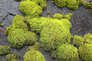
Moss rules all on the North Umpqua Trail
For more photos of this hike, please visit the Flickr album.


Monday, December 12, 2016

North Umpqua Trail - Tioga Segment

It's been kind of hard to hike lately. I mean, it does rain in Oregon but sheesh, enough already! The rain has been pouring non-stop, like from a garden hose, and poor waterlogged Douglas County has more standing water than a walk-in freezer in a power failure during a heatwave. At the higher elevations, the non-stop precipitation has translated to higher than normal snow levels, forcing me to hike along the lower elevation rivers and creeks, or on the Oregon coast. I heard on the news the other day, snow levels in the Cascades are around 130 to 140% of normal. That's a good thing, so I suppose any complaining about snow and rain is not warranted but sheesh, enough already!

It's warm and sunny everywhere I am not
Any break in the constant rain is cause for a celebratory hike and two days after my raingear test on the North Umpqua Trail's Swiftwater Segment, I returned to the same trailhead for a hike on what happily turned out to be a rainless day. The weather forecast had called for "mostly sunny" but that forecast never applies to the south side of the North Umpqua River. It's always shady and cold there, presumingly more so during the winter. Still it was nice to wistfully observe blue sky and sunlight on the  seemingly remote and unattainable mountains on the other side of the river. 

Bob Butte, if you squint
When I last reported from Tioga Bridge just two days prior, the color of the river was a milky brown color. Two days later, the normal winter turquoise color was returning to the still-turbulent North Umpqua River, although just like me, the river was still plenty wide, deep, and fast. No water was falling from the sky, although low clouds and river mist still occluded the view downstream to Bob Butte.

An unnamed creek crosses the trail
Once across Tioga Bridge, instead of turning right onto the Swiftwater Segment, I turned left onto the Tioga Segment. Where the Swiftwater heads uphill and away from the North Umpqua River, the Tioga keeps the rushing river fairly close at hand. Despite the nearness, thick forest kept the river hidden from view but the roar from the winter flow was always audible.

Sorry, boots
So, there was no water in the sky but it sure was all over the ground. Small creeks and runoffs ran across the trail and in many places, right on top of the trail itself. Given the amount of mosquitos and standing water in the Cascades in summer, I've often remarked that "Cascade Mountain Range" is merely a synonym for "large swamp with firs". However, in winter there are no mosquitoes on the Tioga Segment but oh man, was there ever a lot of water sitting on the trail, just waiting to pour into my boots.

Fern capital of the world
The first mile of the western end of the Tioga Segment was under 2 to 3 inches of water and the roar of the river, the splashing of my footfall, and some muted wet-feet related salty language were the only sounds in the forest. But at least the trail was flat and photogenic, what with wet ferns growing in thick profusion next to the trail. The fern growth was so thick that ferns were growing on top of ferns growing on top of ferns. Thick moss and fungi of all type were consuming the numerous fallen trees and the occasional hiker who stopped too long for lunch. 

Trail on a ridge
After a watery mile of hiking, the trail left the standing water behind as the North Umpqua Trail began switchbacking uphill. Ups and downs are very much part of the entire 78 mile North Umpqua Trail experience and it's no different on the Tioga Segment. For some reason, I was feeling pretty walky so the hill was conquered in short order before it began dropping back down at an alarming switchbacking rate. "Man, I really would hate to hike up this beast" I thought to myself, willfully ignoring the fact that I would be doing that very thing on the return leg.

Footbridge, several switchbacks below 
The trail was contouring a steep ridge and what little I could see of the river and highway below was shrouded in river fog. The mountains above the river on the south side were still enjoying the sun and blue sky and I was peevishly jealous. After what seemed like several hundred switchbacks on the knee-jolting descent, a footbridge over a rather large creek hove into view.

Raindrop, still hanging around
Amazingly, considering the amount of water flowing under the bridge, this creek is nameless. My theory for its anonymity is the creek probably dries up in summer. Anyway, after dropping down to a rushing creek, what does our lucky hiking participant receive in return? Tell him what he won, Don Pardo (I'm probably dating myself there but hey, I'm a 60 year old now). That's right, our lucky contestant has won another climb away from the creek up and over another forested ridge. Fortunately, it was not nearly as hard work as what I had just climbed up and over.

British soldiers
Moss-covered cliffs flanked the right side of the trail while the left side dropped rapidly down to the misted-over river. All the cliffy goodness had my inner mountain goat bleating happily although I carefully watched my steps, as I lack a mountain goat's agility and balance. Yup, clumsy and unbalanced, that's me! 


Very swollen Fox Creek
Fox Creek was heard long before it was seen as it was carrying way more water than normal. Dale and I had hiked to Fox Creek from the eastern trailhead a couple of years ago and we had eaten lunch there. However, that'd be a difficult trick on this day for the grassy picnic spot was under rampaging creek water. Besides which, a tall tree had fallen right on the picnic spot to futher hammer the point home that there will be no more picnicking at that spot. Strewn about were smaller trees, limbs, and other tree-related debris and carnage, all miraculously missing the fragile footbridge across the frothy white water of Fox Creek.

One small piece of Buttkicker Hill
It was cold, so I didn't tarry long at Fox Creek. After a quick lunch on the bridge it was back the way I came and I decided that the nameless ridge really needs to be called Buttkicker Hill. The climb disappointingly gained only 285 feet in 0.4 miles, it sure seemed both steeper and longer than that. But, doing the math, it was a 13% grade so my tired legs and heaving lungs were somewhat redeemed by that stat.

Mushrooms were everywhere
Once off Buttkicker Hill, it was back to the mile-long North Umpqua Trail splashfest before crossing the North Umpqua River on Tioga Bridge. It actually had been a sunny day in Roseburg while I had been splashing along in deep canyon shade. On the drive home, the bright sunlight was harsh, leaving my eyes blinking myopically in the glare like an albino cave salamander. But not to worry, the next day things were back to wet and rainy normal, making me quite grateful to have snuck this one in. 

Moss was everywhere, too
For more pictures of this hike, please visit the Flickr album.