Saturday, November 3, 2012

Horsfall Beach

Only 2 more miles of this, dear


There are no falls on Horsfall Beach and there certainly is no Hors, I'm not sure how the name came about or what happened to the missing "e". What there is are miles and miles of sand, grassy dunes, and a bunch of marshes. The lonely beach enjoyed some fame and notoriety several years ago when the New Carissa decided to shipwreck herself on Horsfall Beach. And by the way, as a service to my married male hiking friends, I offer the following advice: don't take your wife hiking in the marshes.

Ha ha ha, they're hiking in the marsh!
The original plan was to visit the remote North Spit by driving down the North Spit Road as far as the road would take us, work our way to the beach and then hike to the end of the spit, looking at the city of Coos Bay across its namesake bay. However, we were lured to an early stop by a wayside whose map showed a trail across Henderson Marsh to the beach.


Wives have no sense of adventure


The short path lasted only about 30 yards before dumping us into the forest, grass, and shrubs next to a swamp full of water colored an unappetizing grayish green. As we kept going, the dense vegetation was pretty intent on forcing us into the water and Dollie was just as intent on not doing that very thing. I met her eyes, set underneath a prominent frown, and in that wordless way of communicating that married people have, we turned around and went back to the trailhead.


Just another blustery day in paradise
Plan B was then executed (instead of me) and we hopped in the car and drove over to Horsfall Beach. Normally, this is a noisy staging area for motorcycles and quads but since this was a blustery day with a threat of rain, we pretty much had the place to ourselves. Of course, we were hiking in the wind with a threat of rain but that's what we do.


I'm board, can we go now?
Up and over a prominent grassy foredune and down to the beach we went. There wasn't much but sand, shells, and waves for miles and miles so there really isn't a lot to report. The occasional log on the beach was cause enough for me to kneel and take a picture as there was nothing else to take a picture of.


It's OK Maggie, you're licensed

After several miles, the clouds thickened and the skies darkened, it felt like rain was coming. We climbed to the top of the foredune and had a good look at Henderson Marsh, triggering flashbacks to the marital near-discord from earlier in the day. It was as good as any point to turn around, so back to the north we hiked.


In search of hard sand to walk on


We found that walking halfway up the foredunes was where the really fine sand accrued, making for a hard sand pack and easier walking. Occasionally, logs and driftwood forced us down onto the beach where the soft sand was not as much fun. Squads of pelicans flew by every few minutes, heading south for warmer climes. Not us, we were heading north, away from the storm coming in from the south and we just made it as the rain started just when we headed home in the car.

For more pictures of this hike, visit the photo album in Flickr.

Greetings, from the planet Mouse

Saturday, October 13, 2012

Clear Lake plus Sahalie and Koosah Falls


I always seem to catch Clear Lake on a dark and dreary day. There's a reason for that as Clear Lake gets visited (by me) in early winter or spring when snows conspire to keep hikers out of the mountains. Situated at just over 3,000 feet of elevation, Clear Lake offers a year-round hiking nibble at the mountains when the higher mountain trails are off limits. And even on a not so nice day, Clear Lake is reliably enticing as a hiking destination, especially when adding Sahalie and Koosah Falls into the hiking mix.


Maybe we should hike on a real trail


So, the drizzle in the air on a gray day came as no surprise when the Friends of the Umpqua Hiking Club disembarked from their vehicles at Carmen Reservoir. Of course, the wet and cold weather meant there were only 8 hikers on hand to follow their fearless leader, which would be me. The hike got off to an awkward start when the trail we grabbed quickly degenerated into a brushy game trail alongside the McKenzie River. We had to backtrack and look for the official McKenzie River Trail. Oops, my bad!


Koosah Falls


Restarting the hike on the correct trail, we followed the McKenzie River upstream on cliffs above the river where we had nice views of the McKenzie tumbling down the mossy canyon. In less than a mile, a roar heralded our arrival at Koosah Falls, with a dizzying view thereof. We were on a "real" trail which meant no hand rails and you better watch your step. On the other side of the river was the "tourist trail" which meant handrails, pavement, and stairs and we could see hordes of gawkers on the other side while we we ran into only two other hikers on our side of the river.

Sahalie Falls
Just a relative hop, skip, and an uphill climb away was thundering Sahalie Falls, with more gawking ensuing. We worked our way downslope a bit for better views, hanging on to tree roots and branches for support. The people on the other side of the river didn't have to do any of that.


Yellow is the color of the moment
As we continued up the considerably calmer McKenzie above the falls, it was obvious that this was going to be a good autumn hike as the vine maples were flashing yellow along the river banks. I think I tried to take a picture of every leaf on the way. A log bridge across the river signaled the temporary end of the river portion of the hike as we crossed Highway 126 and continued on to Clear Lake.


Clear Lake is just that


Clear Lake is aptly named as the waters are remarkably pristine. Allegedly, boaters can see a dead forest about 100 feet deep on a sunny day and that would not surprise me one little bit. The lake's source of water is the Great Spring whose waters are filtered and purified through miles of porous lava. Not content with only being clear, the lake's waters are a picturesque sapphire blue color even on a gray day.


As red as a sunburned tomato
Working our way around to the lake's eastern shore, the autumn colors tended towards the reds due to increased exposure to sunlight. The combination of blue water, yellow and red leaves under a gray sky was entrancing and camera-afflicted hikers made slow progress.


Fire and lava


Also on the eastern side, were some extensive lava flows that emanated from a distant Sand Mountain millenia ago. Fortunately, the trail was paved through this section and I'm happy to report no boots were harmed in the hiking of this hike. Not much grows in the lava except for the odd vine maple or two, their red leaves resembling fire fountains. With a little imagination, one can picture the hot lava burping fire as it oozed along.


The Great Spring, followed by the So-So Summer
The next item of interest was the Great Spring, a deep sapphire pool where the McKenzie gushes out of the ground, fully formed. The water comes out at a uniform 38 degrees all year and as a result, Clear Lake never freezes over.


Sushi, anyone?
While we were at the Great Spring, a merganser paddling in the water dove and came up with a wriggling fish in its beak. We watched, totally enthralled, as the bird swallowed its Great Spring sushi; the fish probably did not appreciate the experience as much as we did.

Time to admire the colors

Rounding the north end of the lake with maple leaves gone wild with color, we returned to civilization as we hiked past cabins and the Clear Lake Resort. Returning to the McKenzie River, we continued on the touristy side of the river, taking advantage of the railed viewpoints to take better pictures as we didn't have to cling to tree roots with one hand while snapping photographs with the other.


Steamy Carmen Reservior

As we reached the end of the hike, a cold mist had settled in, clouding up the Koosah Falls view. Carmen Reservoir was steaming, due to the warm waters emanating several miles upstream from the Great Spring. Peeling off my wet raingear, I promised myself a return to Clear Lake on a clear day.

For more pictures of this picturesque hike, click on this link for the Flickr photo album.

Saturday, October 6, 2012

Sixes River backpack trip


This was an unusually lazy weekend backpack trip. None of the usual tests of endurance and manhood, nosiree. Nope, we eschewed the Man Hike in favor of a Dog Hike. In particular, the dog in question was Teddy as my Maggie can run circles around us humans as we trudge along. John, who was dogsitting Teddy, said Teddy "...has the heart of a lion" but alas, he was born with the stubby legs of a Welsh Corgi and the unassuming shape of a Tootsie Roll.

Day 1

John and the children

We started on a beautiful sunny morning at Floras Lake, on the Oregon coast. A short walk along the sandy shore of the preternaturally still lake joined us up with the Oregon Coast Trail. We didn't stay long on the OCT for long as we cut across a dense patch of vegetation to get on the beach, our "trail" for the next couple of miles.
On the beach until Battleship Bow says to stop
The coarse sand sloping away from the imposing cliffs made for pleasant hiking, especially with fully loaded backpacks on. Discerning readers can sense the sarcasm rolling off the keyboard as I type this. Our cue to leave the beach was the imposing wall of Battleship Bow, otherwise we'd do a slow hiker-speed splat onto the bow as the beach ends rather abruptly there.


Aargh, the trail be here mateys!

A small valley had been cut into the cliffs where a creek makes made its way onto the beach; a trail started there, heading back up to the OCT. In case we were not sure where to find the trail, some enterprising beachgoer had marked the spot by hoisting and raising a mast from a log found on the beach. All that was needed was a Jolly Roger on the top, blowing in the breeze.

A "wow!" moment
The next several miles on the OCT took us through wonderfully shaded coastal forests, the shade not particularly needed on this cool day. Occasionally, we'd beat through the bush to scramble out on top of the cliffs with magnificent view after magnificent view of the coastline stretching out towards Bandon. We had lots of "Wow!" moments on this portion of the trip while simultaneously keeping hold of gnat-brained dogs (yes, I'm talking about you, Maggie) at the cliff's edges.

View towards the Sixes River
Near Blacklock Point, a path dropped off the bluffs and returned us to sea level on a dark-sand beach. The sea had been somewhat boisterous  here because the sand had been carved into slopes, bars, and canyons. Pretty to look at but again, tedious to walk through. Small creeks trickled across the sand and grateful dogs lapped up the refreshing water.

Let the show begin
After setting up camp above a debris strewn beach at the mouth of the Sixes River, we kicked back and watched a magnificent sunset show. I got up in the middle of the night and the wind had blown all the clouds away and I lay in the grass gazing at the multitude of stars above while the beam from the nearby Cape Blanco lighthouse swept overhead, all accompanied by the steady roar of the surf. It was just perfect.

Day 2


Scene from a horror movie
The day dawned brisk and clear, but not for long as fog swept in and became the theme of the day.  A sand bar had dammed the Sixes River but it sure made getting to the other side of the river much easier as all we had to do was walk across it.  The bar served double duty as a seagull hotel and clouds of them lifted off into the air, shrieking indignant at our intrusion.

Maggie wants a new owner


We followed the beach to Cape Blanco and the sand was packed hard and was easy to walk on, unlike the day before. Not much to see but fog and rocks, and at the end of the beach we took the trail up to the top of the cape. Once there, we could not even see the lighthouse which was only a quarter-mile away. Not even the light emanating from the lighthouse was visible. So this wound up being a long water walk as we refilled bottles and hydration bladders at the Cape Blanco campground. The dogs refilled their bladders, too.


Land bridge across the Sixes


So back we go, overland on the Oregon Coast Trail this time, as the fog dripped from the seine of pine branches overhead. We had a limited but nice overlook of the Sixes River. The natural dam at the mouth had caused the river to back up and the river trail was now on an island. But not to worry as there was an alternate trail through the grasses that brought us back to the beach with half a day to kill.


Killed half a day watching waves and birds, yup


Basically, the rest of the day was spent sitting on a log watching the winter migration fly by. Squads of pelicans flew by every few minutes or so, flying in a follow-the-leader formation that undulated like some feathered sine wave. The Sixes River seemed to be the dividing line between fog and sun as it was gray and dreary to the south but sunny and clear to the north; the birds were flying from warm sunshine to cold fog and I know just how they must have felt. In the late afternoon, fog won out and there would be no sunset.

Day 3

Driftwood and rocks
This was getaway day and we had noticed the dogs' paws were bothered by the sand so we hiked on a cow trail in the beachgrass back towards Blacklock Point. We made it about halfway up the beach before the going got too tough so we scrabbled through piles of logs and driftwood back to the soft sands of the beach.


First light transforms a rock island

We had begun the hike out in early morning and we observed the rock islands catching, each in turn, the first light of the day. Eventually it was our turn to be shined on and we enjoyed the sudden warmth of the sun. A short climb away from the beach provided the always pleasing view to Cape Blanco while waves crashed on the rocks below.

You hike barefoot, see if you like it!
Eschewing the sandy beach walk north of Blacklock Point in order to take it easy on the dogs, we stayed on the OCT the rest of the way, hiking through viewless but beautiful woods. The forest ended at Floras Lake and we followed the sandy shore back to our car. All in all, a lazy and unambitious backpack trip but I really should do that more often.

For more pictures of this relaxed weekender, visit the photo album in Flickr.


Saturday, September 22, 2012

Mount Scott and Garfield Peak

Dinner is just something you do before dessert. And dessert is so enjoyable, (mocha chocolate chip ice cream, in particular) one helping is just not enough, especially after skimping on dinner to leave extra room for ice cream, pie, and/or cake. So, invariably, I find myself standing in the dessert line several times to indulge my inner  candy monster.  

Sounds like a dare!
The same principle holds true in hiking: If you like hiking to the top of a mountain with fantastic views, then two mountains will be twice the fun! And three mountains would be thrice the pleasure, and four times would be frice the joy. At least  that's how the logic went after a few beers the night before.

Sometimes beer is involved here, too
At the 5:30 AM alarm clock cuss-out, doubts about this venture crept into my pre-coffee mind. But fortunately, I really didn't wake up or become alert until I was halfway on the drive to Crater Lake National Park; by that time I was committed to the hike.

Mount Scott
Crater Lake was formed when the Mount Mazama blew its top with the resultant crater becoming the Crater Lake bowl. Mount Scott is just off the lake's rim and is a mountain in its own right as opposed to the lakeside peaks which are just high points on the jagged rim.  A 2.5 mile trail climbs the 1,100 feet to the top of  the 8,929 foot high cone, which happens to be the highest point in Crater Lake National Park.

Crater Lake, from Mount Scott
As relentless as a teenager arguing with her parents, the trail headed uphill, switchbacking to and fro up Mount Scott. The views gradually evolved and Crater Lake was the star of the show. From anywhere else in the park, Crater Lake is "just" a lake but Mt. Scott provides a view of the volcano aspect of the lake and one can readily see the truncated remains of Mount Mazama.


This is an edgy trail, literally
Eventually, the trail tops out and provides a relatively level walk on Scott's rim before ending at the actual summit and lookout. The Pole Creek Fire to north was dumping a prodigious amount of smoke into the air and while the views south and east were occluded, the skies were fresh and smoke free in the park. Despite the haze, the views nonetheless were impressive.


Up, up, up on the Garfield Peak Trail

After descending from Mount Scott, a short drive on the rim road brought me to Rim Village, lunch, and an after-lunch start on the Garfield Peak Trail. Similar to Mount Scott, the climb up to the top of Garfiled is short and sweet, gaining 950 feet in less than 2 miles.  


Castle Crest
The Garfield Peak Trail is a lot more scenic than the Mount Scott Trail, in my humble opinion. The trail is raw and edgy, hugging Crater Lake's rim as it sashays to and fro on rugged Castle Crest. The crest sports lots of rock towers, pinnacles, turrets, and a good old-fashioned avalanche slope or two. And always, the views of Crater Lake and its amazing blue waters astound.

Crater Lake, from Garfield Peak
It was a pleasant relief to stroll out onto the flat and sandy summit of Garfield Peak and admire the birds-eye view of Crater Lake with pointy Mount Thielsen looming beyond the lake's opposite rim. It was getting to be late afternoon and from the west, a very pronounced storm system was arriving.  

Crater Lake and a change in the weather
Since I am somewhat averse to being struck by the predicted lightning, I departed the summit in a hurry. Since it was getting dark, and my legs were tired, and because of the lightning, it was decided to end the hiking at a mere two peaks. It's not very often  I pass up an extra helping of dessert.

For more pictures of this outing, please visit the Flickr album.


Saturday, September 15, 2012

Rooster Rock

Years ago (and, sigh, how often I say that nowadays) I hiked to the top of Iron Mountain and looked west into the odd towers, turrets, pinnacles and other rock creatures of The Menagerie Wilderness and filed the area away for a future exploratory hike. Well, in mid-September, the future became now when I paid a visit to Rooster Rock.

Sunlight and leaves were one
of the stories on this hike
Basically, there are two trails in The Menagerie: Trout Creek and Rooster Rock. Both are steep but the Rooster Rock Trail can crow as the winner of the steep-off contest between the two trails. Everything else in the wilderness requires cross country bushwhacking. It is possible to connect the two trails as a loop hike but the loop requires a 2 mile walk along busy Highway 20. Not wanting to share our hike with the car crowd, Maggie the Hiking Dog and I opted for the 7-mile round trip out-and-back on the Trout Creek Trail.

A virtual poem
First of all, apart from a brief view at the trailhead, the misnamed Trout Creek Trail never provides another view of the creek, contouring instead on a forested ridge with the creek hidden from both sight and earshot well on the other side of the formidable ridge. The trail could have been more appropriately named by calling it the Really Steep Trail or the Spider Trail.


Gah!


Spiders were a large part of my Rooster Rock experience. September apparently is the month where the spiders succumb to their biological impulse to snare hikers before the winter snows arrive. Invariably, the webs were strung across the trail at face height. And of course, the fine strands of sticky web were virtually invisible so the only warning was an all too brief cross-eyed glimpse of the spider just before it landed on my nose. I had many opportunities to do the spider dance which consisted of spastic hand-waving and dancing punctuated by panicked shouts of "Gah!"

I can see the top of the ridge!
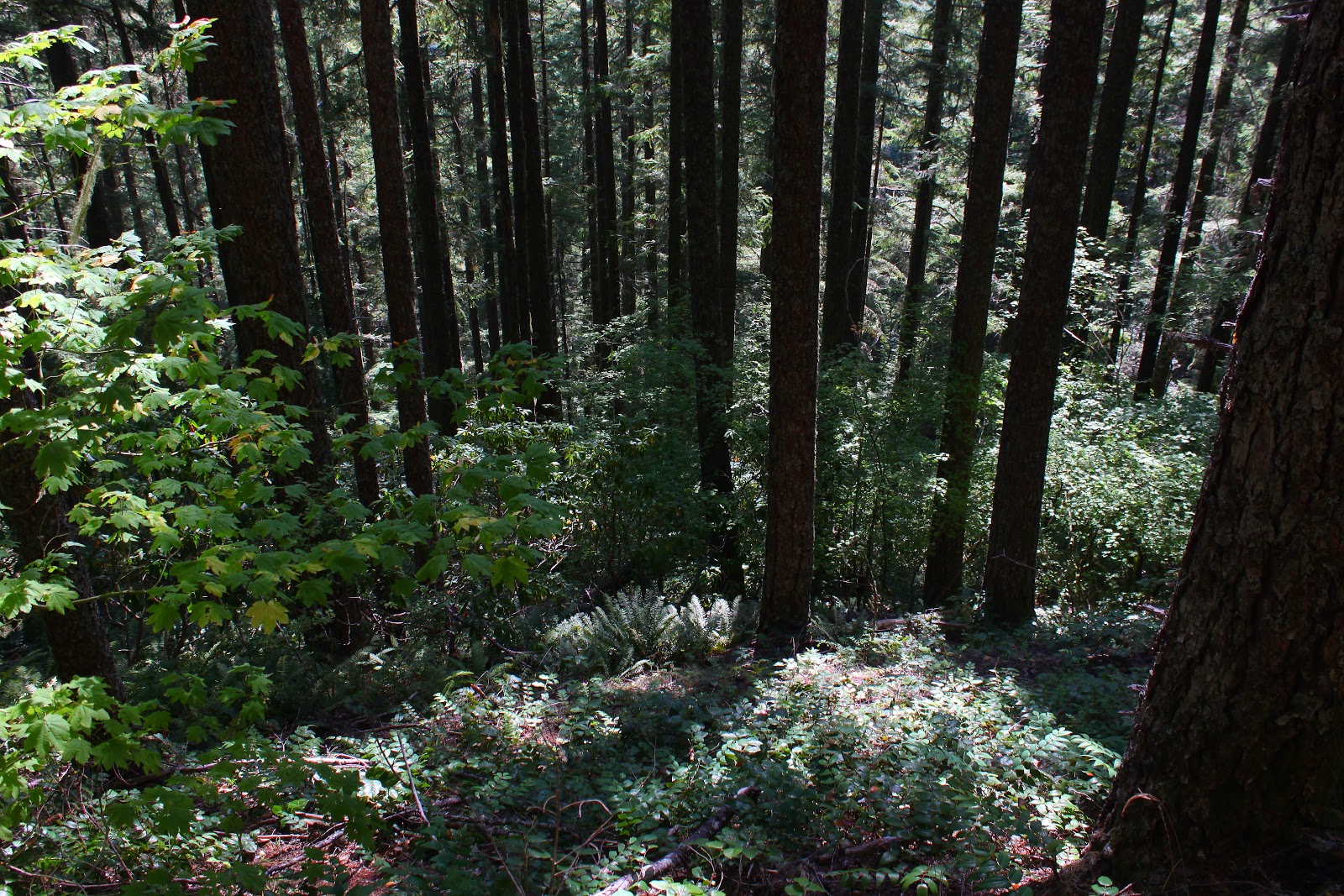
The trail was beautifully shaded with big leaf and vine maples growing among tall fir trees. There was ample opportunity to admire the leaves filtering the sunlight while bent over gasping for breath. You see, the trail gains 2,300 feet at the challenging rate of nearly 700 feet per mile which works out to be a 12% grade, something cars don't even like to do. All the uphill didn't seem to bother Maggie and she waited patiently at all the frequent master-induced rest stops.

Rooster Rock
Shortly after the intersection with the even steeper Rooster Rock Trail, sky could be seen above the ridge crest which gave me hope the trail was topping out. The topping out did occur shortly after passing Rooster Rock. The rocky tower is probably a thrilling sight to the climbing crowd but was hard to see otherwise what with a forest growing around the base of the rock. Despite being on the edge of The Menagerie, it was difficult and nigh impossible to make out the interesting rock features that define this wilderness area.

Our lunchtime view
Not to worry, though, because a short uphill push on an ever increasingly rocky trail brought us to lunch and rest on a rocky viewpoint. Not quite a 360 degree panorama, trees kept us focused on the east where we looked up the South Santiam River valley to Iron Mountain and Cone Peak; in the hazy distance were North and Middle Sisters. To the north of North Sister a massive plume of smoke demonstrated that the Pole Creek Fire was still misbehaving.

Gah!


After about 15 minutes or so, another hiker arrived at the viewpoint and we exchanged pleasantries. He complained about all the spider webs across the trail which was surprising because there shouldn't have been any left after I knocked them all down on the way up. He was kind enough to take a picture of me doing my pose (I think I freaked him out when I did that) before he left and after a 15 minute wait, I also headed back down the trail. Surprisingly, there were lots of spider webs back across the trail with more hand waving and face slapping.  Industrious little buggers!

Nothing quite like the sensation of a spider crawling on your face

Forest, on the way down
It was a pleasant descent through forest as the shadows lengthened despite the occasional eight-legged arachnid creep-out. Next time I come here, I'll bring a racquetball racquet to keep the spiders off of my incredibly handsome face.

For more pictures of this hike, see the Rooster Rock album in Flickr.