Showing posts with label gardiner. Show all posts

Sunday, March 19, 2017

Tahkenitch Dunes Loop

This has been one wet winter and yeah, I know I've been saying that a lot lately. "But O Awesome Hiking Dude" you answer " I read your blog and look at your pictures, you've actually been hiking in sunny weather" Touché, and thanks for reading the blog and looking at the pictures. But the truth of the matter is I've just managed to coincidentally catch rare single sunny days dividing solid weeks of rainstorms. But winter will eventually have to heed our pleas of "rain, rain, go away" and disappear until winter comes round again, which will probably be in another month because in Oregon, it only rains 18 months out of the year.

We should all hike like dogs!
The first such heeding of pleas took place mid-March when Dollie, Luna (our dog), and I enjoyed what was an unbelievably gorgeous day, especially given the wintry and watery context. The following weekend, I'd be leading my innocents (also known as the Friends of the Umpqua Hiking Club) on a hike in this area and wanted to scope out trail conditions before that hike. Uncharacteristically, I was being responsible. Anyway, since the route called for two wades across Tahkenitch Creek, I really needed to lay eyes on the creek to see if such a thing was even possible, considering the amount of rainfall this season.

Diametrically opposed
The three of us set out on the trail on the aforementioned glorious day. Not a cloud in the sky, not that we could even see the sky from the amply shaded footpath wending through the forest. The trailside vegetation was bursting at the seams and the trail tunneled through the burgeoning spring growth. Luna seemed like she was really beginning to understand the concept of walking on a leash so with some trepidation, I took it off. She behaved and generally was able to handle her newly won freedom as she remained within eyesight and obeyed voice commands. Now if I could only get Dollie to do that!  Anyway a "Good doggie" for Luna!

The Grand Canyon of Tahkenitch
Once the dunes were crossed and the forest re-entered, there were a few winter-related travails to overcome. The winter rains had filled up the marshes behind the beach foredunes to the point of overflowing. All that water has to go somewhere so a small creek formed and ran across the trail. The soil here is all sand so that small creek in no time had carved a veritable Grand Canyon of the Tahkenitch. Not only was it relatively deep and abrupt, fallen trees had tumbled into the ditch, filling it with brushy skin-clawing and eye-gouging debris. We met a backpacking group with sad faces heading back, and they advised us there was no way to get to the beach. Sounded like a dare, so we continued on and scrambled across the ditch. It really wasn't all that bad, just a tad bit tedious.

Whee! 
Just after that, the trail disappeared for good under a couple feet of water and Luna took her four feet into the standing water and splashed in happy delirium. Dollie made it plain her two feet were not going in there so a perfunctory bushwhack to Tahkenitch Creek was performed, followed by a scramble down the abrupt bank of the creek. Or in Luna's case, a leap of canine ecstasy took her right into creek with a loud splash and joyous yip and there she was, a little black dot bobbing in the stream, being carried away in the strong current towards the ocean. The creek was probably chest deep in places and with the current moving as fast and strong as it was, a new route for the following weekend's hike entered the planning stage. Thankfully, Luna managed to scramble back to shore before she reached surf line, in case anybody was wondering.

Bye storm, hate to see you go...not!
A week later, I led a dozen trusting souls into the woods and we were off and hiking. It had rained a fair amount of on the drive over from Roseburg but the storm was breaking up by the time the hike began. When the route broke out onto the dunes, sunlight danced on the beach far ahead while tall clouds shaded the open sands.

It's a Richard Hike!
The phrase "It's a Richard Hike!" was bandied about upon arrival at the new creek and newly eroded brush-filled ditch. So, just to be mean, I led them further down the trail where it disappeared under two feet of water and said "Now THIS is a Richard Hike!" Then I let them know they'd been pranked before they started crying, and led the short bushwhack down to Tahkenitch Creek.

Wildness at high tide
It was high tide at Tahkenitch Creek and it was a wild place where ocean and creek collided. Waves were breaking every which way and there was not a lot of room to walk between rampaging creek and tall sandy cliff. Rachel was ahead of me by about 20 yards and she turned back to monitor our progress behind her. One should never turn one's back on the ocean and behind Rachel, a rather belligerent sneaker wave was coming in fast and furious with malevolence in its heart. I emphatically pointed at the wave in warning (It was a little too noisy and she was a little too far to yell back and forth). Rachel smiled sweetly, and waved, thinking I was taking a photo or something and the wave kept roaring in like a bull lining up an unarmed bullfighter. So now I flap my arms a little, point at my eye, point even more emphatically at the wave and still Rachel smiles sweetly and waves some more. Really unclear on the concept, as they say. So now I point with both arms, jump up and down and then it clicked, Rachel looked behind her, sees the wave about to smite her, and takes off running in panic with nary a sweet smile or friendly wave. I didn't get to see the outcome as I too had to run from the same wave. Lindsay and I clung to the sandy cliff like spiders on a living room wall while the mini-tsunami swirled below. Upstream, I could hear shouts of alarm from the rest of the group as they spotted the sneaker wave running up the creek. When next I saw Rachel, her legs were soaking wet as she obviously did not outrun the sneaker wave.

Stella certifies this pond
After a wonderfully lazy lunch on a sunny beach, we backtracked to Tahkenitch Creek. The tide had crested and already there was more room to walk. Fortunately for Rachel, there were no more sneaker waves sneaking up while smiling for the camera. Everybody was in the mood for a few more miles so we grabbed the faint path running across Tahkenitch Dunes to Threemile Lake. Here it was all soft sand and the warm enjoyable sun on the beach transitioned to cold gray clouds that threatened rain. Small ponds filled in the dimples between dunes and I'm always surprised to see water collect in sand, I figure it should just seep into the seemingly porous soil.

Threemile Lake 
Threemile Lake was full to the point of overflowing, just like a bladder on 50¢ Beer Night. It was so full that the body of water might have actually been three miles long and living up to its name. The black water with dark clouds encroaching from above created a rather portentous atmosphere that delighted the camera-toters in our crowd.

One out of two hikers use the bridge properly
A one-railed footbridge crossed the lake's outlet and water lapped at the bottom of the bridge. Normally the wooden bridge spans a 10-foot deep channel there so it was definitely different to see the water level so high. Cattail reeds collected at the bridge, creating the illusion of solid ground surrounding the wooden footbridge. Splash! Jeremy's dog Stella was suckered in by the reeds and was unpleasantly surprised to find erstwhile solid ground to be cold water, instead. A panicked swim to shore brought her to safety and some amused humans.

Zzzzz...
Leaving Threemile Lake behind, it was time to say goodbye to the beach and sand dunes as the trail climbed up and over a forested ridge before dropping down to the trailhead. Green was the dominant color as moss covered everything that did not move. Creeks and trickles ran across the trail and slugs joyfully slithered in the fresh new growth. Rough-skinned newts were spotted crossing the trail here and there and kind-hearted humans gently relocated them off-trail. And in a sign spring has finally arrived, trilliums were in bloom

Tahkentitch Creek, you've been a wonderful host!
So, even though this wound up being an ad-lib route of a hike, we all had a good time and did not feel like we missed anything by not wading across boisterous Tahkenitch Creek. But watch out for those sneaker waves! For more pictures of my scouting trip to Tahkenitch Creek, visit this Flickr album. For the club hike a week later, visit this one instead. Or visit both!


Sunday, December 7, 2014

Oregon Dunes

Several years ago, one of my more memorable hikes on the Oregon coast took place when I combined the Oregon Dunes loop with the Tahkenitch Dunes loop for a seemingly endless 15 miler in soft sand. The two hikes were connected by a knee-deep wade across Tahkenitch Creek. While hiking yesterday at nearby Butterfly Lake, I had entertained the possibility of leading the hiking club on a similar wade across Tahkenitch Creek, but the rain-swollen and fast moving Mighty Tahkenitch quickly disavowed me of any such notion. I still reached the other side of Tahkenitch Creek anyway, by cheating and driving to the Oregon Dunes overlook on the following day.

Traffic signs
It was good weather news as the hiking festivities commenced: it was a beautiful sunny but crisp  morning on the Oregon coast at the tourist overlook of the dunes. Most visitors take the short and very civilized trail to the dunes and stop there. Too bad for them, for there is a nice little loop trail through the extensive dunes that is a moderate and worthy hiking destination. Of course, there are longer route options for the mileage addicted, involving creek wades, hill climbs and such.

Just me and nobody else out here
Anyway, it was sunny at the start but a chilly breeze was blowing and my long-sleeved layers of clothing stayed on. After crossing the sandy dunes, I took the trail through the deflation plain forest and reached the beach at the one mile mark. The walk so far had been kind of like a pizza as there was a little bit of everything sprinkled on the coastal pizza dough: spruce trees, large sand dunes, mushrooms, beachgrass, shoreline foredunes, and the beach itself all in the first mile. But hold the anchovies, please. 

Sunset at high noon
The beach would be my little world for the next 3 miles. The roar of the always restless ocean was my constant companion, not to mention seagulls, sanderlings, and my own idle thoughts. A storm system was blowing from the south and a bank of dark clouds gradually disposed of my beautiful sunny day. The light was eerie, glowing orange at through thin spots in the cloud cover, it was like sunset at high noon.

Ye be walkin' the plank, matey!


The beach was fairly monotonous but in a good way. However, the easy beach walk came to an abrupt end at rowdy Tahkenitch Creek. The area where creek meets sea was a wild and untamed place. There was no beach here as Oregon simply ended at a 5 foot sandy cliff with waves lapping at the base thereof. Logs and driftwood were strewn about the sands in testament to the rushing tides and waves. Lunch was quickly eaten under ever darkening skies while a pod of sea lions cruised the creek's mouth, probably hoping I'd fall in.


Purple fairies, get ready to be clubbed
A short backtrack down the beach brought me to a trail marker atop a foredune and the resumption of the Oregon Dunes Loop Trail. Heading past the beach foredunes, the trail wandered on sandy soil and through a mossy low-growing forest. The soil was seemingly alive with macabre maggoty looking worms emerging from underneath.  These weren't corpse-eating grubs though, merely the thick and dark fingers of a fungus called purple fairy club.  I'm not sure why it's called that except maybe the fungus was used somehow to club purple fairies.

Tahkenitch Creek oxbow
After lying down in the mossy sand taking pictures of fungal tentacles, the next items of interest were the oxbow bends of Tahkenitch Creek. While the creek had been a raging river at its ocean terminus, here it was more like a creek on Ambien, placidly wandering aimlessly in a series of curlicues next to the sand dunes.

Mountains of sand
After another round of camera clicking, the remainder of the hike consisted of hiking in the sands from trail marker post to trail marker post. On the inland side of the trail, tall hills of sand rose, looking like a veritable range of sandy Ruwenzori mountains, but without the monkeys. There were deer nearby though, judging by all the fresh tracks crossing the dunes here and there. I didn't see any deer but I'm sure they were stealthily watching me walk by as they planned an ambush.   

That was work!
Just before the hike finished, a Mount Kilimanjaro of sand rose up ahead of me and a viewing platform on the top was my end destination. The last bit of this 8 mile hike was the steepest and one should never have to walk uphill to the car, especially in sand. But if I wasn't going to walk uphill to the car, then I wasn't going to get to the car so the final trudge was grudgingly performed. At least I wasn't as tired as I had been after the 15 mile loop from a couple of years ago. And at least the rain held off until the drive home, that doesn't always happen, either.

Boardwalk through a marsh
For more pictures of this hike, please visit the Flickr album.

Saturday, May 10, 2014

Umpqua Spit weekend

Years ago, I took co-worker Lisa on a hike to Umpqua Spit and boy did that ever turn out to be a Richard Hike! We had it all: strong winds, horizontal rain, high tide, storm surges and sneaker waves that filled up Threemile Creek and cut us off from the car. That was Lisa's first hike with me and amazingly, we enjoyed other hiking adventures after that memorable outing, probably because no one ever told Lisa she could just say no. From that first abortive hike on Umpqua Spit, I came back with newfound religion about hiking in stormy weather on the beach and I never returned to the spit again.  To be frank, I'm scared of Umpqua Spit.

Halfway across Threemile Creek


However, when snow forces one to scratch a weekend backpack trip to Hyatt Lake, then the coast warrants a second look. The forecast for Saturday morning called for rain, winds, and thunder. However, all that was supposed to ease up by 11 o'clock with the weather becoming increasingly nicer. Since high tide was going to crest at 10 o'clock, I began my hike at noon and it was "hike on!" And since the spit's point is one of the few places on the Oregon coast that I have not yet been to, it was "spit on!"


Cue the horror movie music


I caught a lot of rain on the drive to the coast but once there, it was a gloriously sunny day with white puffy clouds forming just off shore and just on shore. The strip of beach was a cloud free zone and it was nice to get sunburned again. The next six miles were a beach walk with only sanderlings and sea gulls for company. I probably was not good company, judging by the feathered panic at my arrival to the respective flocks minding their own business at the shore's edge.

Puff balls in the sky
Clouds and blue sky were a recurring theme, particularly a low bank forming just off shore, looking like a spilled jar of cotton balls seen in medical offices the world over. The clouds hovering over the nearby town of Reedsport were much larger, towering up into the sky like a wedding cake Godzilla. I have no idea what I'm saying, but let it be noted that much photography ensued.


The jetty rocks!
Past the three mile mark, an otherworldly low dark line on the horizon was my first view of the rock jetty that shepherds the Umpqua River into the Pacific Ocean. Visually, it was a way to track my progress as I neared the jetty, my basic end destination. And over an hour after the first view, I arrived at the formidable rock wall that both contains and constrains the mighty Umpqua River.

Feel the hay fever
Setting down my pack on the sandy beach, I explored the jetty upstream a bit, following a jeep track through what would have otherwise been an impenetrable forest. It was a perfumed forest, redolent with the sweet odor of Scotch broom which was blooming everywhere. Waves were marching up the very wide Umpqua River and I had a nice view of the Umpqua Lighthouse spinning its top on the other side of the river.

Behold the mighty Umpqua River
I have to brag about my campsite, a viable candidate for Best Campsite Ever. I pitched my tent on a small flat spot atop the foredunes, with my humble little home for the weekend perched on the narrow sandy crest like a medieval castle overlooking serfs and peasants laboring in the hot sun.  From my living room window I enjoyed a magnificent view of the beach, jetty, and river as the sun sank in the sky. As day slid into twilight, the tide was coming up the river and the Umpqua was not a happy Umpqua where river outflow met the incoming tide, it was a seething and roiling boat-eating mess of angry water.  Impressive, when seen from the relative safety of the jetty rocks.

Oooh...aaah...!
The sun eventually dropped behind the clouds, which appeared to leak golden light like a tattered tent with a Coleman lantern in it. Eventually the gold turned to orange as the sun finally sunk behind the horizon. A short hike up the jeep track resulted in some photography of the twinkling lights of Winchester Bay as the beam from the lighthouse swept overhead. This whole day is why we hike.

Threemile Creek, on the return leg
The next day dawned cold and foggy and I struck camp with numbed fingers. Once the sun rose, the fog dissipated and it was a pleasant but anticlimactic 6 miles back to the car under cloudless sky. After wading across shallow Threemile Creek, I arrived at the car with a great sense of accomplishment, particularly in view of the first Umpqua Spit storm-loogie of an experience. As the president and sole member of the Umpqua Spit Conquerers, I hailed myself by heartily shouting our motto: "Veni, vidi, et conspuetur", which means "I came, I saw, I spit"

This is why we hike
For more pictures, please visit the Flickr album.

Be it ever so humble...


Saturday, February 1, 2014

Tahkenitch Dunes loop

Nothing will ruin a hike quicker than a bright orange sign with the words "Road Closed" on it. Especially when three burly lumberjacks stand guard behind the sign, effectively deterring a certain lone hiker with a sounds-like-a-dare mentality. And with those two words on the orange sign, my plan to backpack to the end of Umpqua Spit evaporated like so much water on a hot sidewalk in summertime.

What's a hiker to do?
So what's a hiker to do? My backpack was sitting in the back seat and I probably was wearing the same confused look my dog gets when you show her two treats but only give her one. Quickly, a plan B was formed and I drove further up Highway 101, winding up at Tahkenitch Campground Trailhead.


I brake for leprechauns


Feeling walky, I eschewed the easier right fork leading to Tahkenitch Dunes and headed uphill towards Threemile Lake on a crisp morning. The forest is beautiful here with sunlight slanting in through the trees. Green moss flanked the trail and ran up the trees and on the logs and on the benches and...and...suffice to say, moss was everywhere. The trail has its own little magical quality and it's not hard to imagine little leprechauns besides me cavorting in all the greenery.

Lichen on a log cut


Despite the cool nip in the air, I was plenty warm from the exertion of walking uphill with a heavy pack on. Fortunately, all the bad uphill stopped at the two mile mark as the trail crested the forested hill and began the drop down to Threemile Lake. Occasional windows in the forest growth provided intermittent views of the ocean and of Tahkenitch Creek. A wooden bridge crossing the inlet of Threemile Lake signaled my arrival at the lake.

Ducks at Threemile Lake


There is a beautiful campsite in some trees above the lake but some ATV cretins had paid a visit here and had chewed up the dunes with their tire tracks. It really irritates me that they have to incur into the hiking trails as they have their own designated area on Umpqua Spit. I try to be tolerant but there is an element of of the ATV crowd that does not care about the rights of others or following the rules so we all can enjoy the coast. Grrr....at any rate, I could not camp here and be happy.

Arrival at the beach
So off we (me and my imaginary friend) go on a sandy track to the beach below Threemile Lake. The tide was receding and there was plenty of beach to walk on. A row of white clouds formed over the land's edge with a deep blue sky overhead. Several fishermen working the surf were the only other people I'd run into during the weekend.

There's no place like home!
I had intended to wade across Tahkenitch Creek and hike further up the coast for some additional mileage but the creek was an equally effective barrier as a "Road Closed" sign. The creek was running fast and while I have no empirical data, I sensed and respected its deepness. So, at a weeny-like 4.8 miles, camp was set up on the banks overlooking the creek.

Hungry Tahkenitch Creek


The mouth of the creek keeps migrating south and the site where I had camped several years ago was now somewhere in the middle of the creek.  Also several years ago, the trail had to be rerouted because the creek had eaten up the trail and that's going to have to be done again as the current trail is right on the edge of the banks. The creek itself is clogged with dead trees in testament to its ongoing rampage through the forest.

Sunset
After dinner, it was time to sit atop the beach foredunes and enjoy the sunset show. It was a good show, too, until a fog bank ended the festivities before the sunset denouement. It was like eating a banana split with no cherry on top. As soon as the sun disappeared, the cold came in and it was time to seek warmth huddled in a sleeping bag while listening to chunks of creek bank splashing into the creek. 

Sunrise
The next morning, a little bit before dawn, I headed out the beach where a large bird took flight.  The sheer majesty of its soaring flight gave it away as a bald eagle.  I spent about a half-hour observing the bird who did return to the mouth of the creek, joined by two other large birds. I could not tell if the new birds were eagles or not but generally, sea gulls do not chill at the beach with their eagle buddies.  Unfortunately, they were too far away to get a picture of.

Tahkenitch Dunes in the morning
Dawn finally arrived after camp was struck and I had nearly hiked out of the dunes. The golden glow of the sun illuminated the dunes and much photography ensued. After exiting the dunes, it was a mile of a trail tunneling though the lush coastal forest before arriving at the car. I think those burly lumberjacks did me a favor of sorts when they closed the road to Umpqua Spit.

The soft golden glow that comes from backpacking
For more pictures of this hike, please see the Flickr album.


Sunday, November 25, 2012

Tahkenitch Dunes and Butterfly Lake

Tahkenitch Dunes is one of my favorite places on the coast for hiking.  However, once the dunes loop had been hiked several hundred times or so, I began a desperate search for a way to change up the routes to prevent Tahkenitch boredom. Let's see, there was the hike via the Threemile Lake Trail, there was the long and rainy 14.5 mile loop from the Oregon Dunes Overlook, there were the clockwise and counterclockwise renditions, and there was a memorable weekend backpack trip right before last Christmas. So, when I looked at the map and saw Butterfly Lake, my antennae were tickled and a plan for a new route started flitting around in my brain.

Slimy mushroom
Maggie The Hiking Dog and I started at Tahkenitch Campground on a chilly but sunny morn. The morning sun filtered through the trees and fog, the sunbeams lighting up sprays of rhododendron leaves. Mushrooms sprouted everywhere through the moss on the forest carpet while ferns drooped over the trail.


Threemile Lake
Taking the loop in a clockwise direction, it was a fast descent over several miles before crossing a footbridge on Threemile Lake's outlet. A short walk up a sandy trail brought us to an overlook of impressive Threemile Lake. The lake was full and was one single lake as opposed to two separate lakes as is the norm when the water level drops in the summer.


Dune slog
All of this, so far,  had been familiar territory as the trail left the lake overlook and crossed the dunes, heading towards the beach. However, a right turn before reaching the beach was the start of something new: the hunt for Butterfly Lake.


Mindless fun in a marsh
Initially, the hunt followed the trail through the dunes, the trail being a series of tall posts hammered into the sands. I was taking a picture of a picturesque marsh in the dunes when a cavorting and frolicking dog jumped into the viewfinder, whooping with joy as she splashed through the water. Oh, to be a dog in the dunes!


Trees that want to eat me


At a tree island (a mound of trees in the middle of the dunes) we veered right, climbing steeply up a sandy track that eventually petered out altogether. When I had researched how to find the lake, the satellite photos showed the sandy track leading to a forested dune above the lake. The reality on the ground was that a newborn forest had taken over the dunes.  I was having to beat my way through branches that scratched and clawed at my face. The dog portion of my hiking party, however, had no problem running on game trails through the trees.


A not so very good picture of Butterfly Lake

The route worsened on the steep descent through an increasingly hostile forest to the lake; a sudden break in the trees allowed me to lay eyes on the black waters of Butterfly Lake. Much to my dismay, dense brush filled the 70 yards or so between me and the lake. Hanging onto a tree, I quickly snapped a picture of the lake, called it good, and then began the arduous task of returning to the dunes through trees intent on removing my facial skin.

0
 The "trail"

Getting back to the dunes was also tricky but suddenly I burst out of the forest and rolled down onto a steep dune. On the far side of the dune, I espied a blue banded pole which was my trail marker. A short ways beyond, a bona fide trail left the dunes and entered the forest just behind the beach foredunes.
Follow the bouncing dog!
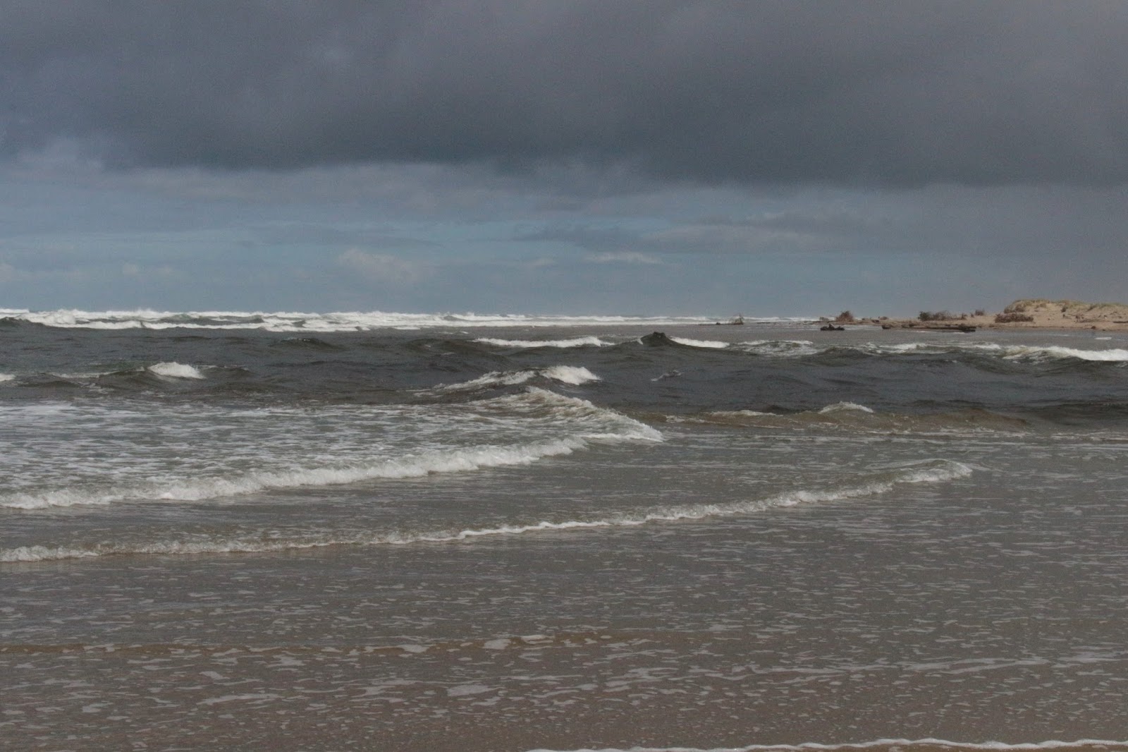
So, while the Butterfly Lake expedition had been a whole lot of work, the fact remained we had not covered a lot of miles. There was no glory at heading back to the car at this point, so we made a left turn at a trail junction and headed to the beach where Tahkenitch Creek meets and greets the Pacific Ocean.

Brush-clogged Tahkenitch Creek
Right next to Tahekenitch Creek, I noticed a large black bird squatting stoop-shouldered  like an aged monk: it was a bald eagle! I descended to the beach and tried to get as close as I could without spooking it. Maggie, on the other hand, saw the creek and she ran up and down splashing in the water with mindless canine exuberance, totally unaware of the potential peril of becoming eagle food. And so much for not spooking the eagle!

And what's wrong with being bald, eagle?
Tahkenitch Creek was swollen with winter runoff and was more of a river than a creek. The eagle was on the other side of the creek and was not at all concerned about our crossing the formidable stream. After several minutes, the eagle gave a dismissive flap of  its mighty wings and soared out of sight while the gulls on the beach scattered in screeching panic. It's not every hike I get to see one of these majestic birds, how cool was that?

Tahkenitch Dunes in the afternoon
As the sun sank, we walked up the Tahkenitch Creek Trail for a mile and back, there was not much to see as it just ambled through pleasant woods. On the plus side, I think I just found another future route to keep Tahkenitch dunes interesting.

For more pictures of this hike, please visit the Flickr album.