Showing posts with label cowhorn mountain. Show all posts

Saturday, July 9, 2022

Cowhorn Mountain


I've told this story before but I'm not above plagiarizing myself. Cowhorn Mountain got its name from a spire that used to be on the mountain and probably resembled a cow's horn. Unfortunately for us present-day hikers, the horn fell off in the early 1900s, knocked down in the middle of the night by a severe winter storm. It just goes to show that mountains, just like people, also become less horny as they get older. 

Move 'em out, head 'em up! Rawhide!

At least the modern-day trimmed-down version of Cowhorn Mountain is presumably easier to summit than it was in the early 1900s. And speaking of trimmed-down versions, Friends of the Umpqua was hosting a trek to the mountain's summit and we numbered a robust and eager eighteen hikers, but who's counting, besides the hike leader? As we laced up our boots, the Pacific Crest Trailhead at Windigo Pass was a busy place, not even counting our lively band of bovines.
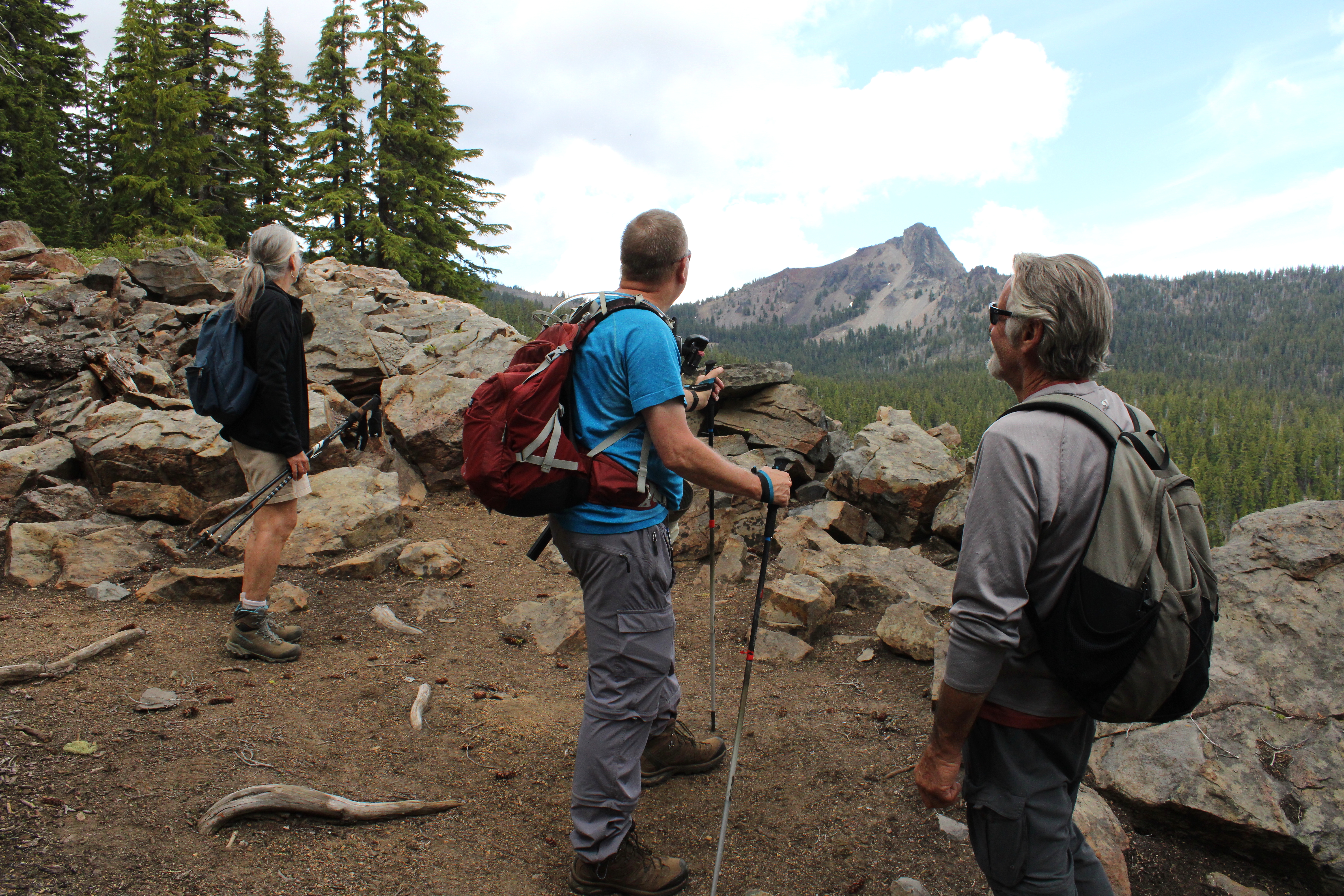
The mountain is calling but do we really have to go?

From the Windigo Pass Trailhead, there is not a lot of water to be found along the trail until hikers reach Summit Lake about 13 miles away. However, a trail angel has adopted the Windigo Pass Trailhead and keeps it well stocked with jugs of water and accordingly, throngs of through-hikers were drinking at the trough, so to speak. The trailhead was quite the festive and high-spirited place that morning!

Gone was the snow around Windigo Lake

This hike took place only a week after my Nip and Tuck hike and I was somewhat disappointed to see the forest between the Pacific Crest Trail and Windigo Lakes to be snow free. It was like my rough bushwhack last week had never happened. What was happening now and not then, was that throngs of voracious mosquitoes were the travail du jour.

A forming thunderhead was cause for concern

The weather forecast called for possible thunder and because standing on top of a tall mountain is not a good idea in a thunderstorm, we kept a wary eye on the clouds forming over the crest we were hiking on. The clouds resembled baby thunderheads but never quite got to the point of hurling lightning bolts at stampeding hikers.
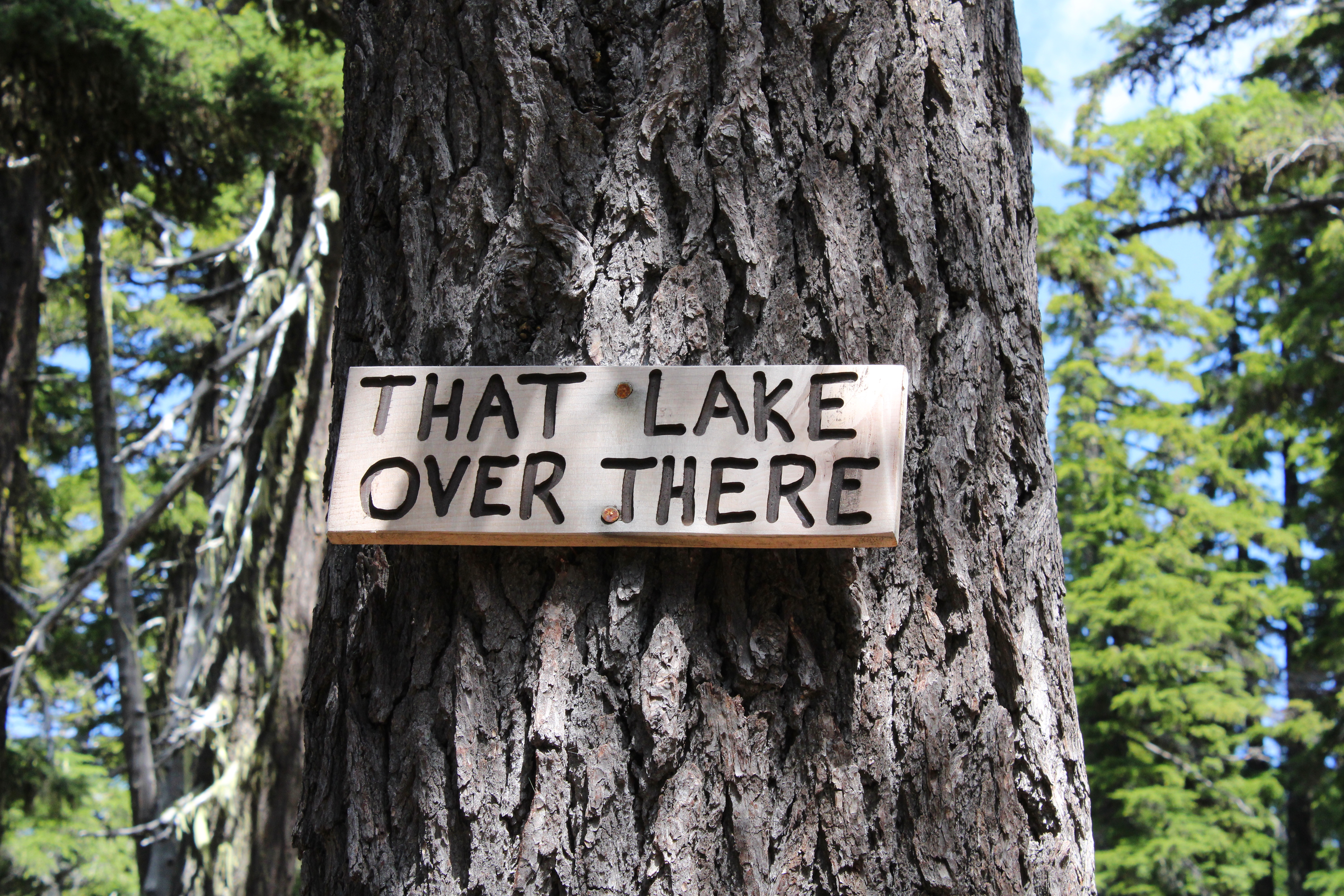
The PCT will be renamed "The Trail You Are Hiking On"

The Pacific Crest Trail heads uphill for about four miles at a steady grade. As we gained altitude, periodic openings in the forest allowed us to see distant Mounts Bailey and Thielsen to the south, and the Cappy Mountain complex east of the PCT and much closer to Windigo Pass. Below, in a forested basin, the twin jewels of Windigo Lakes reposed on a large blanket of forested terrain. And speaking of lakes, a stagnant pond that used to be an important water stop for through hikers before the advent of the Windigo Pass trail angel, had been signed by some wag as "That Lake Over There".

Snow was all over the higher reaches of this hike

As the trail sashayed to and fro and undulated and up and down the forested ridge leading to Cowhorn, openings in the forest provided occasional peeks at the day's object of our desire. Always craggy and udderly foreboding, Cowhorn Mountain looked to be so much higher and farther than our current vantage point. One should never look ahead, it's always so de(moo)ralizing.
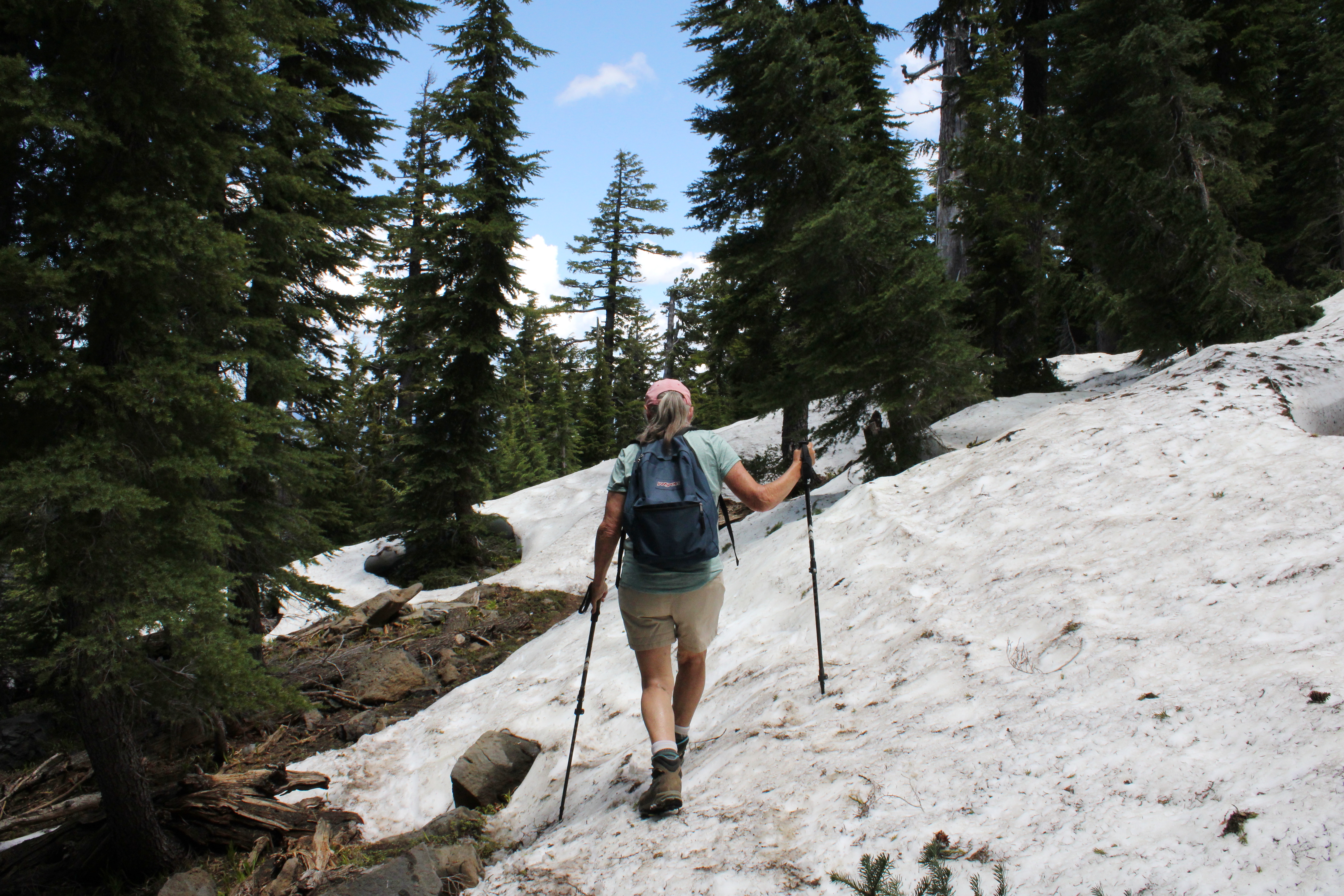
Penny picks her way through the snow drifts

As we continued to gain altitude on the Pacific Crest Trail, snow became a thing and that's snow lie. The drifts were plentiful and deep enough to hide the trail from sight. Fortunately, this is through-hiker season and we just followed their hoof prints in the snow when uncertain. The melting snow was soft and we had to watch out for tree wells and hollow spaces to avoid sudden and unexpected posthole moments in the slushy snow
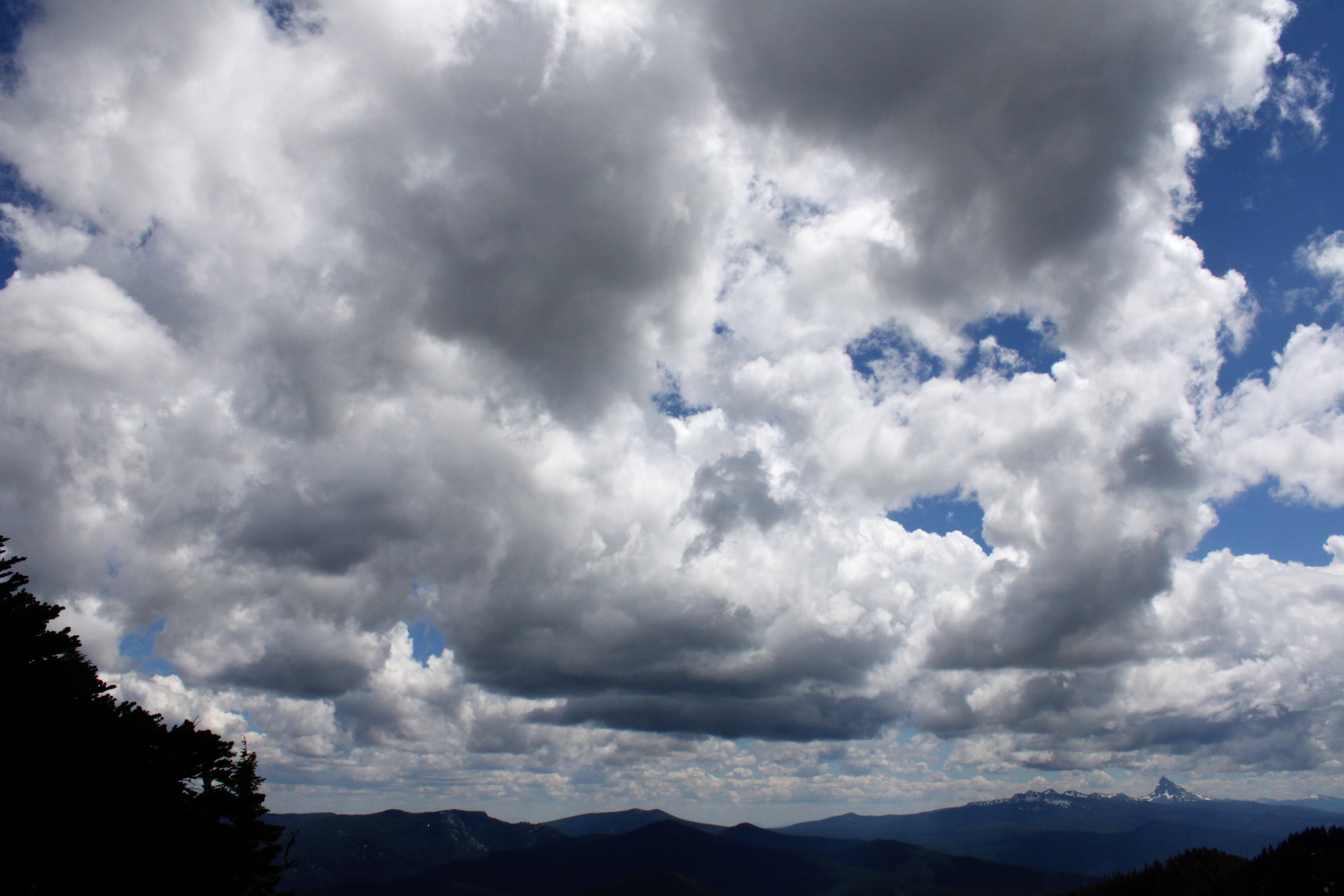
Clouds form and reform over the landscape

I was feeling so walky that I soon found myself in front of the herd, accompanied solely by Katelyn, who was our youngest hiker at age thirteen. I daresay that as fast as I hiked, she would have left me eating her snowflakes if she knew how to get to Cowhorn by herself, and that's no bull. But all that fast moo-ving along had a price for the diabetes impaired and I bonked right at the foot of the mountain. So, while most of my friends made hay and went up to the summit, some of us stayed behind to chew cud and admire the landscape and cloudscape surrounding the prominent peak of Cowhorn Mountain. And one of us ate the proper foods to reconstitute his low blood sugar, darn diabetes anyway.

Hikers carefully navigate their way down

It was all downhill naturally, once our thundering cattle herd disembarked from Cowhorn Mountain. There was some slipping and sliding on the snow drifts on the way down and I took the occasion to instruct the less experienced hikers how to safely kick-step through the snow. It was a perfunctory four-mile hike through thick forest, thick clouds of mosquitoes, and thick throngs of through-hikers before we arrived in good order at Windigo Pass, fully sated with the day's undertaking.
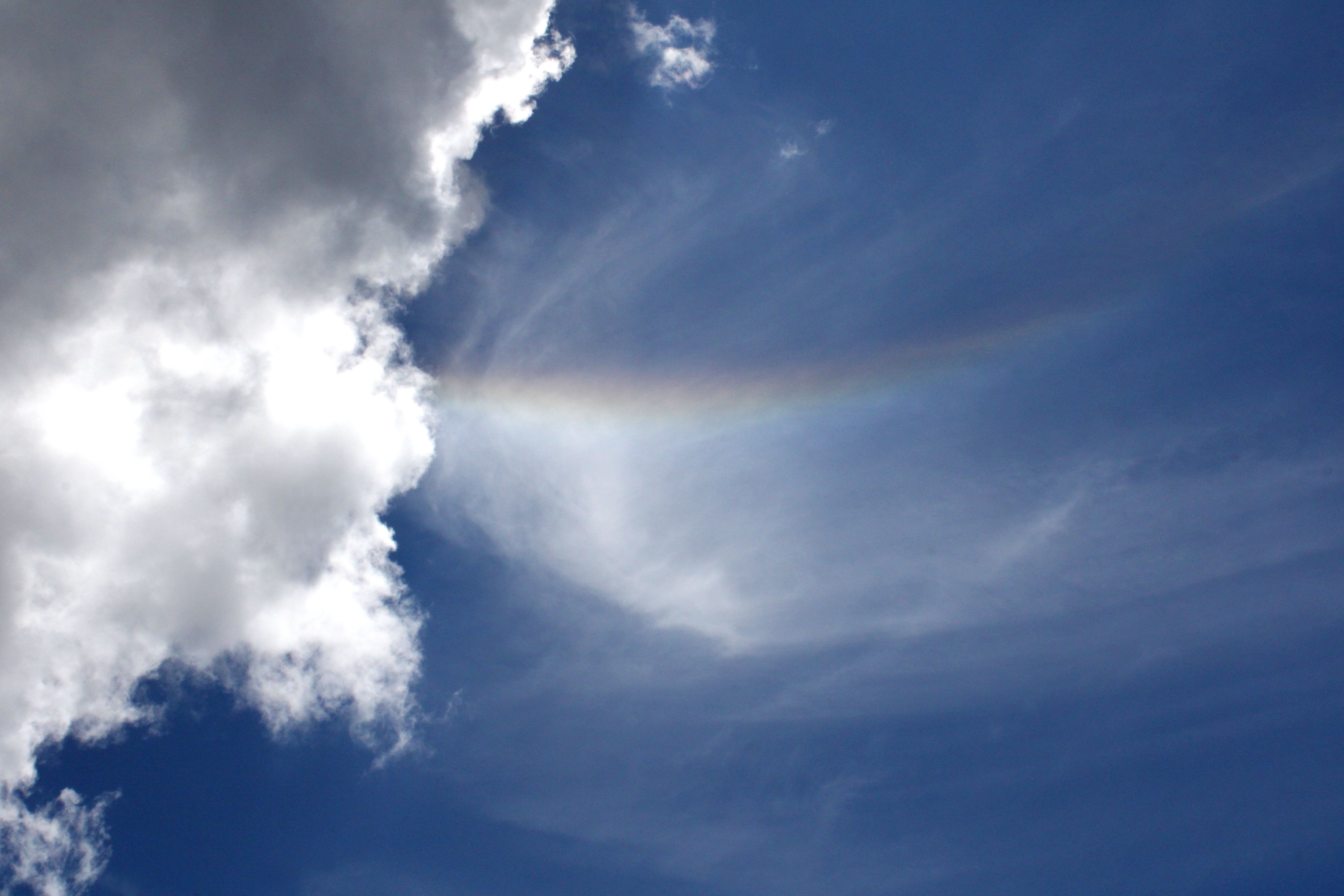
Rainbow in the sky

Well some of us were fully sated, while at least one of us apparently required some more adventure and exercise. Yup, I divested myself of my daypack and hoisted my backpack onto my shoulders, ready for a hike down into the Nip and Tuck Lakes area. Hay, I was back to feeling walky again and head me out and move me up. Rawhide!
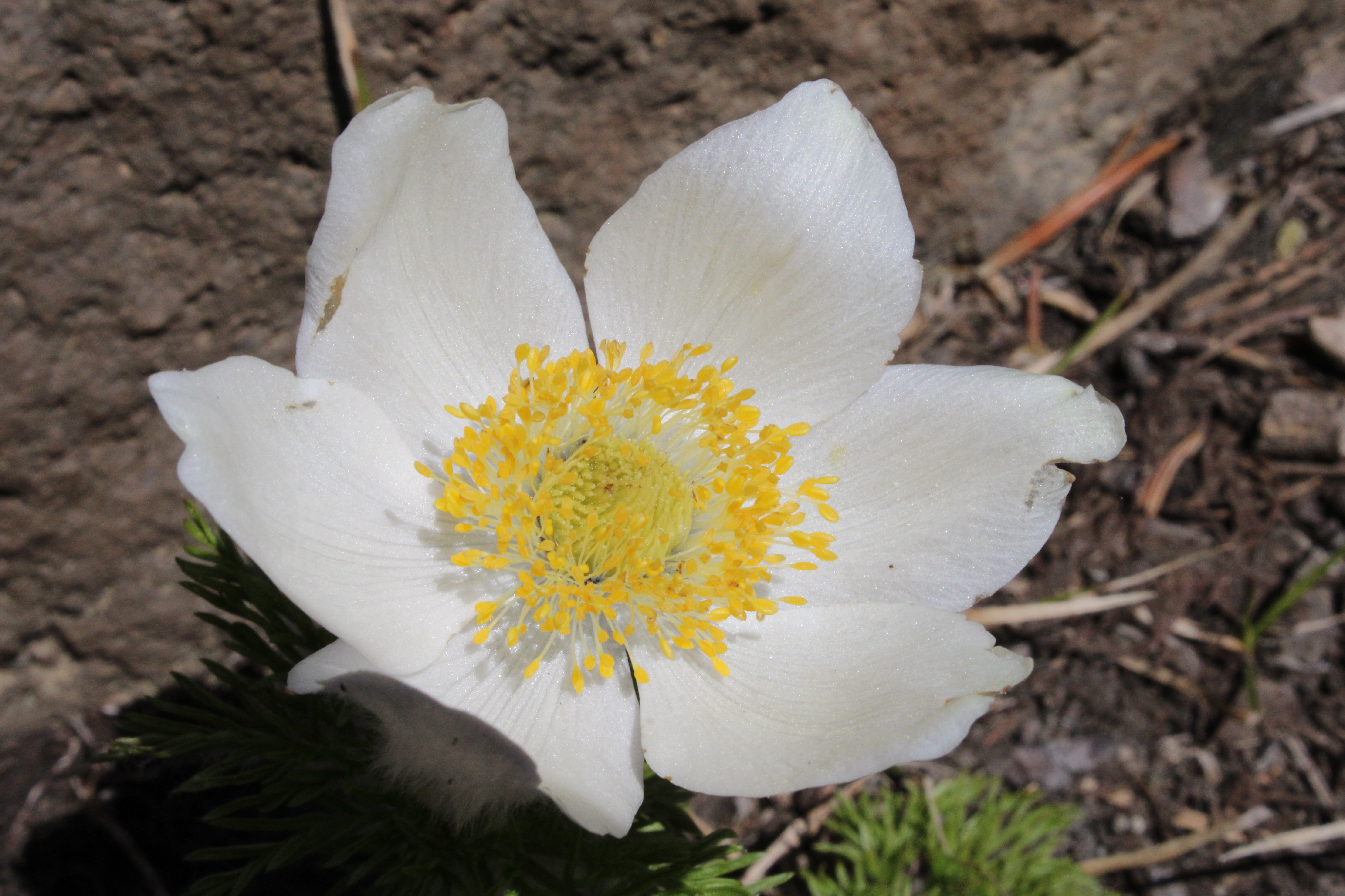
Pasque flower adorned the rock gardens near the summit

For more photos of this hike, please visit the Flickr album.

Friday, July 10, 2020

Cowhorn Mountain

At the Windigo Pass Trailhead, we were getting ready to begin hiking, collectively performing our customary and usual pre-hike rituals such as lacing up boots, hoisting backpacks, and calibrating GPS units, all of us eager to begin hiking on a quiet Pacific Crest Trail (PCT) to Cowhorn Mountain. Because of the Covid-19 pandemic, would-be PCT through-hikers have been asked to postpone or cancel their epic trip from Mexico to Canada and try again in some future year when it can be done safely. So, it stood to reason that the PCT, normally busy with through-hikers this time of year, would be somewhat more calm and sedate. However, a hopeful and helpful "trail angel" had stocked the trailhead with water jugs for the through-hiking crowd and there were two such through-hikers availing themselves of the precious life-sustaining liquid when we arrived.

Trail angels show some PCT through-hiker love
We exchanged greetings with Fiesta, who was given that trail name because of a piƱata ornament hanging on her pack. Her friend had just joined her mid-trip and did not have a trail name yet, so I suggested Hey You until such time as she earned a proper trail name. While we were conversing, the mosquito scourge made their horrendous bloodsucking biting presence known to all of us and Fiesta let it slip out that neither one of them had anticipated so many mosquitoes and as a result, had no repellent on hand. "See this?" she said, pointing at her face which was well pimpled and welted with mosquito bites upon mosquito bites "This is Braille for 'Help!' "

One of two Windigo Lakes was visible from the PCT
As it turned out, I had an extra bottle residing within the dark depths of my day pack and I quickly dug it out and handed it to two very grateful human beings. They offered to give it back after applying a layer but I need the Karma points for my free pass into Hiker Heaven so I told them to keep the bottle and pay it forward. This little episode is one of the things I truly appreciate and love about the hiking community. We are all brethren and sistren out on the trail and we take care of each other, no questions asked. I've been on both the receiving and giving end and this would not be the first or last time trail assistance will be given or received by me. At any rate, it was really cool to commence hiking festivities by doing a good deed, every hike should begin that way.

Penny stops to admire the view
Walking in a figurative cloud of feel-good, we set out on the Pacific Crest Trail which immediately angled uphill through a shady forest. I'm sad to say the cloud of feel-good was woefully ineffective in warding off the thick clouds of mosquitoes pervading the forest. The trail was basically following a ridge crest that was the actual Pacific Crest of the Pacific Crest Trail. Because of our vantage atop the crest, breaks in the forest cover served up large west-side vistas of Mount Bailey, Mount Thielsen, and Crater Lake's rim. On the east side, one Windigo Lake was visible while generally flatter forested terrain rolled off into the desert country of central Oregon.

Patti: Looks kind of far
Cleve: Looks kind of tall, too
Penny: It's probably really steep
Me, Edwin, John: Yep
As we continued to gain elevation in the mosquito-infested forest, we could catch occasional glimpses of Sawtooth Peak, Diamond Peak, and Cowhorn Mountain, today's object of desire rising demoralizingly high above our current elevation. It seemed so far away too, we still had a couple of uphill miles yet to go. Best to duck back into the forest so we could avoid seeing the visual bad news in that regard.

Pasque flower beautified the rock gardens
As we gained elevation, the trees began to thin out a bit and we hiked in and out of small rock gardens festooned with scarlet paintbrush, purple penstemon, and showy white pasque flowers. The pasque flowers, a member of the anemone (or windflower) family, morph from eye-catching bloom into small orbs of fuzzy seed heads that resemble so many hairy-headed hippies from the early 1960s. Along the trail and in the open places too, were patches of snow totally at odds with the warm sunshine vibe.

Now the real work begins!
After four'ish miles of steady uphill hiking, it was time to jump off the PCT and do the actual climb to the summit. Oof, all that uphill hiking to get here was more like level grade hiking by comparison. The trail steepened considerably and legs quickly began screaming in the soft volcanic soil on Cowhorn's shoulders. About halfway up, my legs went wobbly (damn diabetes, anyway) so Patti and I sat on a rock bench atop a rusty red saddle and began enjoying the day and view while my friends continued on to the summit.

View from Crescent Lake to the Three Sisters
The views surrounding Cowhorn are astounding and we were suitably astounded. Diamond Peak is Cowhorn's immediate neighbor to the north and the forested basin between the two peaks was dotted with dozens of lakes big and small. The two large lakes were Summit Lake and Crescent Lake. Not as obvious as its lake neighbors, Timpanogas Lake (the source of the Middle Fork Willamette River) was also visible perched atop the headwaters of the Middle Fork Willamette's deep and formidable canyon. Beyond Diamond Peak and somewhat lost in the summer haze, were the Three Sisters and other members of that mountain tribe. And of course, there was massive Cowhorn Mountain rising directly in front, making us feel really small.

Cowhorn Mountain
There was lots to take in and photograph but as I ate, my replenished legs felt like tackling the climb to Cowhorn. Just as I was about to join the summit party as a late arrival, we could see our friends picking their way down like so many careful ants on a wall. Oh well, but I'm sort of kicking myself for stopping short.

PCT oasis
So, it was back to the trees and mosquitoes as we hiked the four downhill miles back to Windigo Pass. When you hike, you tend to breathe hard and I inhaled and swallowed four mosquitoes in what has to be some small retribution for the thousands of instances they've partaken of me. On the way down, Edwin and I took a small side-trip to a small pond that is an important water stop for through-hikers. The water was warm, tepid, and muddy, but when that's the only available water for miles and miles, then that's the water you drink. However, the water jugs at the trailhead have rendered moot the necessity of this small pond.

Comparing who's boots are better
We all decided that it had been indeed a grand hike despite the heat, the mosquitoes, and all the uphill walking. It could have been worse though, for Cowhorn used to have a "cow horn" that made the mountain much taller than its present height. In the early 1900s, a winter storm toppled the rock spire and like freshly neutered dogs the world over, it's just not as horny as it used to be. And I just set my quest for Hiker Heaven back a thousand points with that one.

Fuzzy-headed pasque flower, gone to seed
For more photos of this hike, please visit the Flickr album.


Friday, June 8, 2018

Windy Pass Trail


The mountains call after the long winter layoff. Invariably, restless hikers will attempt a hike in the Cascades when the clime is hot and summery in the Umpqua Valley, only to find out the mountains are still undergoing some version of winter weather. I thought I'd be smart and hold out for another month but then Edwin called and I said, almost reflexively, "Ok sure, I'll go with you!" And that is the story of how I came to hike the Windy Pass Trail on an early June day.

Nothing but blue skies...for now


The basic plan was to hike from Timpanogas Lake to Cowhorn Mountain. However, a winter storm was blowing in with snowfall predicted so we had a most-of-the-day window of opportunity. But just in case, winter gear was stowed into daypacks before Edwin, John, and I set out from the lake. Although a chill breeze was moving cool air around as we set out, the day was initially sunny and totally at odds with the predicted forecast.

Rodent house, also known as Timpanogas Snow Shelter
A quarter of a mile along Timpanogas Lake's shoreline, lies the Timpanogas Snow Shelter and we stopped by to check it out. You never know when you might want to snowshoe to the lake and spend the night! During the summer, the resident rodentia are only too happy to scurry across sleeping camper's faces and raid their packs. At any rate, after our cursory visit to the shelter, we scurried ousrselves onto the Windy Pass Trail heading up to the Pacific Crest Trail.

One of several small ponds along the trail
Ah, uphill hiking is so much fun and soon our leg muscles were burning in unhappy companionship to that activity. We passed by a number of small ponds and lakelets, all coated with a film of tree pollen. Mosquitoes came by to visit, probably freshly hatched from the aforementioned ponds and lakelets. However, their numbers were not yet up to the usual summery multitudes, thankfully.

Orange peel fungus
We continued to angle upward through a forest of homogeneous trees, all covered with fuzzy moss like so many giant unshaven legs. There wasn't much vegetation underneath the trees but there were plenty of orange peel fungi sprouting alongside the trail like brightly colored doll cups. Periodically, there'd be a break in the trees and we enjoyed views of Sawtooth Mountain when that happened. Hidden by the forest, Amos and Andy Lakes lay below us somewhere, but we did get a glimpse of a lake which may have been one of the watery siblings. And then snow became an issue.

Edwin ponders the mystery of the disappearing trail
We had started hiking at 5,200 feet of altitude, at Timpanogas Lake, and had worked our way up to about 6,200 feet when the trail ran under a small snow drift. It wasn't too daunting, for we could see the trail continuing on the other side of the drift. But as we continued to hike, the drifts became more frequent and larger, really putting our route-finding skills to the test. Between my GPS and John and Edwin's stubbornness, we would find a piece of the trail and thus, were always able to continue.

Yup, this is the trail
I wasn't feeling all that walky on this day and found the hiking in soft snow to be quite tedious and before long, my quads were burning in quiet agony. At the point where my GPS said we were at the intersection with the Windy Pass Trail and the tie-in trail to the Pacific Crest Trail (and Windy Pass itself), I called it, or "wussed out" as John and Edwin termed my departure. They wanted to reach the PCT at least so we parted ways and I headed back down to snow-free environs.

At the wrong pond
On the way down, I hit a walking rhythm, which is easy to do when walking downhill. I stopped at a small pond that for some reason did not look familiar. After taking some pictures, I continued on the trail, which looked faint, sketchy, and even less familiar than the unfamiliar pond. Out came the GPS and I ascertained I had walked past the intersection with the trail leading to Timpanogas Lake. A slight backtrack was executed and I  soon found myself on familiar trail again.

Incoming bad weather
By now, clouds had scudded over and blotted out the sun. A breeze picked up and the temperature began dropping faster than a roller coaster in free fall. The predicted snowstorm was arriving, although any precipitation at this point was just raindrops here and there. After I consumed lunch and a small bottle of wine at the trailhead while slapping at mosquitoes, Edwin and John showed up and we quickly hightailed it out of there. They had made it to Cowhorn Mountain but then decided to turn back without summitting the craggy peak because the wind had picked up and it was uncomfortably cold. Despite the not so-summery hiking conditions, it felt good to be back in the Cascades after the long winter layoff.

Timpanogas Lake, as the storm rolled in
For more pictures of this hike, please visit the Flickr album.