

I've told this story before but I'm not above plagiarizing myself. Cowhorn Mountain got its name from a spire that used to be on the mountain and probably resembled a cow's horn. Unfortunately for us present-day hikers, the horn fell off in the early 1900s, knocked down in the middle of the night by a severe winter storm. It just goes to show that mountains, just like people, also become less horny as they get older.
 |
| Move 'em out, head 'em up! Rawhide! |
At least the modern-day trimmed-down version of Cowhorn Mountain is presumably easier to summit than it was in the early 1900s. And speaking of trimmed-down versions, Friends of the Umpqua was hosting a trek to the mountain's summit and we numbered a robust and eager eighteen hikers, but who's counting, besides the hike leader? As we laced up our boots, the Pacific Crest Trailhead at Windigo Pass was a busy place, not even counting our lively band of bovines.
 |
| The mountain is calling but do we really have to go? |
From the Windigo Pass Trailhead, there is not a lot of water to be found along the trail until hikers reach Summit Lake about 13 miles away. However, a trail angel has adopted the Windigo Pass Trailhead and keeps it well stocked with jugs of water and accordingly, throngs of through-hikers were drinking at the trough, so to speak. The trailhead was quite the festive and high-spirited place that morning!
 |
| Gone was the snow around Windigo Lake |
This hike took place only a week after my Nip and Tuck hike and I was somewhat disappointed to see the forest between the Pacific Crest Trail and Windigo Lakes to be snow free. It was like my rough bushwhack last week had never happened. What was happening now and not then, was that throngs of voracious mosquitoes were the travail du jour.
 |
| A forming thunderhead was cause for concern |
The weather forecast called for possible thunder and because standing on top of a tall mountain is not a good idea in a thunderstorm, we kept a wary eye on the clouds forming over the crest we were hiking on. The clouds resembled baby thunderheads but never quite got to the point of hurling lightning bolts at stampeding hikers.
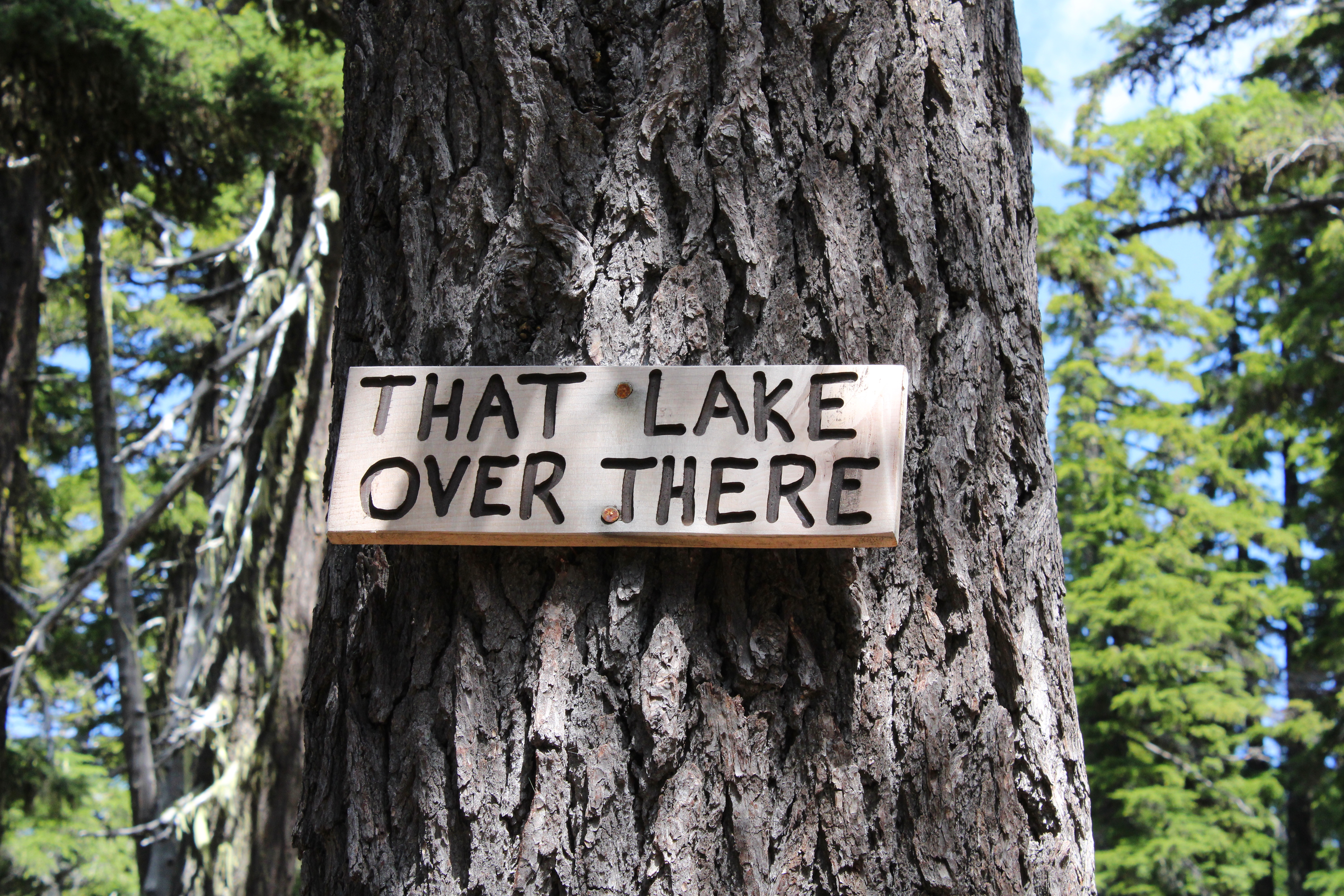 |
| The PCT will be renamed "The Trail You Are Hiking On" |
The Pacific Crest Trail heads uphill for about four miles at a steady grade. As we gained altitude, periodic openings in the forest allowed us to see distant Mounts Bailey and Thielsen to the south, and the Cappy Mountain complex east of the PCT and much closer to Windigo Pass. Below, in a forested basin, the twin jewels of Windigo Lakes reposed on a large blanket of forested terrain. And speaking of lakes, a stagnant pond that used to be an important water stop for through hikers before the advent of the Windigo Pass trail angel, had been signed by some wag as "That Lake Over There".
 |
| Snow was all over the higher reaches of this hike |
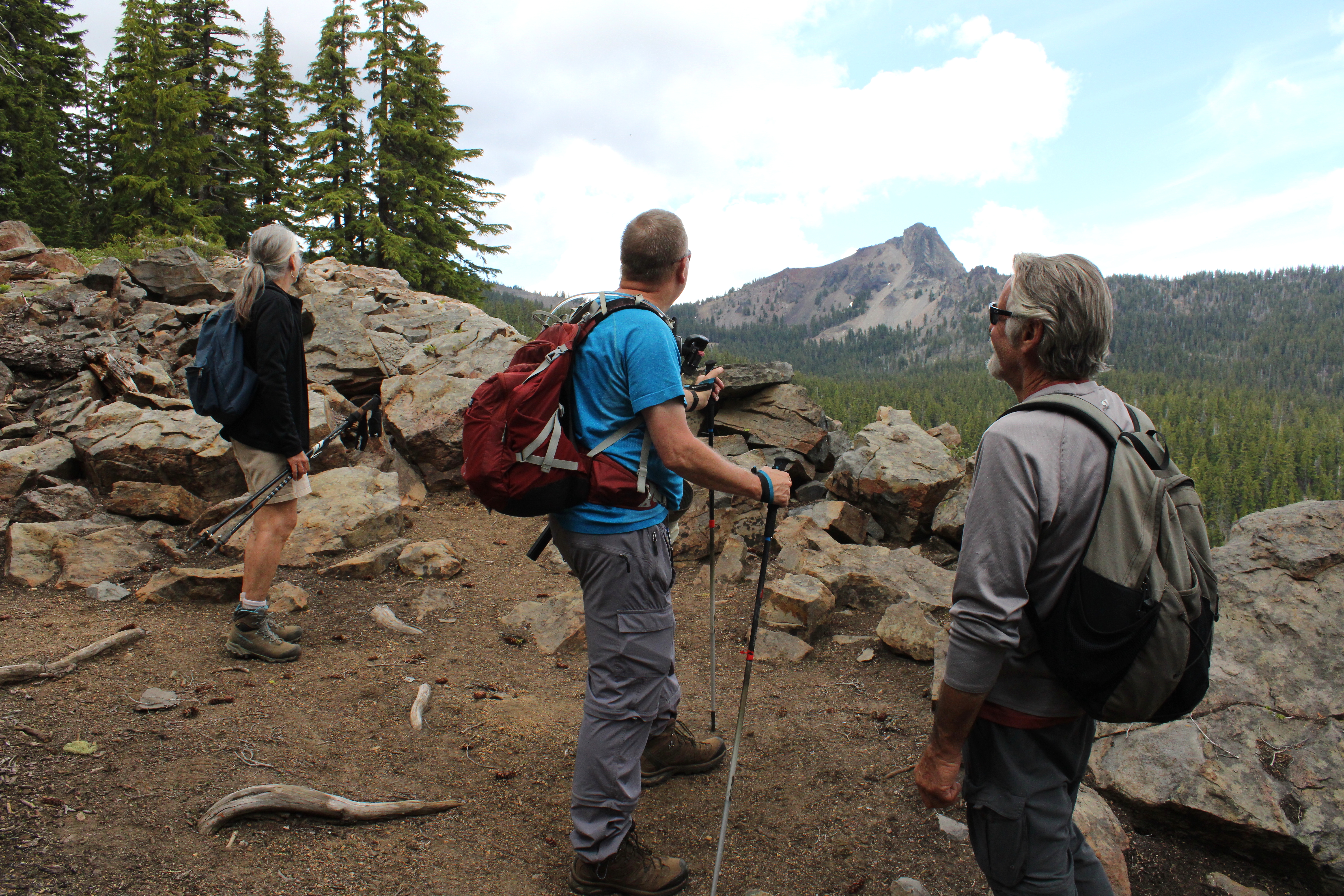
As the trail sashayed to and fro and undulated and up and down the forested ridge leading to Cowhorn, openings in the forest provided occasional peeks at the day's object of our desire. Always craggy and udderly foreboding, Cowhorn Mountain looked to be so much higher and farther than our current vantage point. One should never look ahead, it's always so de(moo)ralizing.
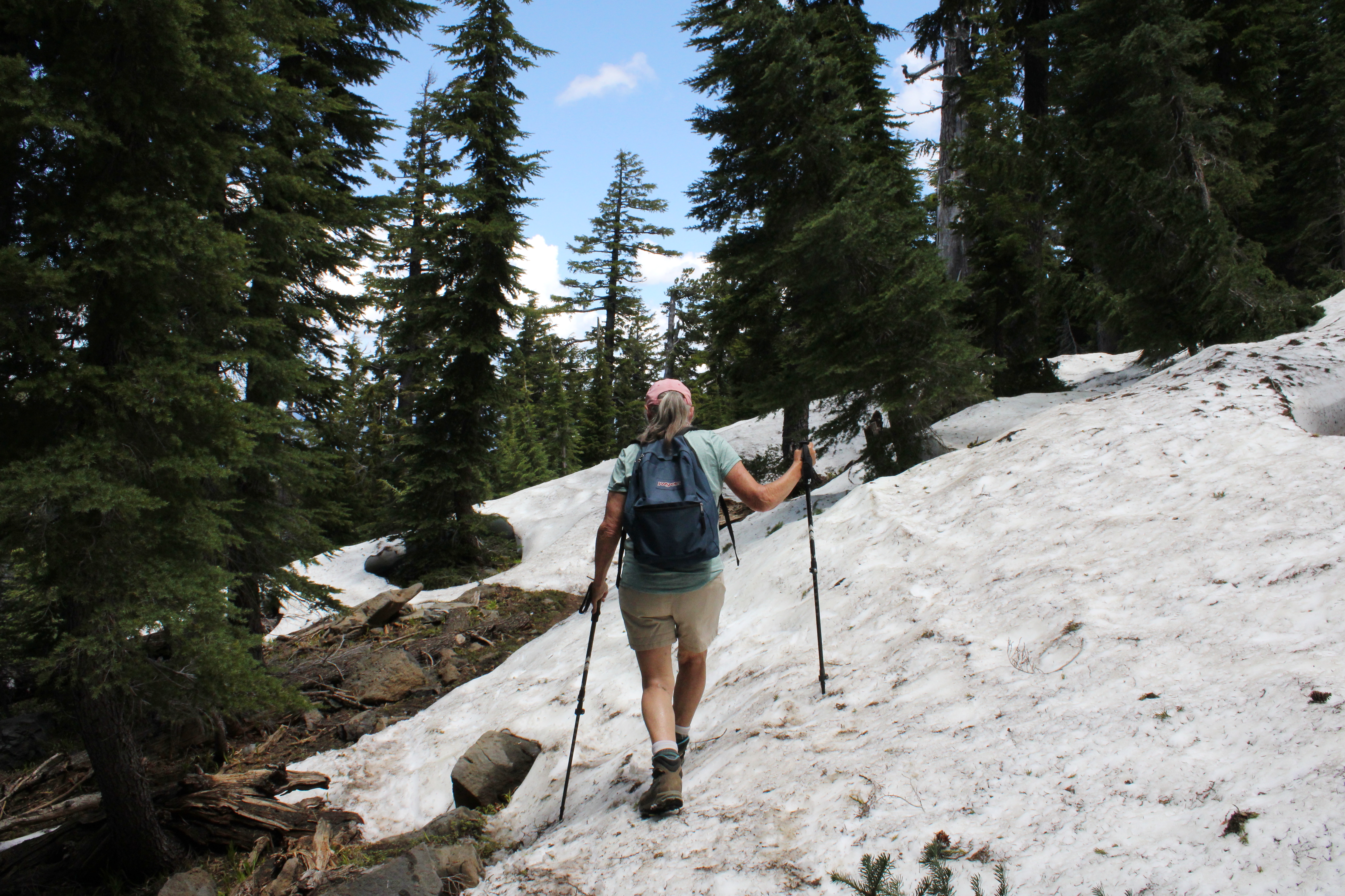 |
| Penny picks her way through the snow drifts |
As we continued to gain altitude on the Pacific Crest Trail, snow became a thing and that's snow lie. The drifts were plentiful and deep enough to hide the trail from sight. Fortunately, this is through-hiker season and we just followed their hoof prints in the snow when uncertain. The melting snow was soft and we had to watch out for tree wells and hollow spaces to avoid sudden and unexpected posthole moments in the slushy snow
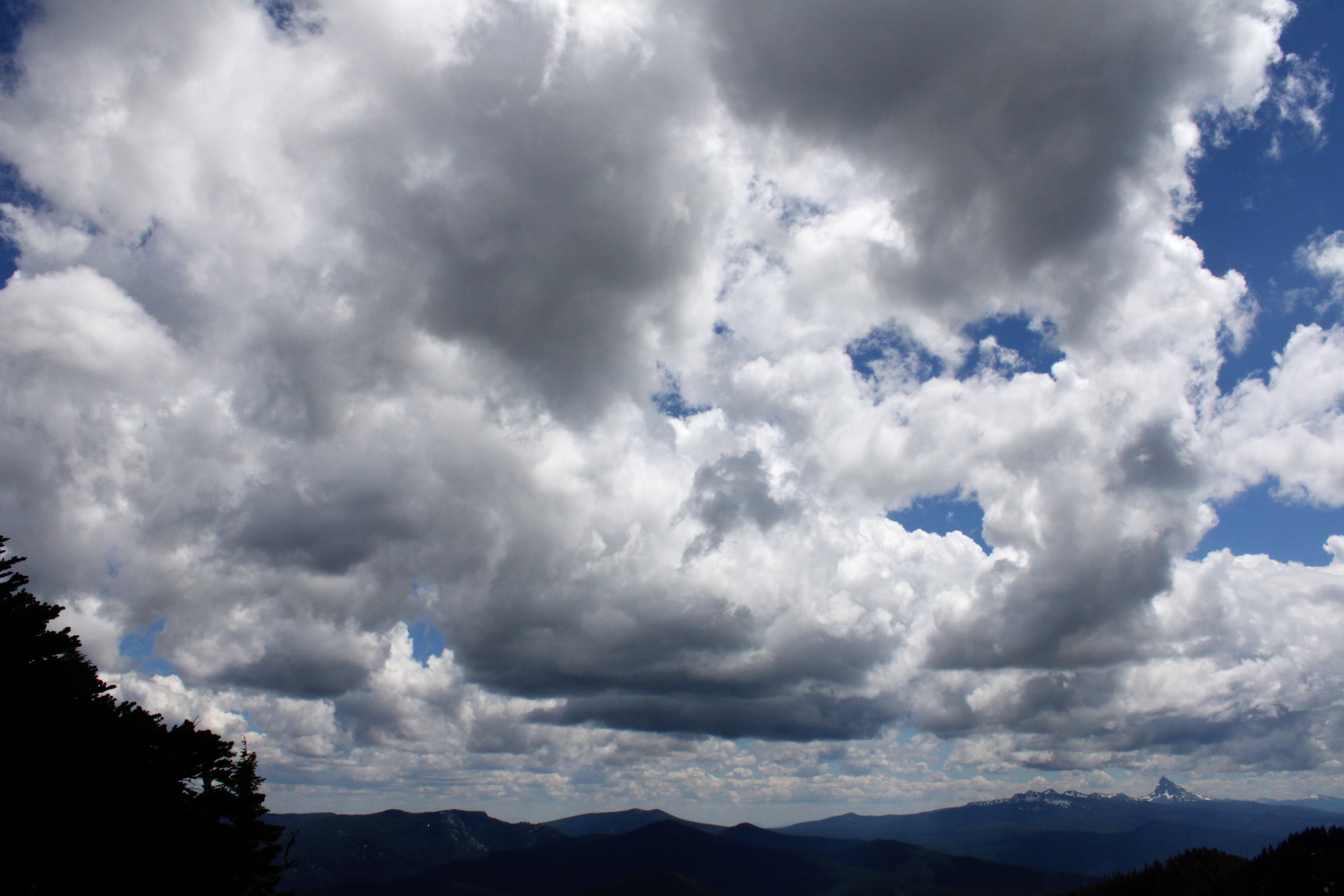 |
| Clouds form and reform over the landscape |
I was feeling so walky that I soon found myself in front of the herd, accompanied solely by Katelyn, who was our youngest hiker at age thirteen. I daresay that as fast as I hiked, she would have left me eating her snowflakes if she knew how to get to Cowhorn by herself, and that's no bull. But all that fast moo-ving along had a price for the diabetes impaired and I bonked right at the foot of the mountain. So, while most of my friends made hay and went up to the summit, some of us stayed behind to chew cud and admire the landscape and cloudscape surrounding the prominent peak of Cowhorn Mountain. And one of us ate the proper foods to reconstitute his low blood sugar, darn diabetes anyway.
 |
| Hikers carefully navigate their way down |
It was all downhill naturally, once our thundering cattle herd disembarked from Cowhorn Mountain. There was some slipping and sliding on the snow drifts on the way down and I took the occasion to instruct the less experienced hikers how to safely kick-step through the snow. It was a perfunctory four-mile hike through thick forest, thick clouds of mosquitoes, and thick throngs of through-hikers before we arrived in good order at Windigo Pass, fully sated with the day's undertaking.
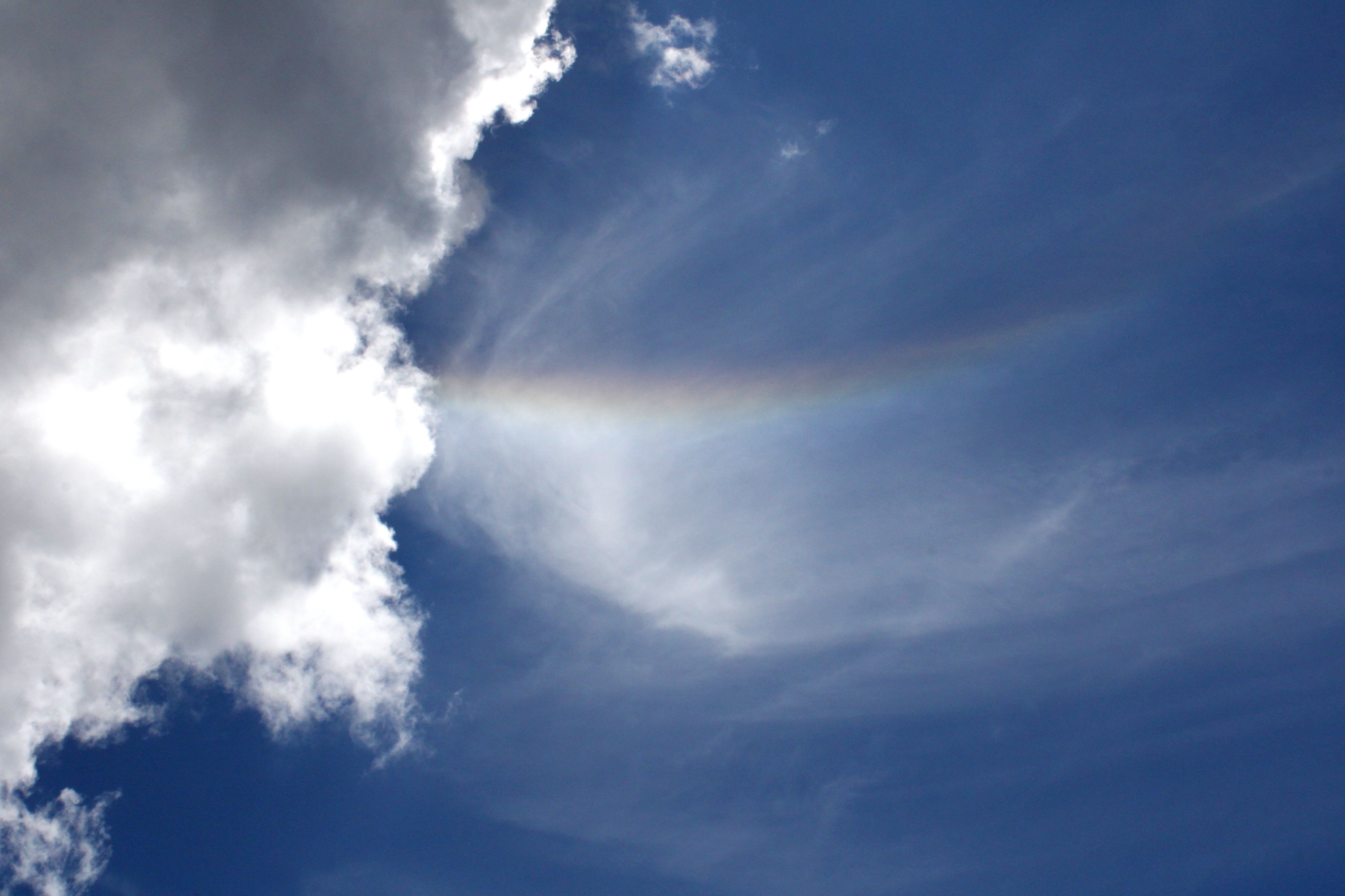 |
| Rainbow in the sky |
Well some of us were fully sated, while at least one of us apparently required some more adventure and exercise. Yup, I divested myself of my daypack and hoisted my backpack onto my shoulders, ready for a hike down into the Nip and Tuck Lakes area. Hay, I was back to feeling walky again and head me out and move me up. Rawhide!
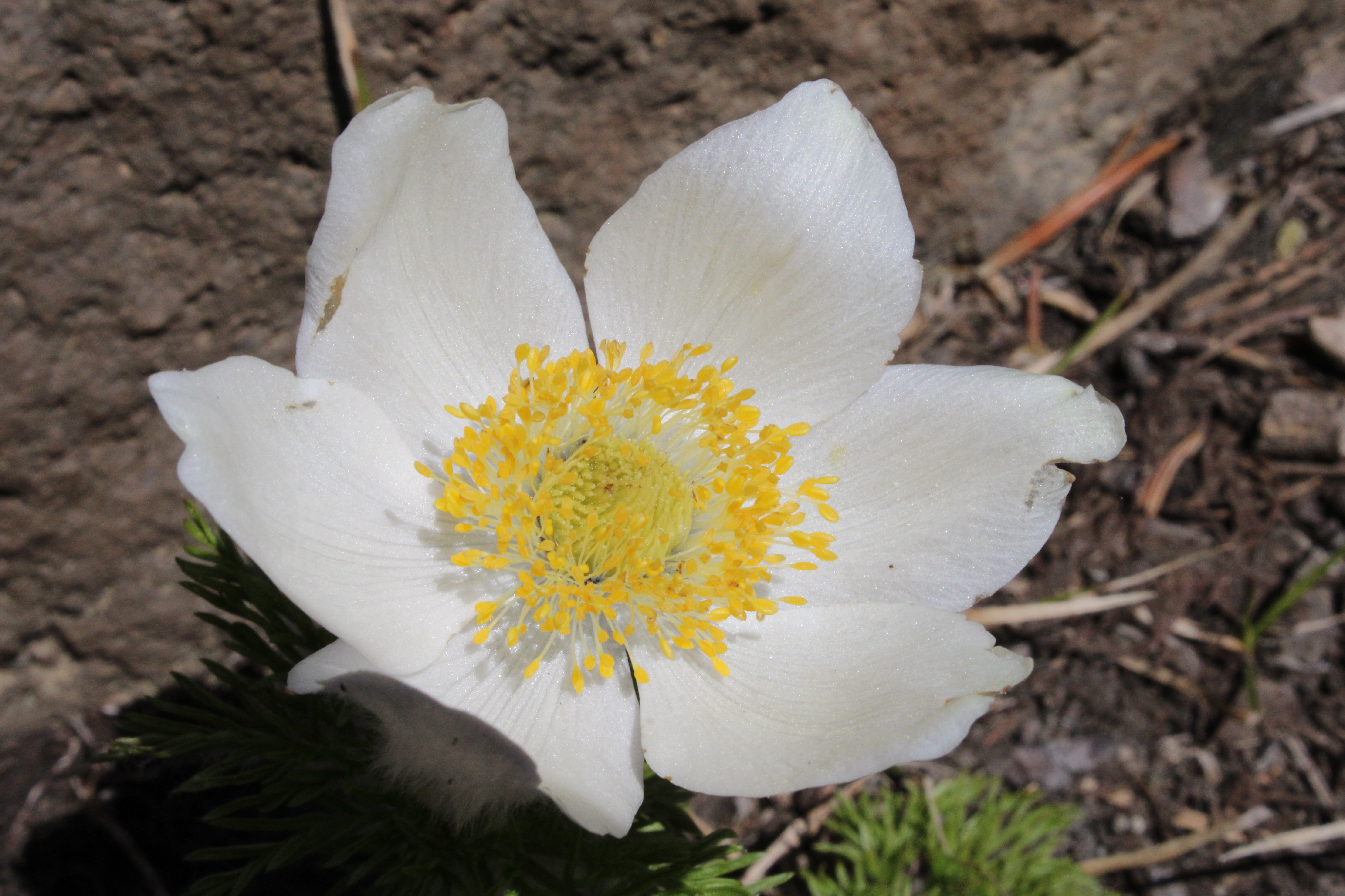 |
| Pasque flower adorned the rock gardens near the summit |
For more photos of this hike, please visit the Flickr album.
No comments :
Post a Comment