Showing posts with label Floras Lake State Natural Area. Show all posts

Wednesday, December 1, 2021

Blacklock Point


Of the six hikers in our little group, only I knew the secret route to a hidden epic viewpoint overlooking the Oregon coast north of Blacklock Point. Naturally, it was incumbent upon me to lead us all on a scrubby and cliff-hugging journey to Mother Nature's observation deck. As we worked our way through cruel growths of scratchy brush, somebody asked "Are you sure you know where you are going?" and my cruel heart was immediately gladdened. Nice to know I still have the touch, even on a hike that I was not formally in charge of.

The Oregon coast calls, and I must go

I've been to Blacklock Point like a million times or so and have had plenty of miles in which to experience Blacklock's many moods, ranging from icy windstorms to stifling heatwaves. Today's offering was sunny and mild, with just a hint of windy bluster (just like me!). Given the cool and wet conditions so prevalent on the coast on most any given day, we gratefully accepted the bright and breezy bounty from the weather gods.

The difference between evergreen and perennial, illustrated

Things got off to a little bit of an awkward start when I tried to find the path running behind the runways of nearby Cape Blanco.  A faint track overgrown by thorny gorse discouraged most of us from taking the loop route to Floras Lake and after a brief discussion (mutiny, really) it was decided by majority vote that 1) the hike would be an out-and-back and 2) nobody should follow me down any further overgrown paths that might otherwise arise during the hiking of this hike.

There were whole entire worlds inside the puddles

The trail from the airport to the Oregon Coast is an old road and as is an old road's wont, potholes had formed on the dirt road. And as are potholes' wont, over time they had grown larger and then had filled up with water during recent rainy weather, testing hikers' mettle and determination both. And as are hikers' wont, an unofficial system of footpaths were illegally braided through the brush for the express purpose of walking dry-footed around the bodies of water. While I'm not particularly averse to hiking with wet feet, some of those puddles were large enough to host a yachting regatta, so we used the detours like everybody else.

Light beams slice through the forest

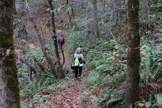
The Oregon Coast Trail basically contours along and atop the coastal cliffs keeping the ocean from overrunning the rest of Oregon. Apart from occasional bushwhacked-to overlooks, most of the hiking was through dense coastal forest, the trees twisted into phantasmagorical shapes by the near-constant sea breeze. It was both dark and light in those woods, with sunbeams slicing through the deep shade like giant light-swords wielded by angry samurais. The air was slightly misted which provided some heft to the sunbeams and I soon lagged behind, completely engrossed with the light show.

The footing was treacherous on this bridge

After a walk of several miles, made slightly longer by side trips to several coastal overlooks, the trail dropped down to a small creek. There usually is a small wooden footbridge spanning the creek but given the proclivity of winter rains, the span is often transported downstream in one piece or sometimes in many pieces. On this day, the rustic bridge was found intact but downstream. A test step revealed that the small span was somewhat slippery so I opted to just get across the creek with one long-legged stride.

Hiking on a beautiful day

We ate lunch on the beach, sitting on driftwood logs while debating whether to continue walking on the beach all the way to Floras Lake. The tide was receding but the sea was still an angry seething cauldron of turbulent water and there was not a lot of beach between watery maw and unyielding cliffs. Several years ago, a hiker and his young child had tragically lost their lives there so our consideration was indeed somber and serious. It was eventually decided to turn around and catch Blacklock Point on the return leg.

Life on the edge

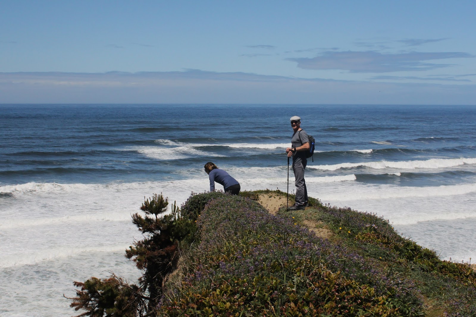
So, it was back the way we had come, through the same old dark forest accentuated by the same old bright sunbeams. Halfway back to Blacklock Point, I led my gullible and trusting comrades on the previously mentioned bushwhack venture to the epic viewpoint. From atop an ochre colored bluff, cliffy ramparts marched in stately procession for many miles north before fading into the misty distance. Waves continually broke at the edge of the vast blue ocean and nearby rocky Battleship Bow imposed its bulk and will upon the beach below. As a bonus, a small waterfall trickled over the cliff's edge and splashed onto the beach below. The awesome scenery was well worth the many aspersions cast in my direction to go along with the scratches.
See Blacklock Point?
Me, neither!

At Blacklock Point, we only had a few minutes to enjoy the view of the craggy point and its chain of rocky islands. While we were there, a fog bank rolled in from the ocean and within minutes, Blacklock Point was just a ghostly outline in the mist. I'll have to add thick fog to the catalog of weather conditions I've experienced at Blacklock Point. From the point, it was a perfunctory hike back to the trailhead, bypassing the familiar potholes and puddles. Hearts were gladdened by today's endeavor and also by a stop in Bandon for some restorative ice cream.

The day completes the transition from blue to gray

For more photos of this hike, please visit the Flickr album.

Wednesday, November 17, 2021

Cooper Creek Reservoir


The day before this little outing at Cooper Creek Reservoir, I had hiked on the Bolt Mountain Trail under mostly sunny skies and relatively warm sunlight. The one exception to the summery vibe occurred when I rounded the north side of the mountain, where the temperature dropped precipitously in a hint of things to come this winter. Fortunately, that frigid little interlude was relatively short-lived as I emerged back into the bright sun after a mile of hiking in the cold. Contrast that with this day's hike along Cooper Creek Reservoir where the gray day was as unflinchingly cold as a predator's calculating gaze. Seemed like, at least on this day, the entire world was on a cosmic north-facing slope.

A very calm and quiet lake and morning

This was a hike among friends and the five of us began hiking in easy companionship across the lake's dam, the cold air slapping our rosy cheeks (of our faces, to be clear) like an outraged diva. Winter cometh and noses runneth, and I hadn't brought gloves or a knit cap so right away my fingers went numb and my head went dumb, thanks to the frosty temperature. Because fingers are not overrated, my hands took alternate turns at some quality pocket time, and cold digits were grateful until their time in the warm pocket was up. The runny nose problem was taken care of with perfunctory swipes from the back of my non-pocket hand and I wonder why nobody will shake hands or fist-bump with me.

The lake needs to kick its smoking habit

All members of our party were Cooper Creek regulars since the lake is so close to Roseburg and we get out there fairly often. Accordingly, it was readily apparent to all concerned that despite the recent runs of rain, the lake level was pretty low. Exposed shores or not, the lake was as preternaturally calm and serene as a monk in deep meditation. The scenery was in grayscale though, seeing as how the sky was overcast, and the dark waters of the lake could only reflect back the same overall grayness. Vapor emanated from the black water of the lake as we hiked by, ourselves uncharacteristically matching the tranquility out of respect for the peaceful scene. We also matched the whole vapor-emanating thing too, as our breaths hung in the still air like so many miniscule cumulonimbus clouds.

Salal contributes some local color

The forest surrounding the lake was damp and sodden thanks to the aforementioned recent rains. There were still some vestigial remnants of autumn in the form of colorful blackberry, salal, and wild rose leaves; along with occasional yellow maple leaves still clinging to life and mother tree alike. Where there were maple trees, the path was carpeted with dead leaves underneath and our boots churned the leafy detritus into the muddy trail. The overall dampness on the trail tread created a few unexpected mud-ski and skating "opportunities" for hikers every now and then.

Trail through a damp forest
next to an even damper lake
The morning had warmed up a degree or two as we hiked along the quiet lake but the exertion of hiking was the primary reason for warming erstwhile cold bodies. The trail around Cooper Creek Reservoir is not particularly rugged but does serve up a regular dose of up and down hiking. So, winter cometh but hiking warmeth uth. Tho thorry.

A meadow forms where there once was a lake

Cooper Creek Reservoir is long and narrow, almost fjord-like, and the trail rounded the Cooper Creek inlet end after a couple of miles. As mentioned, the lake was low and the retreating shoreline had been supplanted in turn by a rather vigorous meadow of tall grass, mostly dry and desiccate this time of year. Now heading back in the general direction of where we had started from, we stopped for a lunch and laze at a convenient picnic table near the boat ramp.

The forested part of our hike

At this point we discussed options for the remainder of the hiking route. We could turn around and go back the way we came or we could continue on and circumnavigate the body of water. The circumnavigation could be completed by either a road walk or by bushwhacking along the shore. John, Patty, and I (namby-pambies!) opted for the road walk, which I'd never done before, while honorary he-men Jennifer and Gayle (and canine friend Sammy) opted to bushwhack around. All routes were soon perfunctorily hiked and we all met up at the trailhead in short order.

Blackberry does not have black leaves

The cold conditions on this hike were not necessarily dire but they did serve as warning for what is to come. Accordingly, my day pack has since been restocked with winter essentials such as crampons, mittens, ski cap, balaclava, and a flask of scotch which will almost guarantee that none of those items will ever be needed (excluding the scotch, that's always useful) during a winter hike. That's just how it works. 

Almost too quiet!

For more photos of this hike, please visit the Flickr album.

Sunday, June 6, 2021

Blacklock Point


With a missionary's zeal, I preach the Gospel of Hiking and to indoctrinate a would-be lifelong devotee, it usually takes one good hike explicitly selected by yours truly for that purpose. However, some converts are more challenging than others. Case in point being long-time friend Anne, who submitted a voluminous pre-hike list of things that could not occur on this outing. Apparently she reads my blog so the list had things like "...no poison oak, no ticks, no wading of rivers...etc." It also had more esoteric items like "...no puns, no spontaneous songs, no armpit farts..." Sheesh, I wasn't sure I had any such hike (or behaviors) in my repertoire!

Archway on the beach

Also enumerated on that list were some weather-related edicts like no thunder, lightning, hail, wind, rain, or any combination thereof. Fortunately, a perfect day awaited the three of us (Anne's husband David came along, too) at the Oregon coast. The forecast had called for a cold, windy, and sometime rainy day but the reality was that the sky was cloudlessly blue, the temperature mild, and the breezes minimal. All signs pointed to a great hike for distrusting newbies and one erstwhile jaded veteran.

The Oregon Coast Trail tunnels through a dark forest

The long version of the Blacklock Point hike is a loop route and we opted to do the less scenic portion of the hike first. That meant starting out by walking behind an airport runway while keeping an eye on the sky for any approaching planes (running from airplanes was on Anne's list, too). After that propeller-free travail, the next couple of miles were a gradual descent on a jeep road through what admittedly were beautiful woods, even if there were no big-ticket items to see.

This bud's for you!

It was late spring and accordingly, the rhododendrons were still putting on a show. The large pink flowers festooned branches well above our heads and my two charges soon found out I brake for flowers. Close to the ground, the trail was flanked by blooming trapper's tea bushes and one patch of beargrass, somewhat out of place at the coast, proffered their distinctive white flowery plumes beneath the rhodies for our perusal. 

Our view of Floras Lake

Well, after a nice little three mile stroll through the trees and wildflowers we popped and plopped out onto a bare open area overlooking Floras Lake. This little lake is often busy with gossamer-winged kite surfers but not today, probably due to the lack of wind. David has a friend who lives at Floras Lake and he tried to spot the home from our vantage point. Whether looking for homes or kite surfers, we all agreed this was the first of many grand views on the day.

Fern tentacles

We backtracked a little bit on the Oregon Coast Trail which tunneled through a forest of dense trees twisted into all sorts of phantasmagorical shapes by near-constant sea breezes. The mix of sun and shade dappled the trail and delighted us hikers striding purposefully on the path. Rhododendrons were not as much of a thing in this part of the forest but the trail was graced nonetheless by ample quantities of wild irises ranging from purple to pale lavender in color.

It's a Richard Hike!

So far, I had managed to keep within the bounds of Anne's oppressive pre-hike manifesto, but a foot-deep creek presented the first test of our friendship. I simply splashed through, David walked across on some small branches, and Anne, surrendering to the inevitable, took off her shoes and waded barefoot, the mud presumably oozing between her toes. Expecting to immediately get unfriended, I was pleasantly surprised when she said the cool water felt good. 

Life on the edge

There is a viewpoint atop the coastal cliffs that, in my opinion, presents the Best View Ever. In years past, a bushwhack through dense coastal shrubbery was required to get there but eventually that faint path became overgrown and lost forever. Nonetheless, we tried to use the old path but couldn't get past the impenetrable growth and we all sported scratches as souvenirs of our failed attempt. Fortunately, I knew of an easier way to get there ("Why didn't you go there in the first place?" says everybody) and while that did require some bushwhacking, at least the bushwhacking took place on the edge of a sheer cliff. 

Our reward for the bushwhack

We did attain the intended viewpoint where the cliffs were covered by dense mats of inch-high dwarf lupines. We all plopped down to lupine level to take photographs of the diminutive flowers and their many attendant bumblebees. And of course, there was the epic surf, coast, and cliff scenery curving to the north under an amazingly superlative blue sky. Much nature appreciation abounded.

Cape Blanco presides over this bay

On the latter part of the hike, we stopped at other, and easier to access, viewpoints but none were imbued with the very secretness enhancing the vista seen from the special hidden overlook we had visited. However, the ever evolving coastal panoramas were still worthy in their own right. The last of these viewpoints was atop Blacklock Point itself, with a row of islands stretching west like an oceanic chain of pearls. Wind-stunted wildflowers grew on the point's summit while Cape Blanco presided at the end of a long curving beach to the south and we just sat and soaked in the view for a while.

One hiker is warier than the other

While I profusely apologized to Anne for the scratchy bushwhack thing, she said that if that was the worst thing that happened to her, then this had been a good day. Deciding to push my luck, I whipped out Anne's weighty tome of hiking don't-do's and found out that eating ice cream was not included in that interminable screed. So we did that very thing in Bandon to close off what had been an awesome 9.7 mile hike with some awesome friends.

Best View Ever

For more photos of this hike, please visit the Flickr album.

Sunday, July 19, 2020

Floras Lake Loop

I had been doing so well, too. During the months of June and July, I had been cranking out a hike every two or three days, getting into hiking trim and losing a few pounds in the process. Then this hike happened. There was a photogenic fungus growing on a tree trunk and I squatted down to get a fungus level shot and "SNAP!" My spine suddenly felt like an adult rat getting squeezed to death by a large python of pain. I just inhaled "oohhhhhhh...." for about five minutes, looked at my GPS which said my car was about 2.5 miles away, and said a few bad words which might have offended jays squawking in the trees overhead. Oh, this was going to be a fun hike back to the trailhead!

Woods dark and mysterious
At the hike's pre-injury commencement, it was a sunny day but at the coast, just because it's a sunny day doesn't mean it's warm. Case in point was this particular morning which began with blue sky and bright sunshine spread out over the trail like a celestial picnic blanket of goodness. Despite the seeming summer vibe however, the air was cool to the point of being cold and a very active breeze made sure to keep hikers moving so as to ward off an attack of the shivers.

Cow parsnip attracted the bees
My basic plan was to hike the Floras Lake - Blacklock Point loop in a counter-clockwise direction, reserving the craggy point for the end of the hike. Because I've been feeling walky these days, I figured I'd drop down off the point to get in some beach hiking between Blacklock Point and the Sixes River for some vague distance to be determined later, depending if my walkiness was still with me or not at that point.

Most of the trail was surrounded by dense vegetation
It used to be you hiked across an airstrip at the Cape Blanco Airport, and what could ever possibly go wrong with hikers on the runway? A lot actually, but fortunately nothing bad ever happened all the times I had taxied down the runway on foot. At any rate, now there are fences put up all around the airport so cutting over to the Oregon Coast Trail from here would be sure to involve some criminal trespass behavior. However, an approved (presumably) side trail now takes hikers to the rear of and around the runway so no crimes were committed (presumably) on this hike.

Trapper's tea was a thing on this hike
On the other side of the airport runway, the Oregon Coast Trail is an old jeep track that runs as unerringly straight as a graph of a linear equation. The clay-like soil is like cement this time of year, baked as hard and unyielding as a dinner cooked by the ex-wife. The track descended ever so gently through flourishing vegetation consisting primarily of tall rhododendrons and flowering trapper’s tea. It was quiet too, my only company being the breeze whooshing through the trees and one solitary trail runner who exchanged greetings with me both coming and going.

A very windy beach
After several miles of easy hiking, I grabbed a side trail to the beach, somewhat to my regret. The wind was howling like a choir of twenty-seven off-key banshees and was as cold as a vampire’s handshake. I tarried just long enough to snap some pictures and hightail it back to the protective cover of dense vegetation. The photos say it was a sunny day and ostensibly warm but the photos lie, don’t believe your eyes.

A paintbrush glows luminescent 
I ate lunch at an overlook of Floras Lake, totally entertained by the sight of about a dozen windsurfers enjoying the brisk wind like so many giant gossamer-winged dragonflies. Me, I did my best to stay out of the buffeting bone-chilling air currents, choosing instead to look at some tiger lilies flowering along the overgrown Oregon Coast Trail.

From atop the bluffs
My planned route was modified somewhat because instead of walking to Blacklock Point via the beach, I opted to take the trail on top of the beach bluffs. It was much less windy that way and besides which, high tide had rendered the beach walk a bit risky. Atop the bluffs, the forest was lush and beautiful with trees gnarled and twisted by the frequent breezes that pummel the Oregon coast. And in that beautiful forest is where my back decided to ruin my hike. Obviously, there’d be no going to Blacklock Point this day, darn it.

The gloom matched my post-injury mood
To match my mood, the weather changed from sunny and cold to foggy and cold on the way back. Periodically, the trail would serve up a view of fog and not much else. Besides which, I was not all that interested in scenery any more, for some pain-infused reason. Nothing lined up in my back the way it should and my posture was crooked as the trees I was walking under. My walking motion was kind off-kilter as I sidled sideways on the trail like a like a scuttling crab with a limp. It really was a shame this happened because I had been hiking fast and furious, well on my way to a preset target of 500 miles this year. Obviously, some down time and a period of recuperation are waiting for me, we’ll have to see how that affects my goal. The other disappointment is that the photo of the fungus that caused my spinal demise wasn’t even that great of a photo!

It was all this photo's fault!
For more photos of this hike, please visit the Flickr album.


Friday, January 11, 2019

Oregon Coast (Near Floras Lake)

I really should know better. It's not like this hasn't happened before. But the lesson here, dear readers, is that one should ALWAYS respect the ocean even though the respect isn't necessarily mutual. The sea is ever ready, willing, and able to merrily smite complacent or inattentive hikers, Exhibit A being this hike on a half-sunny half-stormy day.

The dividing line
Several  years ago, Dale, Lane, and I backpacked the longest continuous beach stretch of the Oregon Coast Trail and our first night was spent at a very crude and primitive campsite next to the New River. So, I figured I'd revisit the campsite by way of Floras Lake on an out-and-back beach hike. What a great idea and what could possibly go wrong?

A great start to this hike
The day was crisp and clear and the sky shone a bright blue with all the sparkling clarity winter air engenders. With a skip and a whistle, I set out on the trail and my mellow was immediately harshed by a warning sign. Literally, it was a rumpled note tacked onto the trailhead bulletin board. Sounding ominous and dire, the notice advised that the beach conditions were way too dangerous due to high surf. However, my inner paralegal noted the sign was dated yesterday and did not mention, cite, or allude to this current day, leaving me a legal loophole large enough to hike through. Based on a) nothing bad ever happens on a clear day and b) if there was a surf warning for today, the note would have said so, and c) those warnings don't ever pertain to me anyway; I decided to ignore what in hindsight, was very prescient advice.

Say bye-bye to the nice trail!
Accompanied by my own sense of delusional infallibility, I stepped around the sign and started hiking. The trail to the beach was underwater from a rain-swollen Floras Lake and I merrily splashed through the extended puddles before peeling to the north on a path I'd never been on. Halfway through a grassy expanse behind the beach foredunes, said path disappeared under several feet of standing water. Sheesh, but the grass made bushwhacking (grasswhacking?) easy and in short order, I found another path leading to the beach.

Belligerent wavery


The ocean was angry. There is no other way to describe it. The waves were booming and frankly, were somewhat on the large side. However, due to the recent storm action, the beach sloped steeply into the ocean which meant that while the waves were large, they didn't run up the beach at all, being effectively deterred by simple slope geometry and gravity (vector cross products and coefficients of static friction too, for the mathematically inclined). 

Shoreline turbulence
The fact the waves did not run far up the beach meant that I could get really close to them and take some awesome pictures of the thundering surf wanting to eat me. Laboring under the misapprehension that I was safe and secure, progress along the beach was slow while the photography was fast and furious. It was time for Master Poseidon to teach Richard a lesson.

Booming waves, as far as the eye can see
The camera was pointed northward along the coast, with my eyes and concentration totally affixed to the scene in the camera viewfinder, when a movement in my peripheral vision caught my attention. It was whitewater in the air, coming in about waist high, and moving faster than a cheetah on a rocket. My mind analyzed the situation and quickly deduced that the airborne water brigade was the leading front of a speeding wave. Obviously, my mind works slower than a speeding wave because before I could take evasive action, I was in it.

Incoming!
The violence of the onrushing water was unexpectedly shocking, for that wave enthusiastically clouted my backside like my abuelita did after catching me in a fib. My hiking pole was rudely snatched out of my right hand and I staggered like a punch-drunk boxer (or even a drunk boxer, for that matter!) in a desperate attempt to remain upright. The outcome of remaining upright was very much in question at that point. I'm proud to say that in a nanosecond, I took firm and decisive action which consisted of raising the camera skyward with my left arm while crying out to the heavens "No, not the camera!" Priorities.

The breach into the New River
The surf quickly retreated, thanks to the steep slope of the beach and I retrieved my hiking pole from where it had been deposited. From that point on, I hiked on the crest of the beach foredunes, soft sand be damned. Truth be told, the beach foredunes were not very tall, and there was a reason for that, which became evident when the New River curved close to the beach. 

The New River on a winter morn
The foredunes are formed by European beachgrass growing next to the beach. As windblown sand collects around the grasses, the dunes grow in height, eventually getting to be 15'ish feet tall. However, on the small strip of sand separating the New River from the beach, there was no grass growing at all. Why? Because the rampaging ocean had clearly breached the dune, running into the New River itself. And here I was, hiking on the precarious sandy perch between two bodies of water that could hurt me if they put their minds to it.

The Coast Range rises on the other side of the New
On the plus side, there was no impromptu hydrologic engineering while I was there and the scenery was fantastic. The wide river glinted in the morning sun and the coastal range rose up in the distance, seemingly coming close to touching the sky. On the ocean side, the noisy waves were a bright white in the early sunlight. Maybe nearly getting drowned was worth all this, but not really.

Clouds start scudding in
I didn't get very far north, not even getting remotely close to the primitive campsite. The walking was tedious, consisting of fighting for footing in soft sand and wading through hummocks of beachgrass. But no way was I going to hike down on the beach! The tide was definitely incoming and it was a logical presumption that hiking conditions would become increasingly challenging. I called it good after several miles and turned back to the south, in the direction of Floras Lake and Blacklock Point.

Not a question of if, but when the rain would start
A storm was undoubtedly blowing in from the southwest and skies quickly became dark with ominous clouds. It was time to quickly hoof it back to Floras Lake but instead, I hiked even slower, taking photo after photo of increasingly belligerent surf and cloud cover. I'm glad to report that there was no more hiker-smiting by the ocean although it did start to rain just as I reached Floras Lake.

Stormy view to Blacklock Point
So the lesson here, dear readers, is always make sure your camera is waterproof! Heed the warning signs, too.

Floras Lake as the day went gloomy
For more photos of this hike, please visit the Flickr album.