Showing posts with label Dellenback Dunes. Show all posts

Saturday, June 1, 2019

Dellenback Dunes

Dellenback Dunes is one of my favorite places to hike at. Even though I've hiked here like a million times, somehow there is always something different about each and every outing. For instance, I've seen the dunes in rainy weather that had me questioning why I was out there in the first place. But then, I've hiked the sands when wind-driven sand particles pained my poor exposed face and legs. I've been on the dunes on a fogbound day, which always makes navigation interesting, to say the least. I've also sweltered there under a blazing sun, the hot and sandy expanse making me feel like I was in the Sahara desert instead of the Oregon coast. And I've been there when the dunes were covered in ice on a day cold enough to make a penguin shiver. And yes, I've enjoyed many a hike in ordinarily good weather where nothing bad happened, as was the case on this early June hike.

Rhododendron was putting on a floral show
By the time we actually started hiking, the sun was already out, but there still was a trace of morning fog above the beach Nine hikers and one dog set out on the trail which in short order, crossed Eel Creek and entered a lush coastal forest. Under the trees, the rhododendrons were putting on a show with their extravagant pink floral display. Less than a mile into the hike, the forest thinned out and sand made an appearance shortly before the trail spit us onto the dunes proper. A chill wind blowing across the dunes maintained all hikers at a comfortable temperature and would do so throughout the day.

Hiking uphill in soft sand is so much fun!
The first order of business upon entering Dellenback Dunes was a requisite slog up to the top of the "Great Dune", a large whaleback dune that does double duty as hiking route because it's so easy to follow across the trailless dunes. In the Oregon Dunes National Recreation Area, Dellenback Dunes is the largest swath of sand set aside for hiking and because of its superior height relative to all the other dune features, the "Great Dune" offers up a fantastic view of the Dellenback Dunes sandbox. To the west was the ocean, east was the coastal forest and equally coastal mountain range, while north and south was nothing but light and bright whitish sand under a clear blue sky. Hovering above the beaches was a rapidly dissipating bank of gray fog well engaged in evaporation from the morning burn-off.

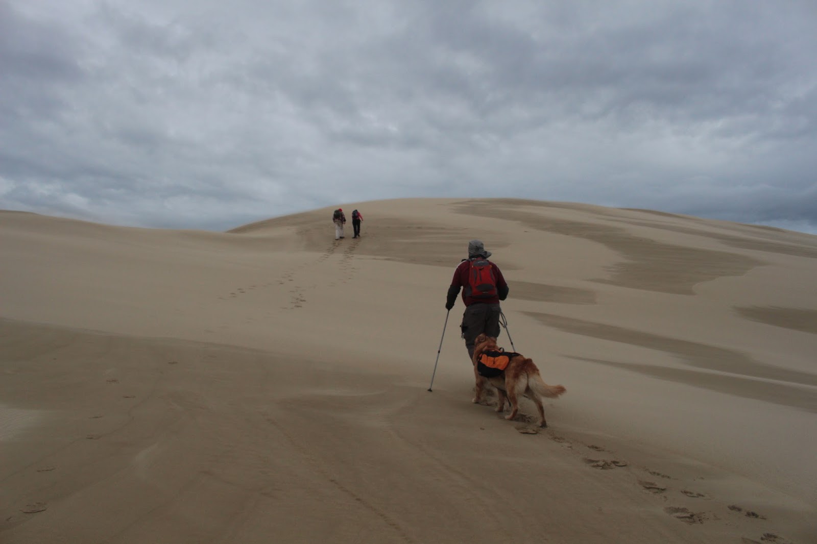
Missy follows our hike leader
Despite the lack of actual trails in the dunes, there are several routes we regularly use without being limited to any one standard route in particular. The choice of route depends on the whim and imagination of the hike leader. Having said that though, we unimaginatively took the one route we do most of the time. Today's hiking choice was to walk straight over the dunes and take the forested trail to the beach, walk south on the beach for a couple of miles to Tenmile Creek, bushwhack (one of my favorite words) through the dense forest growing behind the beach foredunes, skirt the edge of Tenmile Creek for a bit, and then close the triangular loop by way an overland hike across the dunes. Dunes, forest, beach, large creek, marsh, beachgrass, large creek (again), and even more dunes...we would be partaking of all the toppings (including anchovies) on the menu for this Dellenback Dunes pizza.

The trail tunneled through the deepest and darkest jungle
The trail through the deflation plain forest tunneled through the densely tangled trees in the young forest but at least the trail was dry, something that does not always occur in the swampy environs behind the beach foredunes. Once on the beach, it was a two mile hike to the south until we ran into impassable (without swimming across) Tenmile Creek. On the plus side, the brisk breeze was at our backs, sparing us toil and skin pain caused by wind-driven sand striking handsome faces like so many miniscule paint gun pellets. There is a certain ambiance about hiking next to the roaring surf and some hikers walked barefoot while others searched the beach strand for sand dollars, present company included on the latter count.

Behold the Mighty Tenmile!

At its mouth, Tenmile Creek appears more like a mighty river and not much at all like a creek. Over time, the creek has carved out a sandy flood plain on the beach and when the creek is tame, like on this day, it loops back and forth like a snake in search of prey. Arlie, our canine companion, was only too happy to go for a quick swim in Tenmile Creek, serpent analogy notwithstanding.

The flock follows the alpha sheep
After a creekside lunch on some large driftwood logs, we regrouped and cut across a large marsh that again, was fairly dry. Boots were most appreciative of the fact that there was no standing water in the marsh, the lack of swampy boot-filling liquid being a a dry clue that it must be early summer or something like that. On the far side of the marsh was a stunted forest comprised of beachgrass and small scratchy trees that we had to find a way to get through. Because there is no prescribed trail or route through this area, we just followed John in single-file formation like the mindless sheep we are. At least we weren't following like suicidal lemmings.

Tenmile Creek flows through the dunes
We rejoined with Tenmile Creek after crossing the forest, the creek visually at odds with the sere and austere looking dunescape on the north side of the creek. The terrain was rather hummocky and covered with beachgrass. Beachgrass can best be described as "plants with sword points" and since I was walking in shorts, I was very much aware of the pointy ends of the grass blades counting coup on my calves as we hiked through the hummocks, still in our single-file sheep formation. 

Hi ho, it's across the sands we go
All good and painful hikes through beachgrass come to an end though, and our legs and perseverance carried us out of the leg-poking hummocks and back into the much kinder and gentler sand dunes. There are no formal trails across the dunes but navigation is made simple by orientation to a prominent tree island. All you have to do is hike across the dunes, aiming for the west side of the tree island, and then tediously slog up to the crest of the "Great Dune" and voila, nobody gets lost that way. It's always a good thing to finish with the same amount of hikers (and dogs) that started the hike.

Look out for sandworms!
The landscape of this last leg of the triangular route was alien looking, like something out of a science fiction novel (Interesting factoid: Frank Herbert wrote "Dune" after being inspired by a visit to the Oregon Dunes). Apart from a few beachgrass clumps, low mats of lupine, and isolated patches of beach strawberry, pretty much nothing else grows out here. Nothing to see but a train of hikers walking on sand while surrounded by sandy alps rising above on all sides. We sort of looked like a thin army of ants mindlessly marching back to the colony. At least we were no longer in sheep or lemming formation!

Oasis in the dunes
The day had warmed up considerably yet that chill wind was still blowing across the sandy expanse, so it was kind of hard to make up our minds whether to keep light jackets on or hike in shirt sleeves. Depending on the choice, you either were baking hot or uncomfortably chill. Most of us opted for the shirt sleeve look because the heat was more taxing than the chill. 

Abstract art by Michealange-a-Blow
The wind had created what I euphemistically refer to as "sand art" which consists of abstract patterns of stripes, splotches, and striations all left by that famous artist Vincent van Wind. What, you wanted Leonardo di Breezy? It was easy to figure out how the stripes were painted upon the sand: they had been created by winds blowing in the same direction but at differing instances. Some round whorls in the middle of the stripes, kind of resembling Jupiter's red spot, were harder to deduce how they were created. Tornadoes, maybe? Coriolis effect? Witchcraft?

We leave but the beachgrass remains
The hike ended with the quick walk back through the blooming rhododendrons, and we were happy to have hiked here on a gorgeous summer day instead of through some of the travails enumerated at the start of this blog. Hiking in nice weather was markedly different from some of my other hikes here and like I said, it's never the same.

Sand dollar, not quite in mint condition
For more photos of this hike, please visit the Flickr album.


Saturday, May 20, 2017

Dellenback Dunes

The Oregon Dunes National Recreation Area is not one single area, but actually a patchwork collection of many sand-filled areas. Of all the dune areas set aside for hikers, John Dellenback Dunes is the largest of them all. I don't have any actual square acreage data to throw out, but based on my non-empirical impression, the Dellenback Dunes are huge. Recently, the Friends of the Umpqua were going to play, frolic, and generally caper about in Oregon's largest sandbox, so Daweson and I got up early to join the club on what promised to be a sunny day at the coast.

Perfect weather for hiking!
So much for the forecasted sunny day! It was overcast at the trailhead and would remain so for the entire day, but no complaining will be tolerated, for the temperature was cool and perfect for hiking. Even though there was cloud cover overhead, enough UV rays leaked through to cause mild sunburns on some of my more sun-challenged friends.

Uphill in sand, so much fun!
After a short walk from the trailhead on a sandy track through a coastal forest, we headed uphill in soft sand to attain the crest of the "Great Dune". Once atop the dune, the sand was firm and hard-packed (just like me!), making the hiking easy and enjoyable. Sand stretched out in all directions and wind had adorned the sands with patterned artwork.

Beaach lupine
The large dune we were walking on pointed like an abrasive dagger aiming into the sandy heart of Dellenback Dunes, the dune terminating at a prominent tree island that keeps observant  hikers oriented in all the featureless sand. Just before the tree island, we dropped off the tall dune and  set off across a sandy plain, heading south toward Tenmile Creek.

Ponds dotted the dunescape
As of today (May 30th) the Forest Service still has a flood damage alert posted for the Oregon Dunes area. Apparently the ample rain this year has raised havoc with campgrounds, trails, and roads (we ran into some of the flood damage on our Tahkenitch Dunes hike earlier this year). Dellenback Dunes was apparently spared from the watery rampage but there were still a number of leftover ponds collecting in the dune dimples, like so many oases. It seemed like there were more ponds than usual and the usual ponds were fuller than they'd normally be. Of course, our two youngest hikers (Daweson, age 14; and Emma, age 6) just had to sink in the quicksand that typically forms at the edge of the ponds.

Tenmile Creek looks more like a river
Tenmile Creek was wide and deep and looked more like a river as it cut through the dunes. We bushwhacked along the snaking creek/river, eventually trading open sand for thin forest and beach grass. Since I was the only hiker clad in shorts, I quickly became more aware than most that the tips of beachgrass blades are sharp and pointy. When Tenmile Creek made a pronounced turn to the south, the vegetation became too thick to bushwhack comfortably through. In the interest of scratch-free hiking, we bid adieu to the creek and took a more direct route to the beach.
A marsh just begs to be waded across


Despite the forested aspect of our route, we were basically navigating across a series of marshes so  it figures there'd be at least one large marsh in the way. The water was probably knee deep or better and Daweson and I were just about ready to gleefully splash our way across. However, our allergic-to-wet-feet comrades found it fairly easy to walk along the edge to get around the marsh and sadly, our boots remained as sere as a desert as we followed the dry-footers.

It's a bird, a plane, no...it's Super Daweson
Just beyond the marsh was the delta area of Tenmile Creek. The creek obviously changes course with great regularity, frequently shifting its track through the sand, as evidenced by a stagnant bay that formed where the large creek had been particularly indecisive about its route to the sea. Daweson demonstrated his long-jumping prowess by leaping across a tributary creek.

Yes

No
Speaking of showing off skills, Daweson further entertained the crowd by performing some flips, sticking the landing each time. I'd claim that I taught him that but the difference between my flips and his, is that my flips are not done on purpose. Rachel averred that she too, had tumbling skills and began a "graceful" run into an awkward leap in the air that culminated with an emphatic thud in the sand, much to the amusement of all onlookers. She might have jumped as high as six inches but without a ruler, it was hard to tell.

We're so sorry, Mother Kildeer
After a short visit to the tidal flats (it was low tide) and beach, we turned around and headed back. As we skirted a marsh, a kildeer was shrieking in the brackish water, dragging an injured wing behind her. The wing was not really injured, though: kildeer engage in deception in order to protect their young when nesting. Kildeer eggs are speckled and very hard to see, and lie unprotected on the open ground. We did find the nest but not before a hiking boot had disturbed it. It was really quite sad to listen to her anguish as we hiked past, all we can do is say "we are so very sorry, please forgive us for our trespass."

This sums up the hike on the return leg
On the return leg, the two youngsters shed their shoes and slid, rolled, somersaulted, and leaped in the sandy dunes. Progress was slow but it was entertaining. All that energy expended resulted in sleeping passengers on the drive home but at least nobody asked me "Are we there yet?"


Gaoying is dwarfed by the sandy expamse
Because of all the rainfall, it's been prognosticated to be a bad year for ticks. Well, to be more concise, it is going to be a great year for ticks, and not so great a year for hikers. Continuing a recent trend, John kept plucking them off his pant legs on the hike and on the way home, he dispatched no less than eight of the bloodsucking parasites. One tick burrowed into Daweson's shoulder and judging by the excited Chinese emanating from the back seat, Gaoying also found a few crawling on her and Emma. Also continuing a recent trend, not one tick was found on your merry blogster. Not sure why that is, but I'm going to keep eating those habanero chiles. 

Whee!
For more pictures of this hike, please visit the Flickr album.


Saturday, December 5, 2015

Hall Lake

The rain was just pouring sheets of water early in the morning. Just the kind of morning that causes all good hikers to stow their boots back on the basement shelf and call the hike off. I woke up and readily admitted to Dollie that I really didn't feel like going hiking in the wet and cold weather. But I just knew I'd appear at the library parking lot and three hardcore hikers (actually, I used the term "morons") would show up and I'd have to take them out on the dunes in the crappy weather. And sure enough, waiting for me at the meeting spot lot was Kevin (accompanied by dog Wish) and John, with Rachel later showing up at the trailhead. Yup, three hikers and I called it.

On Planet Arrakis
As it turned out, the weather was not all that bad on the coast. The day was overcast, the temperature cool but not cold, and the wind blustery but about 40 m.p.h below hurricane strength. That would change though, as a nasty storm system was supposed to hit late afternoon so the plan was to keep the hike relatively short and make the great escape back to Roseburg in semi-safe driving conditions.


Must..kill...hiking leader
We had all been on Dellenback Dunes many times before, making the unique challenge posed by Dellenback to keep the dunes interesting for erstwhile jaded hikers. One way to ward off hiking ennui is to vary the route. None of my hiking comrades had ever been to Hall Lake before so a challenging hike to the picturesque lake was just the ticket. Upon entry into the expansive dunes an immediate hard right turn was the move that took three-quarters of our group onto a new and different Dellenback Dunes experience. The hard right turn also sent our little band of merry hikers painfully trudging in soft sand up the tallest mountain of sand within several miles.


More ups and downs in our future
This hike would be less about the mileage and more about walking up tall mountains of sand. Once atop the tall first dune, the view of the sandy expanse of Dellenback Dunes was much appreciated by hikers sporting burning leg muscles after less than 0.5 miles of hiking. The ocean was visible under the dark clouds and off in the distance, Arago Peak rose above Cape Arago. Unfortunately, eminently visible to the north was a successive series of sand alps paralleling the tall sand pile we were currently standing on. Ever the cruel hike leader, I pointed out that we would be hiking up and over each tall dune in due time. I get pretty brave when I'm leading just three hikers. 

Grave marker
Down we go and up we went to the top of the second dune, dotted with hummocks of beach grass. The second dune is pretty cool because there is a ghost forest on top. At some point, a thriving knot of trees grew here but were eventually overwhelmed by the marching sands. All that is left of the forest is a tree cemetery comprised of lifeless snags.

Let the skin exfoliation begin!
The third and fourth dunes were not all that tough to climb up, thanks to the elevation gained climbing the second dune, they were each summarily polished off in short order. However, the fifth dune was a rather imposing wall of sand that was hard work to get to the top of. It was two steps up and one slide down in the soft sand as the wind began to increase in velocity. But hiking stubbornness won out in the end and four persevering hikers and one mindlessly happy dog staggered to the top of the fifth dune.

We're number 5!
We had been photographically commemorating our dune climbs by holding up fingers denoting the cardinal order of the dunes. That is, we held up two fingers for the second dune, three for the third dune, etc. However, on the fifth dune, Rachel was about four fingers short of five, maybe that is how they mark five in England, I don't know. But the good news was that the fifth dune overlooked Hall Lake.

Hall Lake
Hall Lake sits in a bowl where forest and dune meet, the view of the lake from the dune overlook is impressive. The dark waters invited a closer look-see and accordingly we sat down at the water's edge, grateful to get out of the wind. Lunch was eaten there as tree tops swayed in the boisterous breeze.


Whee!
Because the wind was picking up in advance of the coming storm, an impromptu decision was made to cut the hike short and circle back to the trailhead. So back up to the large dune we went and we were immediately sandblasted by the wind driving fine particulate matter over the dune crest. And to think, people pay thousands of dollars for skin exfoliation and dermabrasion treatments! Walking on top of the dune crest, we were being flayed alive by wind and sand, but at least we no longer had acne. The sand was whipping without mercy at dog level but Wish didn't seem to mind. The route lead downwards, dropping down towards the flat part of the dunes bordering the forest growing behind the beach foredunes. 

Wish takes his human for a walk
From there, it was a series of mild ups and downs before a sandy draw led to the exit point off of the dunes. Later that night, I checked the weather report and 30 foot ocean swells, driven by strong winds, were marching up the Umpqua River at Winchester Bay. Absolutely made the right call in leaving early and we were able to enjoy a nice hike unlike some of our namby-pamby hiking buddies who stayed at home. Plus, we went home with clean and fresh faces, thanks to the wind-supplied skin spa treatments.

Blurred lines
For more pictures of this hike, please visit the Flickr album.


Saturday, November 9, 2013

Tenmile Creek/Dellenback Dunes

The coast has been calling me lately, with possible hiking destinations ping-ponging randomly in my head like lottery balls bouncing around before they make somebody other than me quite wealthy. At random and for no apparent reason, the idea of hiking along Tenmile Creek in Dellenback Dunes popped out of the lottery machine that is my brain, leaving all the other destinations percolating in my skull waiting for the next draw at some future date.

Ideas emerge from my brain
Dellenback Dunes is one of my favorite little playgrounds on the coast what with plenty of square miles of scenic sand dunes set aside for the hiking crowd. However, I've been there a couple of times this year already and the hiking club has a planned hike there coming up. Favorite place or not, it needs some changing up to keep things interesting and that's where Tenmile Creek came in.

Sand, everywhere I look


Tenmile Creek runs between many-armed Tenmile Lake and the ocean but not before wandering along the southern edge of Dellenback Dunes. A nice hike can be had by taking the dunes trail to the beach and going south to the creek's delta. A tough bushwhack through the wilds to the dunes then completes the standard loop. Been there, done that, yawn. So, this time would be a brand new exploration of the expansive dunes.

The hinterlands beckon

When I arrived at the trailhead, a contingent of hikers from the Obsidians out of Eugene were also lacing up their boots. We left at the same time but I quickly fell behind as the forest floor was sprouting a varied and prodigious amount of mushrooms. Darn camera slows me down every time! After the mycological photo shoot, I continued on to where the trail spits hikers out at the base of the "Great Dune". A hiker-churned track led straight up the massive sand pile but this time, I worked my way around the bottom and headed due south away from the standard route.

The world is not flat

A large expanse of sand stretched ahead with a tree-covered hill in the distance marking the opposite bank of Tenmile Creek. The sands were pristine with only critter tracks sullying the perfect surface.  It was easy to imagine that I was the first human to set foot in the area. Besides being perfectly smooth, the route ahead looked sort of level. After a  mile of walking through the "level" sand, the point was made that looks can be so deceiving as the sands were as level as say, the Himalayas. Actually, I am exaggerating as I am sadly prone to do, the sands were relatively level but there were a few moments going up and down dune faces.


Pastoral scene, sort of


A wooded canyon marked the edge of the Dellenback Dunes with Tenmile Creek hidden below in all the vegetation. After several miles of climbing up and down dune versions of Mt. Everest with the occasional bushwhack mixed in, the coffee colored water of Tenmile Creek finally came into view as the creek snaked its way through the dunes.


Happy place with no OHV'ers

And now for a bit of rectitudinous ranting: The other side of Tenmile Creek is set aside for the OHV and dune buggy crowd and I could hear the whine of the motors as I walked. There is no reason that they have to cross Tenmile Creek and sully the Dellenback Dunes but there they were, tire tracks all over the pristine sands. There were even tracks upon the "Great Dune" which is well beyond the pale in what could be conceivably construed as an incidental incursion. I know there are many OHV'ers that follow the rules but there is an element that doesn't give a damn and they suck. End of rant.

Tenmile Creek
At the two mile mark, I was able to follow the creek without having to deal with dense forest. Periodically, flocks of ducks fled the scary hiker, taking flight in quacking panic. There had been what I thought were dog tracks all over the sands but since there were no human prints nearby, I'm not sure what animal runs all over the dunes when we are not looking. There were occasional piles of bear poop in the grasses, but the prints were too small for bear.

This sort of reminds me of my bike crash last year


The creek horseshoed its way south and it would zigzag through the dunes before reaching the sea. Easy for the creek to do but it was getting harder and harder for a certain hiker to follow the creek. Random hummocks of beachgrass and dunes caused tedious sand climbing while a dense brushy growth deterred easy exploration. Because I was in a good mood and preferred to remain that way, a retreat back to the dunes was effected.

Hikers go in but never come out
In the middle of the Dellenback Dunes, there is a large and notable "tree island" that serves as an effective navigation tool in the trailless dunes. Accordingly, I headed straight towards the tree island, skirting the edge of the deflation plain forest providing a formidible obstacle between the dunes and the beach. However, there is a trail cut through the forest that allowed for a quick beach visit.

On the boardwalk
The trail here has seen some love, what with sturdily constructed boardwalks delivering dry-footed hikers to the beach when all this forest is a big fat marsh during rainy season. It was slow going, not because of the dense growth encroaching the trail but because of all the mushrooms that entertained the camera all over again. It was not time to tarry at the beach because it felt and looked like rain was coming, a cloudy mist limited views to several miles only.

Dunes as far as the eye can see (but I wear glasses)


The rain held off thankfully on the return as I slogged up and down the formidable "Great Dune" which pointed directly to the trailhead. There were other hikers on the dunes and I could see the Obsidians about a mile ahead of me. A class of teenagers were sliding down the dunes with all the boisterousness of youth while their dog appreciated a behind-the-ear scratch from yours truly. All in all, a nice way to spend a Saturday and I'm dune sated, for the time being.

Get your red-hot mushrooms right here!
For more pictures of the hike, please visit the Flickr album.


Create Routes or find more routes in Reedsport from millions at MapMyHike