Showing posts with label Coquille River. Show all posts

Wednesday, February 17, 2021

Cut Creek/Bullards Beach Loop


During my usual wintertime pastime of browsing brochures, guidebooks, and websites, I came across a horse-trail map of Bullards Beach State Park. If I began at the Coquille River Lighthouse, I could cobble together a seven to eight mile route through the coastal woods and dunes lurking behind the beach. The allure of this route was that I had never been on the Cut Creek Trail, Northern Loop, and Tsunami Trail before, so all these routes were already pre-permeated with the alluring scent of new trail. Best of all, the terrain was fairly flat for the hernia-impaired and whatever could go wrong?

New camera took a picture of an old rock

Heh heh, a lot apparently, but more on that in a bit. First off, I was really excited about this hike because not only was this a brand new trail for me, but it was both a new trail AND a new camera! I had been having technical problems with my old camera so I ordered my accountant (to whom I'm married) to drop everything immediately and buy me a new camera, stat! That didn't work too well and I had to rephrase and resubmit so it sounded more like a politely worded request, plus I had to actually ask for permission, saying "please" and "thank you" and all that stupid polite stuff. But, after four days of impatient waiting, the camera arrived and it was now time to go play and hike. I think I was so overjoyed that I nearly ran across the dunes and capered through the woods like some of my uninhibited canine friends, hernia notwithstanding.

The mighty Coquille River

At any rate, the hike began near Bullards Beach Campground and I followed the paved trail overlooking the wide Coquille River to the Cut Creek Trailhead. Along the trail, Scotch broom heralded the coming hay fever season with a few desultory but vibrantly-colored yellow flowers. The paved pathway morphed into a soft brown trail comprised of decomposing pine needles flanked by a green coastal jungle and my new camera was immediately put to work.

Yes, this really is the trail

The Cut Creek Trail is primarily a horse trail and accordingly, begins at Bullards Beach Horse Camp. Upon entering the woods right at the start, I had to step around a puddle of water on the trail. The puddle was only an inch or two deep and I could nearly step across it with one manly stride. But that was too good to last. After the first puddle came another, and another, and another, etc. Each puddle was wider and deeper than the preceding puddle. It was kind of like a computer game in that you could brag "Hey, I made it to Puddle Level 14 today!" 

A knee-deep section of trail with a nice reflection

I'm not sure who Jack was but there is a Red Jack Trail and a Black Jack Trail that lead away from Cut Creek Trail to the beach. Both trails are about a quarter-mile long and hiking on either trail was eschewed in favor of the dubious hiking glory that awaited me on several miles of water-covered Cut Creek Trail. The surrounding terrain was heavily wooded and the thick growth made it nigh impossible to bushwhack around these puddles that now bordered on the size of small lakes. To make it worse, years of usage by the horse-riding crowd had turned the trail into an earthen trough and the puddles, just like teenagers the world over, now had a lot of lip. At some point, water began pouring into my erstwhile waterproof boots from above the ankles, making feet wet and cold. My boots were still mad at me over the Threemile Lake expedition and soon became pretty warm with justified ire. However, the icy coldness of the water kept any sweltering of feet to a minimum, but I got the point.

Trail shot (kidding!)

Suddenly, the path exited the woods and traversed a sandy track that was awesomely dry. Heh heh, that was just a joke played on me by trail-makers because the deep puddles soon resumed even if the dense woods did not. This was open marsh and beachgrass country and I found myself merrily splashing past a series of lakes and ponds that fortunately, were not part of the trail. I ran into several people exploring the dunes on horseback and while they seemed nice and all, I couldn't help but notice their steeds wading in water that nearly came up to their bellies, realizing that they were walking on the trail waiting for me in my immediate future. But after steeling my resolve and hoisting the new camera high, I bravely waded across while the riders, who had stopped to watch, applauded either my bravery or foolishness.

Pictures you take when standing in the surf

Well, after nearly three miles, it was nice to get out of all the standing water and on to the relatively dry confines of Bullards Beach. I had given up on the rest of the Northern Loop which, at a trail junction, appeared to have even more water on it than the Cut Creek Trail. Anyway, my loop route would be closed by a less taxing return on Bullards Beach. As I headed south towards the Coquille River, the day gradually changed from sunny to cloudy, and the surf transitioned to high tide. Normally, I'd run from the incoming waves but what the heck, my boots and the feet contained within were already soaking wet so what would be the point. I stayed put, letting the surf wash around my ankles while I photographed the scene. 

The North Loop was even more waterlogged!

So, to summarize, this was one wet-footed endeavor whether on beach or through woods. Sounds like a great hike to me, and don't listen to my boots! For more photos of this hike, please visit the Flickr album.

Saturday, December 5, 2020

Coquille River


Didn't see that coming! At the end of my hike in the Bullards Beach State Park area, there was parked a van covered with all kinds of decals for windsurfing gear and paraphernalia. The striking combo of white van and dramatic background of dark and foreboding clouds triggered my inner photographer. The rear doors of the van were open so I casually approached the vehicle with the benign intent of politely asking the occupant for permission to take a photo. Yikes! The van was solely occupied by a pair of rabid dogs (wolfhounds from Hades, even!) that let me know vociferously and with much rabidity that my presence anywhere near the vehicle was most definitely not canine approved. I staggered backward in surprise and shock, but really, that was just the last travail on a hike that did present several other trials and tribulations. Also, it was the only travail that involved snarling and sharp teeth but then again, I wasn't hiking with my wife.

The lighthouse presides over the mouth of the Coauille River

There is no official trail along the Coquille River but one can follow a series of use paths tamped out by curious rivergoers or simply follow the wide river when the paths peter out. After shooting some photos of historical Coquille River Lighthouse, I began walking upstream on the aforementioned paths. The sun was out and the river sparkled in the morning light while the town of Bandon sprawled peaceful and quiet on the other side of the river.

Remnants of a bygone era

Bandon's been around since the 1850's or so and much of its history is that of port and harbor on the Coquille River. Once the lighthouse environs were hiked away from, I observed vestiges of that former history in the form of pilings and wooden pillars where once stood viable piers, wharves, and maybe a crab shack of ill repute or two. Notably, the tide was visibly surging upstream through the decaying pilings. Good thing I'd be well off the river banks by the time the tide actually crested.

Raccoons patrol the sandy banks of the Coquille

For the most part, hiking along the river was fairly easy. The tide was rising but not yet fully risen, the ground was firm, and the weather bright and sunny. And yes, you guessed it, that was all too good to last. Bad weather was in the afternoon forecast and by mid-morning, a dark cloud bank scudded over and that was it for the nice sunny day. Additionally, the hiking became a bit tedious when a water-filled slough entered the river at right angles to my route. Time for some bushwhacking!

One of a whole slew of sloughs

It was just a little slough, yet it was too wide to jump over and too deep to wade across, so I followed its banks inland until the watery channel petered out. Part of following the channel involved beating my way through dense patches of Scotch broom, scratchy low-growing conifers, and thorny bushes of gorse. Eventually a pile of logs provided the means of getting across the channel and I made my way back to the river, which acted like nothing out of the ordinary had ever happened at all.

"Make speed in the gathering storm..."
(Paul Kelly)

That was just the beginning. The sloughs came with increasing frequency with each one being wider and deeper which was really annoying because ahead, I could clearly see Bullards Beach Campground, my intended destination. The campground was less than a mile away but it might as well have been located on Jupiter's twelfth moon, thanks to the intervening sloughs. As I negotiated my way around each water channel, the daylight dimmed considerably thanks to increasingly dramatic clouds emoting over the coast. The wind picked up and obviously, rain would be happening at some point in the afternoon.

A waterfowl flees the scary hiker
trying to cross the water channel

What was also increasingly obvious was that the water channels would not let me get to the campground via the Coquille River. The largest slough yet pushed me well to the west and nearly all the way to the beach foredunes, which was almost where I had started this hike from. Giving up on the river-walk thing in entirety, I veered north through some scrubby hinterlands, eventually crossing the Bullards Beach roadway. From there, I grabbed the paved trail leading to the campground, the path providing nice overlooks of the wide river. However, the weather was trending toward downright belligerence, so it was deemed prudent to start heading back to the lighthouse before things got too miserable.

The wind moves sand at high velocity

After taking a sandy footpath that led to the beach, I commenced hiking south into the wind. Airborne rivers of fine particulate matter flowed just a few inches above the sand and my booted and pantsed (panted?) ankles and shins didn't care. My pace was not all that quick because the foreboding clouds were wildly photogenic in a moody and stormy way; naturally, lots of photography ensued. High tide was surging and I had to run from waves every now and then. The constant wind and surf churned up small clouds of seafoam that were spirited away by the breeze to points unknown. Hiking on the beach in stormy weather is wild, yet totally exhilarating, and I enjoyed every tempestuous minute of it. 

This van guarded by devil dogs


After an adrenaline-fueled backpedal away from that van full of snarls and growls, I heard a chuckle from in back of me. It was the wetsuited owner of the van and devil dogs, quite amused by my discomfiture. But, he did let me take my photo and that capped off a great hike and photography combo.

A storm cometh. It has been foretold.

For more photos of this hike, please visit the Flickr album. 

Sunday, March 1, 2020

Bandon Beach

About a half mile into our hike, Daweson just had to stop and do some totally senseless and inane back flips with all the joy and enthusiasm of youth. His ebullience was contagious and there'd be no sadness or wallowing in pity for me this day, I knew there was a reason I brought him along!


Sun, land, and sky
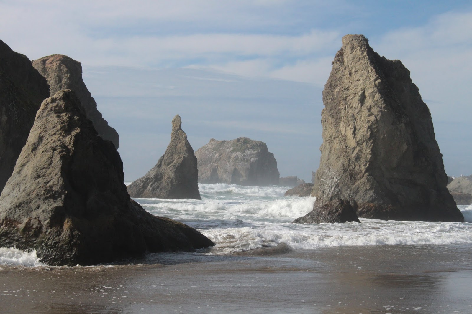
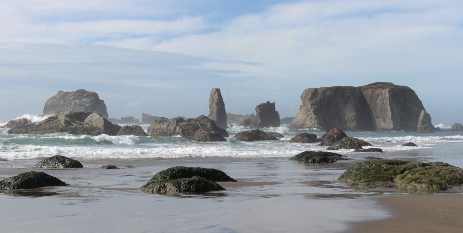
Bandon Beach is awesome, there's no other way to put it. The scenery is world-class and hiking along the beach with its miles of rocky islands and points is one of my favorite things to do. On the day of our hike, the weather was superb, making an already great hike even better. The day could never quite make up its mind whether it was cloudy or sunny, but there was more than enough blue sky to gladden hearts and spirits. While semi-sunny, the temps were cool, just perfect for hiking, and our only small complaint was a pretty good breeze blowing in our faces on the walk back to the car.

Islands, islands, and more islands
Another plus on this day was that the tide was out for most of our hike, making all the islands accessible to curious hikers and tidepoolers alike. Although to be technical about it, should an island be referred to as an island when it really isn't an island during low tide? Does it have to be surrounded by water on all sides 24 hours a day, 7 days a week, 365 days a year (366 in leap year) to qualify as an island? Just asking for a friend. At any rate it was cool to be able to walk down among the islands stranded high and dry by the retreating tide.

A perfect day for hiking
As previously stated, the sun was out and the sky was blue with that crystalline clarity that only occurs on a crisp winter day. There were just enough puffy white clouds to keep the day on the sunny side while making for some nice photography as they floated above the beach. A brisk breeze kept an airborne armada of colorful kites afloat as we started. Because of the low tide, there was plenty of beach to walk on and the wet sand reflected the clouds and sun as if it were a low-resolution reflecting pond.

Before
After


Daweson jumped on a low rock at surf line and did his best one-footed Grandpa pose and I obliged by whipping out the camera. However, through the viewfinder, I could see the wave rolling in behind him and so was able to click off a photo sequence of his being overrun by the surf, complete with comically surprised expression on his face and all. There's two lessons here: never turn your back on the beach and never trust your grandfather. At any rate, his new and previously dry boots had just been properly initiated.

Elephant Island is the largest of the bunch
The last several times I've been at Coquille Point, we've had to scramble over the rocky point due to a high surf. Not today though, we were able to beach stroll around the point, and take in an up-close view of the maze of islands at the point with surging waves snaking their way in between. Elephant Rock has a large ocean-carved tunnel through it and we stopped to watch the ocean flush out the island's lower digestive tract, so to speak.

Oceal: Look at me!
Princess Elwauna: Neverrrr...!
From the point, we enjoyed a leisurely walk along the arcing bay of Bandon Beach, sited between Points Coquille and Grave. The morning sun reflected on a shimmering sea that glittered more than stage lights on a 70's hair band. The islands here resemble all sorts of things from old boots to to lobster claws to my dog leaning back to get her neck scratched. The star of the phantasmagorical collection of islands and rocks is Face Rock, the face thereof belonging to the native princess Elwauna of legend, forever forced to look away from the ocean.

Crooked Creek sparkles
Daweson's boots were just not going to dry out this day as we had to splash across Johnson Creek and later on, Crooked Creek. Both creeks are fairly sizable and although they both fan out across the beach, the main channels of each still remain an ankle-wetter. Once across Johnson Creek though, the islands thinned out a bit with the last major one, Haystack Rock, looming in the distance.

Haystock Rock afloat in a silver sea
After a mile or so on a beach littered with crab parts and other gull lunch leavings, we walked by Haystack Rock, splashed across Crooked Creek, and touched the last rock on the beach to mark our turnaround point. And back the way we had come we went. And yikes, we were catching a full face's worth of cold breeze!

Wind painting on beach sand
We hadn't really noticed the breeze on the walk out because the wind was at our backs which had been protected by our day packs. The wind was really noticeable when certain hikers who like to photograph, got down on one knee or lower; then the windblown fast-moving fine grains of sand applied a stinging dermabrasion treatment to incredibly handsome faces. But the sand on the beach was the Sistine Chapel to the wind's Michelangelo and the artwork of stripes, swirls, and tie-dye in all shades of tan was beautiful enough to justify the skin pain from the near-ground photography. I just hope everybody appreciates my facial skin's bravery and sacrifice.

Daweson braves the wind inside the cave

By this time, the tide was lazily incoming but would be still relatively low for the remainder of the hike. It did become high enough though, to force us to use the scramble route over Coquille Point. Grave Point presented no such problem, although we did take the cave tunnel through the point just for fun. The narrow passageway funneled the wind into gale force proportions as we staggered our way through.

Just gotta ruin my photo, don't you?

When we arrived at the jetty shepherding the wide Coquille River out to sea, a lone surf fisherman was plying his solitary avocation. The rock Daweson had been standing on when the wave had overrun his little perch was no longer visible, being covered up by the incoming tide. Daweson politely declined my request to reenact the morning photo. He seemed tired at the end of this hike but when I told him I'd buy him a jalapeño burger, I daresay he had enough youthful energy left that he nearly did another flip for joy. Such is the enthusiasm of the young, and that's why I brought him along.

More beach abstract art
For more photos of this hike, please visit the Flickr album.


Saturday, January 12, 2019

Bandon Beach 1/2019

I really should know better. It's not like this hasn't happened before. Oh wait...that was yesterday's blog about being attacked by waves near Floras Lake. On this day, the same old high surf warning was still in effect, so heeding the experience from the day prior, I led a small group scrambling over the slippery rocks at the foot of Grave Point because the incoming tide and high surf had taken our beach away. Like I said, I really should know better...but I don't.

Table Rock sets the table for this hike
The day was briskly cool as our group set out on the beach just south of the Coquille River jetty. Sun, mist, and clouds competed photogenically for sky supremacy with the sun mostly prevailing, but not always. Despite the sunlight, the day was still chill and most of us hiked with some jacket or coat on for warmth. The tide was out, but because of the high surf activity, low tide was not all that low. However, we did have plenty of beach to safely walk on while the sea seethed from a safe distance away. What a difference a day and a whole different beach can make!

Some of that amazing Bandon scenery
The high surf first affected us at Coquille Point. Normally, one can just walk around the point on the beach during low tide but on this morn, the ocean was still lapping around the point. However, a well-used short scramble route over the point delivered us to the arcing bay of Bandon Beach. The jumble of rocks and islands always delight and those of us with cameras soon found ourselves straggling behind the speed-walkers who don't care about photography at all.

A furtive peek at Cat and Kittens
Elephant Island has a tunnel boring completely through it and the ocean was busy applying vigorous colonic hydrotherapy to the island, whether the island wanted it or not. Further up the beach was Cat and Kittens, a collection of small islands beyond the waves and an unnamed rock that I euphemistically refer to as "Seal Rock" because it does resemble a seal. At any rate, an entire Noah's Ark of rocks resembling animals were strewn about the beach and surf with Princess Elwauna (mostly known as Face Rock) being the head zookeeper of it all.


Why we hike
Scenery like this is why Bandon is world-famous and why hotels, houses, and condos crowd the clifftops above the beach. It also explains the relative crowds of beach-goers like ourselves out enjoying the sand  and winter sun on a chill morning. Despite the seeming overpopulation, especially when compared to our usual hiking destinations, the scenery commands attention and it is quite easy to ignore the thundering hordes and their abodes. Needless to say, much photography ensued.

Doing the Crooked Creek dance
"Graceful" creek crossing
The recent rains had Crooked Creek full of water as it snaked in serpentine fashion across the sandy beach. Time for boots to get wet although many tried all sorts of leaps and high-steps, some more graceful than others, in a vain attempt to remain dry-footed. Me, I've just learned over the years to simply wade stoically across; it's only water, boys and girls. Still, the interpretive dancelike contortions employed to get across were amusing and much photography ensued, much to the regret of all participants.

High tide moved us up the beach
We turned around at Devils Kitchen, which is where most of the shore and offshore rockery begins to peter out. By the time we had hiked to the Kitchen and lazily consumed lunch, the low tide had become a rising tide. Accordingly, we had less beach for walking on the way back and on more than one occasion, we had to jog away from an incoming wave. On the positive side, the sneaker waves here could not even come close to matching the ferocity of the waves of the day before and thankfully, no hikers were smote on this day. The dryness of our feet were under constant threat, though.

The world's biggest candle
On the return, our group of about 10 hikers or so became strung out and per the natural order of things, I found myself hanging out near the tail end of the pack when a couple of funny things happened. We had hiked, in several instances, on the seaward side of the rocks and sea stacks on the beach when the tide was low. But now, the sea was in the process of overtaking the rocks. That didn't stop Lane from trying to walk around the front anyway and who knew the water was waist deep? Lane didn't but now he did! He had wet trousers and Lane-wet-his-pants jokes as a temporary souvenir of his excursion around the sea side of the rock.

We all should know better
The second point of amusement occurred at Grave Point where the ocean had likewise lapped up against the sheer cliffs of the point. The front (and prudent, too) portion of our hiking group left the beach on a staircase and walked on city streets to bypass the point. But, that's not how I roll! I gauged the situation and decided I could just scramble over the rockpile at the base, warily keeping an eye on the incoming waves wanting to eat me. Several hikers followed me over in blind and trusting faith. Given the situation of the day prior, where I was assaulted by a sneaker wave, you'd think I would know better, but I don't. On the plus side, all hikers got past the point safely and we didn't have to go up a steep flight of stairs either.

The ocean was riled up, to say the least
Once past Coquille Point, it was a sandy beach hike where there was less sand for us to hike on, due to the rising tide. On the seaward side of the rocky Coquille River jetty, the ocean had churned itself into a white frothy bowl of watery anger issues. Large waves rolled up the river, entertaining hikers who had scrambled up to the top of the river jetty at the end of the hike. Occasionally, a wave larger than the rest saw fit to splash us, even though we were on top. Like I said, I really should know better.

Jay tempts the wave gods
For more pictures of this hike, please visit the Flickr album.


Saturday, February 27, 2016

Bandon Beach to New River

Well, this hike got certainly got off to a mysterious start! From the parking lot at Face Rock Viewpoint, we had a nice overlook of the beach below. The sand was adorned with an elaborate crop circle labyrinth and people with long beards (some of whom were men) talked about Ley lines and sacred places. Most onlookers simply admired the artwork and walked the maze. I didn't because I always get lost in those things.

Happy!
It's hard to get lost hiking from Bandon Beach to the New River, though: just keep the ocean on the right and Oregon on the left until a large river blocks the way. Leaving the tie-dye crowd behind at the labyrinth, we headed south past the rocks and islands that make Bandon Beach such a spectacularly scenic place. After splashing across Johnson Creek, Haystack Rock loomed ahead in the misty haze and we pretty much had the Oregon coast all to ourselves at that point.

Not happy!
Speaking of splashing across creeks, Wish and Daisy (our two dog companions) were having the time of their lives and we should all cross creeks as happy as a dog. We wound up wading across creeks 6 times on this hike as we had to cross Johnson, Crooked, and China Creeks two times each. I don't think the 7 of us in our group enjoyed the wading nearly as much as the dogs did.

Sneaker wave just snuck up on us
And now, let us talk about sneaker waves. Sneaker waves are sneaky, alright. They look like normal waves but the difference between a sneaker wave and a regular wave is that a sneaker wave simply keeps on coming. So there we were, walking around a large rock with at least 50 yards of beach to work with when a wave just kept rolling in, and rather quickly too. So we ran to the rock but alas, there was nothing to stand upon. Pinned to the rock wall, we had the endure the indignity of standing knee deep in salty water, although the dogs thought the whole episode more fun than a yard full of cats. Later on in the hike, another wave chased us up the beach where we had to frantically hop on logs to avoid the onrushing water.

The New River
Once we left prominent Haystack Rock behind, it was basically a couple miles of sandy beach walking until we arrived at the mouth of the New River. I had backpacked here last summer and the New River was then all dried up, never quite making it to the ocean. However, on this late winter day it was flowing fast and wide due to all the recent rain. There was one lone hiker on the dunes overlooking the river and it turned out to be our friend Don from the South Coast Striders hiking club.

Not a lot of beach to walk on
We ate lunch next to the New River while some of us did a brief barefoot exploration of Twomile Creek. The return track to Bandon was then all about the high tide and we performed many a sprint to higher ground as the sneaker waves were less sneaky and as brazen as a pack of wild monkeys. We basically had only the driftwood-littered top ten yards of beach to hike in.


Why Bandon Beach is totally awesome
As we neared the rock islands at Bandon Beach, I opted to go around the front of a large rock while everybody else went around the back. It was the same rock involved with the sneaker wave on the way in and you'd think I would learn. I watched the waves and when they retreated, I sprinted around the front, timing my mad dash perfectly. The problem was that I was looking over my shoulder at the waves and did not notice the 6-foot deep puddle in front of me until I plunged waist deep into the cold water. Panicked, because the surf was now coming in, I charged through only to find a subsequent second swimming pool in the beach. Totally soaked from the waist down, I rejoined up with Kevin, who thought the whole episode to be hysterically funny.

High tide was the story on the return leg
By the time we arrived at the trail off the beach, the waves had erased the elaborate labyrinth we had so enjoyed at the start of the hike. It only goes to show that beach art will always be transient and ephemeral in nature. As we prepared to begin the long ride home, Rachel (who resides in nearby Coos Bay) taunted us with "I'll be home in half an hour" To which (retired) Lindsay replied "Yes, but what will you be doing Monday?" Game, set, and match to Lindsay!

Bandon Beach
For more pictures of this hike, please visit the Flickr album.