Recently, I went on yet another hike in the Cascade-Siskiyou National Monument. Am I overdoing it? Will I become jaded about hiking in the Monument? Will the Monument eventually fill me with ennui? Is it possible to get too much of a good thing? I think not in this case, the scenery and greenery are just too beautiful.
 |
| Why we hike |
The object of my hiking affection this time was Hobart Bluff, selected in part because of an earlier hike from Greensprings Summit to Little Hyatt Lake on the Pacific Crest Trail. I remember my comrades asking me what was south of Greensprings Summit and the short answer is Hobart Bluff. The long answer is the border with Mexico. Anyway, this area dries up and goes brown fairly early so I figured I'd better go to the monument one more time while everything is still beautifully green.
 |
| This hike sponsored by Pale Ale |
The weather was great as the sun was out, the sky was gloriously blue and best of all, the temperature was mild and perfect for hiking. From the trailhead, the venerable Pacific Crest Trail climbed gently in a fenced corridor on private property. Once past a couple of gates, the trail would be on public land the rest of the way and thanks to the property owners for allowing the trail to pass through their land.
 |
| Dry meadow on the PCT |
The trail ambled through an odd mix of lush Cascadian conifer forest and open Siskiyou-ish meadows and oak savannas. It can also be an odd mix of mosquitoes and ticks, based on the same vegetative mix but on this day I was lucky enough to not have to deal with either pest. This area is fairly arid when compared to the moister Cascades, here the meadows were already going brown in the rockier stretches of trail. One good thing about meadows is there are no trees to block the view and periodically I caught glimpses of Pilot Rock and Mount Ashland.
 |
| Blue-headed gilia |
Spring was in session, and my hiking pace was relaxed as there were so many wildflowers to take pictures of. Purple balls of ookow were the main culprit but white hyacinth, thimbleberry, columbine, Indian paintbrush, and larkspur all made their floral presence known. I was happily taking photos and just go ahead and call me a flower child.
 |
| Phantom orchid |
After several miles of drying meadows alternating with oak or conifer forest, the trail climbed up a slope that was comprised mostly of old-growth Douglas fir. The trail was well shaded with lush vegetation greening up the forest floor underneath the massive trees. Phantom orchid is a fairly rare plant but here it was sprouting everywhere. Pick a square dekameter of forest floor at random and hundreds of pale white shoots would still issue out of the ground like ghostly wraiths from the underworld. The orchids were a pleasant distraction from one of the few steep stretches of trail.
 |
| A hike with a view |
Shortly after leaving the orchid-infested slope behind, the trail crossed over to the east side of the ridge crest and the forest transitioned to scrubby chaparral and thin stands of scrawny oaks. The views from the open slopes transformed this hike from "pretty darn cool" to "Dude!" (in the like, totally awesome sense of the word). Miles and miles of hills and volcanic cones carpeted by forest lay underneath a blue sky. Nearby Parker Mountain was the most prominent peak as the landscape rolled towards Klamath Falls, but fortunately the town was not visible. I know that may have been an underserved Klamath Falls cheap shot, but then again, I've been there!
 |
| A bee-fly sips from a larkspur |
Periodically, oaks arched over the trail and the mottled shade was most welcome and soothing. Swallowtail butterflies flitted from flower to flower and my camera was quite busy with shady trail, abundant wildflowers, insect life, and expansive views.
 |
| This way to Hobart Bluff |
So far, the route had not been all that strenuous as it rambled along the ridge crest in relatively gentle ups and downs. Hobart Bluff would require some more exertion however, as the trail to the summit charged madly up the bluff, about as subtle as an enraged bull on the other side of the fence from the cow. Stunted and gnarled juniper trees dotted the grassy slopes of the bluff.
 |
| Hobart Lake, from the world's tallest diving board |
 |
| Hobart Mountain (near) and Pilot Rock (far) |
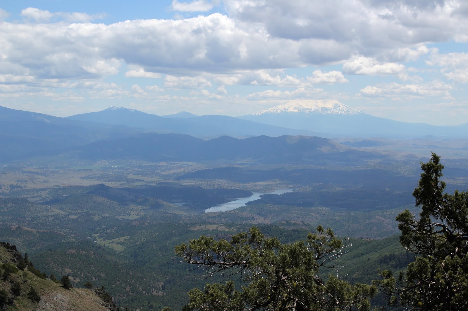
After attaining the actual Hobart Bluff summit, I picked my way down to a rocky point which was the definitive edge of the bluff, one more step and I'd painfully splash into Hobart Lake, about 450 feet below. The 360 degree view from Hobart Bluff was predictably spectacular, especially on such a glorious day. Hobart Mountain is Hobart Bluff's immediate neighbor, its green slopes rising in front of equally green Soda Mountain. In the distance was the squat tower of Pilot Rock, looking somewhat alien in all the forested mountains. Farther away were Mount McLaughlin, Mount Ashland, and the tip of Mount Shasta. However, Bear Creek Valley stole the Hobart Bluff show. Wide and deep, flanked by tall mountains, the valley stretched from Ashland to Medford and I was staring right down the valley's throat like a geologic tonsillologist. Way cool and lunch just tastes better when eaten in the presence of such an awesome vista.
 |
Meadow, set aside as habitat for
the endangered Mardon skipper |
All good things come to an end though, so after a lazy lunch, it was time to get off the butte and head back down the trail. I had entertained a notion of summiting Hobart Mountain's green and grassy slopes so I continued on the Pacific Crest Trail to the foot of the nearby mountain. Upon closer inspection, the green grass was actually a dense head-high thicket of brush and small trees. Wanting to keep my skin reasonably unscratched, I instead continued on to the Soda Mountain Trailhead for some extra mileage. The trailhead was the logical turnaround point, but not before availing myself of the brand new outhouse. Actually, I think if I bushwhack around (next time) the north side of Hobart Mountain, I should be able to make it to the summit.
 |
| "Get that camera out of here!" |
The afternoon cooled off a bit as the sun sank low or maybe it was just my appreciation for shady forests, but it was a pleasant hike back to the car. So, in answer to my question first posed in this blog entry, one more hike in the Cascade-Siskiyou National Monument is not too much of a good thing. However, other trails in other places are also calling to me and I'll save the few remaining monument trails for a later date.
 |
| The PCT alternated between sun and shade |
For more pictures of this hike,
please visit the Flickr album.
 |
| Grassy stretch of trail |