Showing posts with label Whiskey Run Beach. Show all posts

Saturday, February 10, 2018

Bullards Beach to Seven Devils Wayside

That's it, I quit! No more hiking inland! Lately, every time I hike in either the Cascades or the Siskiyous, the weather's been rainy, cold, or all of the above. In contrast, almost every time I've hiked at the coast in the last few months, the weather has been absolutely glorious with spring time sun shining brightly with perfectly mild temps. The latest case in point was a recent hike from the Coquille River to Seven Devils State Recreation Site (which is just a glorified name for "picnic area on Seven Devils Road").

Between the Friends of the Umpqua and the South Coast Striders (a sister hiking club from Coos Bay), we had nearly 20 hikers presenting to arms. By the time we showed at the meet-up point at Seven Devils, the Coos Bayliens had already worked out the intricate machinations of the vehicle shuttle. By way of explanation, the shuttle process was required because this was a one-way beach walk of 8.2 miles with drivers needing a ride back to their vehicles at Bullards Beach after the hike was over. We left a couple of cars at Seven Devils for that express purpose and began hiking from the Coquille River and its attendant lighthouse and river jetty.

This fossil found a fossil
The lighthouse used to be sited on an island in the middle of the river entrance but man in his infinite wisdumb, constructed a rock jetty to shepherd the river safely out to sea. The normal oceanic shoreline currents were interrupted and impeded by the jetty, with the result that backfill soon connected the lighthouse's island to the shore. I think that also as a result of this particular instance of man tampering with nature, is that Bullards Beach is always (within my experience, at least) littered with rocks that make this beach the beachcomber's equivalent of a yard-sale addict with $500 to spend at an estate sale. 

Sanderlings do the wave dance
Well, it didn't take long for me and several other beachcombing like-minded individuals to start walking slower, eyes carefully scanning the ground for beach treasure. Directly related to said activity, my pack soon weighed more that it did when I had started hiking, due to my toting a healthy sampling of clam fossils and petrified wood. My buddy Jay was similarly afflicted and burdened.

Our basic view for 8 miles
Although a cool breeze was a constant and the temps were somewhere in the low 50's, the sun was out and there was no chance of rain. The Oregon coast stretched out in front of us and we could see all the way to Cape Arago. I told Jay we were hiking all the way there because it was  so much fun to hear him cry with dismay.

The tide was out, to put it mildly


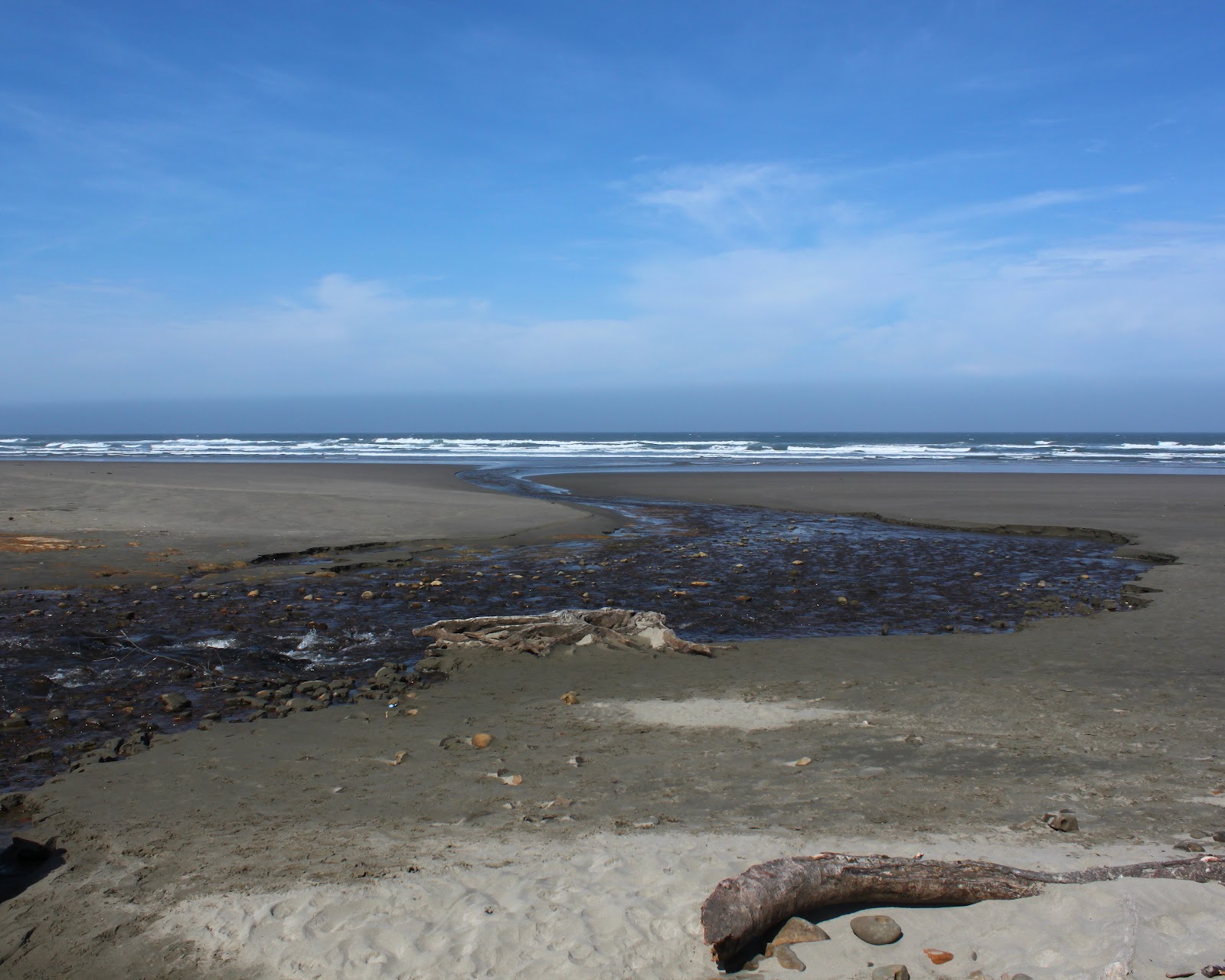
The tide was receding and by the time we reached Cut Creek at the 4 mile mark, we had acres of sand to walk on as the ocean had sullenly withdrawn from all beach proceedings. Tidal flats and sand bars were exposed by the retreating sea, and there was more slow walking due to some more obligatory beachcombing. There was probably like 40 or 50 yards of wet sand that was firm enough to provide a nice hard surface for easy hiking.

Jay ponders how to cross without getting feet wet
The next landmark after Cut Creek was Whiskey Run, a medium sized creek that sinuously S-curved its way to the much larger ocean. A pair of kite surfers were doing their thing in the choppy surf while fisherman were filling up their buckets with perch, enjoying peaceful beachy solitude as they plied their avocation. At the water's edge, flocks of sanderlings comically darted in and out, matching the ebb and flow of the waves.

Tidepool scenery at Fivemile Point
About a mile past Whiskey Run, Fivemile Point seemingly blocked the way. Now, I've hiked around the point a time or two, but always on a receding tide. In each instance, it had been tricky scrambling over the rocks while waves tried to eat me. But ah, at low tide, no such issues at all, it was merely a simple walk around the point.

Exposed shoals at low tide
Well, maybe not all that simple, for the retreating tide had left numerous tide pools that just called for exploration and photography. Jay and I, who were already lagging far behind the main body of power-hikers, soon lagged even further behind but on the other hand, we both have lots of photos of the scenic pools and rocky islands at Fivemile Point. 

Twomile Creek beelines for the sea
Even though it is only a mile further past Fivemile Point, the creek there is called Twomile Creek. Around here, they must use the metric system when naming their landmarks. But Twomile Creek marked our exit point off the beach and the end of this 8.2 mile beach walk. We all really enjoyed this sunny day on the coast, made perhaps even more memorable by comparison to the next day's hike in a swirling snowstorm on the North Umpqua Trail. Seriously, I'm just going to hike at the coast from here on in.

Nice haul!
For more pictures of this hike, please visit the Flickr album.


Monday, July 3, 2017

Fivemile Point

Man, things are really heating up in the Umpqua Valley. It's been hotter than a Chuck Prophet guitar solo at Sam Bond's Garage on a Saturday night. Hotter than my Green Death salsa slathered on homemade tamales. Hotter than me in tight jeans. OK, that last one might be subjective, and not necessarily an opinion held by many. The point is, in early July, summer was beginning to make its oppressive and stultifying presence felt. In hindsight, though, the really hot weather had not arrived, that would be an August experience. Also in hindsight, I probably should not use the word "hindsight" after that remark about my tight jeans.

Not so easy to do what Grandpa does
Anyway, since the valley was heating up, Issiah and I decided to head for the coast in search of cooler environs in which to hike in. And since Luna observed us loading up the Jeep with our hiking boots and backpacks, she whimpered and begged, her beseeching, doggie eyes entreating us to take her along. Powerless to resist her heart-rendering pleas, we opened up the rear deck and she joyfully hopped in.

Issiah wades across Twomile Creek
Well, sometimes you get what you ask for, and then some. At Seven Devils Wayside, near Bandon, a brisk and chilly wind sweeping up the coast had us shivering in no time. Our puny little sweatshirts were no match for the breeze cutting right through the useless fabric, so we walked fast to generate some internal heat.


Whee!
Luna, of course, had no such problem and everybody should hike like Luna. Letting out canine yips of joy, she was running and cavorting on the wide stretch of beach, the wind blowing her ears back as she sprinted to and fro. Twomile Creek fanned out across the beach and since Luna could not decide between splashing in the shallow creek or the roaring surf, she did both. Plus, there was a steady supply of seagulls to chase and scatter into the sky. All life should be like her enjoyment of the beach.

Look Grandpa, I'm floating!
We humans, of course, were somewhat more restrained and decorous, leaning into the wind as we trudged steadily south along Merchant's Beach. A large tree was partially buried in the sand, the dead leaves on its branches testifying to the tree's very recent demise. Dog and boy both enjoyed scrambling in the twiggy limbs and branches.


View south, from Fivemile Point
Like a weightlifting bouncer at a posh nightclub, Fivemile Point blocked the way south to Whiskey Run Beach . At high tide, it is impossible to walk around the point and we were just on the receding side of high tide. No problem for a half-monkey half-boy feral grandson to scramble over the rocky point with the agility and balance of the young. Some problem, but still doable, for an incredibly handsome grandfather using the wisdom and prudence learned from all the bruises, scrapes, and injuries accrued in a lifetime of overestimating the agility and balance of the young. Ah, but for an eager and frisky dog: rock climbing was not in her skill set. Issiah and I guided her gently, placing her feet on the rocks and pushing and pulling her upward. Uncharacteristically, Luna was accepting and restrained during this process, even her little dog brain recognized the danger in doing otherwise.

Where Fivemile Point starts
We didn't go all the way over the point, settling instead for the crest. From a barnacle-encrusted rocky perch, we enjoyed the view south, which consisted of Whiskey Run Beach curving all the way to the Coquille River. To the north was Merchant's Beach with Sacchi Beach beyond. Waves crashed on rocky islands while resting seagulls "painted" them white. Cape Arago and Arago Peak loomed at the end of Sacchi Beach and it looked like the morning overcast was clearing. It still was windy and cold, though.

No Issiah, you can't do what I'm thinking you want to do
So we climbed back down off of Fivemile Point, the two of us helping our less agile canine friend descramble back down to the beach, where she re-engaged in the more familiar and mindless activity of running around just to be running around. On Merchant's Beach, a large needle shaped rock pointed up to the sky and I had to use all my grandfatherly skills to cajole, persuade, and ultimately threaten Issiah not to climb up to the top. 

View north, to Cape Arago
Our plan was to continue north all the way to the terminus of Sacchi Beach but Issiah looked at me and said "my heart's not in it today". Now, Issiah is a hiker's hiker, he's no shirker when it comes to mileage and challenging trails, so when he says he's not into it, that must be honored. To do otherwise, would make hiking a chore instead of a recreational activity. So no problem, we hopped in the car and headed back to Roseburg, where the weather was as warm as a Texas Burrito at the Coquille Valley Produce and Deli.

Rocks, speeding across the sands
For more photos of this hike, please visit the Flickr album.

Saturday, January 19, 2013

Seven Devils Wayside to Bullards Beach

The Friends of the Umpqua Hiking Club had a scheduled hike from Seven Devils Wayside to Fivemile Point several weeks ago. However, it looked like it was going to be a short hike so, naturally, I began to plot a way to jazz it up. I toyed with the idea of putting on a backpack and making a weekend out of walking to Bandon and back but the weather was not all that nice and I really didn't feel like camping in the cold fog. But, hey, I can day hike in cold fog so a shuttle hike was planned for the 9'ish mile beach walk from Seven Devils to Bullards Beach, near Bandon.

If you like the color gray, then this is your hike
Joined by the usual suspects (John, Edwin, and Merle) we bid adieu to our fellow hikers who were heading north while we set off to the south in heavy fog. The weather forecast had called for a sunny day once the fog burned off but as it turned out, we would never see the sun during the hike. Too bad, because the long winter leaves me pale white like one of those blind cave salamanders that scurry away when a flashlight shines upon them.  I could really use some sun.

Fivemile Point rocks!
A short walk to the south brought us to the only obstacle we would encounter on the day: Fivemile Point. The hike leader had admonished us to be careful, citing dangerous sneaker waves from Japan. However, the sneaker waves were so sneaky we never saw them and we enjoyed a wide beach at low tide all day long. There was a greater likelihood of Beyonce not lip-synching at a presidential inauguration than there was of our being swept away by a Japanese sneaker wave.

It's a Richard Hike!
However, the tide had not finished receding when we hit Fivemile Point and we had to scramble over the mollusk encrusted rocks to get around the point. We quickly learned gray rocks were good, black rocks were bad in nature's color coding system for hiking safety. The black on the rocks was seaweed and algae and slipperier than a booger on cold concrete. Sad to say, barnacles were harmed on the crossing of the point but at least we hikers remained hale and hearty.

I don't know, Tiger, my ball just disappeared
Once around the point, miles and miles of empty beach stretched ahead of us although we couldn't see most of it due to the fog and cloud cover. Bandon Dunes, a local golf course, was on top of the shoreline cliffs and it was common for us to find golf balls in the beach debris.  


Cut Creek awaits Edwin
Edwin's going down


On the way to Bullards Beach, there were two large creeks to cross: Whisky Run and Cut Creek. Edwin leaped across Cut Creek and just as I snapped a shot of his landing he toppled over and fell with a thud. Fortunately, that was the only mishap of the day and he was bemused, muddy, but unhurt.

Bullards Beach is a rockhound's delight
About 7 miles into the walk, the sand became stony and we began to encounter other beachgoers searching for agates and other treasure in a sure sign we were nearing Bullards Beach. Edwin found a fossilized clam, I found a couple of nice chunks of petrified wood, and John found a half-dozen more golf balls.


Welcome to Chateau Bullard, accent on the "ard"
On Bullards Beach, ocean currents deposit a lot of driftwood and some enterprising soul had built what could only be described as an architectural structure for a windbreak. We paused in admiration of the engineering involved in the construction, it really was a pretty elaborate endeavor as far as beach windbreaks go.


The Coquille River Lighthouse
Not long after, the Coquille River breakwater and lighthouse came into view, signaling our hike was over. Chilled, we stopped on the way home at the Coquille Produce and Deli for some Texas burritos.  Let's just say that after two bites we were no longer chilled. We couldn't feel our tongues either and taste buds were permanently scalded into oblivion by the hottest hot sauce this side of the Pecos River. I think those burritos were more dangerous than the Japanese sneaker waves.

For more pictures of this gray hike, visit the Flickr album.

Sunday, May 13, 2012

Sacchi Beach

So my alarm rings early Saturday morning but instead of bounding up out of bed with unbridled enthusiasm, I dispiritedly slap at the alarm clock and go back to sleep. And when I woke up several hours later, I had missed a hike with the Friends of the Umpqua Hiking Club. D'oh! It's too bad, because they were hiking from the Seven Devils Wayside, north of Bandon, and I had never been hiking there. After a day of rest and chore-avoidance, I (and Maggie, our happy-to-be-out-hiking dog) drove out to Seven Devils Wayside and performed a solo reenactment of the hike.

Twomile Creek on Merchants Beach

Maggie sprints to Fivemile Point
It was a gorgeous spring day and Twomile Creek burbled merrily onto the beach. We too, burbled happily onto the beach and crossed Twomile Creek and headed south to Fivemile Point. Seven Devils, Twomile, Fivemile: lots of numbers in these parts! Maggie, with unbridled and simple canine enthusiasm, ran ahead and then ran back to make sure I was coming, she got the double mileage award as a result.


Fivemile Point

Fivemile Point is a fairly innocuous looking point that juts out into the sea. Rounding the point at any other time besides at low tide would be anything but innocuous, however. Fortunately, the tide was retreating and we had no issues. Well, Maggie did have an issue as she was getting used to wading through the ankle deep puddles in between all the rocks. Not paying attention, she blundered into a tidepool that was about 5 feet deep and she paddled frantically back to relatively dry land, much to my amusement.


Whiskey Run Beach stretched ahead of us when we rounded the point and there was a noticeable dearth of rocks. It was just miles and miles of sandy beach fading away into the misty yonder. We walked as far as Whiskey Run, a creek that flows through and from its namesake wayside and picnic area. Since it was another 7 miles or so further to Bandon and Bullards Beach and since there really weren't any major sights to see, we turned around and re-rounded Fivemile Point.

Whisky Run, full of water...boo!

Agate Beach rocks!


Heading north, we left the tidepools at Fivemile Point behind and continued north past the Seven Devils Wayside. Rounding a small point, we ambled onto Agate Beach. The beach is covered with rocks of every shape and color, most rounded to smoothness by centuries of wave-on-sand action.  I spent a lot of time prone on the ground, squinting through the camera viewfinder while Maggie plopped down on the sand, bored with the whole photography process. My grandchildren would have a field day on this beach, we'd never get them to leave! Plus, I'd have to carry the bucket of rocks back.


At the north end of Agate Beach was an unnamed point that also would be impassable at high tide, just like Fivemile Point. Rocks and tidepools abounded with starfish clinging to rocks covered with mussels and barnacles. Waiting for us as we rounded the point was the long and secluded cove of Sacchi Beach.

This hike was not pointless

Oceanic mayhem at the end of Sacchi Beach


Arago Peak, above Cape Arago, had been off in the distance when we began this hike but now it was kind of close in an indicator of just how far we had walked. There were some pretty fancy homes, castles really, perched on top of the massive cliffs above the sandy beach. These homes probably have a limited shelf life, judging by the amount of debris at the base of the inexorably crumbling cliffs. At any rate, we walked to the end of the beach which is bordered by a cliff at the north end and observed the waves crashing on the jagged rocks and pinnacles beyond the beach.

One small treasure
It seemed like the tide was beginning to rise so I put the camera away and walked really fast to the unnamed point, having no desire to get stranded at Sacchi Beach. They make horror movies about people who get stranded in remote areas. I need not have worried, for we had plenty of dry land at the point and the camera came out again.


Before we end this blog, a brief word about pelicans. We obviously were walking under a pelican flyway as squadrons of them flew silently and mysteriously above us. This was like an interstate freeway for the odd--looking birds as formation after formation flew north.  Needless to say, my picture collection now has lots of pelicans in it.

Strafe the hiker!