Hiking is sort of like buying a new car. You get in and the seats are waxy and fresh, unsullied as of yet by human butts. The odometer reads close to zero and the air has that wonderful new-car smell. You turn the key and the engine hums quietly, perfectly in tune. Flash forward a year and there's a small dent in the driver's side door, the grandkids have colored the back seat with what you hope is some kind of delible ink, the seats have been butt-imprinted, and there is a slight rattle in the motor that probably has something to do with the "check engine" light.
 |
| Hiking on the Owl Creek Trail |
Hiking is sort of the same way. I remember when Ray and I "discovered" Rocky Ridge in the Rogue-Umpqua Divide, he was so overjoyed he literally danced a jig. Embarrassing, to be sure, but we've never recaptured that first-time feeling on subsequent visits to Rocky Ridge. Because we've hiked every trail in southern Oregon, or so it seems, we have to travel farther afield to get that high from discovery. Like addicts in need of a fix , we journeyed to the very northeastern corner of that foreign country south of us (I am referring to California) in order to satisfy our craving for that new-trail feeling. We had never been to the South Warner Wilderness before and that was the best reason of all for choosing this destination for a 5 day backpack trip.
 |
| That would explain the dizziness |
We began the hike at Pepperdine Campground which was at 7,000 feet of elevation. Us lowlanders were really feeling the difference between 7,000 and our customary 750 feet of elevation and I knew I was in trouble when I got winded just tying my shoes. But, repeating the mantra of "we have all day to get there" we set off on the steep Summit Trail through the forest.
 |
View to Middle Alkali Lake in Surprise Valley
|
The forest didn't last long and the trail spit us out onto a treeless slope with ankle high vegetation consisting of mostly sagebrush and buckwheat. With the lack of trees came views and we could see Mount Shasta to the west and Surprise Valley to the east. Surprise Valley is where the Great Basin starts and the valley contained three very large lakes aptly named Upper, Middle, and Lower Alkali Lakes. Well, to be exact, the lakes existed in name only as we could see the brown dusty bowls where water had once been, the lakes were dry during our visit.
 |
| Camp Tired |
Up, up, up was the the theme of the day as we gained over 2,000 feet in elevation. The lack of trees left us exposed to the hot sun; I didn't pack a thermometer but it had to be in the mid-90's. After the tiring and tedious slog up, we arrived at beautiful Patterson Lake where we set up camp.
 |
| Warren Peak |
Patterson Lake sits in a bowl below Warren Peak, the peak being a tall escarpment typical of this area. The South Warner Mountains were formed by a fault-block uplift and the terrain (particularly on the east side) consists of terraced escarpments arranged like a stair-stepper for giants. We would spend a lot of time hiking up and down and on top of these terraces.
 |
| Sunset |
In the late afternoon, thunderheads formed over Surprise Valley as a brisk breeze ruffled our tent flaps. Our campsite was perched atop a wooded cliff and we enjoyed a great view of the sunset turning the clouds orange.
 |
| Taking it easy |
This was our "acclimation day", the plan being to take it easy while our blood cells learned how to more efficiently transport oxygen to our lungs. So we took it easy by doing an off-trail quest for the summit of Warren Peak.
 |
| Patterson Lake, from Warren Peak |
After attaining a pass with a nice overlook of Patterson Lake, we left the trail and headed up a steep slope consisting of slippery scree. Dense growths of stunted whitebark pines made things difficult at times as we worked our way uphill. We didn't reach the true summit of Warren Peak but we reached a perch below a rock tower that had a dizzying view of the lake below.
 |
| This little lake called us |
Ray continued on a little bit further in search of a way to access the true summit without having to resort to technical climbing. While he was doing that I was snapping pictures of the scenery and noticed a small glacial lake directly below. Well that was an idea put into my head that would not quit and when Ray returned from his unsuccessful quest, we returned to Patterson Lake determined to visit the little pond.
 |
Tough climb
|
We lazed at camp for most of the day but in the afternoon, we worked our way off-trail to the bottom of a wall of loose boulders and rock directly below Warren Peak. Our little lake was hidden from view, but the basic idea was to go uphill until we hit the lake. Easier said than done as rocks shifted constantly underfoot. At the top of the rock pile were snow drifts that were a little dangerous as on occasion our feet plunged through the thin snow without warning.
 |
| Sunset over Squaw Mountain |
The lake was there and we got close enough to notice the iceberg floating in it like a sugar cube in a glacial teacup. On our return to camp, clouds formed overhead and the wind began to blow, the evening wind was becoming a trend. We enjoyed a superb sunset before calling it a day.
 |
| Summit Trail view |
Once again we found ourselves at the pass overlooking Patterson Lake but this time we continued south on the Summit Trail instead of engaging in quests for summits. The Summit Trail stays on top of the broad and treeless Warner crest and offers some incredible scenery as as reward for hiking in the heat.
 |
Yet another picture of Surprise Valley
|
To the east, we enjoyed expansive views to the Alkali Lakes in Surprise Valley, the mountains on the east side of the valley being on the Nevada side of the California-Nevada border. To the north, we could make out in the haze the blocky silhouette of Oregon's Hart Mountain. To the west was Mount Shasta and if we squinted, we could pick out Lassen Peak in the hazy distance. Nearer and to the south was Eagle Peak, the high point of the South Warner Mountains.
 |
| Cow's clover |
I'd be remiss if I did not talk about all the wildflowers growing in the ankle-high vegetation. We saw several species of wild onion, Cusick's monkeyflower, phacelia, kittentails, lupine, blue flax, and dense mats of buckwheat. Much photography ensued as we continued along the ridge crest.
 |
Peak 9053
|
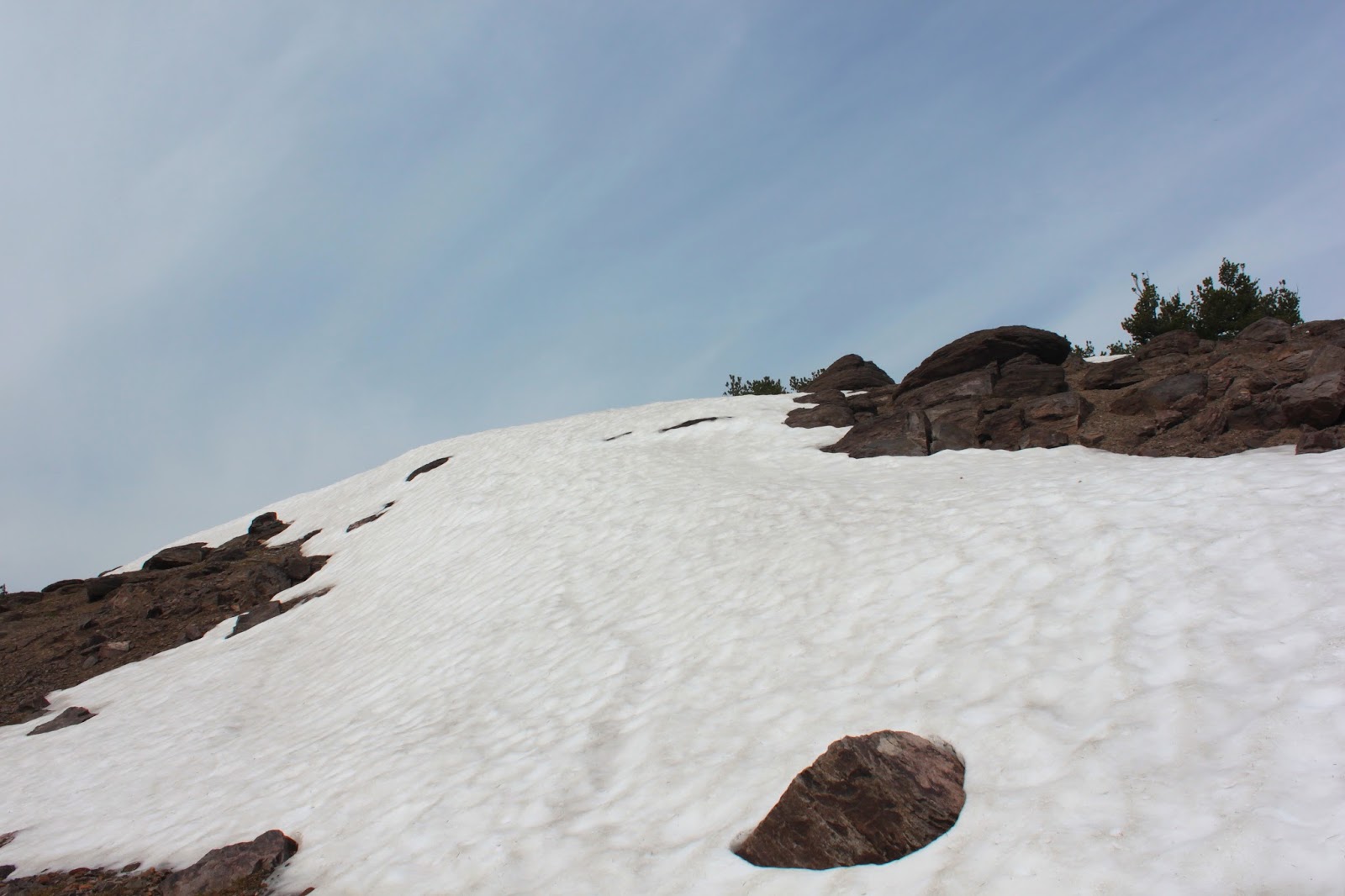
Shortly after peering down into the rugged Owl Creek terrain below, we reached Peak 9053 which was promptly designated to be our lunch spot. So we climbed the small peak, still covered with snow drifts, and enjoyed a superb view down into the Pine Creek Basin where we could see a number of small lakes hiding in the basin's woods.
 |
| Time to get off of Peak 9053 |
Clouds were coming in as we ate and we were aware there was a slight chance of thunder per the weather reports we had perused prior to our coming here. Being on top of a peak when there is a chance of lightning is not a smart thing to do, so we kept our lunch short before heading back.
 |
| Rain was in our future |
It warmed up considerably as we hiked back and it was a tedious slog hiking uphill from the Warner crest to the Patterson Lake pass. Predictably, clouds formed as the wind blew. The only difference was that the clouds covered up the sunset and it rained for most of the night.
 |
| Trail junction |
The next day dawned cloudless and clear and we packed up our gear and grabbed the Cottonwood Trail down to the Owl Creek Trail. The Owl Creek Trail paralells the Summit Trail but is located about 1,000 feet below the Summit Trail; The Cottonwood Trail is a connector trail linking the two trails.
 |
| Meadow, typical of this area |
The Cottonwood Trail dropped rapidly away from Patterson Lake as it switchbacked to and fro down an escarpment. Basically following Patterson Creek, the trail criss-crossed the creek several times and we enjoyed a series of lush hellebore meadows and small waterfalls.
 |
| How waterfalls start |
At a marshy meadow with a huge waterfall, the trail turned to the north and leveled out as it peeled away from the creek, taking us through a forest that had been, and was still being, ravaged by pine beetles. Lots of dead trees waiting for a lightning strike to set things alight.
 |
| Cottonwood Creek headwaters |
Rounding Peak 8298, we left trees behind and dropped into the sagebrushed canyon of Cottonwood Creek. The Warner crest loomed above and an impressive waterfall delivered Cottonwood Creek to the canyon floor. As we approached the creek, the vegetation morphed from sagebrush to lush riverine growth.
 |
| Monument plant |
Blooming in the sagebrush were the unique monument plants. The leaves of these plants are arranged in a rosette resembling an agave or a yucaa but they are not succulents. They flower in tall towers of odd colored green/cream flowers. What makes these plants interesting is that they live from 20 to 80 years, flower once, and die. Because of the dire consequences of their monocarpic lifestyle, monument plants do not engage in premarital, extramarital, or plain old fashioned marital sex. Family values aside, these plants were making their one and only procreative stand on the hillsides of Peak 8298.
 |
Patterson Creek waterfall
|
We set up camp next to the creek and then did a short day hike south on the Owl Creek Trail. Because the trail parallels the Warner Crest, the Owl Creek Trail spends its miles climbing in and out of one creek drainage to the next. The up-and-down experience on our day hike to Patterson Creek is typical of the Owl Creek Trail. It was a steep climb up to a level meadow atop an escarpment before dropping steeply down to Patterson Creek where were treated to lush meadows and a magnificent waterfall.
 |
My view before the "fun" started
|
In the late afternoon, the clouds came in as usual and the wind began to blow, and blow, and blow. Then the rain started and lightning flashed and thunder boomed. I felt so secure with only the nylon tent fabric between myself and 30 kiloamperes of electrical current. Yes, I am being sarcastic. The wind was so strong that it uprooted my tent with me in it so I got to enjoy the experience of staking down, clad in only my Power Rangers underwear, an unruly tent in wind and rain while lightning flashed and thunder boomed.
 |
| Sunrise |
After the previous night's turbulence, it stands to reason Day 5 would dawn crisp and clear. Since neither one of us got a good night's sleep, we had no problem starting early, we hit the trail pretty near 7 AM. Crossing Cottownwood Creek, the Owl Creek also started early, heading steeply uphill as it climbed up Squaw Peak.
 |
Mid-morning view
|
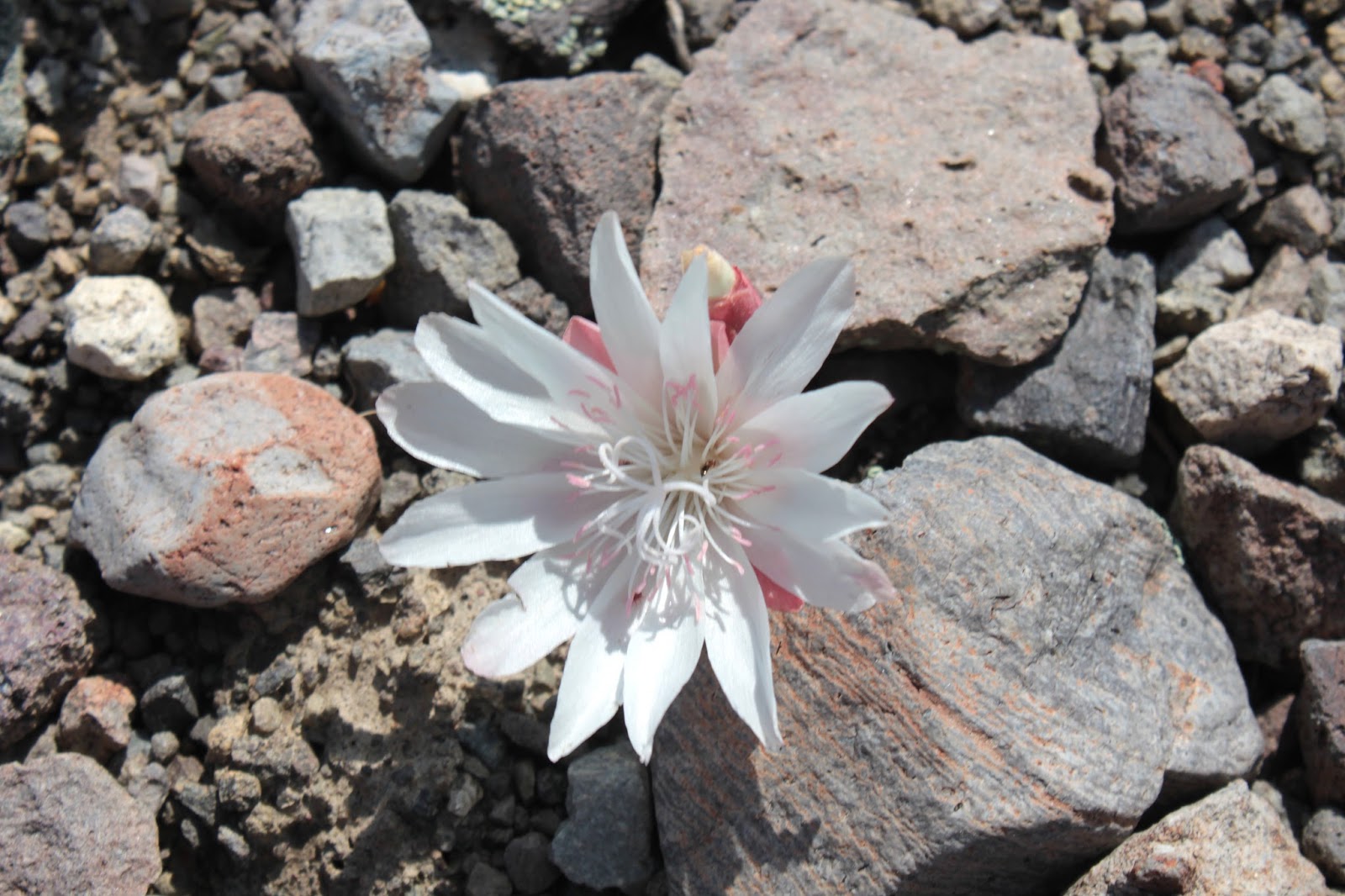
At least the faint trail switchbacked up Squaw Mountain as it gained altitude and the vegetation transitioned from the lush creekside growth to high desert sagebrush. Spotted in the low growth were desert-type flowers such as mariposa lilies and bitterroots. The views opened up as we gained elevation and we enjoyed a nice view down to Cottonwood Creek below.
 |
Flowers gone wild
|
After a fairly rigorous climb, the trail rounded Squaw Mountain and rejoined with the Summit Trail. There was much rejoicing because it would be all downhill from here on in. The trail was flanked by rampant wildflowers blooming away in a floral rainbow. It seems that the rains had inspired the lupines, buckwheat, wild onions, flaxes, and lilies to get busy blooming; much photography ensued.
 |
| I love my civilization |
After a joyous reunion with my car, we stopped at the Pepperdine horse camp and field showered at a spigot. Because there were campers nearby, I left all the important articles of clothing on; I didn't want to sully the new-trail smell with a gratuitous butt-imprint, figuratively speaking.
 |
| Odd-colored paintbrush |
For more pictures of this magnificent hike, please visit the Flickr albums:
Day 1
Day 2
Day 3
Day 4
Day 5
 |
| Bitterroot |