Showing posts with label cascades mountains. Show all posts

Saturday, June 13, 2015

Harriette Lake

So Lane and I sit down for lunch at Lake Como and Lane notices the silhouette of another hiker sitting on a shaded stump across from the lake, also eating lunch. Obviously lost in thought and totally unaware of our presence, the hiker's head rested pensively on a hand propped up on one knee, a la Rodin's "The Thinker". However, the dude was sitting way too still, prompting a debate between Lane and I whether he was an inanimate object or somebody who didn't twitch even one arm hair in the mosquito-filled air. Time passed and the sunlight moved in the forest and illuminated what was obviously a tree stump, earning Lane the trail name "Stump Guy". The rest of the weekend was replete with sudden bursts of "Look at me, I'm Stump Guy!" and we'd freeze in place.  Or we'd point at a stump and say "Look, it's another hiker!" Lane and I are easily amused and will work the same joke over and over for weeks at a time, unlike Stump Guy. Unlike some of our fellow hikers too, I might add.

Lake Como and Whiteface Peak (not named after me!)
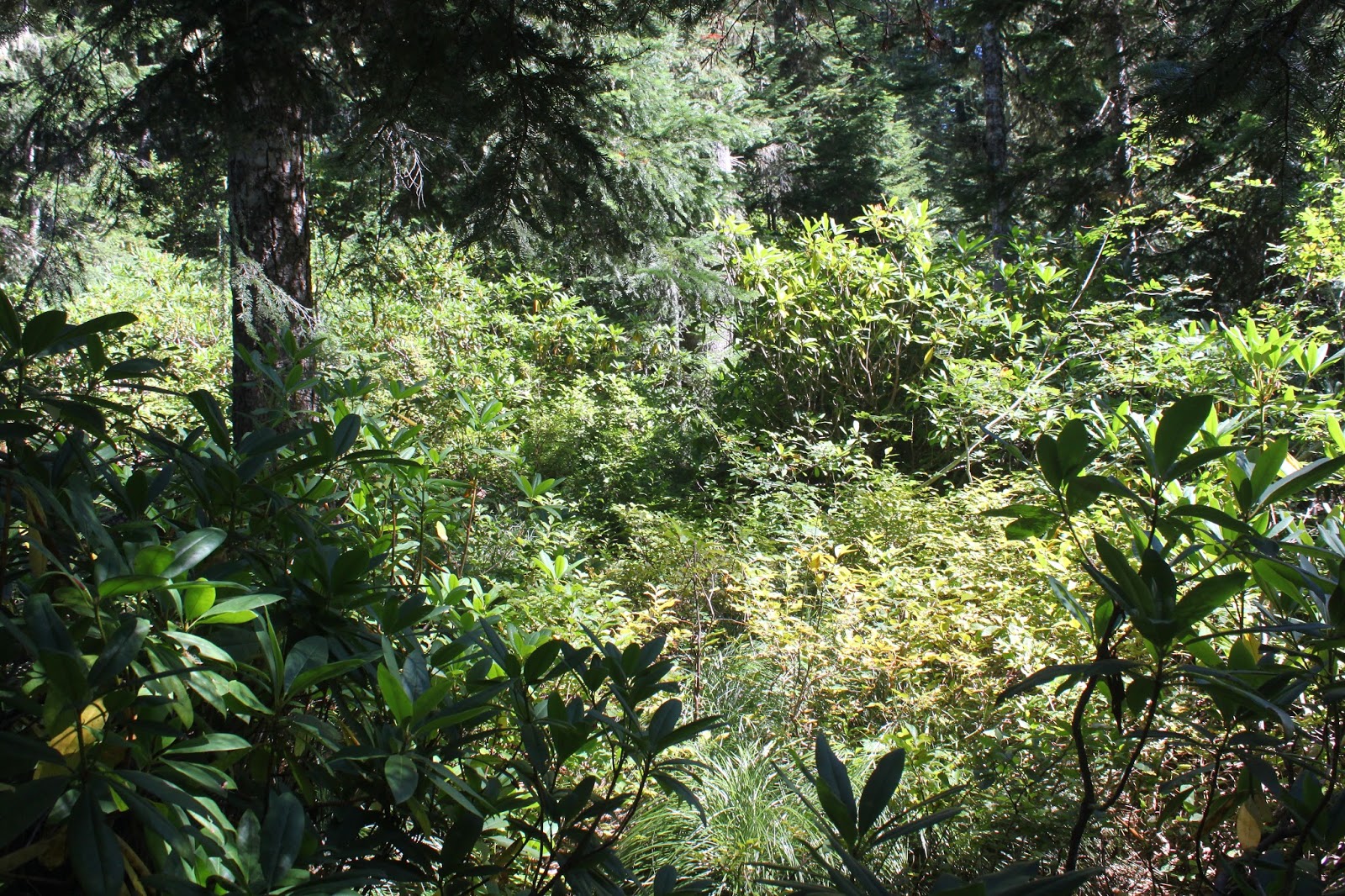
This particular Lake Como was not the famed Italian lake of note, but is instead a small body of water in Oregon's Mountain Lakes Wilderness, a volcanic caldera south of Crater Lake. Basically, the caldera is the left over basin from a volcano that blew itself up just like Crater Lake did millenia ago. Oregon could have been blessed with two Crater Lakes but alas, glaciers intruded their icy heads into the mix and eroded the walls surrounding the Mountain Lakes caldera and all that potential Crater Lake fame and glory drained ignominiously down into midge-infested Upper Klamath Lake. No complaints though, as the caldera basin now has mountains and lakes in it, as befits a wilderness with the name Mountain Lakes. And best of all, the wilderness has hiking trails in it, too.

The bridge Lane
At first the Varney Creek Trail descended gently for a mile or so, dropping through a shady forest to a crossing of like-named Varney Creek. The creek crossing used to take place on a dilapidated and rotting boardwalk through a bunch of dead trees covering a swampy mire. However, the High Desert Trail Riders have rebuilt the bridge and cut a path through all the dead timber; it's now an easy cross over Varney Creek. Because of the new bridge, even Stump Guy was able to make it as far as Lake Como.

Greylock Mountain
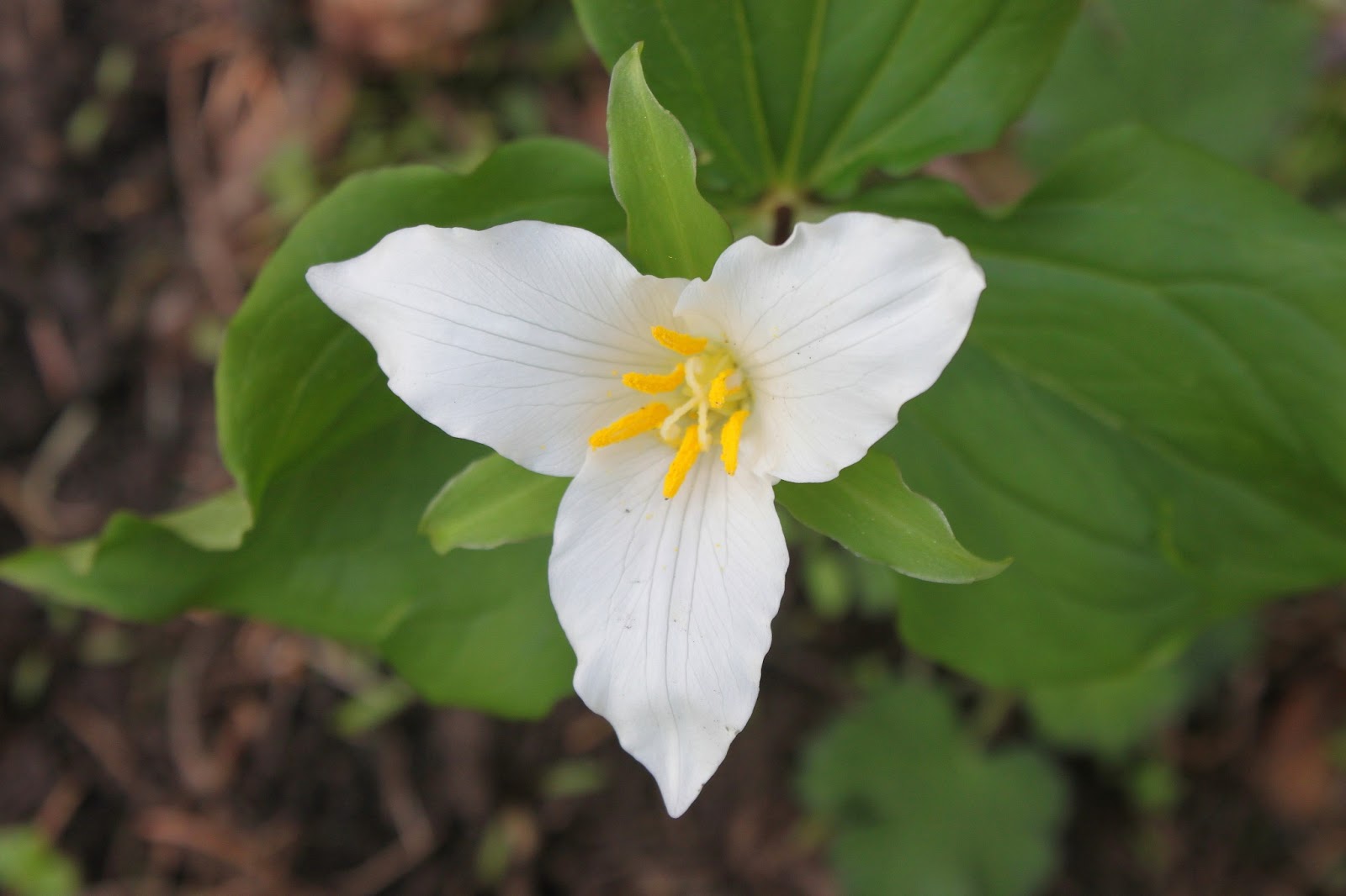
It's a 1,300 foot climb to Harriette Lake but the grade was quite kind and gentle for the first 4 miles. The forest was thin and interspersed with meadows which both Lane and I waded into, each armed with camera in hand. The slopes were colored red in places due to skyrocket and paintbrush putting on a floral show. We enjoyed views of Mount Harriman and Greylock Mountain, both peaks part of the caldera rim.

First look at Harriette Lake
After Lake Como, where we made our aforementioned acquaintance with Stump Guy, all that easy uphill came to an abrupt end. Leaving the lake, the trail went rocky all of a sudden, the incline ramped up, and dang it, we suddenly had to work hard at this backpacking stuff. But at least it was quick work, because after only 0.6 miles of the steep crap, we hit a pass and Harriette Lake made a stunning first impression, just like I've been known to do! In a rocky basin below the pass, reposed half of blue Harriette Lake (the other half was hiding behind a forest). The wall of rock above the lake had created an awesomely large avalanche basin containing all the boulder you could ever want to look at. Aspen Butte (the highest point in Mountain Lakes Wilderness) rose up to the south and to the east Mount Carmine lay a lot closer to the lake.

Be it ever so humble...
After the rigorous climb to the pass, we were only too happy to descend to the lake shore and set up camp. We had neighbors, sociable Scott and Tina from Grants Pass, and we exchanged pleasantries and trail stories (some of which were true). Tina was on her first backpack trip and was holding her own, especially with Scott carrying most of the gear. I think I'll do likewise and have Lane carry most of our gear next time!


View from our camp
The lake shore shallows were covered by an unappetizing film of pine pollen and I somehow became the one designated to wade deep into the lake to filter cleaner water. As the sun set, the breeze abated and mosquitoes happily came to greet us. The feeling was not mutual. However, the sight of the shadows lengthening across the lake while the high peaks caught the the last light of the sun was simply sublime, annoying mosquitoes notwithstanding.

Mount Harriman
Early the next morning and before breakfast, Lane and I bushwhacked to an overlook with a partial view of nearby Echo Lake, giving us both the opportunity to yell "Echo...echo...echo...". Like I said before, we are easily entertained. After our Echo Lake sojourn, we struck camp and headed up and then down the pass above Harriette Lake.


Whiteface Peak rises above Eb Lake
Shortly after passing Lake Como, we stashed our backpacks behind a log and headed up the Mountain Lakes Trail. After a short walk, the trail crossed a narrow spit of land between Eb and Zeb Lakes. We stopped at Eb Lake first before looking at Zeb Lake. Or was it the other way around? I can't tell them apart and only their mother knows for sure. At any rate, the picturesque lakes offered views of Whiteface Peak and some of the lesser surrounding peaks and ridges.  And then the fun started.

Why we did not summit Peak 7703
The trail would climb over 800 feet in 1 mile to a pass which I kept referring to as "south pass" when it fact it was the northern pass of the two passes on this pass through. As the trail switchbacked to and fro, the trees thinned out and rocks ruled this little corner of the world. We had some notion of summiting Peak 7703 and/or Whiteface Peak but our enthusiasm waned when we saw a treeless rocky slope rising all the way up tp 7703's top, about 800 feet above us. We took one look at the rocky slope and wordlessly communicating like a long-time married couple, Lane and I knew we weren't going to do any summitting on this day. However, just to keep things platonic between us, I did utter the phrase "Oh, hell no!" Whiteface Peak had a similarly demanding route if we wanted to stand on top of it. The terrain was hot, rocky, and treeless and we were baked like a pair of purple Peruvian potatoes. Covered by an unappealing slime comprised of sweat, blood, Deet, and trail dust, we called it good at the pass.

You can see Upper Klamath Lake from here!
At the pass, we did have an awesome view to Mount McLaughlin, its symmetrical cone dry on the west side but snowy on the east side. Nearby Brown Mountain was equally visible as was an impressive Peak 7652. To the east, we could see the caldera drainage running down all the way to Upper Klamath Lake. So after soaking in the views, down the hot and mosquito-infested trail we went, stopping only to put snow (from a small drift) underneath our hats to cool our hot heads. We didn't get brain freezes though, as that would require brains.

Cameras got a workout, too
Just past Eb and Zeb Lakes, we retrieved our packs and began the hike back to the trailhead. We only had 4 miles to go but it was the longest 4 miles in the hot sun on a dusty trail. It seemed like it was 14 miles but we eventually made it back to the trailhead. Stump Guy, on the other hand, is still hanging out at Lake Como.

Hey, you're bugging me!
For more pictures of this trip, please visit the Flickr album.


Sunday, September 8, 2013

Tidbits Mountain

Lions and tigers and bears, oh my! In my many trail miles, I've run into the hiking equivalent of those fearsome creatures in the form of bears, rattlesnakes, cougars, and deer. And after last weekend on Tidbits Mountain, yellow jackets have been duly added to the list. At least the bears and cougars ran away from me, but the yellow jackets buzzed angrily towards me en masse with malevolence in their hearts. 

Either a sinkhole or the world's biggest wasp nest
The hike got off to an interesting start when a sign proclaimed the parking lot was closed due to a sinkhole. Stepping around the small pit, we (brother Don and friend Jesse) set out onto the Tidbits Mountain Trail. I must have left my brain in the sinkhole because I'd forgotten to put a fresh battery into the camera. Of course, I didn't realize it until we'd hiked a half-mile or so, I did a quick dash back to the car to retrieve the spare battery. Gotta get my extra miles in, somehow!

Making movies of the trail kind
Hiking for reals now, the trail angled gently for the most part through some beautiful forest typical of the west-side Cascade Mountains: lots of tall fir trees, lush undergrowth, and sunlight filtering through a green canopy of vine maple leaves. On occasion, the trail went steep, and we got to exercise our heavy breathing muscles.  Don was making videos and I was taking pictures, so it was a stop-and-go hike. 

Reenactment of me running from the wasps
About halfway up, I noticed a swarm of flies buzzing on the trail.  Curious, I stopped to see what the buzzing was all about. My mistake! The flies were not flies at all but yellow jackets nesting on the trail. My first inkling that I might have misidentified the insects was communicated to me by the nerve endings in my calves which reported to my brain that my legs were on fire in multiple spots, like a forest the day after a lightning storm. The darn wasps were stinging me and I got my morning sprint in on this hike. And I didn't even get a picture of the wasp nest!

"Trail" to Road 1509
At a wooded saddle, the Tidbits Mountain Trail intersected with a trail that had been long abandoned. Timber and rusting metal marked the site of a former shelter, also long abandoned.  A sign marked this as the Gold Hill Trail and pointed us in the direction of the Tidbits Mountain Lookout, also abandoned a long time ago.  Too bad those yellow jackets couldn't abandon the trail.

Tidbit gives us a finger
After a short climb through the forest, the trail spit us out like chewed up sunflower seeds onto a talus slope right below Tidbits Mountain proper.  From the slope we could see down the Canyon Creek drainage as it emptied into the Santiam River drainage, also visible.  On the western horizon, Mary's Peak on the Coast Range poked up out of the haze.  And above us, small rocky columns on Tidbits Mountain waved greetings, looking like Three-Fingered Jack's other two fingers.

Just about at the summit
A short and steep climb through a forest spit us out like watermelon seeds onto the summit where we whooped with joy. Well, we might have been a bit premature with the whole whooping thing because the actual summit was behind us, requiring another short but steep push up a rock cliff where mild use of hands was required. Apparently, the lookouts used to climb a ladder and the rotting timbers of the ladder still lie on the mountainside.

But who's taking a picture of me?
From the summit, we could see some more stuff.  Tidbits Mountain had a twin and we watched peregrine falcons soar and float around the sheer cliffs.  On the eastern horizon, we had nice views of the Cascades from Diamond Peak to Mount Jefferson, with the Three Sisters being the nearest.  Way cool, and we enjoyed a lengthy lunch and gawk.

Camera gear abandoned to the yellow jackets
On the way down, I got to share the wasp love with Don as he was tagged just before I got tagged a couple of more times on the legs before I could laugh at his discomfiture.  What possessed these yellow jackets to build a nest right on the trail tread?


The children climb Wolf Rock


After the hike, we drove up the Blue River to visit impressive Wolf Rock which had been eminently visible from Tidbits Mountain. Don wanted to take me scrambling up the 1,300 feet or so of cliff to the top of the massive monolith. Heeding the advice of my inner physical therapist, I declined as my surgically repaired wrist is still not ready for such adventure. Don and Jesse scrambled up a rocky amphitheater on their way to the summit while I stayed behind. At least there were no wasps to sting me as I waited for the two tykes to return.
Tidbits Mountain's twin


For more pictures of Tidbits Mountain and Wolf Rock, stop by and visit the Flickr album.

Saturday, May 11, 2013

Grizzly Peak

It seems to me that Grizzly Peak should be to all the other Bear Peaks in Oregon what grizzly bears are to a run-of-the-mill ordinary black bear. In ursine terms, a 5.4 mile hike somehow seems to be more of a koala bear of a hike. However, hiking buddy Glenn assured me the hike was worthy and since I'd never been, Saturday morning found me driving down to Ashland.

Oregon anemone
After a pleasant drive through purple stained hills (the deer vetch was in spectacular bloom) dotted with newly leafed out oaks, I was joined at the trailhead (which had a great view of Mount McLaughlin, by the way) by Glenn, Carol (Mrs. Glenn), and Karen (Glenn's sister). And with a fierce grizzly-like "Grrr..." we set off on the trail.

It was a trillium show in the forest
The trail wasted no time angling uphill through a shady fir forest, the quiet of the forest getting interrupted by the heavy breathing of a certain panting hiker from Roseburg. The undergrowth vegetation was still tamped flat by the recently departed snow but the trilliums and snow queen were sending up their early spring blossoms. The heart shaped and fragrant leaves of wild ginger were also spotted but a cursory examination under the leaves revealed none of the brown and hairy flowers.

See the blackfly?  I didn't, either!
Periodically, the trail would break out into open meadows with yet a few snow patches in them. The whole vibe reminded me of the Rogue-Umpqua Divide Wilderness.  Spring was in the air, literally, and each leg was bitten in turn by a welt-raising blackfly which started me yearning for the insect-killing cold of winter. I imagine mosquitoes and hikers will be renewing bloody acquaintanceship before long.

Disco lives!
After an uphill mile or so, we reached the intersection with the loop trail and opted to hike the loop counterclockwise. The trail leveled out and an unassuming  rocky knoll  flanked by thick patches of diminutive glacier lilies marked the official Grizzly Peak summit. Because of the dense fir forest, there were no views to be had but Glenn and I stood on the summit just because.

Smoky view to Medford
Intermittent views were enjoyed while the trail contours the edge of the broad summit; Mount Thielsen, Union Peak, and the Crater Lake rim were all spotted in the smoky haze. Views were somewhat limited due to hazy smoke, presumably from prescribed maintenance burns nearby.  The fires of the non-prescribed variety are coming because this has been a hot and dry spring.

Walking through the ex-forest
In 2002, the East Antelope Fire charbroiled the forest on the west side of of the mountain.  West antelopes were relieved and hikers have since been grateful for the fire really opened up the views by removing all that annoying forest.   The trail hugs the peak's rim under some rock formations with blooming wildflowers.  But mostly, it's all about the views, even on a hazy day.

Emigrant Lake, below Pilot Rock


Ashland lay nestled in a valley virtually 4000 feet below as the slopes dropped precipitously away from our mountain perch.  Rising on the other side of the valley were the snowy Siskiyou Mountains stretching from Mount Ashland to Grayback Mountain.  To the south was ghostly and very tall Mount Shasta with Emigrant Lake reposing below Pilot Rock.  To the east were the peaks marking the caldera of the Mountain Lakes, one of my favorite haunts.

Mission bells, they toll for thee
When not oohing and aahing at the clifftop panorama, we spent some time on our knees and bellies taking pictures of the many wildflowers blooming in the rock gardens.  Notable were coastal delphinium (a low growing larkspur), Hall's desert parsley, Indian paintbrush, and dwarf hesperochiron which incidentally used to be my nickname on the dude ranch...and that's all I'm saying about that!

All good things come to an end, including hikes, and we closed the loop and reentered the forest.  But, hey, at least it was downhill to the car.  So, while this hike logged an un-grizzlylike 5.4 miles, because of the great scenery, I rate this trail at four Tibetan blue bear paws.


For more pictures of this hike, please visit the Flickr album.