Showing posts with label Washington. Show all posts

Wednesday, August 31, 2016

Comet Falls - Rampart Ridge

"Now Dasher! now, Dancer! now, Prancer and Vixen!
On Comet! on, Cupid! on Dunder and Blixem!
To the top of the porch! to the top of the wall!
Now, dash away! dash away! dash away all!"

From "A Visit By Saint Nicholas"
By Anonymous

Mushrooms were rampant in the lush and damp forest


Hah, I've stumped you all, haven't I? What on earth does an iconic Christmas poem have to do with a late summer hike in Mount Rainier National Park? Well, the answer to that question is the phrase "On Comet!" because we hiked to the top of Comet Falls. But wait, there's more! Like, "...to the top of the wall!" Or maybe "..on Dunder" applies here as well because more than once in my lifetime, I've been referred to as a dunderhead. By my mother too, I might add! But enough of my random babbling, let's talk about the hike.

Photography was rampant next to Van Trump Creek


This was the third day of the Friends of the Umpqua annual campout and it was obvious we were going to lose our run of spectacular weather. Clouds blotted out the blue sky and warm sun, and the air had that "rain cometh" feel to it. But we are from Oregon, where it rains 14 out of 12 months of the year, and we should be accustomed to rain and gray days. So with a cheery "On Comet!" we set out on the Comet Falls Trail.


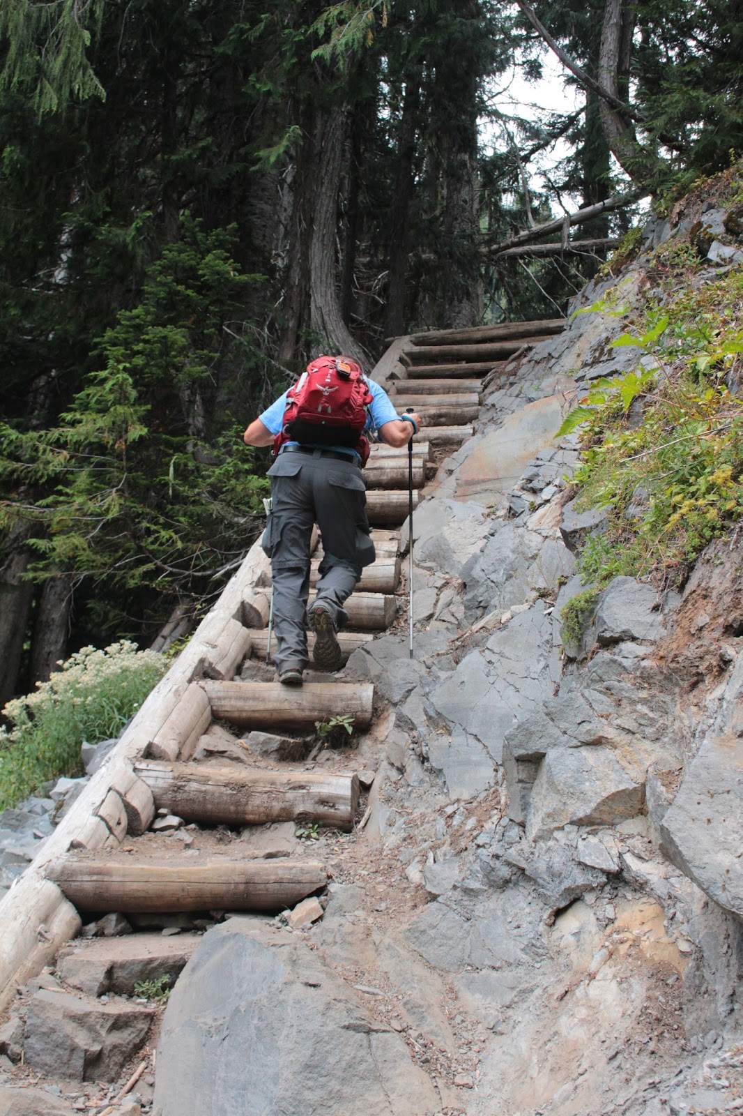
And this was the level portion of the hike!


Sheesh, is every trail in Mount Rainier National Park steep? In a word, yes! Initially, the trail switchbacked and stair-stepped up through a green forest before arriving at a stout footbridge crossing over Van Trump Creek. The creek seethed and roiled in a narrow slot canyon, bounding from pool to pool in a photogenic series of white-watered cascades. After a brief rest and photo shoot, it was time to resume hiking up the Comet Falls Torture Trail.


Salmonberry made this a sweet hike
The route didn't mess around, gaining elevation in big chunks as the trail alternated between switchbacks and stairs. Van Trump Creek was mostly always visible well below the trail, and intermittent breaks in the forest cover provided equally intermittent views of the forested and rocky ramparts of aptly named Rampart Ridge looming well above. The trail was flanked by huckleberry and salmonberry bushes whose branches were bedecked with berries burgeoning with juicy goodness. Much berry grazing ensued.


Jennifer, a bridge, and Van Trump Creek
After a couple of miles of this, Van Trump Creek braided and the footpath crossed the boisterous stream on a picturesque log bridge with one rail. About 50 yards upstream, a noisy cascade made me think we had arrived at Comet Falls. Not so, but at least our spectacular destination was only a short uphill walk away.


Comet Falls
Comet Falls made all the leg-burning and stair-stepping hiking worth it. The falls plunged 320 misty feet over the edge of Rampart Ridge with a couple of lesser waterfalls downstream of the main cascade. The trail worked its way up a grassy slope for a better look and once again, much photography ensued.

This pretty much sums up the
Comet Falls Trail experience
After a protracted photo shoot, Lane and I (bringing up the rear, our customary place in the hiking queue) trudged up the trail. If anything, the trail was steeper than before as it worked its way up and out of the Comet Falls basin. The slope was densely forested but the hike was sweet, thanks to plenty of ripe berries there for the picking.


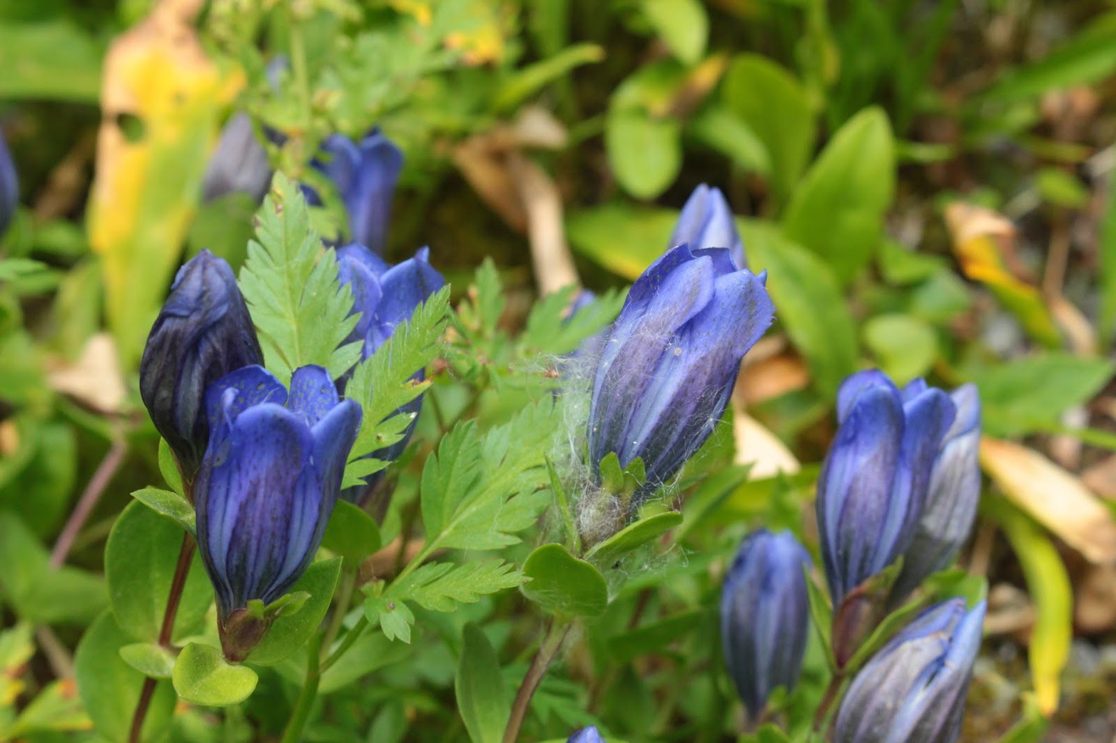
Meadow gentian
Fortunately, all "good" things (like incredibly steep trails) come to an end sometime and as such, the trail crested right above an unnamed fork of Van Trump Creek, 1,900 feet higher and 2.5 miles away from our original starting point along Paradise Road. If you do the math, that's a 13% grade which would explain all the huffing and puffing.


Katsuaki surveys Van Trump Creek, above Comet Falls
Van Trump Creek is born of the Van Trump Glaciers, a collection of small glaciers right on the slopes of Mount Rainier. However, we had hiked fairly close to the cloud cover and the massive mountain was hidden from sight, lost in the gray clouds. No Rainier views for us today! The silted creek tumbled through a rocky draw, coming to an abrupt end at the top of Comet Falls. After crossing the milky creek on a log bridge, we entered the meadows of Van Trump Park. Katsuaki had caught up to us at this point and he made a brief exploration of the park while Lane and I sat down and gave our leg muscles a well-deserved break.

Trail on Rampart Ridge
When we resumed walking, we discovered low growing blueberry bushes with the sweetest tasting berries ever. The delicious fruits were in short supply and there was plenty of hair pulling, cheek slapping, ear tugging, and eye gouging in a brutal competition for the berries. We bid adieu to Katsuaki who went on to join Jennifer and John on top of nearby Mildred Point, probably to get away from me and Lane!


Urp!
It would be all downhill on Rampart Ridge from here on in, and we rapidly lost elevation in a lush forest that reminded us of our own Umpqua National Forest, minus the ferns. Mushrooms were sprouting everywhere in yet another reminder summer is coming to a close. There were several bright yellow specimens of slime mold, looking all the world like some kind of bilious bear urp.


The Wonderland Lane...er, Trail
I was really having to crank up the ISO setting on my camera, empirical proof the day was darkening. After we grabbed the Wonderland Trail, the rain started. Coming up the very steep trail were plenty of backpackers commencing the epic Wonderland Trail loop trek. The Wonderland Trail circumnavigates Mount Rainier in 93 miles with "only" 22,000 feet of cumulative elevation gain. They were starting out from Longmire and they were bent over, laden with heavy packs, straining and grunting from the labor of toting their burdens up a steep trail in the rain. I took one look at their misery and decided I want to do the Wonderland next summer. We'll see.

"...on Dunder!"

The rain was pouring steadily so I stowed the camera in my pack and just concentrated on getting back to Longmire as soon as possible. While wet, it wasn't particularly cold so I hiked in my shirt sleeves, getting thoroughly soaked in the process. Longmire is a combination resort and visitor center and there was hot chocolate available. I raised my mug in the direction of hidden Mount Rainier and shouted out a salutary toast "On Comet!" Everybody looked at me funny and moved away.


On Comet!
For more pictures of this hike, please visit the Flickr album.


Tuesday, August 30, 2016

Burroughs Mountain


As many of you may have surmised from reading this blog, I do a lot of hiking. All those days, all those weekends, all those miles, and all those trails; they often blend into a mushpot of leftover memories. But then there are trails like Burroughs Mountain Trail, a magical hike so transcendent it stands well apart from the rest, earning its own featured niche in my pantheon of most hallowed hikes. On a scale of 1 to 10, Burroughs Mountain rates at least a 57. 

The Burroughs Mountain crew


This was the second day of the annual Friends of the Umpqua camping trip (at Mount Rainier National Park, this year) and we split forces as some of us wanted to drive farther to the Sunrise area trailheads for the privilege of walking uphill on a rugged trail for approximately 12 miles. To be technically accurate, we didn't really start at Sunrise; we instead began the day's venture at Sunrise Point, nearly three hiking miles east of the visitor center at Sunrise.


Our view for most of 9 miles
From Sunrise Point, mountains were everywhere, stretching out to the horizon where they lay in an indistinct jumble which we labeled with the rather general descriptor "The Cascade Mountains". Of course, the elephant in the room, mountain-wise, was Mount Rainier and virtually the entire hike would be done while staring right into the eyes of the massive glacier-covered volcano. We probably blinked first. Katsuaki had brought along 3 guests (Toru, Koki, and Aya) from Japan and while I don't speak Japanese, I could tell from the smiles on their faces afterwards, they did enjoy the hike. And along the lines of "the usual suspects," Edwin and Lane also came along.

Lane approaches Antler Peak
Ron and Diana also came along ("sort of") but they intended to hike a shorter distance so while we laced up our boots in the parking lot, the two cheaters hitched a ride to Sunrise. It was easy to tell that Sourdough Ridge was not one of Rainier's premier hikes as it started out on a real trail with dirt and rocks and all that unpaved stuff. Almost immediately, Sourdough Ridge served up enjoyable vistas down Sunrise Creek's canyon and the high alpine basin of White River Park. Not so nice of a view was a trail directly ahead, climbing straight up the shoulders of Dege Peak without even a trace of a switchback to ease the grade. Hopefully, it wouldn't be our trail. Unfortunately, this was the latest installment of "Trail Designers Will Not Go To Heaven" as consternation gave way to sullen resignation as we surrendered to the inevitable and slogged up Dege Peak through a forest. 

Huckleberry Basin, from Sourdough Ridge
Once on the other side of Dege Peak, the trail contoured mostly grassy slopes with a grand view of the Sunrise complex and the surrounding grassy meadows of Yakima Park. Periodically, the trail would hit the ridge crest between mountains, proffering fantastic views of Huckleberry and Prospector Creek canyons running into the larger and deeper White River canyon. According to the map, there are trails that visit the alpine parks and valleys north of Sourdough Ridge and thanks to our all too brief peeks, these enticing trails are now on my very large and nearly endless list of trails I want to hike on. At any rate, we made plenty of camera stops due to the marvelous vistas on either side of the ridge crest.

Mountain goat on the trail to Frozen Lake
After about 3 miles or so, all the tourists, restaurants, and souvenir stores at Sunrise receded behind us as we continued to hike high up on the ridge crest. Shortly thereafter, the trees, grass, and wildflowers disappeared altogether when the trail contoured a slope made entirely out of rocks. We could see the trail hugging the steep slope all the way to a saddle between Burroughs Mountain and Mount Fremont. And just so I don't repeat myself, please silently add the phrase "...and there was an awesome view of Mount Rainier" after every sentence. Giddily scampering like mountain goats, we made short work of this wonderfully rocky and cliffy trail and sat down to eat lunch at Frozen Lake.

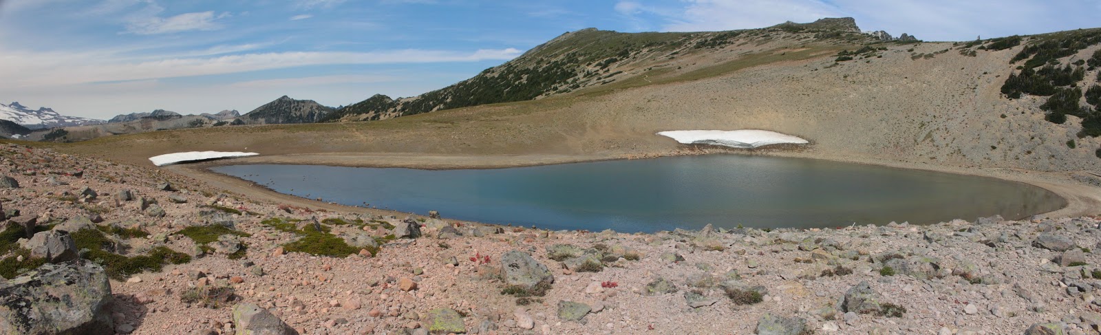
The not so frozen Frozen Lake
Frozen Lake was no longer frozen, but there were a few small land bergs situated on the banks of the small lake. The lake was unscenically fenced off as it is the designated water supply for Sunrise, water tainting is strongly discouraged. Clearly, we had hiked above treeline as the terrain was all rocky tundra at this point. A chill wind blew and we all put on windbreakers or light jackets as we ate and rested.

First &@#$%! climb up &@#$%! First Burroughs


After lunch, the "fun" started. The trail climbed relentlessly steep toward the summit of Burroughs Mountain. Actually, there are three Burroughs Mountain, each known by their ordinal number: First Burroughs Mountain, Second Burroughs Mountain, and Third Burroughs Mountain. I just found it easier to refer to them as First $@#$%! Climb, followed by Second @#$%&! Climb, and so on and so forth. Offering plenty of attitude and altitude, the trail had legs burning, hearts racing, and lungs huffing and puffing. It was totally awesome!

The Wonderland Trail, through a wonderland
At least on the trail up the mountain, the views were absolutely fantastic. Of course, there was the obligatory glacier-clad Mount Rainier view as we neared the mountain. But below and away from the giant volcano, sprawled the rocky plain of Berkeley Park with the Wonderland Trail snaking its way through on the way to Skyscraper Pass. On the other side of the park was a jagged ridge crest culminating in Mount Fremont, with a clearly visible trail leading to the lookout on top. More trails for my list!

Second Burroughs Mountain is calling and we must go
Eventually, the uphill stopped at First Burroughs summit and there was much rejoicing. We met Diana and Ron on First Burroughs as they were on their way down from Second Burroughs and because they had been, we now were forced to perform a second climb up to Second Burroughs, darn it. So it was lower the head and trudge on up another rocky path to Second Burroughs, a high point with a front row seat of the Mount Rainier show.

The White River's inception at Emmons Glacier
By this time, clouds had scudded in and the weather felt slightly threatening. Light ribbons of clouds and mist wrapped themselves around the summit of Mount Rainer, imparting a decidedly mysterious and ethereal air about the mountain. The blue ice of Emmons Glacier was clearly visible along with all the crevasses that make glacier hiking so dangerous. And at the muddy and silty terminus of the glacier, White River sprung forth into its massive and glacier-carved canyon.

Look but don't touch at Third Burroughs


Third Burroughs also called to us but it was much farther and higher than the distance between the first two Burroughs Mountains. We were already committed to a 12'ish mile hike without adding Third Burroughs to the trek, so we contented ourselves with watching a pair of hikers make slow progress on Third Burroughs, looking all the world like two small ants crossing a roadway. When I next return to Mount Rainier National Park, I'll do Third Burroughs from Sunrise to avoid the epic death march of a hike from Sourdough Ridge.

Trail on the Burroughs Mountain rim


Anyway, after a protracted stay atop Second Burroughs, we returned back to First Burroughs and enjoyed the view to Berkeley Park all over again. However, this time we could see a herd of about 50 mountain goats relaxing next to a small pond well below. On the flat top of First Burroughs, we turned onto the loop route back to Sunrise. And after a short and level amble, the rough and rocky path dropped over the edge of First Burroughs and an already pretty awesome hike took it to the next level, attaining the rank of Most Hallowed at that point.


Most Hallowed

A treeless and nearly sheer slope abruptly dropped 2,000 feet into the glacial valley of Emmons Glacier and the White River. Emmons Glacier impressed as it should, seeing how Emmons is the largest glacier in the lower 48. And glory of glories, our trail clung to the face of the slope like a tight tank top on a body builder's pecs. Glacial lakes, colored bright turquoise, dotted the floor of the canyon and were so new or so impermanent that they were not not even shown on the map. The wind was decidedly gusty and we had to hang on to our hats because there would be no retrieving them. And straight ahead, we stared down the chute of the White River canyon as the river seemingly carved up most of Washington. Not a hike for those sensitive to heights and exposure and you definitely want to watch your step here.

Edwin, on the return to Sunrise

Where the Burroughs Mountain Trail met up with the Wonderland Trail, there was a rock-walled viewpoint where we all high-fived each other in appreciative triumph. Hikes just do not get any better than what we had just hiked and we all knew it. From there, the loop closed on what was now a comparatively humdrum path back to Sunrise. It was late in the day and we could clearly see our return trail gaining about 800 feet from Sunrise to Sourdough Ridge. We could also see Dege Mountain, the fourth mountain on the ridge, and regrettably our cars were on the far side of Dege Mountain. We still had a lot of hiking to do yet, but as I told Edwin "I can do it, but I don't want to". Everybody concurred, so Lane and Katsuaki hitched a ride back to the cars and then came back to pick up us lazy sloths eating ice cream sandwiches by the side of the road.

Stormy scene, at the end of the day
For more pictures of this Most Hallowed Hike, please visit the Flickr album.


Monday, August 29, 2016

Skyline Trail

Way back when, around the year 2000, give or take a few, Dollie and I took daughters Jessie and Aislinn on a week-long vacation in Mount Rainier National Park. We had been there for most of the week and had yet to see the mountain, as it was cloudbound the entire time we were there. Finally, in desperation, we decided to hike anyway and went up on the Skyline Trail. The trail climbed relentlessly and eventually entered the cloud cover. Panorama Point was socked in with bitter cold fog but we slogged on anyway and then one of those hiking miracles happened. The fog thinned out and what hikes into the clouds can also hike out of the clouds. And just like that, there was Mount Rainier in all its snowy and rocky glory, rising above a cottony sea of clouds with a blue sky above. It is no small coincidence we have not stopped hiking since.

Pillsbury Doughboy
Of course, we really didn't know what we were doing back then, we carried no water and I sported a soft pudgy physique that pretty much resembled the Pillsbury Doughboy. On the plus side, I did have a lot more hair! We thought we were pretty badass hikers, impressing ourselves with our incredibly long 5 mile hike. A lot of trail miles have since flowed under my feet, and I'm about 35 pounds lighter than I was back then, with most of the lighter weight being attributable to hair loss. However, until this late August weekend, I had never returned to Mount Rainier.

I call "Dibs!"
What I remember about hiking the Skyline Trail in 2000 was all the huffing and puffing on wobbly legs going up a very steep trail. Some things never change! On the 2016 version of this hike (this was the annual Friends of the Umpqua campout venture) it all came back to me: the trail was paved for the first mile or so but paved or unpaved, the trail was unrelentingly steep, gaining 1,700 miles in the first 2 miles. And since we started at 5,300 feet the exertion took place in thinner air that had hearts beating madly in our ribcages. Nearby deer were calling "dibs" on my hiking poles should I keel over. They even started a betting pool on how far I'd make it before collapsing in a heap of exhaustion.

Nisqually Glacier
Like I said, after a mile or so, the pavement changed to dirt and rocks, and we took a slightly longer route by choosing the Glacier Vista Trail. And speaking of vistas, it was a gloriously clear day and wherever we were, there was Mount Rainier looming above in one postcard view after another. The mountain was covered with icy glaciers coursing down the slopes like frozen rivers which in essence, is exactly what they are. The nearest glacier was the imposing Nisqually Glacier and at the glacier's toe, the Nisqually River sprung forth from a muddy ice cave. We were staring down the river canyon, lined with rocks from the constant flooding that takes place every winter.

Pretty chill marmot
Marmot sentries whistled warnings as we approached and occasionally we could hear the "meeps" from pikas, although we never did see one. Periodically, we were overtaken by fully laden mountain climber groups, walking faster with full packs than us with day packs. Some things never change!

Some things never change!


The trail topped out shortly after Panorama Point and we ate lunch with Mount Rainier at our backs. The terrain was rocky tundra and sloped away into the deep canyons of Stevens Creek and the Paradise River with the jagged peaks of the Tatoosh Range rising on the other side. Beyond the Tatooshes were the much larger volcanoes of Mount Adams, Mount Hood, and Mount Saint Helens. Way, way, cool!


Mount Adams rises over the Tatoosh Range
The trail dropped down through some snow fields dotted with climbing groups performing legally required ice-skills training. All the downhill hiking would wind up taking us into the the Paradise River drainage. Small creeks flowed with crystalline snow melt and wildflowers bloomed wherever water flowed. A female ptarmigan wandered across the trail, practically at my feet and chirped a few stern commands. A family of chicks emerged from where they had been hiding (again, practically at my feet) and followed their mother into the woods. Mount Rainier commanded attention and we could see a number of waterfalls cascading on the slopes of the magnificent peak.

Bistort flowers up a ridge crest
The trail left a high ridge and dropped down to the Paradise River, which was more like a creek at this point. The bare rock morphed into green meadows and rampant vegetation and the hiking crowd morphed into "The Casuals", or people who normally don't hike. We could easily spot the Casuals because they either carried no water, hiked in wingtip shoes, or pushed baby strollers.

Flowers in Paradise Park
The crowds were huge at Paradise Lodge and we ate expensive ice cream and people-watched for a while. All in all, a nice reintroduction to the wonders of Mount Rainier National Park and even after this fairly short 6 mile hike, I felt like one badass hiker. Some things never change!


Pearly everlasting
For more pictures of this magnificent hike, please visit the Flickr album.


Thursday, February 18, 2016

Turnbull Wildlife Refuge

Daughter Jessie was getting married so naturally I instead went hiking. Kidding! Actually Dollie and I drove up to Spokane for the very special event which I actually attended. However, the days before the wedding did provide me at least one opportunity to slip away for a mental-health hike on a crisp day that hovered somewhere between winter and spring.

Let the mosquito breeding begin!
The hike of choice was Turnbull Wildlife Refuge as it was a reliable snow-free destination in an area surrounded by mountains covered with snow. At the start, the day was overcast and it felt like it just might rain. However, I cared less about the rain and more about the brisk and biting wind blowing through my layers of clothing. So with a rueful "Dang, it's cold", I set out on the trail, leaving the rustic buildings of the refuge headquarters behind.

Windmill Pond


The double track trail (another term for gravel road) led to marshy Windmill Pond where a small boardwalk provided a view of the tranquil waters. Small birds twittered in the bushes and that was it for any wildlife sighting at Windmill Pond. Because I was wandering aimlessly in an area I was not familiar with, I continued on the first gravel road I saw, which promptly headed up a rolling hill forested with Ponderosa pine.


The loneliness
After a half-mile or so, the road broke out of the forest and an endless prairie of short grass stretched out in front of me. All that wind was working hard at blowing the clouds away and I actually got to enjoy blue sky and bright sun off and on for the rest of the day. It still was cold though. Below the trail reposed the bright blue waters of Middle Pine Lake, surrounded by a bowl of dried brown grass. An intersection with the Stubblefield Trail called to me because it probably had stubble and a field on it.

Blue sky on a winter day
Despite the relatively flat and seemingly dry terrain, there was standing water everywhere. Flanking the trail were ponds and puddles of all sizes and shapes, which no doubt attract migrating birds in birding season. A pamphlet obtained at the headquarters mentioned moose but on this day I was virtually the only wildlife out on the sparse and treeless steppe.


This way to the Mississippi!
This was a great cloud day as clouds formed and reformed overhead, making for slow going as I chronicled each and every atmospheric change with my camera. The trail was unrelentingly straight and I felt if I would keep hiking on it, I'd wind up on the banks of the Mississippi River at some point. The terrain was basically flat but there were a lot of  gentle rolling ups and downs with each little depression containing a body of water sparkling in the intermittent sun.

The Washington State Tree
At about the 2.5 mile mark, Stubblefield Lake came into view, appropriately surrounded by stubble and fields. Ducks, in a rare wildlife sighting, flew away in feathered panic at my arrival. There was actually one tree at the lake so I had to take a picture of it. It was just the perfect place to sit down, shivering in the brisk breeze, and contemplate the stark beauty of the panorama before me.

Not the "Long and Winding Road"
At Stubblefield Lake, another road followed a fence line back towards the refuge headquarters and that was my return route. More clouds, more blue sky, more grass, and more lakes were my source of both entertainment and mental health therapy as I walked. Just a grand, albeit chilly, day in eastern Washington.


Cheever Lake
Cheever Lake is the largest of the Pine Lakes and I took a short side trip to visit the blue lake. A bald eagle was patrolling the sky above the lake but never got close enough for me to get a picture of it. The trail to the lake continued on but totally in the wrong direction so I backtracked and took a left turn on the trail back to the Pine Lakes.


Paved trail next to Middle Pine Lake
This is a wildlife refuge and signs admonished me to stay on trail as the grasslands next to Cheever Lake were are reserved for birds only. I sure hope the moose can read those signs! At Middle Pine Lake, I grabbed a trail that wandered on the opposite side of the lake and a family of trumpeter swans regally paddled away from me. The trail was civilized and totally paved as it wandered past the maze of water channels at the lake's inlet.

Storm blowing in at the end of the hike
Timed it just right because a noticeable storm was blowing in from the south and I made it back to the trailhead just as the rain started. All in all it was a good hike that left me mentally fortified for the next round of wedding preparations.

Joy
For more pictures of this hike, please visit the Flickr album.